Mori Atlas logo
Protected areaPointes et plages de Saziley et Charifou

Analyzing the diverse coastal terrain, ridge topography, and marine protected boundaries of Mayotte

Pointes et plages de Saziley et Charifou: A Geographic and Protected Coastal Landscape Study

Pointes et plages de Saziley et Charifou comprises a distinct protected landscape on the south-eastern coast of Mayotte, featuring the prominent four-kilometre Saziley ridge and adjacent coastal zones. This area represents a unique geographic mosaic of dry shrubland, baobab thickets, mangroves, and sandy beaches. It serves as a vital ecological corridor that integrates terrestrial ridges with the surrounding Indian Ocean marine environments.

coastal protected areaheadlanddry shrublandbaobab thicketmangrovebeach

Pointes et plages de Saziley et Charifou

Protected area

Park overview

Structured park overview, official facts, and landscape profile for Pointes et plages de Saziley et Charifou

Pointes et plages de Saziley et Charifou park facts, protected area profile, and essential visitor context

Review the core facts for Pointes et plages de Saziley et Charifou, including designation, size, terrain, visitor scale, habitats, and operating context in one park-focused overview.

About Pointes et plages de Saziley et Charifou

Pointes et plages de Saziley et Charifou is one of the most ecologically distinctive protected sites in Mayotte, the French overseas department in the Comoro archipelago. Located in the commune of Bandrélé, the site captures the south-eastern tip of Grande-Terre, extending from the dramatic headland of Point Saziley westward to the mangrove-lined beaches of Dapani and Charifou.

The defining feature of the site is Point Saziley itself, a narrow, knife-edged ridge that runs for roughly 4 kilometres and climbs to about 233 metres at its highest point. Despite the surrounding tropical Indian Ocean setting, the exposed slopes support a characteristically dry vegetation community dominated by dense shrubland and thicket, with mature baobab trees (Adansonia digitata) scattered across the slopes, an unusual northern outlier for this iconic African tree. This dry-land character gives the headland an unexpectedly semi-arid feel for a small equatorial island.

West of the headland, the protected area broadens to include the beaches of Dapani and Charifou and their associated mangrove systems. These coastal wetlands provide a sharp ecological contrast to the dry ridge above, creating a compact mosaic of dry thicket, sandy beach, mangrove, and reef-influenced marine habitat within a single protected boundary. The sea fronting the site falls within the wider Mayotte Marine Natural Park, extending the area's conservation role into the marine realm.

Although established in 1997 and owned by the Conservatoire du Littoral, the reserve has gained broader recognition for its conservation value. Together with Mont Choungui further west, the headland contributes to the Mlima Choungui and Sazilé IBA, a roughly 1600 hectare Important Bird Area listed by BirdLife International.

Quick facts and research context for Pointes et plages de Saziley et Charifou

Pointes et plages de Saziley et Charifou is a protected area of around 665 hectares in the commune of Bandrélé on Grande-Terre, the main island of Mayotte. It was established in 1997 and is owned and managed by the Conservatoire du Littoral, France's national coastal conservancy, which classifies the site under IUCN Category IV as a habitat and species management area. The protected area occupies an IUCN Category IV designation focused on habitat and species management, and its coastal waters overlap with the Mayotte Marine Natural Park.

Protection and recognition

Examine the documented protection scope and 1997 designation history for this protected area.

Pointes et plages de Saziley et Charifou Protection Status and Designation History

Historical records establish a mixed protection scope designated in 1997 for Pointes et plages de Saziley et Charifou. Structured facts outline the recorded legal framework and administrative parameters governing the landscape.

Protection details

Protection scope
Mixed
Designated year
1997
Transboundary protection
No
Park context

Deeper park guide and search-rich context for Pointes et plages de Saziley et Charifou

Pointes et plages de Saziley et Charifou history, landscape, wildlife, and travel context

Explore Pointes et plages de Saziley et Charifou through its history, landscape character, ecosystems, wildlife, conservation priorities, cultural context, and seasonal travel timing in a structured park guide built for atlas discovery and search intent.

Why Pointes et plages de Saziley et Charifou stands out

The protected area is best known for Point Saziley, the south-easternmost headland of Mayotte, a 4 kilometre ridge topped with dry shrubland and thicket featuring baobab trees. It is also recognised for the unusual combination of dry volcanic vegetation with mangrove-fringed beaches at Dapani and Charifou, and for its role in supporting several Comoros-endemic bird species and nesting marine turtles.
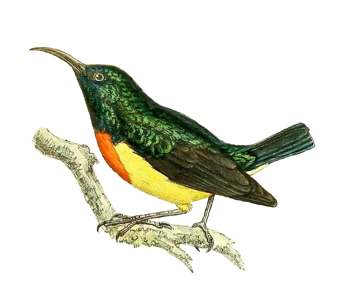
A vintage-style color illustration of a Mayotte Sunbird perched on a bare branch against a white background.
Historical illustration of the Mayotte Sunbird, a species native to the region.

Pointes et plages de Saziley et Charifou history and protected-area timeline

The protected area was formally established in 1997 as part of Mayotte's growing system of protected natural sites, and is owned and managed by the Conservatoire du Littoral, the French national agency responsible for safeguarding coastal land. Under this ownership, the site is managed primarily for habitat and species conservation, recognising the unusual combination of dry terrestrial vegetation and mangrove-fringed coastline at Mayotte's southern extremity. Its later incorporation, alongside Mont Choungui, into the Mlima Choungui and Sazilé Important Bird Area reflects an expanding recognition of its value for endemic Comoran bird species.

Pointes et plages de Saziley et Charifou landscape and geographic character

Pointes et plages de Saziley et Charifou occupies a compact but physically striking stretch of Mayotte's south-eastern coast. The most prominent feature is Point Saziley, a 4 kilometre ridge that forms the south-easternmost tip of Grande-Terre and rises sharply to around 233 metres. Its topography is unusually rugged for a small Indian Ocean island, with a knife-edge profile that falls steeply on both sides toward the sea.

The ridge sits in dramatic contrast with the lower coastal flats west of the headland. There, the beaches and back-beach areas of Dapani and Charifou are backed by mangrove communities, creating a transitional zone between marine, wetland, and dry-land environments. The juxtaposition of exposed dry ridge, sandy beach, mangrove channel, and open ocean gives the site a layered coastal scenery refined within a small area.

Pointes et plages de Saziley et Charifou ecosystems, habitats, and plant life

The protected area encompasses two strongly contrasting ecological zones that meet at Mayotte's south-eastern tip. Above all, the slopes of Point Saziley carry a dry shrubland and thicket community dominated by hardy, xeric-tolerant species, in which baobab trees (Adansonia digitata) take a leading role. This dry-land vegetation is unexpected in the generally humid Comoro setting and reflects the rain-shadow and exposure of the headland.

Below the ridge, the coastal flats include mangrove systems tied to the beaches of Dapani and Charifou, providing brackish, sheltered habitat and acting as a buffer between terrestrial ecosystems and the fringing reef. The adjacent marine waters, recognised as part of Mayotte Marine Natural Park, extend the protected mosaic seaward.

Pointes et plages de Saziley et Charifou wildlife and species highlights

The reserve supports an unusually rich community of endemic and regionally restricted species for its small size. Endemic Comoros olive pigeons (Columba pollenii) and Comoros blue pigeons (Alectroenas sganzini) occur alongside island-endemic passerines including the Mayotte white-eye (Zosterops mayottensis), the Mayotte sunbird (Cinnyris coquerellii), and the red-headed fody (Foudia eminentissima). The site's significance for these species underlies its recognition as part of an Important Bird Area together with Mont Choungui.

Reptile life is also notable, with three Comoran day gecko species documented, including Robert Mertens's day gecko (Phelsuma robertmertensi), the island day gecko (Phelsuma nigristriata), and Pasteur's day gecko (Phelsuma v-nigra pasteuri). The sandy beaches are a nesting ground for green sea turtles and likely also hawksbill sea turtles, linking the terrestrial reserve directly to marine biodiversity.

Pointes et plages de Saziley et Charifou conservation status and protection priorities

Pointes et plages de Saziley et Charifou carries a formal IUCN Category IV designation, recognising its role as a habitat and species management area. The site is owned and managed by the Conservatoire du Littoral, giving it long-term institutional protection under French national coastal-conservation policy. Its terrestrial ecosystems, particularly the dry thicket on Point Saziley, are unusual at the regional scale, and the inclusion of fringing beaches and mangroves extends the conservation value across the land-sea interface.

Inclusion of the site, together with Mont Choungui, in the Mlima Choungui and Sazilé Important Bird Area formally recognised by BirdLife International underscores the reserve's importance for the conservation of Comoran bird endemics. Its position fronting marine waters included in the Mayotte Marine Natural Park adds an additional layer of biodiversity protection, especially for nesting sea turtles.

Top sights and standout views in Pointes et plages de Saziley et Charifou

Pointes et plages de Saziley et Charifou is notable for the unusual combination of a dry, baobab-studded ridge falling straight to white-sand beaches and mangroves within a single small reserve. It is a key site for Comoros-endemic birds, hosting multiple restricted-range pigeon, white-eye, sunbird, and fody species. Nesting green and likely hawksbill sea turtles on its beaches connect the reserve directly to broader Indian Ocean marine conservation, reinforced by its overlap with the Mayotte Marine Natural Park.

Best time to visit Pointes et plages de Saziley et Charifou

As a small coastal-headland reserve on Grande-Terre, the site offers sheltered walking opportunities across different vegetation zones. The area is generally appealing when the dry climate of the ridge is stable and the beaches are accessible, reflecting the semi-arid character of the headland's vegetation.
Monthly climate preview

Long term representative temperature and monthly precipitation statistics for Mayotte

Pointes et plages de Saziley et Charifou Climate Normals and Annual Weather Patterns

Representative coordinates indicate consistent thermal baselines alongside distinct shifts in monthly precipitation across the annual cycle. Reviewing the complete twelve month dataset clarifies the measured climate normals for this protected coastal terrain.
Annual mean27 °C
25 °C28 °C
Jan28°
Feb28°
Mar28°
Apr28°
May27°
Jun26°
Jul25°
Aug25°
Sep25°
Oct26°
Nov27°
Dec28°
Warmest month
April

28.2 °C

Coolest month
August

24.9 °C

Wettest month
January

8.2 mm/day

Driest month
August

0.4 mm/day

Park location guide

Geography guide, regional context, and park location map for Pointes et plages de Saziley et Charifou

Pointes et plages de Saziley et Charifou park geography, regions, and map view in France

Understand where Pointes et plages de Saziley et Charifou sits in France through a broader geographic reading of the surrounding landscape, nearby location context, and its mapped position within the national park landscape.

How Pointes et plages de Saziley et Charifou fits into France

France is a unitary semi-presidential republic and one of the world's largest economies. It borders Belgium, Luxembourg, Germany, Switzerland, Italy, Monaco, Andorra, and Spain, with a maritime border to the United Kingdom. The country is known for its cultural influence, art, cuisine, and political history spanning centuries.

Wider geography shaping Pointes et plages de Saziley et Charifou in France

France is located in Western Europe. Metropolitan France extends from the Rhine to the Atlantic Ocean and from the Mediterranean Sea to the English Channel and North Sea. The country borders Belgium, Luxembourg, Germany, Switzerland, Italy, Monaco, Andorra, Spain, and has a maritime border with the United Kingdom.

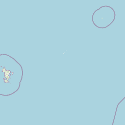
Map view of Pointes et plages de Saziley et Charifou

Use this park location map to pinpoint Pointes et plages de Saziley et Charifou in France, understand its exact geographic position, and read its mapped placement within the surrounding landscape more clearly.

Pigeon | © OpenStreetMap contributors

Location context for Pointes et plages de Saziley et Charifou

Mayotte

Visual reference of dry ridge topography, mangrove channels, and protected coastal habitats

Pointes et plages de Saziley et Charifou Photos, Landscapes, and Coastal Scenery

Visual documentation captures the rugged topography of the main ridge and the transitional mangrove environments across the coastal reserve. Detailed imagery reveals the dry shrubland, baobab thickets, and marine-fringed beaches that define the protected landscape.

A vintage-style color illustration of a Mayotte Sunbird perched on a bare branch against a white background.

A high angle view looking out from a forested hillside over a expanse of deep blue ocean, with a long, thin, bright white sandbank visible in the turquoise shallows.

Park atlas

Compare surrounding coastal reserves and regional protected areas in the Indian Ocean

Parks Near Pointes et plages de Saziley et Charifou and Protected Landscapes

Browsing other protected areas near Pointes et plages de Saziley et Charifou reveals connected coastal ecosystems, mangrove networks, and rugged island ridges. Expanding the geographic comparison helps trace broader conservation patterns across the surrounding territory.
A soft watercolor painting of a calm bay with a small island in the center, surrounded by gentle hills and green coastal land.
Wildlife reserveMayotte
About 9.2 km away#1 closest

Northwest

Baie de Bouéni Wildlife Reserve: Mapping Coastal Biodiversity and Volcanic Terrain

A protected bay and mangrove system on the coast of Mayotte.

Baie de Bouéni stands as a significant wildlife reserve in Mayotte, framed by the volcanic massifs of Mont Bénara and Mont Choungui. This coastal sanctuary protects the largest mangrove belt in the Comoros and offers a clear example of the meeting of intertidal mudflats and marine ecosystems within the western Indian Ocean.

Area
5.19 km²
Established
2007
IUCN
IV
Relief
Lowland
Nature reserveMayotte
About 22 km away#2 closest

Northeast

Vasière des Badamiers: Mapping the Protected Coastal Wetlands of Petite-Terre

Nature reserve geography and intertidal ecosystem character

Vasière des Badamiers is an essential protected coastal wetland in Mayotte, characterized by its tidal mudflats and mangrove fringes. This site acts as a key migratory refuge for waterbirds while functioning as a natural filter for the surrounding lagoon. Use this data to analyze the unique brackish basin and the ecological boundaries that define this Ramsar-recognized environment.

Area
1.25 km²
Established
2002
IUCN
IV
Watercolor illustration of a mountainous landscape with a lake and grassy fields.
National parkAnjouan
About 116 km away#3 closest

Northwest

Mount Ntringui National Park: Protected Volcanic Landscape and Highland Geography on Anjouan

Explore its dramatic peaks, crater lake, and remnant montane forests.

Mount Ntringui National Park is a significant protected area situated in the rugged volcanic highlands of Anjouan. This national park preserves the island's highest peaks, Mount Ntringui and Mount Trindrini, alongside the unique Dzialandzé crater lake and the crucial Moya Forest. It stands as a vital refuge for endemic species and represents the last substantial tract of montane forest on Anjouan, offering deep insights into the region's unique ecology and mapped natural terrain.

Area
79.14 km²
Established
2010
IUCN
II
Relief
Mountain
National parkAnjouan
About 137 km away#4 closest

Northwest

Shisiwani National Park: Anjouan's Protected Marine and Island Landscape Atlas

Coastal and terrestrial protected area mapping in Comoros.

Delve into the protected landscape of Shisiwani National Park, a critical national park situated on Anjouan's Sima Peninsula in Comoros. This atlas entry details the park's combined marine and terrestrial boundaries, highlighting its vital coral reefs, mangrove forests, and unique island geography. Understand the park's role in conservation through its mapped extent and diverse natural environments, offering a clear geographic context for protected area exploration.

Area
64.97 km²
Established
2016
IUCN
II
Climate
Tropical
National parkComoros
About 176 km away#5 closest

Northwest

Mohéli National Park: Comoros National Park and Protected Landscape Exploration

Mapped geography and protected area identity.

Mohéli National Park is a dedicated national park within the Comoros, providing a specific focus for exploring protected lands and their geographic distribution. This entry details the park's mapped boundaries and its significance as a conservation landscape. Understanding Mohéli National Park offers valuable insight into the regional geography of the Comoros archipelago and its unique natural context.

Area
643.62 km²
Established
2010
Relief
Mixed relief
Climate
Tropical
Watercolor painting of a coastal landscape with green trees, rolling hills, and light water reflections.
Protected areaSofia
About 238 km away#6 closest

South

Anjajavy Forest Protected Area: Landscape Geography and Regional Mapping

Tsingy karst, dry forest, and mangrove ecosystems in Sofia, Madagascar

The Anjajavy Forest protects a unique peninsula defined by the meeting of dry deciduous forest and jagged marine tsingy limestone. Spanning fifty square kilometres, this area is bordered by the Majajamba and Narinda Bays, showcasing an accessible convergence of complex karst topography and coastal mangrove corridors essential for endemic species.

Area
50 km²
Relief
Mixed relief
Climate
Tropical
Scope
Mixed
National parkComoros
About 238 km away#7 closest

Northwest

Karthala National Park: Comoros' Active Volcano and Endemic Protected Landscape

Explore mapped volcanic terrain and unique island biodiversity.

Karthala National Park, situated on Grande Comore, is defined by its active shield volcano, Mount Karthala, the highest peak in the Comoros. This protected area is celebrated for its extraordinary endemism, housing unique bird species and plant life evolved in isolation. The park's dramatic caldera system and sloping volcanic mass present a fascinating geological and ecological landscape, offering critical context for understanding island ecosystems and protected areas in the Indian Ocean.

Area
262.14 km²
Established
2010
Relief
Mountain
Climate
Tropical
National parkGrande Comore
About 243 km away#8 closest

Northwest

Coelacanth National Park: Marine Protected Landscape and Geographic Setting off Grande Comore

Explore the unique marine geography and conservation value.

Coelacanth National Park is a significant marine protected area dedicated to preserving a unique underwater ecosystem surrounding Grande Comore. Its designation as a national park highlights its importance for safeguarding the habitat of the coelacanth, a rare prehistoric fish species. The park's landscape comprises vibrant coral reefs and deep offshore waters, integral to the broader Indian Ocean geography, offering insights into marine conservation and protected areas.

Area
92.76 km²
Established
2010
IUCN
II
Scope
Marine

Common questions about visiting, size, designation, and location context for Pointes et plages de Saziley et Charifou

Pointes et plages de Saziley et Charifou FAQs for park facts, access, geography, and protected area context

Find quick answers about Pointes et plages de Saziley et Charifou, including protected-area facts, park geography, trail and visitor context, and how the park fits into its surrounding country and regional landscape.
MoriAtlas Explorer

Continue Your Protected Areas Search Across the Global Atlas

Deepen your exploration by continuing the structured search for national parks and protected areas worldwide. Utilize the comprehensive filtering capabilities to compare different conservation landscapes and refine your understanding of global park geography. Discover more about the distribution and characteristics of protected natural areas.

Global natural geography