
Mori Atlas logo
Protected areaPong Dam Lake

A diverse wetland sanctuary nestled within the mountain ridges of northern Himachal Pradesh

Pong Dam Lake Protected Area: Mapping the Reservoir Landscape and Siwalik Foothills Geography

(Maharana Pratap Sagar)

Pong Dam Lake represents a significant protected reservoir stretching across the lower Siwalik foothills of Himachal Pradesh. This vast wetland sanctuary creates a unique transitional landscape where mountain streams meet undulating ridges and deep-cut valleys. The site provides a critical geographic anchor for migratory bird flyways, while its seasonal water levels reveal mudflats, sand spits, and the submerged architecture of ancient temples.

wetlandreservoirramsar-sitewildlife-sanctuarybird-sanctuarymigratory-birds
An illustration of a deep mountain valley with steep rock walls, a cascading waterfall, and a winding river surrounded by coniferous trees under a soft sun.

Pong Dam Lake

Protected area

Park overview

Structured park overview, official facts, and landscape profile for Pong Dam Lake

Pong Dam Lake park facts, protected area profile, and essential visitor context

Review the core facts for Pong Dam Lake, including designation, size, terrain, visitor scale, habitats, and operating context in one park-focused overview.

About Pong Dam Lake

Pong Dam Lake is one of the defining landscape features of Himachal Pradesh's western foothills, a vast stretch of freshwater set among the Siwalik Hills where the Himalayas begin to descend toward the plains of Punjab. Created in 1975 when the Beas River was dammed at the edge of the low foothills, the reservoir has reshaped both the hydrology and the ecology of the region, transforming a stretch of river and forest into an immense inland lake that now anchors one of northern India's most important wetland systems.

The setting gives the lake a distinctive transitional quality. To the north rises the rugged Dhauladhar range, while to the south the land falls in gentle Siwalik ridges and forested slopes toward the Indo-Gangetic plains. Several islands dot the reservoir, and small settlements such as Pong and Bharmar Shivothan remain on its margins. Mountain streams cut through the surrounding valleys, feeding a catchment of more than 12,500 square kilometres that is sustained by Himalayan snowmelt and intense monsoon rains.

Ecologically, the lake has grown far beyond its original purpose of irrigation, flood control, and hydropower. It is a declared Wildlife Sanctuary and a Ramsar Wetland, famed for the sheer volume of migratory birds that arrive each year. Wetlands like Pong are a key component of the universal trans-Himalayan flyway route for waterfowl and other birds, with birds flying from as far as Siberia and Central Asia crossing the rugged Himalayas to winter in the milder climate of the Indian subcontinent. The lake also supports commercial fishing, ecological tourism, and a regional water sports centre, while its islands and buffer forests shelter mammals ranging from barking deer and sambar to leopard and the oriental small-clawed otter.

Although the dam's construction submerged several villages and displaced communities, planned resettlement, fishery cooperatives drawn from affected families, and ongoing sanctuary management have shaped Pong Dam Lake into a place where engineering, conservation, and local livelihoods coexist on a Himalayan scale.

Quick facts and research context for Pong Dam Lake

Pong Dam Lake is a large man-made reservoir on the Beas River in Kangra district, Himachal Pradesh, formed in 1975 by India's tallest earthfill dam. The reservoir sits in the low Siwalik foothills at the edge of the Indo-Gangetic plains, framed by the Dhauladhar range to the north. It is a designated Ramsar Wetland (designated 19 August 2002, site number 1211) and a declared Wildlife Sanctuary and Bird Sanctuary under Himachal Pradesh state management. The lake covers approximately 240 square kilometres under normal conditions and historically around 450 square kilometres during floods, with a catchment of about 12,561 square kilometres fed largely by monsoon rainfall and Himalayan snow and glacier melt. It also hosts one of India's only dedicated inland water sports centres.

Protection and recognition

Documented terrestrial designation history and Ramsar recognition records

Pong Dam Lake Protection Status and International Recognition Data

Pong Dam Lake maintains a terrestrial protection scope established through official designation records from 2002. Verified international recognition includes a registered Ramsar site listing detailing conservation tracking parameters.

International recognition

Protection details

Protection scope
Terrestrial
Designated year
2002
Transboundary protection
No
Park context

Deeper park guide and search-rich context for Pong Dam Lake

Pong Dam Lake history, landscape, wildlife, and travel context

Explore Pong Dam Lake through its history, landscape character, ecosystems, wildlife, conservation priorities, cultural context, and seasonal travel timing in a structured park guide built for atlas discovery and search intent.

Why Pong Dam Lake stands out

Pong Dam Lake is best known as a winter staging ground for migratory waterfowl on the Central Asian and trans-Himalayan flyway, with over 220 bird species recorded across 54 families, and winter counts that have exceeded 140,000 birds. The combination of receding shoreline mudflats, shallow margins, deep open water, sandy banks, and cultivated drawdown areas generates a remarkable range of feeding and roosting habitats within a single reservoir. Among its signature species are the bar-headed goose, ruddy shelduck, northern pintail, common teal, black stork, and, unusually for India, the red-necked grebe. The reservoir is equally recognised among anglers and naturalists for the strong mahseer fishery in its waters, said to be unique within the country.
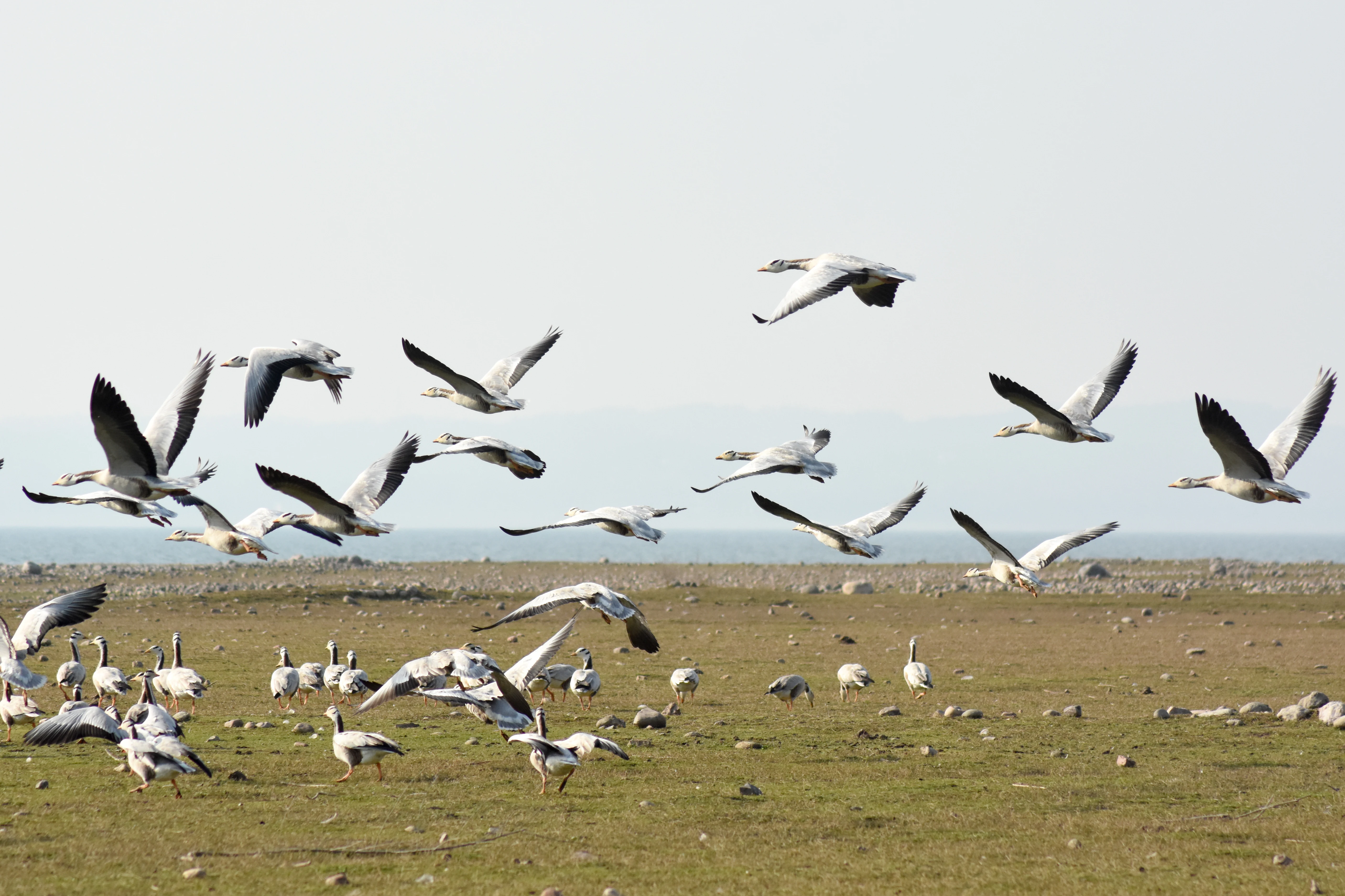
A large flock of bar-headed geese in flight and on the ground in a grassy, open landscape near water.
A flock of bar-headed geese in flight over the landscape of Pong Dam Lake.

Pong Dam Lake history and protected-area timeline

The history of Pong Dam Lake is bound up with the post-partition distribution of the Indus river system and India's effort to harness its allocated share of the three eastern rivers allocated under the Indus Water Treaty of 1960. Once the Bhakra Dam had been built on the Satluj, the Beas River was developed in stages, with the Pong Dam forming the second major stage of that plan. Construction produced what was, at the time, the highest earthfill dam in India.

The reservoir first filled in 1975, dramatically altering the Siwalik landscape and submerging long-standing villages and agricultural land along the Beas valley. The disruption led to the displacement of thousands of people, but it also opened up a new chapter for the region. In 1983, the reservoir was declared a bird sanctuary, and in 1986 the Himachal Pradesh government declared the entire reservoir a Wildlife Sanctuary, an act that carries the name of Maharana Pratap, the Rajput king of Mewar, in whose honour the lake is also known as Maharana Pratap Sagar.

Recognition of the lake's international importance grew steadily through the late twentieth century. After sustained documentation of its waterfowl populations, the reservoir was designated a Ramsar Wetland in August 2002, joining the global network of internationally significant wetland sites. The catchment planting programmes, anti-poaching patrols, and reservoir fishing cooperatives that emerged in subsequent decades have shaped the lake's modern identity as a working, inhabited, and protected landscape rather than a purely engineered reservoir.

Pong Dam Lake landscape and geographic character

Pong Dam Lake lies within the low Shivalik foothills where the Himalayas descend toward the Indo-Gangetic plains, a setting that defines its visual character. The reservoir is framed by the Dhauladhar range on the northern horizon, while the immediate shoreline consists of undulating Siwalik ridges covered in mixed pine and deciduous forest. Mountain streams cut through narrow valleys feeding the reservoir, and the surrounding terrain shifts gradually between rugged ridges, forested slopes, and gentler lowlands.

The lake itself stretches roughly 42 kilometres along its longest axis, with breadths that can approach 15 kilometres under normal conditions and broaden further during flood years. Its surface lies at an elevation of about 436 metres, and depths reach nearly 100 metres near the dam structure. The seasonal drawdown between peak and low water levels exposes extensive mudflats and sand spits along the edges, while several islands rise above the high water mark, giving the lake a varied and seasonally shifting shoreline. In the southern margins the landscape opens out toward the plains, while in the north the relief rises more sharply into deep-cut valleys and steeper hill sections.
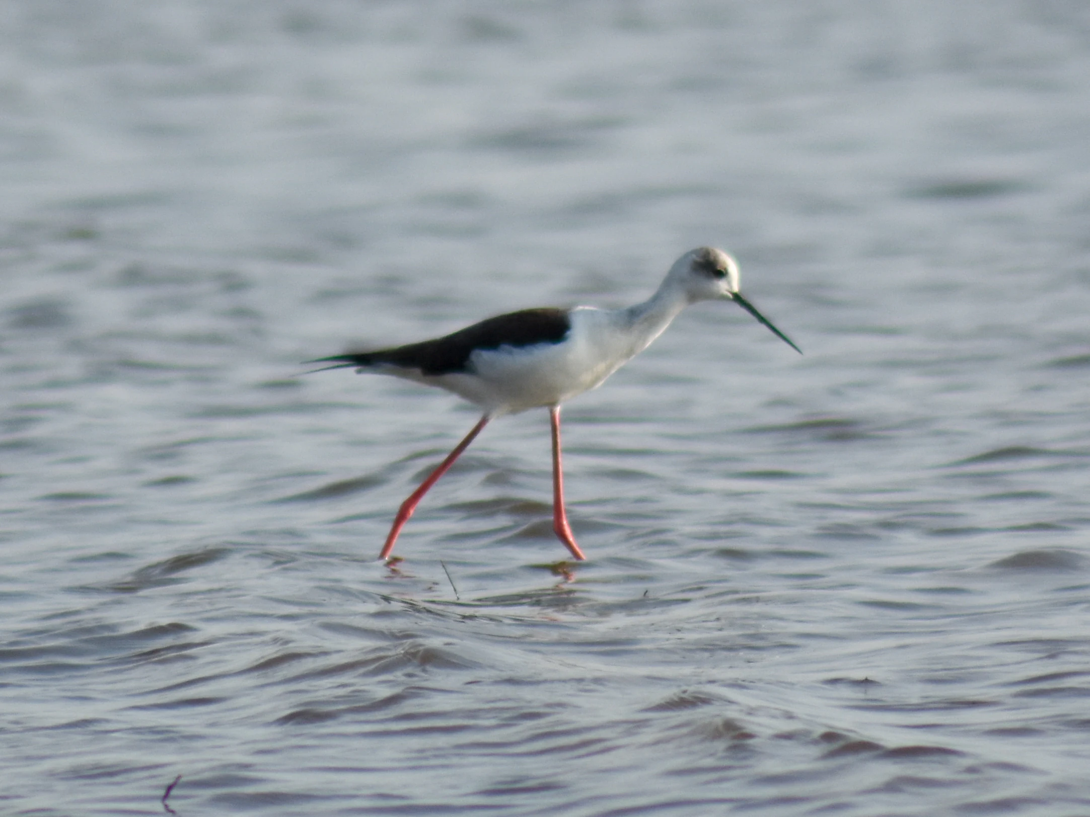
A side profile of a black-winged stilt with long pink legs walking in shallow rippled water.
A black-winged stilt wading through the waters of Pong Dam Lake.

Pong Dam Lake ecosystems, habitats, and plant life

Ecologically, Pong Dam Lake functions as a freshwater mosaic where open deep water, shallow margins, receding mudflats, sandy banks, swamp habitats, and forested catchments all converge within a single landscape. The reservoir's peripheral land is cloaked in mixed perennial and deciduous pine forests, supplemented by plantations of eucalyptus, with a varied understorey of acacia, jamun, shisham, mango, mulberry, ficus, kachnar, amla, and prunus, alongside shrubs, grasses, and climbers. Because water levels fluctuate strongly with the filling and depletion cycle, emergent aquatic vegetation is limited, although some submerged vegetation is recorded within the lake body.

The lake sits at a hinge point between mountain and plain, and that geographic position is what powers its ecological richness. Catchment runoff from glacial melt, snowmelt, and intense monsoon rainfall feeds a nutrient regime capable of supporting both rich fisheries and the enormous seasonal influx of waterfowl. Habitats around the reservoir are highly complementary: muddy shores provide invertebrates for waders, shallow margins suit dabbling ducks, open deep water hosts grebes and diving species, and dry sandy banks dotted with boulders create roosting and feeding habitat for stone curlews and pratincoles. The combination of these conditions within one catchment is what gives Pong Dam Lake its reputation as an unusually complete and ecologically layered wetland.
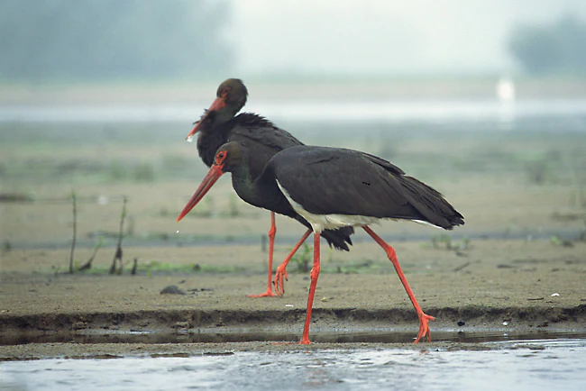
Two black storks with dark plumage and long red beaks walking along the muddy shore of a lake.
Two black storks wading at the edge of the water at Pong Dam Lake.

Pong Dam Lake wildlife and species highlights

Pong Dam Lake is internationally significant for its waterfowl, with more than 220 bird species across 54 families recorded, supported by winter counts that have climbed from an annual average below twenty thousand in the late 1980s and early 1990s to well over one hundred thousand in recent years. The lake sits on the trans-Himalayan flyway, and birds arrive from the plains of India and from distant Central Asian breeding grounds, including Siberia. Among its signature winter visitors are the bar-headed goose, ruddy shelduck, northern pintail, common teal, Indian spot-billed duck, Eurasian coot, black-headed gull, plovers, terns, egrets, and the striking black stork, along with occasional rare records such as the red-necked grebe, first documented in India at this site in 1987.

The lake's fish fauna is equally important. Twenty-seven species from five families have been recorded, with mahseer, catla, mirror carp, and native singhara among the most valued. A deliberate stocking programme, beginning with common carp in 1974 and Indian major carps and silver carp in the late 1970s, shifted the reservoir's catch composition to a carp-dominated profile while mahseer populations have remained strong enough for the site to hold the country's only known dedicated mahseer fishery of its kind.

In the forested catchments above the shore, mammals thrive alongside the birdlife. Barking deer, sambar, wild boar, leopard, and the oriental small-clawed otter have all been recorded in the buffer zone, benefitting from the habitat mosaic the reservoir creates between water, forest, and farmland. Local fishermen, traditional boat builders, and visitors during peak winter all add a human layer to the wildlife experience at Pong Dam Lake.
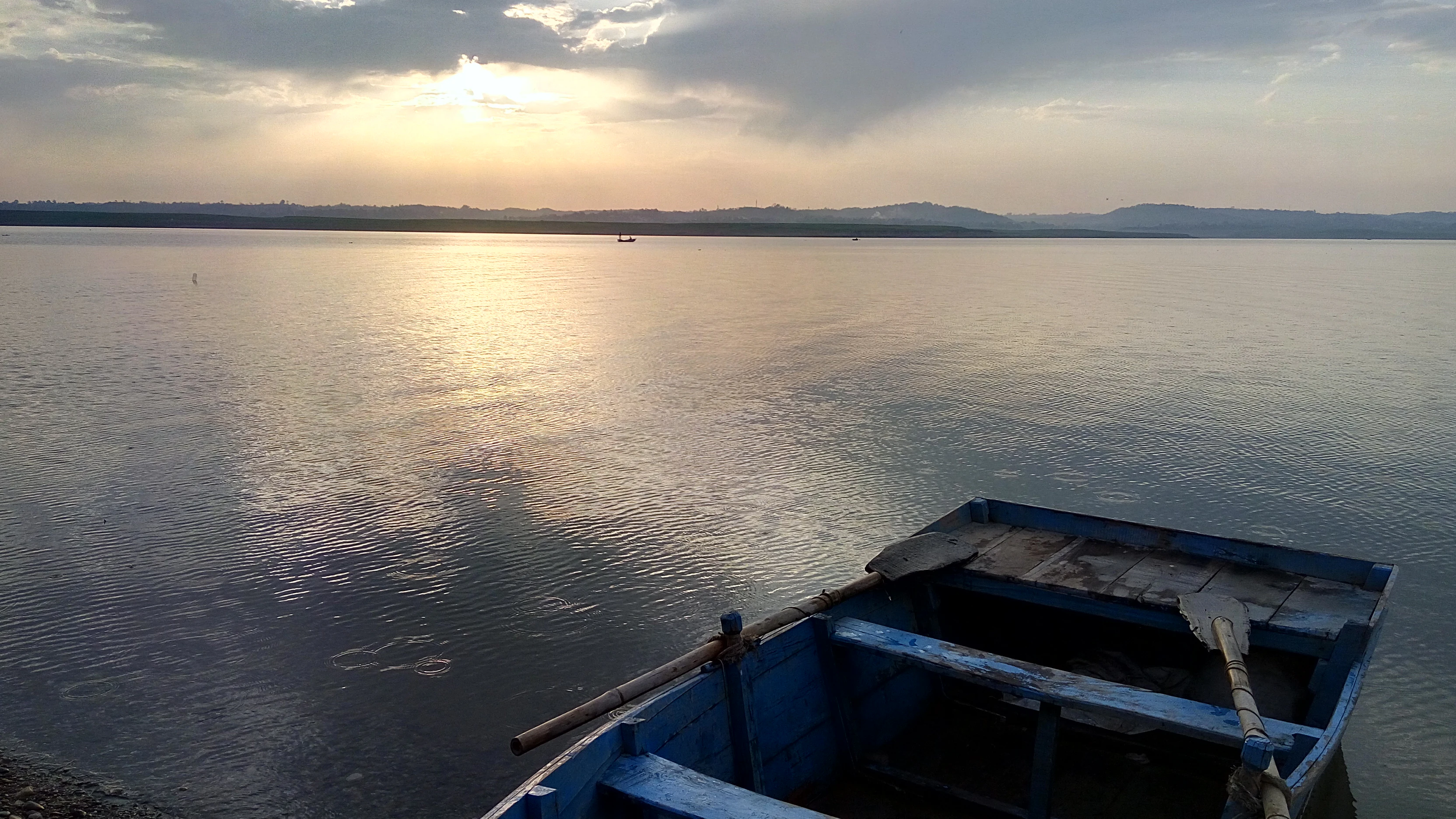
A small blue wooden rowboat sits in the foreground on a calm, expansive lake under a cloudy sunset sky, with distant hills visible on the horizon.
Sunset over the serene waters of Pong Dam Lake, featuring a small wooden boat moored at the shore.

Pong Dam Lake conservation status and protection priorities

The conservation significance of Pong Dam Lake rests on its formal recognition across multiple layers of protection. Declared a Wildlife Sanctuary in 1986 and a Bird Sanctuary earlier in 1983, the lake became a Ramsar Wetland in 2002, joining the global network of internationally important wetland sites and cementing its status as a key stopover and wintering ground on the trans-Himalayan flyway.

This protected framework has been backed by practical measures on the ground. Nearly forty village forest development committees work alongside nine checkposts and two mobile units to suppress poaching of birds and mammals within the sanctuary's five-kilometre buffer belt, while large-scale plantation in the reservoir's peripheral area helps reduce siltation and creates nesting habitat. Strict fishery rules, including minimum catchable sizes for mahseer, are credited with sustaining the reservoir's unusual mahseer population. One of the reservoir's islands has been formally named Ramsar and developed as an education and conservation hub, helping link protected-area management, local livelihoods, and the long-term ecological future of this Himalayan reservoir.

Pong Dam Lake cultural meaning and human context

The cultural setting of Pong Dam Lake blends inherited memory with active community life. The reservoir was named in honour of Maharana Pratap, the sixteenth-century Rajput ruler of Mewar, giving the landscape an identity drawn from a wider Indian historical imagination. Beneath the reservoir itself lies a quieter cultural layer in the form of the Bathu Temples, a cluster of ancient temples that remain submerged for much of the year and emerge only when water levels fall between March and June.

The lake's modern communities remain closely tied to its waters. Families displaced by the original submergence became the backbone of the reservoir's fishing cooperatives, while traditional wooden boat-building continues in settlements such as Dehra, passed down by craftsmen whose numbers have shrunk over time but whose work still links the reservoir to long-standing local practices of using the Beas.
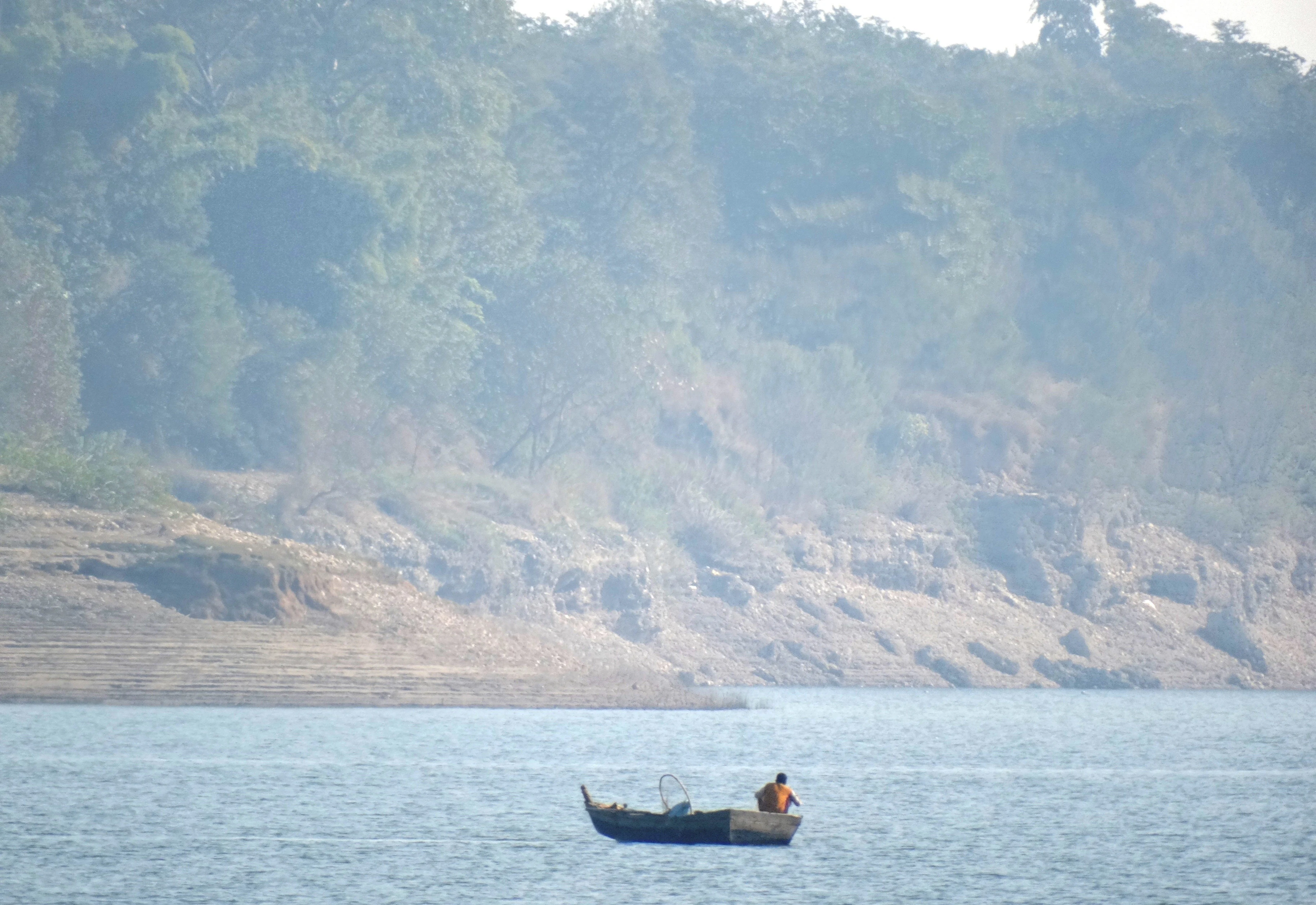
A small boat with a lone fisherman on a calm lake with a forested hillside in the background.
A lone fisherman on the waters of Pong Dam Lake.

Top sights and standout views in Pong Dam Lake

Among Pong Dam Lake's most distinctive qualities is the sheer scale of its seasonal birdlife, with over 220 species and counts exceeding one hundred thousand waterfowl, anchored by flocks of bar-headed geese that have become an iconic winter sight over the Siwalik Hills. Equally distinctive is the reservoir's role as one of India's few strongholds for mahseer angling, supported by carefully managed fishing rules. The setting itself, framed by the Dhauladhar against Siwalik foothills with several forested islands within the lake, gives the site a powerful visual identity. Adding to its distinctiveness are the seasonal emergence of the ancient Bathu Temples and the presence of one of the country's only dedicated water sports centres on an inland reservoir.
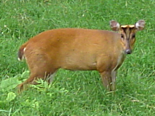
A medium shot of a brown muntjac deer with small antlers standing in a field of bright green grass.
A muntjac deer standing in a grassy meadow at Pong Dam Lake.

Best time to visit Pong Dam Lake

Winter is the most rewarding time to experience Pong Dam Lake, with large flocks of migratory waterfowl arriving between November and March and reaching their peak counts in the early months of the year. Cooler temperatures and clearer skies make this period ideal for birdwatching across the lake's varied shoreline habitats, from mudflats and sand spits to shallow margins and forested edges. Outside of winter, lower water levels between March and June expose more shoreline and reveal the ancient Bathu Temples, while the warmer months offer access to the lake's water sports facilities. Monsoon months bring heavy rainfall and rising water levels that expand the reservoir's surface area and limit land-based access to the shoreline, so most visitors focus on the drier winter and spring windows.
Monthly climate preview

Trace monthly average temperatures and long-term precipitation rhythms at a representative coordinate.

Pong Dam Lake Climate Normals and Measured Annual Temperature Patterns

Long-term representative measurements for Pong Dam Lake record mean monthly temperatures shifting from cooler winter lows to warm summer maximums alongside distinct precipitation fluctuations. Examining the complete twelve-month climatology profile reveals comprehensive variations in average temperature and monthly precipitation across the protected area.
Annual mean20 °C
10 °C29 °C
Jan10°
Feb12°
Mar17°
Apr22°
May27°
Jun29°
Jul27°
Aug25°
Sep24°
Oct20°
Nov16°
Dec12°
Warmest month
June

29.1 °C

Coolest month
January

9.7 °C

Wettest month
August

8.4 mm/day

Driest month
November

0.3 mm/day

Park location guide

Geography guide, regional context, and park location map for Pong Dam Lake

Pong Dam Lake park geography, regions, and map view in India

Understand where Pong Dam Lake sits in India through a broader geographic reading of the surrounding landscape, nearby location context, and its mapped position within the national park landscape.

How Pong Dam Lake fits into India

India is a South Asian country bordered by the Indian Ocean, Arabian Sea, and Bay of Bengal. It shares land borders with Pakistan, China, Nepal, Bhutan, Bangladesh, and Myanmar. The country has a population of over 1.4 billion people and operates as a federal parliamentary republic with its capital in New Delhi.

Wider geography shaping Pong Dam Lake in India

India occupies the Indian subcontinent in South Asia, bordered by the Arabian Sea to the southwest, the Bay of Bengal to the southeast, and the Indian Ocean to the south. It shares land borders with Pakistan to the west, China, Nepal, and Bhutan to the north, and Bangladesh and Myanmar to the east. The territory also includes the Andaman and Nicobar Islands in the Indian Ocean.

Map view of Pong Dam Lake

Use this park location map to pinpoint Pong Dam Lake in India, understand its exact geographic position, and read its mapped placement within the surrounding landscape more clearly.

Pigeon | © OpenStreetMap contributors

Location context for Pong Dam Lake

Himachal Pradesh

Explore photographic records of terrain, shoreline habitats, and protected Siwalik foothills.

Pong Dam Lake Photos and Scenery: Visualizing Himalayan Wetland Landscapes

Photographic documentation reveals the diverse shorelines, receding mudflats, and open water habitats that define Pong Dam Lake. Visualizing these protected wetland environments provides clear insight into the ecological character of the western Himalayan foothills.

A large flock of bar-headed geese in flight and on the ground in a grassy, open landscape near water.

Several bar-headed geese with distinctive black-and-white head markings flying over a flat, hazy landscape.

A side profile of a black-winged stilt with long pink legs walking in shallow rippled water.

Two black storks with dark plumage and long red beaks walking along the muddy shore of a lake.

A small blue wooden rowboat sits in the foreground on a calm, expansive lake under a cloudy sunset sky, with distant hills visible on the horizon.

A wide, hazy sunrise view over the calm water of Pong Dam Lake, with smooth dark stones and gentle waves in the foreground.

A small boat with a lone fisherman on a calm lake with a forested hillside in the background.

A medium shot of a brown muntjac deer with small antlers standing in a field of bright green grass.

Park atlas

Compare adjacent wetland reserves and foothill conservation landscapes

Explore Parks Near Pong Dam Lake and Surrounding Himalayan Protected Areas

Browse nearby protected areas sharing the transitional terrain of the lower western Himalayan foothills. Expand geographic comparison across regional wetland habitats and neighboring wildlife reserves.
Wildlife reservePunjab
About 19 km away#1 closest

Southwest

Beas Conservation Reserve: Geographic Atlas of a Punjab Protected Wildlife Landscape

Braided River Systems and Freshwater Biodiversity

Located in northwestern India, the Beas Conservation Reserve protects a vital 185 km river corridor. The reserve is characterized by a complex, shifting mosaic of sand bars and islands that support rare freshwater species. This entry provides detailed insight into the protected boundaries, hydrological features, and regional geography of this unique wetland conservation area in Punjab.

Established
2017
Relief
Lowland
Scope
Terrestrial
Water
Water-dominated
Wildlife reservePunjab
About 73 km away#2 closest

South

Nangal Wildlife Sanctuary: A Protected Wetland Refuge in the Punjab Foothills

Mapped riparian landscapes and reservoir habitats in the Sutlej River basin

Located within the Shivalik foothills, Nangal Wildlife Sanctuary preserves a unique man-made reservoir ecosystem. This record details the park's protected boundaries, riparian vegetation, and its role as a essential wetland habitat for regional migratory waterbirds and threatened species in the Punjab river landscape.

Area
1.16 km²
Established
2009
IUCN
IV
Relief
Upland
Wildlife reservePunjab
About 95 km away#3 closest

Southwest

Kanjli Wetland Wildlife Reserve: Punjab Regional Geography and Protected Area Atlas

Hydrological boundaries and wetland ecosystems of central Punjab

Kanjli Wetland functions as a critical freshwater habitat and irrigation reservoir within the Punjab river basin. This protected area supports a diverse array of aquatic and terrestrial life, offering a unique window into the intersection of historical royal infrastructure and modern conservation efforts. Use this detailed geographic profile to understand the wetland's physical landscape, its role within the Beas basin, and its status as a key component of the regional protected network.

Area
4.9 km²
Established
1870
Relief
Lowland
Climate
Subtropical
Wildlife reserveIndia
About 116 km away#4 closest

Northwest

Surinsar-Mansar Lakes Wildlife Reserve: Protected Landscapes and Geography in India

Paired wetland ecosystems within the Jammu foothills.

Surinsar-Mansar Lakes, a designated wildlife reserve, provides a unique geographic study of paired wetland basins set in the low-lying hills of Jammu. This protected area supports a variety of migratory waterfowl and native turtle species within its forested borders, bridging the landscape between agricultural lowlands and the sub-Himalayan foothill environment.

Area
0.59 km²
Water
Water-dominated
A horizontal watercolor painting depicting a meandering river passing through green wetlands and low-lying hills with a soft, misty background.
Protected areaPunjab
About 117 km away#5 closest

South

Ropar Wetland: Geographic Mapping of a Punjab Freshwater Protected Landscape

Riverine and lacustrine geography in the Shivalik foothills.

Ropar Wetland stands as a significant protected area within the Punjab region, defined by its man-made reservoir origin and subsequent ecological maturation. This site serves as a vital transition point between the Shivalik hills and the Indo-Gangetic plains, hosting a dense variety of marshland, forest, and open water habitats that support rare reptile species and extensive bird populations.

Area
13.65 km²
Established
1952
Relief
Lowland
Climate
Subtropical
National parkHimachal Pradesh
About 122 km away#6 closest

East

Great Himalayan National Park: Protected Landscape and Mapped Geography

Explore this national park's dramatic elevation and rich biodiversity.

Great Himalayan National Park is a vital protected area within India's Himachal Pradesh, celebrated for its exceptional biodiversity and dramatic mountain geography. This national park encompasses a remarkable range of elevations, creating distinct ecological zones from lower forest elevations to high alpine meadows and glacial zones. Its significance as a mapped protected landscape makes it essential for understanding regional natural heritage and conservation efforts within the Himalayas.

Area
1,171 km²
Established
1984
IUCN
II
Relief
Mountain
National parkIndia
About 127 km away#7 closest

East

Inderkilla National Park: Detailed Protected Landscape and Geographic Atlas Entry

Mapping the natural terrain and protected boundaries across India.

Delve into the protected landscape of Inderkilla National Park, a designated national park located in India. This entry provides essential geographic context, focusing on the park's mapped boundaries and its role within the country's protected areas atlas. Understand the specific natural terrain and regional landscape character that defines Inderkilla National Park for detailed geographic exploration.

Area
46.1 km²
Established
2010
Relief
Mountain
Climate
Alpine
Watercolor illustration showing mountains, a tree, and a landscape with green and pink tones
National parkHimachal Pradesh
About 135 km away#8 closest

East

Khirganga National Park: Himachal Pradesh National Park Geographic Atlas

Mapped protected area and regional landscape context.

Investigate Khirganga National Park, a designated national park situated within the vast mountain geography of Himachal Pradesh. This atlas-focused entry provides critical details on the park's protected landscape identity, its mapped boundaries, and its significance within the broader regional context of northern India's Western Himalayas. Understand the park's geographic position for detailed landscape exploration.

Area
710 km²
Established
2010
IUCN
II
Relief
Mountain

Common questions about visiting, size, designation, and location context for Pong Dam Lake

Pong Dam Lake FAQs for park facts, access, geography, and protected area context

Find quick answers about Pong Dam Lake, including protected-area facts, park geography, trail and visitor context, and how the park fits into its surrounding country and regional landscape.
MoriAtlas Explorer

Continue Your Protected Areas Search Across the Global Atlas

Deepen your exploration by continuing the structured search for national parks and protected areas worldwide. Utilize the comprehensive filtering capabilities to compare different conservation landscapes and refine your understanding of global park geography. Discover more about the distribution and characteristics of protected natural areas.

Global natural geography