
Mori Atlas logo
Nearby park discovery

Geographic landscape context and mapped proximity for surrounding wilderness areas

Regional Protected Areas and National Parks Near the Popo Agie Wilderness in Wyoming

Examine the geographic distribution of protected lands and wilderness areas situated in the proximity of the Popo Agie Wilderness. This data-driven view provides landscape context by mapping the relative positioning of nearby protected sites throughout the southern Wind River Range and the broader Wyoming high country.

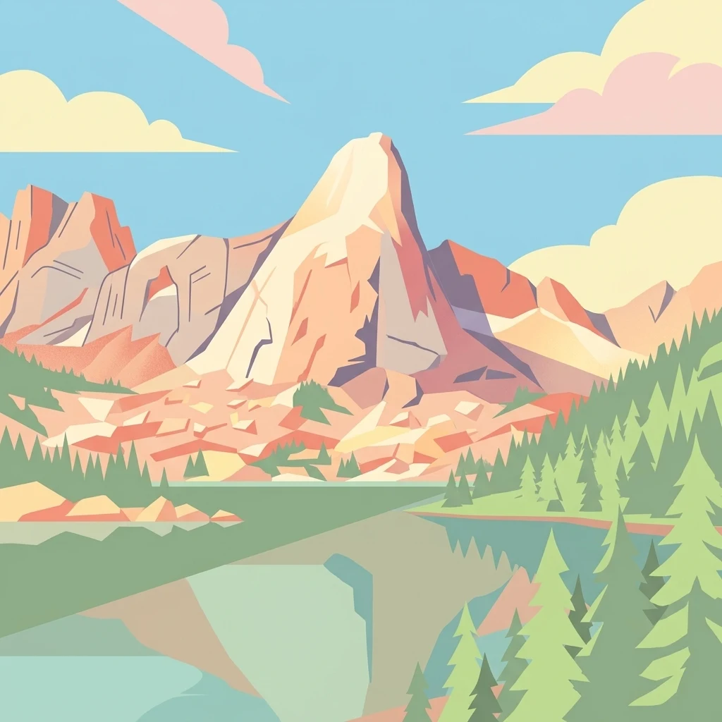
A graphic illustration showing a large, central granite mountain peak reflected in a calm, still lake, framed by pine trees on the right and rolling clouds above.

Alpine wilderness of the southern Wind River Range, anchored by the granite grandeur of the Cirque of the Towers.

Popo Agie Wilderness

Popo Agie Wilderness is a federally designated wilderness area within Shoshone National Forest in west-central Wyoming, covering roughly 101,870 acres on the eastern slope of the continental divide in the southern Wind River Range. The landscape is predominantly subalpine and alpine, rising from around 8,400 feet at its lowest elevations to summits that exceed 13,000 feet, including Wind River Peak, the tallest point in the wilderness at 13,192 feet. The wilderness is a part of the broader Greater Yellowstone Ecosystem, one of the largest intact temperate ecosystems remaining in the contiguous United States. More than 300 lakes and numerous tributaries of the Wind River drain through its valleys, supporting dense conifer forests of lodgepole pine and Douglas fir at lower elevations and stands of Engelmann spruce and subalpine fir as the terrain climbs toward the tree line. Popo Agie is best known for the Cirque of the Towers, a dramatic amphitheater of granite spires and sheer cliffs that draws climbers from across the world. Beyond its iconic climbing terrain, the wilderness offers a remote and motor-free backcountry experience shaped by its rugged peaks, alpine basins, glacial lakes, and the seasonal presence of large mammals and rare fish species native to the Yellowstone region.

Location
United States of America
Park type
Protected area
Established
1984
Area
412.3 km²
Highest point
4,021 m
Popo Agie Wilderness Geography
Regional park map

See the ranked park cluster in its geographic setting

Nearby parks around Popo Agie Wilderness

This regional map shows the same 20 nearby parks ranked below around Popo Agie Wilderness. Select a ranked marker to highlight that park’s boundary where boundary data is available.
Reference park: Popo Agie WildernessRanked nearby parkSelected boundary: Popo Agie Wilderness20 nearby parks shown
20 nearby parks

Distance-ranked regional park geography and surrounding protected landscapes

Parks and protected areas geographically near Popo Agie Wilderness

Spatial proximity measurements establish a ranked sequence of nearby protected areas surrounding Popo Agie Wilderness based on mapped boundary separation. Comparing these surrounding landscapes reveals distinct regional environmental patterns and conservation contexts across the broader geographic territory.
Watercolor painting of a peaceful mountain valley landscape, showing a small winding stream in the foreground, grassy meadows, clusters of pine trees, and rolling mountain peaks in a soft, sunset-colored sky.
Protected landscapeWyoming
Park boundaries overlap#1 closest

North

Shoshone National Forest: A Comprehensive Map and Geography of America's Oldest National Forest

Rugged wilderness and glacial peaks in Wyoming

Discover the immense geographic scale of Shoshone National Forest, which protects a diverse landscape ranging from sagebrush valleys to 13,000-foot granite summits. This atlas overview details its role within the Greater Yellowstone Ecosystem and its expansive, federally designated wilderness areas, offering a clear perspective on its volcanic and glacial terrain.

Area
9,992.69 km²
Established
1891
IUCN
VI
Visitors
500K annual
A soft, minimalist watercolor painting of a serene lake nestled among rolling hills under a gentle, pastel-toned sky.
Protected landscapeWyoming
16 km away#2 closest

Northwest

Fitzpatrick Wilderness: Exploring the Rugged Protected Landscapes of Western Wyoming

A core alpine environment within the Wind River Range.

Fitzpatrick Wilderness represents one of the most uncompromisingly wild segments of the Wind River Range, featuring persistent glaciers, dramatic U-shaped valleys, and high granite spires. This protected landscape offers a deep look into the alpine geography of Wyoming, preserved under the Wilderness Act to maintain its rugged character, remote glacial cirques, and intricate mountain ecosystems.

Area
803.4 km²
Established
1976
IUCN
Ib
Relief
Mountain
A watercolor painting showing a stylized landscape with a light blue lake, soft green rolling hills, and hints of red rock cliffs against a white background.
Protected areaWyoming
129 km away#3 closest

South

Flaming Gorge National Recreation Area: Protected Reservoir and Canyon Landscape Atlas

High desert geography and canyon terrain on the Wyoming and Utah border.

Flaming Gorge National Recreation Area features a complex geography where the Green River carves through vivid red sandstone cliffs. This protected area integrates large-scale reservoir management with mountain forest slopes and diverse river corridors, creating a unique mapped landscape that reflects the geologic character of the intermountain West.

Area
839.17 km²
Established
1968
Relief
Upland
Climate
Arid
National parkUnited States of America
133 km away#4 closest

Northwest

Grand Teton National Park: Protected Landscape and Geographic Atlas Exploration

Explore the mapped terrain and regional park geography.

Grand Teton National Park is a protected landscape offering rich geographic discovery opportunities within the United States of America. This detailed entry facilitates an atlas-style exploration of its mapped boundaries, the surrounding regional geography, and its identity as a significant national park. Understand the specific landscape context and discover its placement within the broader natural terrain of North America.

Area
1,300 km²
Established
1929
IUCN
II
Visitors
2.8M annual
Wildlife reserveWyoming
150 km away#5 closest

Northwest

Jedediah Smith Wilderness: Protected Alpine Terrain and Teton Range Geography

Glacially sculpted high-country basins in western Wyoming

Spanning the western face of the Teton Range, the Jedediah Smith Wilderness serves as a federally protected buffer for iconic mountain landscapes. The region features dramatic cirques, hanging valleys, and dense subalpine forest habitats, forming an essential, roadless link within the broader Greater Yellowstone Ecosystem. Explore the terrain features and structural geography that define this remote high-country wilderness area.

Area
499.59 km²
Established
1984
IUCN
Ib
Relief
Mountain
National parkWyoming
151 km away#6 closest

Northwest

Yellowstone National Park: US National Park Protected Landscape & Geographic Atlas

Explore mapped boundaries and regional natural landscape context.

Yellowstone National Park represents a significant protected landscape within Wyoming, designated as a US national park. This entry offers detailed insight into its geographic scope, mapped boundaries, and the unique natural terrain that defines it. Understand its role in regional geography and discover its protected-area identity through a structured atlas exploration, providing context for its conservation landscape.

Area
8,983.18 km²
Established
1872
IUCN
II
Visitors
4.7M annual
Wildlife reserveUtah
215 km away#7 closest

Southwest

Mount Naomi Wilderness: Mapping High-Altitude Protected Landscapes in Northern Utah

Alpine summits, forested ridges, and subalpine lake basins

Situated in the Bear River Range of northern Utah, Mount Naomi Wilderness stands as a protected corridor of rugged mountain terrain. This wilderness area preserves a diverse high-elevation environment, spanning from the steep western canyons of the Logan River to the prominent summits of Naomi Peak. It serves as a vital point of geographic interest for understanding the subalpine ecosystems and wilderness boundaries within the Uinta-Wasatch-Cache National Forest.

Area
180.18 km²
Established
1984
IUCN
Ib
Relief
Mountain
Protected landscapeMontana
222 km away#8 closest

North

Bighorn Canyon National Recreation Area: Maps and Protected Landscape Geography

A reservoir-anchored protected area in the Montana high desert

Defined by its striking contrast between deep blue reservoir water and sheer canyon walls, Bighorn Canyon National Recreation Area protects an essential arid landscape in the Mountain West. This region encompasses portions of the Pryor Mountains and the historic Bad Pass Trail, offering a window into the intersection of vast high-desert plains and rugged mountain terrain.

Area
486.82 km²
Established
1966
Visitors
217.7K annual
Relief
Upland
Protected areaWyoming
223 km away#9 closest

Southeast

Huston Park Wilderness: Atlas Exploration of Wyoming Protected Mountain Terrain

Examining the high-country forest and alpine geography of the Medicine Bow region.

Huston Park Wilderness serves as a protected sanctuary for the coniferous forests and rocky ridges of central Wyoming. This atlas entry provides geographic insights into its 30,000 acres of subalpine wilderness, tracing how its mountain terrain remains preserved within the Medicine Bow National Forest without human development.

Area
123.79 km²
Established
1984
IUCN
Ib
Relief
Mountain
Wildlife reserveWyoming
240 km away#10 closest

Southeast

Encampment River Wilderness: Protected River Canyon Geography and Mapped Terrain

A focused wilderness landscape in the Medicine Bow National Forest

The Encampment River Wilderness preserves a unique, roadless canyon corridor in south central Wyoming. By protecting the river drainage, it maintains a critical forest ecosystem defined by steep slopes and riparian habitats within the broader Medicine Bow National Forest mountain range.

Area
40.97 km²
Established
1984
IUCN
Ib
Relief
Mountain
A watercolor illustration of a mountain range with soft, pastel-colored peaks in the background and a green treeline in the foreground.
Wildlife reserveColorado
250 km away#11 closest

Southeast

Mount Zirkel Wilderness: Protected Mountain Geography and Forested Landscape Overview

A study of high elevation terrain in the Colorado Rocky Mountains.

Mount Zirkel Wilderness stands as a primary protected area within the Colorado Rocky Mountains. The landscape is defined by the Encampment River headwaters, glaciated alpine basins, and the characteristic ribbon forests formed by extreme snowfall. This analysis explores the metamorphic bedrock and forest composition across the high ridges near the Continental Divide, providing a clear view of the park boundaries and regional environmental features.

Area
647.23 km²
Established
1980
IUCN
Ib
Relief
Mountain
Protected landscapeUnited States of America
About 260 km away#12 closest

Southwest

Wasatch-Cache National Forest Protected Area: Geography, Mountains, and Wilderness Mapping

Analyzing high-mountain terrain and watershed connectivity across the Intermountain West

Wasatch-Cache National Forest serves as a major ecological anchor in the United States. Its territory encompasses the iconic Wasatch Range, extensive designated wilderness zones, and alpine basins. The region provides critical watershed protection and supports diverse high-altitude ecosystems, from narrow, dissected ridges to broad, glaciated terrain throughout northern Utah and surrounding areas.

Area
6,504.01 km²
Established
1906
Relief
Mountain
Access
Easy access
A horizontal watercolor painting depicting a winding river flowing through a green valley with purple-tinted mountain ranges in the background.
Wildlife reserveWyoming
263 km away#13 closest

Southeast

Platte River Wilderness: Geography and Protected Landscape Atlas

Mapping wild river corridors and mountain forest terrain across Wyoming and Colorado.

Platte River Wilderness preserves a vital stretch of the North Platte River, carving through mountain ranges with steep canyon walls and rocky gorges. The terrain offers a distinct profile of conifer forests and shifting river landscapes. This protected area stands as a primary example of wilderness administration, managing complex river-based topography and regenerating mountain habitat for regional wildlife populations.

Area
95.07 km²
Established
1984
IUCN
Ib
Relief
Mountain
Wildlife reserveMontana
266 km away#14 closest

Northwest

Lee Metcalf Wilderness: Geographic Profile and Protected Landscape Boundaries in Montana

Mapping rugged alpine terrain across four distinct mountainous units

Located in southwestern Montana, the Lee Metcalf Wilderness serves as a cornerstone of ecological connectivity within the Greater Yellowstone Ecosystem. Spanning over 250,000 acres, this protected area features a unique fragmented geography consisting of the Bear Trap Canyon, Spanish Peaks, Taylor-Hilgard, and Monument Mountains units. The landscape is defined by its roadless mountain ridges, forested slopes, and deep river corridors, providing essential sanctuary for large mammal populations.

Area
1,029.07 km²
Established
1983
IUCN
Ib
Relief
Mountain
Nature reserveBeaverhead County
268 km away#15 closest

Northwest

Red Rock Lakes Wilderness: Nature Reserve and Wetland Geography in Beaverhead County

High elevation marshes and protected water basins.

Red Rock Lakes Wilderness preserves an extensive high-elevation wetland complex in Beaverhead County, Montana. This nature reserve, characterized by shallow lake basins and forested mountain ridges, serves as a vital ecological corridor in the Northern Rockies. Its protected landscape offers a study in water-driven geography, where remote marshes and reflective lakes define the terrain's character.

Area
130.9 km²
Established
1976
IUCN
Ib
Relief
Upland
Protected landscapeWyoming
272 km away#16 closest

East

Thunder Basin National Grassland: A Protected Landscape in the Wyoming Powder River Basin

Mapping the prairie and sagebrush mosaic of northeastern Wyoming

Thunder Basin National Grassland is a sprawling, federally protected territory in northeastern Wyoming that functions as a critical ecotone between the Great Plains and the Rocky Mountain region. Its landscape is characterized by wide-open vistas, intricate sedimentary bluffs, and diverse habitats shaped by natural disturbance patterns and ongoing grassland management. This record outlines the geography, terrain features, and protected boundaries that define this essential segment of the American West.

Area
2,215.65 km²
Established
1960
Relief
Upland
Climate
Arid
Protected areaIdaho
274 km away#17 closest

West

Curlew National Grassland: Protected Area Geography and Sagebrush Steppe Landscape in Idaho

Mapped regional geography and rangeland conservation context

Located in southeastern Idaho, Curlew National Grassland offers an expansive view of the Intermountain sagebrush steppe. This protected area provides a historical example of Depression-era land restoration and currently functions as a vital habitat for sagebrush-associated wildlife, showcasing the unique, rolling plains and semi-arid terrain characteristic of the northern Great Basin.

Area
193.4 km²
Established
1934
Relief
Upland
Scope
Terrestrial
A horizontal watercolor painting showing a range of purple and reddish-toned mountains in the distance, behind rolling green fields and a pale pinkish waterway in the foreground.
Protected landscapeColorado
288 km away#18 closest

Southeast

Roosevelt National Forest: Mapping Wilderness and Protected Landscapes in Northern Colorado

Regional geography, river corridors, and alpine mountain terrain

Roosevelt National Forest encompasses a significant protected landscape across Larimer, Boulder, Gilpin, and Jefferson counties. The forest features a complex terrain of deep canyons, forested plateaus, and protected wilderness areas that form a scenic buffer along the eastern side of the Continental Divide and Rocky Mountain National Park.

Area
3,293.33 km²
Established
1902
Relief
Mountain
Climate
Subpolar
Watercolor painting of a calm lake surrounded by forested shores and distant mountains, depicted in soft pastel tones.
Protected landscapeIdaho
298 km away#19 closest

West

Sawtooth National Forest: Geographic Overview and Protected Mountain Boundaries

Central Idaho mountain systems and wilderness corridors

Spanning over two million acres, Sawtooth National Forest defines the heart of the Rocky Mountains in Idaho. This protected landscape contains a complex network of glacial basins, alpine lakes, and varied ecosystems ranging from arid sagebrush foothills to high-altitude peaks. Explore the internal boundaries, drainage systems, and structural geography of this significant wilderness area.

Area
8,540.52 km²
Established
1905
Visitors
1.2M annual
Relief
Mountain
Soft watercolor illustration of a rolling mountain landscape with a forested foreground and faded, distant peaks.
Protected landscapeIdaho
313 km away#20 closest

Northwest

Salmon, Challis National Forest: Geography and Protected Land Map in Central Idaho

Extensive alpine ridges and wild river corridors

Spanning over 4.2 million acres, Salmon, Challis National Forest is a foundational protected landscape in Idaho. This area includes the highest peaks in the state, such as Borah Peak, and holds the majority of the Frank Church, River of No Return Wilderness. Utilize this atlas resource to examine the intricate mountain topography, expansive river systems, and the contiguous wild corridors that define this significant portion of the northern Rockies.

Area
17,142.2 km²
Established
1908
Relief
Mountain
Climate
Temperate
Distance methodology

Geographic measurements, not driving distances

How nearby park distances are calculated

Distances use park boundaries whenever the available geometry allows it. When one or both boundaries are missing, the mapped park locations provide a clearly labelled estimate. Every value represents straight-line geographic separation and does not use roads or routing.

Boundary distance

Calculated between the nearest points of both park boundaries.

Location-to-boundary estimate

Estimated from one mapped park location to the nearest boundary of the other park.

Mapped-location estimate

Estimated between the mapped locations of both parks.

MoriAtlas Explorer

Explore the Protected Landscapes of the Popo Agie Wilderness

Deepen your understanding of the Popo Agie Wilderness through its mapped alpine geography and high-country terrain. Discover how this massive protected area in the Wyoming Wind River Range contributes to the broader Greater Yellowstone Ecosystem and shapes the surrounding mountain landscape.

Global natural geography