
Mori Atlas logo
Nature reservePrameniště

A regional analysis of spring systems, upland peat bogs, and mountain river headwaters in Plzeňský kraj

Prameniště Nature Reserve: Mapping the Protected Hydrological Landscapes of the Šumava Mountains

(Přírodní rezervace Prameniště)

Prameniště Nature Reserve comprises a series of ecologically significant wetland zones situated along the Pancířský hřbet ridge within the Šumava Mountains of the Czech Republic. This protected area captures the essential headwaters of the Křemelná and Řezná rivers, sustaining complex peatland habitats and seepage channels that define the high mountain hydrology of Plzeňský kraj. Through careful geographic mapping, observers can distinguish the reserve's unique role in maintaining cold-climate wetland ecosystems and montane water cycles across this distinct ridge-and-slope terrain.

springspeatlandsheadwatersmiremontane forestŠumava Mountains
A flat-design, stylized vector illustration of a lush mountain valley featuring a winding river, a central waterfall dropping from high cliffs, and evergreen trees in the foreground and midground.

Prameniště

Nature reserve

Park overview

Structured park overview, official facts, and landscape profile for Prameniště Natural Reserve

Prameniště Natural Reserve park facts, protected area profile, and essential visitor context

Review the core facts for Prameniště Natural Reserve, including designation, size, terrain, visitor scale, habitats, and operating context in one park-focused overview.

About Prameniště Natural Reserve

Prameniště Natural Reserve lies in the heart of the Šumava, the largest contiguous forest landscape in Central Europe, occupying a high ridge position where the boundaries of the Šumava National Park and Protected Landscape Area are managed as a single coherent ecological system. The reserve is structured around water: the springs, peat bogs, and upper river courses that originate from the slopes of two summits, Můstek (1235 m) and Pancíř (1214 m), define both its physical character and its conservation purpose.

Although the reserve is composed of several geographically separate parts, these parts collectively form a logical hydrological unit. The eastern flank of Můstek hosts the headwater area and upper course of the Křemelná river, one of the key streams of the Šumava region. Along the eastern side of Pancíř runs the source area of Slatinný potok, a tributary that joins the Křemelná and drains extensive peatland terrain characteristic of this part of the Šumava. On the opposite, southern slope of Pancíř, the reserve includes the springs of the Řezná river, a watercourse that, under its German name Regen, becomes one of the major rivers of the Bavarian Forest region across the border.

The reserve sits at altitudes between roughly 870 and 1140 meters, placing it firmly within the cool, moist climate zone of the Bohemian Forest. Long winters, persistent fog, and abundant precipitation create conditions favorable for the slow accumulation of peat and the maintenance of stable cold groundwater flows. These conditions support a mosaic of montane spruce forest, open spring fens, transitional peatlands, and small stream corridors. The protected status, established in 1994, reflects a long-running recognition that these upland wetland systems are exceptionally sensitive to disturbance and that their ecological functions extend well beyond the local area.

Quick facts and research context for Prameniště Natural Reserve

Prameniště is a Czech natural reserve (přírodní rezervace), classified under IUCN Category IV (habitat/species management area). It was established on 27 December 1994 and is administered by the Šumava National Park and Protected Landscape Area administration, through the Czech Agency for Nature Conservation and Landscape Protection (AOPK ČR).

The reserve lies in the Pancířský hřbet ridge of the Šumava Mountains in the Plzeňský kraj, Klatovy District, between Čachrov (cadastral area Javorná na Šumavě) and Železná Ruda (cadastral area Pancíř). Its territory spans roughly 353 hectares across multiple non-contiguous parcels, at elevations of approximately 870 to 1140 meters above sea level, covering the headwater catchments of the rivers Křemelná and Řezná.

Protection and recognition

Examine official designation records and management frameworks for Prameniště.

Prameniště Protection Status and Terrestrial Conservation Scope

Terrestrial conservation records outline the documented protection status and management scope established for Prameniště. Structured designation data details international recognition frameworks associated with the protected landscape.

Protection details

Protection scope
Terrestrial
Transboundary protection
No
Park context

Deeper park guide and search-rich context for Prameniště Natural Reserve

Prameniště Natural Reserve history, landscape, wildlife, and travel context

Explore Prameniště Natural Reserve through its history, landscape character, ecosystems, wildlife, conservation priorities, cultural context, and seasonal travel timing in a structured park guide built for atlas discovery and search intent.

Why Prameniště Natural Reserve stands out

The reserve is best known for its upland spring systems and peat bogs, set within the catchment areas of the Křemelná and Řezná rivers. It protects a chain of headwater wetlands, seepage areas, and peatlands around the slopes of Můstek and Pancíř, two of the highest summits in this part of the Šumava Mountains. These spring and peatland habitats, together with their associated plant and animal communities, are the central conservation focus. The reserve is valued for safeguarding the ecological integrity, hydrological function, and self-regulating character of these upland wetland systems in one of the Czech Republic's most important mountain landscapes.
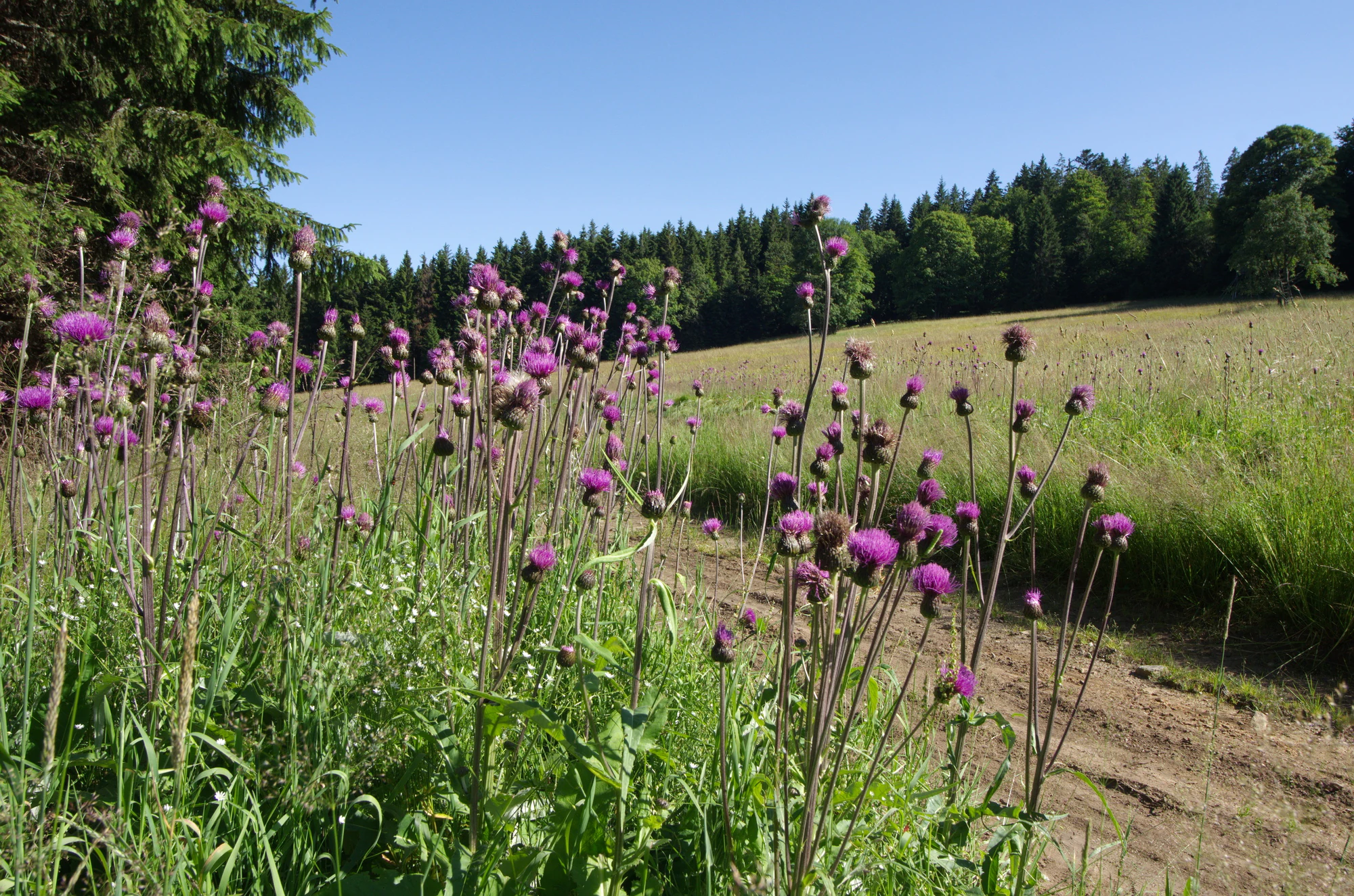
A group of purple thistle flowers in the foreground of a grassy field, with a forest in the background under a blue sky.
Wildflowers in bloom at the Prameniště nature reserve in the Šumava region.

Prameniště Natural Reserve history and protected-area timeline

Prameniště was formally designated as a natural reserve on 27 December 1994, through a declaration issued by the administration of the Šumava National Park and Protected Landscape Area. Its establishment was part of a wave of site-specific protections in the early 1990s, following the broader reorganization of nature conservation in the Czech Republic after 1989, when expanded environmental awareness and new legal frameworks allowed for the formal safeguarding of ecologically valuable areas that had previously been only loosely managed or had suffered from forestry and drainage pressures during earlier decades.

The decision to protect this particular territory was rooted in the recognition that the spring systems and peatlands along the upper Křemelná and Řezná were among the most ecologically significant wetland complexes in the Czech Šumava. By the time of designation, these headwaters were already known for their biodiversity value and their role in regulating downstream water quality and flow regimes. The reserve was assigned the IUCN Category IV designation, focusing on the management of habitats and species of conservation importance.

Since its establishment, the reserve has been managed as part of the wider Šumava conservation system, with oversight from the AOPK ČR and the Šumava National Park administration. The protection aims have consistently emphasized not only the preservation of the existing biological communities but also the restoration and maintenance of the ecosystem's natural self-regulating capacity, an approach that has shaped subsequent conservation planning across the broader Šumava region.

Prameniště Natural Reserve landscape and geographic character

The landscape of Prameniště is shaped by ridge-and-slope topography typical of the central Šumava Mountains. The reserve occupies parts of the Pancířský hřbet, a high ridge connecting the summits of Můstek (1235 m) and Pancíř (1214 m). From these rounded, forested summits, long slopes descend in multiple directions, dissected by shallow valleys carved by small streams and seepage channels.

Because the reserve's parts are geographically separate but hydrologically connected, the resulting landscape is a patchwork of contrasting environments. Along the upper Křemelná, the terrain forms a narrow, cool, and often misty valley where water emerges from numerous springs at the base of slopes and across saturated ground. The Slatinný potok catchment adds a distinctly wetter character, with peat-forming flats, sluggish flow, and characteristic bog vegetation patterns. On the southern slope of Pancíř, the source area of the Řezná displays a more open, south-facing profile, where springs and bog margins mix with stony slopes and bog pine stands.

Despite this internal diversity, the reserve shares a common climatic and visual character: a high-mountain setting of soft ridges, dense coniferous cover, boggy clearings, and the persistent presence of water at or near the surface. The terrain is not dramatic in the Alpine sense, but its subdued, misty, water-rich quality gives it an atmospheric and distinctly Šumava identity.
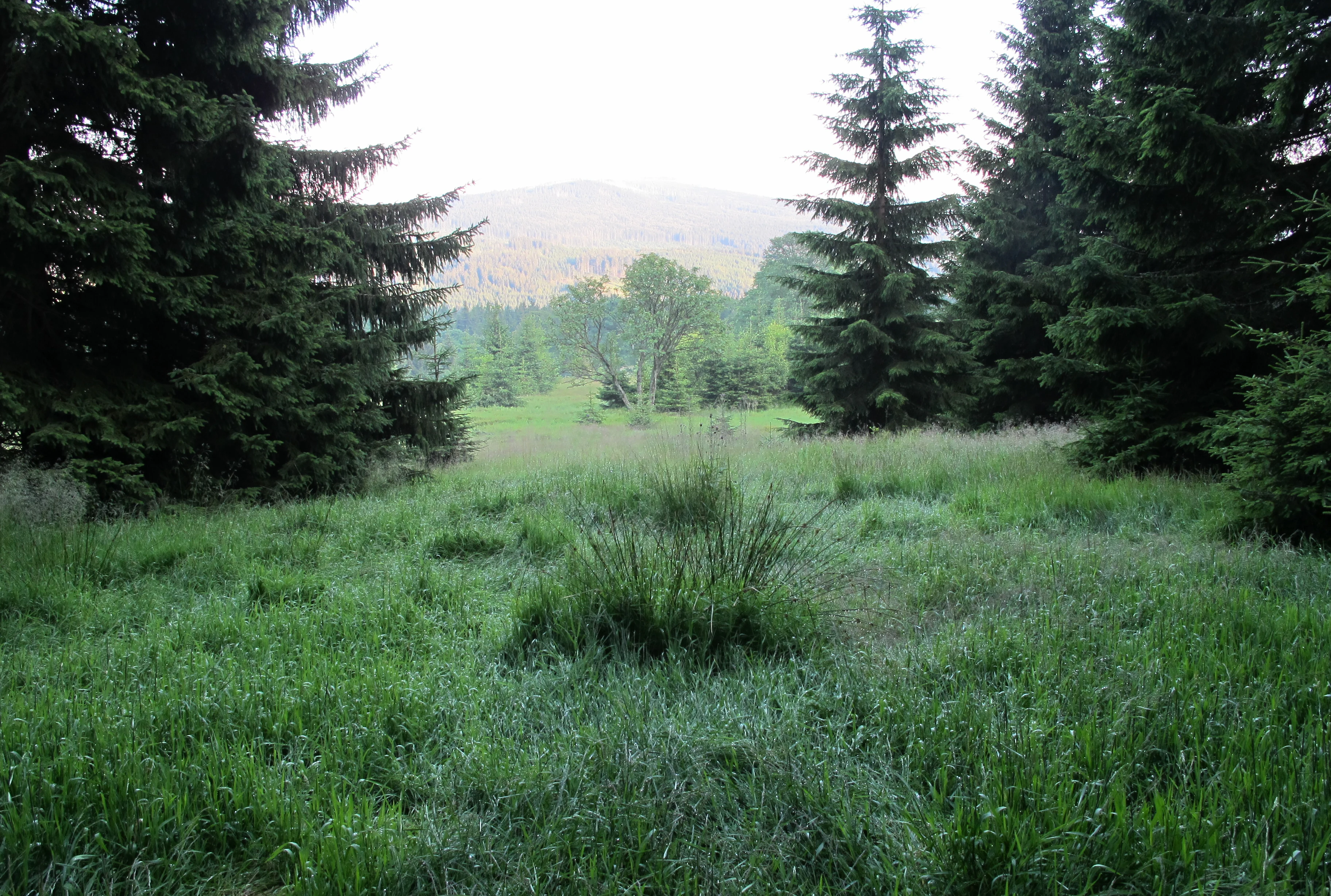
A green grassy clearing framed by dark conifer trees leading to a distant, hazy hillside.
A meadow clearing surrounded by coniferous forest in the Prameniště nature reserve.

Prameniště Natural Reserve ecosystems, habitats, and plant life

The reserve's ecological identity is built around the interplay between cold, oxygen-rich spring waters, deep organic peat soils, and the cool montane climate of the upper Šumava. Together, these conditions support a specialized network of habitats that includes spring fens, transitional peatlands, mire margins, and boggy spruce forests. The prevailing vegetation reflects the combination of stable groundwater discharge, acidic organic substrates, and a short growing season.

Forested portions of the reserve are dominated by montane spruce, often with structurally open or waterlogged understories where the water table rises close to the surface. In the most waterlogged sections, spruce gives way to peatland communities that include classic Šumava mire species, such as bog pools, hummocks, and characteristic moss- and sedge-dominated cover. The mosaic structure of forest, mire, and seepage zone is central to the reserve's ecological value, because it preserves not just individual species but the full functional relationships between water, soil, and vegetation.

The vegetation patterns of these habitats directly determine the animal communities they support, creating a refuge for species adapted to cool, wet, and structurally complex environments. The reserve's ecological character is closely tied to the broader conservation priorities of the Šumava Mountains, where intact hydrological systems and undisturbed peatlands are recognized as key to maintaining regional biodiversity and climate regulation.
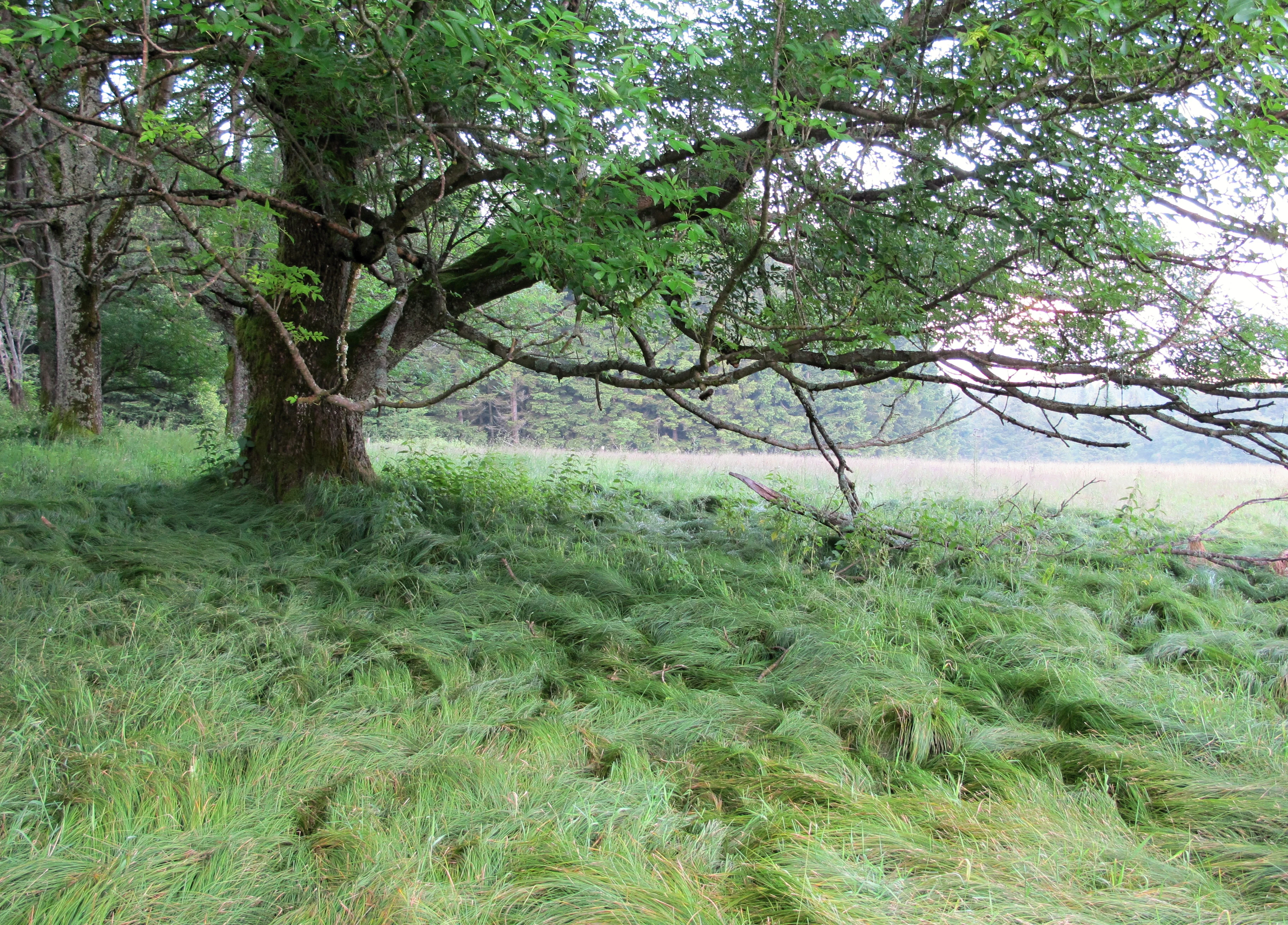
A large, leafy tree with spreading branches provides shade over a field of tall, bent grass in a natural forest setting.
A mature tree overlooking a grassy clearing in the Prameniště nature reserve.

Prameniště Natural Reserve wildlife and species highlights

Prameniště supports wildlife communities typical of intact upland wetland and forest complexes in the Šumava Mountains. The reserve's spring systems, peatlands, and montane spruce forests together provide habitat for species that depend on cool, humid conditions and structurally undisturbed landscapes. These include species associated with old-growth and waterlogged spruce forest, peatland bird communities, and organisms adapted to cold, oxygen-rich spring waters.

The reserve contributes to the conservation of Šumava's broader fauna, which includes large mammals such as red deer, roe deer, and, in the surrounding landscape, lynx and other species of conservation importance. Peatland and mire margins in the reserve provide breeding and foraging habitat for bird species typical of central European mountain wetlands, while the dense, often mist-shrouded spruce stands offer shelter for forest-dwelling species that are sensitive to disturbance. Aquatic and semi-aquatic habitats support specialized invertebrate communities adapted to the specific chemistry and temperature regime of Šumava's spring waters.
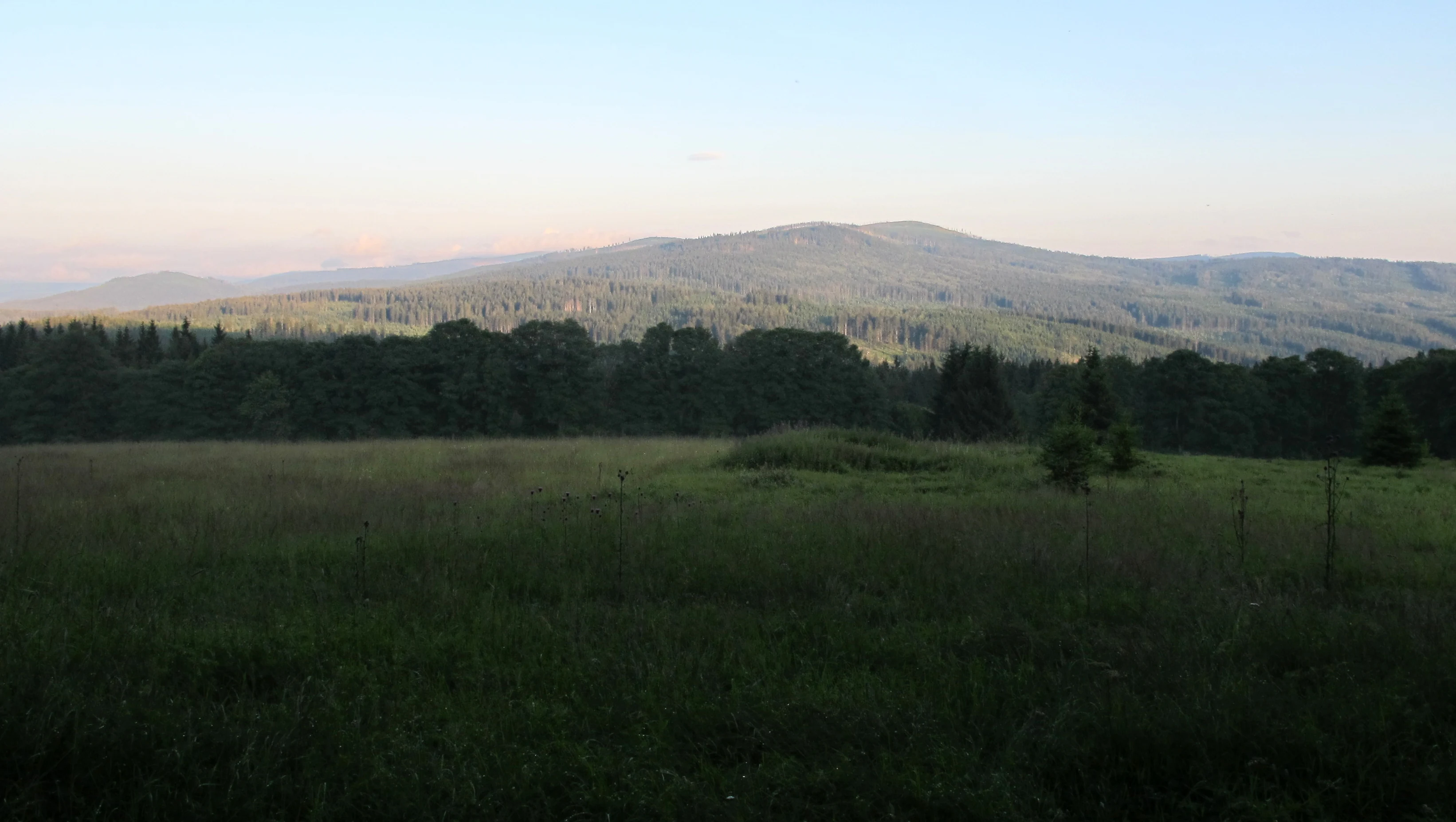
A wide view of a sloping meadow in the foreground leading to a dense coniferous forest and rounded mountains under a soft, hazy sky.
A view across the grassy meadows towards the forested hills of the Prameniště nature reserve in the Šumava region.

Prameniště Natural Reserve conservation status and protection priorities

The reserve's central conservation objective is the preservation of its spring and peatland systems, including their full ecological functionality, rather than the protection of any single species. This focus reflects a recognition that the hydrological and self-regulating processes of the upper Křemelná and Řezná catchments are themselves the conservation asset, and that maintaining these processes is essential for sustaining the area's distinctive plant and animal communities.

By targeting the entire system of springs, peat bogs, and headwater streams together with their associated flora and fauna, the reserve aims to safeguard not only current biodiversity but also the long-term ecological resilience of the landscape. The IUCN Category IV designation supports this goal by emphasizing habitat and species management rather than strict non-intervention, allowing active measures where needed to restore or maintain natural ecological functioning.

Within the wider Šumava conservation framework, Prameniště contributes to a network of protected sites that collectively address the region's most sensitive ecosystems, particularly its peatlands, which are among the most important carbon stores and biodiversity reservoirs in the Czech Republic. The reserve's protection is therefore both locally significant for the headwaters of the Křemelná and Řezná and regionally meaningful for the broader ecological integrity of the Šumava Mountains.

Top sights and standout views in Prameniště Natural Reserve

What distinguishes Prameniště from many other Šumava protected areas is that its identity is fundamentally hydrological: the reserve exists to protect the springs and peat bogs that give rise to two important rivers, the Křemelná, a central Šumava stream, and the Řezná, which becomes the Bavarian Regen across the German border. This hydrological focus shapes both the landscape and the conservation logic of the site.

The reserve's multi-part structure, covering the eastern slopes of Můstek, the eastern flanks of Pancíř, and the southern slope of Pancíř, means that it captures a remarkable range of spring and mire environments within a relatively compact geographical framework. Its position between 870 and 1140 meters places it firmly within the high-rainfall, cool-climate zone where peatland formation is most active in central Europe.
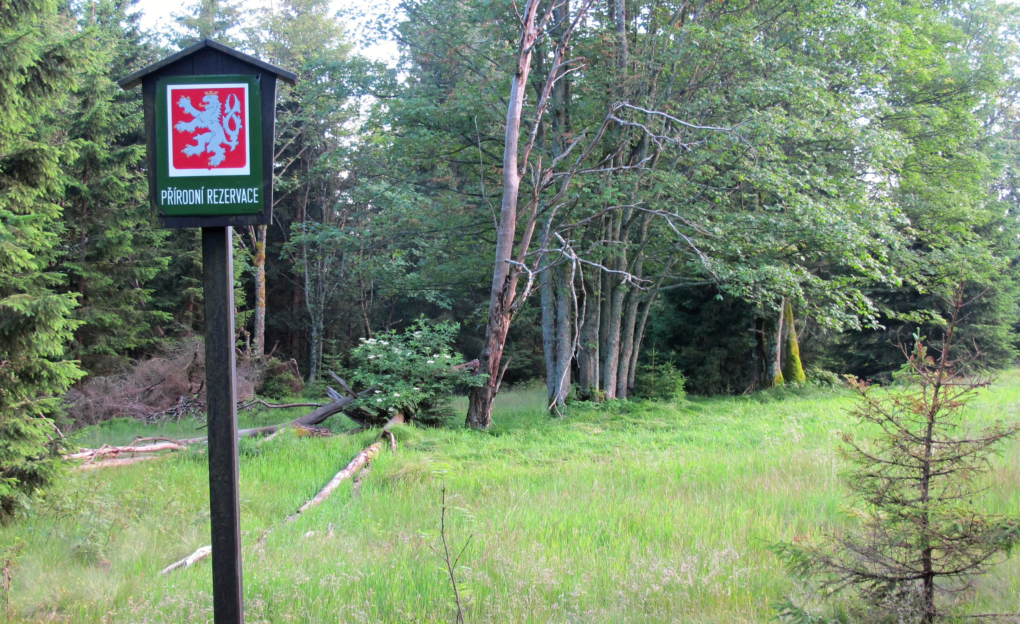
A green sign with the Czech lion emblem marking a nature reserve, mounted on a post in a meadow bordering a forest.
A nature reserve boundary sign at Prameniště.

Best time to visit Prameniště Natural Reserve

The reserve's character changes meaningfully across the seasons in ways that reflect its wetland and mountain identity. Late spring and early summer, after snowmelt, are typically the most dynamic period, with high water tables, active springs, and visibly saturated ground, and the most pronounced peatland colors and flowering in open mires. Summer brings stable conditions and the densest vegetation cover, while early autumn often offers the best combination of dry accessible trails, cooler temperatures, and peatland landscapes beginning to shift into their seasonal palettes.

Winter transforms the reserve into a cold, often snow-covered high-mountain environment, with frozen peat surfaces and snow-buried stream courses, conditions that emphasize the area's exposure to harsh montane climate. Visitors interested in seeing the reserve's defining hydrological features in action generally find the snowmelt and early growing season most rewarding.


Monthly climate preview

Long-term representative averages tracking monthly temperature and precipitation variation across the protected terrain.

Prameniště Climate Normals and Measured Annual Temperature Rhythm

Representative coordinates record measured monthly temperature ranges and precipitation rates spanning consecutive intervals across the protected terrain. Examining the complete twelve-month record clarifies long-term baseline conditions and broader seasonal rhythms.
Annual mean8 °C
-3 °C18 °C
Jan-3°
Feb-2°
Mar
Apr
May12°
Jun16°
Jul18°
Aug18°
Sep13°
Oct
Nov
Dec-2°
Warmest month
July

17.8 °C

Coolest month
January

-3 °C

Wettest month
June

3.2 mm/day

Driest month
April

1.6 mm/day

Park location guide

Geography guide, regional context, and park location map for Prameniště Natural Reserve

Prameniště Natural Reserve park geography, regions, and map view in Czechia

Understand where Prameniště Natural Reserve sits in Czechia through a broader geographic reading of the surrounding landscape, nearby location context, and its mapped position within the national park landscape.

How Prameniště Natural Reserve fits into Czechia

Czech Republic is a landlocked Central European country with a population of approximately 10.9 million people. The nation was established as an independent state on January 1, 1993, following the dissolution of Czechoslovakia. Its capital and largest city is Prague, with other major urban centers including Brno, Ostrava, Plzeň, and Liberec.

Wider geography shaping Prameniště Natural Reserve in Czechia

The Czech Republic is a landlocked country in Central Europe. It is bordered by Germany to the west, Austria to the south, Poland to the northeast, and Slovakia to the southeast. The landscape is predominantly hilly, with the territory covering 78,871 square kilometers.

Map view of Prameniště Natural Reserve

Use this park location map to pinpoint Prameniště Natural Reserve in Czechia, understand its exact geographic position, and read its mapped placement within the surrounding landscape more clearly.

Pigeon | © OpenStreetMap contributors

Location context for Prameniště Natural Reserve

Plzeňský kraj

Explore protected area views, upland springs, and peatland habitats in the Šumava Mountains.

Prameništē Photos and Scenery: Visualizing the Headwater Wetlands

Examine high-resolution park photography showcasing the diverse montane spruce forests and saturated valley terrain of Prameništē. Visual documentation reveals the distinct hydrological character of headwater streams and protected mire ecosystems across the mountain range.

A group of purple thistle flowers in the foreground of a grassy field, with a forest in the background under a blue sky.

A small, narrow stream cuts through a dense forest floor covered in green moss, ferns, and various woodland plants in the Prameniště nature reserve.

A green grassy clearing framed by dark conifer trees leading to a distant, hazy hillside.

A large, leafy tree with spreading branches provides shade over a field of tall, bent grass in a natural forest setting.

A wide view of a sloping meadow in the foreground leading to a dense coniferous forest and rounded mountains under a soft, hazy sky.

A landscape view of a marshy meadow with tall green grass leading to a dense forest of spruce trees under an overcast sky.

A green sign with the Czech lion emblem marking a nature reserve, mounted on a post in a meadow bordering a forest.

A small stream originating from a pipe embedded in the mossy, forested ground at the Prameniste nature reserve.

Park atlas

Compare adjacent Šumava reserves, headwater wetlands, and regional protected terrain.

Exploring Parks Near Prameniště and Surrounding Protected Mountain Landscapes

Visitors browsing Prameniště can extend their geographic inquiry to neighboring protected areas across the Šumava Mountains. Comparing adjacent valley catchments and upland peatlands provides deeper context for regional mountain conservation.
Watercolor illustration of a river flowing through a forested landscape with rolling hills in the background
National parkSouth Bohemian Region
About 2.4 km away#1 closest

Southeast

Šumava National Park: Czech Republic's Premier Forested National Park and Protected Landscape

Explore the unique glacial lakes, peat bogs, and regional geography.

Šumava National Park, situated in the South Bohemian Region of the Czech Republic, is the nation's largest protected area and a vital component of Central Europe's forest ecosystems. This entry details its expansive terrain, highlighting the significant peat bog complexes and ancient glacial lakes that define its unique landscape. Discover the park's geographic context, mapped boundaries, and its importance as a protected natural asset within the broader regional atlas.

Area
680.64 km²
Established
1991
IUCN
II
Visitors
2M annual
Watercolor painting showing mountains, forests, and valleys in a landscape.
National parkGermany
About 8.3 km away#2 closest

South

Bavarian Forest National Park: Protected Landscape and Regional Geography Atlas

Explore mapped terrain and protected park boundaries in Germany.

Dive into the specifics of Bavarian Forest National Park, a key protected area noted for its distinct landscape and geographic importance. This MoriAtlas entry details the park's mapped boundaries and its setting within the surrounding regional geography, offering a clear atlas-style view of its natural terrain. Understand its identity as a national park and discover its place in Germany's protected lands.

Area
242.45 km²
Established
1970
IUCN
II
Visitors
1.3M annual
A horizontal watercolor illustration of a misty moorland with soft green hills, patches of forest, and marshy foreground vegetation, rendered in a light, atmospheric palette.
Nature reserveLandkreis Regen
About 15 km away#3 closest

South

Rotfilz Nature Reserve: Geographic Profile of a Bavarian Forest Peatland

Protected moorland geography and raised bog pine woodland

Rotfilz is a significant nature reserve situated within the Landkreis Regen district of Lower Bavaria. Known for its mature bog pine woodland and ongoing peatland restoration, this protected area offers a look at the historical moorland mosaic of the Bavarian Forest. The terrain, defined by Pleistocene deposits and a clear hydrological boundary, provides a compact but essential site for studying Central European bog conservation and landform evolution.

Area
12.88 km²
Established
1973
IUCN
IV
A horizontal watercolor painting showing rolling green hills and distant purple ridges against a white background.
Protected landscapeKlatovy District
About 23 km away#4 closest

Northeast

Přírodní park Buděticko: Protected Landscape and Geographic Atlas of Klatovy District

Orchid-rich meadows and riparian terrain in the Bohemian foothills

Přírodní park Buděticko serves as a vital protected landscape in the Klatovy District, characterized by the transition between the Šumava foothills and broader upland plains. This area supports a mosaic of orchid-rich limestone meadows and riparian habitats along the Otava River. Discover the park's geological character and its integration of natural biodiversity with the cultural heritage of southwestern Bohemia.

Area
44 km²
Established
1994
Relief
Upland
Climate
Temperate
Watercolor painting of a grassy meadow bordered by a forest line with soft green and muted earth tones.
Nature reserveJihočeský kraj
About 28 km away#5 closest

East

Rašeliniště u Martinala: A Protected Nature Reserve in the Jihočeský kraj Foothills

Mapping transitional bog ecosystems and submontane habitats

Located in the Šumava foothills, Rašeliniště u Martinala is a protected nature reserve defined by its dual-parcel structure of peat-forming wetlands and juniper-rich dry grasslands. This site acts as a key ecological node, supporting a high density of protected species within the Jáchymovský potok drainage basin and representing a refined example of south Bohemian submontane landscape character.

Area
0.095 km²
Established
2011
IUCN
IV
Relief
Upland
Natural monumentPlzeňský kraj
About 31 km away#6 closest

Northeast

Velký kámen Natural Monument: Protected Siliceous Outcrops and Regional Geography

Geological landscape within the Plánický hřeben area of Plzeňský kraj.

Velký kámen serves as a notable protected landmark featuring an elongated siliceous rock formation and remnants of natural beech forest. Its location on the V Kopaninách hillside makes it a key feature of the broader regional geography, while its status as both a natural monument and an Eneolithic archaeological site provides a layered perspective on the Bohemian landscape.

Area
0.012 km²
IUCN
IV
Relief
Upland
Scope
Terrestrial
A horizontal watercolor illustration depicting soft, rolling hills in shades of green, yellow, and light pink with small clusters of trees.
Nature reservePlzeňský kraj
About 33 km away#7 closest

Northeast

Prácheň Nature Reserve: Protected Broadleaf Woodlands and Historic Castle Remains

An atlas view of Bohemian forest geography and heritage landscapes

Prácheň Nature Reserve protects a compact block of warm-loving deciduous woodland set atop a hilltop in the Plzeňský kraj region. The area integrates significant natural habitats with cultural heritage, encompassing an early medieval hillfort and castle ruins. This unique blend of forest ecology and Bohemian historical geography offers a distinct perspective on protected areas within the southwestern Czech landscape.

Area
0.283 km²
Established
1953
IUCN
IV
Relief
Upland
A watercolor painting showing a panoramic view of a green wetland area with trees, grass, and rolling hills in the background.
Nature reserveJihočeský kraj
About 39 km away#8 closest

Southeast

Pravětínská Lada Nature Reserve: Geography and Protected Area Landscape Context

Wetland mosaics and peat bog terrain in the South Bohemian Region

Pravětínská Lada serves as a vital protected landscape where peatland and spring headwater ecosystems meet recovering farmland. Located in the Jihočeský kraj, this nature reserve demonstrates how small-scale terrain variations and moisture gradients support high ecological density within the wider Bohemian Forest. The site provides a concentrated look at the transitional boundary between wetland communities and secondary meadows.

Area
0.516 km²
Established
2000
IUCN
IV
Relief
Upland

Common questions about visiting, size, designation, and location context for Prameniště Natural Reserve

Prameniště Natural Reserve FAQs for park facts, access, geography, and protected area context

Find quick answers about Prameniště Natural Reserve, including protected-area facts, park geography, trail and visitor context, and how the park fits into its surrounding country and regional landscape.
MoriAtlas Explorer

Continue Your Protected Areas Search Across the Global Atlas

Deepen your exploration by continuing the structured search for national parks and protected areas worldwide. Utilize the comprehensive filtering capabilities to compare different conservation landscapes and refine your understanding of global park geography. Discover more about the distribution and characteristics of protected natural areas.

Global natural geography