
Mori Atlas logo
National parkPribaikalsky National Park

A comprehensive geographic examination of the Primorsky Range, Olkhon Island, and the Angara River corridor.

Pribaikalsky National Park: Mapping the Protected Landscapes and Coastal Terrain of Lake Baikal

Pribaikalsky National Park serves as a vital protected area along the southwestern shores of Lake Baikal within Irkutsk Oblast. This territory encompasses a complex interplay of steep mountain slopes, coastal cliffs, and expansive island ecosystems that define the Siberian landscape. By analyzing the park boundaries and regional topography, one gains a deeper understanding of this ancient freshwater environment, its karst features, and the interconnected river systems that flow toward the Yenisei.

Lake BaikalTaiga ForestUNESCO World Heritage SiteEndemic SpeciesOlkhon IslandSiberia
Illustration of green cliffs, a body of water, forested hills, and a sky with pink clouds and a yellow sun

Pribaikalsky National Park

National park

Park overview

Structured park overview, official facts, and landscape profile for Pribaikalsky National Park

Pribaikalsky National Park park facts, protected area profile, and essential visitor context

Review the core facts for Pribaikalsky National Park, including designation, size, terrain, visitor scale, habitats, and operating context in one park-focused overview.

About Pribaikalsky National Park

Pribaikalsky National Park represents one of Siberia's most important protected landscapes, spanning the southwestern shoreline of Lake Baikal and the adjacent mountain slopes of the Primorsky Range. The park's strategic location along one of Earth's most ecologically significant freshwater bodies places it at the heart of a UNESCO World Heritage Site recognized for both its outstanding universal value and its extraordinary biodiversity. Lake Baikal itself holds approximately one-fifth of the world's unfrozen freshwater, with waters characterized by exceptional clarity and oxygen saturation exceeding 70% even at maximum depths. The park encompasses a diverse array of terrain, from the steep lake-facing mountain slopes rising to 1,500 meters in the north, to the vast interior of Olkhon Island, a forested landmass larger than many countries. Four rivers exceeding 25 kilometers in length and 150 permanent streams drain through the park, with 60 of these flowing directly into Lake Baikal. The combination of ancient geological formations, boreal forest ecosystems, and the profound cultural heritage associated with Olkhon Island creates a protected area of exceptional multidimensional significance.

Quick facts and research context for Pribaikalsky National Park

Located in Irkutsk Oblast approximately 50 kilometers southeast of Irkutsk city, Pribaikalsky National Park covers 417,300 hectares along the southwestern coast of Lake Baikal. The park includes Olkhon Island, the world's fourth-largest lake-bound island, measuring 71 kilometers in length. The Angara River, Lake Baikal's only outflow, passes through the park as it carries water westward toward the Yenisei River basin. The protected area sits at the southern central extreme of the East Siberian taiga ecoregion, experiencing a moderate continental climate with four distinct seasons, long dry winters, and short warm summers.

Protection and recognition

Examine documented conservation scope and formal protected area frameworks

Pribaikalsky National Park Protection Status and International Recognition

Pribaikalsky National Park maintains a documented mixed protection status within its regional landscape. Structured records outline the governing management framework and official designation history associated with the protected territory.

Protection details

Protection scope
Mixed
Transboundary protection
No
Park context

Deeper park guide and search-rich context for Pribaikalsky National Park

Pribaikalsky National Park history, landscape, wildlife, and travel context

Explore Pribaikalsky National Park through its history, landscape character, ecosystems, wildlife, conservation priorities, cultural context, and seasonal travel timing in a structured park guide built for atlas discovery and search intent.

Why Pribaikalsky National Park stands out

Pribaikalsky is best known for protecting the extraordinary biodiversity of Lake Baikal, the world's deepest and oldest freshwater lake, which contains approximately 20% of the planet's unfrozen surface freshwater. The park's Olkhon Island holds deep spiritual significance for the Buryat people and features the sacred Shaman Rock formation. The combination of ancient taiga forests, endemic species, dramatic island landscapes, and the lake's remarkable clear waters makes this one of Russia's most ecologically significant protected areas. The Great Baikal Trail traverses the park's western coastline, offering visitors access to some of the most scenic vistas in Siberia.
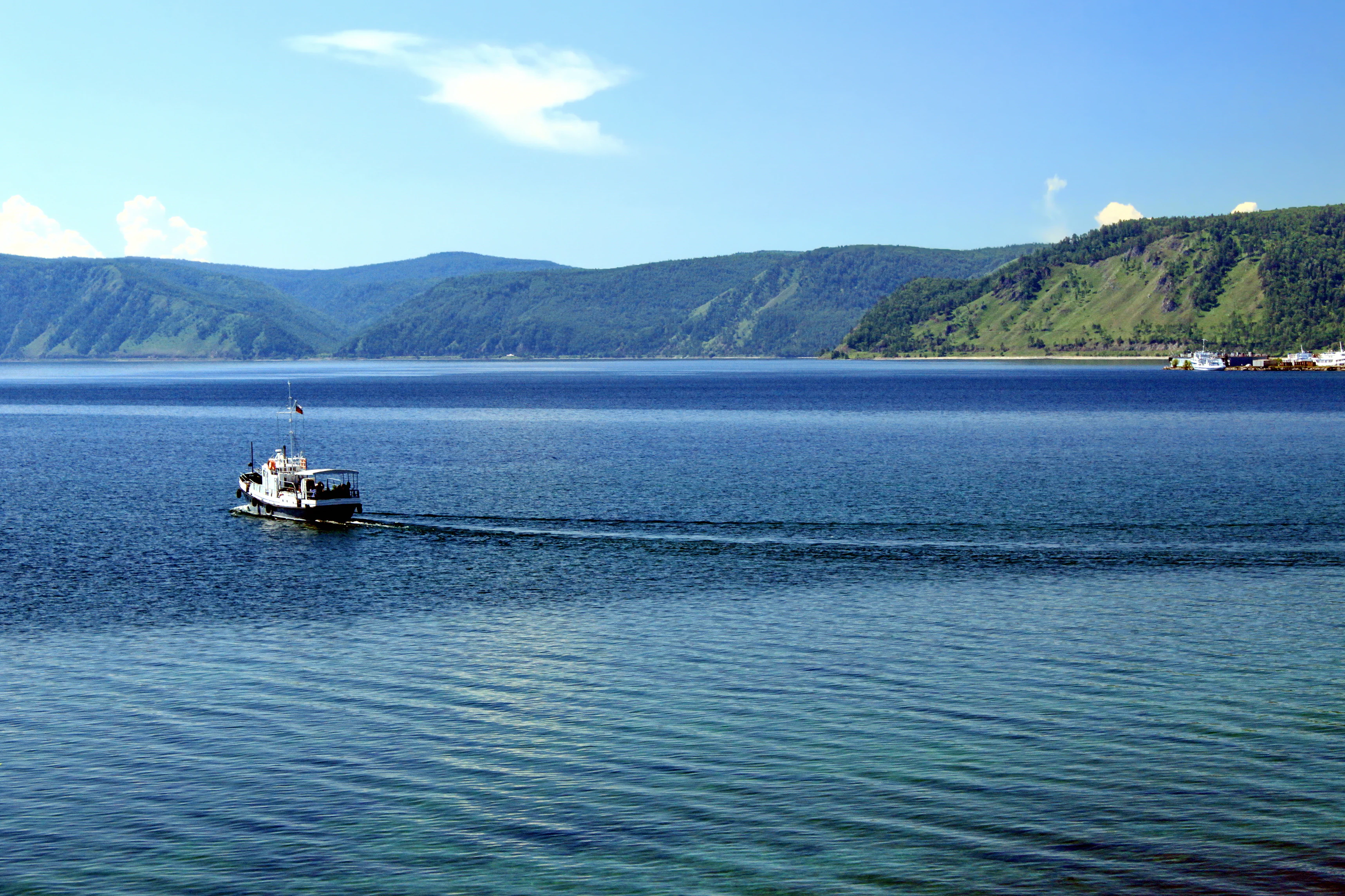
A boat traveling on the calm waters of Lake Baikal with green hills and a clear blue sky in the background
Boat on Lake Baikal with green hills under a clear blue sky

Pribaikalsky National Park history and protected-area timeline

The lands comprising Pribaikalsky National Park have been inhabited since ancient times, with archaeological evidence concentrated along the lakeshore where human settlement traces extend back through millennia. The indigenous Buryat people have maintained a continuous presence on Olkhon Island, where approximately 1,500 Buryat residents continue traditional ways of life connected to the land and spiritual practices centered on the island's sacred sites. Pribaikalsky National Park was established in 1986 alongside the Baikal-Lensky Nature Reserve, both placed under the unified management of FGBU Zapovednoe Baikal. This administrative arrangement reflects the integrated approach to protecting the broader Baikal region, where multiple protected areas work collectively to safeguard the lake's exceptional ecosystem. Within the park's boundaries, small settlements such as Bolshie Koty illustrate the long human presence in this landscape, demonstrating how communities have coexisted with the natural environment throughout the region's history.

Pribaikalsky National Park landscape and geographic character

The topography of Pribaikalsky National Park presents a striking combination of mountain terrain, coastal cliffs, and island landscapes. The Primorsky Range rises steeply from the lake's western shore, with elevations reaching 1,100 meters in the southern portions of the park and climbing to 1,500 meters in the north. These mountains feature a uniform distribution of small, mountainous rivers, each typically under 10 kilometers in length, which drain rainfall and snowmelt westward into Lake Baikal. The park's offshore islands include Olkhon, the world's fourth-largest lake-bound island, stretching 71 kilometers in length and 21 kilometers across with a total area of 730 square kilometers. Despite its size, Olkhon Island receives relatively little precipitation, averaging only 10 inches annually, resulting in limited surface water and just one lake on the island. The landscape also includes the Angara River corridor, the only outflow from Lake Baikal, which carries water westward through the park toward the Yenisei River system. Steppe and karst lakes punctuate the terrain in certain areas, adding ecological variety to the predominantly forested landscape.
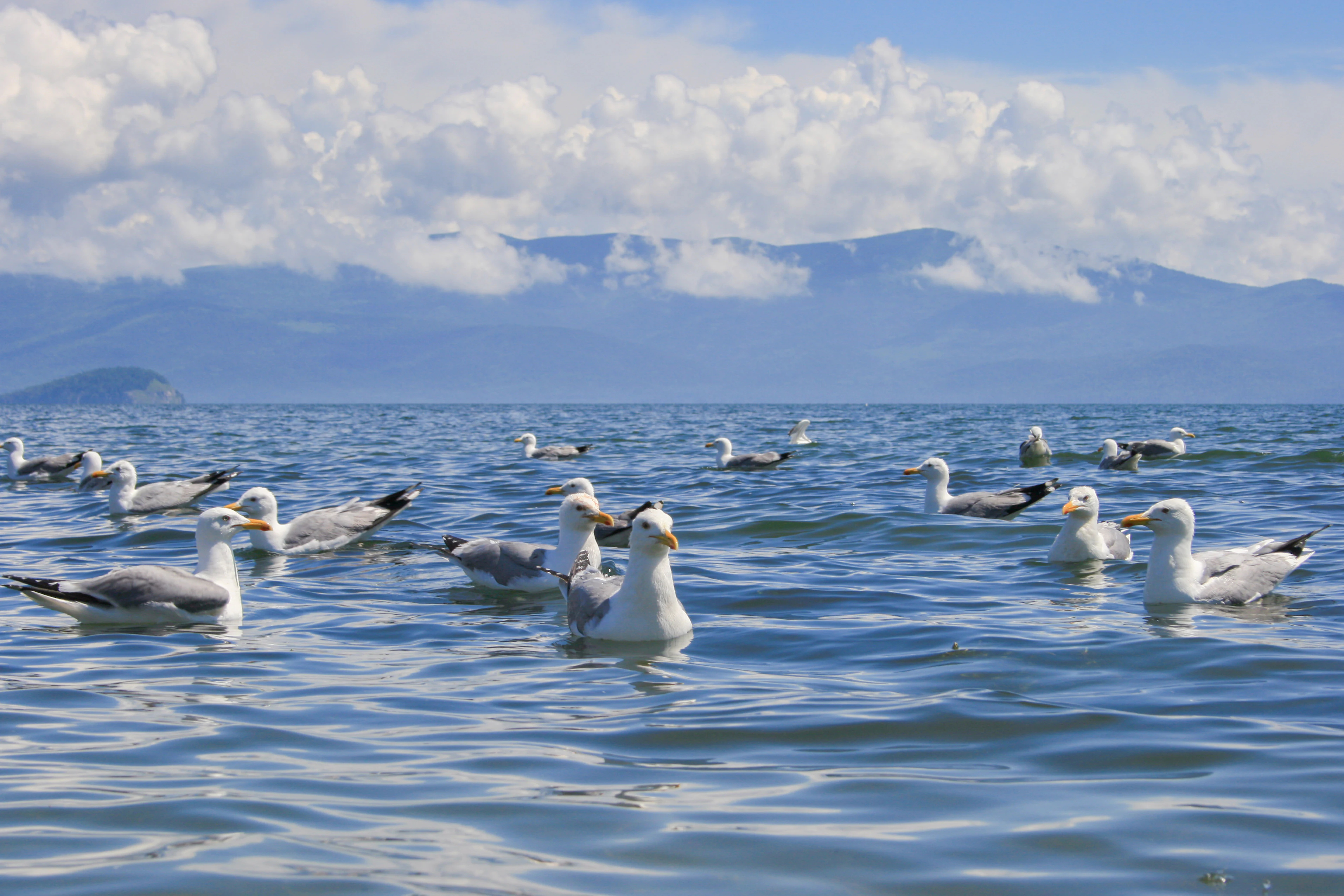
A group of seagulls swimming in a large body of water with mountains and clouds in the background
Mongolian gulls swimming in Chivyrkuysky Bay on Lake Baikal

Pribaikalsky National Park ecosystems, habitats, and plant life

Pribaikalsky National Park occupies a critical position within the East Siberian taiga, representing the high end of precipitation for this vast ecoregion that spans most of central Siberia. The park's forests display distinct zonation according to elevation and moisture gradients: steppe pine and larch dominate the lower slopes facing the lake, while Siberian pine and fir occupy the wetter ridgelines above. Valley bottoms support mixed forests of spruce, larch, alder, aspen, and birch, creating a layered landscape of ecological complexity. The biodiversity figures for the park and its surroundings are extraordinary, with 1,385 species and subspecies of vascular plants documented, alongside 339 moss species, 676 lichens, and 655 fungi. Of these, 557 species are endemic to the Baikal region, reflecting the long evolutionary isolation of this freshwater system and the diverse microhabitats created by the mountainous terrain. The lake itself belongs to the Lake Baikal freshwater ecoregion, characterized by oxygen-saturated waters that remain clear to great depths and low calcium content.
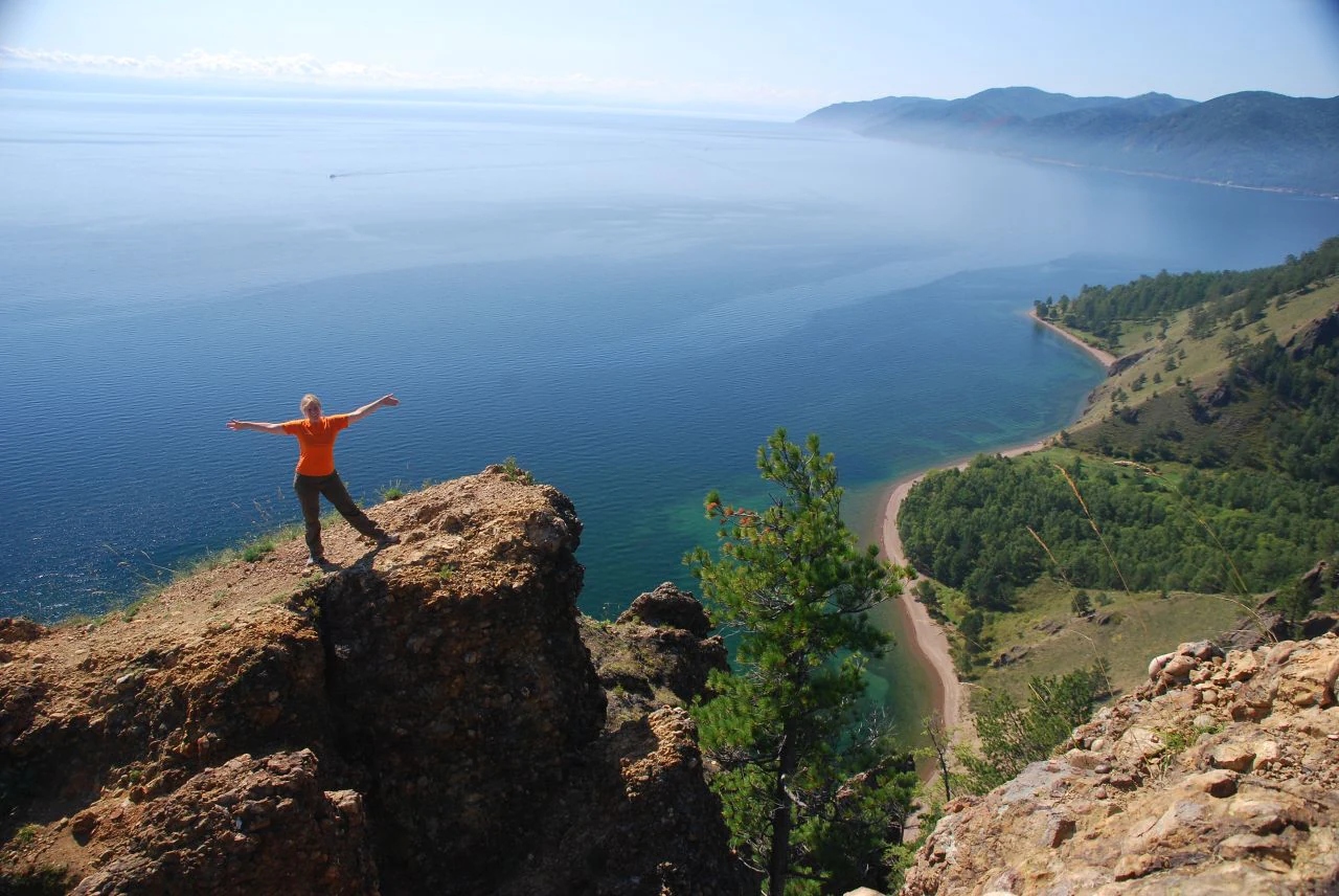
Person in orange shirt standing on rocky cliff with arms outstretched overlooking blue lake and coastal road
Hiker standing on a rocky cliff overlooking Lake Baikal with a coastal road and mountains in the distance

Pribaikalsky National Park wildlife and species highlights

The animal life of Pribaikalsky National Park matches the botanical diversity in richness and endemism, with over 2,500 species recorded within the park's boundaries and many found nowhere else on Earth. Terrestrial vertebrates number 220 species, with ungulates including Caspian deer, Siberian roe deer, and moose representing the characteristic large mammals of the Siberian taiga. Carnivores such as sables, Siberian weasels, and ermines patrol the forest understory, while steppe sections in the park's southern reaches support species more typical of open grasslands, including steppe polecats, long-tailed sousliks, meadow larks, and black kites. Rocky outcrops and islands provide nesting habitat for rock doves and Siberian swifts. The lake itself harbors the Baikal seal, the world's only freshwater seal species and a remarkable example of marine mammal adaptation to an inland water body. The surrounding waters support diverse fish populations and seasonal concentrations of waterfowl, with Mongolian herring gulls among the visible avian residents.
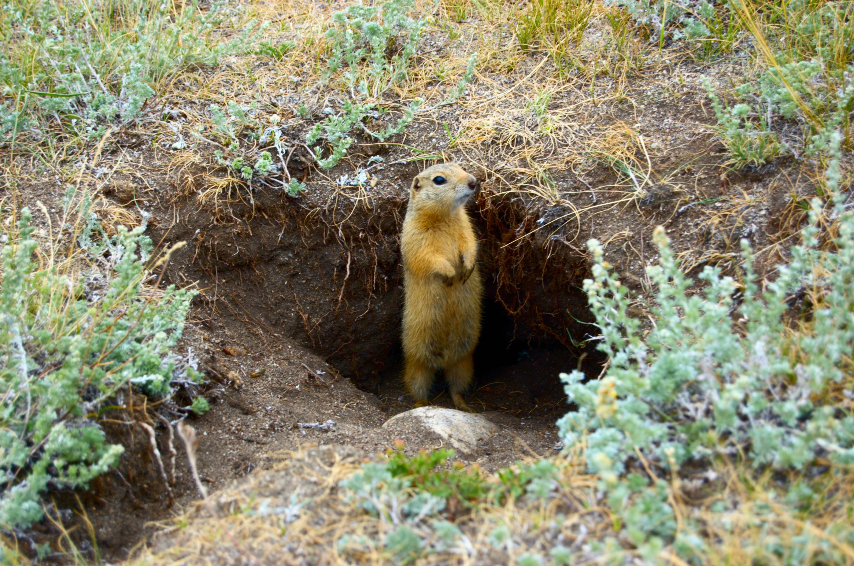
Ground squirrel standing at the entrance of a burrow surrounded by dry grass and small shrubs
Ground squirrel at burrow entrance in Pribaikalsky National Park

Pribaikalsky National Park conservation status and protection priorities

As a core component of the UNESCO World Heritage Site recognizing Lake Baikal, Pribaikalsky National Park carries international responsibility for preserving one of Earth's most significant natural areas. The park's conservation significance stems from multiple factors: the lake's extraordinary biodiversity and endemism with thousands of species found nowhere else, the ancient and relatively untouched state of the Baikal ecosystem, and the role the protected area plays in maintaining water quality for the region's freshwater supply. Managing over 400,000 annual visitors while maintaining ecological integrity represents a core challenge, requiring careful balancing of recreational access with habitat protection. The park operates year-round, with winter months offering unique opportunities to experience the frozen lake's ice formations through skiing, skating, and snowmobile trails along the Great Baikal Trail. The integrated management approach linking Pribaikalsky with other Baikal-region protected areas under FGBU Zapovednoe Baikal reflects the understanding that comprehensive conservation requires landscape-scale coordination.

Pribaikalsky National Park cultural meaning and human context

The cultural dimension of Pribaikalsky centers on Olkhon Island, where the Buryat people have maintained a continuous presence for generations and where spiritual traditions remain connected to the landscape. Approximately 1,500 Buryat residents live on the island, practicing traditional customs and maintaining sacred sites that reflect the deep historical relationship between indigenous communities and this particular place. Shaman Rock, a prominent formation rising from the waters near Olkhon's shore, represents one of the most significant spiritual landmarks in the region, drawing practitioners and visitors interested in the traditional belief systems of Siberia's Turkic and Mongolian peoples. The presence of archaeological sites concentrated along the lake shore attests to even older human occupation of the region, with evidence of human activity extending back through centuries of continuous cultural presence in this landscape.
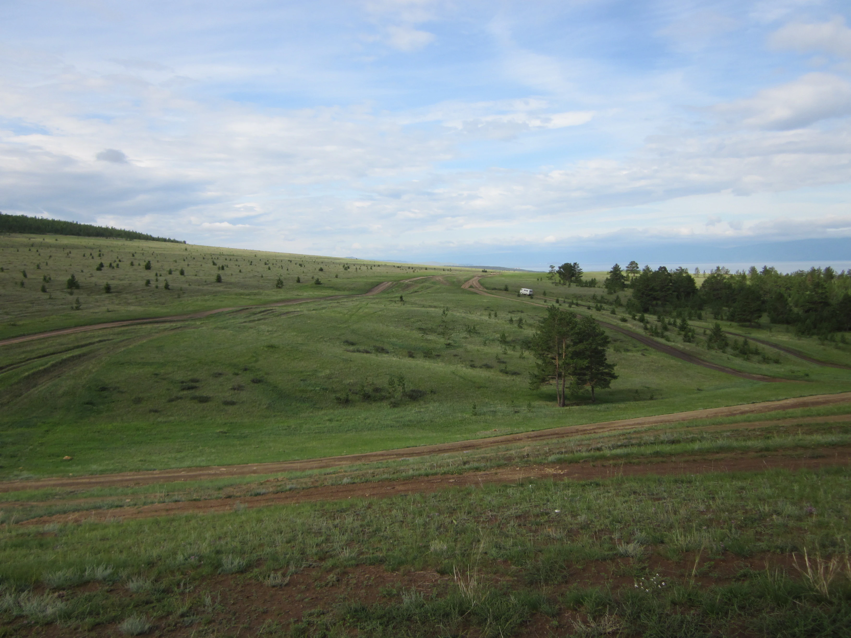
Grassy hills with dirt roads and scattered trees under a partly cloudy sky
Grassy hills and dirt roads across Olkhon Island in Lake Baikal

Top sights and standout views in Pribaikalsky National Park

Pribaikalsky National Park offers visitors access to some of Siberia's most spectacular natural scenery, from the dramatic cliff faces along the lake's western shore to the forested interior of Olkhon Island. The Great Baikal Trail provides the primary hiking corridor through the park, following the coastline to connect settlements and scenic viewpoints. Listvyanka, positioned at the point where the Angara River exits Lake Baikal, serves as the main visitor hub with facilities, accommodations, and access to the park's interpretive resources. Winter transforms the park into a dramatically different experience, with the frozen lake surface allowing travel across ice to reach otherwise inaccessible areas. The contrast between the rugged mountain backcountry and the serene, crystal-clear waters of the world's deepest lake creates an experience distinct among Earth's protected landscapes.
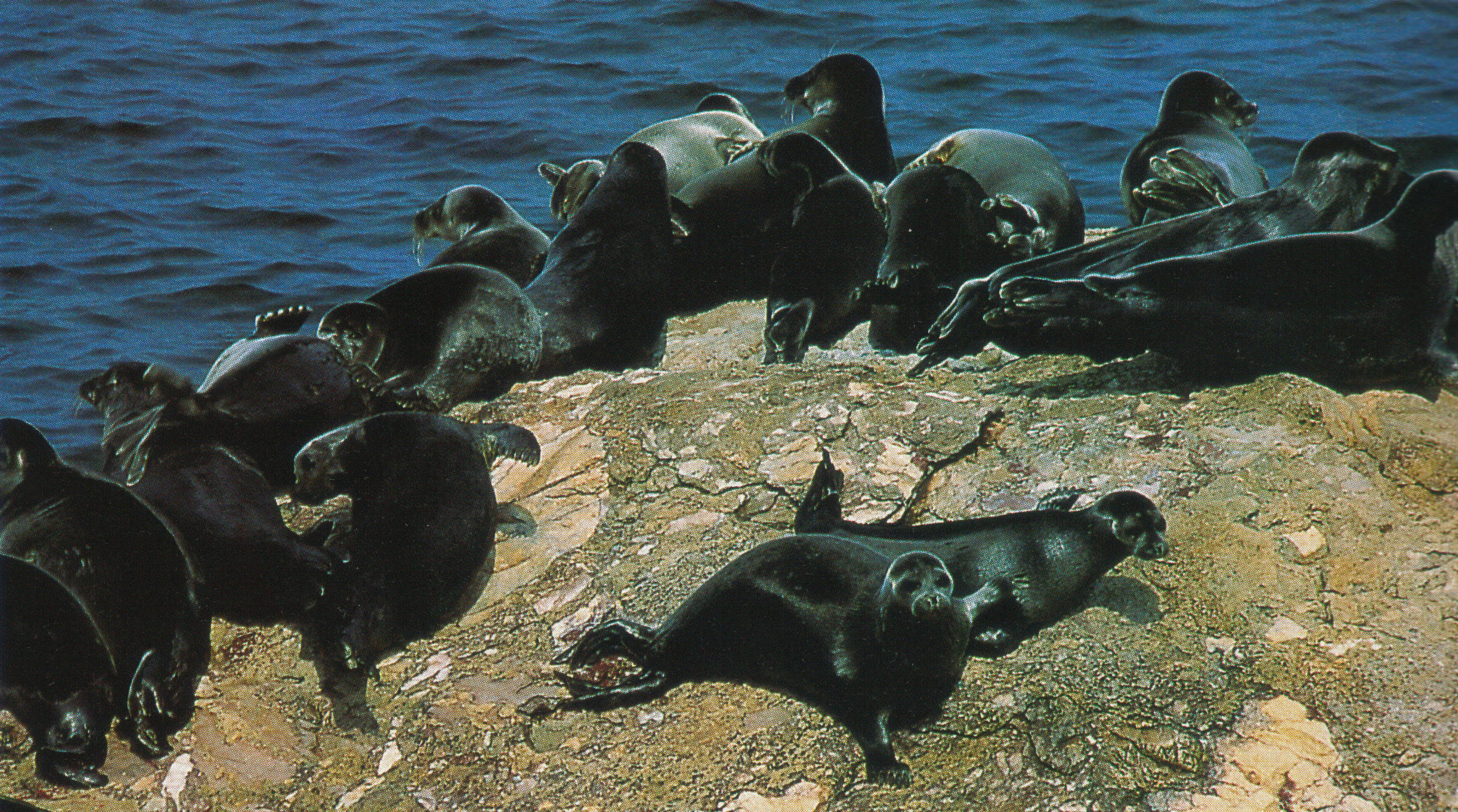
Multiple dark-colored seals resting on a rocky shore with blue water in the background
Nerpa seals resting on a rocky shoreline

Best time to visit Pribaikalsky National Park

Pribaikalsky National Park welcomes visitors year-round, with each season offering distinctly different experiences of the Baikal region. Summer months bring warm conditions ideal for hiking, wildlife observation, and boat travel to Olkhon Island, though this period also coincides with the highest visitor numbers. Autumn transforms the landscape with brilliant foliage colors across the taiga forests, creating exceptional photographic conditions. Winter, despite the extreme cold, draws visitors seeking the unique experience of walking on Lake Baikal's frozen surface, viewing the ice formations known as ice hummocks, and traveling via snowmobile or ski along winter trails. The frozen lake typically forms solid ice from January through May, creating a winter landscape unlike any other freshwater environment. Spring brings the dramatic breakup of winter ice and the renewal of wildlife activity throughout the park, though this transitional period sees fewer visitors than the peak summer season.

Park guides

Targeted reference material for navigating seasonal conditions along Lake Baikal

Pribaikalsky National Park Focused Guides and Planning Resources

Selected research guides help address core planning questions for the protected area without duplicating the full atlas index. Specific publications examine seasonal timing and weather variations affecting travel along the Siberian coastline.
Monthly climate preview

Trace long-term monthly temperature averages and precipitation measurements across the protected landscape

Pribaikalsky National Park Climate Normals and Annual Weather Patterns

Pribaikalsky National Park exhibits wide long-term monthly temperature swings alongside measured precipitation variations recorded at a representative coordinate. Examining the complete twelve-month climate profile reveals structured annual baseline data for this protected area.
Annual mean0 °C
-21 °C20 °C
Jan-21°
Feb-17°
Mar-8°
Apr
May10°
Jun17°
Jul20°
Aug17°
Sep
Oct
Nov-11°
Dec-18°
Warmest month
July

20.1 °C

Coolest month
January

-20.9 °C

Wettest month
August

3.3 mm/day

Driest month
February

0.4 mm/day

Park location guide

Geography guide, regional context, and park location map for Pribaikalsky National Park

Pribaikalsky National Park park geography, regions, and map view in Russia

Understand where Pribaikalsky National Park sits in Russia through a broader geographic reading of the surrounding landscape, nearby location context, and its mapped position within the national park landscape.

How Pribaikalsky National Park fits into Russia

Russia is a transcontinental nation spanning eleven time zones, bordered by fourteen countries. It is the world's largest country by area, covering 17,098,246 km². Moscow is the capital and largest city, while Saint Petersburg is the second-largest and a major cultural centre.

Wider geography shaping Pribaikalsky National Park in Russia

Russia spans Eastern Europe and North Asia, covering 17,098,246 km². It shares land borders with fourteen countries, more than any other nation, and spans eleven time zones. The landscape includes vast plains, mountain ranges such as the Urals and Caucasus, and extensive coastlines along the Arctic Ocean, Pacific Ocean, Baltic Sea, Black Sea, and Caspian Sea.

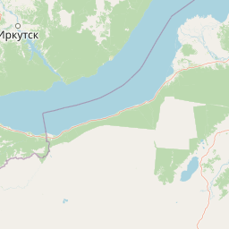
Map view of Pribaikalsky National Park

Use this park location map to pinpoint Pribaikalsky National Park in Russia, understand its exact geographic position, and read its mapped placement within the surrounding landscape more clearly.

Pigeon | © OpenStreetMap contributors

Location context for Pribaikalsky National Park

Irkutsk Oblast
Recorded earthquake history

Examine the Earthquake History Catalogue for Pribaikalsky National Park

Navigate through the historical seismic record associated with the protected landscapes of Pribaikalsky National Park. MoriAtlas provides a clean, searchable catalogue of recorded events that offers geographic context for the seismic history of the Lake Baikal region.

Pribaikalsky National Park Earthquake Records

Catalogued events

126 events

Strongest magnitude

Magnitude 6.3

Most recent event

May 8, 2026

This history includes earthquakes recorded inside the park or within 50 km of its borders

Explore protected area views, taiga forests, and coastal mountain terrain.

Visualizing Pribaikalsky National Park Photos, Landscapes, and Scenery

Visual records capture the rugged topography and freshwater habitats defining Pribaikalsky National Park across Siberia. Photographic documentation reveals the interplay of mountain ridges, boreal forests, and lake vistas.

A boat traveling on the calm waters of Lake Baikal with green hills and a clear blue sky in the background

Rocky cliffside coastline view of Lake Baikal with golden light on cliffs and a partly cloudy sky

A group of seagulls swimming in a large body of water with mountains and clouds in the background

Person in orange shirt standing on rocky cliff with arms outstretched overlooking blue lake and coastal road

Ground squirrel standing at the entrance of a burrow surrounded by dry grass and small shrubs

Rocky cape with large stone formation at the edge of Lake Baikal, sandy path along the shore, two trees on a grassy hillside, one person walking

Grassy hills with dirt roads and scattered trees under a partly cloudy sky

Multiple dark-colored seals resting on a rocky shore with blue water in the background

Park atlas

Compare surrounding Siberian geography and regional conservation areas

Other Parks Near Pribaikalsky National Park and Connected Protected Landscapes

Continue exploring protected areas near Pribaikalsky National Park by examining adjacent taiga forests, mountain ranges, and freshwater ecosystems. Expanding the geographic comparison reveals broader Siberian conservation networks and related natural reserves.
Soft watercolor painting of a lakeshore with rolling hills, coniferous trees, and a distant mountain horizon.
National parkIrkutsk Oblast
Mapped location lies within the park boundary#1 closest

Northeast

Pribaikalsky National Park: Atlas and Geographic Overview of Lake Baikal Shoreline

Protected taiga, rift valleys, and Olkhon Island topography

Pribaikalsky National Park serves as a critical protected landscape featuring 470 kilometers of western shoreline along Lake Baikal. Its geography is defined by the steep scarps of the Obruchev fault, the dense taiga of the Primorsky Range, and the unique steppe environments of Olkhon Island. This atlas entry provides essential context on the physical relief and regional characteristics of this landmark Siberian protected area.

Area
4,173 km²
Established
1986
IUCN
II
Visitors
400K annual
National parkBuryatia
About 83 km away#2 closest

Northeast

Zabaykalsky National Park: Geographic and Protected Area Mapping for the Eastern Baikal Shore

Mountain taiga, islands, and protected peninsula landscapes.

Zabaykalsky National Park comprises an extensive area of the eastern Baikal shoreline, characterized by the Barguzin Range, the prominent Sviatoy Nos peninsula, and a dense network of mountain taiga forests. Its protected boundaries include diverse mineral springs, karst features, and crucial marine habitats, providing a comprehensive look at the unique geomorphology and biodiversity of this Siberian wilderness.

Area
2,690 km²
Established
1986
IUCN
II
Relief
Mountain
Watercolor painting depicting a lake with mountain ranges, green hills, and scattered trees.
National parkBuryatia
About 83 km away#3 closest

Northeast

Zaybaykalsky National Park: Geographic Atlas of Lake Baikal Protected Terrain

Mapping the Svyatoy Nos peninsula and Barguzin mountain landscapes

Spanning over 269,000 hectares, Zaybaykalsky National Park protects a dramatic transition from the shores of Lake Baikal to high-altitude mountain complexes. This atlas resource details the park's steep topography, characterized by ancient taiga forests and geological features like the Academician Ridge and marble-limestone islands, offering a structured view of this significant Siberian protected area.

Area
2,690 km²
Established
1986
IUCN
II
Relief
Mountain
National parkBuryatia
About 111 km away#4 closest

West

Tunkinsky National Park National Park: Protected Landscape and Geographic Context in Buryatia

Discover mapped park boundaries and regional terrain.

Delve into Tunkinsky National Park, a significant protected national park situated in the Buryatia region of Russia. This detail page provides a geographic overview, highlighting the park's mapped boundaries and its place within the surrounding natural landscape. Understand its designation as a protected area, offering a focused entry point for atlas-based discovery of its specific terrain and regional importance.

Area
11,837 km²
IUCN
II
Relief
Mountain
Climate
Boreal
A horizontal watercolor painting showing a soft landscape with distant purple mountains, a calm lake in the midground, and green grassy shores in the foreground.
National parkKhövsgöl Province
About 236 km away#5 closest

West

Lake Khövsgöl National Park: Geography and Protected Area Landscape Analysis

Highland taiga and ancient freshwater basin in Khövsgöl Province

Analyze the complex geography of Lake Khövsgöl National Park, which protects a massive, ultraoligotrophic waterbody surrounded by the rugged Sayan Mountains. The area serves as a vital ecological transition zone, containing diverse alpine, forest, and aquatic terrains that form a central part of Mongolia's natural heritage.

Area
2,760 km²
Relief
Mountain
Climate
Alpine
Access
Remote access
Wildlife reserveKhentii Province
About 410 km away#6 closest

Southeast

Khan Khentii Strictly Protected Area: Geographic Overview and Protected Landscape Mapping

Eastern Mongolia wilderness and Khentii mountain terrain

Explore the expansive reaches of Khan Khentii Strictly Protected Area, a cornerstone of Mongolian conservation. This reserve shields intact taiga forests, river valley habitats, and the historic Burkhan Khaldun mountain from industrial activity, preserving one of the most significant mountain wilderness regions in the province of Khentii.

Area
12,270 km²
Established
1992
IUCN
Ib
Relief
Mountain
Watercolor painting of a river winding through hills with trees and vegetation
National parkZabaykalsky Krai
About 419 km away#7 closest

Southeast

Chikoy National Park: Protected National Park with Highland Landscape and River Basin Geography

Explore its protected boundaries and unique taiga-steppe transition in Zabaykalsky Krai.

Chikoy National Park, a protected area in Russia's Zabaykalsky Krai, showcases the rugged geography of the Khentei-Daur Highlands. As a national park, it preserves the upper Chikoy River basin and represents a significant ecological borderland, marking the transition from Siberian taiga to Mongolian steppe. This page facilitates a structured understanding of the park's mapped landscape, its prominent natural monument Bystrinsky Golets, and its role within the broader atlas of protected natural areas.

Area
6,665 km²
Established
2014
IUCN
II
Relief
Mountain
A horizontal watercolor illustration depicting a soft, green landscape with distant rolling hills, foreground meadows, and flowering bushes under a pale sky.
Protected areaArkhangai Province
About 446 km away#8 closest

South

Ögii Lake Protected Area: A Comprehensive Geographic Overview of the Mongolian Steppe

Freshwater basin and wetland geography in Arkhangai Province

Ögii Lake represents a pivotal protected landscape in central Mongolia, defined by its 25 square kilometer surface area and gentle, shallow underwater topography. This site functions as an ecological nexus for migratory waterbirds and is essential for understanding the transition between open grassland and the mountainous terrain of the Khangai region.

Area
25.7 km²
Established
2006
Relief
Lowland
Access
Access unknown

Common questions about visiting, size, designation, and location context for Pribaikalsky National Park

Pribaikalsky National Park FAQs for park facts, access, geography, and protected area context

Find quick answers about Pribaikalsky National Park, including protected-area facts, park geography, trail and visitor context, and how the park fits into its surrounding country and regional landscape.
MoriAtlas Explorer

Continue Your Protected Areas Search Across the Global Atlas

Deepen your exploration by continuing the structured search for national parks and protected areas worldwide. Utilize the comprehensive filtering capabilities to compare different conservation landscapes and refine your understanding of global park geography. Discover more about the distribution and characteristics of protected natural areas.

Global natural geography