
Mori Atlas logo
Wildlife reservePusch Ridge Wilderness

Analyzing the dramatic Sky Island geography, vertical ecological gradients, and rugged canyon terrain of this protected wilderness area.

Pusch Ridge Wilderness: A Protected Wildlife Reserve in the Santa Catalina Mountains of Arizona

(Pusch Ridge Wilderness Area)

Pusch Ridge Wilderness covers 56,000 acres within the Coronado National Forest, serving as a critical refuge for Desert Bighorn Sheep in southern Arizona. The protected area showcases a striking ecological transition from saguaro-dotted Sonoran Desert lowlands to high-elevation fir and aspen forests. Its complex geology, featuring ancient Catalina granite and folded gneiss, defines a rugged skyline that rises abruptly from the desert floor north of Tucson.

Sky Islanddesert bighorn sheepSonoran Desertsaguaropinyon-juniper woodlandfir-aspen forest
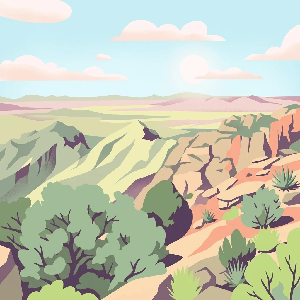
A flat-style digital illustration of a desert mountain landscape with rocky slopes; sparse desert vegetation; and a distant horizon under a pale blue sky.

Pusch Ridge Wilderness

Wildlife reserve

Park overview

Structured park overview, official facts, and landscape profile for Pusch Ridge Wilderness

Pusch Ridge Wilderness park facts, protected area profile, and essential visitor context

Review the core facts for Pusch Ridge Wilderness, including designation, size, terrain, visitor scale, habitats, and operating context in one park-focused overview.

About Pusch Ridge Wilderness

Pusch Ridge Wilderness preserves a remarkable slice of the Santa Catalina Mountains, the prominent Sky Island range that rises just north of Tucson, Arizona. Designated in 1978 and managed by the U.S. Forest Service as part of the Coronado National Forest, the wilderness protects a rugged transition zone where Sonoran Desert lowlands meet the forested highlands of southern Arizona.

The defining character of Pusch Ridge is its extreme vertical range. Elevations within the wilderness climb from around 2,800 feet near the desert floor to over 9,100 feet along the upper ridges. This dramatic gradient produces an unusually compact sequence of ecological zones, allowing visitors to pass from saguaro forests to pine-fir forests within a single day's hike. Because the range is isolated from other major mountain systems by surrounding desert basins, Pusch Ridge functions as an ecological island, with species distributions and vegetation patterns shaped by elevation, aspect, and rainfall far more than by latitude alone.

The wilderness is closely tied to the urban edge of Tucson. The cities of Oro Valley and Catalina Foothills line the base of the Santa Catalinas, making Pusch Ridge an unusually accessible high-country reserve for the region. This proximity has shaped both the conservation challenges and the conservation successes of the area. The 2013 reintroduction of adult Desert Bighorn Sheep, and the 2014 birth of the first Catalina-born lambs in nearly a quarter century, marked a dramatic reversal of decades of decline and underscored the importance of the wilderness as a refuge for species pushed out by surrounding development.

Quick facts and research context for Pusch Ridge Wilderness

Pusch Ridge Wilderness sits in Pima County, Arizona, just north of the Tucson metropolitan area and adjacent to communities such as Catalina Foothills and Oro Valley. It is administered by the U.S. Forest Service as part of the Coronado National Forest.

Designated in 1978 under the National Wilderness Preservation System and classified as IUCN Category Ib, the wilderness preserves a steep, biologically rich slice of the Santa Catalina Mountains. It is recognized for its Desert Bighorn Sheep habitat, its elevation-driven vegetation zones, and its position as one of the most accessible Sky Island wildernesses in the American Southwest.

Protection and recognition

Explore documented terrestrial conservation parameters and international recognition

Pusch Ridge Wilderness Protection Status and Recognition Data

Pusch Ridge Wilderness maintains a documented terrestrial protection scope within regional conservation frameworks. Official designation records and international recognition sources provide verified baseline data for this protected area.

Protection details

Protection scope
Terrestrial
Transboundary protection
No
Park context

Deeper park guide and search-rich context for Pusch Ridge Wilderness

Pusch Ridge Wilderness history, landscape, wildlife, and travel context

Explore Pusch Ridge Wilderness through its history, landscape character, ecosystems, wildlife, conservation priorities, cultural context, and seasonal travel timing in a structured park guide built for atlas discovery and search intent.

Why Pusch Ridge Wilderness stands out

Pusch Ridge Wilderness is best known for its role in protecting Desert Bighorn Sheep in the Santa Catalina Mountains, including the landmark 2013 reintroduction that produced the first lambs born in the range in nearly twenty-five years. It is also recognized for its stark ecological transitions, where classic Sonoran Desert cacti give way to pine forests and high-elevation aspen-fir woodlands within just a few thousand feet of vertical rise. Equally distinctive is the area's geology, centered on a dome-shaped core of ancient Catalina granite surrounded by steep, folded formations of gneiss and quartzite. Together, these features make Pusch Ridge one of the most concentrated examples of Sky Island ecology in the Arizona desert region, despite its close proximity to a major American city.
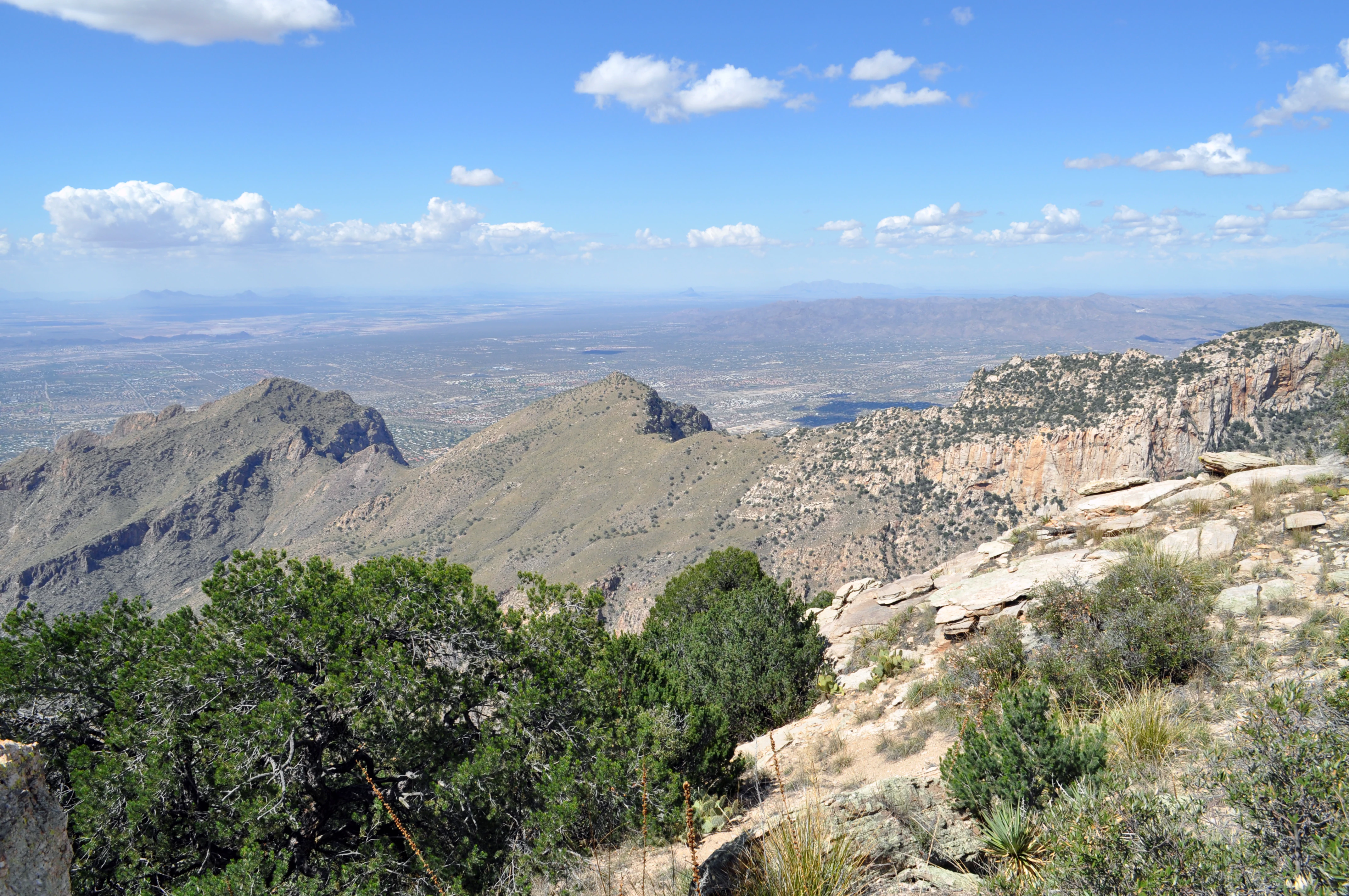
A high-angle scenic view of the rugged Pusch Ridge mountains under a clear blue sky, with rocky foreground slopes and a distant desert valley.
A wide view of the Pusch Ridge mountain range as seen from Prominent Point.

Pusch Ridge Wilderness history and protected-area timeline

Pusch Ridge Wilderness was formally designated in 1978 under the National Wilderness Preservation System. Its primary purpose was to protect the Desert Bighorn Sheep population of Pusch Ridge, one of the last remaining populations of this species still present in Arizona at the time.

Throughout the late twentieth century, the bighorn population inside the wilderness declined sharply. Habitat pressure, combined with rapid residential and commercial growth around the Santa Catalina Mountains, particularly in Oro Valley and the Catalina Foothills, effectively cut the animals off from traditional movement corridors and water sources. By the early 2000s, sightings of bighorns in the wilderness had become extremely rare.

In November 2013, a major reintroduction effort brought 31 adult Desert Bighorn Sheep back to Pusch Ridge. The program quickly showed signs of success: in early February 2014, an Arizona Game and Fish Department official documented two newborn lambs, the first Desert Bighorn lambs born in the Santa Catalina Mountains in nearly twenty-five years. This event marked a turning point in the wilderness's conservation history and reaffirmed its original purpose as a sanctuary for one of the Southwest's most iconic large mammals.

Pusch Ridge Wilderness landscape and geographic character

The landscape of Pusch Ridge Wilderness is dominated by the eastern escarpment of the Santa Catalina Mountains, a steep and rugged fault-block range that rises directly out of the Sonoran Desert. The terrain is shaped by sharp ridgelines, deep canyons, and boulder-strewn slopes that funnel runoff down toward the desert basins near Tucson.

Geologically, the range is built around a dome-shaped core of Catalina granite that formed during the Triassic period. The southern face of the mountains is composed of Catalina gneiss interlayered with bands of white quartzite, forming a steep anticline that is separated from the rest of the range by a series of valleys. This combination of resistant granite uplifts and folded metamorphic rocks gives Pusch Ridge its characteristic jagged skyline and visually dramatic cliffs.

The wilderness captures both faces of this range transition. Below, the terrain opens into classic Sonoran Desert bajadas dotted with saguaros. Above, the slopes tighten into rocky canyons and forested ridges, with elevation emphasizing the contrast between arid lowlands and cool, forested high country. This sharp transition between desert and mountain is one of the wilderness's most defining landscape features.

Pusch Ridge Wilderness ecosystems, habitats, and plant life

Because of its sharp elevation range, Pusch Ridge Wilderness compresses multiple Southwestern vegetation zones into a relatively small area. At the lowest elevations, the terrain supports classic Sonoran Desert flora, with saguaro cactus and other heat-adapted desert plants dominating the rocky bajadas and lower slopes.

Mid-elevations are characterized by mountain mahogany, juniper, and pinyon pine, forming open woodlands that occupy much of the wilderness's transitional zone. Above roughly 8,000 feet, the vegetation shifts into denser forests of fir and aspen, with cooler, moister conditions supporting a very different suite of plant communities than those found on the desert floor.

The juxtaposition of desert, woodland, and mixed conifer vegetation within a single wilderness unit makes Pusch Ridge a vivid example of Sky Island ecology. Each elevation band functions almost like a separate habitat, and the interfaces between these bands are especially rich zones for birds, mammals, and plant diversity.

Pusch Ridge Wilderness wildlife and species highlights

Wildlife has always been central to the identity of Pusch Ridge Wilderness. The area was originally designated specifically to protect Desert Bighorn Sheep, which historically used the rugged cliffs and ridges of Pusch Ridge as core habitat. Although the population declined sharply in the late twentieth century due to surrounding development, the 2013 reintroduction of 31 adult sheep, followed by the 2014 birth of the first Catalina-born lambs in nearly twenty-five years, marked an important recovery milestone overseen by the Arizona Game and Fish Department.

Beyond bighorn sheep, the wide elevation range of the wilderness supports a broad mix of species, ranging from typical Sonoran Desert fauna in the lower reaches to montane species in the higher forests. The dense stands of pinyon-juniper and the fir-aspen forests above 8,000 feet provide seasonal habitat for a variety of birds and mammals adapted to cooler, more forested terrain, while the desert lowlands host desert-adapted species typical of the Tucson Basin ecosystem.

Pusch Ridge Wilderness conservation status and protection priorities

Pusch Ridge Wilderness plays a disproportionate conservation role for its size because of its proximity to a major urban area. Sitting directly north of Tucson and adjacent to the rapidly growing communities of Oro Valley and Catalina Foothills, the wilderness represents one of the most important undeveloped buffers for wildlife in the region, particularly for species sensitive to human encroachment.

The wilderness's conservation value is anchored in its role as a refuge for Desert Bighorn Sheep. The decline of the local population through the late twentieth century, and the subsequent reintroduction program, have made Pusch Ridge a case study in how suburban development pressures can fragment wildlife habitat in Sky Island ecosystems, and in how targeted management can partially reverse those losses.

At a broader scale, the protection of this steep, elevation-rich terrain helps preserve vegetation communities and ecological processes that would otherwise be lost to development, fire, or invasive species. By keeping the transition between desert and mountain intact, the wilderness safeguards a key node in the larger network of protected lands in the Coronado National Forest.

Top sights and standout views in Pusch Ridge Wilderness

Pusch Ridge Wilderness stands out for the sheer diversity of landscapes compressed into a single protected area: saguaro-studded desert lowlands just miles below high-country fir and aspen forests, all overlain on a dramatic geology of Triassic granite and folded gneiss.

Its conservation story is equally distinctive, anchored by the successful 2013 reintroduction of Desert Bighorn Sheep to a range where the species had nearly disappeared after decades of suburban growth at the base of the mountains. Together, these qualities make Pusch Ridge one of the most ecologically rich and historically significant wilderness areas in southern Arizona.

Best time to visit Pusch Ridge Wilderness

Pusch Ridge Wilderness is approachable year-round, but the character of a visit changes sharply with elevation. Winter and early spring are typically the most comfortable seasons for exploring the lower desert portions of the wilderness, when daytime temperatures are mild and saguaro landscapes are at their most accessible.

Late spring through early fall brings intense heat at lower elevations, but the cooler, forested high country above 8,000 feet becomes increasingly attractive as the desert lowlands warm. Summer monsoon storms can produce dramatic skies but also bring flash flood risk in canyons and rough trail conditions. Many visitors target the shoulder seasons of spring and fall to experience both the desert and forested zones of the wilderness in a single trip.
Monthly climate preview

Examine long-term representative temperature ranges and monthly precipitation patterns across twelve recorded periods

Pusch Ridge Wilderness Climate Normals, Annual Temperature and Precipitation Rhythm

Representative coordinate measurements reveal how monthly average temperatures and daily precipitation fluctuate across the terrain throughout the year. Reviewing the complete twelve-month climate profile provides deeper analytical context for long-term environmental conditions.
Annual mean18 °C
7 °C28 °C
Jan
Feb
Mar13°
Apr17°
May22°
Jun28°
Jul28°
Aug27°
Sep25°
Oct19°
Nov12°
Dec
Warmest month
July

28.2 °C

Coolest month
December

7.4 °C

Wettest month
August

1.9 mm/day

Driest month
May

0.2 mm/day

Park location guide

Geography guide, regional context, and park location map for Pusch Ridge Wilderness

Pusch Ridge Wilderness park geography, regions, and map view in United States of America

Understand where Pusch Ridge Wilderness sits in United States of America through a broader geographic reading of the surrounding landscape, nearby location context, and its mapped position within the national park landscape.

How Pusch Ridge Wilderness fits into United States of America

The United States of America is a federal presidential republic and one of the world's largest countries by area and population. It consists of 50 states across a vast territory spanning multiple time zones, with its capital in Washington, D.C. and largest city in New York City. The nation has a diverse economy, influential political system, and significant cultural and military presence globally.

Wider geography shaping Pusch Ridge Wilderness in United States of America

The United States occupies a vast territory in North America, bordered by Canada to the north and Mexico to the south. The 48 contiguous states stretch from the Atlantic to the Pacific Ocean, while Alaska occupies the northwestern region and Hawaii is an archipelago in the Pacific. The country encompasses diverse terrain including the Rocky Mountains, Appalachian Mountains, Great Plains, and extensive river systems.

Map view of Pusch Ridge Wilderness

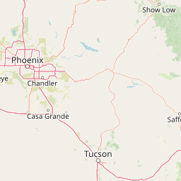
Use this park location map to pinpoint Pusch Ridge Wilderness in United States of America, understand its exact geographic position, and read its mapped placement within the surrounding landscape more clearly.

Pigeon | © OpenStreetMap contributors

Explore protected area views, rugged mountain terrain, and dramatic desert ecosystems.

Pusch Ridge Wilderness Photos and Landscape Scenery: Visualizing Arizona Sky Islands

Visual documentation captures the stark ecological gradients and rugged granite formations defining Pusch Ridge Wilderness. Protected area photography reveals how saguaro desert lowlands transition directly into high-elevation pine forests across the Santa Catalina Mountains.

A high-angle scenic view of the rugged Pusch Ridge mountains under a clear blue sky, with rocky foreground slopes and a distant desert valley.

Park atlas

Compare adjacent Sky Island ranges and regional desert wilderness areas

Explore Parks Near Pusch Ridge Wilderness and Surrounding Protected Landscapes

Browse protected areas and rugged mountain reserves located near Pusch Ridge Wilderness in southern Arizona. Examining surrounding regional geography provides deeper context for desert bighorn habitats and dramatic ecological gradients.
National parkPima County
About 17 km away#1 closest

South

Saguaro National Park: Discover Its Protected Landscape Geography and Mapped Boundaries

Explore the natural terrain and regional context of this national park.

Saguaro National Park offers a focused exploration of a specific protected landscape, highlighting its unique geographic features and mapped boundaries within Pima County. This detail page provides an atlas perspective, allowing for a deep dive into the park's natural terrain and its regional significance. Understand the protected area's identity and its place within the wider geographical context.

Area
371.16 km²
Established
1994
IUCN
II
Visitors
946.4K annual
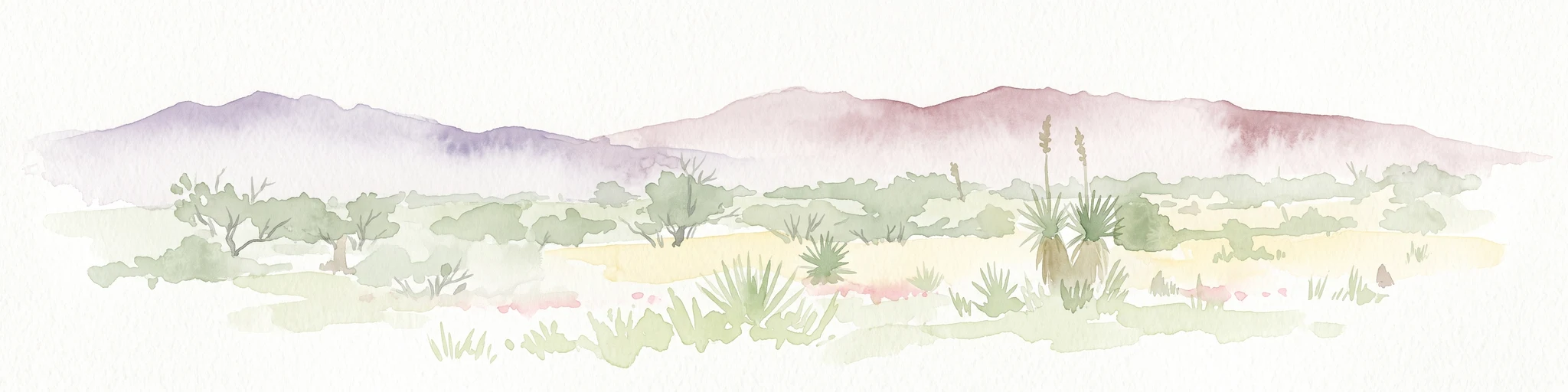
A horizontal watercolor painting depicting a desert landscape with mountains in the distance, soft green and yellow foreground vegetation, and several yucca plants.
Protected landscapeUnited States of America
About 36 km away#2 closest

Southeast

Rincon Mountain Wilderness: Geographic Atlas and Protected Landscape Overview

Sky island ecosystems and mountainous desert terrain in Arizona

This protected landscape encompasses the core of the Rincon Mountains, defining a classic triangular range oriented southwest to northeast. The wilderness serves as a vital ecological bridge, rising from arid Sonoran lowlands to cool, high-elevation montane forests. Its boundaries protect an intricate system of ridges and canyons that support isolated relict plant communities, offering a distinct study in regional desert mountain geography.

Relief
Mountain
Access
Moderate access
Scope
Terrestrial
Water
Minor water
A soft watercolor painting of a wide, rolling mountain landscape with muted greens, yellows, and purples.
Wildlife reserveArizona
About 44 km away#3 closest

Northeast

Galiuro Wilderness: A Protected Mountain Landscape in Southeastern Arizona

Mapped geography and terrain of the Galiuro range

Trace the uplifted slabs and eroded canyons that define Galiuro Wilderness. This protected area rises from the Arizona plains to reveal a complex geography of brushy slopes, spring-fed riparian zones, and sky-high summit vistas.

Area
309 km²
Established
1932
IUCN
Ib
Relief
Mountain
Wildlife reserveArizona
About 89 km away#4 closest

North

Needle's Eye Wilderness: Protected Desert Geography and Mescal Mountain Topography

Gila River canyons and limestone desert landscapes in Arizona

Needle's Eye Wilderness encompasses a rugged segment of the Mescal Mountains where the Gila River has incised deep limestone gorges. This protected area features a striking shift between harsh arid uplands and a dense riparian corridor, offering a study in concentrated desert canyon topography and dramatic geological formations within southern Arizona.

Area
35.5 km²
Established
1990
IUCN
Ib
Relief
Mountain
Protected landscapeArizona
About 94 km away#5 closest

North

Tonto National Forest: Understanding the Geography of an Expansive Protected Landscape

Exploring the vertical ecosystem gradients in Central Arizona

Spanning from arid Sonoran basins to the towering Mogollon Rim, Tonto National Forest offers a unique study in vertical geography and protected land management. This expansive territory provides a vital map of Southwest life zones, encompassing reservoir systems, rugged river canyons, and critical wilderness habitat that define the environmental identity of the region.

Area
11,627 km²
Established
1905
Visitors
5.9M annual
Relief
Mountain
Wildlife reserveArizona
About 123 km away#6 closest

Northeast

Fishhooks Wilderness: An Arizona Desert Wildlife Reserve and Protected Landscape Atlas

Mapped terrain and arid geography in Graham County

Fishhooks Wilderness represents an intact, undeveloped stretch of southeastern Arizona desert managed by the Bureau of Land Management. The area provides a critical example of basin-and-range topography, where volcanic ridges and desert flats border the San Carlos Apache Indian Reservation. This record offers a clear perspective on the wilderness boundaries, ecological transition zones, and remote backcountry character of this distinctive regional landscape.

Area
42 km²
IUCN
Ib
Relief
Upland
Climate
Arid
A horizontal watercolor painting showing distant mountains in shades of purple, soft green rolling hills, a central winding river or stream, and grassy foreground elements on a white background.
Protected landscapeNew Mexico
About 178 km away#7 closest

Northeast

Gila National Forest: A Geographic Overview of New Mexico's Protected Wilderness Core

Mapped terrain, forest boundaries, and regional wilderness character

Gila National Forest stands as a critical protected landscape in New Mexico, encompassing immense mountain ranges, narrow river gorges, and extensive backcountry basins. This atlas entry details the forest's topographic transition from high-altitude ponderosa stands to desert lowlands, highlighting its status as the foundational site for the global wilderness movement and a stronghold for regional ecological diversity.

Area
10,969.7 km²
Established
1905
Relief
Mountain
Climate
Temperate
Wildlife reserveArizona
About 182 km away#8 closest

North

Mazatzal Wilderness: Geographic Overview of Arizona's Expansive Protected Mountain Terrain

Mapping the ecological transition from desert canyon to forest ridge

Mazatzal Wilderness stands as an essential protected area in central Arizona, covering vast tracts of the Tonto and Coconino National Forests. The landscape is defined by the stark vertical contrast between the low-lying Verde River corridor and the high-elevation forests of the Mazatzal Mountains. This expansive wilderness remains a key study in regional topography and ecological zonation for those exploring the rugged backcountry of the southwestern United States.

Area
1,021.4 km²
Established
1964
IUCN
Ib
Relief
Mountain

Common questions about visiting, size, designation, and location context for Pusch Ridge Wilderness

Pusch Ridge Wilderness FAQs for park facts, access, geography, and protected area context

Find quick answers about Pusch Ridge Wilderness, including protected-area facts, park geography, trail and visitor context, and how the park fits into its surrounding country and regional landscape.
MoriAtlas Explorer

Continue Your Protected Areas Search Across the Global Atlas

Deepen your exploration by continuing the structured search for national parks and protected areas worldwide. Utilize the comprehensive filtering capabilities to compare different conservation landscapes and refine your understanding of global park geography. Discover more about the distribution and characteristics of protected natural areas.

Global natural geography