
Rivers
Park geography
Structured regional overview of terrain, elevations, and park boundary dimensions
Ranomafana National Park Geography and Mapped Landscape Profile in Madagascar
Ranomafana National Park occupies a 416 square kilometer region in Madagascar, spanning the Haute Matsiatra and Vatovavy administrative areas. This geography profile details the park's physical extent, including elevation ranges from 800 to 1200 meters and its integration with river systems like the Namorona and Faraony.
Related tags
Tropical RainforestUNESCO World Heritage SiteLemur ConservationEndemic BiodiversityPrimates
A biodiversity-rich rainforest sanctuary in southeastern Madagascar famed for its endemic lemurs and bamboo lemur discoveries
Ranomafana National Park
Ranomafana National Park is a protected area of approximately 416 square kilometers in southeastern Madagascar, spanning the Haute Matsiatra and Vatovavy regions. Established in 1991, it represents one of Madagascar's most significant conservation areas, protecting a tract of tropical rainforest at elevations between 800 and 1,200 meters. The park's establishment was directly tied to the rediscovery of the greater bamboo lemur and the discovery of the golden bamboo lemur by primatologist Dr. Patricia Wright, events that highlighted the region as a critical biodiversity hotspot. The park's name derives from the Malagasy words rano mafana, meaning hot water, referencing the thermal springs found in the nearby town of Ranomafana. In 2007, Ranomafana was inscribed as a component of the UNESCO World Heritage Site known as the Rainforests of the Atsinanana, recognizing its outstanding universal value as a center of endemism and ecological significance.
- Location
- Madagascar
- Park type
- National park
- Established
- 1991
- Area
- 416 km²
Location overview
Administrative boundaries across Haute Matsiatra and Vatovavy
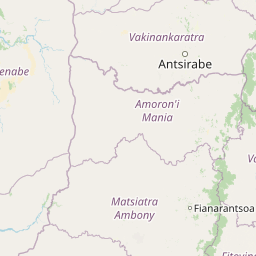
Geographic Position of Ranomafana National Park in Madagascar
Ranomafana National Park is situated within the inland territory of Madagascar, spanning the Haute Matsiatra and Vatovavy regions. The protected area operates entirely within national borders as an inland terrestrial reserve.
- Countries
- Madagascar
- Regions
- Haute Matsiatra, Vatovavy
- Primary location
- Madagascar
- Geographic setting
- Inland
Boundary and coordinates
Mapped park geometry, recorded area, and geographic coordinate spans
Ranomafana National Park Boundary Map and Spatial Extent Explorer
Interactive boundary geometry provides spatial context for the protected area. Accompanying measurements outline recorded area, perimeter, and coordinate spans without survey precision.
- Boundary area
- 405.2 km²
- Boundary perimeter
- 241.3 km
- Northernmost point
- 21.0381° S
- Southernmost point
- 21.4028° S
- Easternmost point
- 47.595° E
- Westernmost point
- 47.3381° E
- Geographic centre
- 21.2189° S, 47.4556° E
- North–south span
- 40.4 km
- East–west span
- 26.7 km
Elevation and terrain
Recorded vertical range and internal natural features
Ranomafana National Park Elevation and Terrain Geography
Recorded terrain spans an elevation range from 800 to 1200 meters across the protected landscape. Internal feature records detail specific river networks and peak locations found within park boundaries.
- Minimum elevation
- 800 m
- Maximum elevation
- 1,200 m
Selected named natural features
Peaks
Vohidratiana
Rivers
Faravory
Rivers
Faraony
Environmental setting
Tropical forest zones, dominant canopy cover, and riverine mountain terrain
Ranomafana National Park Environmental Classifications and Physical Settings
Recorded classifications frame the physical setting through interconnected forest, valley, and tropical climate categories. Stored environmental attributes link directly to relevant atlas destinations across the protected landscape.
- Climate
- Tropical
- Water
- Minor water
- Forest cover
- Dense forest cover
- Seasonality
- Year-round
Landscape features
Mountains · Valleys · Forest · Rivers
Habitat types
Tropical forest · Montane forest · Riverine habitat
Park atlas
Compare diverse rainforest landscapes and conservation sites across Madagascar's central highlands and eastern slopes
Explore Other National Parks and Protected Areas Near Ranomafana National Park in Eastern Madagascar
Continue your exploration from Ranomafana National Park by discovering other protected areas and national parks across Madagascar's rich eastern and central regions. Browsing these nearby landscapes provides essential geographic context, revealing the spread of tropical rainforests and unique biodiversity conservation efforts beyond a single park entity.
Protected areaAtsinanana
72 km away#1 closest
Northeast

Nosivolo River Protected Area: A Geographic Profile of Madagascar’s Wetland Landscape
Freshwater habitat mapping and catchment geography
Investigate the physical geography of the Nosivolo River, a protected area in Madagascar characterized by its intact highland forest sources and diverse aquatic habitats. This profile provides context on the river’s role as a Ramsar-designated wetland and its function within the wider Mangoro River basin in the Atsinanana region.
- Established
- 2010
- Relief
- Mixed relief
- Scope
- Terrestrial
- Water
- Water-dominated
National parkHaute Matsiatra
95 km away#2 closest
Southwest
Andringitra National Park: A Protected Landscape within Haute Matsiatra's Geography
Explore mapped park boundaries and regional terrain.
Andringitra National Park represents a vital protected area within the Haute Matsiatra region, contributing significantly to the mapped landscape of central Madagascar. Its designation as a national park underscores its importance for conservation and geographic study. Users exploring this destination can gain a detailed understanding of its specific protected boundaries, the surrounding natural terrain, and its overall contribution to the regional geography, making it a key site for atlas-based landscape discovery.
- Area
- 311.6 km²
- Established
- 1999
- IUCN
- II
- Visitors
- 3.4K annual
National parkMadagascar
About 117 km away#3 closest
North
Marolambo National Park: Madagascar's National Park and Protected Landscape
Explore mapped boundaries and regional geography.
Marolambo National Park stands as a protected national park within Madagascar's globally recognized biodiversity hotspot. This entry provides focused insight into its protected landscape, its specific geographic context within the island nation, and its role in the conservation of unique natural terrain. Understanding Marolambo National Park through its mapped boundaries and regional geography contributes to a broader atlas exploration of Madagascar's endemic ecosystems.
- Area
- 950.63 km²
- Climate
- Tropical
- Access
- Remote access
- Scope
- Terrestrial
Wildlife reserveIhorombe
About 131 km away#4 closest
South
Réserve spéciale du Pic d'Ivohibe: Protected Wildlife Reserve in the Ihorombe Region
A rugged mountain massif and vital watershed landscape
Located in the Ihorombe region, Réserve spéciale du Pic d'Ivohibe protects the southern section of the Andringitra mountain chain. The reserve acts as a vital condensation-driven microclimate, supporting lush evergreen forests and rupicolous highland vegetation. This protected area serves as an essential water source for local river systems while harboring a documented diversity of endemic plants and southeast-restricted lemur populations.
- Area
- 34.53 km²
- Established
- 1964
- IUCN
- Ia
- Relief
- Mountain
Wildlife reserveAtsimo-Atsinanana
About 161 km away#5 closest
South
Manombo Special Reserve: Protected Geography and Coastal Forest Mapping
Southeastern Madagascar wildlife reserve and humid forest habitat.
Examine the ecological mosaic of Manombo Special Reserve, a protected wildlife area located in the Atsimo-Atsinanana region. This reserve features a distinctive split-parcel configuration across National Route 12, offering insights into lowland rainforest conservation, wetland systems, and the dense endemism of Madagascar's southeastern coastal geography.
- Area
- 53.2 km²
- Established
- 1956
- IUCN
- IV
National parkIhorombe Region
229 km away#6 closest
Southwest
Isalo National Park: Explore Madagascar's Sandstone Canyons and Protected Landscape Geography
Discover unique geology, tapia woodlands, and regional park context.
Isalo National Park is a prominent protected area in Madagascar's Ihorombe Region, celebrated for its spectacular sandstone landscape. This national park features deep canyons, eroded rock domes, and striking runiform mountains, formed from ancient sedimentary deposits. The park preserves significant tapia woodlands and remarkable plant endemism, offering a rich context for understanding protected land distribution and Madagascar's unique geography. Its mapped terrain provides a visual atlas of natural wonders.
- Area
- 815.4 km²
- Established
- 1962
- IUCN
- II
- Visitors
- 32.7K annual
National parkAtsimo-Atsinanana
About 238 km away#7 closest
South
Midongy du sud National Park: National Park in Atsimo-Atsinanana, Madagascar
Explore its protected landscape and mapped geography.
Midongy du sud National Park is a significant protected area located in the Atsimo-Atsinanana region of Madagascar. This entry provides detailed geographic context, focusing on the park's mapped boundaries and its identity as a national park. It supports atlas-based discovery by offering insights into the park's specific landscape and its regional setting within southeastern Madagascar, serving as a factual resource for understanding its protected status.
- Area
- 1,922 km²
- Established
- 1997
- IUCN
- II
- Relief
- Mountain
Wildlife reserveMadagascar
About 247 km away#8 closest
South
Kalambatritra Special Reserve: Exploring the Geography of Southern Madagascar Protected Lands
Mapping a unique humid highland forest refuge
The Kalambatritra Special Reserve comprises a significant forested block in southern Madagascar, defined by ridges and valleys that maintain a humid microclimate. This protected area serves as a critical habitat for endemic wildlife, bridging the gap between eastern forest ecosystems and the drier terrain of the southern plateau, providing an essential study in island geography and conservation.
- Area
- 282.55 km²
- Established
- 1959
- IUCN
- IV
- Scope
- Terrestrial
MoriAtlas Explorer
Continue exploring the geographic details of Ranomafana National Park
Deepen your understanding of Ranomafana National Park's role as a protected landscape and its intricate geographic features. Use this entry point to investigate its mapped boundaries, surrounding terrain, and unique natural environment within Madagascar's atlas. This is essential for comprehending its ecological significance and protected area identity.
Browse next
Global natural geography
Explore related park routes
Explore MoriAtlas Global ParksBrowse All MoriAtlas ParksGlobal Park Map DiscoveryMoriAtlas: Browse All CountriesBrowse All MoriAtlas ContinentsNational Park Environment AtlasGrand Canyon National Park AtlasYellowstone National Park AtlasYosemite National Park Atlas and GeographySerengeti National Park AtlasGalápagos National Park Protected LandscapeBanff National Park Geography and AtlasKruger National Park Atlas EntryUluṟu-Kata Tjuṯa National Park AtlasExplore Uluru-Kata Tjuta National Park GeographyPlitvice Lakes National Park AtlasFiordland National Park Protected LandscapeGreat Smoky Mountains National Park AtlasAfghanistan National Parks and Protected AreasAlbania National Parks and Protected AreasAlgeria National Parks and Protected AreasAmerican Samoa National Parks and Protected AreasAndorra National Parks and Protected AreasAngola National Parks and Protected AreasAntarctica National Parks and Protected AreasAntigua and Barbuda Park List