

Mori Atlas logo
Wildlife reserveRed Deer Migratory Bird Sanctuary

Understanding the wetland terrain and ecological corridors of this historic Alberta wildlife reserve

Red Deer Migratory Bird Sanctuary: Mapped Protected Landscapes and Aspen Parkland Geography

Red Deer Migratory Bird Sanctuary protects a vital corridor of aspen woodland and wetland terrain within the city of Red Deer, Alberta. Centered on the distinctive oxbow channels of the Gaetz Lakes, this wildlife reserve provides a rare surviving mosaic of Aspen Parkland habitat. The mapped boundaries showcase a transitional ecosystem that serves as a critical nesting and stopover site for diverse waterfowl and shorebird species in central Canada.

migratory bird sanctuarywetland habitataspen parklandoxbow lakeswaterfowlurban wildlife area

Red Deer Migratory Bird Sanctuary

Wildlife reserve

Park overview

Structured park overview, official facts, and landscape profile for Red Deer Migratory Bird Sanctuary

Red Deer Migratory Bird Sanctuary park facts, protected area profile, and essential visitor context

Review the core facts for Red Deer Migratory Bird Sanctuary, including designation, size, terrain, visitor scale, habitats, and operating context in one park-focused overview.

About Red Deer Migratory Bird Sanctuary

Red Deer Migratory Bird Sanctuary is a small but ecologically significant federally protected bird sanctuary in the city of Red Deer, Alberta. Established in 1924, it predates much of the city's modern growth and represents one of the early entries in Canada's migratory bird sanctuary network. Although it lies within an urban setting, the sanctuary retains a distinctly natural character because of its combination of open water, marsh, shrub thickets, and deciduous forest typical of the Aspen Parkland ecoregion that runs through central Alberta.

The heart of the sanctuary is the Gaetz Lakes, two curving lakes that were originally side channels or oxbows of the Red Deer River before the river shifted course. These lakes, along with surrounding marshy margins, provide the wetland habitat that defines the site's value for waterbirds. Around and between the lakes, a mosaic of woody cover and open areas offers nesting structure for many species. The sanctuary's land composition reflects this mix, with shrub and forest vegetation forming the majority of the area, wetlands covering a meaningful but smaller share, and only limited cultivated or landscaped land including a portion of a cemetery.

Beyond its habitat value, the sanctuary matters because the Aspen Parkland it sits in has been heavily altered by agriculture, energy development, and urban expansion across Alberta. The Red Deer Migratory Bird Sanctuary preserves a working example of what central Alberta's natural parkland mosaic once looked like across a much wider area. Its accessibility within city limits also gives it a strong role in local environmental education, supported by the adjacent Kerry Wood Nature Centre, which connects visitors to the sanctuary's ecology and history.

Quick facts and research context for Red Deer Migratory Bird Sanctuary

Red Deer Migratory Bird Sanctuary is a protected bird sanctuary of approximately 130 hectares inside the city of Red Deer in central Alberta. It was established in 1924 under the Canadian Migratory Birds Convention Act framework and is administered by the Canadian Wildlife Service, a branch of Environment and Climate Change Canada. The sanctuary sits east of the Red Deer River within the Aspen Parkland ecoregion and includes the Gaetz Lakes, which are former oxbow channels of the river. Its land cover is dominated by shrubs and forest, with smaller proportions of wetland, cultivated open land, and landscaped areas, making it a notably diverse habitat mosaic for an urban sanctuary of its size.

Park context

Deeper park guide and search-rich context for Red Deer Migratory Bird Sanctuary

Red Deer Migratory Bird Sanctuary history, landscape, wildlife, and travel context

Explore Red Deer Migratory Bird Sanctuary through its history, landscape character, ecosystems, wildlife, conservation priorities, cultural context, and seasonal travel timing in a structured park guide built for atlas discovery and search intent.

Why Red Deer Migratory Bird Sanctuary stands out

The sanctuary is best known for the Gaetz Lakes, a pair of oxbow lakes that anchor the protected area's wetland habitat and give the site its alternate local name. It is also recognized for its long-running role as a nesting and stopover site for waterfowl in Alberta's Aspen Parkland, supporting breeding populations of several duck species and seasonal use by grebes, herons, terns, and shorebirds. Its presence as an established 1924 sanctuary within a modern mid-sized prairie city gives it additional importance as a surviving example of native parkland habitat amid significant regional land conversion.
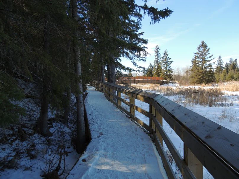
Kerry Wood Nature Centre
Kerry Wood Nature Centre and Gaetz Lake in Red Deer, Alberta, Canada

Red Deer Migratory Bird Sanctuary history and protected-area timeline

The Red Deer Migratory Bird Sanctuary was established in 1924 as one of the early federally designated bird sanctuaries in Alberta. Its creation followed the framework of Canada's Migratory Birds Convention and the federal push to set aside key wetland and breeding sites during the early twentieth century, when many North American waterfowl populations were under heavy pressure from unregulated hunting and widespread habitat loss.

The site was chosen for its Gaetz Lakes, oxbow features that already provided dependable water, marsh, and woodland conditions for nesting and migrating waterfowl. Over the following decades, the sanctuary remained protected even as the surrounding landscape was progressively transformed by the growth of the city of Red Deer and by agricultural and industrial activity across the Aspen Parkland region. Today it is administered by the Canadian Wildlife Service and continues to be recognized as one of the older surviving migratory bird sanctuaries in the Canadian system.

Red Deer Migratory Bird Sanctuary landscape and geographic character

The sanctuary's landscape is defined above all by the Gaetz Lakes, two curving oxbow lakes that trace the old path of the Red Deer River. These shallow lakes, fringed by marsh and emergent vegetation, form the wetland core of the site, while their oxbow shape gives the area a distinctive looping shoreline pattern visible even within an urban setting.

Around the lakes, the terrain shifts into a mixed cover of shrubs, aspen woodland, and scattered openings typical of the Aspen Parkland belt that runs through central Alberta. This transitional ecoregion blends grassland and northern forest character, producing a patchy mosaic of open and wooded habitats rather than a single dominant landform. Small areas of cleared open ground and landscaped land including a portion of a cemetery are also part of the protected area, breaking up the otherwise continuous mosaic of natural vegetation. Outside the sanctuary, the Red Deer River lies just to the west, while the broader region is characterized by the flat to gently rolling terrain of central Alberta's populated corridor.

Red Deer Migratory Bird Sanctuary ecosystems, habitats, and plant life

The protected area sits in the Aspen Parkland ecoregion, one of the most characteristically mixed ecological zones on the Canadian Prairies. Here, trembling aspen and other deciduous trees share the land with patches of grassland, meadow, and wetland, producing an unusually rich habitat mosaic at the boundary between dry prairie and boreal forest influences. Within the sanctuary, this transitional character is expressed in the combination of aspen woodland, shrub thickets, marsh, and open water found at the Gaetz Lakes.

The sanctuary's land cover reflects this diversity: a majority of shrub and forest vegetation, a meaningful but smaller portion of wetland, and limited areas of cultivated and landscaped open ground. The Gaetz Lakes themselves, as former river oxbows, concentrate aquatic and emergent plant communities that would otherwise be scarce in this part of Alberta, where extensive wetland loss has occurred. The result is a compact but broadly representative slice of Aspen Parkland habitat preserved inside a heavily modified urban and agricultural landscape.

Red Deer Migratory Bird Sanctuary wildlife and species highlights

The sanctuary's wildlife significance is strongly focused on birds, and especially on waterfowl. The site's breeding bird list includes several duck species such as mallard, gadwall, American wigeon, northern shoveler, canvasback, redhead, lesser scaup, common merganser, bufflehead, and ruddy duck, alongside Canada goose, blue-winged teal, and green-winged teal. These species nest around the marshy edges of the Gaetz Lakes and within the surrounding shrub and aspen cover, where they benefit from the combination of water, nesting structure, and relative protection.

A wider range of waterbirds also uses the sanctuary seasonally without breeding there. The species recorded migrating through or visiting include grebes such as horned, eared, pied-billed, and red-necked grebes, along with American bittern, great blue heron, several gull species including California and ring-billed gulls, Franklin's gull, Wilson's snipe, killdeer, spotted sandpiper, solitary sandpiper, Wilson's phalarope, black-necked stilt, common tern, and black tern. Together these visitors highlight the sanctuary's role not only as a nesting area but also as a stopover point for waterbirds moving through central Alberta.

Red Deer Migratory Bird Sanctuary conservation status and protection priorities

Conservation significance at the Red Deer Migratory Bird Sanctuary comes from its combination of legal protection, early establishment, and ecological setting. As a federally designated migratory bird sanctuary managed by the Canadian Wildlife Service, it carries long-standing habitat protections within a network that has played a major role in North American waterfowl conservation since the early twentieth century. Its 1924 establishment date places it among the earliest bird sanctuaries in Alberta.

Ecologically, the sanctuary matters because the surrounding Aspen Parkland region has experienced extensive conversion of native vegetation to agriculture and urban land. By preserving a functioning example of wetland, aspen woodland, and shrub habitat set around the Gaetz Lakes, the sanctuary protects nesting and migratory habitat that has become scarce at the regional scale. It also serves a conservation outreach function through its connection with the Kerry Wood Nature Centre, helping link formal habitat protection with local awareness of prairie wetland and parkland biodiversity.

Red Deer Migratory Bird Sanctuary cultural meaning and human context

The sanctuary sits within Red Deer, a city named after the Red Deer River and the historic presence of elk in the region, and is closely tied to the local identity of the community. The Gaetz Lakes take their name from early settlers in the area, and the sanctuary's protected status from the mid-1920s means it predates much of the city's modern growth, giving it a distinctive role as a long-standing piece of preserved natural landscape within an urban setting.

The presence of the Kerry Wood Nature Centre adjacent to the sanctuary ties the protected area into local education and public engagement with nature. For the people of Red Deer and visitors to central Alberta, the sanctuary is both a working bird habitat and a familiar local landmark where urban life and prairie parkland wildlife continue to meet.

Top sights and standout views in Red Deer Migratory Bird Sanctuary

A century-old migratory bird sanctuary in the heart of Red Deer, Alberta, anchored by the curving Gaetz Lakes oxbows. One of the early entries in Canada's migratory bird sanctuary network, established in 1924 and still under federal protection. A rare surviving example of Aspen Parkland habitat in central Alberta, where most native vegetation has been converted. Home to nesting waterfowl and seasonal visitors ranging from grebes and bitterns to terns and shorebirds, connected to public nature education through the Kerry Wood Nature Centre.

Best time to visit Red Deer Migratory Bird Sanctuary

The sanctuary's birdlife changes through the seasons in ways that shape what visitors can expect to see. Spring and early summer are typically the most active period, when waterfowl and other species are breeding around the Gaetz Lakes and the surrounding aspen and shrub cover, and when migratory visitors are also moving through. Late summer and fall bring migrating waterfowl and shorebirds gathering on the lakes. Winter conditions reflect the central Alberta climate, with cold temperatures freezing shallow water and reducing visible activity, although hardy species can still be present.
Monthly climate preview

Long term representative monthly temperature and precipitation patterns

Red Deer Migratory Bird Sanctuary Climate Normals and Annual Temperature Rhythm

Measured coordinates track monthly thermal ranges alongside daily precipitation averages across the representative location. Detailed monthly climate records outline full temperature variations and precipitation distributions.
Annual mean4 °C
-10 °C17 °C
Jan-10°
Feb-8°
Mar-3°
Apr
May10°
Jun14°
Jul17°
Aug16°
Sep11°
Oct
Nov-4°
Dec-9°
Warmest month
July

17 °C

Coolest month
January

-10.2 °C

Wettest month
June

3.2 mm/day

Driest month
December

0.6 mm/day

Park location guide

Geography guide, regional context, and park location map for Red Deer Migratory Bird Sanctuary

Red Deer Migratory Bird Sanctuary park geography, regions, and map view in Canada

Understand where Red Deer Migratory Bird Sanctuary sits in Canada through a broader geographic reading of the surrounding landscape, nearby location context, and its mapped position within the national park landscape.

How Red Deer Migratory Bird Sanctuary fits into Canada

Canada is a federal parliamentary constitutional monarchy spanning North America from the Atlantic to the Pacific and Arctic Oceans. With a population of over 41 million, it is officially bilingual in English and French at the federal level. The country gained independence from the United Kingdom through a gradual process culminating in 1982.

Wider geography shaping Red Deer Migratory Bird Sanctuary in Canada

Canada occupies the northern portion of North America, sharing its longest international border with the United States. The country extends from the Atlantic Ocean to the Pacific Ocean and northward into the Arctic Ocean, giving it the longest coastline of any nation.

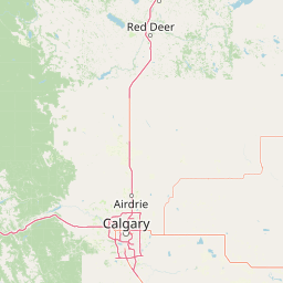
Map view of Red Deer Migratory Bird Sanctuary

Use this park location map to pinpoint Red Deer Migratory Bird Sanctuary in Canada, understand its exact geographic position, and read its mapped placement within the surrounding landscape more clearly.

Pigeon | © OpenStreetMap contributors

Location context for Red Deer Migratory Bird Sanctuary

Alberta
Recorded earthquake history

View Historical Earthquake Records for Red Deer Migratory Bird Sanctuary

Explore the documented seismic history surrounding the Red Deer Migratory Bird Sanctuary. MoriAtlas provides a searchable database of past earthquake events, including magnitude and proximity details, for a deeper understanding of the regional geological record.

Red Deer Migratory Bird Sanctuary Earthquakes

Catalogued events

1 event

Strongest magnitude

Magnitude 3.8

Most recent event

Mar 4, 2019

This history includes earthquakes recorded inside the park or within 50 km of its borders

Visual reference of wetland habitats, oxbow lakes, and aspen parkland terrain

Red Deer Migratory Bird Sanctuary Photos and Landscape Scenery

Visual documentation captures the oxbow lakes, marsh edges, and aspen parkland vegetation defining the protected landscape. Examining sanctuary imagery reveals the intact natural terrain surviving within a heavily altered urban environment.

Kerry Wood Nature Centre

Park atlas

Compare regional wildlife habitats and connected conservation lands across central Alberta

Explore Other Parks and Protected Areas Near Red Deer Migratory Bird Sanctuary

Browsing nearby protected areas allows travelers to examine how different wetland reserves and urban sanctuaries preserve native Aspen Parkland ecosystems. Comparing adjacent reserves reveals broader ecological patterns across central Alberta's heavily modified regional landscape.
Wildlife reserveAlberta
About 112 km away#1 closest

East

Spiers Lake National Wildlife Area: Mapping Native Grasslands in Central Alberta

A federally managed reserve for rare prairie flora and bird populations.

Located in the County of Stettler, Spiers Lake National Wildlife Area protects one of the remaining fragments of native fescue prairie in Alberta. The reserve provides essential habitat for rare plants and grassland birds, offering a focused look at the original prairie matrix before agricultural conversion. It is a key example of Canadian federal conservation policy preserving vanishing grassland biodiversity.

Area
0.64 km²
Established
1982
IUCN
Ia
Scope
Terrestrial
Wildlife reserveAlberta
About 140 km away#2 closest

South

Inglewood Migratory Bird Sanctuary: Federal Wildlife Reserve and Riparian Corridor Map

Protected riparian ecosystems along the Bow River in Alberta.

Analyze the geography of the Inglewood Migratory Bird Sanctuary, a federal wildlife reserve in Calgary, Alberta. This site preserves rare cottonwood floodplain forest and river habitats that serve as a critical stopover for migratory birds, offering a unique look at how protected landscapes persist within urban environments.

Area
1.11 km²
Established
1929
Relief
Lowland
Scope
Terrestrial
National parkCanada
141 km away#3 closest

Southwest

Banff National Park: Exploring Canada's Iconic National Park Protected Landscape and Geography

Mapped park boundaries and regional geographic context for Banff National Park.

Gain a structured understanding of Banff National Park as a key protected area within Canada. This resource details its identity as a national park, providing insights into its geographic setting and mapped landscape. It serves as a vital point for atlas-based discovery, helping to contextualize Banff National Park's significance within Canada's protected lands and natural terrain.

Area
6,641 km²
Established
1885
IUCN
II
Visitors
4.1M annual
National parkAlberta
148 km away#4 closest

North

Elk Island National Park: National Park Protected Landscape and Alberta Geography

Discover the mapped terrain and protected boundaries.

Elk Island National Park, a designated national park in Alberta, Canada, offers a distinct protected landscape for geographic exploration. This detail page focuses on its mapped boundaries, regional setting within Western Canada, and the specific natural terrain that constitutes its protected area. Users can gain a structured understanding of Elk Island National Park's role as a conserved natural entity, ideal for atlas-based discovery and geographic context.

Area
194 km²
Established
1913
IUCN
II
Visitors
401.9K annual
National parkBritish Columbia
193 km away#5 closest

Southwest

Kootenay National Park: National Park Protected Landscape and Geographic Context

Explore Kootenay National Park's mapped terrain and regional geography.

Kootenay National Park is a protected national park located in British Columbia, Canada. This dedicated detail page provides an atlas-style exploration of its geographic identity, focusing on its mapped boundaries and the surrounding natural terrain. Understand how Kootenay National Park fits into the larger regional geography, offering rich context for protected landscape discovery and analysis.

Area
1,406 km²
Established
1920
IUCN
II
Visitors
574.1K annual
National parkBritish Columbia
195 km away#6 closest

Southwest

Yoho National Park: Mapped Protected Area in British Columbia's Geography

Exploring the park's protected boundaries and terrain.

Yoho National Park is presented here as a distinct national park within British Columbia's vast geographic framework. This page provides a structured view of its protected land status, allowing for detailed exploration of its mapped boundaries and surrounding natural landscapes. Understand Yoho National Park's place in the Canadian atlas through its specific geographic features and protected area context.

Area
1,313 km²
Established
1886
IUCN
II
Visitors
663.9K annual
National parkAlberta
209 km away#7 closest

West

Jasper National Park National Park: Mapped Protected Landscape and Alberta Geography

Explore Alberta's regional park context and natural terrain.

Jasper National Park is a key protected national park in Alberta, Canada, offering extensive natural landscapes. This park page details its precise geographic location, outlines its protected boundaries, and provides context within the regional geography of Western Canada. Discover the mapped terrain and the park's significance as a protected area within a broader atlas perspective.

Area
10,878 km²
Established
1907
IUCN
II
Visitors
2.4M annual
National parkColumbia-Shuswap Regional District
258 km away#8 closest

West

Glacier National Park: A National Park within Canada's Protected Landscape Atlas

Explore its mapped boundaries and regional geography.

Glacier National Park represents a significant protected area entity within the broader Canadian geography. This page offers an atlas-oriented perspective on its identity as a national park, focusing on its mapped geographic spread and role as a conservation landscape. Users can explore the park's place within the Columbia-Shuswap Regional District and understand its distinct contribution to the national protected area framework.

Area
1,349 km²
Established
1886
IUCN
II
Visitors
4M annual

Common questions about visiting, size, designation, and location context for Red Deer Migratory Bird Sanctuary

Red Deer Migratory Bird Sanctuary FAQs for park facts, access, geography, and protected area context

Find quick answers about Red Deer Migratory Bird Sanctuary, including protected-area facts, park geography, trail and visitor context, and how the park fits into its surrounding country and regional landscape.
MoriAtlas Explorer

Continue Your Protected Areas Search Across the Global Atlas

Deepen your exploration by continuing the structured search for national parks and protected areas worldwide. Utilize the comprehensive filtering capabilities to compare different conservation landscapes and refine your understanding of global park geography. Discover more about the distribution and characteristics of protected natural areas.

Global natural geography