
Mori Atlas logo
Protected landscapeŘehořkovo Kořenecko

Mapping the distinctive peatland corridors and forested plateau ridges of the Czech upland countryside

Řehořkovo Kořenecko: A Comprehensive Geographic Overview of the Protected Landscape and Upland Terrain

(Přírodní park Řehořkovo Kořenecko)

The Řehořkovo Kořenecko protected landscape spans 23 square kilometers of undulating upland terrain within the Blansko District of the Czech Republic. This defined protected area serves as a significant ecological junction, connecting the Protivanovská planina plateau with the Mojetínský hřbet ridge through a mosaic of spruce forests, relict beech stands, and essential wetland fragments. Characterized by elevations reaching up to 721 meters at the Paprč summit, the area preserves the upper course of the Bělá river and its interconnected pond systems, forming a persistent cultural and natural mosaic shaped by centuries of traditional land use.

nature parkupland landscapeCzech MoraviaBlansko Districtspruce forestbeech remnants
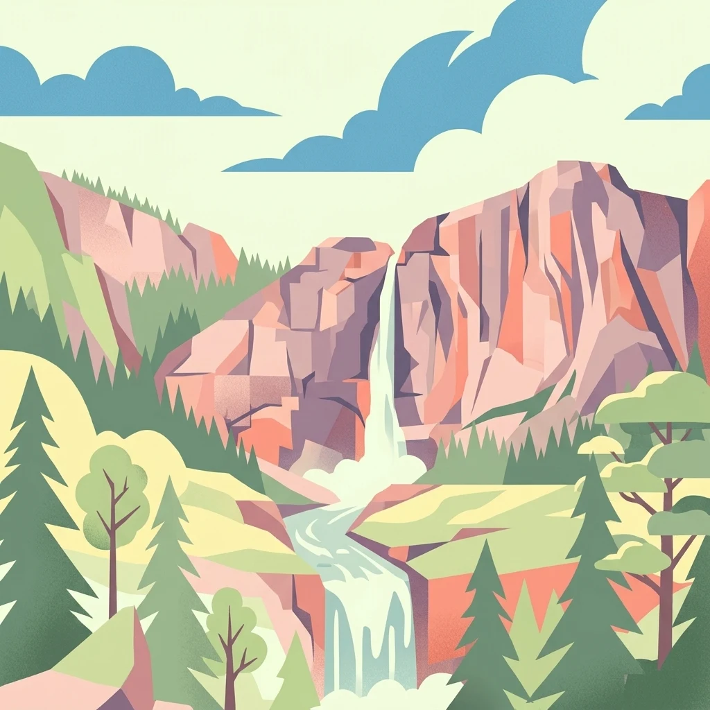
An artistic vector-style illustration of a waterfall flowing between steep, geometric mountain slopes with pine trees in the foreground and a light-colored sky.

Řehořkovo Kořenecko

Protected landscape

Park overview

Structured park overview, official facts, and landscape profile for Řehořkovo Kořenecko Nature Park

Řehořkovo Kořenecko Nature Park park facts, protected area profile, and essential visitor context

Review the core facts for Řehořkovo Kořenecko Nature Park, including designation, size, terrain, visitor scale, habitats, and operating context in one park-focused overview.

About Řehořkovo Kořenecko Nature Park

Řehořkovo Kořenecko occupies a strategically located stretch of Czech upland in the Blansko District, where the Protivanovská planina meets the northern edge of the Konická planina and the Mojetínský hřbet rises across the deep valley of the Bělá. Although modest in size, the park captures a complete cross-section of the regional landscape: plateau forest, agricultural valleys, small villages, isolated hamlets, and patches of valuable wetland scattered between them.

The protection regime reflects this mixed identity. Rather than functioning as a strict wilderness reserve, the park operates as a landscape protection area, balancing forestry, farming, and conservation. About half of the territory is forested, much of it in spruce monoculture reflecting historical planting practices, while the rest remains in agricultural use. Where the original forest composition survives, it is most likely along the Mojetínský hřbet, where beech stands offer a glimpse of the fifth fir-beech vegetation zone that defines the area ecologically.

Water is the defining thread of the park. The Bělá rises in the southeastern part of the area and flows first north through Pavlov, then west through the Pavlovské mokřady wetland complex, before turning south along the park's western margin and leaving toward the Boskovice reservoir. Smaller streams, including the Pohora and the Benešovský potok with its Višňový potok tributary, join it along the way, while on the eastern side numerous smaller headwaters such as the Okluka, Bukový potok, Zábrana, and Žďárná originate within or near the park boundaries. Together these waters sustain a network of ponds around Pavlovský Dvůr and Melkov, several of which have been actively restored in recent decades after the area suffered from drainage and peat extraction in the mid-twentieth century.

Culturally, the park carries the legacy of the painter František Řehořek, whose depictions of the regional countryside lent the protected area its name. Surviving rural monuments, including the Dutch-type windmill in Kořenec and the Church of the Exaltation of the Holy Cross in Benešov, reinforce the sense of a lived-in landscape rather than a purely ecological zone. This combination of natural and cultural value gives Řehořkovo Kořenecko its distinctive regional character.

Quick facts and research context for Řehořkovo Kořenecko Nature Park

Řehořkovo Kořenecko is a Czech přírodní park, a category of landscape protection area situated in the Blansko District of the South Moravian region. It covers roughly 23.14 km² of upland terrain, with elevations falling between 600 and 800 meters above sea level and a highest point at Paprč (721 m). Originally designated in 1992 as a quiet zone, it was reclassified as a nature park in 2000 under the Blansko District administration.

The park encompasses the cadastres of Kořenec, Benešov, Okrouhlá, Knínice, and Šebetov, along with the small settlements and isolated farms of Pavlov, Melkov, and Pilka. Geologically, the underlying substrate is composed of greywackes, conglomerates, and shales, with waterlogged soils surviving above them in many places. The landscape is drained by the Bělá river, whose upper catchment gives the park its most ecologically important wetlands, peat remnants, and pond clusters.

Protection and recognition

Examine the documented terrestrial conservation scope and recognition history.

Řehořkovo Kořenecko Protection Status and International Recognition

Territorial protection status and conservation management scope define the baseline geography of Řehořkovo Kořenecko. Structured recognition records outline official designations and international status without external assumptions.

Protection details

Protection scope
Terrestrial
Transboundary protection
No
Park context

Deeper park guide and search-rich context for Řehořkovo Kořenecko Nature Park

Řehořkovo Kořenecko Nature Park history, landscape, wildlife, and travel context

Explore Řehořkovo Kořenecko Nature Park through its history, landscape character, ecosystems, wildlife, conservation priorities, cultural context, and seasonal travel timing in a structured park guide built for atlas discovery and search intent.

Why Řehořkovo Kořenecko Nature Park stands out

Řehořkovo Kořenecko is best known for its upland mosaic of spruce-dominated forest, peatland fragments, and the meandering upper course of the Bělá river. The Pavlovské mokřady nature reserve captures the park's most distinctive ecological identity, combining former peat diggings, relict peatlands, and a chain of small ponds supplied by the Bělá and its tributaries. Though much of the woodland is spruce monoculture, the park preserves notable fragments of more natural beech forest, particularly along the Mojetínský hřbet ridge. Combined with rolling plateau scenery, traditional farmland, cultural monuments such as the Kořenec windmill and the Church of the Exaltation of the Holy Cross in Benešov, and its connection to the painter František Řehořek, the park stands out as a compact example of Czech upland cultural landscape with strong wetland character.
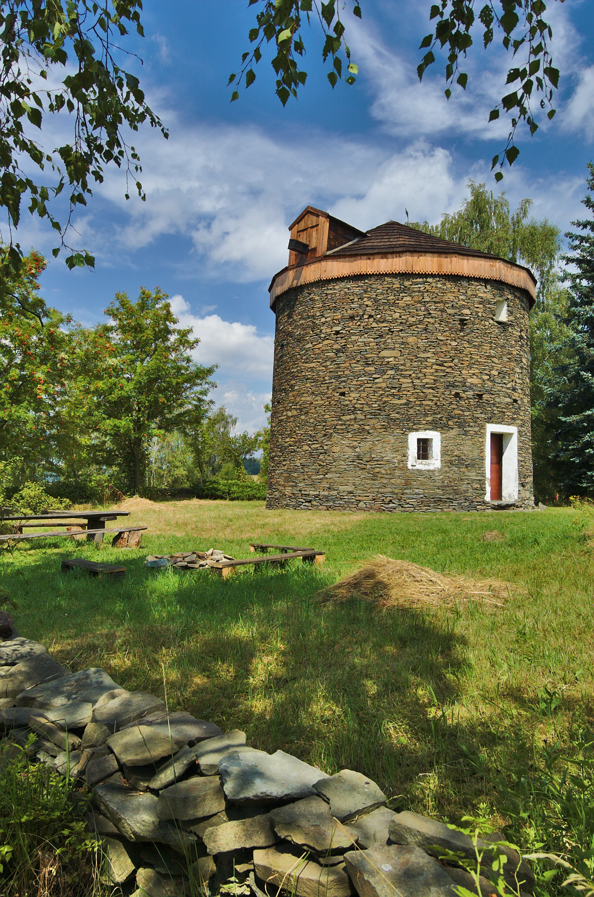
A historic circular stone windmill with a wooden roof stands in a grassy field on a sunny day, surrounded by trees and a stone wall in the foreground.
The historic stone windmill in Kořenec, a cultural monument situated within the Řehořkovo Kořenecko Nature Park.

Řehořkovo Kořenecko Nature Park history and protected-area timeline

The protection story of Řehořkovo Kořenecko begins in 1992, when the area received its first formal designation under the quieter category of a klidová oblast, or quiet zone. That early recognition reflected growing awareness of the upland's mixed forest, farmland, and wetland values, but the more durable category arrived in 2000, when the territory was reclassified as a přírodní park, the Czech landscape protection designation.

The geographic scope of the park was a deliberate compromise. Earlier planning envisioned a cross-district protected area covering parts of both the Blansko and Prostějov districts, including territory near Horní Štěpánov. In the end, the park was established in a slightly smaller extent, confined to the Blansko District portion of the original concept. The smaller territorial footprint of roughly 23.14 km² has nonetheless remained stable enough to capture the upland's key forests, fens, and cultural sites.

Equally important is the cultural naming of the park. Rather than taking the name of a settlement or geographic feature alone, the protected area honors František Řehořek (1890 to 1982), a local artist celebrated for painting this very landscape. Naming the park after him ties its identity to the long visual and cultural memory of the region, rather than only to its administrative or natural characteristics.

In parallel with formal protection, the park has seen active ecological intervention. Intensive peat extraction in the early 1960s drained and degraded parts of what is now the Pavlovské mokřady reserve, and the hydrological impacts of that era shaped the wetland character for decades afterward. In 2015, restoration work addressed some of that legacy: the Červený rybník pond was desilted, and a new two-hectare pond was constructed to help counter ongoing drainage in the area. These interventions mark a shift from passive protection toward active recovery of the park's wetland systems.

Řehořkovo Kořenecko Nature Park landscape and geographic character

The terrain of Řehořkovo Kořenecko is shaped by the meeting of two planinas (plateaus) and a single dominant ridge. Much of the park's surface lies on the Protivanovská planina, while the Konická planina sets its northern limit. Across the deep Bělá river valley, the Mojetínský hřbet rises as the park's eastern frame. Together these landforms create a stepped, undulating topography of gentle plateau surfaces interrupted by valley incisions and ridge silhouettes.

Elevations sit broadly between 600 and 800 meters above sea level, giving the area a distinctly upland character without reaching true mountain altitude. The highest point is Paprč at 721 meters, a summit that offers commanding views over the surrounding forests, fields, and the village of Kořenec. The valleys are markedly deeper: the Bělá cuts a pronounced trough along the western and northern sides of the park, separating the higher forested plateaus from the Mojetínský hřbet.

Geologically, the substrate is consistent with the broader Drahany highland region. Greywackes, conglomerates, and shales underpin most of the surface, and despite historical melioration works, waterlogged soils remain a recurring feature. The combination of relatively impermeable rocky substrate, modest gradient, and historic poor drainage has produced the conditions in which peatlands and fen fragments survive to this day. The geological character therefore directly informs both the visible scenery and the ecological identity of the park.
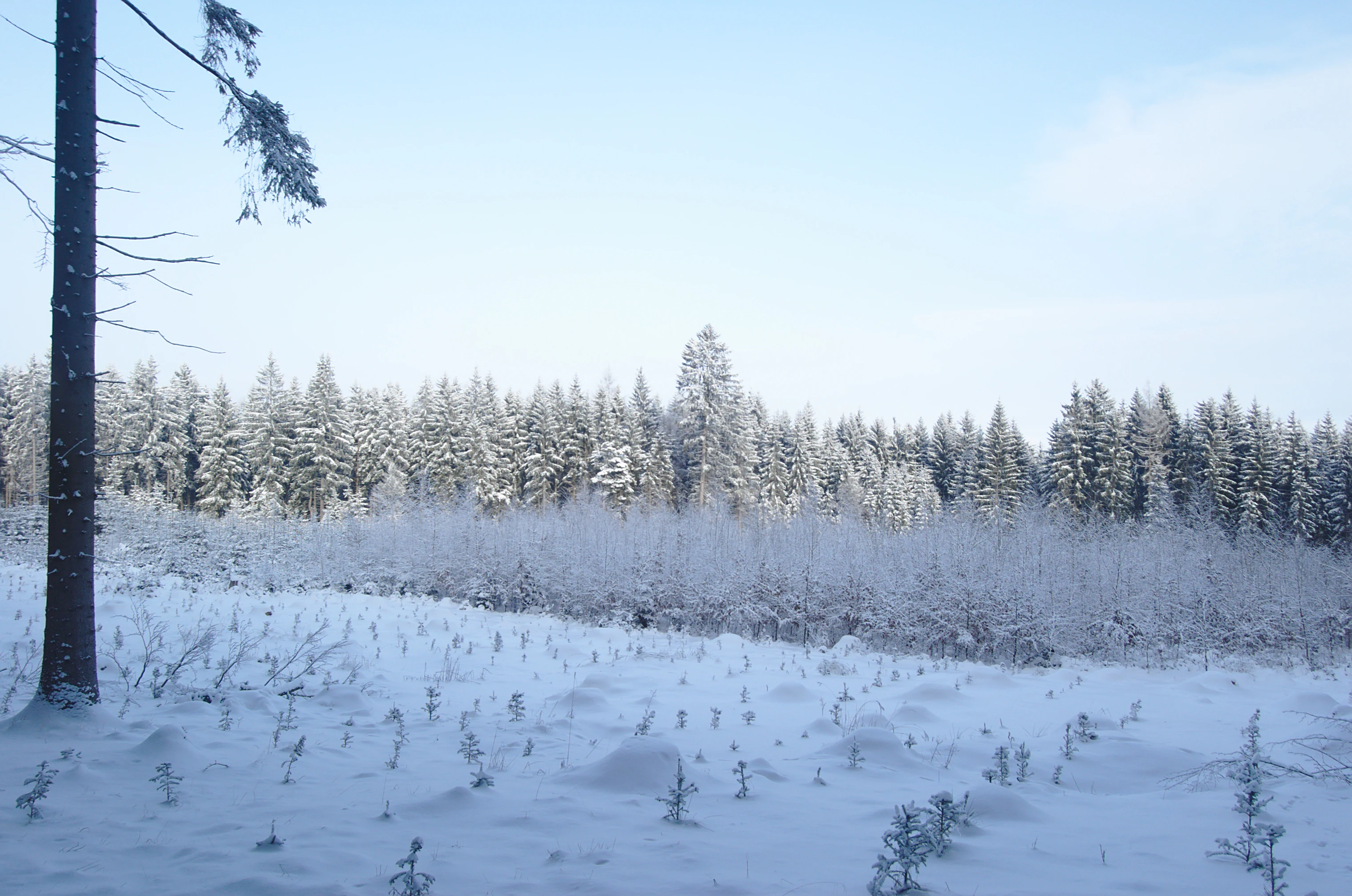
A wide, snow-covered landscape showing a foreground clearing with small scattered trees, leading to a dense forest edge in the background under an overcast winter sky.
A snow-covered clearing and forest edge within Řehořkovo Kořenecko Nature Park.

Řehořkovo Kořenecko Nature Park ecosystems, habitats, and plant life

Ecologically, the park belongs to the fifth fir-beech vegetation zone, a designation that signals both the historical forest character of the region and the degree to which current land cover has diverged from it. About half of the territory is forested, but the bulk of that forest is spruce monoculture, a legacy of twentieth-century forestry rather than natural stand composition. The reward for careful observation is that scattered remnants of more natural beech forest persist, most notably along the slopes of the Mojetínský hřbet, where topography and exposure have sheltered them from wholesale conversion.

Open agricultural land continues to occupy much of the remaining area, sustaining a half-open landscape rather than a closed forest environment. Within this matrix, the most ecologically distinctive habitats are concentrated around the Bělá river system. The Pavlovské mokřady nature reserve exemplifies this ecological contrast: despite severe degradation from mid-century peat extraction and drainage, the area retains a network of former extraction pools, surviving peatland fragments, and a chain of ponds fed by springs and the Bělá itself.

Along the western margin of the park, the Horní Bělá natural monument adds to this wetland-oriented character, while the broader vicinity hosts additional protected sites such as Uhliska, Pod Švancarkou, Pohorská louka, V chaloupkách, and the Lipovské upolínové louky, the last of these notable for its globeflower-rich meadows. Important landscape elements registered separately include the Kocourov site and the Bělá headwaters area, reinforcing the importance of the park's meadows, springs, and forest margin habitats in ecological terms.
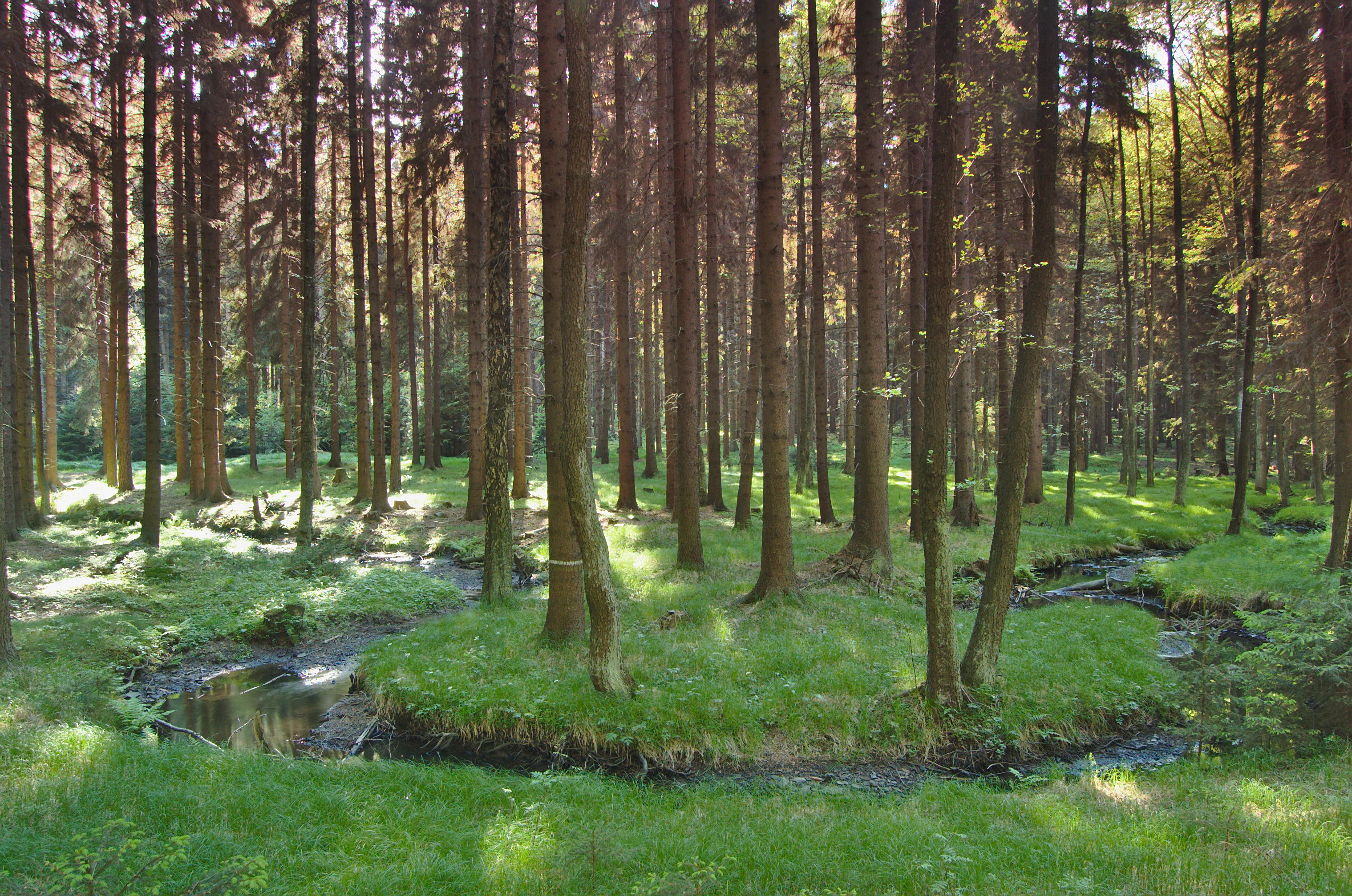
A small, winding stream flows through a lush, green forest with tall, straight trees and grass covered banks.
A small meander of the Bělá river flowing through a forested area within Řehořkovo Kořenecko.

Řehořkovo Kořenecko Nature Park conservation status and protection priorities

From a conservation perspective, Řehořkovo Kořenecko is primarily valued not for rare species records but for the survival of habitat types that have been heavily reduced elsewhere in central Moravia. The fifth fir-beech vegetation zone designation frames the park as a reference landscape for an ecological belt that has been substantially altered by spruce planting, agricultural intensification, and drainage. The surviving beech fragments along the Mojetínský hřbet and the peatland remnants around the Bělá represent the kind of habitat continuity that is otherwise difficult to maintain in this part of the Czech Republic.

The conservation strategy of the park is therefore as much about restoration and curbing decline as it is about preservation. The area's most serious historical impact came from peat extraction in the early 1960s, which drained and biologically impoverished what is now the Pavlovské mokřady reserve. The 2015 restoration program, including the desilting of Červený rybník and the creation of a new two-hectare pond, illustrates an active approach aimed at reversing long-term water loss in the wetland core.

At the broader level, the network of smaller protected sites within and adjacent to the park, including Horní Bělá, Uhliska, Pod Švancarkou, Pohorská louka, V chaloupkách, and the Lipovské upolínové louky, demonstrates a conservation model in which a nature park acts as a connective framework for multiple smaller reserves and natural monuments. This layered approach, with å přírodní park at its center and finer-scale reserves around it, gives the area a stronger collective conservation value than its modest size alone would suggest.

Řehořkovo Kořenecko Nature Park cultural meaning and human context

The cultural layer of Řehořkovo Kořenecko is unusually direct. The park takes its name not from a dominant village or a geographic feature, but from František Řehořek (1890 to 1982), a local artist whose paintings depicted the surrounding countryside. Naming the protected area after him turns the landscape itself into a kind of cultural exhibit, where the scenery visible today is the same scenery he committed to canvas. This artistic heritage gives the park an identity that goes beyond routine nature protection.

The villages within and around the park reflect a long history of rural settlement on the Czech-Moravian uplands. Kořenec preserves a Dutch-type windmill, an unusually distinctive technical monument for a small inland village, while Benešov hosts the Church of the Exaltation of the Holy Cross, anchoring the village as a traditional center of local religious and community life. Smaller hamlets like Pavlov, Melkov, and the isolated farmstead of Pilka contribute to a still-inhabited cultural landscape, in which people, agriculture, and protected nature coexist rather than being separated by zoning.

The area also includes features that link natural and cultural history. The Melkovská alej, the avenue of trees near the settlement of Melkov and the Pilka farmstead, placed second in the Czech Alley of the Year competition in 2015, illustrates how rural tree planting traditions have become part of the park's recognized cultural value. Together these elements position Řehořkovo Kořenecko as much as a cultural landscape worth preserving as a strictly defined nature reserve.
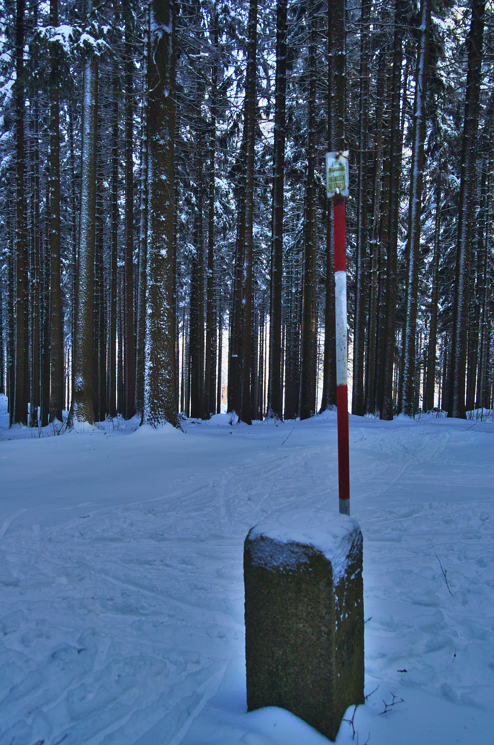
A stone boundary marker stands in a snowy forest, with a red and white striped metal post behind it against a background of dense evergreen trees.
A snow-covered boundary marker and directional post within the forest of Řehořkovo Kořenecko.

Top sights and standout views in Řehořkovo Kořenecko Nature Park

Řehořkovo Kořenecko's strongest points of distinction are the surviving peatland and pond system of the Pavlovské mokřady reserve, the deeply incised Bělá river valley, and the surviving beech forest fragments along the Mojetínský hřbet ridge. The summit of Paprč at 721 meters provides the park's most recognizable panoramic viewpoint, while the Dutch-type windmill in Kořenec and the Church of the Exaltation of the Holy Cross in Benešov add notable cultural anchors within an otherwise nature-led profile.

The park is also notable as a landscape named for a visual artist rather than for a place, an unusual origin that ties ecological protection directly to regional artistic memory. Add in the registered important landscape elements of Kocourov and the Bělá headwaters, the award-recognized Melkovská alej, and the layered interaction of nature park with surrounding smaller reserves, and the area emerges as a compact but unusually well-rounded example of Czech upland protected countryside.
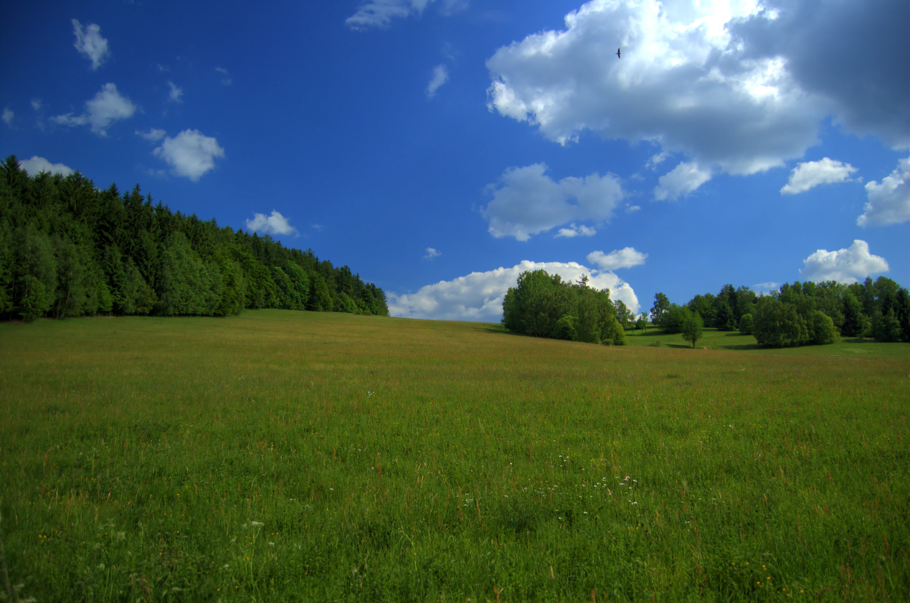
A wide view of a sunlit grassy field leading toward clusters of trees and a distant village under a blue sky with white clouds.
A view across a grassy meadow towards forests and the village of Korenec.

Best time to visit Řehořkovo Kořenecko Nature Park

The park's upland character means spring and early summer tend to be the most biologically active periods, when the Bělá valley wetlands hold water reliably and the surrounding meadows around Pavlov and the Lipovské upolínové louky area come into flower. Late spring is also when the beech forest remnants along the Mojetínský hřbet are at their freshest, and the Melkovská alej avenue near Pilka and Melkov is in full leaf.

Early autumn brings out the plateau scenery around Paprč and across the Protivanovská planina, when the mosaic of spruce, surviving deciduous patches, and harvested fields is visually strongest. Winter visits can be attractive for their quiet atmosphere and snow-covered beech stands on the ridge, though visitors should be prepared for typical Czech upland winter conditions rather than relying on any specific operational season. The park's value lies in seasonal landscapes rather than any single peak moment.

Monthly climate preview

Long-term temperature and precipitation records across twelve months

Řehořkovo Kořenecko Climate Normals and Annual Temperature Patterns

Representative coordinate measurements reveal the annual temperature and precipitation rhythm recorded at a 416 meter elevation point within Blansko District. Detailed monthly climatology profiles provide complete year-round thermal and moisture data for deeper geographical analysis.
Annual mean8 °C
-4 °C19 °C
Jan-4°
Feb-2°
Mar
Apr
May13°
Jun17°
Jul19°
Aug19°
Sep14°
Oct
Nov
Dec-2°
Warmest month
July

19.3 °C

Coolest month
January

-3.7 °C

Wettest month
July

2.7 mm/day

Driest month
February

1.2 mm/day

Park location guide

Geography guide, regional context, and park location map for Řehořkovo Kořenecko Nature Park

Řehořkovo Kořenecko Nature Park park geography, regions, and map view in Czechia

Understand where Řehořkovo Kořenecko Nature Park sits in Czechia through a broader geographic reading of the surrounding landscape, nearby location context, and its mapped position within the national park landscape.

How Řehořkovo Kořenecko Nature Park fits into Czechia

Czech Republic is a landlocked Central European country with a population of approximately 10.9 million people. The nation was established as an independent state on January 1, 1993, following the dissolution of Czechoslovakia. Its capital and largest city is Prague, with other major urban centers including Brno, Ostrava, Plzeň, and Liberec.

Wider geography shaping Řehořkovo Kořenecko Nature Park in Czechia

The Czech Republic is a landlocked country in Central Europe. It is bordered by Germany to the west, Austria to the south, Poland to the northeast, and Slovakia to the southeast. The landscape is predominantly hilly, with the territory covering 78,871 square kilometers.

Map view of Řehořkovo Kořenecko Nature Park

Use this park location map to pinpoint Řehořkovo Kořenecko Nature Park in Czechia, understand its exact geographic position, and read its mapped placement within the surrounding landscape more clearly.

Pigeon | © OpenStreetMap contributors

Location context for Řehořkovo Kořenecko Nature Park

Blansko District

Explore photographic records of upland plateaus, wetland reserves, and forest habitats.

Řehořkovo Kořenecko Landscapes and Scenery: Visualizing the Protected Uplands

Visual documentation captures the undulating plateaus, relict peatlands, and incised river valleys that define the upland character of Řehořkovo Kořenecko. Photographic records reveal the mosaic of spruce forests, beech stands, and wetland ecosystems across the protected terrain.

A historic circular stone windmill with a wooden roof stands in a grassy field on a sunny day, surrounded by trees and a stone wall in the foreground.

A small, calm pond in a rural setting, bordered by a grassy bank with trees and a utility pole on the left, under a blue sky with scattered clouds.

A wide, snow-covered landscape showing a foreground clearing with small scattered trees, leading to a dense forest edge in the background under an overcast winter sky.

A small, winding stream flows through a lush, green forest with tall, straight trees and grass covered banks.

A wide panoramic winter landscape showing snow-covered trees and a clearing in a forest.

A stone boundary marker stands in a snowy forest, with a red and white striped metal post behind it against a background of dense evergreen trees.

A wide view of a sunlit grassy field leading toward clusters of trees and a distant village under a blue sky with white clouds.

A wide panoramic shot of a snow-covered open landscape and forest edge in winter, under a partly cloudy sky.

Park atlas

Compare surrounding regional landscapes and adjacent protected nature reserves.

Explore Protected Areas and Parks Near Řehořkovo Kořenecko

Browse nearby protected areas and regional reserves that share the upland character of Řehořkovo Kořenecko. Comparing adjacent terrain helps trace the broader ecological patterns across the highland plateaus and river valleys.
Natural monumentOlomouc Region
About 3.1 km away#1 closest

Northeast

V chaloupkách Natural Monument: Botanical Preservation and Highland Landscape in the Olomouc Region

A protected highland meadow within the Drahanská vrchovina

V chaloupkách is a protected natural monument located in the Olomouc Region of the Czech Republic. The site preserves an essential spring fed meadow and its distinct herbaceous flora. Situated within the hilly uplands of the Drahanská vrchovina, the area serves as a focal point for understanding the ecological diversity of traditional highland landscapes in Moravia.

Area
0.046 km²
Established
1990
IUCN
IV
Relief
Upland
A watercolor painting showing a stylized, rolling hilly landscape with green and light pink tones, featuring minimal foreground vegetation and soft, layered hills in the background.
Natural monumentOlomouc Region
About 12 km away#2 closest

Northeast

Na Kozénku Natural Monument: Protected Limestone Landscapes in the Olomouc Region

A localized refuge of dry grassland and thermophilic vegetation

Na Kozénku is a protected natural monument in the Czech Republic, notable for its limestone-rich soil and specialized plant communities. This site offers insight into the conservation of isolated habitats within the agricultural mosaic of the Zábřežská Highlands, providing essential shelter for sensitive anemone populations.

Area
0.01 km²
Established
1985
IUCN
IV
Relief
Upland
A soft watercolor illustration of a rural landscape with green fields and distant purple-hued hills.
Nature reserveOlomouc Region
About 16 km away#3 closest

Northeast

Průchodnice Nature Reserve: Mapped Limestone Ridges and Highland Forest Geography

Protected karst landscape in the Olomouc Region of the Czech Republic

Průchodnice Nature Reserve is defined by its dramatic 120-meter limestone ridge rising from forested slopes. This protected area supports a rich mix of rock-loving flora, mature beech forest, and essential cave habitats for rare bat populations. It serves as a study in concentrated highland karst geography within the southern Zábřežská vrchovina.

Area
0.206 km²
Established
1985
IUCN
IV
Relief
Mountain
A watercolor painting showing a wide view of soft, green rolling hills against a pale, warm-toned sky.
Protected landscapeBlansko District
About 18 km away#4 closest

West

Halasovo Kunštátsko Nature Park: Protected Highland Landscapes and Regional Geography

A detailed geographic study of the Blansko District highland interior.

Covering the eastern flank of the Czech-Moravian Highlands, Halasovo Kunštátsko Nature Park provides a diverse inland environment of ridges, valleys, and forest mosaics. From the high summit of Kulíšek to the transitional zones of the Boskovická brázda, this protected landscape integrates geological, botanical, and regional environmental values into a single, cohesive geographic area.

Area
68.3 km²
Established
1980
Relief
Upland
Climate
Temperate
Watercolor painting of a soft, rolling landscape with green hills, a grassy foreground, and distant purple-hued ridgelines.
Natural monumentOlomouc Region
About 18 km away#5 closest

East

Na hůrkách Natural Monument: Protected Grassland and Biodiversity Reserve in Olomouc Region

Central Moravian grassland habitat and protected terrain map

Na hůrkách preserves unique dry-grassland vegetation on former pastures in the Olomouc Region. This natural monument serves as an essential refuge for protected flowering plants and grassland-dependent butterfly species, illustrating the conservation value of traditional agricultural landscapes in the Czech Republic.

Area
0.041 km²
Established
1990
IUCN
IV
Relief
Upland
A pale, minimalist watercolor painting showing a soft horizon line with hints of green, yellow, and pink foliage against a white background.
Natural monumentJihomoravský kraj
About 21 km away#6 closest

South

Rudice, Seč Natural Monument: A Comprehensive Geological and Landscape Atlas Overview

Protected mineral landscapes and pioneer ecosystems in the Moravian Karst

Rudice, Seč provides a concentrated view into the geological history of the Drahanská vrchovina. The site is a former quarry that now protects unique sedimentary layers, abundant geodes, and secondary pond habitats. This protected monument offers a clear case study of how karstic depressions are filled by Cretaceous materials and how human-modified terrain can recover to host specialized biodiversity.

Area
0.07 km²
Established
2022
IUCN
III
Relief
Upland
Watercolor painting of a soft landscape with rolling hills, meadows, and a small body of water under a light sky.
Protected landscapePardubice Region
About 25 km away#7 closest

North

Přírodní park Bohdalov-Hartinkov: Protected Landscape and Geographic Atlas

Mapping the natural features and terrain of the Svitavy District

Located in the southwestern Zábřezh Highlands, this protected area features a complex mosaic of forests and meadows. Discover the geological diversity, from ancient shales to calcareous soils, that supports the unique flora and fauna of this significant Bohemian-Moravian borderland landscape.

Area
62.65 km²
Established
1996
Relief
Mountain
Climate
Temperate
Watercolor illustration of a karst landscape featuring hills, a lake, and cave-like rock formations with green vegetation
Protected landscapeSouth Moravian Region
About 27 km away#8 closest

South

Moravian Karst Protected Landscape: Detailed Geographic and Cave System Atlas

Mapped protected boundaries and karst phenomena in the South Moravian Region.

Moravian Karst, designated a Protected Landscape Area, offers a profound look into complex karst geology within the South Moravian Region. This entry within MoriAtlas facilitates a structured discovery of its approximately 92 square kilometers, featuring an intricate network of over 1,100 caves and gorges. Users can explore the mapped extent of this geological treasure, understand its relationship with the surrounding regional geography, and appreciate the unique formations sculpted by underground water systems, including the iconic Macocha Abyss.

Area
92 km²
IUCN
V
Scope
Terrestrial
Water
Minor water

Common questions about visiting, size, designation, and location context for Řehořkovo Kořenecko Nature Park

Řehořkovo Kořenecko Nature Park FAQs for park facts, access, geography, and protected area context

Find quick answers about Řehořkovo Kořenecko Nature Park, including protected-area facts, park geography, trail and visitor context, and how the park fits into its surrounding country and regional landscape.
MoriAtlas Explorer

Continue Your Protected Areas Search Across the Global Atlas

Deepen your exploration by continuing the structured search for national parks and protected areas worldwide. Utilize the comprehensive filtering capabilities to compare different conservation landscapes and refine your understanding of global park geography. Discover more about the distribution and characteristics of protected natural areas.

Global natural geography