
Mori Atlas logo
Protected areaReichardtsluch

A critical seasonal wetland habitat shaped by glacial moraine terrain and postglacial channels

Reichardtsluch Protected Area: Understanding the Geography and Wetland Landscapes of Brandenburg

Reichardtsluch represents a significant protected area within the Brandenburg region of Germany, defined by its unique glacial ground moraine setting on the Beeskower Platte. This wetland system comprises shallow, seasonally fluctuating ponds that serve as a crucial breeding habitat for protected amphibian populations. Its ecological importance extends into the surrounding pine-mixed forests, which provide essential migration corridors and wintering quarters for local species within the Naturpark Dahme-Heideseen network.

wetlandamphibian habitatNatura 2000 siteFFH extension areashallow pondsseasonally fluctuating water
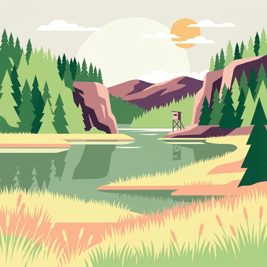
A stylized vector illustration of a wetland scene with a central body of water, grassy shores, pine forest, and a small elevated wooden observation platform against a sunset background.

Reichardtsluch

Protected area

Park overview

Structured park overview, official facts, and landscape profile for Reichardtsluch

Reichardtsluch park facts, protected area profile, and essential visitor context

Review the core facts for Reichardtsluch, including designation, size, terrain, visitor scale, habitats, and operating context in one park-focused overview.

About Reichardtsluch

Reichardtsluch is one of the smaller yet biologically most focused protected wetlands in eastern Brandenburg. Although it covers only about two hectares of open water, its ecological significance is amplified by the surrounding 29-hectare Special Area of Conservation extension, which connects the ponds to forested land habitats needed by amphibians for hibernation and dispersal. The site is located on the Beeskower Platte, a gently undulating glacial plateau whose sandy and loamy soils are typical of the Ostbrandenburgisches Heide- und Seengebiet.

The wetland is shaped by the postglacial channel of the Schwenowseegraben, a once-flowing stream course that now runs mostly dry. Two shallow, unnamed ponds sit within this channel: a larger northern basin roughly 300 metres long and up to 55 metres wide, and a smaller southeastern pool about 80 metres long and up to 25 metres wide. When water levels are high enough, the ponds merge into a single waterbody; during dry spells, the system can disappear almost completely. Maximum recorded depth in wet years approaches one metre. The site exhibits this dramatic hydrological rhythm by design: the alternating wet and dry phases help maintain habitat conditions suited to pioneering amphibians.

Ecologically, the Luch is best understood as the core of a wider landscape mosaic. The open water serves as the breeding habitat, while neighbouring pine-dominated mixed forests on the surrounding heights, especially north of the Landesstraße 42 that crosses the area, supply winter quarters and migration corridors. The site has been integrated into the Natura 2000 network as an extension to the main Schwenower Forst Site of Community Importance, recognizing both the amphibians and the land habitats necessary to sustain them. Conservation here is largely a story of connectivity; even small wetlands gain their full ecological value only when the surrounding land remains permeable to the species that depend on them.

Quick facts and research context for Reichardtsluch

Reichardtsluch is a roughly two-hectare Luch, or wetland depression, in the Naturpark Dahme-Heideseen within the Landkreis Oder-Spree of Brandenburg. It lies on the Beeskower Platte, a saale-glacial ground-moraine plateau reshaped during the last ice age. The wetland was listed as a protected area in 2003 and incorporated into the European Natura 2000 network as Schwenower Forst Ergänzung under site code DE-3850-303.

The site's defining feature is its exceptional amphibian fauna, particularly the great crested newt and European fire-bellied toad, both Annex II species that require strict protection. A permanent amphibian fence runs alongside the Landesstraße that crosses the migration route, and volunteers carry animals across the road each spring to support breeding continuity.

Protection and recognition

Examine the terrestrial conservation framework, management scope, and recognition data.

Reichardtsluch Protection Status and International Recognition Details

Reichardtsluch maintains a recorded terrestrial protection status within official conservation datasets. Structured records outline the governing designation scope and associated administrative metrics for the protected landscape.

Protection details

Protection scope
Terrestrial
Transboundary protection
No
WDPA ID
555519209
Core area
0.02 km²
Park context

Deeper park guide and search-rich context for Reichardtsluch

Reichardtsluch history, landscape, wildlife, and travel context

Explore Reichardtsluch through its history, landscape character, ecosystems, wildlife, conservation priorities, cultural context, and seasonal travel timing in a structured park guide built for atlas discovery and search intent.

Why Reichardtsluch stands out

Reichardtsluch is renowned above all for its extraordinarily dense populations of European fire-bellied toads and great crested newts, making it the single most important amphibian breeding complex within the Naturpark Dahme-Heideseen. The site's strong seasonal hydrology, alternating between full inundation and complete drying, creates ideal reproductive conditions for pioneer amphibian species that thrive in temporary waters.
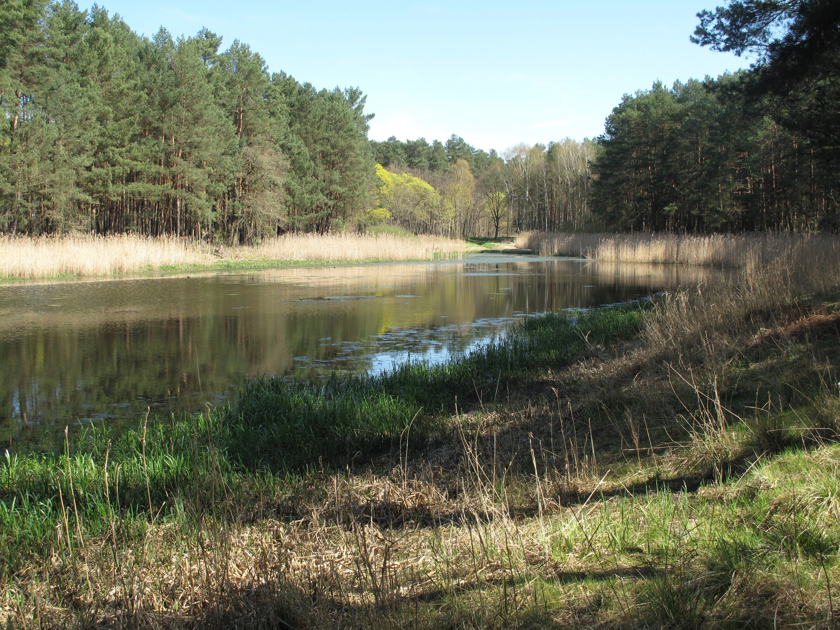
A peaceful, reflective lake nestled in a forest clearing with tall grasses and pine trees along the banks.
A view across the Reichardtsluch wetland area, showcasing its characteristic water bodies and surrounding forest.

Reichardtsluch history and protected-area timeline

Reichardtsluch entered the conservation record in the early 2000s after a small but telling natural history event. In March 2001, rangers discovered crushed great crested newts on the Landesstraße that bisects the migration route, drawing attention to the richness of the local amphibian fauna. Over subsequent years, the Naturwacht surveyed the populations of frogs, toads, newts, and reptiles across the area, gradually revealing that Reichardtsluch was by far the most important breeding ground for European fire-bellied toads and great crested newts in the entire Naturpark Dahme-Heideseen.

Because both species are listed under Annex II of the Habitats Directive as strictly protected taxa for which special areas must be designated, the site was proposed as a complementary area to the existing Schwenower Forst Special Area of Conservation. Following submission of standard Natura 2000 data forms, it was officially incorporated into the network under site code DE-3850-303 as Schwenower Forst Ergänzung. The protected area was formally established in 2003, with the broader 29-hectare extension including the wooded heights north of the road that amphibians use as winter habitat.

Around the same time, the Landesstraße that crosses the migration corridor was fitted with a roughly 110-metre amphibian protection fence, with buried collection buckets, to reduce road mortality. Each spring, volunteers retrieve the animals and carry them across the road by hand, a small but symbolically important tradition of place-based conservation in the Dahme-Heideseen region.

Reichardtsluch landscape and geographic character

The landscape around Reichardtsluch is shaped by the Beeskower Platte, a low-relief plateau formed as a ground moraine from the Saale glaciation and reworked during the subsequent Weichselian cold period. The plateau's sandy to loamy substrate supports mixed pine forest on the heights and gives way to wet depressions where groundwater emerges. Reichardtsluch itself occupies one such depression, sitting in a north-to-south aligned postglacial meltwater channel that is now largely dry.

The two ponds lie in this former stream course. The larger northern pond extends roughly 300 metres from north to southwest and reaches about 55 metres across; the smaller southeastern pond stretches about 80 metres long and 25 metres wide. In wet years, peak water depths approach one metre. The site is named for the regional term Luch, referring to a shallow, fluctuating wetland. Streamside vegetation includes white-flowered common water crowfoot, which blooms across the surface in spring, and tall reed beds, which rise from the margins by autumn.

Surrounding the open water, the Beeskower Platte is cloaked in mixed forest dominated by pine, with leafy trees in places. Forest stands serve not only as visual backdrop but as functional habitat, particularly as winter refuges for amphibians that spend the breeding season in the ponds and disperse into the woodlands for the colder months. The Landesstraße 42, which links Limsdorf with Ahrensdorf, is the most prominent human feature in the immediate landscape and has shaped both the practical and symbolic history of the site.

Reichardtsluch ecosystems, habitats, and plant life

Ecologically, Reichardtsluch is best characterized as a small, fluctuating lowland wetland embedded within a postglacial sand and till landscape. The two shallow ponds, sometimes merged, sometimes separated or dry, produce a habitat mosaic that shifts with each season. In spring, the open water surface is dotted with common water crowfoot; by late summer and autumn, reed stands rise around the margins, while central areas can become exposed mud or cracked sediment under drier conditions.

The site is too small and too variable to support stable fish populations, which is part of what makes it biologically valuable. Fish-free temporary waters are precisely the conditions required by pioneer amphibians that would otherwise be excluded from permanent lakes by predation. Beneath the open water, wet soils and shallow margins support robust populations of aquatic invertebrates, while the forested ridges above the Luch add a different structural habitat dominated by pines and broadleaf admixture.

At the broader landscape scale, Reichardtsluch belongs to the Ostbrandenburgisches Heide- und Seengebiet, a region of alternating heathland, forest, lowland moors, and lakes. The local hydrology is tied into the Krumme Spree watershed. The Schwenowseegraben, which threads through the Luch, is part of a Gewässerentwicklungskonzept aimed at restoring the natural flow and ecological continuity of streams in the catchment under the EU Water Framework Directive, although in this stretch the channel now runs mostly dry.

Reichardtsluch wildlife and species highlights

Reichardtsluch's wildlife significance is overwhelmingly focused on amphibians, the group that triggered the site's formal protection. The two flagship species are the great crested newt and the European fire-bellied toad. Both are Annex II species of the EU Habitats Directive, meaning they are considered of community interest and require designated protection areas.

Spring counts give a sense of the site's density. In 2009, volunteers recorded 1,010 fire-bellied toads and 247 great crested newts along the amphibian fence, numbers that reflect only a fraction of the actual populations, perhaps 10 to 20 percent, given a parallel sampling fence at the southeast shore. Substantial populations of common toad are also present, alongside smaller numbers of smooth newt, garlic toad, moor frog, common frog, and green frogs of indeterminate species. Reptile records include occasional viviparous lizards, sand lizards, and slow worms, with the latter two considered vulnerable in Brandenburg.

The role of the surrounding forest is central to the wildlife story. Amphibians in the region overwinter in the woodland soils and migrate back to the breeding ponds each spring, often crossing the Landesstraße in the process. This annual migration, and the volunteer effort to ferry the animals safely across the road, is the most visible expression of the site's ecological function and one of its defining cultural-natural rituals.

Reichardtsluch conservation status and protection priorities

Reichardtsluch is a paradigmatic small-scale Natura 2000 site: its formal protection exists primarily because two small animals, the great crested newt and the European fire-bellied toad, depend on its very particular combination of fluctuating shallow water and surrounding woodland. Designated in 2003, the Luch itself was incorporated into the European network as an extension, Schwenower Forst Ergänzung, rather than as a standalone site, recognising that its amphibians cannot persist without the adjacent forests.

Conservation management operates across two scales. At the pond scale, the hydrological regime is essentially self-sustaining, allowing the pools to fill and dry with the seasons, which is critical to the reproductive strategy of the species that breed here. At the landscape scale, the surrounding gehölzreiche Höhen are managed to retain forest cover and to allow amphibian movement between breeding and hibernation habitats.

A defining practical feature is the 110-metre amphibian protection fence along the Landesstraße and the daily volunteer effort each spring to carry toads and newts across the carriageway. The Schwenowseegraben, which runs through the Luch, is also part of a watercourse development plan under the EU Water Framework Directive, reflecting an attempt to integrate species protection, hydrological restoration, and watercourse connectivity across the wider Krumme Spree system.

Reichardtsluch cultural meaning and human context

There is little built cultural heritage associated with Reichardtsluch itself: the ponds remain unnamed on official Brandenburg mapping, and the name Reichardtsluch (with variants Reichardsluch and Reichards-Luch) is used primarily in publications by the NABU Regionalverband Dahmeland and by the administration of the Naturpark Dahme-Heideseen. The site lies in the Limsdorf district of Storkow, within the broader cultural region of the Dahme-Heideseen, a landscape of villages, forests, and lakes that has historically been shaped by ice-age geography and small-scale rural settlement.

The most meaningful cultural element is informal rather than architectural: the yearly amphibian rescue. Each spring, volunteers gather at the Landesstraße to collect toads and newts from buckets along the fence line and to ferry them across the road, a small but enduring local tradition that connects human communities to a specific place and species. This volunteer practice has become part of how the site is understood and valued within the region, well beyond its formal ecological status.

Top sights and standout views in Reichardtsluch

The standout qualities of Reichardtsluch are its small size and its disproportionately large ecological weight. Two hectares of fluctuating shallow water, surrounded by pine-dominated mixed forest, support some of the most important fire-bellied toad and great crested newt populations in the Naturpark Dahme-Heideseen. The site's formal protection hinges on the recognition that even very small wetlands can carry regional conservation significance if they host Annex II species.

Equally distinctive is the combination of hydrology, landscape, and hands-on stewardship. The ponds fill and dry with the seasons, the Schwenowseegraben continues to shape their setting, and the Landesstraße 42 crossing makes the site a working example of how small infrastructure decisions intersect with wildlife migration. The annual amphibian rescue by volunteers is a small but vivid expression of how protection is enacted in practice at this scale.

Best time to visit Reichardtsluch

From an ecological perspective, spring is the defining season at Reichardtsluch. The ponds usually hold water through this period, the white flowers of common water crowfoot may be visible across the surface, and amphibians migrate from the surrounding forest to the breeding waters, which is when the protection fence and the volunteer activity at the Landesstraße become visible. Late spring is also when waterbirds and amphibian larvae are most reliably present.

In summer and autumn, the character shifts. Reed stands rise from the margins and the ponds can show their full dimensions. In dry years, by late summer the system may partially dry, exposing mudflats and reducing open water. Winter conditions tend to silence the site for most casual visitors, although the surrounding forest retains some shelter for amphibians beneath the surface. Overall, late April through early June offers the richest combination of biological activity and visible habitat, with summer offering a quieter but still rewarding visit focused on the landscape and the Luch itself.

Monthly climate preview

Track monthly average temperatures and precipitation cycles across representative coordinates in Brandenburg

Reichardtsluch Climate Normals, Long-Term Temperature and Precipitation Patterns

Long-term data records trace the measured annual temperature rhythm and monthly precipitation patterns across representative coordinates in Brandenburg. Exploring the complete twelve-month profile reveals detailed baseline figures for long-term planning without relying on current forecasts.
Annual mean10 °C
-1 °C21 °C
Jan-1°
Feb
Mar
Apr
May14°
Jun18°
Jul21°
Aug20°
Sep15°
Oct
Nov
Dec
Warmest month
July

20.6 °C

Coolest month
January

-0.8 °C

Wettest month
July

2.5 mm/day

Driest month
April

1.1 mm/day

Park location guide

Geography guide, regional context, and park location map for Reichardtsluch

Reichardtsluch park geography, regions, and map view in Germany

Understand where Reichardtsluch sits in Germany through a broader geographic reading of the surrounding landscape, nearby location context, and its mapped position within the national park landscape.

How Reichardtsluch fits into Germany

Germany is a federal republic in Western and Central Europe with a population of over 83 million across sixteen constituent states. It is Europe's largest economy by nominal GDP and a major global exporter and importer. The capital is Berlin, and the country borders Denmark, Poland, Czech Republic, Austria, Switzerland, France, Luxembourg, Belgium, and the Netherlands.

Wider geography shaping Reichardtsluch in Germany

Germany is located in Western and Central Europe, spanning 357,022 km². It borders Denmark to the north, Poland and the Czech Republic to the east, Austria and Switzerland to the south, and France, Luxembourg, Belgium, and the Netherlands to the west. The country has coastlines on the Baltic Sea and North Sea to the north, with the Alps located in the southern region.

Map view of Reichardtsluch

Use this park location map to pinpoint Reichardtsluch in Germany, understand its exact geographic position, and read its mapped placement within the surrounding landscape more clearly.

Pigeon | © OpenStreetMap contributors

Location context for Reichardtsluch

Brandenburg

Explore detailed imagery of shallow fluctuating ponds, glacial terrain, and surrounding pine ecosystems.

Reichardtsluch Photos and Landscape Scenery: Visualizing the Protected Wetland and Forest Habitat in Brandenburg

Visual documentation captures the seasonal hydrology and mixed pine forest habitats defining the protected wetland environment of Reichardtsluch. Examining field photography reveals the distinct terrain features and ecological character supporting regional amphibian populations across the Brandenburg plateau.

A peaceful, reflective lake nestled in a forest clearing with tall grasses and pine trees along the banks.

A small, shallow wetland lake surrounded by tall pine trees and grassy banks, with a wooden hunting platform visible in the background.

Park atlas

Compare regional wetland habitats and connected conservation areas across Brandenburg

Exploring Parks Near Reichardtsluch and Surrounding Protected Landscapes

Visitors exploring Reichardtsluch can continue browsing adjacent protected areas and regional wetland reserves across the Beeskower Platte. Comparing nearby nature reserves helps reveal broader patterns of amphibian habitats and glacial landforms throughout eastern Germany.
Nature reserveBrandenburg
About 8.7 km away#1 closest

Northwest

Groß Schauener Seenkette Nature Reserve: Mapped Wetlands and Brandenburg Lake Geography

An undisturbed chain of shallow lakes and protected fen landscapes

This protected nature reserve in Brandenburg preserves a vital chain of six interconnected lakes. The geography is defined by extensive reedbeds, sedge stands, and rare inland saline meadows, providing a crucial habitat mosaic. Learn how these wetlands connect to the surrounding Dahme-Heideseen region through a network of terrain-focused conservation areas and historic trails.

Area
21.249 km²
Established
2000
Relief
Lowland
Climate
Temperate
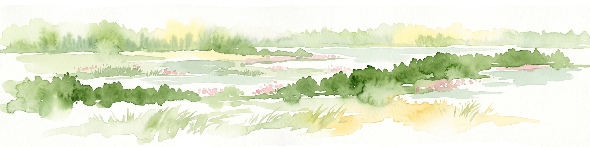
A watercolor illustration of an open dune landscape with soft yellow sand, green grass, and scattered trees under a light sky.
Nature reserveBrandenburg
About 13 km away#2 closest

Northwest

Binnendüne Waltersberge: Nature Reserve and Glacial Landscape in Brandenburg

Exploring inland sand dune geography and protected habitat boundaries.

Binnendüne Waltersberge is a significant nature reserve representing the glacial history of Brandenburg. Its terrain features a wave-like sand ridge that contrasts bare, sun-exposed surfaces with lichen-rich pine forests. This site serves as an essential example of psammophilic ecosystem restoration and regional geomorphology within the Oder-Spree landscape.

Area
0.14 km²
Established
1990
Relief
Upland
Climate
Temperate
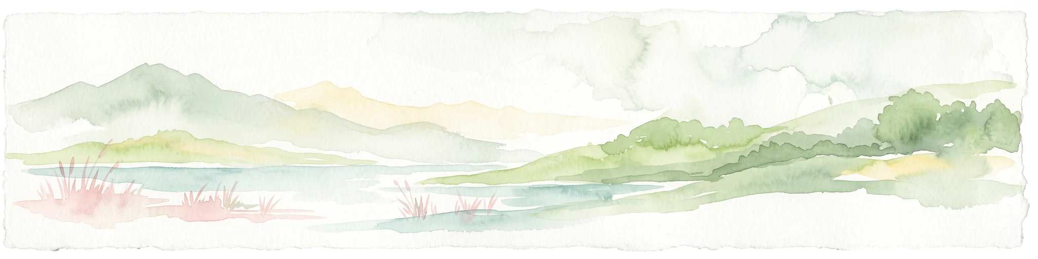
A watercolor painting showing a panoramic view of the Spree River mouth with green trees, reeds, and marshy water areas.
Nature reserveBrandenburg
About 14 km away#3 closest

Southeast

Alte Spreemündung Nature Reserve: Protected Wetland and River Geography in Brandenburg

A preserved mosaic of river mouths and lake shorelines

Alte Spreemündung serves as a focal point for understanding the transition between the River Spree and the Schwielochsee in Brandenburg. This protected area covers a compact, water-shaped terrain characterized by riparian habitats and ancient river arms. It remains a key site for examining the glacial geomorphology and lowland water dynamics prevalent across northeastern Germany.

Area
1.08 km²
Established
1990
IUCN
IV
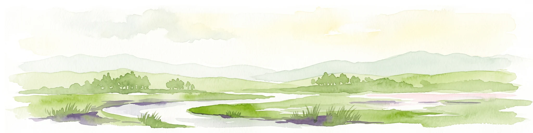
A pale, soft-toned watercolor painting showing a wetlands landscape with rolling green hills, a calm river or stream, and sparse red vegetation in the foreground.
Nature reserveBrandenburg
About 15 km away#4 closest

Southwest

Kockot Nature Reserve: Protected Hardwood Forest and Brandenburg Hydrology

A core zone of the Spreewald Biosphere Reserve

Kockot represents an essential piece of Brandenburg lowland geography. This nature reserve protects a water-influenced hardwood forest mosaic on peat and gley soils, offering a focused look at non-intervention forest dynamics within the Spree river floodplain system.

Area
2.868 km²
Established
1990
IUCN
IV
Nature reserveBrandenburg
About 17 km away#5 closest

Southeast

Dammühlenfließniederung Nature Reserve: Brandenburg Protected Land and Geography Atlas

Floodplain and riparian habitats in the Niederlausitz region

Explore the geographic framework of Dammühlenfließniederung, an essential nature reserve in eastern Brandenburg. This area safeguards the Dammühlenfließ stream valley and a segment of the Schwielochsee lakeshore, representing the unique glacial lowlands of the region through a focused wetland and floodplain corridor.

Area
0.79 km²
Established
1998
IUCN
IV
Nature reserveBrandenburg
About 18 km away#6 closest

West

Streganzsee-Dahme Nature Reserve: Mapping Brandenburg Protected River Landscapes and Dunes

An ecological mosaic in the Dahme-Spreewald river corridor

Streganzsee-Dahme represents an intact Brandenburg riverine corridor characterized by sharply varied topography. The reserve encompasses water bodies, floodplain forests, fens, and dry sandland heaths. Its protected boundaries connect various biotopes, offering an essential look at the region's diverse lowland ecology and the structured geography of the local conservation network.

Area
4.36 km²
Established
1999
IUCN
IV
Relief
Lowland
Nature reserveBrandenburg
About 20 km away#7 closest

West

Katzenberge Nature Reserve: An Atlas of Glacial Moraine Woodlands in Brandenburg Germany

Protected oak forest habitats within the Dahme-Spreewald landscape

Katzenberge offers a focused look at the conservation of mature deciduous forest environments on sandy moraine soils. As a designated nature reserve within the Brandenburg region, the area serves as a primary reference point for studying habitat continuity and the unique glacial terrain that defines the south-eastern lowlands near the Dahme river.

Area
1.44 km²
Established
2004
IUCN
IV
Relief
Upland
Nature reserveBrandenburg
About 20 km away#8 closest

West

Stintgraben Nature Reserve: Protected Stream Landscapes in Southern Brandenburg

Ecological connectivity between glacial lakes and river corridors.

Located in the Dahme-Spreewald district, Stintgraben is a protected stream corridor defined by its lowland riparian habitats and position between the Klein Köriser See and the Dahme river. This nature reserve provides essential ecological continuity within the broader Dahme-Heideseen region, offering a clear example of how small-scale protected areas maintain the natural integrity of Germany's glacial lake districts.

Area
1.09 km²
Established
1995
IUCN
IV

Common questions about visiting, size, designation, and location context for Reichardtsluch

Reichardtsluch FAQs for park facts, access, geography, and protected area context

Find quick answers about Reichardtsluch, including protected-area facts, park geography, trail and visitor context, and how the park fits into its surrounding country and regional landscape.
MoriAtlas Explorer

Continue Your Protected Areas Search Across the Global Atlas

Deepen your exploration by continuing the structured search for national parks and protected areas worldwide. Utilize the comprehensive filtering capabilities to compare different conservation landscapes and refine your understanding of global park geography. Discover more about the distribution and characteristics of protected natural areas.

Global natural geography