
Mori Atlas logo
Nature reserveRéserve naturelle nationale de la haute vallée du Béranger

A critical mountain buffer zone anchoring the threshold of the wider Écrins massif.

Réserve naturelle nationale de la haute vallée du Béranger, France: Protected Alpine Map

The Réserve naturelle nationale de la haute vallée du Béranger protects a compact yet diverse cross-section of the southern French Alps. Located in the Isère department, this nature reserve encircles the historic hamlet of Valsenestre and traces the Béranger torrent corridor. It serves as a vital ecological transition zone between inhabited Alpine valleys and the protected wilderness of the adjacent Écrins National Park.

Alpine reservebuffer zonemountain torrentmixed forestalpine pastureprotected valley
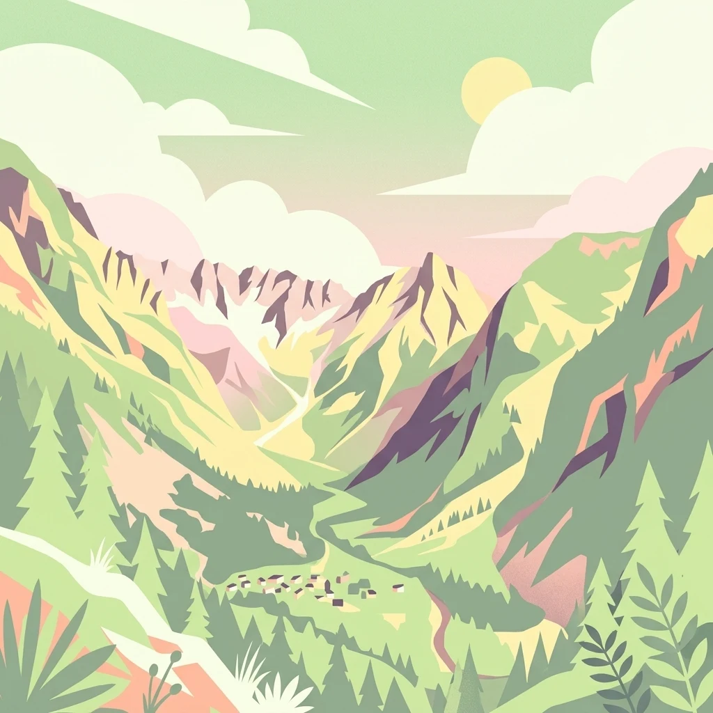
A flat, stylized digital illustration of a green mountain valley with a small cluster of houses in the foreground, pine trees, and a sunlit sky with clouds.

Réserve naturelle nationale de la haute vallée du Béranger

Nature reserve

Park overview

Structured park overview, official facts, and landscape profile for Réserve naturelle nationale de la haute vallée du Béranger

Réserve naturelle nationale de la haute vallée du Béranger park facts, protected area profile, and essential visitor context

Review the core facts for Réserve naturelle nationale de la haute vallée du Béranger, including designation, size, terrain, visitor scale, habitats, and operating context in one park-focused overview.

About Réserve naturelle nationale de la haute vallée du Béranger

The Réserve naturelle nationale de la haute vallée du Béranger is one of a group of French national nature reserves created in the 1970s to act as transitional, protective belts around the Écrins National Park. Although only about 84 hectares in extent, the reserve plays an important ecological part in the southern Alps by safeguarding habitat between the settled valleys of the Isère department and the deeper wilderness of the Écrins.

The reserve occupies the upper part of the Béranger valley, the namesake watercourse being a tributary of the Bonne river. Its territory lies entirely within the commune of Valjouffrey and surrounds the small hamlet of Valsenestre, a place that remains inhabited and forms part of the human context of the protected area. The terrain climbs from roughly 1,070 metres at the valley bottom up to about 1,400 metres on the surrounding slopes, giving the site a clear subalpine to lower alpine character.

Ecologically, the reserve stands out for the breadth of environments it shelters within its small footprint. The Béranger torrent corridor, with its associated riparian woodland, gives way to mixed forests where beech and conifers mingle, then to open pastures, rocky outcrops, and higher scrubland. This mosaic supports roughly 136 plant species and a similarly diverse fauna. The site's proximity to the Écrins ensures that species typical of the larger massif, including chamois and Alpine ibex, are also present here.

Today the reserve continues to be managed by the Écrins National Park, which oversees its conservation, monitoring, and visitor use. Hiking trails cross the protected area, allowing visitors to experience the Béranger valley and Valsenestre hamlet from within the reserve, while the rules of a national nature reserve govern activities. The site is therefore both a working Alpine landscape with pastoral heritage and a formally protected natural area with national-level conservation status.

Quick facts and research context for Réserve naturelle nationale de la haute vallée du Béranger

The Réserve naturelle nationale de la haute vallée du Béranger is a national nature reserve covering roughly 84 hectares in the commune of Valjouffrey, Isère, within the Auvergne-Rhône-Alpes region. It lies at the northwestern fringe of the Écrins National Park, where it serves as a buffer zone protecting the approach to one of France's largest mountain parks.

Its elevation spans roughly 1,070 to 1,400 metres. The reserve encircles the small hamlet of Valsenestre and much of the Béranger torrent, which flows into the Bonne river. Administered by the Écrins National Park, it was originally created by decree on 15 May 1974 and later reclassified by decree on 21 June 2011. Its IUCN management category is IV.

Protection and recognition

Documented terrestrial designation history, management scope, and protected area records

Réserve naturelle nationale de la haute vallée du Béranger Protection Status

Réserve naturelle nationale de la haute vallée du Béranger maintains a documented terrestrial protection status established in 2011 with verified database identifiers. Official records compile designated protection history and international recognition data for comprehensive geographic analysis.

Protection details

Protection scope
Terrestrial
Designated year
2011
Transboundary protection
No
WDPA ID
106701
Park context

Deeper park guide and search-rich context for Réserve naturelle nationale de la haute vallée du Béranger

Réserve naturelle nationale de la haute vallée du Béranger history, landscape, wildlife, and travel context

Explore Réserve naturelle nationale de la haute vallée du Béranger through its history, landscape character, ecosystems, wildlife, conservation priorities, cultural context, and seasonal travel timing in a structured park guide built for atlas discovery and search intent.

Why Réserve naturelle nationale de la haute vallée du Béranger stands out

The reserve is best known for its role as a buffer zone protecting the northwestern approach to the Écrins National Park, and for the surprisingly rich concentration of habitats packed into its small territory: a mountain torrent with its riparian woodland, mixed beech, fir and pine forest, alpine pasture, rocky crests, and fallow land all within a few dozen hectares. It is also recognised for hosting a representative cross-section of southern French Alpine wildlife in a compact setting. Chamois, Alpine ibex, marmot, and mountain hare share the slopes with rock partridge, Tengmalm's owl, hazel grouse, black woodpecker, and Eurasian eagle-owl, making the reserve a useful reference site for the transitional zone between inhabited Alpine valleys and the wilder interior of the Écrins massif.
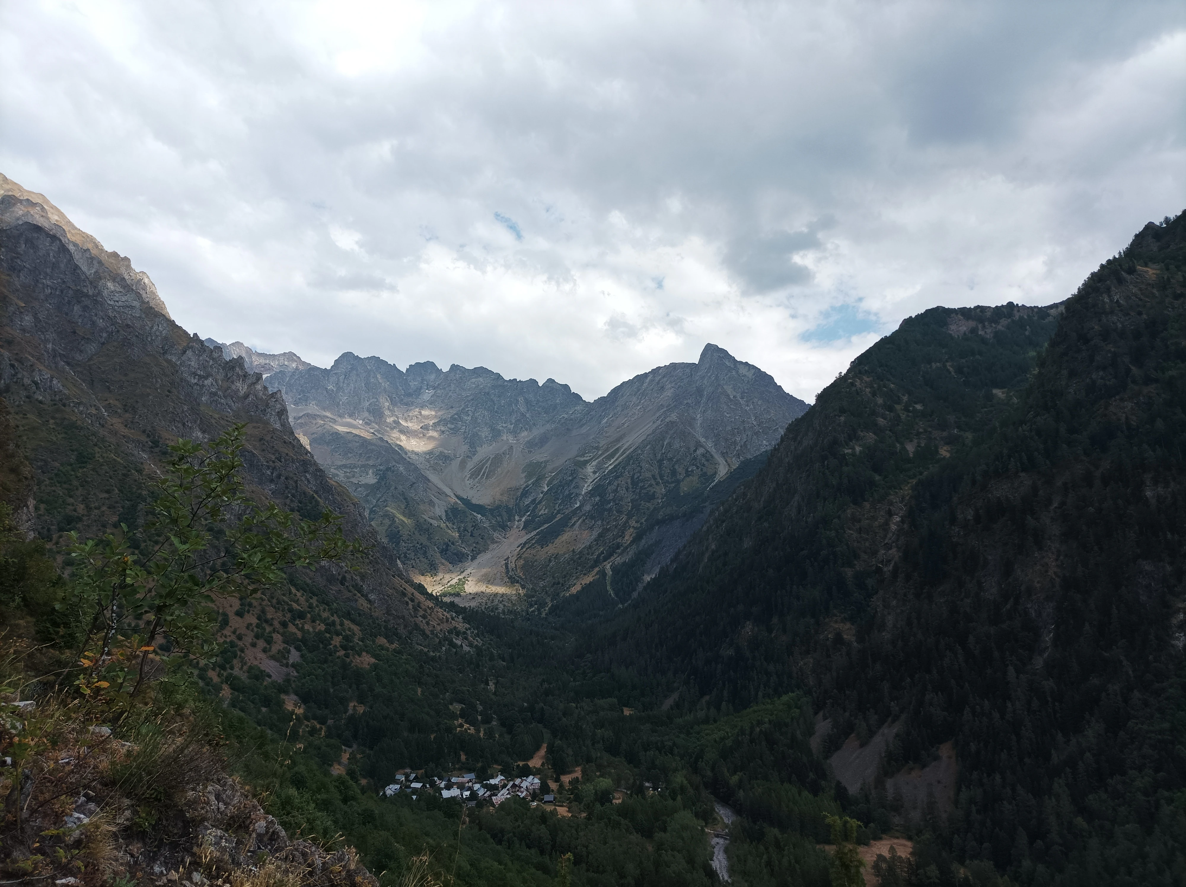
A wide, eye-level mountain landscape showing a steep, forested valley framed by high rocky peaks under a cloudy sky.
A wide view of the Béranger Valley, highlighting the dramatic mountain landscape of the nature reserve.

Réserve naturelle nationale de la haute vallée du Béranger history and protected-area timeline

The Réserve naturelle nationale de la haute vallée du Béranger was created on 15 May 1974 by decree as part of an early strategy to strengthen protection around the newly established Écrins National Park. Along with three companion reserves in the upper Vénéon, Séveraisse, and Saint-Pierre valleys, it was designated specifically as a buffer zone, intended to extend the effective reach of the national park into the inhabited valleys just beyond its boundary.

The reserve was reclassified by a further decree on 21 June 2011, updating its legal framework in line with later French national nature reserve practice. Throughout its history, responsibility for its administration has rested with the Écrins National Park, which continues to manage habitat conservation, ecological monitoring, and visitor infrastructure in coordination with the local commune of Valjouffrey and the Valsenestre hamlet contained within its perimeter.

Réserve naturelle nationale de la haute vallée du Béranger landscape and geographic character

The landscape of the reserve is shaped by the steep-sided upper valley of the Béranger torrent as it flows toward the Bonne river. Within a compact area the terrain steps from the rocky torrent floor through a riparian fringe of moisture-loving trees, into mixed forest on the lower slopes, then up toward open pasture, scree, and rocky shoulders on the flanks of the surrounding mountains just below 1,400 metres.

The human element is preserved in the form of the hamlet of Valsenestre, which sits inside the reserve's perimeter and gives the valley a longstanding settled character. Long-established pastoral use has shaped the open meadows and grazed slopes that remain part of the landscape today, alongside the wooded and rocky zones where natural vegetation dominates. Because much of the Écrins massif rises behind the reserve, the views from within it open toward sharper and higher Alpine terrain, while the valley itself retains a softer, partly inhabited feel.

Réserve naturelle nationale de la haute vallée du Béranger ecosystems, habitats, and plant life

The reserve combines an unusually broad range of habitats for its size. The Béranger torrent and its associated ripisylve, or riverside woodland, form the central ecological axis, bordered by mixed woods of broadleaf and coniferous trees, openings of alpine pasture and grazing land, abandoned rough ground, and rocky outcrops that rise toward the upper edge of the protected area.

This habitat mosaic has produced a rich floral inventory of roughly 136 recorded species, including notable alpine and subalpine plants such as Rhaponticum heleniifolium, Alpine clematis, the hairy primrose, Montpellier milkvetch, and the Austrian dragonhead, the latter being an emblematic species of the reserve. The combination of forest, pasture, and rock also supports a varied fauna, with five species of reptiles recorded and a particularly diverse bird list that includes montane specialists alongside more widespread Alpine breeders.

Réserve naturelle nationale de la haute vallée du Béranger wildlife and species highlights

The wildlife of the Béranger reserve reflects its position between inhabited valley and high mountain. Mammals number around 16 species, among them chamois and Alpine ibex coming down from the Écrins above, as well as marmot and mountain hare, which use the open slopes and rocky ground. The reserve is also a stronghold of birdlife, with 72 recorded species of which 35 are breeding birds. Notable breeding and visiting species include rock partridge on the rocky slopes, Tengmalm's owl in the older forest, hazel grouse in the denser woodland, and black woodpecker, while the cliffs and crests provide habitat for Eurasian eagle-owl. Reptiles include species such as the western green lizard and the smooth snake, and the site also supports amphibians in the wetter habitats along the torrent.

Réserve naturelle nationale de la haute vallée du Béranger conservation status and protection priorities

The reserve's conservation value lies primarily in its function as a buffer zone protecting the northwestern gateway to the Écrins National Park, one of the largest and most ecologically important protected mountain areas in France. By extending protection into a valley that is partly inhabited and traditionally grazed, it preserves ecological continuity between the core of the Écrins massif and the surrounding Alpine landscapes of the Isère department.

The mosaic of torrent, riparian woodland, mixed forest, pasture, and rock gives the reserve a high ecological density in a small area, supporting rare alpine plants such as Austrian dragonhead and a wide range of nesting bird species. National nature reserve status under French law and IUCN Category IV recognition give the site formal protection, while management by the Écrins National Park ensures that monitoring, habitat conservation, and visitor rules are coordinated with the wider strategy of the National Park.

Réserve naturelle nationale de la haute vallée du Béranger cultural meaning and human context

The reserve's cultural dimension is anchored in the presence of the hamlet of Valsenestre, which lies within its perimeter and remains a living Alpine community. Long-established pastoral use has shaped the open meadows and grazed slopes and continues to influence both the appearance of the landscape and the kinds of habitats the reserve protects. Its creation as one of the early Écrins buffer reserves also reflects an Alpine regional tradition of linking high-mountain wilderness protection with the maintenance of the inhabited valleys below.

Top sights and standout views in Réserve naturelle nationale de la haute vallée du Béranger

The reserve's defining feature is the way a tiny area concentrates a representative slice of the southern French Alps: a torrent corridor, riparian woodland, mixed forest, alpine pasture, and rocky ridges all within about 84 hectares.

It is equally notable for combining national nature reserve protection with an authentic inhabited setting around the Valsenestre hamlet, and for its role as one of the original Écrins buffer reserves, linking the human-scale valley to one of France's great mountain national parks.

Best time to visit Réserve naturelle nationale de la haute vallée du Béranger

The reserve's mid-elevation position between roughly 1,070 and 1,400 metres gives it a clear seasonal rhythm. Summer, when the alpine pastures are green and the high trails are clear of snow, is the most accessible period for walking the marked footpaths that cross the reserve, with flowering plants at their peak.

Late spring and early autumn offer quieter conditions with active wildlife, including easier sightings of marmots and chamois in the open meadows, and good chances to hear and observe breeding birds through the warmer months. Winter brings substantial snow cover at this altitude, restricting access and giving the reserve a much more restricted, low-traffic character.

Monthly climate preview

Long-term representative monthly temperature and precipitation rhythm at high altitude elevations

Climate Normals and Annual Weather Patterns for Réserve naturelle nationale de la haute vallée du Béranger

Representative coordinates record sustained sub-zero winter minimums alongside warm summer peaks, accompanied by year-round precipitation averages spanning the recorded baseline period. Analyzing the full twelve-month profile reveals complete seasonal temperature distributions and precise monthly precipitation data for the protected terrain.
Annual mean2 °C
-7 °C12 °C
Jan-7°
Feb-7°
Mar-3°
Apr
May
Jun10°
Jul12°
Aug12°
Sep
Oct
Nov-2°
Dec-6°
Warmest month
August

12.4 °C

Coolest month
January

-7.1 °C

Wettest month
November

3 mm/day

Driest month
March

1.9 mm/day

Park location guide

Geography guide, regional context, and park location map for Réserve naturelle nationale de la haute vallée du Béranger

Réserve naturelle nationale de la haute vallée du Béranger park geography, regions, and map view in France

Understand where Réserve naturelle nationale de la haute vallée du Béranger sits in France through a broader geographic reading of the surrounding landscape, nearby location context, and its mapped position within the national park landscape.

How Réserve naturelle nationale de la haute vallée du Béranger fits into France

France is a unitary semi-presidential republic and one of the world's largest economies. It borders Belgium, Luxembourg, Germany, Switzerland, Italy, Monaco, Andorra, and Spain, with a maritime border to the United Kingdom. The country is known for its cultural influence, art, cuisine, and political history spanning centuries.

Wider geography shaping Réserve naturelle nationale de la haute vallée du Béranger in France

France is located in Western Europe. Metropolitan France extends from the Rhine to the Atlantic Ocean and from the Mediterranean Sea to the English Channel and North Sea. The country borders Belgium, Luxembourg, Germany, Switzerland, Italy, Monaco, Andorra, Spain, and has a maritime border with the United Kingdom.

Map view of Réserve naturelle nationale de la haute vallée du Béranger

Use this park location map to pinpoint Réserve naturelle nationale de la haute vallée du Béranger in France, understand its exact geographic position, and read its mapped placement within the surrounding landscape more clearly.

Pigeon | © OpenStreetMap contributors
Recorded earthquake history

View Recorded Seismic History for Réserve naturelle nationale de la haute vallée du Béranger

Examine the recorded seismic history associated with the Réserve naturelle nationale de la haute vallée du Béranger. Explore the data collection for insights into regional earthquake activity and proximity analysis, powered by historical geological archives.

Réserve naturelle nationale de la haute vallée du Béranger Earthquake Records

Catalogued events

36 events

Strongest magnitude

Magnitude 5

Most recent event

Jan 7, 2013

This history includes earthquakes recorded inside the park or within 50 km of its borders

Visual exploration of alpine landscapes, torrent corridors, and mountain habitats

Réserve naturelle nationale de la haute vallée du Béranger Photos and Scenery

Visual records capture the steep-sided valley, rushing torrent corridors, and mixed forest zones that define the terrain of Réserve naturelle nationale de la haute vallée du Béranger. Examining these protected landscapes reveals the transitional mountain habitats and pastoral features situated along the approach to the Écrins massif.

A wide, eye-level mountain landscape showing a steep, forested valley framed by high rocky peaks under a cloudy sky.

Park atlas

Explore nearby protected areas and connected alpine landscapes

Parks Near Réserve naturelle nationale de la haute vallée du Béranger

Compare Réserve naturelle nationale de la haute vallée du Béranger with adjacent mountain reserves and neighboring protected valleys. Examining surrounding alpine terrain provides broader regional context for southern French conservation landscapes.
Watercolor illustration showing mountains, a winding river, and pine trees in a landscape
National parkFrance
Park boundaries overlap#1 closest

East

Écrins National Park: Alpine Glaciated Terrain and Protected Landscape Details

Mapped boundaries and regional geography of a major French National Park.

Delve into Écrins National Park, a defining national park within the French Alps. This page provides a comprehensive overview of its protected landscape, focusing on its dramatic glaciated terrain, significant peaks such as the Barre des Écrins, and its position within the regional geographic context. Explore the mapped extent and understand the unique alpine environment of this protected area.

Area
925 km²
Established
1973
IUCN
II
Visitors
800K annual
A watercolor illustration of a landscape with purple and pink layered mountain peaks in the background and soft green trees in the foreground, set against a plain white background.
Nature reserveAuvergne-Rhône-Alpes
17 km away#2 closest

East

Réserve naturelle nationale de la haute vallée du Vénéon: Alpine Geography and Protected Boundaries

High-altitude mountain terrain in the French Alps

The Réserve naturelle nationale de la haute vallée du Vénéon occupies 61 hectares of striking alpine terrain near the hamlet of La Bérarde. Its landscape of steep slopes and glacial deposits functions as a key protected buffer zone, supporting diverse flora and fauna within the broader mountainous geography of the Auvergne-Rhône-Alpes region.

Area
0.61 km²
Established
1974
IUCN
IV
A watercolor painting of a river valley with soft green trees, rolling hills, and distant mountains under a light sky.
Nature reserveProvence-Alpes-Côte d'Azur
About 17 km away#3 closest

Southeast

Réserve naturelle nationale de la haute vallée de la Séveraisse: Protected Alpine Corridor

High-mountain riverine landscape and buffer zone in Hautes-Alpes

This nature reserve encompasses a 4-kilometer stretch of the upper Séveraisse valley, focusing on alluvial riverbed habitat and peripheral mountain terrain. Located in the French Alps, the reserve provides a protected transition zone characterized by its narrow, U-shaped valley floor and steep rocky inclines, offering a key geographic link to the wider Écrins ecosystem.

Area
1.55 km²
Established
1974
IUCN
IV
A pale, soft watercolor illustration showing a horizontal landscape of a pond and wetlands bordered by trees, with faint mountain silhouettes in the distance.
Nature reserveIsère
33 km away#4 closest

Northwest

Réserve naturelle régionale de l'étang de Haute-Jarrie, Isère Protected Wetland Landscape

Regional nature reserve and migratory bird sanctuary

Situated on the Plateau de Champagnier in Isère, this regional nature reserve offers a concentrated example of glacial pond ecology and wetland biodiversity. Covering 11 hectares, it acts as a critical stopover within the Grésivaudan valley migratory corridor. This protected site features diverse habitats, including reedbeds and wet meadows, that support hundreds of recorded bird species and a variety of dragonflies and amphibians, making it a significant area for ecological study.

Area
0.11 km²
Established
2008
IUCN
IV
Relief
Upland
A soft watercolor painting depicting a winding river through a lush green valley with distant hills in the background.
Nature reserveAuvergne-Rhône-Alpes
About 33 km away#5 closest

Northwest

Réserve naturelle régionale des Isles du Drac: Braided River Landscape and Regional Map Context

A vital riverine conservation corridor in the Auvergne-Rhône-Alpes region of France

The Réserve naturelle régionale des Isles du Drac occupies an expansive alluvial floodplain where the river transitions into a braided system. This reserve preserves dynamic gravel bars and woodland habitats that support exceptional biodiversity within the northern Alpine landscape. It offers a detailed look at how riverine corridors persist alongside significant hydroelectric and industrial infrastructure in the Grenoble area.

Area
8.048 km²
Established
2009
IUCN
IV
Relief
Lowland
A watercolor painting on a white background showing a landscape with rolling green hills, a small lake, and distant mountain ridges in shades of pink, purple, and green.
Nature reserveProvence-Alpes-Côte d'Azur
About 38 km away#6 closest

East

Réserve naturelle régionale des Partias: Alpine Geography and Protected Nature Reserve Data

High-altitude mountain terrain in the southern French Alps

Covering slopes west of Briançon, Réserve naturelle régionale des Partias protects a layered alpine environment ranging from forested basins to rocky crests. This atlas entry provides a detailed geographic overview of the protected area, focusing on its distinctive mountain lakes, diverse soil substrates, and essential role in conserving alpine ecosystems.

Area
8.018 km²
Established
2009
IUCN
IV
Relief
Mountain
Watercolor painting depicting mountains, a river, and trees under a light sky
National parkSavoie
56 km away#7 closest

Northeast

Vanoise National Park: Explore France's Original National Park in the Savoie Alps

Mapped Alpine geography, glacial terrain, and protected landscape.

Vanoise National Park is France's pioneering national park, a protected landscape of immense alpine beauty situated in the Savoie department. Renowned for its dramatic glacial terrain, over 100 peaks above 3,000 meters, and the iconic Alpine ibex, this park offers a profound geographic context. Explore its mapped boundaries and discover the unique atlas-level insights into France's mountainous protected areas and their ecological significance.

Area
534 km²
Established
1963
IUCN
II
Relief
Mountain
A watercolor painting of a soft, rolling landscape with green hills, light forest cover, and wild grasses in the foreground, rendered in a light, atmospheric style.
Nature reserveAuvergne-Rhône-Alpes
About 67 km away#8 closest

Southwest

Réserve naturelle régionale de la grotte des Sadoux: Protected Cave and Forested Hills

Regional Nature Reserve in the Drôme department of France

The Réserve naturelle régionale de la grotte des Sadoux encompasses a 30-hectare forested coteau above the Courance valley. This site is defined by its subterranean karstic gallery and surrounding woodland edge, creating a focused conservation landscape for threatened bat species within the Auvergne-Rhône-Alpes region.

Area
0.3 km²
Established
2010
IUCN
IV
Relief
Upland

Common questions about visiting, size, designation, and location context for Réserve naturelle nationale de la haute vallée du Béranger

Réserve naturelle nationale de la haute vallée du Béranger FAQs for park facts, access, geography, and protected area context

Find quick answers about Réserve naturelle nationale de la haute vallée du Béranger, including protected-area facts, park geography, trail and visitor context, and how the park fits into its surrounding country and regional landscape.
MoriAtlas Explorer

Continue Your Protected Areas Search Across the Global Atlas

Deepen your exploration by continuing the structured search for national parks and protected areas worldwide. Utilize the comprehensive filtering capabilities to compare different conservation landscapes and refine your understanding of global park geography. Discover more about the distribution and characteristics of protected natural areas.

Global natural geography