
Mori Atlas logo
Nature reserveRéserve naturelle nationale de la plaine des Maures

Tracing the boundaries and ecological terrain of this vital Var department nature reserve.

Réserve naturelle nationale de la plaine des Maures: Mediterranean Protected Landscapes and Geography

(Réserve naturelle nationale de la plaine des Maures (RNN171))

Réserve naturelle nationale de la plaine des Maures serves as a critical refuge within the Provence-Alpes-Côte d'Azur region, safeguarding a complex mosaic of Mediterranean habitats. This protected territory features an intricate network of temporary ponds, cork oak woodlands, and stone pine stands shaped by impermeable siliceous soils. By analyzing the park boundaries and regional topography, researchers and visitors alike can understand its role as the primary mainland stronghold for the Hermann's tortoise and an essential corridor for Mediterranean biodiversity.

Mediterranean ecosystemsmaquiscork oak woodlandstone pine foresttemporary poolsorchids
A flat vector illustration depicting a stream flowing over pink and yellow rocks, surrounded by green trees and bushes, with a purple mountain and a sun in the sky.

Réserve naturelle nationale de la plaine des Maures

Nature reserve

Park overview

Structured park overview, official facts, and landscape profile for Plaine des Maures National Nature Reserve

Plaine des Maures National Nature Reserve park facts, protected area profile, and essential visitor context

Review the core facts for Plaine des Maures National Nature Reserve, including designation, size, terrain, visitor scale, habitats, and operating context in one park-focused overview.

About Plaine des Maures National Nature Reserve

The Plaine des Maures National Nature Reserve is a relatively young but ecologically critical protected area in the heart of Provence. Established on 23 June 2009 and managed since August 2022 by the Société nationale de protection de la nature, it preserves one of the last extensive mosaics of lowland Mediterranean habitats on the French mainland. The reserve is part of a wider natural region, the Plaine des Maures, which extends over more than 13,000 hectares, but the protected perimeter is tightly defined at around 5,276 hectares in order to concentrate protection on the most sensitive ecological core.

The protected territory stretches across five communes of the Var: La Garde-Freinet, Le Cannet-des-Maures, Le Luc-en-Provence, Les Mayons, and Vidauban. To the north and west, the landscape rises gently toward limestone hills, while to the south and east the ancient crystalline ridges of the Massif des Maures frame the reserve. This setting, between Mediterranean lowlands and an older mountainous massif, produces a transitional environment with both acidic siliceous substrates and calcareous influences, supporting unusual combinations of species.

Ecologically, the reserve is defined by its mosaic character. Cork oak woodland, stone pine formations, low and tall maquis, open grasslands, sandstone outcrops, vineyards, and a dense network of temporary pools and streams create a patchwork of habitats within a compact perimeter. This mosaic supports more than 130 protected plant species, including roughly 30 orchid species, several rare ferns such as Isoetes durieui and Ophioglossum species, a number of mosses, and various Mediterranean endemics. On the faunistic side, the reserve has recorded 241 animal species of faunistic interest, with particular importance for Hermann's tortoise, the European pond turtle, the ocellated lizard, and a wide range of reptiles, amphibians, and birds.

Cultural and historical layers are also part of the reserve's identity. For centuries, the Plaine des Maures supported cork harvesting, stone pine exploitation, sheep pastoralism, vineyards, olive groves, and cereal cultivation, activities that have shaped the present-day mosaic of open and wooded habitats. The reserve's regulations deliberately accommodate these traditional practices, aiming to maintain and guide them toward more sustainable forms rather than exclude them entirely.

Quick facts and research context for Plaine des Maures National Nature Reserve

The Plaine des Maures National Nature Reserve lies in the Var department within the Provence-Alpes-Côte d'Azur region. It was established on 23 June 2009 by decree, becoming the first national nature reserve in the Var, and it covers around 5,276 hectares along the northern edge of the Massif des Maures.

The reserve sits within the larger Plaine des Maures natural region, which spans more than 13,000 hectares and is bordered to the north and west by limestone hills and to the south and east by the crystalline ridges of the Massif des Maures. Its territory overlaps with a Natura 2000 site and a Special Protection Zone for birds, and it is classified as IUCN Category IV by the World Database on Protected Areas. Since August 2022 it has been managed by the Société nationale de protection de la nature.

The reserve is internationally recognized as the most important French mainland refuge for Hermann's tortoise and hosts more than 130 protected plant species, including around 30 orchid species and several Mediterranean endemics.

Protection and recognition

Examine documented terrestrial boundaries and official conservation status records

Protection Status and International Recognition for Réserve naturelle nationale de la plaine des Maures

Terrestrial protection status records detail the conservation framework established for Réserve naturelle nationale de la plaine des Maures. Structured administrative data compiles official protection metrics and baseline designations into a unified reference view.

Protection details

Protection scope
Terrestrial
Transboundary protection
No
WDPA ID
391926
Park context

Deeper park guide and search-rich context for Plaine des Maures National Nature Reserve

Plaine des Maures National Nature Reserve history, landscape, wildlife, and travel context

Explore Plaine des Maures National Nature Reserve through its history, landscape character, ecosystems, wildlife, conservation priorities, cultural context, and seasonal travel timing in a structured park guide built for atlas discovery and search intent.

Why Plaine des Maures National Nature Reserve stands out

The Plaine des Maures Reserve is best known as the most important mainland French refuge for the Hermann's tortoise, a vulnerable Mediterranean land turtle that has survived for around 35 million years but today persists outside of Corsica only in this single Provençal massif. Its protection was in fact the original motivation for the reserve, following a 1991 proposal from the Standing Committee of the Bern Convention. It is also renowned for its unusually dense network of temporary pools, ponds, and streamlets, an ecological feature valued internationally and linked directly to the siliceous and relatively impermeable soils of the Massif des Maures. These wet microhabitats, together with the surrounding cork oak, stone pine, and maquis, form a mosaic that supports a remarkable concentration of orchids, reptiles, amphibians, and birds within a relatively small area.
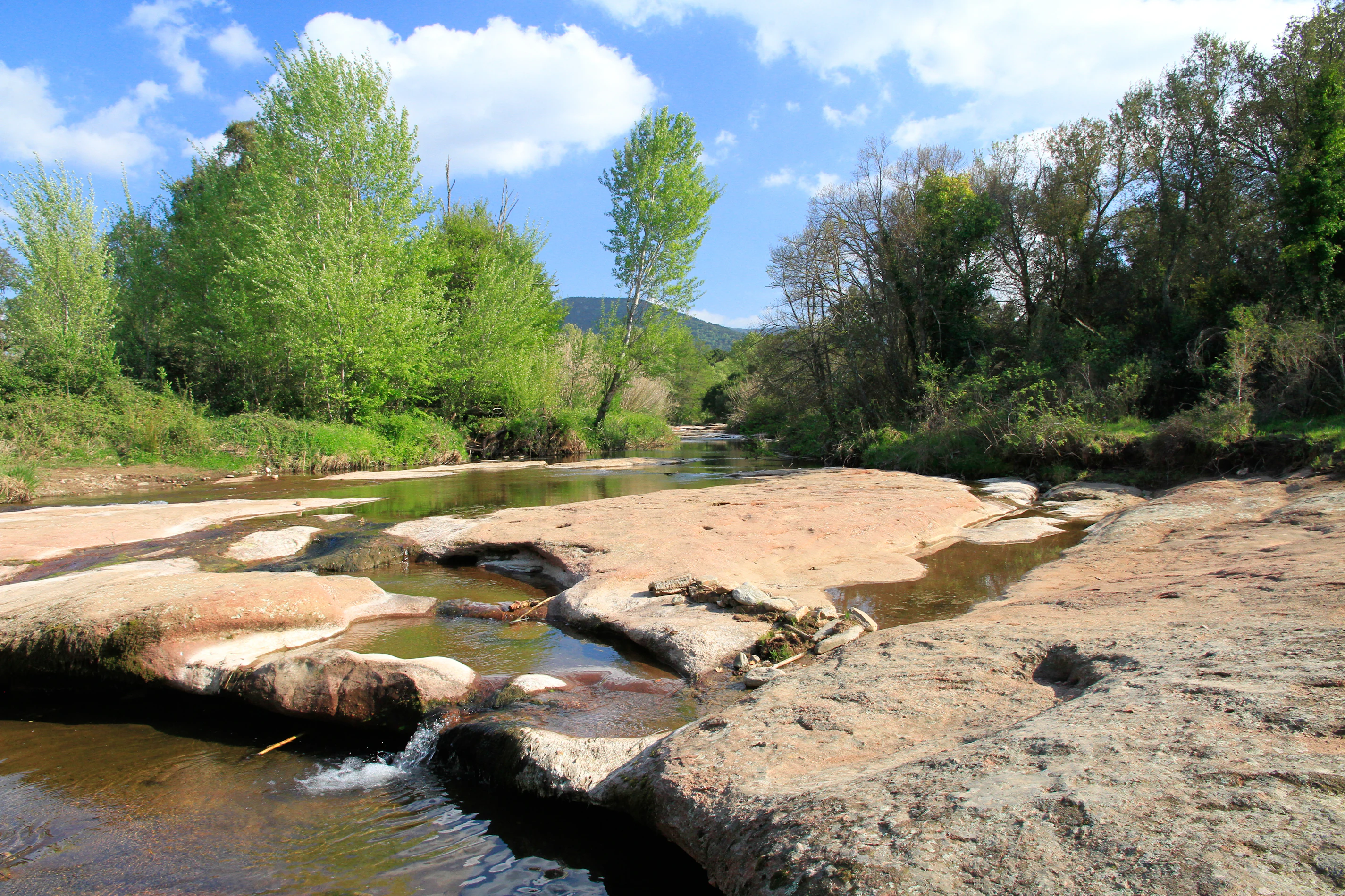
A shallow stream flows over wide, flat, reddish-brown rocky beds surrounded by green trees under a blue sky with white clouds.
Le Mourrefrey, a permanent watercourse in the Plaine des Maures National Nature Reserve.

Plaine des Maures National Nature Reserve history and protected-area timeline

The Plaine des Maures has long been shaped by human activity. In the nineteenth century, the area supported a combination of forestry (cork oak and stone pine exploitation), pastoralism (especially sheep), and agriculture including vineyards, olive groves, and cereal fields. These activities continue to influence the landscape mosaic of maquis, woodland, and open ground that the reserve now protects.

The idea of formally protecting the Plaine des Maures emerged in 1991, when the Standing Committee of the Bern Convention proposed creating a nature reserve specifically to safeguard Hermann's tortoise, a species already under pressure across Mediterranean Europe. A joint steering committee for the Natura 2000 designation and the proposed reserve was set up in 2001, with the Office national des forêts acting as local operator, and the same year the national council for nature protection (CNPN) gave a favorable opinion.

Natura 2000 implementation in 2003 delayed the formal process, and the public inquiry only opened in February 2007. The reserve was finally created by decree on 23 June 2009, becoming the first national nature reserve of the Var department, although opponents challenged the decree in court, with the Conseil d'État rejecting the appeal in 2010. Initially administered by the Var departmental council, management was transferred on 1 August 2022 to the Société nationale de protection de la nature.

In August 2021, a major wildfire, the worst in France since 2003, destroyed between 60 and 80 percent of the reserve's surface, igniting from a nearby motorway rest area and burning more than 8,000 hectares of surrounding habitat. The fire profoundly affected both the ecological communities and the management outlook for the site, prompting renewed local calls to upgrade its protection by integrating it into a regional natural park.

Plaine des Maures National Nature Reserve landscape and geographic character

The reserve occupies a transitional zone between the flat-to-rolling lowlands of the Plaine des Maures and the northern slopes of the Massif des Maures, an ancient massif of crystalline and metamorphic rocks formed between the late Proterozoic and the end of the Paleozoic. To the north and west, the broader plain is bounded by limestone hills, while to the south and east the crests of the Massif des Maures rise up, enclosing the site.

Its geology is dominated by siliceous substrates that are relatively compact and impermeable, the key reason for one of the reserve's most distinctive landscape features: a dense network of temporary ponds, streamlets, and small marshy depressions fed by rainfall. These wet microhabitats, including sandstone slabs dotted with vernal pools, are visually subtle but ecologically central, supporting specialized flora and amphibians and giving the plain its renowned biodiversity.

Above these wet mosaics, the landscape is shaped by a varied tree cover: majestic stone pines (Pinus pinea) and cork oaks (Quercus suber) rise above a dense understory of low and tall maquis, including heather-dominated formations and aromatic Mediterranean scrub. Vineyard parcels, olive groves, and pastoral clearings remain woven into this matrix, maintaining the traditional open-and-closed character of the Provençal countryside.
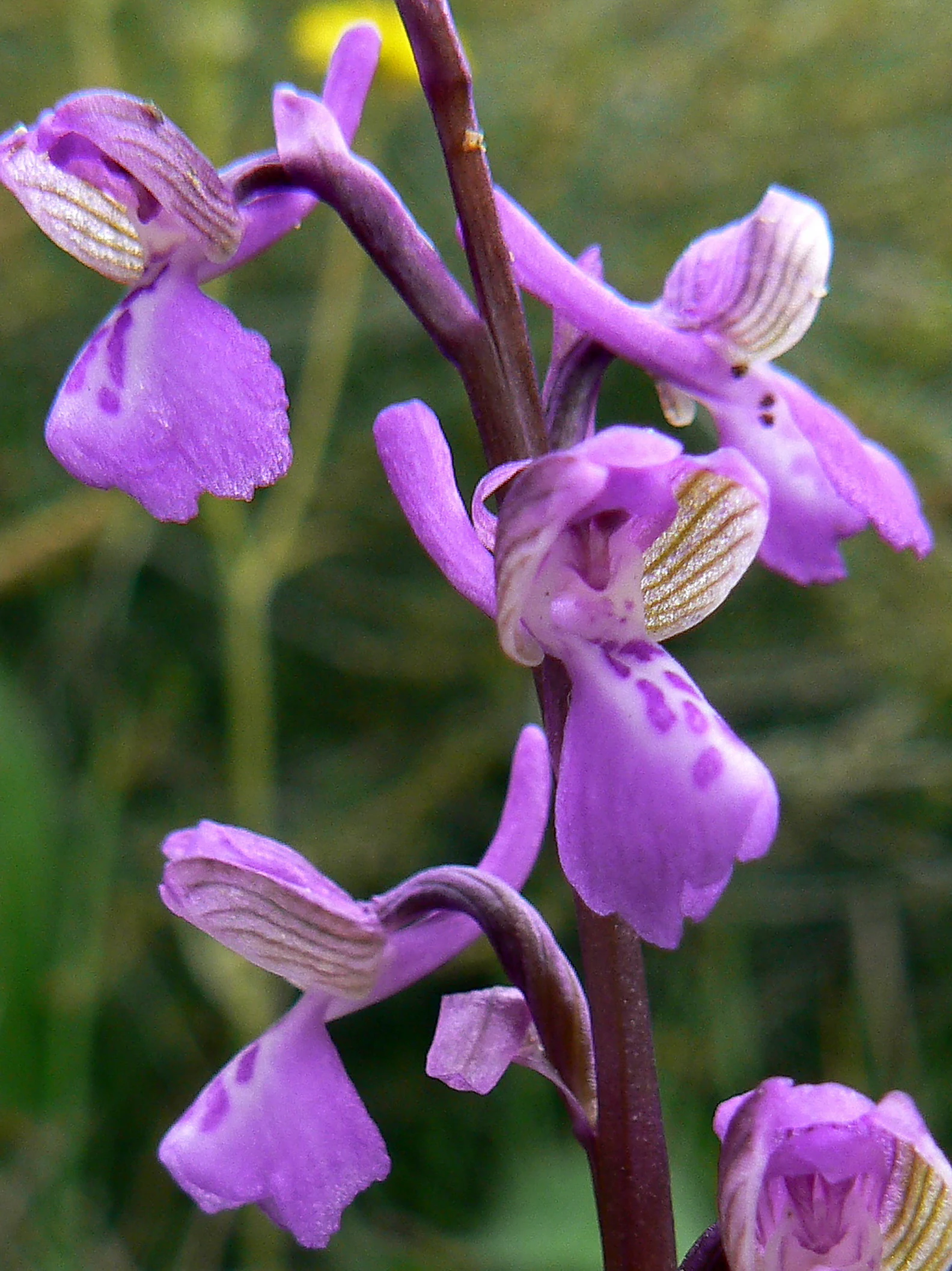
Close-up photograph of purple orchid flowers with striped white and purple lips on a dark reddish stem, set against a blurred green background.
Close-up of Anacamptis morio subsp. picta orchid flowers in the Massif des Maures, Var, France.

Plaine des Maures National Nature Reserve ecosystems, habitats, and plant life

The nature of the Plaine des Maures Reserve is defined above all by its habitat mosaic. Low maquis dominated by heather, tall maquis with tree heather, cork oak woodlands, stone pine forests, exposed sandstone slabs, temporary pools, streams, and cultivated enclosures all coexist within a relatively small perimeter. This variety arises from the interplay of acidic siliceous soils, Mediterranean climate, traditional land use, and topography.

This mosaic forms the basis for an exceptionally rich flora. The reserve lists more than 130 protected plant species, including roughly 30 orchid species across genera such as Serapias, Ophrys, and Spiranthes, as well as rare ferns like Isoetes durieui and Ophioglossum species, uncommon mosses, and several regional endemics. The combination of acidic substrates and Mediterranean seasonality produces orchid-rich grasslands and fern colonies that are nationally distinctive.

Two artificial lakes, the lac des Escarcets and the lac des Aurèdes, were originally created to support firefighting capacity. Over time, they have developed reedbeds and riparian woodland that host rich bird and aquatic communities, adding a wetland dimension to an otherwise dry Mediterranean mosaic. The reserve's biodiversity, in both floristic and faunistic terms, is considered unique at the national scale.
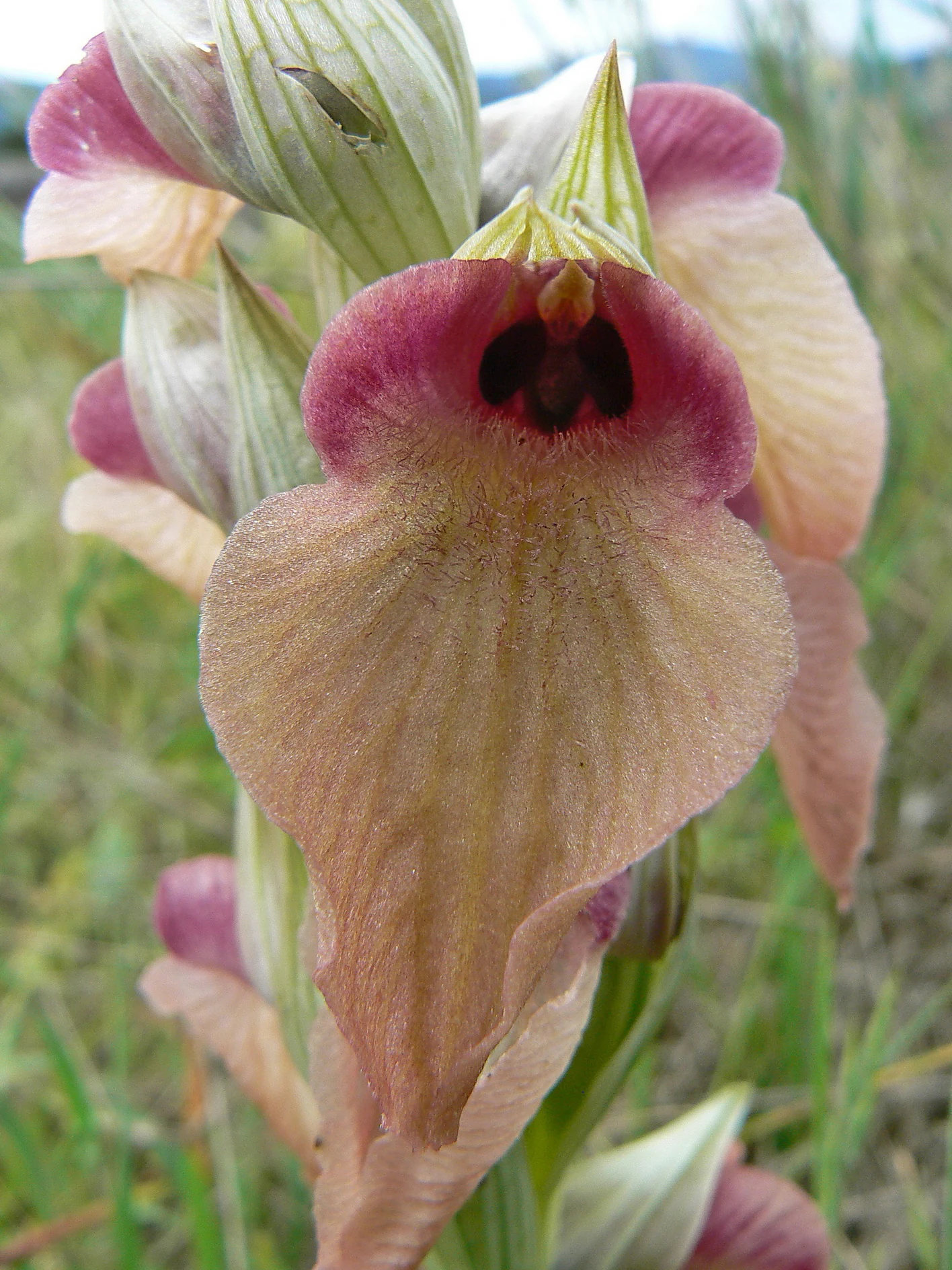
Close-up photograph of a Serapias neglecta orchid flower with pink and cream petals and a dark center, set against a blurred green grass background.
Close-up view of a Serapias neglecta flower in the Plaine des Maures, Var, France.

Plaine des Maures National Nature Reserve wildlife and species highlights

Before the devastating 2021 fires, the reserve hosted 241 animal species of recognized faunistic interest, an unusually high figure for a French terrestrial protected area of its size. Reptiles dominate the profile, and the Hermann's tortoise (Testudo hermanni) is the reserve's flagship and original target for protection. Classified as vulnerable on the French national red list, this tortoise has existed for around 35 million years but in mainland France now survives only in the Var within this very massif, sustained by active monitoring and protection efforts dating back to the 1980s.

Other reptiles of conservation concern include the European pond turtle (Emys orbicularis) and the ocellated lizard (Timon lepidus), both threatened in France, as well as Aesculapian, Montpellier, western whip, and viperine snakes. A wide variety of amphibians depend on the temporary pools and streams, including fire salamanders, natterjack toads, agile frogs, and Mediterranean tree frogs. The temporary pools, despite their seasonal fragility, are biologically rich and internationally recognized.

The maquis and woodland host characteristic Mediterranean birds such as the European bee-eater, wood lark, scops owl, common raven, tawny owl, and lesser grey shrike. Around the lakes, ponds, and marshes, birdlife includes little grebes, marsh harriers, snipes, common kingfishers, grey and purple herons, moorhens, and water rails, while the woodpeckers, hoopoes, and golden orioles contribute to the more open and edge habitats. After the 2021 fires, which burned an estimated 60 to 80 percent of the reserve and more than 8,000 hectares of surrounding habitat, the long-term recovery of these communities became a central concern for management.
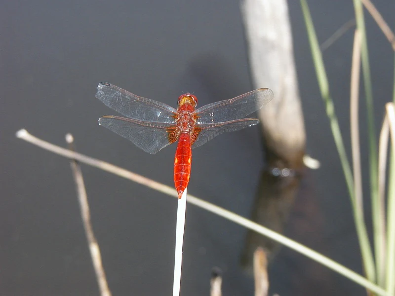
A bright red dragonfly with transparent wings perched on a thin white stem against a dark water background with blurred reeds
A scarlet darter dragonfly perched on a reed stem above the dark waters of a temporary pond in Plaine des Maures

Plaine des Maures National Nature Reserve conservation status and protection priorities

Conservation is at the very heart of the Plaine des Maures Reserve. The reserve was created explicitly to safeguard the Hermann's tortoise on the French mainland, making it one of the most directly species-driven protected areas in the national network. Management is now handled by the Société nationale de protection de la nature, following a transition from departmental oversight, and the regulations were carefully designed to maintain traditional land uses that have historically shaped the mosaic habitats on which the species depend.

The reserve sits within a nested protection framework: it overlaps with a Natura 2000 site, including both a Site of Community Importance covering the Plaine and Massif des Maures and a Special Protection Zone for birds. A nearby biotope protection prefectural order (APPB) further secures habitats for the Hermann's tortoise. In the World Database on Protected Areas it is listed under IUCN Category IV, recognizing its focus on habitat and species management.

The main pressures identified for the site are foreseeable land take from urban expansion and infrastructure, an elevated fire risk linked to the dry microclimate, artificialization of environments (notably highlighted by the fact that the 2021 fire started from a motorway rest area), intensification of agriculture, and unregulated outdoor recreation. The catastrophic August 2021 fire, the worst in France since 2003, destroyed a large portion of the reserve's surface and intensified debates about upgrading its protection, with local elected representatives pushing for classification as the tenth regional natural park of Provence-Alpes-Côte d'Azur.

Plaine des Maures National Nature Reserve cultural meaning and human context

The Plaine des Maures is a landscape shaped continuously by human activity for at least a couple of centuries. In the nineteenth century the area combined forestry, especially cork oak and stone pine exploitation, with sheep pastoralism and polyculture including vineyards, olive groves, and cereal fields. These practices left a lasting imprint on the present-day open-and-closed mosaic that the reserve now protects, and the mosaic itself is one of the key reasons for its biodiversity.

The reserve's approach explicitly recognizes this cultural heritage. Its regulations are adapted to the specificities of the Plaine des Maures and accept the continuation of traditional human activities, on the principle that these activities shaped and preserved the landscape in the first place. The goal is not to remove people from the territory but to guide their practices toward more sustainable and ecologically respectful forms, including modern adaptations of cork harvesting, pastoral use, and managed viticulture.

The reserve is also embedded in a broader regional movement. After the 2020 creation of the Mont-Ventoux Regional Natural Park, local elected representatives have advocated reclassifying the Plaine des Maures Reserve as a regional natural park to enhance both its protection level and its resources, a debate that connects ecological concerns with longstanding Provençal land identity.

Top sights and standout views in Plaine des Maures National Nature Reserve

The reserve's foremost highlight is its role as the most important protected mainland habitat of Hermann's tortoise, an emblematic Mediterranean species with deep evolutionary roots and a precarious future in France. Around this anchor species is built a wider mosaic of cork oak, stone pine, maquis, temporary pools, and sandstone slabs that supports an exceptional concentration of orchids, reptiles, amphibians, and birds within a compact area.

A second highlight is the landscape itself, a striking Provençal tableau of umbrella pines, aromatic maquis, vineyards, and clearings framed by the ancient ridges of the Massif des Maures. The reserve is also notable for being the first national nature reserve of the Var department and for its integration into both the national protected-area network and the European Natura 2000 network, giving it both local and continental conservation significance.

Best time to visit Plaine des Maures National Nature Reserve

The Plaine des Maures lies in a dry, sunny Mediterranean climate with hot summers and mild winters. Spring, generally from April to early June, is widely considered the most rewarding time to experience the reserve, when wildflowers, including the rich orchid communities, peak across the maquis and grasslands, and the temporary pools and streams are full enough to attract amphibians and waterbirds.

Early summer retains much of the floral interest, while high summer brings intense heat and a heightened fire risk, conditions that also coincide with the period when many natural areas of Provence are driest. Autumn offers calmer weather and the chance to observe late-season wildlife, and winter, though cooler, is mild compared with much of France. The reserve's trail around the lac des Escarcets and roadside interpretive panels allow visitors to engage with the landscape across seasons, though the August 2021 fires have reshaped much of the visible scenery and continue to influence recovery dynamics on the ground.

Monthly climate preview

Long-term temperature and precipitation records across twelve measured monthly intervals

Annual Climate Normals and Weather by Month for Réserve naturelle nationale de la plaine des Maures

Representative coordinates track measured monthly temperature swings from winter lows to summer maximums alongside varying daily precipitation rates. Examining the full twelve-month profile reveals complete climate normals for evaluating long-term environmental patterns across the protected terrain.
Annual mean14 °C
5 °C25 °C
Jan
Feb
Mar
Apr12°
May16°
Jun21°
Jul25°
Aug24°
Sep19°
Oct15°
Nov
Dec
Warmest month
July

24.6 °C

Coolest month
January

5.4 °C

Wettest month
November

3.4 mm/day

Driest month
July

0.5 mm/day

Park location guide

Geography guide, regional context, and park location map for Plaine des Maures National Nature Reserve

Plaine des Maures National Nature Reserve park geography, regions, and map view in France

Understand where Plaine des Maures National Nature Reserve sits in France through a broader geographic reading of the surrounding landscape, nearby location context, and its mapped position within the national park landscape.

How Plaine des Maures National Nature Reserve fits into France

France is a unitary semi-presidential republic and one of the world's largest economies. It borders Belgium, Luxembourg, Germany, Switzerland, Italy, Monaco, Andorra, and Spain, with a maritime border to the United Kingdom. The country is known for its cultural influence, art, cuisine, and political history spanning centuries.

Wider geography shaping Plaine des Maures National Nature Reserve in France

France is located in Western Europe. Metropolitan France extends from the Rhine to the Atlantic Ocean and from the Mediterranean Sea to the English Channel and North Sea. The country borders Belgium, Luxembourg, Germany, Switzerland, Italy, Monaco, Andorra, Spain, and has a maritime border with the United Kingdom.

Map view of Plaine des Maures National Nature Reserve

Use this park location map to pinpoint Plaine des Maures National Nature Reserve in France, understand its exact geographic position, and read its mapped placement within the surrounding landscape more clearly.

Pigeon | © OpenStreetMap contributors

Location context for Plaine des Maures National Nature Reserve

Provence-Alpes-Côte d'Azur
Recorded earthquake history

View Recorded Earthquake Data for Réserve naturelle nationale de la plaine des Maures

Examine the historical catalogue of recorded seismic activity associated with the Réserve naturelle nationale de la plaine des Maures. This resource provides a structured, data-driven view of regional earthquake records and magnitudes compiled through the MoriAtlas geographical discovery platform.

Réserve naturelle nationale de la plaine des Maures Earthquake History

Catalogued events

6 events

Strongest magnitude

Magnitude 3.4

Most recent event

Aug 22, 2000

This history includes earthquakes recorded inside the park or within 50 km of its borders

Visual exploration of cork oak woodlands, temporary pools, and Mediterranean habitats

Réserve naturelle nationale de la plaine des Maures Photos and Landscape Scenery

Visual records reveal the diverse terrain, cork oak woodlands, and temporary pools that characterize Réserve naturelle nationale de la plaine des Maures. Photographic exploration provides clear insight into the protected habitats, stone pine forests, and distinctive scenery of the Provençal landscape.

A shallow stream flows over wide, flat, reddish-brown rocky beds surrounded by green trees under a blue sky with white clouds.

A landscape photograph showing reddish rocky ground with shallow pools of water reflecting a blue sky, surrounded by Mediterranean vegetation including stone pine trees and low shrubs.

Close-up photograph of purple orchid flowers with striped white and purple lips on a dark reddish stem, set against a blurred green background.

Close-up photograph of a Serapias neglecta orchid flower with pink and cream petals and a dark center, set against a blurred green grass background.

A bright red dragonfly with transparent wings perched on a thin white stem against a dark water background with blurred reeds

A dense forest scene featuring numerous trees with dark, textured trunks rising from a thick layer of green undergrowth.

Park atlas

Compare nearby regional reserves, Mediterranean habitats, and connected conservation landscapes in Provence

Parks Near Réserve naturelle nationale de la plaine des Maures and Surrounding Protected Areas

Browsing other protected areas near Réserve naturelle nationale de la plaine des Maures reveals broader ecological connections across the Provençal landscape. Evaluating adjacent regional parks and reserves helps place local Mediterranean habitats and rare tortoise refuges within a wider geographic context.
Marine protected areaFrance
13 km away#1 closest

East

Sanctuaire Pelagos Marine Protected Area: Mediterranean Geography and Seascape

A transboundary conservation zone spanning 87,500 square kilometers.

Sanctuaire Pelagos represents a unique collaborative effort in marine conservation across the Mediterranean. Spanning the waters between France, Italy, and Monaco, this protected maritime area is defined by its deep-sea canyons and nutrient-rich currents that sustain diverse cetacean populations. Its immense scale and international governance make it a focal point for understanding Mediterranean marine biodiversity and environmental policy.

Area
87,500 km²
Established
1999
IUCN
IV
Relief
Lowland
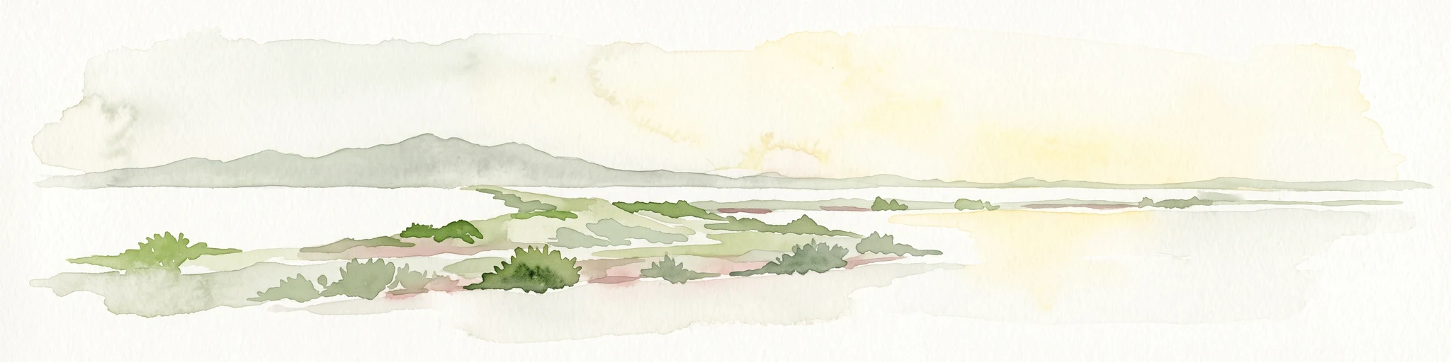
A pale, minimalist watercolor painting showing a low-lying marshy peninsula extending into water, with distant hills on the horizon under a soft, light-filled sky.
Nature reserveVar
About 25 km away#2 closest

Southwest

Salins d'Hyères Nature Reserve: Coastal Wetland Geography and Protected Landscape Context

Mapped salt pans and wetland habitats on the Var coast.

The Salins d'Hyères consist of a coastal wetland network of salt pans and marshes near the Giens peninsula. This area offers a unique glimpse into the geography of the Var department, where centuries of salt production have created a diverse ecosystem of hypersaline basins, dunes, and coastal pine forests.

Area
9 km²
Established
1983
IUCN
IV
Relief
Lowland
Watercolor painting of a landscape with trees, hills, and a body of water
National parkFrance
About 34 km away#3 closest

South

Port-Cros National Park: French Mediterranean Island National Park & Marine Sanctuary

Discover mapped protected land and unique Mediterranean ecosystems.

Port-Cros National Park offers a glimpse into a pioneering model of integrated terrestrial and marine conservation within the Mediterranean. This park protects a distinctive island geography marked by rugged terrain, endemic species, and vital underwater habitats, including crucial posidonia meadows and rich marine life. Through MoriAtlas, explore the mapped boundaries and ecological significance of Port-Cros, understanding its role as a vital protected landscape in the European atlas.

Area
46 km²
Established
1963
IUCN
II
Visitors
1M annual
A soft watercolor painting of a coastal landscape with rolling hills, distant mountains, and green vegetation against a light sky.
Marine protected areaProvence-Alpes-Côte d'Azur
About 40 km away#4 closest

East

Parc maritime départemental Estérel-Théoule: Marine Protected Area and Coastal Geography

A vital Mediterranean corridor along the French Riviera coast

This marine protected area preserves a unique underwater mosaic where rocky shallows, sandy patches, and Posidonia seagrass meadows converge. Located offshore from the Estérel massif, the site provides a continuous conservation corridor between inland natural spaces and the Mediterranean Sea, offering insight into the littoral environment of the French Riviera.

Area
3.5 km²
Water
Water-dominated
Season
Seasonal
Nature reserveProvence-Alpes-Côte d'Azur
About 46 km away#5 closest

North

Réserve naturelle régionale de Saint-Maurin: Geological Heritage in the Verdon Gorge

Travertine formations and cave habitats in Provence

Covering 25 hectares at the mouth of the Gorges du Verdon, this regional nature reserve protects a rare set of travertine terraces and tufa caves. Its geography creates a micro-refuge for specific cave-dwelling species and cliff-nesting raptors, standing as a significant example of geological and biological preservation in the Alpes-de-Haute-Provence department.

Area
0.248 km²
Established
2009
IUCN
IV
Relief
Upland
Watercolor painting of a park landscape with a foreground pond, grassy areas, and rolling hills in the background.
State or regional parkProvence-Alpes-Côte d'Azur
57 km away#6 closest

Northeast

Parc de Vaugrenier: Regional Protected Area and Archaeological Landscape in France

Wetland habitats and historic trails in Alpes-Maritimes

Parc de Vaugrenier protects a diverse hundred-hectare expanse between Antibes and Villeneuve-Loubet. Its terrain bridges Mediterranean woodland and lush freshwater meadows, distinguished by a rare collection of exotic trees and remnants of the ancient Via Julia Augusta. This park provides a quiet geographic contrast to the surrounding coastal urbanization of the French Riviera.

Area
1 km²
Established
1995
Visitors
500K annual
Relief
Lowland
Watercolor illustration of coastal mountains and shoreline with scattered trees
National parkBouches-du-Rhône
61 km away#7 closest

West

Calanques National Park: Mediterranean Limestone Cliffs and Marine Protected Area

France's First Peri-Urban National Park

Calanques National Park, situated in the Bouches-du-Rhône department, represents a significant protected landscape where dramatic limestone geology meets the Mediterranean Sea. This atlas-focused entry details the park's iconic calanques, its combined terrestrial and marine protected zones, and its rich prehistoric cultural significance. Understand its unique geographic setting and its importance as a conservation area accessible for map-based discovery and regional landscape context.

Area
520 km²
Established
2012
IUCN
II
Relief
Mountain
A soft watercolor illustration depicting layered rolling hills, distant mountain silhouettes, and clusters of trees in a pale color palette.
Regional parkProvence-Alpes-Côte d'Azur
62 km away#8 closest

Northwest

Parc naturel régional du Luberon: Regional Park Boundaries and Protected Landscape Atlas

Geology, mountain ridges, and Mediterranean ecosystems of Provence

Parc naturel régional du Luberon serves as a vital protected corridor in southeastern France. The park features three parallel limestone massifs, dramatic ochre formations, and fossil-rich plateaus. Its geography offers a case study in integrating sustainable land use with rich biodiversity across the Vaucluse and Alpes-de-Haute-Provence departments.

Area
1,747.26 km²
Established
1977
IUCN
V
Visitors
350K annual

Common questions about visiting, size, designation, and location context for Plaine des Maures National Nature Reserve

Plaine des Maures National Nature Reserve FAQs for park facts, access, geography, and protected area context

Find quick answers about Plaine des Maures National Nature Reserve, including protected-area facts, park geography, trail and visitor context, and how the park fits into its surrounding country and regional landscape.
MoriAtlas Explorer

Continue Your Protected Areas Search Across the Global Atlas

Deepen your exploration by continuing the structured search for national parks and protected areas worldwide. Utilize the comprehensive filtering capabilities to compare different conservation landscapes and refine your understanding of global park geography. Discover more about the distribution and characteristics of protected natural areas.

Global natural geography