Mori Atlas logo
Nature reserveRéserve naturelle régionale de la mine du Verdy

Mapping the underground galleries and bat habitats of France's smallest regional nature reserve.

Réserve naturelle régionale de la mine du Verdy: Geography of a Subterranean Protected Area

Located within the wooded hills of the Monts du Lyonnais in the Auvergne-Rhône-Alpes region, the Réserve naturelle régionale de la mine du Verdy represents a unique intersection of industrial history and ecological preservation. While its surface footprint is measured in a mere fraction of a hectare, the reserve encompasses roughly 350 meters of abandoned mining galleries. These artificial caverns serve as an essential subterranean sanctuary for cave-dwelling invertebrates, lichens, and diverse bat populations, providing a rare refuge within the Rhône department.

abandoned minesubterranean habitatbat reservechiroptèresregional nature reservesmallest nature reserve in France

Réserve naturelle régionale de la mine du Verdy

Nature reserve

Park overview

Structured park overview, official facts, and landscape profile for Réserve naturelle régionale de la mine du Verdy

Réserve naturelle régionale de la mine du Verdy park facts, protected area profile, and essential visitor context

Review the core facts for Réserve naturelle régionale de la mine du Verdy, including designation, size, terrain, visitor scale, habitats, and operating context in one park-focused overview.

About Réserve naturelle régionale de la mine du Verdy

The Réserve naturelle régionale de la mine du Verdy is a striking example of how a place of modest size can carry remarkable ecological weight. Located in the commune of Pollionnay, in the Monts du Lyonnais range west of Lyon, the reserve protects a single cadastral parcel surrounding the entrance of a former mine, with the protected zone extending roughly 350 meters into the abandoned underground galleries beneath that parcel. Although the above-ground footprint is only about 0.0535 hectares, making it the smallest nature reserve in France, the reserve shelters more than 500 recorded species and functions as a major biodiversity hotspot at the regional scale.

Ecologically, the value of the Verdy mine lies in the absence of natural caves in the department of the Rhône. Because true subterranean environments are rare in this part of France, abandoned mines and quarries take on critical ecological importance. The Verdy mine offers the constant darkness, stable humidity, and buffered temperatures that subterranean fauna require, and it has become a particularly important winter and transitional roost for bats.

Administratively, the site has a layered conservation history. The mine was exploited industrially from the late nineteenth century until roughly 1940, then served for decades as an illegal dump before being reclaimed for nature conservation. After the site was acquired in 1988 by what is now France Nature Environnement Rhône-Alpes, it was cleaned of around 200 cubic meters of waste, secured at the entrance, and progressively protected, first as a voluntary nature reserve in 1990, then, in 2008, as the first and only regional nature reserve (RNR 79) in the Rhône department.

Quick facts and research context for Réserve naturelle régionale de la mine du Verdy

The Réserve naturelle régionale de la mine du Verdy is a regional nature reserve (RNR) in the Auvergne-Rhône-Alpes region, in the Rhône department of central-eastern France. It is situated in the Monts du Lyonnais, on the commune of Pollionnay, roughly 15 kilometers west of Lyon.

At about 0.0535 hectares of surface land, it is effectively the smallest nature reserve in France, although the protected volume also extends into about 350 meters of old mining galleries beneath the parcel. It is classified as IUCN Category IV and designated as a ZNIEFF of type 1 covering 1.98 hectares. The reserve is managed by France Nature Environnement Rhône-Alpes (formerly FRAPNA) and is registered in the World Database on Protected Areas as WDPA 555514330.

Protection and recognition

Documented protection history, terrestrial scope, and official designation records

Réserve naturelle régionale de la mine du Verdy Protection Status and Designation

Terrestrial protection status for Réserve naturelle régionale de la mine du Verdy dates from the official designation established in 2008. Documented protection records outline the management scope and registry details without imported international recognition sources.

Protection details

Protection scope
Terrestrial
Designated year
2008
Transboundary protection
No
WDPA ID
555514330
Park context

Deeper park guide and search-rich context for Réserve naturelle régionale de la mine du Verdy

Réserve naturelle régionale de la mine du Verdy history, landscape, wildlife, and travel context

Explore Réserve naturelle régionale de la mine du Verdy through its history, landscape character, ecosystems, wildlife, conservation priorities, cultural context, and seasonal travel timing in a structured park guide built for atlas discovery and search intent.

Why Réserve naturelle régionale de la mine du Verdy stands out

The reserve is best known for being effectively the smallest protected natural area in France, and for transforming a tiny abandoned fluorite and barite mine into a vital underground refuge for bats. It serves as a roost, or gîte, for ten of the thirty bat species present in the former Rhône-Alpes region, several of which carry strong patrimonial value and all of which are protected under European law. Its second layer of importance lies in the broader ecological role that old mines and quarries play in landscapes where natural caves are scarce. In the Rhône department, where true subterranean cavities are rare, abandoned mining works like the Verdy mine provide the constant darkness, humidity, and temperature stability needed by cave-dwelling invertebrates, lichens, and vascular plants, supporting more than 500 recorded species on a site that is barely measurable at ground level.

Réserve naturelle régionale de la mine du Verdy history and protected-area timeline

The history of the mine du Verdy stretches from late nineteenth-century industrial extraction to a contemporary biodiversity sanctuary. The deposit was discovered in 1890 and first exploited for barite, then from 1915 onward for fluorite. Over its working life it produced roughly 8,500 tonnes of ore before being abandoned around 1940. After closure the site deteriorated, and for about forty years it served as an informal dumping ground.

In 1985 the old workings were rediscovered by naturalists, who recognized their ecological potential. The site was purchased in February 1988 by the Fédération Rhône-Alpes de protection de la nature (FRAPNA), the precursor of France Nature Environnement Rhône-Alpes. Roughly 200 cubic meters of waste were removed, the surface terrain was remodeled, and the entrance was secured. The site was classified as a voluntary nature reserve (réserve naturelle volontaire) by prefectoral decree on 3 April 1990.

In 2008 the reserve moved into a more durable institutional framework. By a deliberation of the regional council of Rhône-Alpes on 25 January 2008, the site became France's newest regional nature reserve at that time and the first and only such reserve in the Rhône department, designated as RNR 79. The site is also recorded as a ZNIEFF of type 1 covering about 1.98 hectares. A management contract was approved by the regional council's standing commission on 11 April 2008, and the management plan was validated on 30 September 2008, formalizing continuous protection under the new regional regime.

Réserve naturelle régionale de la mine du Verdy landscape and geographic character

The surface landscape of the reserve is extraordinarily small. The protected ground consists of a single cadastral parcel around the entrance of the mine, measuring roughly 0.0535 hectares, set within the wooded hills of the Monts du Lyonnais. From the exterior, the site shows little of the ecological richness that lies below; the terrain was remodeled after the 1988 cleanup, and the entrance was secured to protect both visitors and the underground fauna.

The much larger part of the reserve, in volumetric terms, lies underground. Beneath the parcel runs some 350 meters of abandoned mining galleries, originally cut for barite and later for fluorite. These artificial cavities now form the active ecological landscape of the reserve, replicating the conditions of natural karst caves in a region where such features are scarce. Frequent rockfalls within the galleries are part of the ongoing dynamic of the underground environment, though they also pose a continuing safety concern that informs the site's strict access policy.

Around the entrance, the surrounding Monts du Lyonnais provide a typical upland setting of forests and rural terrain, framing a reserve that, on the surface, is essentially a small fenced woodland parcel, and whose true protected landscape is the dark, humid labyrinth of tunnels directly below it.

Réserve naturelle régionale de la mine du Verdy ecosystems, habitats, and plant life

The reserve's ecological character is shaped by the contrast between an extremely small surface parcel and an extensive underground network of former mining galleries. This unusual structure creates a hybrid ecosystem, with surface vegetation in a forested hill setting and a subterranean biome whose conditions approach those of natural karst caves. Because true caves are rare in the Rhône department, these artificial cavities carry disproportionate regional importance for biodiversity.

More than 500 species have been inventoried on the site, an extraordinary density given its size. The biodiversity inventory includes lichens, vascular plants, cave-dwelling invertebrates, and a rich bat assemblage. The combination of stable darkness, buffered humidity, and relatively constant temperatures throughout much of the year is the key ecological driver that allows subterranean species to maintain viable populations in such a small site.

Above ground, the reserve blends into the wooded habitats of the Monts du Lyonnais, supporting common birdlife and the typical flora of a small forest clearing. Below ground, however, the mine acts as a stepping-stone habitat in a region where equivalent natural shelters are almost absent.

Réserve naturelle régionale de la mine du Verdy wildlife and species highlights

Wildlife is the core reason the mine du Verdy exists as a protected area, and the reserve's fauna is dominated by bats. Of the roughly 30 bat species known from the former Rhône-Alpes region, ten have been recorded on the site, and all of them are protected at the European level. Roughly half of these bat species are considered to carry strong patrimonial value, indicating either regional rarity or conservation concern.

The recorded bat assemblage includes the Western barbastelle, Bechstein's bat, Natterer's bat, Daubenton's bat, the Geoffroy's bat, the whiskered bat, the brown long-eared bat, the grey long-eared bat, the greater horseshoe bat, and the lesser horseshoe bat. Among these, the lesser horseshoe bat is the most prevalent species within the mine itself. Together, the species mix indicates that the reserve functions as both a hibernation and a transitional or summer roost for a significant fraction of the regional bat fauna.

Beyond bats, the reserve supports a rich community of invertebrates adapted to subterranean life. Among the characteristic cave-dwelling invertebrates is Niphargus aquilex, a small crustacean typical of underground aquatic habitats. On the surface, common bird species such as the black redstart and the yellow wagtail frequent the area around the entrance, contributing to the broader food web around the mine.

Réserve naturelle régionale de la mine du Verdy conservation status and protection priorities

The conservation importance of the mine du Verdy rests on a clear and unusual argument: in the Rhône department, where natural caves are scarce, abandoned mines like the Verdy become irreplaceable shelters for cave-dependent species. By protecting roughly 350 meters of old galleries along with their above-ground entrance parcel, the reserve preserves habitat that cannot easily be replaced elsewhere in the department.

The site's conservation credentials are backed by multiple layers of designation. It is a regional nature reserve (RNR 79) under French regional protection law, a voluntary nature reserve historically under prefectoral order, a ZNIEFF of type 1 covering about 1.98 hectares, and an IUCN Category IV protected area. It also appears in the World Database on Protected Areas as record 555514330, integrating it into the global accounting of protected sites.

Management is overseen by France Nature Environnement Rhône-Alpes, which owns the land and runs day-to-day protection. Because human disturbance is a major threat to the sensitive subterranean fauna, the mine itself is closed to the general public. Access is regulated and unauthorized entry is subject to penalties under French environmental law, while the physical fragility of the galleries, which are prone to rockfall, makes strict access control both a conservation and a safety necessity.

Réserve naturelle régionale de la mine du Verdy cultural meaning and human context

The cultural dimension of the reserve is largely industrial and naturalistic rather than folkloric. The mine du Verdy is a tangible trace of late nineteenth- and early twentieth-century extractive activity in the Monts du Lyonnais, when barite and fluorite were economically important minerals in the hills west of Lyon. The site's working life, around 1890 to 1940, and its production of about 8,500 tonnes of ore, link it to the broader industrial heritage of the Lyon region.

After abandonment, the mine passed through a damaging phase as an informal dump for around forty years, a pattern that affected many former mining sites in France. Its modern identity is closely tied to the regional naturalist movement: the reserve was acquired, cleaned, and protected by FRAPNA, now France Nature Environnement Rhône-Alpes, an organization founded to coordinate and defend naturalist protection across the region. The site's story of rediscovery, citizen-led acquisition, and transformation into a protected area is itself part of its cultural significance, illustrating how regional conservation movements in France have reclaimed abandoned industrial land for biodiversity.

Top sights and standout views in Réserve naturelle régionale de la mine du Verdy

Effective smallest nature reserve in France, at about 0.0535 hectares of surface land; Subterranean galleries extending roughly 350 meters beneath the entrance parcel; Ten bat species recorded, all protected at the European level and including the lesser horseshoe bat, the greater horseshoe bat, and the western barbastelle; More than 500 species inventoried on an exceptionally small site; First and only regional nature reserve in the Rhône department, designated RNR 79; Recognized as a ZNIEFF of type 1 of about 1.98 hectares and an IUCN Category IV protected area.

Best time to visit Réserve naturelle régionale de la mine du Verdy

The mine itself is closed to the general public year-round because of the sensitivity of the bat roosts and the risk of rockfall inside the galleries, so the notion of a 'best time to visit' applies chiefly to outdoor appreciation of the surrounding site.

The broader Monts du Lyonnais landscape around Pollionnay is most pleasant in late spring and early autumn, when mild weather supports walking and birdwatching around the entrance area. Winter can be quieter and offers crisp forest scenery, though cold-weather disturbance around the entrance may be discouraged to protect hibernating bats. Visitors interested in the reserve's ecology will generally find the warmer months more comfortable for short visits to the surface area, while keeping in mind that the underground workings themselves remain inaccessible.
Monthly climate preview

Long-term representative coordinate measurements trace monthly temperature and precipitation variation across the protected terrain

Climate Normals and Annual Temperature Range at Réserve Naturelle Régionale de la Mine du Verdy

Representative coordinates record an annual thermal range spanning sub-zero winter minimums to warm summer highs alongside steady monthly precipitation rates. Detailed monthly normals provide complete context for the multi-year temperature and precipitation averages recorded across the protected landscape.
Annual mean10 °C
1 °C20 °C
Jan
Feb
Mar
Apr
May13°
Jun18°
Jul20°
Aug20°
Sep15°
Oct11°
Nov
Dec
Warmest month
July

20.3 °C

Coolest month
January

1.3 °C

Wettest month
May

2.5 mm/day

Driest month
March

1.3 mm/day

Park location guide

Geography guide, regional context, and park location map for Réserve naturelle régionale de la mine du Verdy

Réserve naturelle régionale de la mine du Verdy park geography, regions, and map view in France

Understand where Réserve naturelle régionale de la mine du Verdy sits in France through a broader geographic reading of the surrounding landscape, nearby location context, and its mapped position within the national park landscape.

How Réserve naturelle régionale de la mine du Verdy fits into France

France is a unitary semi-presidential republic and one of the world's largest economies. It borders Belgium, Luxembourg, Germany, Switzerland, Italy, Monaco, Andorra, and Spain, with a maritime border to the United Kingdom. The country is known for its cultural influence, art, cuisine, and political history spanning centuries.

Wider geography shaping Réserve naturelle régionale de la mine du Verdy in France

France is located in Western Europe. Metropolitan France extends from the Rhine to the Atlantic Ocean and from the Mediterranean Sea to the English Channel and North Sea. The country borders Belgium, Luxembourg, Germany, Switzerland, Italy, Monaco, Andorra, Spain, and has a maritime border with the United Kingdom.

Map view of Réserve naturelle régionale de la mine du Verdy

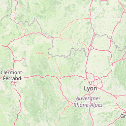
Use this park location map to pinpoint Réserve naturelle régionale de la mine du Verdy in France, understand its exact geographic position, and read its mapped placement within the surrounding landscape more clearly.

Pigeon | © OpenStreetMap contributors

Location context for Réserve naturelle régionale de la mine du Verdy

Auvergne-Rhône-Alpes
Park atlas

Compare adjacent subterranean habitats, upland forests, and protected landscapes across the region

Parks Near Réserve naturelle régionale de la mine du Verdy and Surrounding Regional Protected Areas

Continue exploring protected areas near Réserve naturelle régionale de la mine du Verdy to evaluate adjacent regional nature reserves and woodland habitats. Comparing these surrounding conservation lands provides broader geographic context for subterranean ecosystems and upland terrain.
A soft watercolor painting of a wetland landscape featuring a central pond, surrounding reeds, and distant rolling hills in pale green and pink hues.
Nature reserveAuvergne-Rhône-Alpes
About 43 km away#1 closest

Southeast

Réserve naturelle régionale de l'étang de Saint-Bonnet: Wetland Atlas and Map Discovery

Examining protected wetland geography in the Isère department

This protected area centers on the étang de Saint-Bonnet, a wetland habitat defined by dense reedbeds and pond-centered ecosystems. It provides a distinct example of nature conservation situated between major urban corridors, showcasing how amphibians and diverse bird communities thrive within a small, managed lowland basin.

Area
0.514 km²
Established
1987
IUCN
IV
Relief
Lowland
A horizontal watercolor painting showing a soft, stylized river winding through green hills and forests.
Regional parkAuvergne-Rhône-Alpes
About 46 km away#2 closest

Southwest

Réserve naturelle régionale des gorges de la Loire: Landscape and Protected Area Geography

Regional nature reserve in the Auvergne-Rhône-Alpes landscape.

The Réserve naturelle régionale des gorges de la Loire protects a rugged stretch of the Loire River valley in the eastern Massif Central. Discover the geographic mosaic of rocky outcrops, shrubby heaths, and woodland slopes that define this protected area, and see how the terrain shapes its distinct biodiversity and river corridor boundaries.

Area
3.55 km²
Established
1988
IUCN
IV
Relief
Upland
Nature reserveAuvergne-Rhône-Alpes
About 61 km away#3 closest

East

Réserve naturelle régionale des étangs de Mépieu: Atlas and Geographic Protected Area Overview

Wetlands, peatlands, and dry grasslands in northern Isère

The Réserve naturelle régionale des étangs de Mépieu offers a striking study in ecological contrast. This protected landscape contains a dense mosaic of five ponds and marshy terrain set directly against sun-exposed dry grasslands and heathland slopes. The site serves as a vital corridor for migratory birds and rare flora within the rolling countryside of the Auvergne-Rhône-Alpes region.

Area
1.618 km²
Established
2008
IUCN
IV
Relief
Lowland
A soft watercolor painting of a rolling landscape with green fields, distant purple hills, and patches of yellow and pink vegetation.
Nature reserveAuvergne-Rhône-Alpes
About 64 km away#4 closest

West

Réserve naturelle régionale des Jasseries de Colleigne Protected Area and Landscape Atlas

High-altitude moorlands and glacial geography in the Monts du Forez

This regional nature reserve provides a critical look at the Hautes Chaumes du Forez, an upland plateau in the Massif Central characterized by open grasslands and peat bogs. The site serves as a vital case study for the conservation of rare montane habitats maintained through traditional pastoral farming practices. Map the glacial Chorsin valley and explore the diverse botanical landscape contained within these protected high-altitude boundaries.

Area
2.85 km²
Established
1985
IUCN
IV
Relief
Mountain
A soft, panoramic watercolor illustration of rolling hills, mountains, and trees in pastel shades of green, yellow, and pink.
Nature reserveAuvergne-Rhône-Alpes
About 74 km away#5 closest

Northeast

Réserve naturelle nationale de la grotte de Hautecourt: Jura Mountain Cave Geography

Protected subterranean landscapes in the Ain department of France.

This nature reserve protects a complex underground environment characterized by a vertical 36-meter cave system and rich invertebrate biodiversity. Located on the flank of Mont Rosset in the Auvergne-Rhône-Alpes region, the area provides a crucial habitat that balances delicate subterranean passages with surface limestone ridges and dry grassland ecosystems.

Area
0.102 km²
Established
1980
IUCN
IV
A soft watercolor painting depicting a wide river flowing through a lush green landscape with distant rolling purple hills in the background.
Nature reserveAuvergne-Rhône-Alpes
About 77 km away#6 closest

East

Rhône du Pont de Groslée à Murs-et-Gélignieux: Alluvial Nature Reserve & River Geography

Protected riparian habitat in Auvergne-Rhône-Alpes, France.

Analyze the complex fluvial dynamics of the Rhône du Pont de Groslée à Murs-et-Gélignieux nature reserve. This site features a well-preserved landscape of alder and ash floodplain forests, isolated side channels, and marshy meadows that provide an essential ecological corridor through the Rhône river valley.

Area
21.05 km²
Relief
Lowland
Scope
Terrestrial
Water
Water-dominated
A watercolor illustration of a serene landscape with rolling hills, a meandering river, and soft light.
Regional parkAuvergne-Rhône-Alpes
About 80 km away#7 closest

South

Parc naturel régional des Monts d'Ardèche: Protected Landscapes and Geographic Map Context

Volcanic highland terrain within the Auvergne-Rhône-Alpes region

Covering over 248,000 hectares, Parc naturel régional des Monts d'Ardèche represents a significant protected area in the southern Massif Central. The region is marked by its distinctive volcanic sucs, including Mont Gerbier-de-Jonc, and a complex network of Cévenol river valleys. It remains a focal point for understanding the transition between high volcanic plateaus and traditional terraced agricultural slopes in southeastern France.

Area
2,280 km²
Established
2001
IUCN
V
A wide watercolor illustration showing a soft landscape with pink flowers on the left, green bushes and rocks on the right, and distant mountains across a misty valley.
Protected areaFrance
About 81 km away#8 closest

North

Site naturel protégé de la Boucherette: Protected Limestone Grasslands in Southern Burgundy

Calcareous habitat and botanical trail geography

Located in the Saône-et-Loire commune of Lugny, this 104-hectare protected area showcases a distinctive transition between limestone hills and the Saône valley. The site is recognized for its concentration of wild orchids and its integration of ecological conservation with the historical footprint of centuries-old stone quarrying and tile production.

Area
1.04 km²
Established
2000
Visitors
1K annual
Relief
Upland

Common questions about visiting, size, designation, and location context for Réserve naturelle régionale de la mine du Verdy

Réserve naturelle régionale de la mine du Verdy FAQs for park facts, access, geography, and protected area context

Find quick answers about Réserve naturelle régionale de la mine du Verdy, including protected-area facts, park geography, trail and visitor context, and how the park fits into its surrounding country and regional landscape.
MoriAtlas Explorer

Continue Your Protected Areas Search Across the Global Atlas

Deepen your exploration by continuing the structured search for national parks and protected areas worldwide. Utilize the comprehensive filtering capabilities to compare different conservation landscapes and refine your understanding of global park geography. Discover more about the distribution and characteristics of protected natural areas.

Global natural geography