
Mori Atlas logo
Nature reserveRéserve naturelle régionale de la Vallée des Cailles

Mapping the botanical diversity and distinct calcareous habitats in Centre-Val de Loire

Réserve naturelle régionale de la Vallée des Cailles: A Protected Chalk Valley Landscape

The Réserve naturelle régionale de la Vallée des Cailles protects a unique mosaic of dry grassland, thermophilous oak woodland, and chalk valley terrain near the Dreux forest. This site represents a specialized conservation landscape in the Paris Basin where flint geology and historical land use maintain rare habitat patches. Discover the mapped boundaries and topographical features that define this compact but ecologically vital protected area in the heart of France.

calcareous grasslandchalk valleydry grasslandorchidsthermophilous oak woodlandregional nature reserve
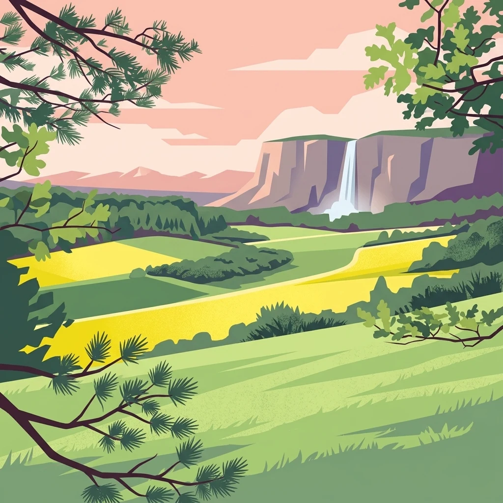
A stylized, graphic-style illustration of a green valley with a distant cliff face and a waterfall, framed by foreground pine and deciduous branches under a pink and peach sky.

Réserve naturelle régionale de la Vallée des Cailles

Nature reserve

Park overview

Structured park overview, official facts, and landscape profile for Vallée des Cailles Regional Nature Reserve

Vallée des Cailles Regional Nature Reserve park facts, protected area profile, and essential visitor context

Review the core facts for Vallée des Cailles Regional Nature Reserve, including designation, size, terrain, visitor scale, habitats, and operating context in one park-focused overview.

About Vallée des Cailles Regional Nature Reserve

The Vallée des Cailles Regional Nature Reserve sits in a quiet agricultural and forested corner of the Eure-et-Loir department, where the plains north of the Loire meet the wooded edge of the Dreux forest. Although it covers only around 45 hectares, the reserve captures a striking concentration of habitats commonly lost elsewhere in the Paris Basin to cultivation, afforestation, and land homogenization. Its setting along a short flint-strewn chalk valley gives the site both its name and its identity: the small flint stones, or cailles, eroding from Cretaceous chalk have shaped soils, vegetation, and even the long human history of the valley.

From a conservation perspective, the reserve is significant because it preserves one of the finer examples of calcareous dry grassland mosaic habitat in Centre-Val de Loire. It includes thermophilous downy oak woodland, scrub, dry swards on its north-facing slope, and spontaneous woodland interspersed with conifer plantations on its south-facing slope. Five habitats of European community interest are recorded on site, and one of them, the meso-xerophilous calcareous grassland, qualifies as a priority habitat. These designations frame the reserve as a small but ecologically weighty component of the broader Natura 2000 and ZNIEFF framework covering the Eure valley and its tributary valleys.

The reserve has been shaped as much by people as by geology. Paleolithic and Neolithic flint working left a substantial lithic record, nineteenth-century industry left brick and quarry workings, and traditional grazing maintained open grassland until the 1980s. Recognition of the site's botanical value eventually led the commune of Boncourt, in partnership with the Conservatoire d'espaces naturels, to declare a voluntary nature reserve in 1999, which was upgraded to regional nature reserve status in 2012. Today the reserve blends a working conservation program, public access, and ongoing monitoring of flora, avifauna, mammals, reptiles, and invertebrates.

For visitors, the reserve is designed to be approachable rather than remote: a roughly four-kilometer interpretive loop encircles the site, allowing people to experience the valley's contrasting slopes, dry grassland, and woodland edge without disturbing the most sensitive habitats. The combination of compact size, clear ecological focus, and accessible trail design makes Vallée des Cailles an instructive example of how a small regional reserve can protect a disproportionately rich natural heritage.

Quick facts and research context for Vallée des Cailles Regional Nature Reserve

The Vallée des Cailles Regional Nature Reserve is a regional nature reserve (réserve naturelle régionale) located on the commune of Boncourt in the Eure-et-Loir department, in the Centre-Val de Loire region of France. It occupies more than 45 hectares along a flint-rich chalk valley on the northern edge of the state forest of Dreux, roughly fifteen kilometers from Dreux.

Originally created as a voluntary nature reserve on 24 June 1999, it was officially redesignated as a regional nature reserve by deliberation on 17 February 2012. The reserve is managed by the Conservatoire d'espaces naturels of the Centre-Val de Loire region and is classified under IUCN Category IV. It hosts five habitats of community interest, including one priority habitat, a meso-xerophilous calcareous grassland, and incorporates a ZNIEFF Type I site, a broader ZNIEFF Type II area along the Eure valley, and a Special Area of Conservation connected to that valley system.

Protection and recognition

Documented terrestrial protection history and designation framework

Réserve naturelle régionale de la Vallée des Cailles Protection Status

Terrestrial protected area designation for Réserve naturelle régionale de la Vallée des Cailles establishes a formal 2012 baseline for the landscape. International recognition records provide structured context regarding administrative scope and official conservation status.

Protection details

Protection scope
Terrestrial
Designated year
2012
Transboundary protection
No
WDPA ID
555559575
Park context

Deeper park guide and search-rich context for Vallée des Cailles Regional Nature Reserve

Vallée des Cailles Regional Nature Reserve history, landscape, wildlife, and travel context

Explore Vallée des Cailles Regional Nature Reserve through its history, landscape character, ecosystems, wildlife, conservation priorities, cultural context, and seasonal travel timing in a structured park guide built for atlas discovery and search intent.

Why Vallée des Cailles Regional Nature Reserve stands out

The Vallée des Cailles reserve is best known for its calcareous dry grasslands and the remarkable concentration of orchids and other specialized plants they sustain. Within a compact chalk valley, just over 45 hectares support 317 vascular plant species, including fourteen orchid species and a suite of regionally notable taxa such as dark red helleborine, German gentian, summer lady's tresses, bitter candytuft, dwarf restharrow, and the pasqueflower. The site is also distinguished by the way geology, climate, and traditional land use have combined to maintain open dry habitat on chalk. Flint-rich Cretaceous chalk subsoil, low spring rainfall, a temperate oceanic climate averaging around 11.2 degrees Celsius annually, and the long-running influence of grazing and small-scale quarrying have all shaped the present-day mosaic of thermophilous oak woodland, scrub, dry grassland, and spontaneous forest on the opposing slopes.
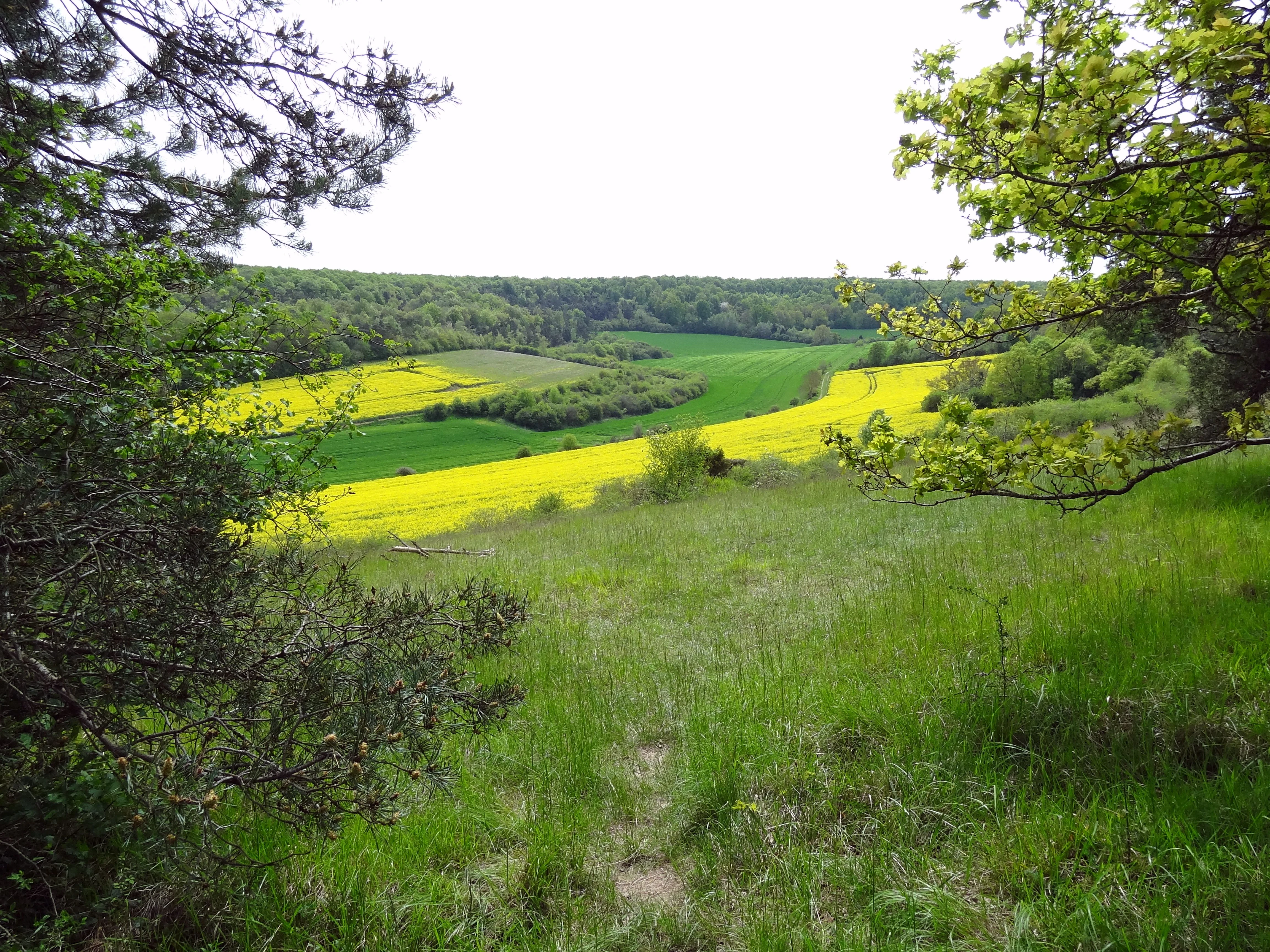
A wide view overlooking a valley with vibrant yellow fields and lush green meadows, framed by trees on the left and right sides.
A scenic view of the Vallée des Cailles landscape showing green meadows and blooming yellow fields.

Vallée des Cailles Regional Nature Reserve history and protected-area timeline

Human presence in the Vallée des Cailles stretches back tens of thousands of years. The valley's flint deposits attracted prehistoric use of the site, and archaeological evidence shows occupation from the Lower Paleolithic through the Neolithic. The abundance of workable stone generated an important lithic assemblage later recovered through excavations, making the valley one of the locally documented prehistoric flint-working locations of the region.

During the nineteenth century, the valley entered an industrial phase. A brickworks and a quarry operated on the site, exploiting clay-with-flint deposits and chalk from the valley slopes. These activities sat alongside the valley's growing nineteenth-century reputation for its distinctive dry-grassland flora, an appreciation that helped lay the groundwork for later protection.

In the twentieth century, agricultural abandonment gradually changed the valley's vegetation dynamics. Open dry grassland that had long been maintained by grazing persisted into the 1980s, after which reduced pastoral pressure began allowing woodland and scrub encroachment. Concern about this trajectory, combined with the recognized botanical richness of the site, prompted the commune of Boncourt and the Conservatoire d'espaces naturels to establish a voluntary nature reserve on 24 June 1999.

By délibération of 17 February 2012, the site was reclassified as a regional nature reserve (réserve naturelle régionale), strengthening its legal status within the French protected-area framework. A second management plan, covering 2012 to 2023 and approved in 2011, guides ongoing conservation work, integrating Vallée des Cailles within a wider network of ZNIEFF and Natura 2000 designations along the Eure valley and its tributary valleys.

Vallée des Cailles Regional Nature Reserve landscape and geographic character

The reserve occupies a roughly two-kilometer-long valley cutting into the chalk plateau of northern Eure-et-Loir. The shape of the valley is the dominant physical feature of the site: a narrow, asymmetrical chalk valley with contrasting exposures, small dolines on the southern slope, and flint-rich soils eroding from the steepening flanks. The name itself, Vallée des Cailles, refers to the small flint stones that weather out of the chalk and accumulate across the slopes and valley floor.

Geologically, the substrate is Cretaceous chalk of the Campanien stage, locally capped by clay-with-flint and loess. This produces thin, well-drained, calcareous soils, particularly on the slopes, where summer drought stress and good drainage favor thermophilous woodland and dry grassland rather than mesic forest. On the south-facing slope, the chalk is partly concealed by spontaneous woodland and historical conifer plantations, while the north-facing slope, more sheltered and cooler, retains its open character of dry grassland, scrub, and downy oak.

The reserve forms a clear ecological transition at the edge of the larger state forest of Dreux. Beyond its borders, the landscape shifts into managed forest, agricultural fields, and scattered hamlets of the Boncourt commune. Internally, the topography is gentle enough to be walked comfortably, and the network of slopes, valley bottom, dry swards, and woodland edge creates a compact but varied terrain that supports a wide range of habitats within a very small footprint.

Vallée des Cailles Regional Nature Reserve ecosystems, habitats, and plant life

Vallée des Cailles is fundamentally a calcareous habitat reserve. Its primary conservation interest is the mosaic of calcicolous communities developed on chalk and flint-rich soils under a relatively dry temperate oceanic climate, which distinguishes it from the more mesic forests that dominate much of the surrounding region.

The most ecologically significant component is the meso-xerophilous calcareous grassland on the north-facing slope, classed as a priority habitat of community interest. Around this core, the site supports thermophilous downy oak woodland (Quercus pubescens), Mediterranean-influenced scrub communities, and open calcareous swards rich in orchids and other specialists. On the south-facing slope, spontaneous broadleaved regeneration and older conifer plantations give a different ecological character, supporting more shade-tolerant species and providing structural contrast with the open north slope.

Five habitats of European community interest are recorded on the site overall, and the dry calcareous vegetation hosts a remarkable vascular flora of 317 species. Many of these are regionally uncommon calcicolous or thermophilous taxa, including several orchid species and plants of conservation concern. The site's botanical richness is amplified by the contrast in microclimate between the two slopes: species that favor warm, dry conditions concentrate on the south, while species tolerant of cooler, north-facing exposures persist on the opposing slope in surprisingly close proximity.

Vallée des Cailles Regional Nature Reserve wildlife and species highlights

Although the reserve's size limits its role as a refuge for large mammals, its habitat mosaic supports a meaningful cross-section of small fauna, invertebrates, and breeding birds typical of calcareous dry grassland systems in the Paris Basin.

Avifaunal surveys have recorded 18 bird species, including five confirmed breeding species, reflecting the value of the open and semi-open habitats for ground-nesting and insectivorous birds. Mammal records include 12 species, of which four are bats: Daubenton's bat (Myotis daubentoni), Geoffroy's bat (Myotis emarginatus), the greater mouse-eared bat (Myotis myotis), and the whiskered bat (Myotis mystacinus). The presence of multiple bat species indicates the importance of woodland edge, caves, and old structures in the area for roosting and foraging.

Reptile records include the sand lizard (Lacerta agilis), a species strongly associated with dry, sunny, structured habitats. Among invertebrates, the inventory highlights the small mountain cicada (Cicadetta montana), the praying mantis (Mantis religiosa), the stripe-winged grasshopper (Stenobothrus lineatus), and the saddle-backed bush-cricket (Ephippiger ephippiger), several of which prefer warm, open, floristically rich environments. While this is not a high-profile charismatic fauna site, the diversity of taxonomic groups confirms that the habitat mosaic functions as a living ecological system rather than solely a botanical refuge.

Vallée des Cailles Regional Nature Reserve conservation status and protection priorities

Vallée des Cailles matters from a conservation perspective because it preserves, in compact form, a habitat type that has become rare across the cultivated plains of northern France. Calcareous dry grasslands and their associated species have declined substantially across the Paris Basin due to agricultural intensification, abandonment of grazing, conifer afforestation, and urban expansion. The reserve holds one of the better-regarded remnants of this habitat in the Eure-et-Loir department, and it does so alongside supporting thermophilous oak woodland, scrub, and complementary habitat types.

The site is embedded in a layered conservation framework. It overlaps with ZNIEFF Type I site 240003921 "Pelouses de la Vallée des Cailles" and falls within ZNIEFF Type II area 2042 covering the Eure valley between Cherisy and Anet. It is also linked to the Special Area of Conservation FR2400552, which extends along the Eure valley from Maintenon to Anet and its tributary valleys, and stands adjacent to the Dreux protection forest. Five habitats of European community interest are recognized on site, including one priority habitat, giving the reserve direct relevance to the EU Habitats Directive.

Management is delivered by the Conservatoire d'espaces naturels of Centre-Val de Loire under the second management plan covering 2012 to 2023, approved in 2011. This plan addresses habitat maintenance, grazing reintroduction or continuation where appropriate, control of woodland encroachment on formerly open grasslands, monitoring of flora and fauna, and coordination with the surrounding forest and agricultural landscape to maintain the ecological integrity of the valley.

Vallée des Cailles Regional Nature Reserve cultural meaning and human context

The cultural identity of Vallée des Cailles is rooted in long human interaction with a small but resource-rich landscape. The flint-bearing chalk attracted Paleolithic and Neolithic hunter-gatherers and early farmers, whose knapping activities have left an unusually rich lithic record for such a compact site. This prehistoric heritage is part of how the valley is understood locally, with the name "Vallée des Cailles" itself preserving the everyday word for flint nodules.

In the modern era, the valley reflects the gradual transformation of rural land use in the Eure-et-Loir countryside. Nineteenth-century industrial activity (a brickworks and quarry) coexisted with rising appreciation of the valley's remarkable flora, foreshadowing today's conservation role. Twentieth-century grazing decline and the move toward protection in 1999 and 2012 mirror broader shifts in rural French land management, and the reserve now stands as a community-supported conservation project owned by the commune of Boncourt.

The interpretive trail encircling the site makes this layered history visible to visitors, integrating geological, archaeological, and ecological interpretation in a single short loop, and reinforcing the site's identity as a place where natural and human history overlap on a highly local scale.

Top sights and standout views in Vallée des Cailles Regional Nature Reserve

A four-kilometer interpretive trail circles the reserve, offering access to both slopes of the valley and their contrasting habitats within a single short walk; the site is also notable for its layered conservation status across ZNIEFF, Natura 2000, and protection forest frameworks, making it a strong example of small-site conservation in the Paris Basin.

Best time to visit Vallée des Cailles Regional Nature Reserve

Late spring and early summer are generally the most rewarding period for visiting Vallée des Cailles. The site's orchids and many of its characteristic calcareous grassland species flower in late spring, and the warm, dry conditions that define the reserve's ecology are most apparent from May through July, when the contrast between the open, sun-exposed north slope and the more wooded south slope is at its most visible.

Because the reserve lies in a temperate oceanic climate with relatively low spring rainfall and an annual mean around 11.2 degrees Celsius, summers tend to remain mild rather than extreme, and the dry grassland communities retain their open appearance well into August. Autumn brings changes in woodland color around the valley rim, while winter visits, though quieter botanically, can reveal the geomorphology of the chalk valley, including flint exposures and small dolines, more clearly. Visitors should expect the site to be most rewarding when the dry slopes are in flower and when bird and insect activity is at its seasonal peak.
Monthly climate preview

Long-term monthly climate measurements and temperature variations across the protected landscape

Annual Temperature and Precipitation Normals for Réserve naturelle régionale de la Vallée des Cailles

Representative baseline coordinates trace measured monthly temperature shifts alongside daily precipitation averages from 1991 to 2020. Examining the complete twelve-month record reveals full climatological norms and monthly averages across the protected area.
Annual mean11 °C
3 °C19 °C
Jan
Feb
Mar
Apr10°
May13°
Jun16°
Jul19°
Aug19°
Sep15°
Oct11°
Nov
Dec
Warmest month
July

18.6 °C

Coolest month
January

3.3 °C

Wettest month
December

2.4 mm/day

Driest month
March

1.5 mm/day

Park location guide

Geography guide, regional context, and park location map for Vallée des Cailles Regional Nature Reserve

Vallée des Cailles Regional Nature Reserve park geography, regions, and map view in France

Understand where Vallée des Cailles Regional Nature Reserve sits in France through a broader geographic reading of the surrounding landscape, nearby location context, and its mapped position within the national park landscape.

How Vallée des Cailles Regional Nature Reserve fits into France

France is a unitary semi-presidential republic and one of the world's largest economies. It borders Belgium, Luxembourg, Germany, Switzerland, Italy, Monaco, Andorra, and Spain, with a maritime border to the United Kingdom. The country is known for its cultural influence, art, cuisine, and political history spanning centuries.

Wider geography shaping Vallée des Cailles Regional Nature Reserve in France

France is located in Western Europe. Metropolitan France extends from the Rhine to the Atlantic Ocean and from the Mediterranean Sea to the English Channel and North Sea. The country borders Belgium, Luxembourg, Germany, Switzerland, Italy, Monaco, Andorra, Spain, and has a maritime border with the United Kingdom.

Map view of Vallée des Cailles Regional Nature Reserve

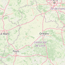
Use this park location map to pinpoint Vallée des Cailles Regional Nature Reserve in France, understand its exact geographic position, and read its mapped placement within the surrounding landscape more clearly.

Pigeon | © OpenStreetMap contributors

Location context for Vallée des Cailles Regional Nature Reserve

Centre-Val de Loire

Visual reference of chalk valley terrain, calcareous dry grasslands, and protected habitats

Réserve naturelle régionale de la Vallée des Cailles Photos and Landscapes

Visual documentation of Réserve naturelle régionale de la Vallée des Cailles reveals the distinct topography and vegetation mosaics of this protected chalk valley. Photographic records capture the contrasting slopes, rare orchids, and native woodland communities that define the local environment.

A wide view overlooking a valley with vibrant yellow fields and lush green meadows, framed by trees on the left and right sides.

Park atlas

Compare nearby chalk valleys, regional nature reserves, and protected landscapes across the surrounding region

Parks Near Réserve naturelle régionale de la Vallée des Cailles And Surrounding Protected Areas

Continue exploring protected areas near Réserve naturelle régionale de la Vallée des Cailles by browsing adjacent reserves and regional chalk valley landscapes. Comparing nearby habitats provides deeper context for chalk geology and rare botanical communities throughout north-central France.
Nature reserveÎle-de-France
About 28 km away#1 closest

Northeast

Réserve naturelle régionale du site géologique de Limay: Protected Landscapes and Geological Maps

A diverse nature reserve in the Yvelines department of Île-de-France.

Deeply rooted in the geological history of the Paris Basin, this former quarry site in Limay is now a thriving regional nature reserve. Its compact territory features a striking contrast between ancient limestone exposures and rich wetland pockets, providing a vital educational platform for studying biodiversity and land reclamation in north-central France.

Area
0.698 km²
Established
2009
IUCN
IV
Relief
Lowland
Watercolor painting of a wide, soft green landscape featuring rolling hills, scattered trees, and meadows under a warm sky.
Nature reserveÎle-de-France
About 29 km away#2 closest

Northeast

Réserve naturelle régionale de la boucle de Moisson: Protected Seine Meander and Plain

Regional Nature Reserve in Île-de-France

Located in the Yvelines department, this protected area occupies a striking loop of the Seine river. The reserve preserves a blend of open meadow plains and birch-rich woodlands, offering insight into river valley geography and local landscape patterns within the Île-de-France basin.

Area
3.163 km²
Established
2009
IUCN
IV
Nature reserveÎle-de-France
About 43 km away#3 closest

Northeast

Réserve naturelle régionale du site géologique de Vigny-Longuesse: A Geological Reference Site

Protected limestone landscape in the Vexin region of Île-de-France

Protecting a critical paleontological and stratigraphic record, this reserve showcases a unique Tertiary reef complex. The site combines artificial quarry cliffs with natural geomorphological features, including paleolandslides and fossil-bearing limestone plates, providing a comprehensive outdoor archive of the Paris Basin.

Area
0.219 km²
Established
2009
IUCN
IV
Relief
Upland
Nature reserveÎle-de-France
About 48 km away#4 closest

East

Réserve naturelle régionale du val et coteau de Saint-Rémy: Regional Nature Reserve Geography

A protected river valley and coteau habitat in Île-de-France

Spanning eighty-three hectares across five distinct parcels, this protected area serves as a vital ecological corridor along the Yvette river. Analyze the site's unique habitat distribution, ranging from moist bottomlands to dry, calcareous slopes, and trace its role in preserving regional biological diversity near Saint-Rémy-lès-Chevreuse.

Area
0.83 km²
Established
2008
IUCN
IV
Watercolor painting of a gentle, winding river or pond flowing through a green meadow with soft, rolling hills in the background under a pale sky.
Nature reserveÎle-de-France
About 48 km away#5 closest

Southeast

Réserve naturelle régionale des étangs de Bonnelles: Regional Nature Reserve Geography

Wetland ecosystem analysis in the Yvelines department.

Defined by its two core ponds, this regional nature reserve creates a critical mosaic of wetland, marsh, and woodland habitats. It stands out in the Île-de-France area as a concentrated zone of freshwater biodiversity, supporting a variety of avian and invertebrate life in a region where such undisturbed watery terrain is limited.

Area
0.221 km²
Established
1990
IUCN
IV
Relief
Lowland
A soft, painterly watercolor illustration depicting a winding river flowing through a green basin with rolling hills, grasses, and scattered trees under a light sky.
Nature reserveÎle-de-France
About 62 km away#6 closest

East

Réserve naturelle régionale du bassin de la Bièvre: Protected Wetland and Basin Geography

A vital urban nature reserve within the Île-de-France region

Located south of Paris, this six-hectare nature reserve demonstrates how an artificial stormwater basin can evolve into a functioning wetland. Its geography is defined by fluctuating water levels and reedbed habitats that provide sanctuary for migratory birds. Examine the protected boundaries and landscape terrain of this significant, compact ecological refuge in the Bièvre valley.

Area
0.06 km²
Established
2009
IUCN
IV
Relief
Lowland
A pale, soft watercolor painting of a calm wetland or marsh, featuring muted green vegetation, light water reflection, and a gentle shoreline under a hazy sky.
Nature reserveÎle-de-France
About 63 km away#7 closest

Northeast

Réserve naturelle régionale du marais de Stors: Atlas and Protected Landscape Overview

A rare wetland enclave in the Vallée de Chauvry

Focusing on the hydrological and ecological character of the Réserve naturelle régionale du marais de Stors, this overview examines its role as a protected nature reserve in the Paris region. Explore the marshland terrain and valley topography that define this unique pocket of conserved habitat in northern France.

Area
0.47 km²
Established
2009
IUCN
IV
Nature reserveNormandie
About 65 km away#8 closest

West

Réserve naturelle régionale de la clairière forestière de Bresolettes: Normandy Protected Landscapes

Mapping forest ecosystems and historic industrial water features in the Perche region.

Spanning roughly 780 hectares, this regional nature reserve serves as a vital biodiversity refuge in northwestern France. The landscape integrates mature woodland, wet meadows, and mire ecosystems that support rare flora and specialized fauna, offering a clear view of the complex environmental history of the Perche forest.

Area
7.8 km²
Established
2010
IUCN
IV

Common questions about visiting, size, designation, and location context for Vallée des Cailles Regional Nature Reserve

Vallée des Cailles Regional Nature Reserve FAQs for park facts, access, geography, and protected area context

Find quick answers about Vallée des Cailles Regional Nature Reserve, including protected-area facts, park geography, trail and visitor context, and how the park fits into its surrounding country and regional landscape.
MoriAtlas Explorer

Continue Your Protected Areas Search Across the Global Atlas

Deepen your exploration by continuing the structured search for national parks and protected areas worldwide. Utilize the comprehensive filtering capabilities to compare different conservation landscapes and refine your understanding of global park geography. Discover more about the distribution and characteristics of protected natural areas.

Global natural geography