
Mori Atlas logo
Nature reserveRéserve naturelle régionale de Lachaussée

Mapping the medieval pond ecosystems and historic water landscapes in the Woëvre region

Réserve naturelle régionale de Lachaussée: A Detailed Geographic Atlas of Protected Wetlands

The Réserve naturelle régionale de Lachaussée protects a significant mosaic of reedbeds, wet woodlands, and open water within the Meuse department of northeastern France. This geographic entry provides an atlas view of the protected landscape, tracing the history of the thirteenth-century pond dam and its vital role as a wetland habitat for avian species. Through mapped boundaries and environmental data, understand the ecological interplay between the water surface, marshy edges, and traditional agricultural land use in the Grand Est region.

regional nature reservewetlandspondreedbedswaterbirdsbirdwatching
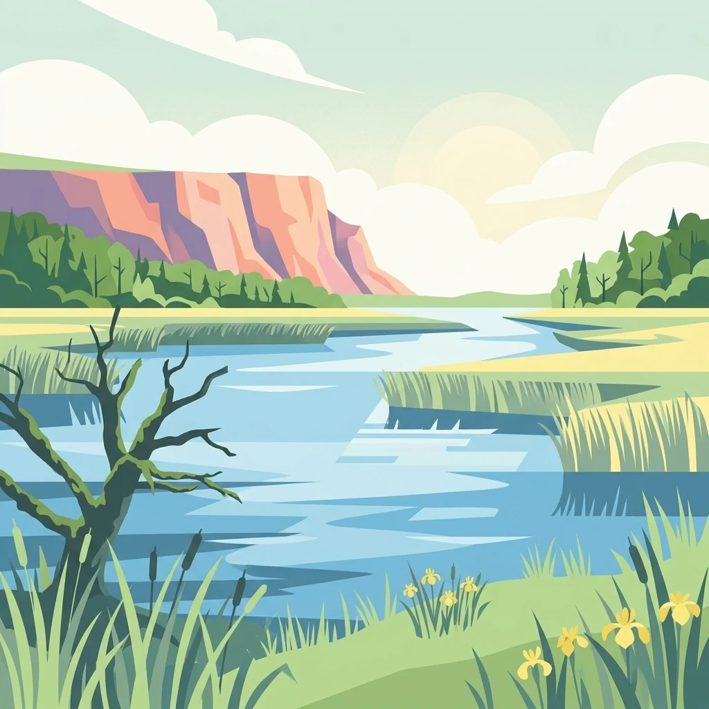
A stylized flat illustration of a wetland landscape featuring a calm blue river, marsh grasses, yellow flowers, and a large rock formation under a bright sky with soft clouds.

Réserve naturelle régionale de Lachaussée

Nature reserve

Park overview

Structured park overview, official facts, and landscape profile for Lachaussée Regional Nature Reserve

Lachaussée Regional Nature Reserve park facts, protected area profile, and essential visitor context

Review the core facts for Lachaussée Regional Nature Reserve, including designation, size, terrain, visitor scale, habitats, and operating context in one park-focused overview.

About Lachaussée Regional Nature Reserve

The Lachaussée Regional Nature Reserve protects a signature piece of the Woëvre, the broad, gently undulating plain east of Verdun in the Meuse department that has long been shaped by a network of ponds, wet forests, and small agricultural clearings. At its heart lies the Étang de Lachaussée, a roughly 300-hectare body of water originally established in 1273 when Count Thiébaut II of Bar ordered the construction of a dam that submerged four hamlets and produced the lake that still defines the landscape today. The reserve encompasses the pond, its fringing reedbeds, adjacent woodlands, and surrounding rural land, creating a coherent protected unit of about 607 hectares within Grand Est.

Ecologically, the reserve sits within a wider mosaic of Woëvre ponds, a habitat pattern recognized for its exceptional importance to wetland-dependent birds. The combination of open water, extensive reedbeds, and wooded margins supports breeding, wintering, and migratory populations of herons, bitterns, harriers, crakes, cranes, and many other species, while amphibians such as the European tree frog and the great crested newt reinforce the site's natural value. Insect life is also notable, including the emperor dragonfly and the scarce white-tailed darter among dragonflies, and the large copper butterfly among Lepidoptera.

Culturally and administratively, the reserve has accumulated several layers of recognition over time. It was inscribed as a nationally listed scenic site in 1981, designated under the Ramsar Convention in 1992, and included in the Natura 2000 network in 1995, before gaining its current Regional Nature Reserve status in 2009. The estate is managed jointly by the Conservatoire d'espaces naturels de Lorraine, the commune of Lachaussée, and the Association des paralysés de France, with practical site maintenance supported by a herd of Konik polski semi-wild horses. A visitor trail network of three signed footpaths (6, 12, and 15 kilometers long) starts from the Domaine du Vieux Moulin and links the main scenic and ecological features of the area.

Quick facts and research context for Lachaussée Regional Nature Reserve

Located in the Meuse department, east of France, in the Grand Est region, the reserve spans the communes of Lachaussée and Vigneulles-lès-Hattonchâtel. The protected area is classified as a Regional Nature Reserve under IUCN Category IV and was formally created by a deliberation of the Regional Council of Lorraine on 27 November 2009 for an initial period of twelve years. The pond that anchors the reserve was artificially created in the thirteenth century and now feeds primarily on surface runoff, while the surrounding reserve includes reedbeds, wet forest, meadows, and farmland.

The reserve is co-owned and co-managed by the Conservatoire d'espaces naturels de Lorraine, the commune of Lachaussée, and the Association des paralysés de France, which currently operates the estate. A Konik polski herd is used for site maintenance, and the active management plan adopted in December 2014 covers a six-year cycle. The Étang de Lachaussée also benefits from earlier designations, including a national inscription as a scenic site in 1981, Ramsar status since 1992, and Natura 2000 recognition since 1995.

Protection and recognition

Documented terrestrial protection scope, designation year, and official records

Protection Status and Designation History for Réserve naturelle régionale de Lachaussée

Exploration of Réserve naturelle régionale de Lachaussée reveals official terrestrial protection status established in 2009. Structured records organize the designation history and formal conservation parameters associated with this protected area.

Protection details

Protection scope
Terrestrial
Designated year
2009
Transboundary protection
No
WDPA ID
555514379
Park context

Deeper park guide and search-rich context for Lachaussée Regional Nature Reserve

Lachaussée Regional Nature Reserve history, landscape, wildlife, and travel context

Explore Lachaussée Regional Nature Reserve through its history, landscape character, ecosystems, wildlife, conservation priorities, cultural context, and seasonal travel timing in a structured park guide built for atlas discovery and search intent.

Why Lachaussée Regional Nature Reserve stands out

The reserve is best known for the Étang de Lachaussée, a large medieval pond embedded in the Woëvre wetland mosaic and renowned as a major staging and breeding ground for waterbirds. Its avifauna includes more than 200 observable species, with notable populations of herons, marsh harriers, bitterns, and migratory cranes that use the site for nesting, wintering, or rest during passage. Its secondary identity is tied to the layered human and ecological story of the Woëvre. A thirteenth-century engineered pond, a long continuity of noble stewardship, a working fishery tradition, and modern conservation practice all converge on the same landscape, giving the reserve a distinctive profile in which medieval European water management and contemporary biodiversity protection exist side by side.
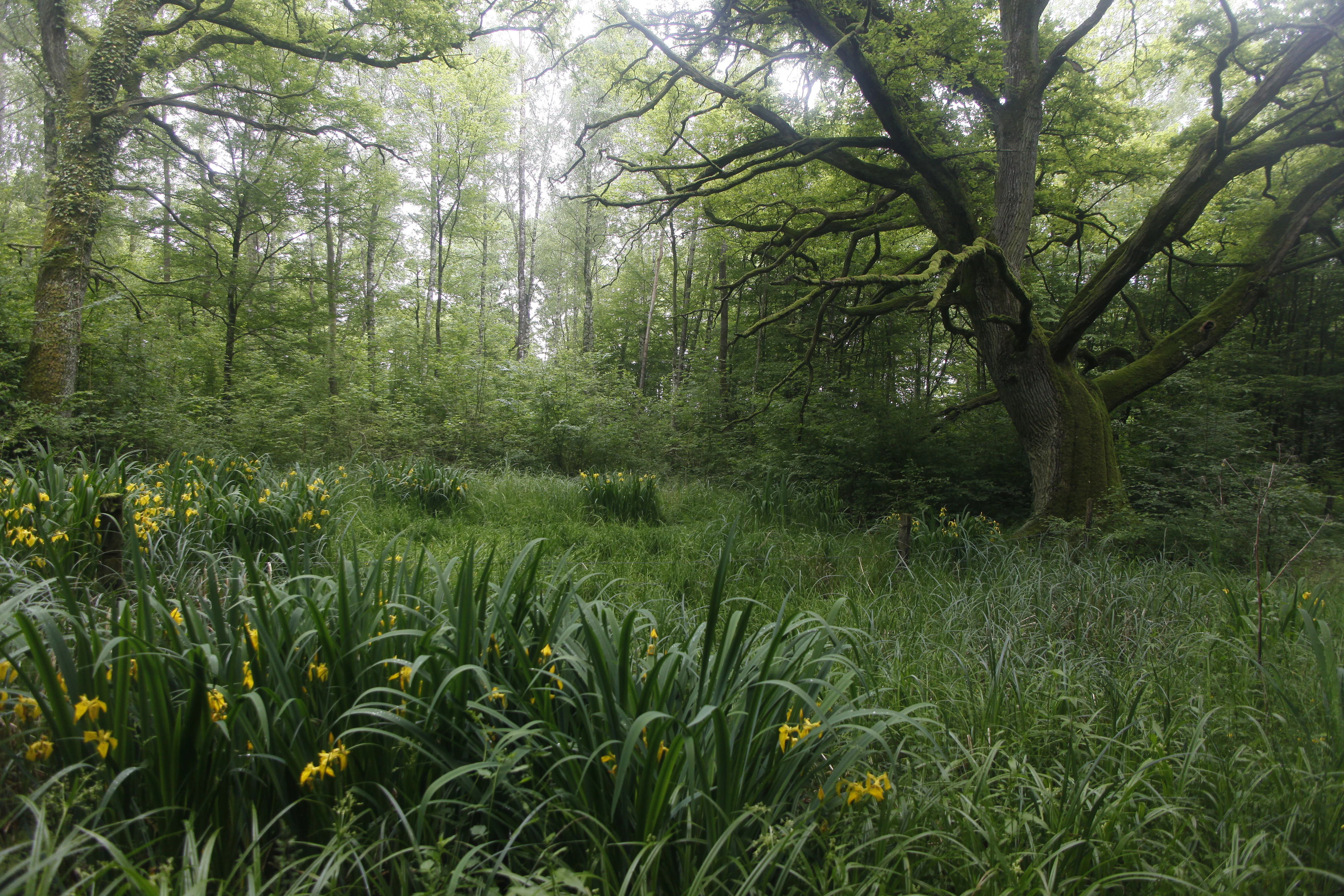
A misty, green forest floor filled with long grass and patches of yellow irises, with large, mossy oak trees in the background.
Oak trees and yellow irises in the woodland of Réserve naturelle régionale de Lachaussée.

Lachaussée Regional Nature Reserve history and protected-area timeline

The defining historical event of the site is the creation of the Étang de Lachaussée itself. In 1273, Count Thiébaut II of Bar ordered the construction of a dam whose eventual height caused the flooding that submerged four hamlets in the surrounding countryside. From that moment, the lake became a fixed feature of the Woëvre landscape, and the village of Lachaussée took shape at the foot of the embankment, taking its name from the chaussée, the historic name for the raised dam structure.

The pond and its surrounding estate were held for several centuries by the noble Wangen family. Christian de Wangen von Gerolsdeck (1900 to 1983) donated the property in 1978, transferring long-standing stewardship into a new phase. The traditional autumn net fishery, conducted from mid-October to mid-November each year and historically enacted with the participation of local villagers who dragged the nets before the fish were sold, remains a living cultural thread that the current owners continue to honor. Today the estate is operated by the Association des paralysés de France, which runs the Domaine du Vieux Moulin with activities including food service, accommodation, and the sale of local products.

From an ecological and legal standpoint, the site's modern protection history began before its formal reserve status. The Étang de Lachaussée and its surroundings were inscribed as a French national scenic site by ministerial order in 1981, recognized under the Ramsar Convention in April 1992, and included in the Natura 2000 ecological network in 1995. The Regional Nature Reserve itself was established on 27 November 2009 by a deliberation of the Regional Council of Lorraine for an initial twelve-year term, and a management plan validated in December 2014 guides the site's conservation for a six-year cycle.

Lachaussée Regional Nature Reserve landscape and geographic character

The Lachaussée reserve occupies a section of the classic Woëvre plain, a low-relief landscape in northeastern France where water has shaped terrain and land use for centuries. The Étang de Lachaussée dominates the visual experience, its broad, open expanse of water bordered by a man-made dam whose medieval origin still structures the surrounding topography. About half of the reserve's surface is open water, and the remaining area blends reedbeds, wet woodlands, meadows, and cultivated fields into a fine-grained mosaic.

The gentle relief of the Woëvre produces subtle but distinctive horizons: flat stretches of water backed by lines of trees, marshy edges colonised by reeds and rushes, and wooded islets rising above the water surface. The standing water is fed chiefly by surface runoff rather than by a large inflowing river, which gives the pond a particular hydrological personality and shapes the surrounding soils into saturated, wetland-friendly substrates. Together, these features create the visual character of a place where land and water meet in slow, layered transitions rather than dramatic contrasts.
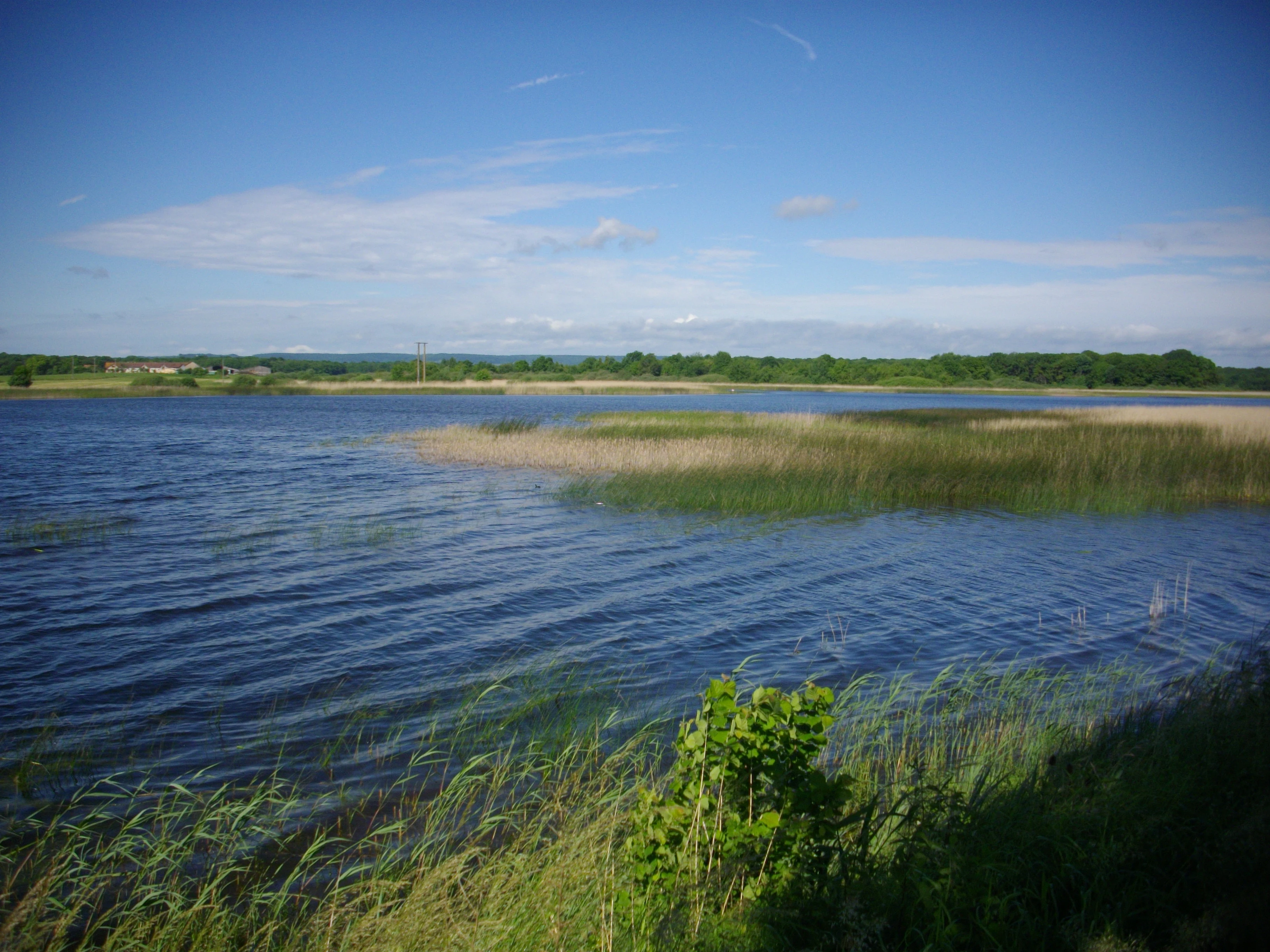
A wide view of a calm pond with tall marsh grasses along the shoreline under a bright blue sky.
The pond at Réserve naturelle régionale de Lachaussée, characteristic of the wetlands in the Woëvre region.

Lachaussée Regional Nature Reserve ecosystems, habitats, and plant life

The reserve's ecological identity is woven from a tight mosaic of aquatic, marshland, forest, and agricultural habitats typical of the Woëvre. Open water gives way to extensive reedbeds, then to wet woodland dominated by oak and other broadleaved trees, and finally to damper meadows and cultivated parcels. This sequence of habitats, repeated in slightly different combinations across the region's network of ponds, is what gives the Woëvre its exceptional value for biodiversity.

Vegetation in the reedbeds includes species such as the greater spearwort, the marsh ragwort, and the fringed water-lily, while submerged and shoreline floras include grasses-leaved water-plantain, sharp-leaved pondweed, marsh germander, and pennyroyal. The Bohemian sedge and other characteristic wet-grassland plants round out a flora adapted to fluctuating water levels. The result is a vegetation pattern in which aquatic species, marsh forbs, and water-tolerant trees coexist over short distances, producing high local ecological diversity within a comparatively compact area.

Lachaussée Regional Nature Reserve wildlife and species highlights

The reserve is internationally significant for birds, with more than 200 observable species reported. Breeding and visiting species include the red kite, the Eurasian bittern, the little bittern, the purple heron, the spotted crake, and the common crane, with the latter using the site during migration. The pond and reedbeds also support a wide spectrum of other waterbirds and marshland passerines, contributing to the site's strong ornithological profile within the broader Woëvre system.

Beyond birds, the reserve harbors a varied amphibian community that includes the European tree frog and the great crested newt, both species strongly tied to high-quality wetland mosaics. Dragonflies are exceptionally well represented, with the emperor dragonfly and the white-tailed darter among notable species, and more than thirty butterfly species have been recorded, including the threatened large copper. Mammals include the wildcat and a noteworthy bat community that includes the common noctule, the western barbastelle, the lesser and greater horseshoe bats, the greater mouse-eared bat, long-eared bats, and Geoffroy's bat, reinforcing the reserve's value as a refuge for fauna sensitive to disturbance and habitat continuity.

Lachaussée Regional Nature Reserve conservation status and protection priorities

The reserve embodies a layered conservation story in which a single site accumulates recognition under multiple frameworks over time. The Étang de Lachaussée and its surroundings were inscribed as a national scenic site in 1981, designated under the Ramsar Convention in April 1992, and incorporated into the Natura 2000 ecological network in 1995. Its Regional Nature Reserve status, granted in 2009, added a dedicated management-oriented layer with a binding plan adopted in December 2014.

From a biodiversity perspective, the reserve's conservation importance rests on the unusual concentration of breeding, wintering, and migratory waterbirds it supports, the integrity of its reedbed and wet-forest mosaic, and the presence of endangered or sensitive species such as the large copper butterfly, the white-tailed darter dragonfly, and multiple bat and amphibian species. Active management is multi-institutional, with the Conservatoire d'espaces naturels de Lorraine providing regional coordination alongside the commune of Lachaussée and the Association des paralysés de France as co-owners. The use of a Konik polski herd to graze key zones reflects a practical, low-mechanization strategy to maintain open wetland habitats within a working estate.

Lachaussée Regional Nature Reserve cultural meaning and human context

The Lachaussée landscape is inseparable from the human history of the Woëvre. The pond itself is an artifact of thirteen-century territorial planning, and the village of Lachaussée literally takes its name from the dam (chaussée) that created it after four earlier hamlets were submerged. This long history of human-engineered water management pre-dates modern conservation by hundreds of years and gives the reserve a distinctive cultural depth.

A noble stewardship tradition, most recently embodied by the Wangen family and culminating in Christian de Wangen von Gerolsdeck's 1978 donation of the estate, ties the present-day reserve to inherited land-practice. The annual autumn net fishery, once carried out with the help of villagers, is preserved as a living tradition, and the current operation by the Association des paralysés de France extends the site's social role through hospitality, catering, and the promotion of local products at the Domaine du Vieux Moulin.

Top sights and standout views in Lachaussée Regional Nature Reserve

The reserve's standout features form a compact but rich set: a thirteen-century, man-made pond of roughly 300 hectares that anchors the protected area; one of the most bird-rich inland wetlands in Lorraine, with more than 200 observable avian species; rare specialist invertebrates including the white-tailed darter dragonfly and the large copper butterfly; a multi-layered status as a Ramsar site, a Natura 2000 site, and a former national scenic site, all under one Regional Nature Reserve umbrella; and a working cultural landscape that pairs active ecological management with cycles such as the traditional autumn net fishery and the seasonal grazing of Konik polski horses.

Best time to visit Lachaussée Regional Nature Reserve

Seasonality strongly influences the experience of the Lachaussée reserve. Spring and early summer are typically the most rewarding periods for birdwatching, when reedbeds host breeding herons, bitterns, and crakes and amphibians such as the European tree frog are most visible around ponds and wet woodland. Migratory cranes and other passage species can also be encountered in spring.

Autumn brings its own distinctive atmosphere. The traditional net fishery takes place from mid-October to mid-November, transforming the pond into a working landscape and combining ecological observation with cultural heritage. Cooler autumn light also enhances the visual contrast between open water, reedbeds, and the surrounding oak woodlands. Winter visits are appealing for observing waterbird assemblages, while summer offers the richest dragonfly and butterfly activity, though reedbed access may feel more enclosed.

Monthly climate preview

Long-term representative point measurements for temperature and precipitation patterns

Réserve naturelle régionale de Lachaussée Climate Normals and Annual Weather Rhythm

Historical data records monthly temperature variations alongside daily precipitation rates across the sampled coordinate. Examining twelve-month averages reveals the long-term climatic rhythm governing the protected area.
Annual mean10 °C
1 °C19 °C
Jan
Feb
Mar
Apr
May13°
Jun17°
Jul19°
Aug19°
Sep15°
Oct10°
Nov
Dec
Warmest month
July

19 °C

Coolest month
January

0.9 °C

Wettest month
December

2.7 mm/day

Driest month
April

1.7 mm/day

Park location guide

Geography guide, regional context, and park location map for Lachaussée Regional Nature Reserve

Lachaussée Regional Nature Reserve park geography, regions, and map view in France

Understand where Lachaussée Regional Nature Reserve sits in France through a broader geographic reading of the surrounding landscape, nearby location context, and its mapped position within the national park landscape.

How Lachaussée Regional Nature Reserve fits into France

France is a unitary semi-presidential republic and one of the world's largest economies. It borders Belgium, Luxembourg, Germany, Switzerland, Italy, Monaco, Andorra, and Spain, with a maritime border to the United Kingdom. The country is known for its cultural influence, art, cuisine, and political history spanning centuries.

Wider geography shaping Lachaussée Regional Nature Reserve in France

France is located in Western Europe. Metropolitan France extends from the Rhine to the Atlantic Ocean and from the Mediterranean Sea to the English Channel and North Sea. The country borders Belgium, Luxembourg, Germany, Switzerland, Italy, Monaco, Andorra, Spain, and has a maritime border with the United Kingdom.

Map view of Lachaussée Regional Nature Reserve

Use this park location map to pinpoint Lachaussée Regional Nature Reserve in France, understand its exact geographic position, and read its mapped placement within the surrounding landscape more clearly.

Pigeon | © OpenStreetMap contributors

Location context for Lachaussée Regional Nature Reserve

Grand Est

Visualizing the medieval wetland mosaics, open waters, and rich habitats of the Woëvre plain

Réserve naturelle régionale de Lachaussée Landscapes, Scenery, and Protected Area Photos

Photographic records capture the expansive open waters and dense reedbeds that define the terrain of Réserve naturelle régionale de Lachaussée. Visualizing these protected wetland habitats provides deeper insight into the ecological character and subtle horizons of the surrounding regional landscape.

A misty, green forest floor filled with long grass and patches of yellow irises, with large, mossy oak trees in the background.

A wide, calm pond surrounded by lush green grasses and reeds, with a line of trees in the distance under a blue sky with scattered clouds.

A wide view of a calm pond with tall marsh grasses along the shoreline under a bright blue sky.

Park atlas

Compare adjacent wetland reserves and regional nature domains across northeastern France

Other Parks Near Réserve naturelle régionale de Lachaussée and Surrounding Protected Landscapes

Browsing nearby protected areas helps place the wetland habitats of Réserve naturelle régionale de Lachaussée into a broader regional context. Examining adjacent reserves reveals interconnected natural features and lowland ecosystems across the surrounding French countryside.
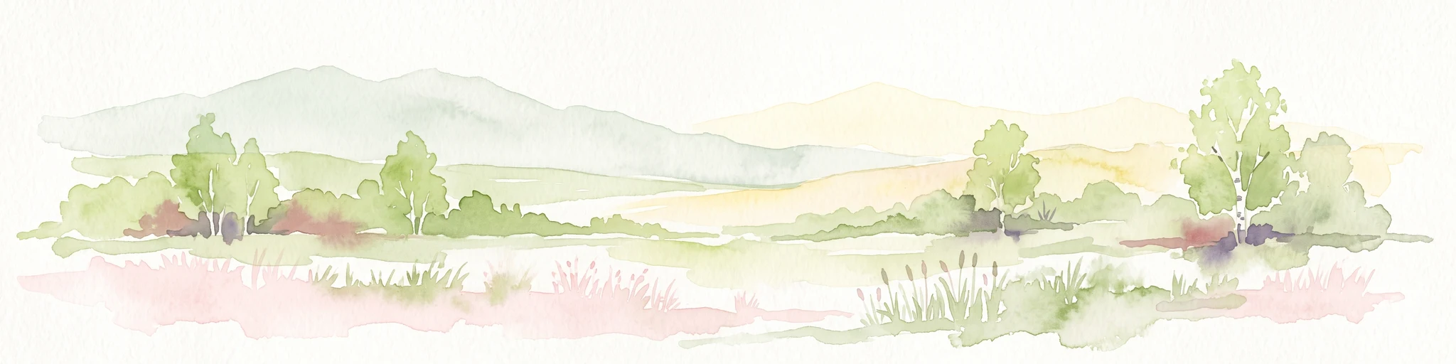
A soft watercolor painting of a wide, peaceful pond surrounded by gentle hills, trees, and marshy wetlands in a muted color palette.
Nature reserveGrand Est
About 30 km away#1 closest

Northwest

Réserve naturelle régionale de l'étang d'Amel: Protected Wetland Geography in Grand Est

Exploring the landscape and habitat history of France's first regional nature reserve

Spanning 147 hectares in the Meuse department, Réserve naturelle régionale de l'étang d'Amel provides a detailed look at a traditional Lorraine pond ecosystem. The site features a mix of reedbeds, marshes, and meadows that offer a sanctuary for protected bird and amphibian species. As a foundational project for French regional conservation, the reserve remains a vital case study in maintaining natural wetland structure within a managed agricultural landscape.

Area
1.47 km²
Established
2006
IUCN
IV
Nature reserveGrand Est
About 42 km away#2 closest

East

Réserve naturelle régionale de la côte de Delme: Protected Limestone Outlier and Grassland

Regional nature reserve in the Grand Est department of Moselle

Located in northeastern France, the Réserve naturelle régionale de la côte de Delme features a prominent Jurassic limestone hill known as a butte témoin. This protected area offers a rare glimpse into specialized calcareous grassland habitats, maintained through long-standing grazing traditions and dedicated conservation management across its diverse rocky slopes and open meadows.

Area
1.05 km²
Established
2007
IUCN
IV
Relief
Upland
Nature reserveLuxembourg
About 51 km away#3 closest

North

Ellergronn Nature Reserve: Mapping Protected Woodland and Industrial Collapse Terrain

An atlas of reclaimed post industrial habitats in southern Luxembourg

Ellergronn Nature Reserve acts as a case study in landscape reclamation, transforming former ironstone mining pits into a deep network of collapse ponds and diverse woodland. This protected area offers a look at how subsidence and quarrying have resulted in a unique mosaic of calcareous grasslands and forest pools, providing a clear map of Luxembourg's industrial environmental history.

Area
1.104 km²
Established
1988
Scope
Terrestrial
Water
Minor water
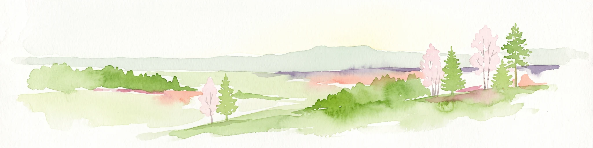
A minimalist watercolor illustration featuring rolling green hills, patches of trees, and a soft, light-toned foreground against a white background.
Nature reserveLuxembourg
About 54 km away#4 closest

North

Naturschutzgebitt Haard: Exploring Luxembourg's Largest Reclaimed Nature Reserve

Geography of a transformed iron-mining industrial landscape

Naturschutzgebitt Haard encompasses vast quarry faces and pioneer meadows, serving as a critical biodiversity hub within southern Luxembourg. The area offers an intricate landscape mosaic of calcareous grassland, recovering forest, and dramatic mining cliffs, providing a window into how post-industrial ground evolves into a protected refuge for specialized orchid and butterfly species.

Area
5.943 km²
Established
1994
Relief
Upland
Climate
Temperate
A minimalist watercolor painting showing rolling green hills and a gentle landscape under a light sky.
Nature reserveGrand Est
About 54 km away#5 closest

South

Réserve naturelle régionale des éboulis et pelouses calcaires de Pagny-la-Blanche-Côte et Champougny Landscape Overview

Geographic protected area in the Meuse department

Analyze the limestone scree and calcareous grassland habitats of this 49-hectare reserve. The site provides a focused look at the unique Jurassic-age formations and open-terrain conservation efforts managed within the Grand Est region, offering a clear map of its protected perimeter.

Area
0.493 km²
Established
2021
IUCN
IV
Watercolor painting of a green, rolling landscape with scattered trees and soft hills against a light background.
Nature reserveLuxembourg
About 54 km away#6 closest

North

Brucherbierg-Lallengerbierg Nature Reserve: Industrial Heritage and Protected Geography in Luxembourg

A restored Minett mining landscape and thriving dry-grassland ecosystem.

Brucherbierg-Lallengerbierg offers a window into the evolution of post-industrial terrain. Spanning 267 hectares in southern Luxembourg, the reserve protects a rugged landscape of cliffs, stony basins, and terraces that have been reclaimed by pioneer vegetation. Through careful ecological maintenance, the site serves as a prime example of habitat conservation, preserving a rare, open dry-meadow environment within the broader Minett industrial corridor.

Area
2.67 km²
Established
2016
Relief
Upland
Water
Minor water
Watercolor illustration of a landscape with rolling hills, a river, and green vegetation
Protected areaProvince of Luxembourg
About 55 km away#7 closest

North

Gaume Natural Park: A Protected Area Defining the Landscape of Province of Luxembourg

Explore its mapped natural landscape and geographic context.

Gaume Natural Park is a protected area offering a unique perspective on the natural landscapes found within Belgium's Province of Luxembourg. As a key geographic entity, it provides a vital component for atlas exploration, showcasing distinct mapped boundaries and regional terrain. Understand its significance as a protected natural space contributing to the Ardennes region's extensive geography, making it an essential point for structured discovery of protected lands.

Area
581.04 km²
Established
2014
IUCN
V
Relief
Lowland
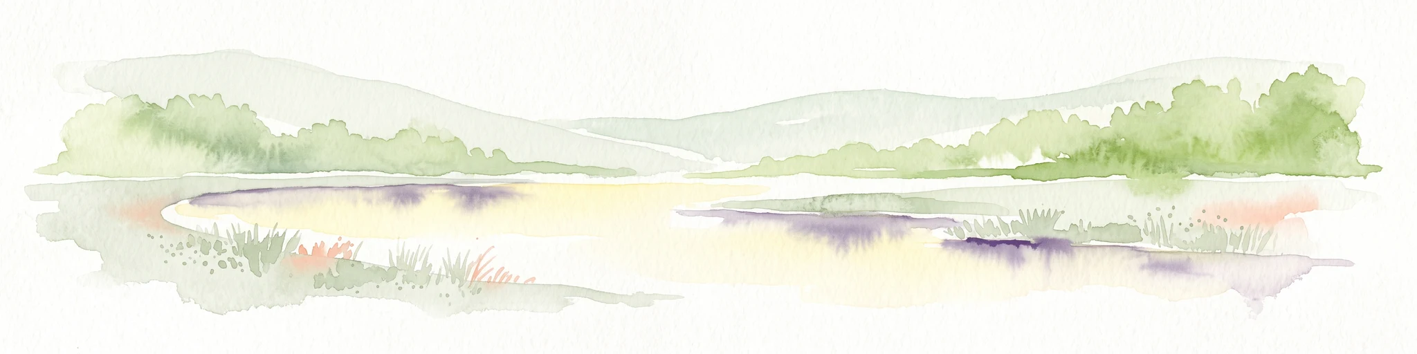
A horizontal watercolor painting showing a quiet wetland with light green vegetation, a shallow pool of water reflecting soft purples, and gentle hills in the background on a white background.
Nature reserveSchifflange
About 56 km away#8 closest

North

Brill Nature Reserve: Wetland Geography and River Restoration in Schifflange

Exploring the protected Alzette River floodplain and riparian habitat mosaic

Brill Nature Reserve stands as an ecologically significant protected area within the heavily developed valley of Schifflange, Luxembourg. This wetland sanctuary showcases a successful river restoration project, creating a dense network of ponds, reedbeds, and river-delta woodlands that function as a crucial refuge for wildlife amidst urban surroundings.

Area
0.197 km²
Established
1988
Relief
Lowland
Scope
Terrestrial

Common questions about visiting, size, designation, and location context for Lachaussée Regional Nature Reserve

Lachaussée Regional Nature Reserve FAQs for park facts, access, geography, and protected area context

Find quick answers about Lachaussée Regional Nature Reserve, including protected-area facts, park geography, trail and visitor context, and how the park fits into its surrounding country and regional landscape.
MoriAtlas Explorer

Continue Your Protected Areas Search Across the Global Atlas

Deepen your exploration by continuing the structured search for national parks and protected areas worldwide. Utilize the comprehensive filtering capabilities to compare different conservation landscapes and refine your understanding of global park geography. Discover more about the distribution and characteristics of protected natural areas.

Global natural geography