
Mori Atlas logo
Nature reserveRéserve naturelle régionale des bruyères de Sainte-Assise

Mapping the rare sandy landscapes and acidic habitats of the Seine-et-Marne river corridor

Réserve naturelle régionale des bruyères de Sainte-Assise and Protected Heathland Geography

The Réserve naturelle régionale des bruyères de Sainte-Assise preserves a distinct fragment of lowland heathland situated on the sandy plateaus near the Seine valley. Located within the Île-de-France region, this protected area serves as an essential ecological refuge where rare, heather-dominated vegetation persists against the surrounding suburban and agricultural landscape. The site features a unique juxtaposition of natural acidic soil terrain and technical infrastructure, maintaining representative examples of habitat types that are increasingly scarce in the Paris basin.

regional nature reservelowland heathlandheather habitatacidic soilsSeine valleyÎle-de-France
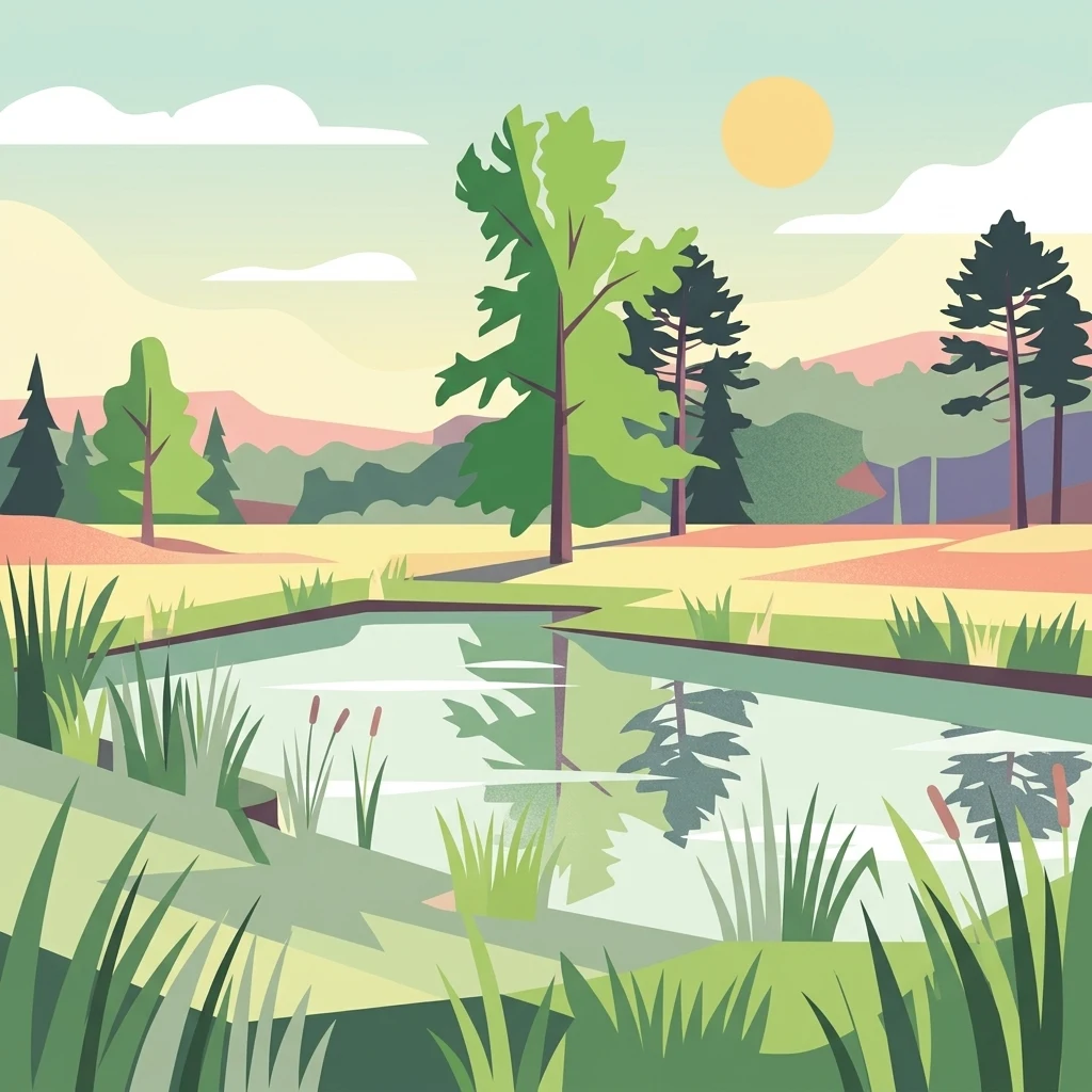
A digital illustration of a serene pond surrounded by grassy banks, tall reeds, and various trees under a soft sun, reflecting the surrounding landscape on the water surface.

Réserve naturelle régionale des bruyères de Sainte-Assise

Nature reserve

Park overview

Structured park overview, official facts, and landscape profile for Sainte-Assise Heather Regional Nature Reserve

Sainte-Assise Heather Regional Nature Reserve park facts, protected area profile, and essential visitor context

Review the core facts for Sainte-Assise Heather Regional Nature Reserve, including designation, size, terrain, visitor scale, habitats, and operating context in one park-focused overview.

About Sainte-Assise Heather Regional Nature Reserve

The Sainte-Assise Heather Regional Nature Reserve is a regional nature reserve located in the Île-de-France region in north-central France, within the Seine-et-Marne department. Spanning roughly 87 hectares, it occupies territory on the communes of Boissise-la-Bertrand and Seine-Port, in a stretch of countryside that lies southwest of the Paris urban area. The reserve protects a fragment of lowland heathland and the associated open, acidic habitats that once covered larger parts of the sandy plateaus of the Paris basin but have largely disappeared under modern land use.

The site's natural character is closely tied to its position near the Seine valley and to underlying sandy or siliceous substrates that historically supported heathers and other acid-loving plants rather than the richer woodland vegetation found across much of Île-de-France today. Over time, these open, fire- or grazing-maintained landscapes have been largely replaced by conifer plantations, cropland, or built-up areas. The reserve is therefore significant as one of the few remaining places in the region that still preserves something close to the original heathland community, including the characteristic heathers that give the site its name.

Around the protected core, part of the perimeter encloses the Sainte-Assise transmission site, an area occupied by numerous radio and telecommunications antennas. The coexistence of modern infrastructure with a regional nature reserve gives the site a distinctive profile, blending a protected ecological function with a long-established technical use. Despite its modest size, the reserve plays an important role in the regional network of protected areas tasked with safeguarding Île-de-France's rarer biodiversity, and it offers a small window into the open habitats that once characterized this part of northern France.

From an administrative perspective, the reserve is managed by the Agence des espaces verts de la région d'Île-de-France, the regional public agency responsible for green and natural spaces. Its classification on 22 October 2009 formalized its protection, with a subsequent deliberation on 21 November 2012 adjusting the list of parcels included. The official code RNR207 identifies it within the French regional nature reserve system.

Quick facts and research context for Sainte-Assise Heather Regional Nature Reserve

The Sainte-Assise Heather Regional Nature Reserve is situated in the Île-de-France region of northern France, within the Seine-et-Marne department and the communes of Boissise-la-Bertrand and Seine-Port. It protects approximately 87 hectares of lowland heathland near the upper Seine valley, an unusually rare habitat type in the Paris basin. Classified on 22 October 2009, it is administered by the Agence des espaces verts de la région d'Île-de-France as part of the regional nature reserve network. Its IUCN management category is IV, reflecting a habitat and species management focus, and its registration in international databases is generally represented under ID 555514375.

Protection and recognition

Documented terrestrial protection scope, management records, and official database identifiers

Protection Status and International Recognition Data for Réserve naturelle régionale des bruyères de Sainte-Assise

Terrestrial protection status, management scope, and official records define the documented conservation framework for Réserve naturelle régionale des bruyères de Sainte-Assise. Verified database identifiers provide reliable tracking for protected area designation history and international recognition data.

Protection details

Protection scope
Terrestrial
Transboundary protection
No
WDPA ID
555514375
Park context

Deeper park guide and search-rich context for Sainte-Assise Heather Regional Nature Reserve

Sainte-Assise Heather Regional Nature Reserve history, landscape, wildlife, and travel context

Explore Sainte-Assise Heather Regional Nature Reserve through its history, landscape character, ecosystems, wildlife, conservation priorities, cultural context, and seasonal travel timing in a structured park guide built for atlas discovery and search intent.

Why Sainte-Assise Heather Regional Nature Reserve stands out

The reserve is best known for being one of the rare surviving examples of lowland heathland (landes) in the Île-de-France region, a habitat defined by heathers and dry, acidic, open vegetation. In a metropolitan region where most of the natural land has been converted to agriculture, urbanization, or forestry, the persistence of heather-dominated communities at Sainte-Assise gives the site a particular ecological identity. Its location on the edge of the Seine valley, in a setting shaped by old sandy substrates, helps explain why these rare open habitats have survived here.
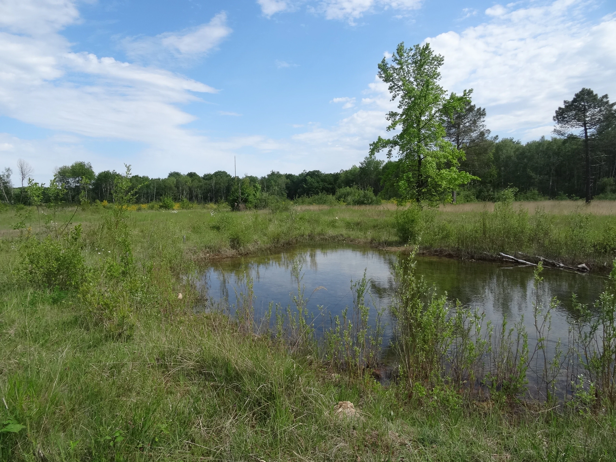
A small, still pond sits in the center of a grassy, open field, surrounded by sparse vegetation and a line of trees in the background under a partly cloudy blue sky.
A small pond nestled within the grassy heathland of the Réserve naturelle régionale des bruyères de Sainte-Assise.

Sainte-Assise Heather Regional Nature Reserve history and protected-area timeline

The historical record explicitly available for this site is limited. The reserve was formally classified as a regional nature reserve on 22 October 2009 by a regional deliberation, putting the site under the protective framework of the regional nature reserve network in France. A subsequent deliberation dated 21 November 2012 modified the list of land parcels included within the reserve, indicating an early administrative adjustment to its boundaries or composition.

Beyond the formal steps of creation and the boundary revision, the broader landscape history that shaped the reserve reflects long-term changes in land use across the Île-de-France region, where traditionally open dry habitats on poor soils were gradually abandoned, afforested, or built over. The portion of the reserve linked to the Sainte-Assise transmission site suggests an established background of non-natural use, with telecommunications antennas occupying part of the perimeter. The reserve's relatively recent formal protection, in 2009, illustrates a regional conservation effort to safeguard one of the few remaining examples of these habitats before further loss occurred.

Sainte-Assise Heather Regional Nature Reserve landscape and geographic character

The landscape of the reserve is shaped by its position on the lower terraces and sandy plateaus near the Seine valley, south of Paris. The terrain reflects the acid, well-drained soils of this part of Seine-et-Marne, which favor heathers (bruyères), gorse, and other low, open vegetation rather than dense deciduous woodland. The open character of the site, with its low shrubs and grassy patches, contrasts with the surrounding agricultural and suburban matrix and gives the reserve a visually distinct, open heathland feel.

A particular feature of the perimeter is the integration of the Sainte-Assise transmission site, where the smooth, low vegetation of the heathland meets the vertical lines of telecommunications antennas. This juxtaposition is part of the site's broader landscape character and explains why the protected area includes parcels that are not exclusively natural, while still surrounding their natural core sections. The overall impression is of a small, open, sandy-textured oasis embedded in a peri-urban landscape, with the Seine valley shaping the wider setting in which the reserve sits.

Sainte-Assise Heather Regional Nature Reserve ecosystems, habitats, and plant life

Ecologically, the reserve is most significant for protecting a fragment of lowland heathland, a habitat type based on heathers and associated dry, acidic vegetation. Such heaths are characteristic of sandy, nutrient-poor soils and have become extremely rare in the Paris region, where long history of settlement and land conversion has eliminated most of the original heathland communities. The site's flora and vegetation are therefore likely to be dominated by heather species, grasses, and open-ground specialists rather than the broadleaf forests typical of more fertile Île-de-France soils.

The narrower perch of this habitat type amid predominantly agricultural and urban surroundings gives ecological value to the reserve well beyond its hectare count. The dry, open conditions, exposure to sun, and underlying substrates together create conditions different from those of nearby woods or fields, allowing for specialized plants and insects associated with this environment. By representing a habitat type that is underrepresented across the regional network of protected areas, the reserve contributes to the ecological coverage of Île-de-France.

Sainte-Assise Heather Regional Nature Reserve wildlife and species highlights

The article provides little specific wildlife detail, and so detailed fauna claims would be speculative. In general terms, lowland heathland sites of this kind tend to host insects, reptiles, and ground-nesting or heath-loving birds that depend on open, dry, shrub-rich vegetation, often different from species found in the surrounding woodlands and fields. The combination of open spaces, sandy soils, and adjacent technical infrastructure creates a particular local environment whose specific wildlife inventory is not described in the available source. Returning a stronger wildlife profile would require information beyond what the article provides.

Sainte-Assise Heather Regional Nature Reserve conservation status and protection priorities

The conservation significance of the reserve is tied to the rarity of the habitat it protects rather than to its size. Lowland heaths are scarce in Île-de-France, and the reserve safeguards one of the remaining fragments in a region where such habitats have been heavily reduced by reforestation, agriculture, and urban growth. Its protection under the regional nature reserve framework formalizes its role in maintaining habitat diversity and provides a legal basis for managing threats such as vegetation closure, trampling, or invasive species.

Managed by the Agence des espaces verts de la région d'Île-de-France, the reserve fits into a broader regional strategy of conserving representative examples of Île-de-France's natural heritage. Its IUCN management category IV indicates a focus on habitat and species management, often through intervention to maintain the open character of the vegetation. Although small and partly bordering an antenna site, the reserve therefore offers a meaningful contribution to the conservation of heathland ecosystems in a metropolitan context.

Sainte-Assise Heather Regional Nature Reserve cultural meaning and human context

The site does not present a strong, separately documented cultural story. Regional natural reserves in Île-de-France are typically connected to local heritage through older landscapes shaped by traditional rural land use, and the heathland environment of Sainte-Assise reflects a historical rural setting often associated with pastures, rough grazing, and poor-soil land that resisted agricultural improvement. However, the article does not develop notable indigenous, folkloric, or community-based cultural aspects around the site, so a richer cultural framing would go beyond the available source material.

Top sights and standout views in Sainte-Assise Heather Regional Nature Reserve

Key distinguishing features of the Sainte-Assise Heather Regional Nature Reserve include its rarity value as one of the few surviving lowland heathland sites in Île-de-France, anchored in acidic, sandy substrates near the Seine valley. Its classification in 2009 and management by a specialized regional agency confirm its standing as a formal conservation site, while its modest scale keeps it an intimate, locally important reserve rather than a large-scale wilderness area. The unusual combination of open heathland habitat and a telecommunications antenna perimeter gives the site a distinctive visual identity within the regional network of protected areas.

Best time to visit Sainte-Assise Heather Regional Nature Reserve

Because the article does not describe seasonal characteristics in detail, broad framing is appropriate. Lowland heathland sites in the Île-de-France region are typically most expressive in late spring and summer, when heathers flower and the open vegetation reaches its most visible and fragrant expression. In cooler months the open character remains, but the color and activity of the habitat are reduced. The local climate of Seine-et-Marne near the Seine is broadly temperate, so durable visiting conditions are common across much of the year, though this guidance is general rather than site-specific.
Monthly climate preview

Long-term temperature ranges and monthly precipitation cycles across the representative coordinate

Réserve Naturelle Régionale des Bruyères de Sainte-Assise Climate and Annual Weather Patterns

Measured NASA POWER climatology records trace the annual temperature progression and daily precipitation rates across the protected representative point. Detailed monthly comparisons illustrate the full twelve-month weather rhythm for structured geographical analysis.
Annual mean11 °C
3 °C20 °C
Jan
Feb
Mar
Apr10°
May14°
Jun17°
Jul20°
Aug19°
Sep16°
Oct11°
Nov
Dec
Warmest month
July

19.6 °C

Coolest month
January

3 °C

Wettest month
December

2.2 mm/day

Driest month
March

1.5 mm/day

Park location guide

Geography guide, regional context, and park location map for Sainte-Assise Heather Regional Nature Reserve

Sainte-Assise Heather Regional Nature Reserve park geography, regions, and map view in France

Understand where Sainte-Assise Heather Regional Nature Reserve sits in France through a broader geographic reading of the surrounding landscape, nearby location context, and its mapped position within the national park landscape.

How Sainte-Assise Heather Regional Nature Reserve fits into France

France is a unitary semi-presidential republic and one of the world's largest economies. It borders Belgium, Luxembourg, Germany, Switzerland, Italy, Monaco, Andorra, and Spain, with a maritime border to the United Kingdom. The country is known for its cultural influence, art, cuisine, and political history spanning centuries.

Wider geography shaping Sainte-Assise Heather Regional Nature Reserve in France

France is located in Western Europe. Metropolitan France extends from the Rhine to the Atlantic Ocean and from the Mediterranean Sea to the English Channel and North Sea. The country borders Belgium, Luxembourg, Germany, Switzerland, Italy, Monaco, Andorra, Spain, and has a maritime border with the United Kingdom.

Map view of Sainte-Assise Heather Regional Nature Reserve

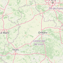
Use this park location map to pinpoint Sainte-Assise Heather Regional Nature Reserve in France, understand its exact geographic position, and read its mapped placement within the surrounding landscape more clearly.

Pigeon | © OpenStreetMap contributors

Location context for Sainte-Assise Heather Regional Nature Reserve

Île-de-France

Examine the rare lowland heathland habitats, sandy terrain, and unique scenery of a protected regional nature reserve.

Visual Exploration of Réserve naturelle régionale des bruyères de Sainte-Assise Photos and Protected Landscapes

Visual documentation captures the rare lowland heathland vegetation, acidic sandy terrain, and open heather landscapes preserved within Réserve naturelle régionale des bruyères de Sainte-Assise. Photographic records provide clear insight into the protected habitats and peri-urban environmental setting found south of Paris.

A small, still pond sits in the center of a grassy, open field, surrounded by sparse vegetation and a line of trees in the background under a partly cloudy blue sky.

Park atlas

Compare adjacent protected landscapes and rare lowland habitats across the surrounding region

Parks Near Réserve naturelle régionale des bruyères de Sainte-Assise and Regional Reserves

Browse other protected areas and regional nature reserves situated across the surrounding sandy plateaus and river valleys. Comparing adjacent conservation sites provides deeper context for regional habitat diversity and suburban green spaces.
A horizontal watercolor illustration depicting a soft, light-toned marshy landscape with green trees, reeds, and rolling hills in the background.
Nature reserveÎle-de-France
About 28 km away#1 closest

South

Réserve naturelle régionale du marais de Larchant: Protected Landscape and Map Context

Wetland ecosystems at the edge of the Gâtinais plateau

Located in the Seine-et-Marne department, this regional nature reserve features a dynamic calcareous marsh ecosystem shaped by the Gâtinais plateau scarp. The site serves as a vital hydrological nexus, providing essential habitats for waterbirds and wetland flora through cyclic aquifer-fed flooding and diverse terrain patterns.

Area
1.24 km²
Established
2008
IUCN
IV
Relief
Lowland
A soft, painterly watercolor illustration depicting a winding river flowing through a green basin with rolling hills, grasses, and scattered trees under a light sky.
Nature reserveÎle-de-France
About 31 km away#2 closest

Northwest

Réserve naturelle régionale du bassin de la Bièvre: Protected Wetland and Basin Geography

A vital urban nature reserve within the Île-de-France region

Located south of Paris, this six-hectare nature reserve demonstrates how an artificial stormwater basin can evolve into a functioning wetland. Its geography is defined by fluctuating water levels and reedbed habitats that provide sanctuary for migratory birds. Examine the protected boundaries and landscape terrain of this significant, compact ecological refuge in the Bièvre valley.

Area
0.06 km²
Established
2009
IUCN
IV
Relief
Lowland
Nature reserveÎle-de-France
About 33 km away#3 closest

Southeast

Réserve naturelle régionale de la colline Saint-Martin et des Rougeaux: Protected Area Atlas

Mapping limestone hill and dry valley habitats in Seine-et-Marne

Spanning roughly 28 hectares near the Seine valley, this nature reserve showcases a complex intersection of former quarry lands and limestone ecosystems. The site provides a critical protected corridor for bat fauna and diverse botanical species, serving as a distinct example of peri-urban conservation in north-central France.

Area
0.277 km²
Established
2024
IUCN
IV
Relief
Upland
A horizontal watercolor illustration showing a calm river winding around small tree-covered islands with low hills in the distance.
Nature reserveÎle-de-France
About 36 km away#4 closest

North

Réserve naturelle régionale des îles de Chelles: Protected River Islands in Île-de-France

Wetland ecosystems and riparian landscape geography

Located on the Marne River, this protected regional nature reserve encompasses a series of river islands known for their rich wetland biodiversity. The site offers a unique geographic perspective on urban-adjacent conservation, featuring a mosaic of riparian thickets and hygrophilous flora that contrasts with the surrounding Seine-et-Marne landscape.

Area
0.05 km²
Established
2008
IUCN
IV
Relief
Lowland
Nature reserveÎle-de-France
About 41 km away#5 closest

Northwest

Réserve naturelle régionale du val et coteau de Saint-Rémy: Regional Nature Reserve Geography

A protected river valley and coteau habitat in Île-de-France

Spanning eighty-three hectares across five distinct parcels, this protected area serves as a vital ecological corridor along the Yvette river. Analyze the site's unique habitat distribution, ranging from moist bottomlands to dry, calcareous slopes, and trace its role in preserving regional biological diversity near Saint-Rémy-lès-Chevreuse.

Area
0.83 km²
Established
2008
IUCN
IV
Watercolor painting of a gentle, winding river or pond flowing through a green meadow with soft, rolling hills in the background under a pale sky.
Nature reserveÎle-de-France
About 42 km away#6 closest

West

Réserve naturelle régionale des étangs de Bonnelles: Regional Nature Reserve Geography

Wetland ecosystem analysis in the Yvelines department.

Defined by its two core ponds, this regional nature reserve creates a critical mosaic of wetland, marsh, and woodland habitats. It stands out in the Île-de-France area as a concentrated zone of freshwater biodiversity, supporting a variety of avian and invertebrate life in a region where such undisturbed watery terrain is limited.

Area
0.221 km²
Established
1990
IUCN
IV
Relief
Lowland
A pale, soft watercolor painting of a calm wetland or marsh, featuring muted green vegetation, light water reflection, and a gentle shoreline under a hazy sky.
Nature reserveÎle-de-France
About 66 km away#7 closest

Northwest

Réserve naturelle régionale du marais de Stors: Atlas and Protected Landscape Overview

A rare wetland enclave in the Vallée de Chauvry

Focusing on the hydrological and ecological character of the Réserve naturelle régionale du marais de Stors, this overview examines its role as a protected nature reserve in the Paris region. Explore the marshland terrain and valley topography that define this unique pocket of conserved habitat in northern France.

Area
0.47 km²
Established
2009
IUCN
IV
Nature reserveÎle-de-France
About 76 km away#8 closest

Northwest

Réserve naturelle régionale du site géologique de Vigny-Longuesse: A Geological Reference Site

Protected limestone landscape in the Vexin region of Île-de-France

Protecting a critical paleontological and stratigraphic record, this reserve showcases a unique Tertiary reef complex. The site combines artificial quarry cliffs with natural geomorphological features, including paleolandslides and fossil-bearing limestone plates, providing a comprehensive outdoor archive of the Paris Basin.

Area
0.219 km²
Established
2009
IUCN
IV
Relief
Upland

Common questions about visiting, size, designation, and location context for Sainte-Assise Heather Regional Nature Reserve

Sainte-Assise Heather Regional Nature Reserve FAQs for park facts, access, geography, and protected area context

Find quick answers about Sainte-Assise Heather Regional Nature Reserve, including protected-area facts, park geography, trail and visitor context, and how the park fits into its surrounding country and regional landscape.
MoriAtlas Explorer

Continue Your Protected Areas Search Across the Global Atlas

Deepen your exploration by continuing the structured search for national parks and protected areas worldwide. Utilize the comprehensive filtering capabilities to compare different conservation landscapes and refine your understanding of global park geography. Discover more about the distribution and characteristics of protected natural areas.

Global natural geography