
Mori Atlas logo
Nature reserveRéserve naturelle régionale des coteaux du Fel

Map and explore the dry hillside habitats, oak woodlands, and meadows of this regional reserve.

Réserve naturelle régionale des coteaux du Fel, Protected Landscapes in Occitanie, France

The Réserve naturelle régionale des coteaux du Fel protects a distinct mosaic of hillside habitats above the Lot valley in the Occitanie region of southern France. This nature reserve features warm, sun-exposed slopes that support a varied mix of chestnut and oak woodlands, open heathland, and traditional meadow landscapes. The protected area serves as an essential site for dryland biodiversity within the broader geography of the Aveyron department, offering insights into the transition between agricultural land and natural terrain.

regional nature reservedry hillside habitatschestnut woodlandoak forestheathlandtraditional meadows
A stylized vector illustration of a river valley with terraced hillsides, pine forests, and steep rocky slopes under a light sky.

Réserve naturelle régionale des coteaux du Fel

Nature reserve

Park overview

Structured park overview, official facts, and landscape profile for Réserve naturelle régionale des Coteaux du Fel

Réserve naturelle régionale des Coteaux du Fel park facts, protected area profile, and essential visitor context

Review the core facts for Réserve naturelle régionale des Coteaux du Fel, including designation, size, terrain, visitor scale, habitats, and operating context in one park-focused overview.

About Réserve naturelle régionale des Coteaux du Fel

The Réserve naturelle régionale des Coteaux du Fel is one of the smaller but ecologically distinctive protected areas in southern France. It lies on the commune of Le Fel in the northern part of Aveyron, on the west-facing and south-facing slopes that frame the Lot valley shortly after the confluence between the Lot and the Truyère rivers. The setting is characteristic of the Lot valley system, where steep slopes descend toward the river and traditional rural land use has shaped patchwork habitats over centuries.

The reserve covers a compact area of dry hillside terrain, currently around 123 hectares, including a core zone of stronger protection on the west-facing slope and an additional area on the south-facing side of the Lot valley. Rather than protecting a single habitat type, the Coteaux du Fel protects a mosaic: chestnut-dominated woodlands blend into oak forest, open heaths, dry meadows, and pockets of old vineyard, all on slopes with warm exposure.

Ecologically, the reserve stands out for its dryland character and the fauna that depends on such landscapes. Reptiles such as the eyed lizard are among the most emblematic species, but the site is also important for woodland mammals like the hazel dormouse and wildcat, a suite of birds tied to open or semi-open countryside, and several bat species. The combination of chestnut and oak woodland, heathland, and traditional meadow creates a heterogeneous environment that supports a wide range of species within a small area.

At a broader scale, the Coteaux du Fel illustrate the role of France's regional nature reserve framework as a tool for safeguarding locally important habitats that might otherwise be lost to abandonment or intensification. The reserve is freely accessible via marked paths, making it also an example of how small protected areas in southern France can combine biodiversity conservation with informal public engagement.

Quick facts and research context for Réserve naturelle régionale des Coteaux du Fel

The Coteaux du Fel is a regional nature reserve classified in 2011 in the Occitanie region of France, in the northern Aveyron department, on the slopes of the Lot valley downstream of the Lot-Truyère confluence. The reserve protects approximately 123 hectares of dry hillside habitat that includes chestnut woodlands, oak forests, heaths, meadows, and vineyards. It is classified under IUCN category IV and is managed by the Aveyron delegation of the Ligue pour la Protection des Oiseaux. Its creation was directly linked to the discovery of the eyed lizard on the slopes of the Fel commune.

Protection and recognition

Documented protection records and administrative designation history for the protected area

Protection Status and International Recognition for Réserve naturelle régionale des coteaux du Fel

Examine the official protection status, management framework, and designated attributes recorded for Réserve naturelle régionale des coteaux du Fel. Review the verified international database references and structured conservation criteria associated with this protected landscape.

Protection details

WDPA ID
555514322
Park context

Deeper park guide and search-rich context for Réserve naturelle régionale des Coteaux du Fel

Réserve naturelle régionale des Coteaux du Fel history, landscape, wildlife, and travel context

Explore Réserve naturelle régionale des Coteaux du Fel through its history, landscape character, ecosystems, wildlife, conservation priorities, cultural context, and seasonal travel timing in a structured park guide built for atlas discovery and search intent.

Why Réserve naturelle régionale des Coteaux du Fel stands out

The reserve is best known for its warm, dry hillside habitats along the Lot valley and for the presence of the eyed lizard, a Mediterranean-affiliated reptile at the northern edge of its range in France. It is also recognized for its mosaic of chestnut woodland, oak forest, heathland, and traditional meadow habitats, a combination that has largely disappeared from more intensively managed French countryside. The conservation initiative that led to the reserve was unusual in being triggered by a single reptile species, the eyed lizard, which drew attention to the broader ecological value of the Coteaux du Fel slopes. This origin story has given the site a profile within France's network of small-area reserves focused on dryland biodiversity.
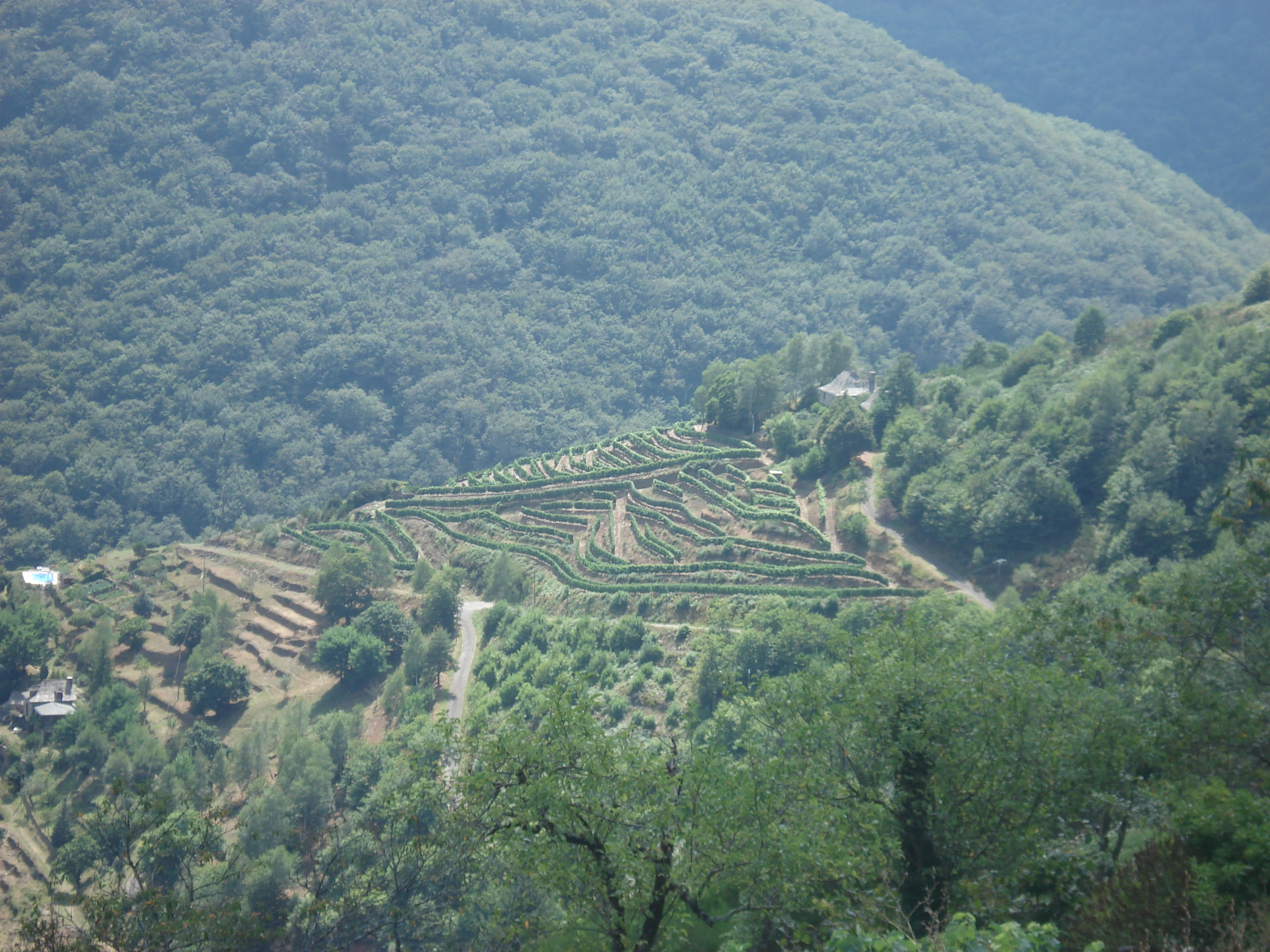
A high-angle view of terraced vineyard slopes carved into a hillside, surrounded by dense green forest in a valley setting.
Terraced slopes within the Réserve naturelle régionale des coteaux du Fel, showcasing the agricultural history of the valley.

Réserve naturelle régionale des Coteaux du Fel history and protected-area timeline

The idea for the Coteaux du Fel nature reserve emerged in 2002, when a population of eyed lizards was discovered on the slopes above Le Fel. This discovery highlighted the broader ecological value of the hillside habitats there and led to a long process of landowner engagement and institutional coordination.

The reserve was formally classified through a regional deliberation on 10 February 2011, initially covering 81 hectares, with a 10-year protection horizon. At its creation, the site was placed under the management of the Aveyron delegation of the Ligue pour la Protection des Oiseaux, an unusual arrangement that reflects the strong bird and broader biodiversity focus of the LPO's work in the region.

After the initial classification period, some landowners withdrew their support, but the commune of Le Fel, along with committed and adjacent property owners, requested a renewal. The reserve was reclassified on 21 October 2022, this time without a fixed end date, and its surface was extended to approximately 123 hectares. The renewal consolidated the reserve's long-term role within the regional network of protected areas in Occitanie.

Réserve naturelle régionale des Coteaux du Fel landscape and geographic character

The landscape of the Coteaux du Fel is dominated by the slopes of the Lot valley in northern Aveyron. The reserve occupies hillsides just downstream of the confluence between the Lot and the Truyère, where the river has cut a broad and open valley into the surrounding countryside. This valley setting gives the reserve its characteristic amphitheater of slopes, with sectors facing west and others facing south.

These exposures create warm, dry microclimates. Soils on the slopes tend to be shallow, and vegetation reflects this, with chestnut and oak woodlands interspersed with open heathland, dry meadows, and small patches of vineyard clinging to the hillsides. The combination of forest cover and open ground produces a varied hillside scenery, with frequent transitions between woodland, scrub, and herbaceous habitats that give the Coteaux du Fel a distinct rural character.

The topography itself is moderately steep, with paths and tracks winding through the slopes. From higher points, the Lot valley and surrounding ridges form a wide rural panorama typical of southern central France, blending agricultural land, woodland, and small villages into a continuous cultural landscape.

Réserve naturelle régionale des Coteaux du Fel ecosystems, habitats, and plant life

Ecologically, the Coteaux du Fel is defined by dry, sun-exposed hillside habitats. The site harbors a true mosaic of environments rather than a single dominant habitat type. Woodlands of chestnut and oak cover much of the slope, while open areas include dry meadows, heaths dominated by common heather, and remaining fragments of vineyard. Smaller features such as rock outcrops, edges, and clearings add further structural diversity.

This combination of habitats supports a flora adapted to acidic, well-drained soils and warm conditions. Beyond the dominant chestnut and oak trees, the reserve includes characteristic dryland species such as opposite-leaved golden saxifrage, common heather, bracken, and broom. The mix of closed woodland, semi-open scrub, and open ground gives the site its ecological identity and ensures that plants tied to different light and moisture conditions can coexist within a small area.

At a larger scale, the Coteaux du Fel forms one element in a wider network of dry hillside environments along the Lot and Truyère valleys. Protecting this mosaic helps maintain ecological connectivity for species that depend on traditional southern French rural landscapes dominated by chestnut, oak, and open ground.

Réserve naturelle régionale des Coteaux du Fel wildlife and species highlights

The wildlife of the Coteaux du Fel reflects the dry, mosaic character of the reserve. Reptiles are among the most notable groups, with the eyed lizard standing out as the species that triggered the reserve's creation. This reptile is at the edge of its range in this part of France, making its presence here of particular conservation interest.

Mammals include the hazel dormouse, a small woodland rodent tied to mature deciduous habitat, and the wildcat, whose presence on the wooded slopes indicates the continuity of forest cover in the area. Bats are also well represented, with species recorded including the western barbastelle, the lesser horseshoe bat, and Geoffroy's bat, all of which depend on a mixture of woodland, old structures, and open foraging areas.

The birdlife includes species associated with both woodland and open countryside. Notable breeding or visiting birds include the European nightjar, the wood warbler, the red-backed shrike, and the short-toed snake eagle, a Mediterranean raptor. In addition, the marbled newt and the golden-ringed dragonfly, the latter linked to nearby watercourses, contribute to the site's diversity. Together, these groups illustrate how a small dry hillside reserve can support a rich cross-section of southern French fauna.

Réserve naturelle régionale des Coteaux du Fel conservation status and protection priorities

The Coteaux du Fel nature reserve represents a focused effort to safeguard a small but ecologically significant piece of southern French countryside. Its conservation importance lies less in size than in the rarity and fragility of its dryland mosaic habitats, which have been shaped by centuries of traditional land use and are vulnerable to both abandonment and intensification.

The reserve's creation was unusual in being directly motivated by the discovery of the eyed lizard, a species whose presence signals high-quality dry habitat. This origin reflects a broader conservation lesson: protecting charismatic but localized species can also protect the wider ecological fabric of a site. Several other species of conservation interest are now known from the same slopes, including bats, woodland mammals, and birds of prey.

At the regional scale, the Coteaux du Fel contributes to the network of protected areas in Occitanie and the broader set of dry hillside habitats along the Lot and Truyère valleys. Its renewal in 2022 on a permanent basis, with an expanded area, signals the long-term commitment of the commune of Le Fel, its landowners, and the LPO Aveyron to maintaining this habitat mosaic as a refuge for southern French dryland biodiversity.

Réserve naturelle régionale des Coteaux du Fel cultural meaning and human context

The Coteaux du Fel lies at the heart of a rural area where chestnut woodlands, vineyards, and small pastoral holdings have long defined the local economy. The presence of old vineyard patches within the reserve is part of this cultural landscape, recalling the historical importance of viticulture on the sun-exposed slopes of the Lot valley.

The reserve's conservation history is also a story of community engagement. The project was driven by local landowners, the commune of Le Fel, and the Aveyron LPO delegation, and its renewal in 2022 depended on continued support from these actors. This pattern illustrates how small French nature reserves often depend on stable local cooperation to remain effective over the long term.

Top sights and standout views in Réserve naturelle régionale des Coteaux du Fel

Key features of the Coteaux du Fel reserve include its warm west- and south-facing slopes above the Lot valley, its mosaic of chestnut and oak woodland, heathland, meadows, and old vineyard, and its unusually rich dryland fauna for such a small area. The site is especially notable for the eyed lizard, along with species such as the hazel dormouse, wildcat, European nightjar, red-backed shrike, short-toed snake eagle, and several bat species.

Another highlight is the reserve's origin story. A single reptile discovery in 2002 set in motion a process that eventually produced one of Aveyron's distinctive regional nature reserves, expanded to about 123 hectares in 2022. This trajectory demonstrates how small-scale, locally driven conservation initiatives can lock in long-term protection for ecologically valuable landscapes.

Best time to visit Réserve naturelle régionale des Coteaux du Fel

Because the Coteaux du Fel is centered on dry, sun-exposed hillside habitats, the warmer months tend to bring out the character of the reserve, with chestnut and oak in full leaf, heaths in bloom, and reptiles and insects active on warm slopes. Spring can be a rewarding period to observe flowering heath species and breeding birds, while summer highlights the openness of the meadows and the thermal qualities of the slopes.

Autumn offers a more subdued atmosphere, with chestnut foliage and shifting light across the valley. Winters are mild in this part of southern France, but activity among reptiles and many insects is reduced. Visitors planning a walk on the marked paths should adjust their expectations to seasonal conditions, with milder seasons generally offering the richest combination of landscape color and wildlife encounters.

Monthly climate preview

Long-term monthly averages tracking temperature and precipitation profiles across the protected landscape

Climate Normals and Annual Temperature Rhythm for Réserve naturelle régionale des coteaux du Fel

Representative coordinate records show measured monthly averages scaling from a low of 2.49 degrees Celsius up to a peak mean of 20.63 degrees Celsius alongside consistent daily precipitation distributions. Examining the complete twelve-month climatology dataset reveals broader shifts in long-term temperature ranges and precipitation rhythms across the protected area.
Annual mean11 °C
2 °C21 °C
Jan
Feb
Mar
Apr
May13°
Jun17°
Jul20°
Aug21°
Sep16°
Oct12°
Nov
Dec
Warmest month
August

20.6 °C

Coolest month
January

2.5 °C

Wettest month
May

2.8 mm/day

Driest month
July

1.6 mm/day

Park location guide

Geography guide, regional context, and park location map for Réserve naturelle régionale des Coteaux du Fel

Réserve naturelle régionale des Coteaux du Fel park geography, regions, and map view in France

Understand where Réserve naturelle régionale des Coteaux du Fel sits in France through a broader geographic reading of the surrounding landscape, nearby location context, and its mapped position within the national park landscape.

How Réserve naturelle régionale des Coteaux du Fel fits into France

France is a unitary semi-presidential republic and one of the world's largest economies. It borders Belgium, Luxembourg, Germany, Switzerland, Italy, Monaco, Andorra, and Spain, with a maritime border to the United Kingdom. The country is known for its cultural influence, art, cuisine, and political history spanning centuries.

Wider geography shaping Réserve naturelle régionale des Coteaux du Fel in France

France is located in Western Europe. Metropolitan France extends from the Rhine to the Atlantic Ocean and from the Mediterranean Sea to the English Channel and North Sea. The country borders Belgium, Luxembourg, Germany, Switzerland, Italy, Monaco, Andorra, Spain, and has a maritime border with the United Kingdom.

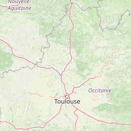
Map view of Réserve naturelle régionale des Coteaux du Fel

Use this park location map to pinpoint Réserve naturelle régionale des Coteaux du Fel in France, understand its exact geographic position, and read its mapped placement within the surrounding landscape more clearly.

Pigeon | © OpenStreetMap contributors

Location context for Réserve naturelle régionale des Coteaux du Fel

Occitanie

Visualizing the dry hillside habitats, woodlands, and protected valley terrain

Réserve naturelle régionale des coteaux du Fel Photos and Landscape Scenery

Photographic documentation reveals the steep valley slopes, chestnut woodlands, and mosaic meadows that define the protected landscape. Visual exploration of the terrain highlights the warm microclimates and diverse habitats supporting specialized dryland fauna.

A high-angle view of terraced vineyard slopes carved into a hillside, surrounded by dense green forest in a valley setting.

Park atlas

Compare adjacent valley habitats, dry hillside reserves, and regional protected terrain

Exploring Parks Near Réserve naturelle régionale des coteaux du Fel and Surrounding Protected Landscapes

Browsing other protected areas near Réserve naturelle régionale des coteaux du Fel reveals the diverse ecological patterns shaping southern French valleys. Comparing these regional reserves provides deeper geographic context for dryland habitats and hillside conservation networks.
A soft, horizontal watercolor painting depicting a gentle, rolling landscape with green hills, sparse trees, and a hazy background in pale green and pink tones.
Regional parkOccitanie
About 46 km away#1 closest

West

Parc naturel régional des Causses du Quercy: Protected Karst Plateaus and River Valleys

Geographic atlas of the Causses du Quercy karst landscapes

An essential look at the geography of Parc naturel régional des Causses du Quercy. This protected area in Occitanie features an expansive network of limestone plateaus and carved river gorges. Learn about the karst terrain, sedimentary history, and the natural boundaries that define this French regional park and internationally recognized geopark.

Area
1,855 km²
Established
1999
IUCN
V
Watercolor painting depicting a soft green landscape with rolling hills, riverbank vegetation, and a central waterway.
Nature reserveNouvelle-Aquitaine
About 56 km away#2 closest

Northwest

Réserve naturelle régionale des gorges de la Maronne et Tours de Merle: Protected Gorge Geography

Mapping the Maronne river basin and medieval towers in Nouvelle-Aquitaine

This protected area captures the distinct vertical relief of the Maronne river valley. The landscape profile includes steep rocky outcrops, narrow riparian corridors, and the historic site of the Tours de Merle. Exploring this regional reserve offers an understanding of how northern Massif Central ecosystems and medieval stone structures coexist within a protected framework in the heart of the Corrèze region.

Area
2.059 km²
Established
2025
IUCN
IV
Relief
Upland
Nature reserveOccitanie
About 60 km away#3 closest

West

Réserve naturelle régionale du marais de Bonnefont: Protected Wetland and Regional Atlas

Exploring the largest reedbed in the Lot department.

Situated in the heart of the Causses du Quercy, this protected nature reserve shelters the most significant reedbed in the Lot department of Occitanie. The site serves as a vital hydrological marker, demonstrating a rare transition between wetland habitats and the characteristic dry limestone plateaus of the region. This overview examines the geography, terrain, and structural importance of the reserve within the broader French protected lands network.

Area
0.42 km²
Established
2011
IUCN
IV
Relief
Lowland
Watercolor painting of a soft, hazy mountain landscape with rolling green fields and a distant forest, set against a light, warm, pale background.
Nature reserveAuvergne-Rhône-Alpes
About 65 km away#4 closest

Northeast

Réserve naturelle régionale des tourbières du Jolan et de la Gazelle: Geographic Overview

A vital wetland protected area in the Auvergne volcanic highlands.

Located in the Cantal department, the Réserve naturelle régionale des tourbières du Jolan et de la Gazelle features a unique collection of peatland habitats, trembling mires, and acidic grasslands. This area sits within the broader volcanic terrain of the Parc naturel régional des Volcans d'Auvergne, offering a protected catchment for diverse marshland flora and fauna.

Area
1.558 km²
Established
2018
IUCN
IV
Relief
Highland
Watercolor illustration of green fields, a river, and mountains under a soft pink and yellow sky
National parkOccitanie
About 73 km away#5 closest

Southeast

Cévennes National Park: Explore its Mapped Terrain and Protected Landscape in Occitanie

Discover the unique geographic context and park boundaries.

Cévennes National Park, situated in Occitanie, France, offers a rich exploration of mid-mountain Mediterranean geography. As a protected landscape, its mapped terrain features dramatic limestone plateaus, deep river gorges, and distinct granite massifs. This entry provides essential geographic context for Cévennes National Park, highlighting its unique natural features and its significance as a protected area within the broader regional atlas.

Area
937 km²
Established
1970
IUCN
V
Visitors
800K annual
Protected areaLot
About 75 km away#6 closest

West

Vallée de la Dordogne quercynoise: Regional Protected Area and River Valley Geography

A detailed geographic study of limestone slopes and riparian corridors in the Lot department.

Spanning 5,567 hectares across the Lot department, this protected area preserves the ecological integrity of the Dordogne river. The region is marked by its transition from narrow, hill-enclosed upstream stretches to broader floodplain zones, creating a complex habitat mosaic of alluvial meadows, travertine springs, and rocky chasmophytic slopes that support important European biodiversity.

Area
55.67 km²
Established
2007
Relief
Upland
Climate
Temperate
A soft watercolor painting depicting rolling green hills and distant faint mountains under a light sky.
Nature reservePuy-de-Dôme
About 93 km away#7 closest

Northeast

Réserve naturelle nationale du rocher de la Jaquette Protected Area and Volcanic Landscape

Explore rocky cliffs and rare entomological habitats in the Puy-de-Dôme region.

Situated on the flanks of a volcanic outcrop above the Rentières valley, this nature reserve protects a diverse habitat mosaic within the Massif Central. The site provides essential breeding grounds for protected raptors and represents one of the most significant insect sites in central France, offering a clear view into regional volcanic ecology and mountain-valley geography.

Area
0.362 km²
Established
1976
IUCN
IV
Relief
Mountain
A watercolor illustration of a serene landscape with rolling hills, a meandering river, and soft light.
Regional parkAuvergne-Rhône-Alpes
About 110 km away#8 closest

East

Parc naturel régional des Monts d'Ardèche: Protected Landscapes and Geographic Map Context

Volcanic highland terrain within the Auvergne-Rhône-Alpes region

Covering over 248,000 hectares, Parc naturel régional des Monts d'Ardèche represents a significant protected area in the southern Massif Central. The region is marked by its distinctive volcanic sucs, including Mont Gerbier-de-Jonc, and a complex network of Cévenol river valleys. It remains a focal point for understanding the transition between high volcanic plateaus and traditional terraced agricultural slopes in southeastern France.

Area
2,280 km²
Established
2001
IUCN
V

Common questions about visiting, size, designation, and location context for Réserve naturelle régionale des Coteaux du Fel

Réserve naturelle régionale des Coteaux du Fel FAQs for park facts, access, geography, and protected area context

Find quick answers about Réserve naturelle régionale des Coteaux du Fel, including protected-area facts, park geography, trail and visitor context, and how the park fits into its surrounding country and regional landscape.
MoriAtlas Explorer

Continue Your Protected Areas Search Across the Global Atlas

Deepen your exploration by continuing the structured search for national parks and protected areas worldwide. Utilize the comprehensive filtering capabilities to compare different conservation landscapes and refine your understanding of global park geography. Discover more about the distribution and characteristics of protected natural areas.

Global natural geography