
Mori Atlas logo
Nature reserveRéserve naturelle régionale des îles de Chelles

Mapping the ecological sanctuary of the Marne River within the Île-de-France region

Réserve naturelle régionale des îles de Chelles: A Protected River Island Wetland Landscape

(Réserve naturelle régionale des îles de Chelles (RNR174))

The Réserve naturelle régionale des îles de Chelles forms a distinct protected riparian landscape on the Marne River, situated in the commune of Chelles in the Île-de-France region. This nature reserve safeguards a cluster of islands that support critical wetland biodiversity, including hygrophilous vegetation and riparian thickets. By preserving these riverine microhabitats, the protected area maintains essential ecological corridors adjacent to the dense metropolitan development of the Paris outskirts.

regional nature reserveriver islandsMarne riverurban-adjacent natureriparian habitathygrophilous vegetation
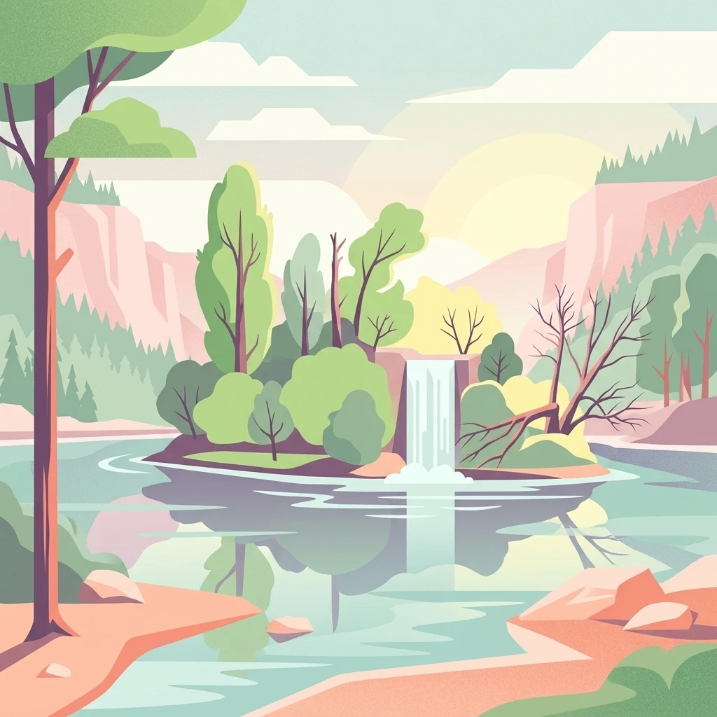
Digital illustration of a river scene with a central island, a small waterfall, and surrounding trees, rendered in a soft pastel color palette.

Réserve naturelle régionale des îles de Chelles

Nature reserve

Park overview

Structured park overview, official facts, and landscape profile for Réserve naturelle régionale des îles de Chelles

Réserve naturelle régionale des îles de Chelles park facts, protected area profile, and essential visitor context

Review the core facts for Réserve naturelle régionale des îles de Chelles, including designation, size, terrain, visitor scale, habitats, and operating context in one park-focused overview.

About Réserve naturelle régionale des îles de Chelles

Set on an unnavigable stretch of the Marne river within the commune of Chelles, the Réserve naturelle régionale des îles de Chelles protects a fragmented but ecologically meaningful group of river islands just east of Paris. Although the surface area is small, around 5 hectares, the reserve's location in a river corridor otherwise lined by urban development gives it a disproportionate importance for local biodiversity and river habitat preservation in Île-de-France.

Boat traffic along this part of the Marne has historically been diverted into a parallel navigation canal extending roughly 8.8 kilometers between Neuilly-sur-Marne downstream and Vaires-sur-Marne upstream. The natural river channel, set aside for the reserve, has been allowed to develop its own riparian dynamics, generating the mosaic of hygrophilous vegetation, shrubby thickets, and spontaneous wild herbaceous stands that characterize the islands today.

The reserve sits within the broader territory of the Communauté d'agglomération Paris - Vallée de la Marne, which acts as its managing authority. Its proximity to dense residential neighborhoods and transport infrastructure makes it a remarkable example of natural heritage conservation embedded directly within a metropolitan hinterland. Despite the constrained surface, it shelters plant species protected at the regional level and supports breeding populations of several bird species typical of healthy lowland river systems.

Quick facts and research context for Réserve naturelle régionale des îles de Chelles

The Réserve naturelle régionale des îles de Chelles is a French regional nature reserve (réserve naturelle régionale) located on the Marne river in the commune of Chelles, Seine-et-Marne, in the Île-de-France region. It covers about 5 hectares across a group of river islands in a non-navigable section of the Marne, where a parallel navigation canal carries boat traffic instead. Classified on 27 November 2008 and IUCN Category IV, the reserve replaced a former Réserve Naturelle Volontaire created in 2001. It is administered by the Communauté d'agglomération Paris - Vallée de la Marne.

Protection and recognition

Documented terrestrial protection scope, designation year, and official dataset records

Protection Status and Designation History for Réserve naturelle régionale des îles de Chelles

Terrestrial protection status records for Réserve naturelle régionale des îles de Chelles outline the established designation history dating from 2008. Official database metrics trace the documented conservation scope and administrative identifiers for the protected area.

Protection details

Protection scope
Terrestrial
Designated year
2008
WDPA ID
555514343
Park context

Deeper park guide and search-rich context for Réserve naturelle régionale des îles de Chelles

Réserve naturelle régionale des îles de Chelles history, landscape, wildlife, and travel context

Explore Réserve naturelle régionale des îles de Chelles through its history, landscape character, ecosystems, wildlife, conservation priorities, cultural context, and seasonal travel timing in a structured park guide built for atlas discovery and search intent.

Why Réserve naturelle régionale des îles de Chelles stands out

The reserve is best known for preserving an island-and-river wetland ecosystem of genuine ecological interest immediately adjacent to the Paris metropolitan area. Its combination of hygrophilous island vegetation, spontaneous riparian thickets, and surprisingly diverse birdlife, including breeding species such as the European kingfisher, has made it a small but valued reference site for urban-adjacent biodiversity in Île-de-France.
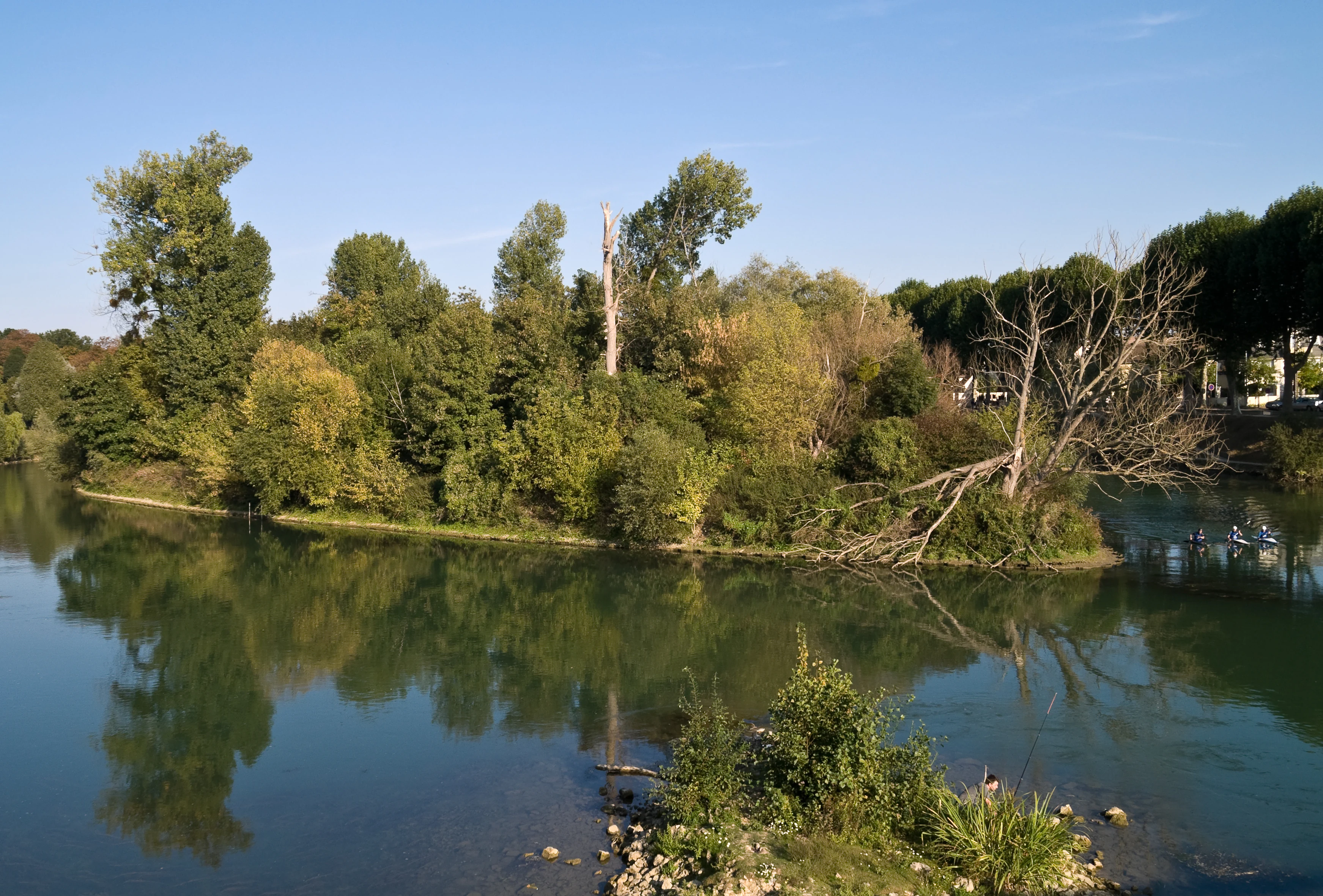
A peaceful river scene featuring a lush island with dense trees and a fallen branch extending into the water, reflecting the sky and vegetation.
A view of the Ile Refuge, a forested river island within the Réserve naturelle régionale des îles de Chelles on the Marne river.

Réserve naturelle régionale des îles de Chelles history and protected-area timeline

The protection history of the islands began in earnest in 1989, when the municipality of Chelles decided to redevelop its banks of the Marne, entrusting the local development company SESM with projects that included riparian works, quays, real estate developments, and a marina. The 1991 local urban plan would have endorsed these developments, but in 1993 the Versailles Administrative Court overturned the portion of the plan concerning the ZAC des bords de Marne for incompatibility with the regional Master Plan for Île-de-France. Only the rock-armoring of the islands and banks remained permissible; however, by that point the 1878 Moulin building had already been demolished in August 1991.

Environmental associations then mobilized against a subsequent municipal push to continue armoring the islands in line with the original marina scheme. After inspectors from the DIREN visited the islands in 1995, the municipality accepted a conservation-oriented plan in 1997. This led to the creation on 8 February 2001 of the Réserve Naturelle Volontaire (RNV) des îles mortes de Chelles, a voluntary nature reserve classification. In 2002 the voluntary reserve regime was abolished and replaced by regional nature reserves, and on 27 November 2008 the regional council formally reclassified the site as the Réserve naturelle régionale des îles de Chelles, the designation it retains today.

In 2004, the municipality undertook the naming of the individual islands within the reserve, an effort that gave the site a clearer identity and made ongoing ecological management easier. The reserve's continuing administration by the Communauté d'agglomération Paris - Vallée de la Marne reflects the broader shift from purely municipal stewardship to inter-communal management of natural heritage in the eastern Paris suburbs.

Réserve naturelle régionale des îles de Chelles landscape and geographic character

The landscape of the reserve is defined entirely by its riverine character. A series of low-lying islands sits within a non-navigable stretch of the Marne, separated from active boat traffic by a parallel navigation canal that handles shipping between Neuilly-sur-Marne downstream and Vaires-sur-Marne upstream.

The islands present a gentle, flat topography shaped by seasonal water level fluctuations, sediment deposition, and historical human interventions along the banks. Their vegetation grades from hygrophilous communities along the water's edge to shrubby thickets on slightly higher ground, interspersed with patches of spontaneous riparian wild herbaceous growth. Under winter conditions, particularly when the river channel freezes and snow settles on the islands, the site takes on a notably calm, almost secluded atmosphere in contrast with the dense urbanization visible from the banks.

Although small in absolute terms, the island mosaic creates a continuous weave of varied microhabitats, each shaped by its position relative to the main channel and by the history of bank works around the reserve. This combination of river islands, regulated water levels, and contiguous riparian land use forms the core physical setting of the protected area.
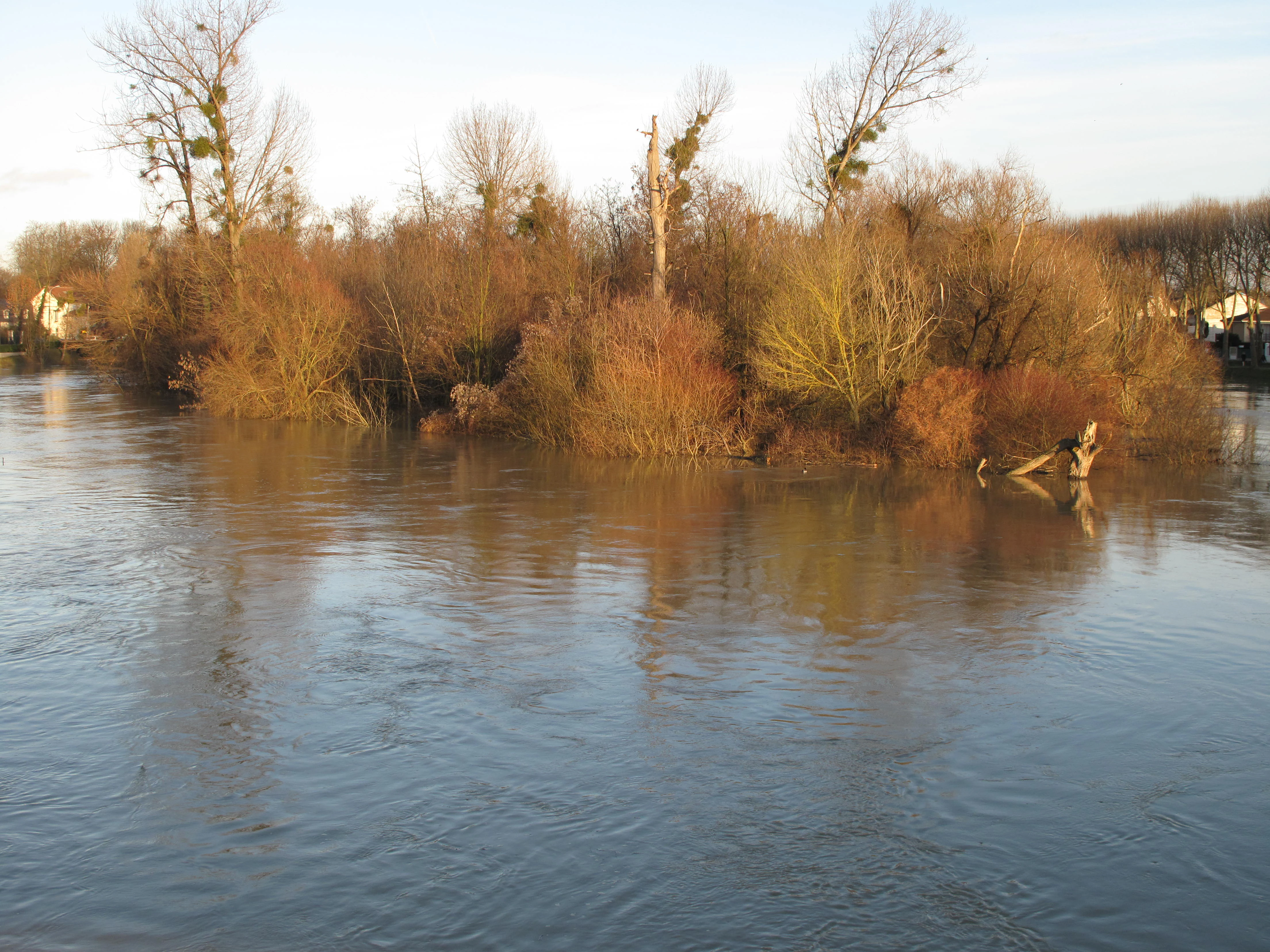
A view of a small island covered in dormant winter vegetation surrounded by the flowing waters of the Marne River.
Ile Refuge island on the Marne River during winter.

Réserve naturelle régionale des îles de Chelles ecosystems, habitats, and plant life

Ecologically, the islands function as a compact hygrophilous complex whose biodiversity is sustained by the interplay between river dynamics, island topography, and the absence of intensive land use. The hygrophilous and shrubby vegetation typical of river-island environments dominates the site, complemented by patches of riparian fallow land in which spontaneous wild herbaceous communities have established themselves.

Two of the recorded plant species are protected at the regional level within Île-de-France: Cardamine impatiens and Cuscuta grandiflora, both indicators of sensitive hygrophilous habitats. Their presence on an island complex less than 20 kilometers from central Paris underlines the ecological value of preserving even small river-island systems in heavily urbanized regions.

The river channel and its banks support a coherent aquatic and semi-aquatic ecosystem. Fish populations described as the local piscifaune inhabit the waters around the islands, while the combination of open water, shrub cover, and sheltered banks provides habitat structure for nesting and feeding birds. The overall ecological character of the reserve is therefore that of a small, self-contained riparian island system with multiple interconnected habitat layers, from submerged aquatic environments to emergent shrubby vegetation.

Réserve naturelle régionale des îles de Chelles wildlife and species highlights

Given its location within the densely populated eastern suburbs of Paris, the wildlife profile of the reserve is unusually rich. Documented observations include 53 bird species, of which 17 are confirmed breeders on or around the islands. Among the most regularly observed species are the European kingfisher and the grey wagtail, both strongly associated with healthy lowland river corridors and good water quality.

The aquatic environment supports a local fish fauna of 17 river fish species, a notable diversity for such a confined stretch of the Marne. Species recorded include the bitterling and the burbot, both of which are characteristic of European lowland river systems and sensitive to habitat degradation.

The reserve's value for wildlife lies less in rare or emblematic species than in the persistence of a functional breeding and feeding habitat for typical riverine fauna in an urban-adjacent setting. The combination of nesting cover, varied aquatic habitats, and limited human disturbance allows a bird and fish community of real regional interest to maintain itself on islands surrounded by suburban infrastructure.

Réserve naturelle régionale des îles de Chelles conservation status and protection priorities

The reserve's principal conservation significance is the protection of a functioning river-island ecosystem in one of the most urbanized regions of France. By setting aside the islands and the surrounding channel from development, the reserve safeguards hygrophilous vegetation, riparian thickets, and river habitats that would otherwise be vulnerable to bank armoring, marina projects, or further real estate pressure.

Its regional classification under the French reserves naturelles régionales framework ensures a legal commitment to ecological management and protects the islands from public access in order to maintain their tranquility. The IUCN Category IV designation reflects a habitat/species management focus, emphasizing the importance of preserving the islands as a living habitat complex rather than as a strict reserve.

The site's history, which saw the original marina project halted and progressively replaced by conservation planning through administrative and civic action, illustrates the broader role of the reserve as a precedent for urban-adjacent natural heritage protection in Île-de-France. Protecting regionally rare plant species such as Cardamine impatiens and Cuscuta grandiflora on islands of this size, so close to Paris, gives the reserve an outsized importance for regional biodiversity conservation.

Réserve naturelle régionale des îles de Chelles cultural meaning and human context

The islands sit within a historically river-oriented landscape along the Marne, where milling, navigation, and riverside settlement shaped the identity of the commune of Chelles for centuries. The 1878 Moulin building demolished in 1991 stands as a reminder of the long-standing human presence along these banks, even if that heritage was partly lost before the reserve's protection was secured.

The site's more recent cultural meaning is tied to civic mobilization around environmental protection. Residents, local associations, and public authorities negotiated the transformation of an urban infrastructure project into a conservation tool, an episode now embedded in the reserve's identity. The 2004 naming of the individual islands further reflects a desire to anchor the site in local identity and to make its natural heritage tangible for the surrounding community.

Top sights and standout views in Réserve naturelle régionale des îles de Chelles

Among the reserve's most distinctive qualities are its compact yet ecologically rich river-island character within the Île-de-France region, its role as a breeding site for 17 bird species including the European kingfisher and the grey wagtail, and its protection of two regionally rare plant species. The unusually high ecological interest of a 5-hectare site located immediately east of Paris is itself one of its defining features.

Best time to visit Réserve naturelle régionale des îles de Chelles

The reserve is closed to public access in order to preserve the tranquility of the islands, so direct individual visitation is not possible. From the surrounding banks, the site is visually approachable throughout the year. Winter reveals the islands under quieter conditions, with snow and ice emphasizing their seclusion within the urban landscape, while spring and summer bring the most active birdlife and the densest riparian vegetation, when breeding species are most visibly associated with the river corridor.
Monthly climate preview

Long-term representative temperature and precipitation averages across the protected area

Réserve naturelle régionale des îles de Chelles Climate Normals and Weather by Month

Measured climatology data for Réserve naturelle régionale des îles de Chelles establishes baseline monthly temperature ranges and daily precipitation values from representative coordinate records. Examining the complete twelve-month statistical profile reveals broader seasonal shifts and detailed thermal transitions across the protected landscape.
Annual mean11 °C
3 °C19 °C
Jan
Feb
Mar
Apr10°
May14°
Jun17°
Jul19°
Aug19°
Sep16°
Oct11°
Nov
Dec
Warmest month
July

19.3 °C

Coolest month
January

3 °C

Wettest month
December

2.3 mm/day

Driest month
April

1.5 mm/day

Park location guide

Geography guide, regional context, and park location map for Réserve naturelle régionale des îles de Chelles

Réserve naturelle régionale des îles de Chelles park geography, regions, and map view in France

Understand where Réserve naturelle régionale des îles de Chelles sits in France through a broader geographic reading of the surrounding landscape, nearby location context, and its mapped position within the national park landscape.

How Réserve naturelle régionale des îles de Chelles fits into France

France is a unitary semi-presidential republic and one of the world's largest economies. It borders Belgium, Luxembourg, Germany, Switzerland, Italy, Monaco, Andorra, and Spain, with a maritime border to the United Kingdom. The country is known for its cultural influence, art, cuisine, and political history spanning centuries.

Wider geography shaping Réserve naturelle régionale des îles de Chelles in France

France is located in Western Europe. Metropolitan France extends from the Rhine to the Atlantic Ocean and from the Mediterranean Sea to the English Channel and North Sea. The country borders Belgium, Luxembourg, Germany, Switzerland, Italy, Monaco, Andorra, Spain, and has a maritime border with the United Kingdom.

Map view of Réserve naturelle régionale des îles de Chelles

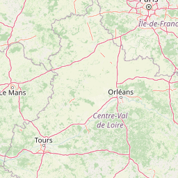
Use this park location map to pinpoint Réserve naturelle régionale des îles de Chelles in France, understand its exact geographic position, and read its mapped placement within the surrounding landscape more clearly.

Pigeon | © OpenStreetMap contributors

Location context for Réserve naturelle régionale des îles de Chelles

Île-de-France

Visualizing the river islands, riparian thickets, and wetland habitats along the Marne corridor.

Réserve naturelle régionale des îles de Chelles Photos and River Landscape Scenery

Visual documentation of Réserve naturelle régionale des îles de Chelles reveals the intricate mosaic of river islands, hygrophilous vegetation, and secluded wetland habitats sheltered along the Marne. Studying protected-area photography offers clear insight into the complex ecological character of this urban-adjacent reserve.

A peaceful river scene featuring a lush island with dense trees and a fallen branch extending into the water, reflecting the sky and vegetation.

A snowy riverbank view of islands in the Marne River, with bare trees covered in light snow and a calm, grey river surface.

A view of a small island covered in dormant winter vegetation surrounded by the flowing waters of the Marne River.

Park atlas

Compare nearby protected landscapes, river corridors, and urban-adjacent natural habitats in Île-de-France.

Parks Near Réserve Naturelle Régionale Des Îles De Chelles And Surrounding Regional Reserves

Browse other protected areas and river-island reserves located near Réserve naturelle régionale des îles de Chelles. Comparing adjacent wetland ecosystems provides broader geographic context for urban conservation across the surrounding region.
A soft, painterly watercolor illustration depicting a winding river flowing through a green basin with rolling hills, grasses, and scattered trees under a light sky.
Nature reserveÎle-de-France
About 27 km away#1 closest

Southwest

Réserve naturelle régionale du bassin de la Bièvre: Protected Wetland and Basin Geography

A vital urban nature reserve within the Île-de-France region

Located south of Paris, this six-hectare nature reserve demonstrates how an artificial stormwater basin can evolve into a functioning wetland. Its geography is defined by fluctuating water levels and reedbed habitats that provide sanctuary for migratory birds. Examine the protected boundaries and landscape terrain of this significant, compact ecological refuge in the Bièvre valley.

Area
0.06 km²
Established
2009
IUCN
IV
Relief
Lowland
A soft watercolor illustration depicting a serene landscape with rolling green fields, scattered deciduous trees, and a small meandering stream, set against a light, hazy background.
Nature reserveÎle-de-France
About 36 km away#2 closest

South

Réserve naturelle régionale des bruyères de Sainte-Assise: Heathland Conservation Geography

A protected sandy heathland within the Île-de-France region

This reserve protects rare lowland heathland habitat on acidic soils within the Seine-et-Marne department. Spanning approximately 87 hectares near the Seine valley, the landscape is defined by heather and open vegetation. The site provides a vital sanctuary for biodiversity in a peri-urban setting, balancing conservation with its unique integration of historical land use and local geography.

Area
0.872 km²
Established
2009
IUCN
IV
Relief
Lowland
A pale, soft watercolor painting of a calm wetland or marsh, featuring muted green vegetation, light water reflection, and a gentle shoreline under a hazy sky.
Nature reserveÎle-de-France
About 36 km away#3 closest

Northwest

Réserve naturelle régionale du marais de Stors: Atlas and Protected Landscape Overview

A rare wetland enclave in the Vallée de Chauvry

Focusing on the hydrological and ecological character of the Réserve naturelle régionale du marais de Stors, this overview examines its role as a protected nature reserve in the Paris region. Explore the marshland terrain and valley topography that define this unique pocket of conserved habitat in northern France.

Area
0.47 km²
Established
2009
IUCN
IV
Nature reserveÎle-de-France
About 42 km away#4 closest

Southwest

Réserve naturelle régionale du val et coteau de Saint-Rémy: Regional Nature Reserve Geography

A protected river valley and coteau habitat in Île-de-France

Spanning eighty-three hectares across five distinct parcels, this protected area serves as a vital ecological corridor along the Yvette river. Analyze the site's unique habitat distribution, ranging from moist bottomlands to dry, calcareous slopes, and trace its role in preserving regional biological diversity near Saint-Rémy-lès-Chevreuse.

Area
0.83 km²
Established
2008
IUCN
IV
Watercolor painting of a gentle, winding river or pond flowing through a green meadow with soft, rolling hills in the background under a pale sky.
Nature reserveÎle-de-France
About 51 km away#5 closest

Southwest

Réserve naturelle régionale des étangs de Bonnelles: Regional Nature Reserve Geography

Wetland ecosystem analysis in the Yvelines department.

Defined by its two core ponds, this regional nature reserve creates a critical mosaic of wetland, marsh, and woodland habitats. It stands out in the Île-de-France area as a concentrated zone of freshwater biodiversity, supporting a variety of avian and invertebrate life in a region where such undisturbed watery terrain is limited.

Area
0.221 km²
Established
1990
IUCN
IV
Relief
Lowland
Nature reserveÎle-de-France
About 54 km away#6 closest

Northwest

Réserve naturelle régionale du site géologique de Vigny-Longuesse: A Geological Reference Site

Protected limestone landscape in the Vexin region of Île-de-France

Protecting a critical paleontological and stratigraphic record, this reserve showcases a unique Tertiary reef complex. The site combines artificial quarry cliffs with natural geomorphological features, including paleolandslides and fossil-bearing limestone plates, providing a comprehensive outdoor archive of the Paris Basin.

Area
0.219 km²
Established
2009
IUCN
IV
Relief
Upland
Nature reserveÎle-de-France
About 59 km away#7 closest

Southeast

Réserve naturelle régionale de la colline Saint-Martin et des Rougeaux: Protected Area Atlas

Mapping limestone hill and dry valley habitats in Seine-et-Marne

Spanning roughly 28 hectares near the Seine valley, this nature reserve showcases a complex intersection of former quarry lands and limestone ecosystems. The site provides a critical protected corridor for bat fauna and diverse botanical species, serving as a distinct example of peri-urban conservation in north-central France.

Area
0.277 km²
Established
2024
IUCN
IV
Relief
Upland
Nature reserveÎle-de-France
About 64 km away#8 closest

West

Réserve naturelle régionale du site géologique de Limay: Protected Landscapes and Geological Maps

A diverse nature reserve in the Yvelines department of Île-de-France.

Deeply rooted in the geological history of the Paris Basin, this former quarry site in Limay is now a thriving regional nature reserve. Its compact territory features a striking contrast between ancient limestone exposures and rich wetland pockets, providing a vital educational platform for studying biodiversity and land reclamation in north-central France.

Area
0.698 km²
Established
2009
IUCN
IV
Relief
Lowland

Common questions about visiting, size, designation, and location context for Réserve naturelle régionale des îles de Chelles

Réserve naturelle régionale des îles de Chelles FAQs for park facts, access, geography, and protected area context

Find quick answers about Réserve naturelle régionale des îles de Chelles, including protected-area facts, park geography, trail and visitor context, and how the park fits into its surrounding country and regional landscape.
MoriAtlas Explorer

Continue Your Protected Areas Search Across the Global Atlas

Deepen your exploration by continuing the structured search for national parks and protected areas worldwide. Utilize the comprehensive filtering capabilities to compare different conservation landscapes and refine your understanding of global park geography. Discover more about the distribution and characteristics of protected natural areas.

Global natural geography