
Mori Atlas logo
Nature reserveRéserve naturelle régionale des landes et tourbières du Cragou et du Vergam

Analyzing the diverse moorland, peat bog, and granite ridge ecosystems of the Monts d'Arrée

Mapping the Réserve naturelle régionale des landes et tourbières du Cragou et du Vergam Protected Landscape

(Réserve naturelle régionale des Landes et tourbières du Cragou et du Vergam)

Discover the geographic footprint of the Réserve naturelle régionale des landes et tourbières du Cragou et du Vergam, a protected nature reserve nestled within the Monts d'Arrée of Bretagne. This atlas resource examines the spatial distribution of the Cragou and Vergam blocks, highlighting the intersection of ancient granite geology, Sphagnum-dominated mires, and relict oak woodlands that define this significant French conservation area.

BretagneFinistèreMonts d'Arréeregional nature reservepeatlandwet heathland
A flat-style digital illustration depicting a winding river leading toward a waterfall cascading between two mountain cliffs, surrounded by evergreen trees in a soft, pastel-toned color palette.

Réserve naturelle régionale des landes et tourbières du Cragou et du Vergam

Nature reserve

Park overview

Structured park overview, official facts, and landscape profile for Cragou and Vergam Heathland and Peatland Regional Nature Reserve

Cragou and Vergam Heathland and Peatland Regional Nature Reserve park facts, protected area profile, and essential visitor context

Review the core facts for Cragou and Vergam Heathland and Peatland Regional Nature Reserve, including designation, size, terrain, visitor scale, habitats, and operating context in one park-focused overview.

About Cragou and Vergam Heathland and Peatland Regional Nature Reserve

The Cragou and Vergam Heathland and Peatland Regional Nature Reserve is a compact but ecologically intense conservation area set on the northern flank of the Monts d'Arrée in Finistère, Brittany. Although it covers only around 343 hectares, it captures a remarkably full expression of the heathland and peatland landscapes that once characterised much of inland Brittany and that have otherwise been drastically reduced by agricultural drainage, afforestation, and land conversion.

The reserve's identity is shaped by its unusual geological and climatic position. The Monts d'Arrée form the highest ridge in Brittany, with the Cragou section of the reserve reaching around 280 metres at the Roc'h Sparfili, or "falcon rock". On these acid, often peaty soils and under the influence of frequent mist, a distinctive vegetation mosaic has developed: wet and dry heaths dominated by gorse, heather, and purple moor-grass; raised bogs and blanket mires dominated by Sphagnum mosses; acidic flushes and base-poor mires; patches of willow scrub; and, in sheltered locations on the eastern site, an ancient oak woodland that retains a strongly primitive character. Rocky outcrops break through the vegetation in places, adding craggy microhabitats particularly visible around the Cragou ridge.

What makes the reserve significant at the regional and national levels is not simply the presence of these habitats but their condition and the species assemblages they support. Sixteen natural habitat types have been catalogued within the protected perimeter, including two that are classified as priority habitats, specifically hygrophile heaths on peaty substrates and Sphagnum-dominated peatland zones. The site is monitored as part of France's national ecological inventory and contributes to the country's Natura 2000 reporting. It falls under IUCN protected-area category IV, indicating its focus on active management of species and habitat conservation.

The reserve is owned and managed by Bretagne Vivante, the conservation organisation that grew out of the historic Société pour l'Étude et la Protection de la Nature en Bretagne. The organisation combines monitoring, habitat restoration, controlled grazing by Dartmoor ponies and Nantes cattle, and targeted cutting to maintain open heath and bog habitats in good conservation condition. Interpretation infrastructure is modest but effective, with two marked trails of about two and fourteen kilometres on the Cragou site, accompanied by a downloadable leaflet and QR-coded panels. While the reserve is not promoted as a major visitor attraction, it functions both as a refuge for threatened Breton biodiversity and as a living reference site for understanding the ecology of the Monts d'Arrée.

Quick facts and research context for Cragou and Vergam Heathland and Peatland Regional Nature Reserve

The Cragou and Vergam reserve is a regional nature reserve (RNR) of about 343 hectares, classified on 20 December 2008 and managed by Bretagne Vivante, a long-established Breton conservation association. It is located in the Finistère department in Brittany, within the communes of Lannéanou, Le Cloître-Saint-Thégonnec, Plougonven, and Scrignac, on the northern side of the Monts d'Arrée range. The protected area is split into two components: the larger western site around the Cragou ridge (around 215 hectares), which rises to the Roc'h Sparfili, and the smaller eastern Vergam site (around 129 hectares) on the eastern extension of the Arrée ridge. The reserve's core ecological value lies in its ombrotrophic peat bogs together with raised bog systems dominated by Sphagnum, wet and dry heaths, acidic flushes, willow and broadleaf woodland, and rocky outcrops that support specialised flora and fauna. Sixteen habitat types are present, two of which qualify as priority habitats under European habitat classifications, and the site is monitored as part of the national Natura 2000 and INPN protected-area networks.

Protection and recognition

Review documented terrestrial protection scope and baseline recognition records for this protected landscape.

Protection Status and Designated Scope for Réserve naturelle régionale des landes et tourbières du Cragou et du Vergam

Terrestrial protection status records outline the administrative parameters established for Réserve naturelle régionale des landes et tourbières du Cragou et du Vergam. Structured database entries aggregate official designation details and registry identifiers for comparative analysis.

Protection details

Protection scope
Terrestrial
Transboundary protection
No
WDPA ID
555514352
Park context

Deeper park guide and search-rich context for Cragou and Vergam Heathland and Peatland Regional Nature Reserve

Cragou and Vergam Heathland and Peatland Regional Nature Reserve history, landscape, wildlife, and travel context

Explore Cragou and Vergam Heathland and Peatland Regional Nature Reserve through its history, landscape character, ecosystems, wildlife, conservation priorities, cultural context, and seasonal travel timing in a structured park guide built for atlas discovery and search intent.

Why Cragou and Vergam Heathland and Peatland Regional Nature Reserve stands out

The reserve is best known for protecting an exceptional and ecologically coherent mosaic of wet heathland and peatland in the northern Monts d'Arrée, including some of the best-preserved Sphagnum-dominated peat bogs and acidic mires in inland Brittany. It is particularly notable for its flora of conservation interest, with thirty-five recorded patrimonial plant species, including the summer lady's tresses orchid, marsh malaxis (held to be the largest European station of that species), bog clubmoss, the Pylaie sphagnum moss, intermediate sundew, and white beak-sedge. Botanists also consider the small pedunculate oak grove on the sheltered slopes of the eastern block to be one of the last surviving examples of the primitive forest that once cloaked the Monts d'Arrée's protected slopes.
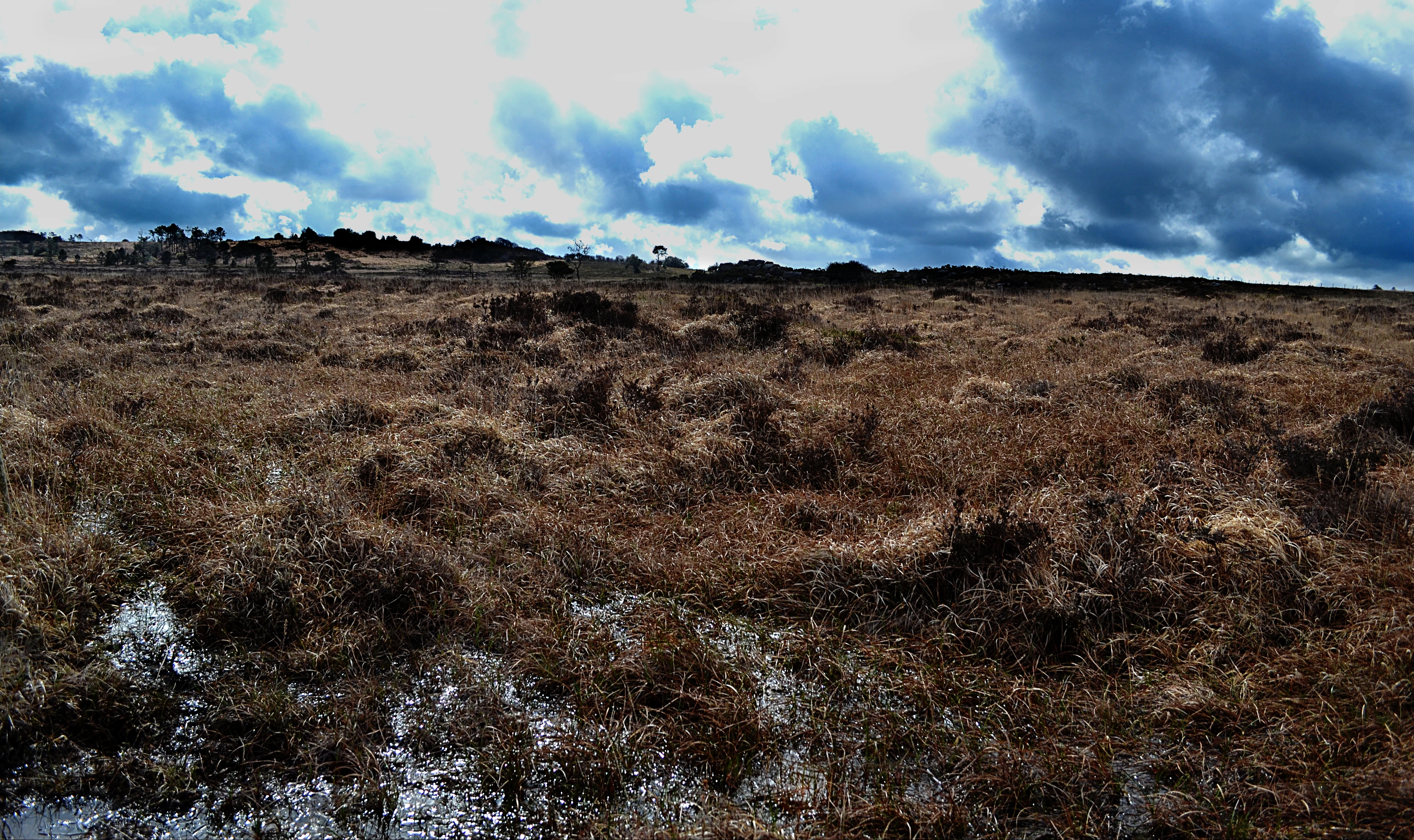
A wide, low-angle shot of a flat, marshy landscape with brown, withered vegetation and patches of standing water under a cloudy, dramatic sky.
Wet heathland and peat bog landscape in the Cragou and Vergam reserve.

Cragou and Vergam Heathland and Peatland Regional Nature Reserve history and protected-area timeline

The Cragou and Vergam reserve has a long human history layered over its natural history. The extensive heathlands of the Cragou belonged to the Abbaye du Relec until the events of 1789, and the narrow rocky ridge there once marked a traditional boundary between the old dioceses of Tréguier to the north and Cornouaille to the south. The distinctive rocks of the Cragou were already described in regional tourist guides by 1864, reflecting an early appreciation of the site's unusual character.

The first scientific studies came in the 1920s, with surveys of bryophytes, the mosses and liverworts that today remain central to the site's conservation value. Naturalists returned regularly throughout the twentieth century, and the Cragou became nationally significant in 1938 when some of the earliest pollen analyses ever conducted in France were carried out on its peat deposits. These early studies revealed the long ecological history preserved in the bog layers and laid the groundwork for later conservation action.

The Vergam site continued to be exploited in more traditional ways well into the late twentieth century, used for grazing livestock, harvesting bedding litter, and extracting peat. Recognising the ecological value of these working landscapes, the SEPNB, the historical predecessor of Bretagne Vivante, purchased its first parcels at the Cragou in 1986 and established a voluntary nature reserve there. Additional land at the Vergam was acquired in 1992, extending protection to the eastern site. Building on these voluntary protections, the area was formally classified as a regional nature reserve by regional decision on 20 December 2008, consolidating decades of land acquisition, scientific study, and habitat management under a single legal framework that continues to operate today.

Cragou and Vergam Heathland and Peatland Regional Nature Reserve landscape and geographic character

The reserve occupies a distinctive upland section of the northern Monts d'Arrée, where ancient granite ridges and acid, often peaty soils combine with a cool, wet Atlantic climate to produce a landscape of open moorland, boggy hollows, and rocky knolls. Although elevations are modest, reaching just 280 metres at the Roc'h Sparfili, the terrain feels distinctly upland, with exposed crests, sudden drops, and long views across the Breton countryside.

The two sites are not continuous but complementary. The Cragou block, the western and larger site at roughly 215 hectares, is dominated by the rocky ridge of the Cragou itself, a narrow spine of granite outcrops that historically separated two old dioceses. The Vergam block, about 129 hectares to the east, lies on the eastern end of the same northern Arrée ridge, where slopes become more sheltered and where the small pedunculate oak grove survives as a relict of older woodland.

Between and around these rocky outcrops lie the wet heaths and peatlands that define the visual character of the reserve. Molinia-dominated moor-grass tussocks, gorse thickets, heather-clad slopes, and open Sphagnum mires create a patchwork of textures and colours that shifts with the seasons. Streams and flushed slopes lend a marshy quality to much of the terrain, while mature oaks, birches, and conifer plantations frame the reserve's edges, giving way abruptly to the open habitats within.

Cragou and Vergam Heathland and Peatland Regional Nature Reserve ecosystems, habitats, and plant life

Ecologically, the reserve is a textbook example of the Atlantic wet heath and peatland complex that once covered much of inland Brittany and that today survives only in scattered fragments. Its habitats are closely tied to the acid substrates and humid conditions of the Monts d'Arrée, and they form a tightly interlocking mosaic rather than isolated stands.

Open wet and dry heaths are the most visible habitat, characterised by European gorse, Le Gall's gorse, common heather, ciliate heather, bell heather, and cross-leaved heath, with purple moor-grass, bracken, bilberry, and great wood-rush as the dominant ground layer. In the wettest depressions, the habitat transitions into Sphagnum-dominated peatland, where raised and blanket bog communities support the liverwort and moss flora for which the Cragou was first scientifically studied in the 1920s.

Alongside the open mires, acidic flushes, wet meadows, and willow scrub add structural diversity, while conifer and broadleaf plantations, together with the relict pedunculate oak grove on the Vergam slopes, provide woodland habitats that contrast sharply with the open moorland. The combination of bog, heath, woodland, and exposed rock in a small area gives the reserve a high density of habitat transitions, which in turn supports a rich community of specialist species.

Among the most significant elements documented within the site are populations of conservation interest such as the bog clubmoss Lycopodiella inundata, the marsh helleborine orchid Malaxis paludosa (which here holds what is considered the largest European station of the species), and the rare Pylaie sphagnum moss Sphagnum pylaesii. These species, together with sundews, white beak-sedge, and a notable assemblage of patrimonial bryophytes, define the site's core botanical identity.

Cragou and Vergam Heathland and Peatland Regional Nature Reserve wildlife and species highlights

The animal communities of the reserve reflect the close ecological relationship between the heathland, peatland, and woodland habitats. The site supports a relatively small but conservation-relevant fauna, with about thirty-nine patrimonial animal species recorded across the two blocks.

Birds are the most prominent group. Heathland specialists such as the Dartford warbler are present, alongside typical Breton wetland and scrub species including the common snipe, the European stonechat, and various heathland passerines. The Vergam block is particularly important for nesting, hosting rare breeding species such as the hen harrier, the Montagu's harrier, the Eurasian curlew, and the European nightjar, all of them associated with extensive open moorland rather than closed forest.

Amphibians and reptiles also feature in the recorded fauna. The smooth snake is documented, along with midwife toads and the viviparous lizard, both of which are typical of cool, damp Atlantic habitats. Invertebrate communities associated with the Sphagnum mires, acidic flushes, and old heathland vegetation remain an important and ongoing focus of study, contributing to the site's value for entomology and ecological monitoring.

While some of these species are rare or localised, the overall character of the reserve's fauna is one of specialist, Atlantic-influenced wildlife closely tied to traditional Breton habitats that have become increasingly scarce in the wider landscape.

Cragou and Vergam Heathland and Peatland Regional Nature Reserve conservation status and protection priorities

From a conservation perspective, the Cragou and Vergam reserve is significant as a surviving fragment of the inland Breton heath and peatland complex, much of which has been lost to drainage, conifer afforestation, agricultural intensification, and peat extraction over the past two centuries. The site is recognised under the French Natura 2000 network and is listed in the national INPN inventory of protected natural spaces, with IUCN category IV designation emphasising its role in active habitat and species management.

The reserve contains sixteen habitat types, of which two are classed as European priority habitats: hygrophile heaths on peaty substrates and Sphagnum-dominated peatland zones. Together these habitats support a particularly high concentration of patrimonial species, with the reserve having been instrumental in confirming or rediscovering several rare bryophytes, orchids, and mire-dwelling plants in Brittany. The site's peat deposits also serve as long-term ecological archives, having yielded some of the earliest pollen analyses conducted in France.

Practical conservation work at the site is carried out by Bretagne Vivante and combines traditional low-intensity land use with modern habitat management. Dartmoor ponies have grazed parts of the reserve since 1990, followed by Nantaise cattle, while mowing campaigns help control encroachment by woody species into open heath and bog. Land purchase by the association between 1986 and the early 1990s, followed by formal regional classification in 2008, has allowed the cumulative gains of nearly four decades of protection to be consolidated into a permanent legal status.

Cragou and Vergam Heathland and Peatland Regional Nature Reserve cultural meaning and human context

The landscape preserved by the reserve carries a deep human imprint shaped by centuries of monastic and rural land use. The Cragou heathlands belonged to the Abbaye du Relec until 1789, and the rocky crest of the Cragou historically marked the ecclesiastical boundary between the dioceses of Tréguier and Cornouaille. This sense of a boundary ridge, between communities, parishes, and biomes, remains part of how the site is understood locally.

Traditionally, the Vergam block supported extensive grazing, bedding-litter harvesting, and peat cutting for local domestic use, a pattern that persisted into the late twentieth century. These activities helped maintain the open character of the heathland and bog habitats, and much of the current management ethos, including the reintroduction of extensive grazing with hardy pony and cattle breeds, seeks to recover that continuity. The Cragou itself entered regional cultural memory as a notable geological and scenic landmark already in the 1860s, when guidebooks began describing its rocks. Today the site is also part of a wider Breton regional identity, framed locally as a piece of surviving inland Arrée landscape.

Top sights and standout views in Cragou and Vergam Heathland and Peatland Regional Nature Reserve

The reserve's most distinctive feature is its compact yet highly representative expression of inland Breton wet heath and peatland, anchored by Sphagnum-dominated peat bogs that are rare in this region. Sixteen habitat types are present, including two European priority habitats, helping the site punch well above its modest 343-hectare size in terms of conservation importance.

It also combines ecological and cultural depth: a relic pedunculate oak grove on the sheltered Arrée slopes, historically rooted monastic and ecclesiastical landscapes at the Cragou, and a continuous thread of scientific research running from the first bryophyte surveys of the 1920s through the pioneering peat pollen analyses of 1938 to ongoing flora and fauna monitoring today. The result is a small but unusually rich site that captures both the natural heritage and the working rural history of the Monts d'Arrée.

Best time to visit Cragou and Vergam Heathland and Peatland Regional Nature Reserve

The reserve is most atmospheric in late spring and early summer, when the gorse is in full bloom and the heathland takes on its characteristic yellow and purple palette, with Sphagnum mires and acidic flushes still holding water from the wetter months. Bird song, including heathland passerines and the unusual breeding species of the Vergam, is also most conspicuous through spring and early summer.

Late summer and early autumn bring softer light, ripening heather, and a quieter atmosphere, while cooler, damper conditions make it easier to appreciate the peatland and flush habitats in full. Winters tend to be mild and wet in this part of Brittany, with saturated ground and mist around the ridge, limiting access in exposed sections but offering a stark, atmospheric sense of the upland heath. As with all peatland reserves, visitors should stay on marked paths to avoid damaging fragile bog surfaces, regardless of season.
Monthly climate preview

Long-term temperature and precipitation averages recorded at representative coordinates

Réserve naturelle régionale des landes et tourbières du Cragou et du Vergam Climate Normals

Historical climate records for Réserve naturelle régionale des landes et tourbières du Cragou et du Vergam outline measured temperature ranges and monthly precipitation patterns from 1991 to 2020. Detailed twelve-month climate tables provide complete data regarding average minimum and maximum temperatures across the protected landscape.
Annual mean11 °C
6 °C17 °C
Jan
Feb
Mar
Apr
May12°
Jun15°
Jul17°
Aug17°
Sep15°
Oct12°
Nov
Dec
Warmest month
August

17.3 °C

Coolest month
February

6.2 °C

Wettest month
December

3.4 mm/day

Driest month
July

1.6 mm/day

Park location guide

Geography guide, regional context, and park location map for Cragou and Vergam Heathland and Peatland Regional Nature Reserve

Cragou and Vergam Heathland and Peatland Regional Nature Reserve park geography, regions, and map view in France

Understand where Cragou and Vergam Heathland and Peatland Regional Nature Reserve sits in France through a broader geographic reading of the surrounding landscape, nearby location context, and its mapped position within the national park landscape.

How Cragou and Vergam Heathland and Peatland Regional Nature Reserve fits into France

France is a unitary semi-presidential republic and one of the world's largest economies. It borders Belgium, Luxembourg, Germany, Switzerland, Italy, Monaco, Andorra, and Spain, with a maritime border to the United Kingdom. The country is known for its cultural influence, art, cuisine, and political history spanning centuries.

Wider geography shaping Cragou and Vergam Heathland and Peatland Regional Nature Reserve in France

France is located in Western Europe. Metropolitan France extends from the Rhine to the Atlantic Ocean and from the Mediterranean Sea to the English Channel and North Sea. The country borders Belgium, Luxembourg, Germany, Switzerland, Italy, Monaco, Andorra, Spain, and has a maritime border with the United Kingdom.

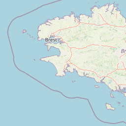
Map view of Cragou and Vergam Heathland and Peatland Regional Nature Reserve

Use this park location map to pinpoint Cragou and Vergam Heathland and Peatland Regional Nature Reserve in France, understand its exact geographic position, and read its mapped placement within the surrounding landscape more clearly.

Pigeon | © OpenStreetMap contributors

Location context for Cragou and Vergam Heathland and Peatland Regional Nature Reserve

Bretagne
Recorded earthquake history

Explore Recorded Earthquake History for the Cragou and Vergam Reserve

Review the historical collection of seismic events recorded in the vicinity of the Réserve naturelle régionale des landes et tourbières du Cragou et du Vergam. This archive allows for the study of regional epicentre data and past seismic events within the northern Monts d'Arrée, providing a structured look at the area's earthquake history as compiled by MoriAtlas.

Cragou and Vergam Earthquake History

Catalogued events

14 events

Strongest magnitude

Magnitude 3.7

Most recent event

Feb 19, 2020

This history includes earthquakes recorded inside the park or within 50 km of its borders

Protected moorland topography, Sphagnum peat bogs, and upland granite ridges across northern Brittany

Visual Explorer and Landscape Photography of Réserve naturelle régionale des landes et tourbières du Cragou et du Vergam

Photographic documentation reveals the distinct upland character, granite outcroppings, and expansive wet heath mosaic defining Réserve naturelle régionale des landes et tourbières du Cragou et du Vergam. Visual references capture the delicate botanical habitats, relict oak woodland patches, and peatland environments preserved within the Monts d'Arrée landscape.

A wide, low-angle shot of a flat, marshy landscape with brown, withered vegetation and patches of standing water under a cloudy, dramatic sky.

Park atlas

Compare surrounding protected areas and regional landscapes across northwestern France

Parks Near Réserve naturelle régionale des landes et tourbières du Cragou et du Vergam

Browsing nearby protected areas allows travelers to examine adjacent peatlands and upland moor-grass habitats across the surrounding Breton region. Comparing related reserves provides deeper geographic context into the granite ridges and Atlantic wetland ecosystems of the Monts d'Arrée.
Nature reserveFinistère
1.1 km away#1 closest

Southwest

Vallée de l'Aulne Nature Reserve: A Detailed Mapping of Finistère River Valley Geography

Protected riparian landscapes, watershed ecology, and regional basin boundaries

The Vallée de l'Aulne serves as a central artery for the natural landscapes of western France. Spanning from inland Brittany toward the Atlantic, this protected reserve encompasses riverine corridors, bocage terrain, and tidal estuary zones. Use this detailed profile to examine the geographic distribution of protected habitats, river basin features, and the integrated environmental protections that define this key Finistère landscape.

Area
35.64 km²
Established
2014
Relief
Lowland
Climate
Temperate
A watercolor painting showing a wide, panoramic view of a marshy landscape with green clumps of grass in the foreground and soft purple hills in the distance.
Nature reserveFinistère
About 11 km away#2 closest

Southwest

Réserve naturelle nationale du Venec: Protected Peatland and Monts d'Arrée Geography

A core nature reserve and active sphagnum bog ecosystem in Finistère

Located in central Brittany, the Réserve naturelle nationale du Venec represents the only remaining large, active raised bog in the region. This protected area within the Finistère department offers deep insight into the geomorphology of the Yeun-Elez basin, mapping the transition from granite-edged dry moorland through marshy transition zones to the central, ombrotrophic peat dome.

Area
3.341 km²
Established
1993
IUCN
IV
Relief
Upland
Nature reserveBretagne
About 14 km away#3 closest

Northeast

Réserve naturelle régionale des landes, prairies et étangs de Plounérin: Protected Habitat Atlas

Inland Bretagne landscape mosaic and regional nature reserve mapping

This protected area in the heart of Brittany serves as a vital refuge for heathland, meadows, and ponds. Examine the site's mapped boundaries and understand its role as an IUCN Category IV conservation landscape within the broader geography of the Côtes-d'Armor department.

Area
1.607 km²
Established
2016
IUCN
IV
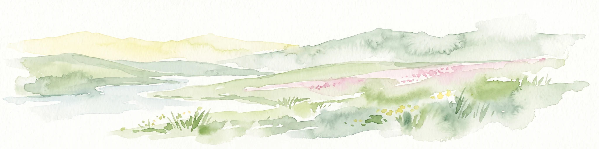
A watercolor painting showing a soft, stylized landscape of green hills, marshy fields, and patches of pink wildflowers or heathland against a white background.
Nature reserveBretagne
About 34 km away#4 closest

Southeast

Réserve naturelle régionale des landes et marais de Glomel: Protected Bog and Heathland Atlas

A rare inland wetland refuge within the Bretagne Montagnes Noires

Explore the geographic mosaic of the Réserve naturelle régionale des landes et marais de Glomel, a protected area in Bretagne comprising dual sites of peat bogs, wet heaths, and marshy meadows. This atlas entry details the internal terrain, including the Grazius stream network and the historic canal environment, essential for understanding the habitat distribution and conservation of this distinct inland landscape.

Area
1.078 km²
Established
2008
IUCN
IV
Relief
Upland
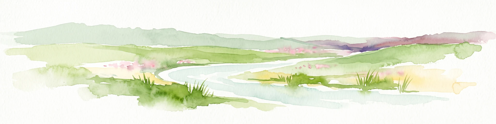
A soft, painterly watercolor illustration of a winding river flowing through green marshlands, coastal dunes, and gentle rolling hills under a bright, open sky.
Nature reserveFinistère
About 52 km away#5 closest

West

Réserve naturelle régionale des marais, dunes et baies de Guissény: Protected Atlas Detail

Coastal reserve geography and maritime landscape mapping

Located in Finistère, this protected area features an intricate network of reedbeds, dune ridges, and coastal lagoons. The reserve provides a critical refuge for over 200 bird species and serves as a prime example of the land-and-sea ecological transition characteristic of the northern Breton coastline.

Area
6.083 km²
Established
2025
IUCN
IV
Relief
Lowland
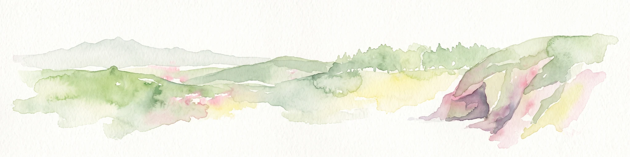
Watercolor painting of soft, rolling green hills and pinkish, jagged coastal cliffs on a white background.
Nature reserveBretagne
About 53 km away#6 closest

Southwest

Réserve naturelle régionale des sites d'intérêt géologique de la presqu'île de Crozon: Protected Area and Atlas

Coastal geological heritage and maritime landscapes in the heart of Bretagne.

Spanning 27 distinct locations, the Réserve naturelle régionale des sites d'intérêt géologique de la presqu'île de Crozon documents millions of years of volcanic, tectonic, and sedimentary evolution. The reserve anchors its scientific value in its open-air exposures of Paleozoic rock, while simultaneously providing a sanctuary for specialized coastal flora and fauna along the Atlantic edge of Bretagne.

Area
1.564 km²
Established
2013
IUCN
IV
Relief
Upland
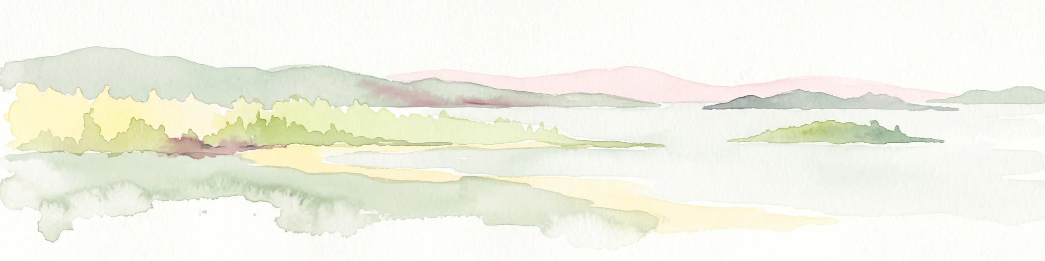
A soft watercolor illustration showing a calm coastal bay with distant low hills, green shorelines, and sandy patches under a pale sky.
Nature reserveCôtes-d'Armor
About 72 km away#7 closest

East

Réserve naturelle nationale de la baie de Saint-Brieuc: Coastal Geography and Protected Terrain

Tidal mudflats and salt marshes on the North-Armorican coast.

Located in the Côtes-d'Armor department, this French nature reserve spans over 1,000 hectares of intertidal terrain. The area features a complex mosaic of sandy flats, brackish marshes, and dune systems, providing a critical study of coastal processes and tidal ecosystems along the Brittany shoreline.

Area
11.4 km²
Established
1998
IUCN
IV
Relief
Lowland
A soft watercolor painting showing a green landscape with a small pond in the foreground and rolling hills in the background under a pastel sky.
Nature reserveMorbihan
About 76 km away#8 closest

South

Réserve naturelle régionale des étangs du Petit et du Grand Loc'h: Wetland Landscape Atlas

Coastal protected area in Morbihan, Brittany

Located along the Atlantic coast near Guidel, this regional nature reserve protects a vital corridor of freshwater ponds, wet meadows, and reclaimed polders. The area is defined by its complex hydrology and serves as a key refuge for wintering and migratory bird populations within the Morbihan landscape, showcasing the intersection of maritime and terrestrial environments.

Area
1.18 km²
Established
2008
IUCN
IV
Relief
Lowland

Common questions about visiting, size, designation, and location context for Cragou and Vergam Heathland and Peatland Regional Nature Reserve

Cragou and Vergam Heathland and Peatland Regional Nature Reserve FAQs for park facts, access, geography, and protected area context

Find quick answers about Cragou and Vergam Heathland and Peatland Regional Nature Reserve, including protected-area facts, park geography, trail and visitor context, and how the park fits into its surrounding country and regional landscape.
MoriAtlas Explorer

Continue Your Protected Areas Search Across the Global Atlas

Deepen your exploration by continuing the structured search for national parks and protected areas worldwide. Utilize the comprehensive filtering capabilities to compare different conservation landscapes and refine your understanding of global park geography. Discover more about the distribution and characteristics of protected natural areas.

Global natural geography