Mori Atlas logo
Nature reserveRéserve naturelle régionale des marais de Cré-sur-Loir et La Flèche

A regional nature reserve protecting the largest alluvial marshland in the Sarthe department.

Réserve naturelle régionale des marais de Cré-sur-Loir et La Flèche: Mapped Wetland Geography

This protected area, situated within a meander of the Loir river, serves as a vital wetland complex in western France. The landscape encompasses a distinct mosaic of reedbeds, alluvial woodlands, and wet meadows, all connected by a network of historical canals. Through this atlas entry, discover the geographic boundaries and terrain characteristics that define this significant regional nature reserve within the Pays de la Loire territory.

regional nature reservealluvial marshwetlandloodplainreedbedwet meadow

Réserve naturelle régionale des marais de Cré-sur-Loir et La Flèche

Nature reserve

Park overview

Structured park overview, official facts, and landscape profile for Réserve naturelle régionale des marais de Cré-sur-Loir et La Flèche

Réserve naturelle régionale des marais de Cré-sur-Loir et La Flèche park facts, protected area profile, and essential visitor context

Review the core facts for Réserve naturelle régionale des marais de Cré-sur-Loir et La Flèche, including designation, size, terrain, visitor scale, habitats, and operating context in one park-focused overview.

About Réserve naturelle régionale des marais de Cré-sur-Loir et La Flèche

The Réserve naturelle régionale des marais de Cré-sur-Loir et La Flèche is one of the small but ecologically concentrated regional nature reserves of the Pays de la Loire. Established through a formal classification in 2008, it safeguards around fifty hectares of alluvial marshland within a meander of the Loir river, on the communes of Cré-sur-Loir and La Flèche in the southern Sarthe. Although modest in size, the site carries regional significance because it preserves the largest floodplain marsh of the entire department.

The character of the protected area is shaped by the geomorphology of the Loir valley. Repeated flooding has built up the alluvial soils that define the marsh and have determined, over time, the pattern of habitats found here. Visitors walking the perimeter trail encounter a layered landscape: dense reedbeds along the watercourses, bands of alluvial woodland on slightly higher ground, and open wet meadows laced with drainage canals. The result is a structurally varied wetland that offers valuable resources for a wide spectrum of wildlife.

Biodiversity is a defining strength of the site. Botanical surveys have recorded more than 300 plant species, including several that benefit from regional protection. The avifauna exceeds 150 bird species, ranging from wetland specialists such as herons, bitterns, rails, and snipes to species of drier fringes like shrikes and woodpeckers. Amphibians, fish, and insects, including notable butterflies, round out the fauna. A dedicated ornithological observatory and several viewpoints along the trail provide access to much of this diversity, allowing the reserve to function simultaneously as a conservation site and as a quiet setting for wetland-focused exploration in the Loir valley.

Quick facts and research context for Réserve naturelle régionale des marais de Cré-sur-Loir et La Flèche

The Réserve naturelle régionale des marais de Cré-sur-Loir et La Flèche is a regional nature reserve (RNR) classified on 31 March 2008 by the Regional Council of Pays de la Loire. It sits on the communes of Cré-sur-Loir and La Flèche, in the southern Sarthe department, within a meander of the Loir river.

Its territory covers a little over fifty hectares of alluvial wetland, making it the largest alluvial marshland of the Sarthe. The reserve is classified under IUCN Category IV (habitat/species management area) and is administered by the Communauté de communes du Pays Fléchois. A walking trail circles the site, providing access to a bird observatory and to viewpoints across the marsh.

Protection and recognition

Documented protection history, terrestrial scope, and designation records

Protection Status and Official Recognition for Réserve naturelle régionale des marais de Cré-sur-Loir et La Flèche

Terrestrial protection status for Réserve naturelle régionale des marais de Cré-sur-Loir et La Flèche dates from the established 2008 designation records. Documented management scope and official administrative data provide a clear baseline for examining this protected area.

Protection details

Protection scope
Terrestrial
Designated year
2008
Transboundary protection
No
WDPA ID
555559607
Park context

Deeper park guide and search-rich context for Réserve naturelle régionale des marais de Cré-sur-Loir et La Flèche

Réserve naturelle régionale des marais de Cré-sur-Loir et La Flèche history, landscape, wildlife, and travel context

Explore Réserve naturelle régionale des marais de Cré-sur-Loir et La Flèche through its history, landscape character, ecosystems, wildlife, conservation priorities, cultural context, and seasonal travel timing in a structured park guide built for atlas discovery and search intent.

Why Réserve naturelle régionale des marais de Cré-sur-Loir et La Flèche stands out

The reserve is best known for being the largest alluvial marshland of the Sarthe, a floodplain wetland mosaic where reedbeds, alluvial woods, and wet meadows coexist with a network of canals along an old meander of the Loir river.

Réserve naturelle régionale des marais de Cré-sur-Loir et La Flèche history and protected-area timeline

The marsh itself is a product of long-term natural processes: the repeated flooding of the Loir river gradually deposited alluvial sediments that built the wetland floor visible today. Human intervention came later, when local authorities recognized both the ecological value and the fragility of the site and decided to organize its protection.

In 1994, elected officials of the Communauté de communes du Pays Fléchois acquired the marsh in order to guarantee its long-term safeguarding. This municipal initiative paved the way for a formal protection regime. On 31 March 2008, the Regional Council of Pays de la Loire adopted the deliberation classifying the territory as a regional nature reserve, under the designation RNR188. The classification was issued for an initial renewable period of six years and placed the site under the management of the same intercommunal structure that had initiated its acquisition.

Réserve naturelle régionale des marais de Cré-sur-Loir et La Flèche landscape and geographic character

The reserve sits inside a meander of the Loir river, in a section of the valley shaped by long-standing alluvial dynamics. The terrain is essentially flat and low-lying, determined by the floodplain of the river, with subtle variations in elevation that translate into clear contrasts in vegetation cover.

The landscape combines several visually distinct units: tall reedbeds and emergent marsh vegetation along drains and channels, softwood alluvial woods on the higher alluvial ridges, and open wet meadows occupying the broader grassy flats. A network of canals, partly inherited from historical drainage work, threads through the marsh and gives the site its characteristic compartmentalized appearance. Together, these features form the distinctive alluvial marsh landscape that defines the reserve.

Réserve naturelle régionale des marais de Cré-sur-Loir et La Flèche ecosystems, habitats, and plant life

Ecologically, the site belongs to the category of alluvial marshlands found along lowland rivers in western France. The habitats are closely tied to the hydrology of the Loir: ground saturation, seasonal flooding, and canal flow all influence which plant communities establish and persist. This dependency on water is what gives the reserve its particular ecological coherence.

The vegetation mosaic includes reedbeds dominated by tall graminoids, wet meadows of mesophilic and hygrophilous herbaceous species, and alluvial woodlands composed of typical floodplain trees and shrubs. More than 300 plant species have been recorded within the reserve, four of which benefit from a specific protection status. The combination of open water, marsh, grassland, and woodland creates a network of complementary habitats that together support an unusually rich fauna for such a small protected area.

Réserve naturelle régionale des marais de Cré-sur-Loir et La Flèche wildlife and species highlights

Wildlife is one of the principal motivations behind the protection of the site. The reserve supports over 150 bird species, making it a significant ornithological site at the departmental scale. Wetland habitats attract herons, including the grey heron and the purple heron, as well as the little bittern. The denser marsh vegetation hosts the spotted crake and common snipe, while the drier edges and surrounding bushy areas provide habitat for the red-backed shrike, the Eurasian wryneck, and the willow tit.

The fauna is not limited to birds. Amphibians are well represented, with species such as the European tree frog, the common toad, and the palmate newt breeding in the wetter sections of the marsh. Aquatic habitats shelter around 15 species of fish, while insects include notable butterflies such as the large copper, a species closely tied to wetland habitats. This combination of aquatic, semi-aquatic, and terrestrial fauna reinforces the ecological value of the mosaic of habitats preserved by the reserve.

Réserve naturelle régionale des marais de Cré-sur-Loir et La Flèche conservation status and protection priorities

From a conservation perspective, the site is significant primarily because it conserves the largest alluvial marshland of the Sarthe department within a formal protection framework. Its status as a regional nature reserve places it under the IUCN Category IV, denoting a habitat and species management area, and ensures the application of a management plan focused on maintaining the integrity of the wetland mosaic.

The protected status provides tools to control land use, manage water levels, and monitor wildlife populations. Protection covers not only the plant communities, including the regionally protected species, but also the habitats on which the reserve's breeding and migrating birds, amphibians, fish, and insects depend. By preserving an intact stretch of alluvial marsh within a meander of the Loir, the reserve contributes to the maintenance of ecological connectivity along the river and safeguards a representative example of the wetland heritage of the Pays de la Loire.

Top sights and standout views in Réserve naturelle régionale des marais de Cré-sur-Loir et La Flèche

The reserve stands out for the compact yet rich concentration of alluvial habitat types in a single protected site, from reedbeds and wet meadows to alluvial woodlands threaded by canals. Its location within an easily accessible meander of the Loir, near the towns of Cré-sur-Loir and La Flèche, makes it an approachable place to observe characteristic wetland wildlife.

A walking trail encircles the marsh and connects a bird observatory with several viewpoints oriented toward the open water and reedbeds. This combination of formal protection, rich biodiversity, accessible visitor infrastructure, and proximity to a regional town gives the reserve a distinctive identity within the network of regional nature reserves of Pays de la Loire.
Monthly climate preview

Long-term representative monthly climate patterns measured across the protected wetland landscape

Annual Temperature and Precipitation Normals for Réserve naturelle régionale des marais de Cré-sur-Loir et La Flèche

Historical monitoring data from 1991 to 2020 records consistent monthly temperature swings and precipitation levels across sampled coordinates in Réserve naturelle régionale des marais de Cré-sur-Loir et La Flèche. Detailed twelve-month climate normals provide complete comparative statistics for average minimum and maximum thresholds.
Annual mean12 °C
4 °C20 °C
Jan
Feb
Mar
Apr10°
May14°
Jun18°
Jul20°
Aug20°
Sep17°
Oct12°
Nov
Dec
Warmest month
August

20 °C

Coolest month
January

4.3 °C

Wettest month
December

2.5 mm/day

Driest month
August

1.5 mm/day

Park location guide

Geography guide, regional context, and park location map for Réserve naturelle régionale des marais de Cré-sur-Loir et La Flèche

Réserve naturelle régionale des marais de Cré-sur-Loir et La Flèche park geography, regions, and map view in France

Understand where Réserve naturelle régionale des marais de Cré-sur-Loir et La Flèche sits in France through a broader geographic reading of the surrounding landscape, nearby location context, and its mapped position within the national park landscape.

How Réserve naturelle régionale des marais de Cré-sur-Loir et La Flèche fits into France

France is a unitary semi-presidential republic and one of the world's largest economies. It borders Belgium, Luxembourg, Germany, Switzerland, Italy, Monaco, Andorra, and Spain, with a maritime border to the United Kingdom. The country is known for its cultural influence, art, cuisine, and political history spanning centuries.

Wider geography shaping Réserve naturelle régionale des marais de Cré-sur-Loir et La Flèche in France

France is located in Western Europe. Metropolitan France extends from the Rhine to the Atlantic Ocean and from the Mediterranean Sea to the English Channel and North Sea. The country borders Belgium, Luxembourg, Germany, Switzerland, Italy, Monaco, Andorra, Spain, and has a maritime border with the United Kingdom.

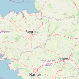
Map view of Réserve naturelle régionale des marais de Cré-sur-Loir et La Flèche

Use this park location map to pinpoint Réserve naturelle régionale des marais de Cré-sur-Loir et La Flèche in France, understand its exact geographic position, and read its mapped placement within the surrounding landscape more clearly.

Pigeon | © OpenStreetMap contributors

Location context for Réserve naturelle régionale des marais de Cré-sur-Loir et La Flèche

Pays de la Loire
Park atlas

Compare nearby protected areas and regional wetland reserves across the surrounding river valley geography

Parks Near Réserve Naturelle Régionale Des Marais De Cré-Sur-Loir Et La Flèche

Browsing other protected areas near Réserve naturelle régionale des marais de Cré-sur-Loir et La Flèche reveals broader regional wetland networks and alluvial valley ecosystems. Comparing adjacent conservation landscapes provides valuable geographic context for understanding Western France natural reserves.
Nature reservePays de la Loire
About 19 km away#1 closest

East

Réserve naturelle régionale du coteau et prairies des Caforts: Protected Area and Map Atlas

A diverse protected landscape in the Pays de la Loire region

Situated in the Loir valley, this regional nature reserve combines three distinct landscape types: dry limestone slopes, humid hay meadows, and 910 meters of man-made tuffeau quarry galleries. The site represents a significant pocket of biodiversity, hosting sixteen bat species and rare flora within its compact protected footprint in Sarthe.

Area
0.064 km²
Established
2009
IUCN
IV
Nature reservePays de la Loire
About 33 km away#2 closest

East

Réserve naturelle régionale des prairies et roselière des Dureaux: Loir Valley Protected Landscapes

Regional Nature Reserve in Pays de la Loire, France

Spanning the alluvial plains near Vaas, this reserve protects essential wet meadows and reedbed communities shaped by the seasonal rhythm of the Loir River. The landscape features a classic bocage character, offering a distinct example of wetland conservation within the Pays de la Loire region.

Area
0.253 km²
Established
2001
IUCN
IV
Relief
Lowland
A soft watercolor illustration featuring a calm pond in the foreground, with reeds on the right and a distant treeline and rolling hills in the background.
Nature reservePays de la Loire
About 40 km away#3 closest

South

Réserve naturelle régionale des étang et boisements de Joreau: Protected Area Atlas Profile

Wetland and woodland mosaic in the Pays de la Loire region.

This profile examines the 92-hectare Réserve naturelle régionale des étang et boisements de Joreau, a protected area in the Maine-et-Loire department. The site features a specialized composition of freshwater ponds and mature woodlands, reflecting the traditional riverine landscapes found throughout the broader Loire Valley regional geography.

Area
0.92 km²
Established
2015
IUCN
IV
A watercolor painting showing a soft, stylized landscape with rolling green hills, small clusters of trees, and a winding waterway, with tall grass and flowers in the foreground.
Nature reservePays de la Loire
About 46 km away#4 closest

Northeast

Réserve naturelle régionale du bas-marais tourbeux de la Basse-Goulandière: Regional Wetland Mapping

A rare alkaline lowland peatland within the Pays de la Loire administrative region

Examine the mapped terrain and habitat structure of this protected peatland near Le Mans. This site preserves an uncommon alkaline mire environment, serving as an essential ecological bridge within the Roule-Crottes stream valley and demonstrating the significant conservation value of small, high-quality wetland pockets in agricultural landscapes.

Area
0.38 km²
Established
2011
IUCN
IV
Nature reservePays de la Loire
About 48 km away#5 closest

Southwest

Réserve naturelle régionale de Basses-Brosses et Chevalleries: Protected Area Mapping

A dense bocage landscape in the Pays de la Loire region

This regional nature reserve protects a well-preserved mosaic of meadows, cultivated plots, and wooded hedgerows across 90 hectares. The site serves as a vital ecological anchor in the Maine-et-Loire department, maintaining traditional land patterns and diverse species habitats that define the historic rural character of the Anjou countryside.

Area
0.9 km²
Established
2012
IUCN
IV
Nature reservePays de la Loire
About 63 km away#6 closest

South

Réserve naturelle régionale Champagne de Méron: Geographic and Protected Area Overview

A regional nature reserve within the Maine-et-Loire department.

Located in the heart of the Anjou countryside, Réserve naturelle régionale Champagne de Méron represents a strategic effort to safeguard biodiversity within western France. Covering 146 hectares, this protected area illustrates the intersection of modern conservation goals and historic rural landscapes, offering a clear view of how regional authorities manage and restore fragmented natural habitats.

Area
1.461 km²
Established
2023
IUCN
IV
Scope
Terrestrial
Nature reserveCentre-Val de Loire
About 67 km away#7 closest

Southeast

Marais de Taligny Regional Nature Reserve: A Protected Wetland in Centre-Val de Loire

Alluvial valley geography and restored marshland habitats

Spanning the Négron valley, this regional nature reserve serves as an vital sanctuary for alkaline fen formations and diverse aquatic species. The site provides a detailed look at the intersection of riverine drainage, alluvial woodland, and the successful ecological restoration of historical French wetland landscapes.

Area
0.354 km²
Established
2014
IUCN
IV
Relief
Lowland
Nature reserveNouvelle-Aquitaine
About 76 km away#8 closest

South

Réserve naturelle nationale du Toarcien: Protected Jurassic Stratotype and Geological Map

A vital paleontological heritage site in the Nouvelle-Aquitaine region

As the smallest national nature reserve in France, Réserve naturelle nationale du Toarcien provides a concentrated, scientifically essential view of Jurassic marine sediments. The protected quarries preserve ammonite-rich strata and complex geological unconformities, serving as the international definition for the Toarcian geological stage within the Thouet valley landscape.

Area
0.006 km²
Established
1987
IUCN
III
Relief
Lowland

Common questions about visiting, size, designation, and location context for Réserve naturelle régionale des marais de Cré-sur-Loir et La Flèche

Réserve naturelle régionale des marais de Cré-sur-Loir et La Flèche FAQs for park facts, access, geography, and protected area context

Find quick answers about Réserve naturelle régionale des marais de Cré-sur-Loir et La Flèche, including protected-area facts, park geography, trail and visitor context, and how the park fits into its surrounding country and regional landscape.
MoriAtlas Explorer

Continue Your Protected Areas Search Across the Global Atlas

Deepen your exploration by continuing the structured search for national parks and protected areas worldwide. Utilize the comprehensive filtering capabilities to compare different conservation landscapes and refine your understanding of global park geography. Discover more about the distribution and characteristics of protected natural areas.

Global natural geography