
Mori Atlas logo
Nature reserveRéserve naturelle régionale des Partias

Mapping high-altitude basins, alpine meadows, and geological diversity above the Briançonnais region

Réserve naturelle régionale des Partias: A Protected Alpine Mosaic in the Southern French Alps

The Réserve naturelle régionale des Partias encompasses a steep high-altitude basin stretching from subalpine valleys to the rocky Cime de la Condamine. This protected landscape features a distinct mosaic of alpine lakes, scree slopes, and moist meadows that sustain diverse mountain flora and fauna. By documenting the intersection of acidic and basic geological substrates, the reserve serves as a vital anchor for understanding the ecological complexity of the Hautes-Alpes terrain.

alpine reservehigh mountainsregional nature reservemountain lakealpine floraalpine avifauna
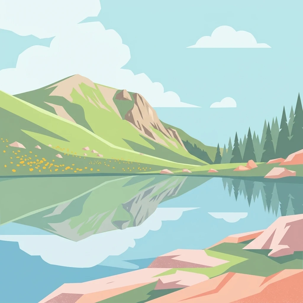
A flat-style digital illustration showing a calm alpine lake reflecting a green mountain and surrounding pine trees under a blue sky with clouds.

Réserve naturelle régionale des Partias

Nature reserve

Park overview

Structured park overview, official facts, and landscape profile for Réserve naturelle régionale des Partias

Réserve naturelle régionale des Partias park facts, protected area profile, and essential visitor context

Review the core facts for Réserve naturelle régionale des Partias, including designation, size, terrain, visitor scale, habitats, and operating context in one park-focused overview.

About Réserve naturelle régionale des Partias

The Réserve naturelle régionale des Partias safeguards a stretch of high-mountain landscape perched above the Serre Chevalier valley in the southern French Alps. Located on the commune of Puy-Saint-André a short distance west of Briançon, the reserve lies entirely within the Hautes-Alpes department and belongs to the Provence-Alpes-Côte d'Azur region. Its altitudinal range, from subalpine meadows near 1,600 meters up to the bare summits around the Cime de la Condamine at nearly 2,940 meters, allows a wide spectrum of mountain habitats to coexist within a relatively compact area.

Long before formal protection, the Vallon des Combes and the broader Partias basin were recognized for their natural value. Their scientific interest was first documented in the mid-1960s, and local conservation efforts gathered pace in the 1970s and 1980s, eventually leading to a voluntary nature reserve status by 1990. The stronger regional nature reserve classification arrived in 2009, and a subsequent reclassification in 2019 extended the protected surface to its current size.

Today the reserve is co-administered by the commune of Puy-Saint-André and the LPO Provence-Alpes-Côte d'Azur, an arrangement that reflects both local civic engagement and the strong ornithological importance of the site. Walking trails from Serre Chevalier and from Puy-Saint-André provide access to the heart of the reserve, notably allowing visitors to discover the Lac des Partias and the surrounding alpine scenery, while visitors are expected to respect the regulations that govern this fragile environment.

Quick facts and research context for Réserve naturelle régionale des Partias

The Réserve naturelle régionale des Partias lies in the Provence-Alpes-Côte d'Azur region, Hautes-Alpes department, on the commune of Puy-Saint-André west of Briançon. Classified in 2009 and reclassified in 2019, it covers a substantial alpine territory between roughly 1,600 m and 2,940 m of elevation, including the Cime de la Condamine. It is managed as a regional nature reserve (UICN Category IV) by the commune of Puy-Saint-André together with the Ligue pour la Protection des Oiseaux (LPO) of Provence-Alpes-Côte d'Azur, succeeding an earlier voluntary nature reserve that originated in 1990.

Protection and recognition

Explore the documented terrestrial protection scope and 2019 designation timeline.

Réserve naturelle régionale des Partias Protection Status and Designation History

Réserve naturelle régionale des Partias maintains a documented terrestrial protection status established in 2019. Structured records organize the designation history, management scope, and verified registry entries for this protected natural area.

Protection details

Protection scope
Terrestrial
Designated year
2019
Transboundary protection
No
WDPA ID
555514401
Park context

Deeper park guide and search-rich context for Réserve naturelle régionale des Partias

Réserve naturelle régionale des Partias history, landscape, wildlife, and travel context

Explore Réserve naturelle régionale des Partias through its history, landscape character, ecosystems, wildlife, conservation priorities, cultural context, and seasonal travel timing in a structured park guide built for atlas discovery and search intent.

Why Réserve naturelle régionale des Partias stands out

The reserve is best known for its high-altitude mosaic ecosystems, where alpine lakes, moist meadows, rocky outcrops and steep scree slopes combine to support a remarkable diversity of mountain plants and animals. It is especially recognized for its rich avifauna, including black grouse, ptarmigan and rock partridge, and for the traditional mountain fauna of chamois, marmots and stoats. The Lac des Partias, sitting in a protected basin, is a defining visual and ecological feature of the site.
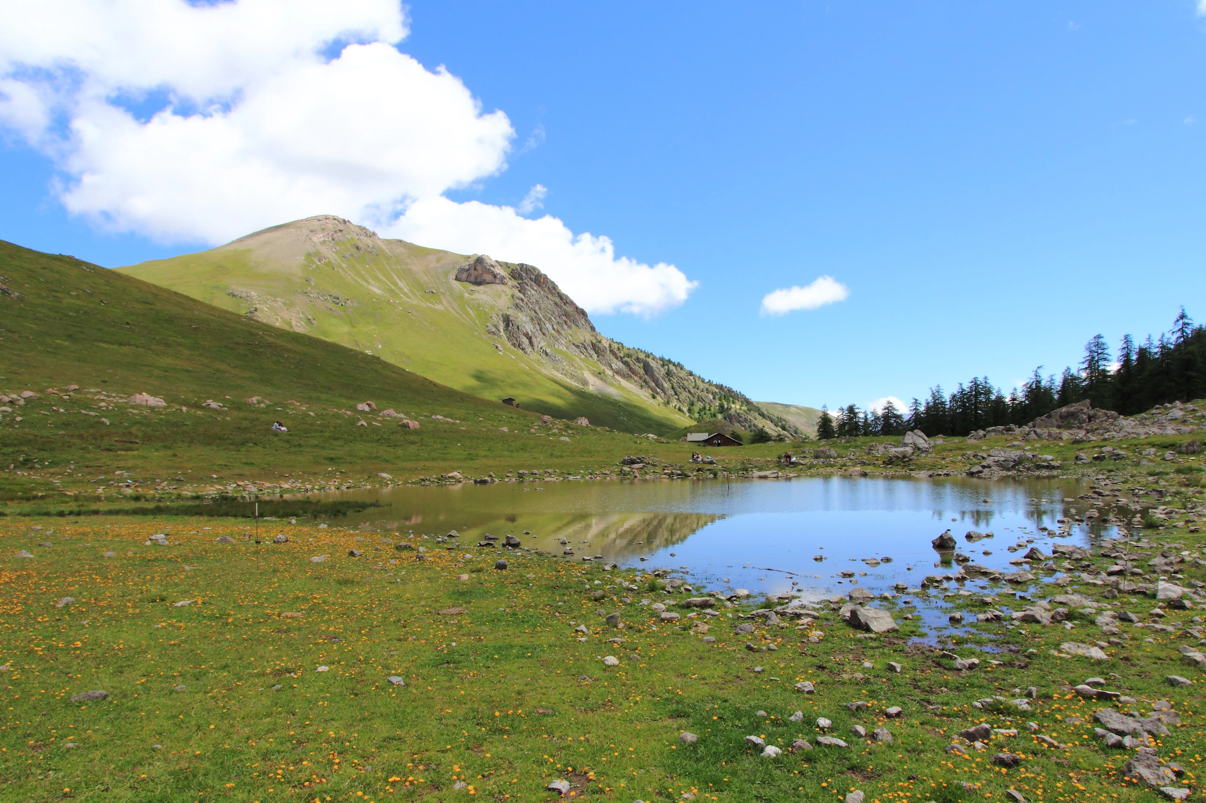
A small mountain lake reflects the clear blue sky and puffy clouds in a grassy alpine meadow, with a large green mountain rising in the background.
A peaceful view of the alpine landscape and Lac des Partias within the Réserve naturelle régionale des Partias.

Réserve naturelle régionale des Partias history and protected-area timeline

The natural value of the Vallon des Partias was first identified scientifically by the Institut national de la recherche agronomique in 1965. In 1974, local residents formed the Association des Amis des Combes to defend the area, marking the beginning of sustained civic action for its preservation.

The commune of Puy-Saint-André joined the effort in 1990, helping the site achieve classification as a voluntary nature reserve (réserve naturelle volontaire). This earlier status provided the foundation for a stronger formal protection when, on 30 October 2009, the territory was classified as a Réserve naturelle régionale. A new deliberation on 13 December 2019 expanded the reserve to its present area of 801.78 hectares. The first management plan for the reserve covered the period from 2011 to 2016, setting the framework for ongoing conservation work by the commune and the LPO PACA.

Réserve naturelle régionale des Partias landscape and geographic character

The reserve unfolds across a steep, sun-exposed alpine basin typical of the southern Alps. Elevations climb from around 1,600 meters in the lower basins to the rocky crest of the Cime de la Condamine at roughly 2,940 meters, producing a layered scenery of forested slopes, open meadows, and high bare rocky terrain. Glacial and post-glacial processes have left a varied surface of polished rock, loose scree, and damp depressions, while small streams feed the modest Lac des Partias, a small mountain lake set in a quiet cirque.

Above the lake, the terrain opens into wide alpine pastures and rocky plateaus, dissected by gullies and boulder fields. The geology of the site is unusually diverse for its size, contributing to sharp local contrasts between acidic and basic substrates and, with them, a patchwork of soil types and plant communities. Throughout the reserve, the dominant feel is one of high open space: long sightlines over bare ridges, quiet cirque lakes, and the sense of elevation typical of the Briançonnais.

Réserve naturelle régionale des Partias ecosystems, habitats, and plant life

The Partias reserve encompasses the full range of habitats associated with high-altitude southern Alps. Rocky outcrops, mobile scree slopes, wet meadows, small lake and stream margins, and dry alpine grasslands all occur within the perimeter. This habitat mosaic, combined with varied geology, creates the conditions for unusually rich plant communities in a relatively restricted area.

Wetland fragments, including the margins of the Lac des Partias and associated peat-influenced soils, support moisture-loving species such as the Arctic rush (Juncus arcticus) and dwarf club-rush (Scirpus nanus). Drier slopes and rocky areas carry classic high-alpine species including columbine, martagon lily, and edelweiss, while lower zones blend into subalpine meadows typical of the Briançonnais. Overall, the ecological character of the reserve is defined by the interplay between dry alpine substrates, moist basins, and the strong seasonality of a high-mountain climate.

Réserve naturelle régionale des Partias wildlife and species highlights

The reserve's birdlife is one of its principal conservation assets. More than 100 bird species have been recorded, mixing resident high-altitude specialists such as black grouse, rock ptarmigan, alpine rock partridge, and snowfinch with summer visitors like common house martins and the striking rock thrush. The combination of cliffs, meadows, and wet margins gives rise to a layered bird community in which specialists of open rock, alpine lawns, and aquatic edges all share the same airspace.

Among mammals, around 25 species have been documented. The reserve is home to classic alpine mammals such as chamois on the rocky slopes, alpine marmots in the meadows, and stoats hunting among the rocks and scree. Mountain hares (Lepus timidus) also find suitable habitat here, while two bat species, the western barbastelle and Savi's pipistrelle, have been recorded in the area.

Reptile presence is documented by populations of European green lizards taking advantage of sunny rocky exposures. Amphibians, though less emphasized in the source material, are likely associated with the wet margins of the lake and stream systems, complementing the broader picture of a reserve with a broad, balanced high-altitude fauna.

Réserve naturelle régionale des Partias conservation status and protection priorities

The Réserve naturelle régionale des Partias plays an important conservation role in a heavily visited alpine region. By protecting an altitudinal gradient from subalpine meadows up to almost 3,000 meters, the reserve preserves a continuum of habitats that would otherwise be vulnerable to ski-area expansion, grazing pressure, tourism development, and climate-driven change. Its formal IUCN Category IV status reflects its focus on the conservation of particular species or habitats through active management.

The involvement of the LPO PACA, a leading regional bird protection organization, underlines the ornithological priority of the site, particularly the safeguarding of grouse, ptarmigan, and rock partridge habitat. Joint management by the commune of Puy-Saint-André ensures that conservation actions are embedded in local land use, while the initial management plan (2011-2016) and the 2019 extension illustrate an active, evolving protection strategy for the area.

Réserve naturelle régionale des Partias cultural meaning and human context

The reserve lies in a territory with a long tradition of mountain pastoralism and tight-knit Alpine communities. Puy-Saint-André, the commune that administers the reserve together with the LPO, has historically shaped the landscape through traditional seasonal grazing, haymaking, and the maintenance of the trails that still link the valley to the high pastures. Local civic engagement has been central to the reserve's existence: the Association des Amis des Combes, founded in 1974 by local residents, played a foundational role in the long path from scientific recognition to formal protection.

Top sights and standout views in Réserve naturelle régionale des Partias

Crossing the reserve, visitors encounter a layered alpine landscape anchored by the Lac des Partias and crowned by the Cime de la Condamine. Trails from Serre Chevalier and Puy-Saint-André open access to a varied terrain where alpine lakes, wet meadows, scree slopes and rocky ridges converge within a single protected area. The reserve stands out for the richness of its birdlife and the presence of emblematic mountain mammals, managed jointly by a committed local commune and a regional bird protection organization.

Best time to visit Réserve naturelle régionale des Partias

The reserve is at its most accessible and biologically active during the snow-free alpine summer, when meadows are in flower and high-altitude bird species, including grouse and rock thrush, are actively breeding. Late spring and early summer favour blossoming alpine flora, with edelweiss, martagon lily and columbine in evidence; high summer offers the best conditions for reaching the higher ridges and the lake. Outside this window, deep snow, frozen ground, and elevated avalanche risk limit safe access, and the high-altitude fauna largely leaves or descends to lower ground.

Monthly climate preview

Examine long-term representative temperature and precipitation averages across twelve months.

Réserve naturelle régionale des Partias Climate Normals and Temperature Rhythm

Representative coordinate records show measured monthly temperature variations spanning from sub-zero winter lows to milder summer peaks alongside steady precipitation rates. Reviewing the complete twelve-month climate profile provides detailed historical baseline values for this protected area.
Annual mean2 °C
-7 °C12 °C
Jan-7°
Feb-7°
Mar-3°
Apr
May
Jun10°
Jul12°
Aug12°
Sep
Oct
Nov-2°
Dec-6°
Warmest month
August

12.4 °C

Coolest month
January

-7.1 °C

Wettest month
November

3 mm/day

Driest month
March

1.9 mm/day

Park location guide

Geography guide, regional context, and park location map for Réserve naturelle régionale des Partias

Réserve naturelle régionale des Partias park geography, regions, and map view in France

Understand where Réserve naturelle régionale des Partias sits in France through a broader geographic reading of the surrounding landscape, nearby location context, and its mapped position within the national park landscape.

How Réserve naturelle régionale des Partias fits into France

France is a unitary semi-presidential republic and one of the world's largest economies. It borders Belgium, Luxembourg, Germany, Switzerland, Italy, Monaco, Andorra, and Spain, with a maritime border to the United Kingdom. The country is known for its cultural influence, art, cuisine, and political history spanning centuries.

Wider geography shaping Réserve naturelle régionale des Partias in France

France is located in Western Europe. Metropolitan France extends from the Rhine to the Atlantic Ocean and from the Mediterranean Sea to the English Channel and North Sea. The country borders Belgium, Luxembourg, Germany, Switzerland, Italy, Monaco, Andorra, Spain, and has a maritime border with the United Kingdom.

Map view of Réserve naturelle régionale des Partias

Use this park location map to pinpoint Réserve naturelle régionale des Partias in France, understand its exact geographic position, and read its mapped placement within the surrounding landscape more clearly.

Pigeon | © OpenStreetMap contributors

Location context for Réserve naturelle régionale des Partias

Provence-Alpes-Côte d'Azur

Visual reference for high-altitude terrain, alpine lakes, and protected mountain habitats

Réserve naturelle régionale des Partias Photos and Landscape Scenery

Visual documentation captures the high-mountain landscape, rocky scree slopes, and subalpine meadows of Réserve naturelle régionale des Partias. Photographic records reveal the protected terrain surrounding Lac des Partias and the rugged crests of the French Alps.

A small mountain lake reflects the clear blue sky and puffy clouds in a grassy alpine meadow, with a large green mountain rising in the background.

Park atlas

Compare high-altitude regional reserves and connected mountain landscapes across the southern Alps

Other Parks Near Réserve naturelle régionale des Partias and Surrounding Alpine Protected Areas

Browsing other protected areas near Réserve naturelle régionale des Partias reveals shared high-mountain topography and diverse alpine habitats. Comparing surrounding regional reserves establishes broader geographic context across the rugged Briançonnais terrain.
Watercolor illustration showing mountains, a winding river, and pine trees in a landscape
National parkFrance
About 4.4 km away#1 closest

West

Écrins National Park: Alpine Glaciated Terrain and Protected Landscape Details

Mapped boundaries and regional geography of a major French National Park.

Delve into Écrins National Park, a defining national park within the French Alps. This page provides a comprehensive overview of its protected landscape, focusing on its dramatic glaciated terrain, significant peaks such as the Barre des Écrins, and its position within the regional geographic context. Explore the mapped extent and understand the unique alpine environment of this protected area.

Area
925 km²
Established
1973
IUCN
II
Visitors
800K annual
A watercolor illustration of a landscape with purple and pink layered mountain peaks in the background and soft green trees in the foreground, set against a plain white background.
Nature reserveAuvergne-Rhône-Alpes
About 20 km away#2 closest

West

Réserve naturelle nationale de la haute vallée du Vénéon: Alpine Geography and Protected Boundaries

High-altitude mountain terrain in the French Alps

The Réserve naturelle nationale de la haute vallée du Vénéon occupies 61 hectares of striking alpine terrain near the hamlet of La Bérarde. Its landscape of steep slopes and glacial deposits functions as a key protected buffer zone, supporting diverse flora and fauna within the broader mountainous geography of the Auvergne-Rhône-Alpes region.

Area
0.61 km²
Established
1974
IUCN
IV
A watercolor painting of a river valley with soft green trees, rolling hills, and distant mountains under a light sky.
Nature reserveProvence-Alpes-Côte d'Azur
About 24 km away#3 closest

West

Réserve naturelle nationale de la haute vallée de la Séveraisse: Protected Alpine Corridor

High-mountain riverine landscape and buffer zone in Hautes-Alpes

This nature reserve encompasses a 4-kilometer stretch of the upper Séveraisse valley, focusing on alluvial riverbed habitat and peripheral mountain terrain. Located in the French Alps, the reserve provides a protected transition zone characterized by its narrow, U-shaped valley floor and steep rocky inclines, offering a key geographic link to the wider Écrins ecosystem.

Area
1.55 km²
Established
1974
IUCN
IV
Watercolor painting depicting mountains, a river, and trees under a light sky
National parkSavoie
About 38 km away#4 closest

Northeast

Vanoise National Park: Explore France's Original National Park in the Savoie Alps

Mapped Alpine geography, glacial terrain, and protected landscape.

Vanoise National Park is France's pioneering national park, a protected landscape of immense alpine beauty situated in the Savoie department. Renowned for its dramatic glacial terrain, over 100 peaks above 3,000 meters, and the iconic Alpine ibex, this park offers a profound geographic context. Explore its mapped boundaries and discover the unique atlas-level insights into France's mountainous protected areas and their ecological significance.

Area
534 km²
Established
1963
IUCN
II
Relief
Mountain
A soft watercolor illustration featuring rolling green hills, a winding path, and distant mountain ridges in a muted, painterly style.
Nature reserveFrance
About 38 km away#5 closest

West

Réserve naturelle nationale de la haute vallée du Béranger: Mountain Protected Area Map

Tracing the alpine terrain and torrent corridors in the French Alps.

Covering roughly 84 hectares in the Isère region, this nature reserve integrates traditional pastoral landscapes with steep-sided forest slopes and rocky alpine ridges. It functions as a key protective buffer for the larger Écrins National Park, preserving a representative slice of southern French Alpine geography within a single, cohesive valley setting.

Area
0.84 km²
Established
1974
Relief
Mountain
Climate
Alpine
A horizontal watercolor painting showing a soft alpine meadow with a stream running through it, framed by distant rolling mountains and patches of trees.
Regional parkPiemonte
About 48 km away#6 closest

Southeast

Pian del Re Regional Park: Geography and Alpine Protected Landscapes in Piemonte

Glacial springs, peat bogs, and Monviso mountain terrain

Pian del Re is a significant regional park situated in the upper Po Valley of the Cottian Alps. Known for its high-altitude plateau, the area marks the origin of the Po River and hosts sensitive wetland habitats. The landscape is defined by the sharp relief of the Monviso group and a complex network of glacial meltwater, providing a distinct study in alpine ecology and mountain geography.

Relief
Mountain
Climate
Alpine
Access
Moderate access
Scope
Terrestrial
Watercolor illustration of a mountainous landscape featuring a river, rolling hills, and green vegetation
National parkFrance
About 58 km away#7 closest

Southeast

Mercantour National Park: Mapped Alpine Protected Landscape and Regional Geography

Explore France's dramatic Alps, park boundaries, and unique ecotones.

Mercantour National Park stands as a premier protected area within the French Alps, distinguished by its remarkable geographic diversity and ecological significance. This national park encompasses mountainous terrain featuring dramatic peaks, deep glacial valleys, and a unique ecotone where Mediterranean and Alpine ecosystems converge. MoriAtlas facilitates a detailed atlas-style exploration of Mercantour National Park, highlighting its mapped protected boundaries, varied natural landscapes, and its pivotal role in regional geography and conservation efforts.

Area
679 km²
Established
1979
IUCN
II
Visitors
800K annual
A pale, soft watercolor illustration showing a horizontal landscape of a pond and wetlands bordered by trees, with faint mountain silhouettes in the distance.
Nature reserveIsère
About 68 km away#8 closest

West

Réserve naturelle régionale de l'étang de Haute-Jarrie, Isère Protected Wetland Landscape

Regional nature reserve and migratory bird sanctuary

Situated on the Plateau de Champagnier in Isère, this regional nature reserve offers a concentrated example of glacial pond ecology and wetland biodiversity. Covering 11 hectares, it acts as a critical stopover within the Grésivaudan valley migratory corridor. This protected site features diverse habitats, including reedbeds and wet meadows, that support hundreds of recorded bird species and a variety of dragonflies and amphibians, making it a significant area for ecological study.

Area
0.11 km²
Established
2008
IUCN
IV
Relief
Upland

Common questions about visiting, size, designation, and location context for Réserve naturelle régionale des Partias

Réserve naturelle régionale des Partias FAQs for park facts, access, geography, and protected area context

Find quick answers about Réserve naturelle régionale des Partias, including protected-area facts, park geography, trail and visitor context, and how the park fits into its surrounding country and regional landscape.
MoriAtlas Explorer

Continue Your Protected Areas Search Across the Global Atlas

Deepen your exploration by continuing the structured search for national parks and protected areas worldwide. Utilize the comprehensive filtering capabilities to compare different conservation landscapes and refine your understanding of global park geography. Discover more about the distribution and characteristics of protected natural areas.

Global natural geography