Mori Atlas logo
Nature reserveRéserve naturelle régionale des tourbières du Morvan

A decentralized ecological network protecting diverse mires, bogs, and hydrologic habitats across the Morvan massif

Réserve naturelle régionale des tourbières du Morvan: Exploring the Peatland Landscapes of Bourgogne-Franche-Comté

The Réserve naturelle régionale des tourbières du Morvan encompasses fourteen distinct sectors spanning thirty kilometers of the Morvan massif. This regional nature reserve secures a mosaic of raised bogs, transitional mires, and wet meadows that illustrate the complex post-agricultural recovery of peatland ecosystems in central-eastern France. Through its integrated network of protected wetlands, the area offers critical insight into the hydrologic and ecological history of the granite mountain range within Bourgogne-Franche-Comté.

peatlandsbogsmireswetlandsregional natural reserveMorvan

Réserve naturelle régionale des tourbières du Morvan

Nature reserve

Park overview

Structured park overview, official facts, and landscape profile for Réserve naturelle régionale des tourbières du Morvan

Réserve naturelle régionale des tourbières du Morvan park facts, protected area profile, and essential visitor context

Review the core facts for Réserve naturelle régionale des tourbières du Morvan, including designation, size, terrain, visitor scale, habitats, and operating context in one park-focused overview.

About Réserve naturelle régionale des tourbières du Morvan

The Réserve naturelle régionale des tourbières du Morvan is a network-based protected area designed to safeguard some of the most characteristic peatland landscapes of the Morvan, a low mountain range in the heart of Burgundy. Rather than forming a single contiguous block, the reserve is a mosaic of fourteen separate sites scattered across ten municipalities in Nièvre and Saône-et-Loire. Together these sites protect twelve distinct tourbières, ranging from small, isolated bogs to extensive peatland complexes attached to lakes and springheads.

The Morvan's particular climate, marked by relatively cool, humid conditions, supports peat accumulation processes that have shaped the local landscape over millennia. The reserve conserves examples of different peatland stages and types, including raised bogs, transitional mires, wooded peat edges, and open peat meadows. Several sites were historically exploited for grazing, hay cutting, peat extraction, or timber transport, and their abandonment has allowed characteristic bog vegetation and hydrology to redevelop, even as some have required active restoration.

Among the most distinctive sites in the reserve is the Champgazon peatland near Montsauche-les-Settons, notable as the only raised bog in the Morvan. Interpretive trails focused on palynology, the study of pollen preserved in peat, offer visitors a way to understand how these environments record ecological history. The Étang de la Chevrée upstream of the Lac de Saint-Agnan provides a rich peatland environment closely tied to lake hydrology, while the Tourbière de la Croisette at Roussillon-en-Morvan exemplifies peatlands restored after former agricultural use. The Étang Taureau at Saint-Brisson, historically used for timber floating, features concentric bands of peatland vegetation that can be explored along a discovery trail.

Administered by the Parc naturel régional du Morvan, the reserve fits into a wider regional strategy of wetland conservation and ecological continuity. Its network structure, spanning about thirty kilometers across the massif, supports ecological corridors between isolated peatland habitats and helps maintain the hydrological and biological functions that make these environments so important for biodiversity in central France.

Quick facts and research context for Réserve naturelle régionale des tourbières du Morvan

The Réserve naturelle régionale des tourbières du Morvan is a French regional natural reserve (réserve naturelle régionale) classified on 13 November 2015 by a deliberation of the Regional Council. It protects twelve peatlands distributed across fourteen sectors spanning about thirty kilometers in the Morvan massif. The reserve lies within the departments of Nièvre and Saône-et-Loire, in the Bourgogne-Franche-Comté region, and is administered by the Parc naturel régional du Morvan. It is classified under IUCN Category IV, covering a total area of 266 hectares.

Protection and recognition

Review documented terrestrial protection scope, management records, and administrative designations.

Protection Status and International Recognition for Réserve naturelle régionale des tourbières du Morvan

Examine the recorded terrestrial protection status, administrative framework, and international recognition data associated with Réserve naturelle régionale des tourbières du Morvan. Structured registry details outline the verified conservation background and official designation parameters for this protected area.

Protection details

Protection scope
Terrestrial
Transboundary protection
No
WDPA ID
555597277
Park context

Deeper park guide and search-rich context for Réserve naturelle régionale des tourbières du Morvan

Réserve naturelle régionale des tourbières du Morvan history, landscape, wildlife, and travel context

Explore Réserve naturelle régionale des tourbières du Morvan through its history, landscape character, ecosystems, wildlife, conservation priorities, cultural context, and seasonal travel timing in a structured park guide built for atlas discovery and search intent.

Why Réserve naturelle régionale des tourbières du Morvan stands out

The reserve is best known for safeguarding a dozen peatlands of the Morvan massif, including the only raised bog (tourbière bombée) in the range, at Champgazon near Montsauche-les-Settons. It brings together diverse mire types: raised bogs, peatland meadows, spring-fed mires, and peat-bordered ponds such as the Étang de la Chevrée upstream of the Lac de Saint-Agnan and the Étang Taureau at Saint-Brisson. The site's mosaic of restored and actively conserved bogs makes it a key reference for peatland protection in Burgundy and central France. The reserve also stands out for its historical layer of land use, with several former agricultural mires, such as the Tourbière de la Croisette, having been restored after abandonment, and others, like the Étang Taureau, retaining traces of past timber-floating activity.
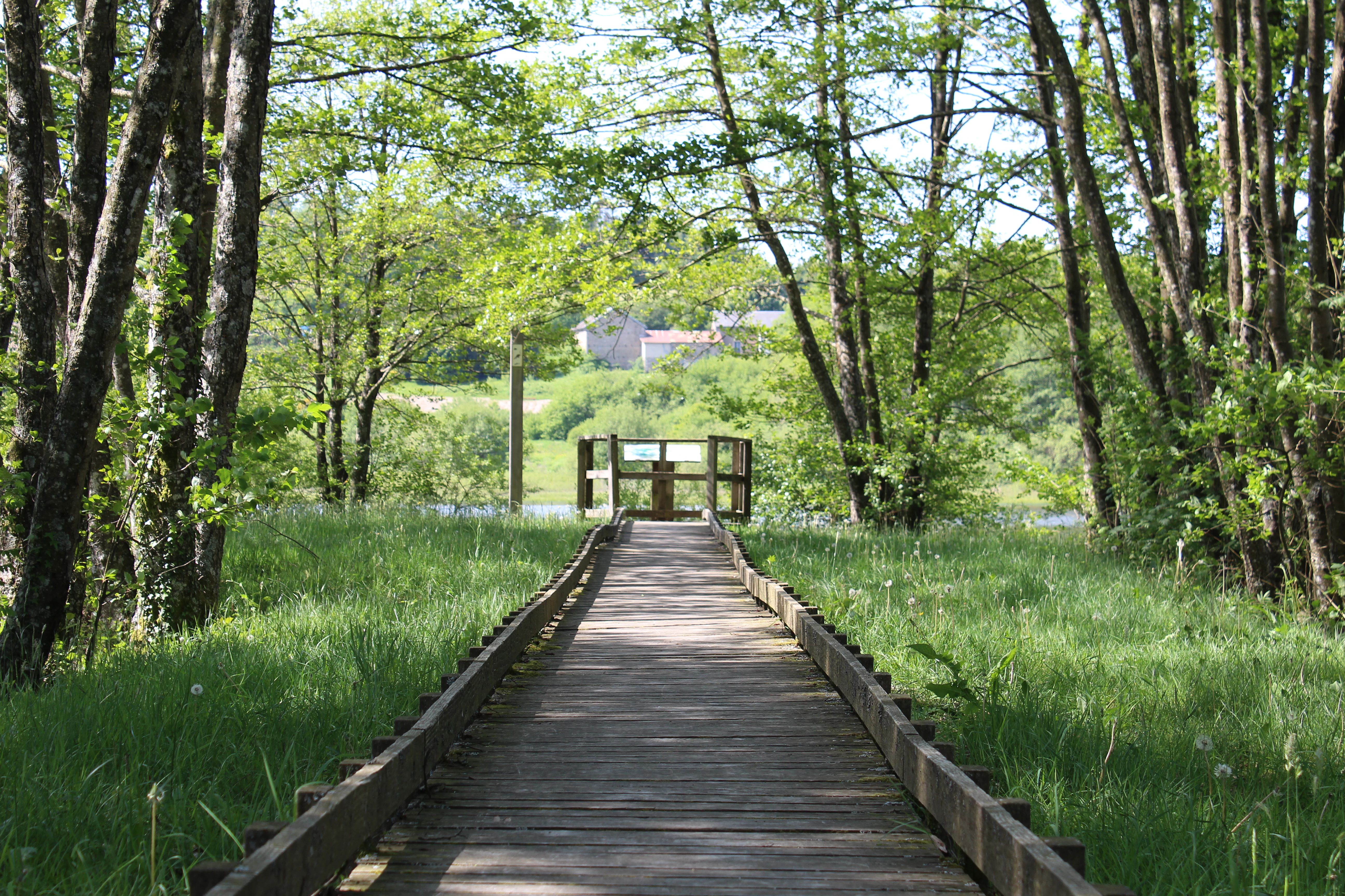
A wooden boardwalk stretches through a green grassy area flanked by trees, ending at a small wooden viewing platform overlooking water.
A wooden boardwalk leads to a viewing platform at the edge of the wetlands in the Morvan peatlands.

Réserve naturelle régionale des tourbières du Morvan history and protected-area timeline

The peatlands of the Morvan have a long history of human use. Because the massif's cool and humid climate favors peat formation, many of its tourbières were, over the centuries, pressed into agricultural service, primarily through grazing and mowing. The Étang Taureau at Saint-Brisson, for example, was historically used for timber floating, illustrating how peatland-adjacent water bodies were integrated into regional forestry logistics.

During the twentieth century, these traditional uses progressively declined, and many peatlands were simply abandoned. This abandonment triggered natural ecological transitions, but it also raised concerns about habitat loss, fragmentation, and changes in hydrology. The need to protect the most representative and ecologically valuable peatlands of the massif led to a regional conservation initiative under the framework of the natural reserve program.

On 13 November 2015, the Conseil régional formally classified the territory as the Réserve naturelle régionale des tourbières du Morvan, with reference number RNR302. Since then, the reserve's management has been entrusted to the Parc naturel régional du Morvan, which coordinates protection, ecological monitoring, restoration of degraded sites, and public engagement around these fragile wetland landscapes.

Réserve naturelle régionale des tourbières du Morvan landscape and geographic character

The reserve's landscape is defined by the gentle, rounded relief of the Morvan massif and by its extensive network of wetlands. The Morvan itself forms a low granite mountain range in the center of Burgundy, with an Atlantic-influenced climate that promotes the formation and persistence of peatlands. Elevation in the region is moderate, but the combination of cool temperatures, abundant rainfall, and acidic soils creates ideal conditions for peat accumulation in valleys, depressions, and along watercourses.

Within the reserve, the protected territory includes a mix of open peatlands, wet meadows, peat-fringed ponds, spring-fed mires, and wooded bog margins. The Étang Taureau near Saint-Brisson offers concentric bands of bog vegetation encircling a body of water, while the Étang de la Chevrée upstream of the Lac de Saint-Agnan integrates peatland with larger lacustrine hydrology. The Tourbière de la Croisette at Roussillon-en-Morvan illustrates a former agricultural peatland in the process of recovery, and the Champgazon peatland near Montsauche-les-Settons displays the distinctive domed shape of Morvan's only raised bog.

The reserve's fourteen sectors are distributed over approximately thirty kilometers, turning the protected area into a landscape-scale mosaic rather than a single contiguous site. This scattered pattern preserves the ecological diversity of the Morvan's peatlands, while also maintaining connections between isolated bog habitats across the massif.

Réserve naturelle régionale des tourbières du Morvan ecosystems, habitats, and plant life

Ecologically, the reserve belongs to the temperate peatland biome typical of central-western Europe, characterized by waterlogged, nutrient-poor, acidic conditions that support highly specialized flora and fauna. The twelve protected peatlands represent a range of successional stages and hydrological regimes, from active raised bogs with Sphagnum-rich surfaces to more transitional mires and wet meadows with underlying peat layers.

Bog margins around lakes and ponds, such as those at the Étang Taureau and the Étang de la Chevrée, feature concentric vegetation zones where aquatic, semi-aquatic, and terrestrial species meet. These zones are particularly rich biotopes, combining open water, floating mats, sedge and rush communities, wet heath, and bog woodland transitions. The presence of different ecological gradients within a single reserve network gives the site strong scientific and conservation value.

The peatlands of the Morvan also function as important carbon stores and water regulation systems. By preserving intact hydrology and typical peat-forming vegetation, the reserve contributes to maintaining the ecosystem services these wetlands provide, including water retention, water quality improvement, and long-term carbon sequestration.

Réserve naturelle régionale des tourbières du Morvan wildlife and species highlights

Specific fauna data for the reserve is limited in the available source material, as the dedicated wildlife section of the reference page remains incomplete. Nevertheless, the ecological character of the protected sites clearly supports bog-dependent fauna: amphibians associated with pond and mire margins, dragonflies and other invertebrates tied to acidic open water, and bird species typical of peatland, wetland edges, and mosaicked countryside. Wet meadows and open bog surfaces provide habitat for waders and passerines, while wooded bog margins offer shelter for forest-associated species.

Because the reserve comprises multiple isolated sectors connected ecologically across the Morvan massif, it also contributes to maintaining movements and dispersal of wetland species across the landscape. Detailed species inventories would be needed to fully characterize the wildlife value, but the structural diversity of the habitats suggests a meaningful faunal interest.

Réserve naturelle régionale des tourbières du Morvan conservation status and protection priorities

The reserve was created to address the vulnerability of Morvan peatlands, many of which had suffered from drainage, agricultural conversion, abandonment, or fragmentation during the twentieth century. By protecting twelve representative tourbières within a single regulatory framework, the reserve aims to preserve the diversity of peatland types found in the massif and to ensure their hydrological, biogeochemical, and ecological functions are maintained.

A key conservation focus is the preservation of typical bog vegetation and hydrology, including active raised bog processes at Champgazon and the transitional mires associated with lakes such as Saint-Agnan and Taureau. Several sites, including the Tourbière de la Croisette, have been the target of restoration efforts after past agricultural use. The reserve's network structure also supports landscape-scale conservation by maintaining habitat continuity across roughly thirty kilometers of the massif.

Administered by the Parc naturel régional du Morvan, the reserve benefits from integration into broader regional conservation strategies for wetlands and protected areas in Bourgogne-Franche-Comté. Its IUCN Category IV designation reflects its management as a habitat and species management area, focused on maintaining peatland habitats in favorable condition.

Réserve naturelle régionale des tourbières du Morvan cultural meaning and human context

The protected peatlands are deeply interwoven with the historical rural economy of the Morvan. Many of the bogs were traditionally used for grazing and mowing, shaping agrarian landscapes and practices that endured for generations. Water bodies associated with the peatlands, such as the Étang Taureau at Saint-Brisson, also played a role in regional forestry through timber floating, a log transport practice characteristic of many French mountain regions.

The gradual abandonment of these traditional land uses in the twentieth century marks a significant cultural transition in the Morvan: landscapes once shaped by active exploitation have become sites of ecological recovery and conservation. Today, the reserve simultaneously preserves natural heritage and the memory of these past human relationships with the land, with interpretive trails and thematic paths allowing visitors to engage with both ecologies and the region's rural history.

Top sights and standout views in Réserve naturelle régionale des tourbières du Morvan

The reserve's standout features include its unique character as a network reserve, comprising fourteen sectors that span roughly thirty kilometers to protect twelve distinct peatlands. The Champgazon peatland near Montsauche-les-Settons is a particular highlight as the only raised bog in the Morvan, while the Étang de la Chevrée upstream of the Lac de Saint-Agnan and the peat-rimmed Étang Taureau at Saint-Brisson showcase striking interactions between open water and bog vegetation. The Tourbière de la Croisette at Roussillon-en-Morvan demonstrates successful restoration of a former agricultural peatland. Across all these sites, the combination of ecological value and public discovery infrastructure, including palynology-themed trails and boardwalks, gives the reserve both scientific significance and educational reach.

Best time to visit Réserve naturelle régionale des tourbières du Morvan

The Morvan's peatlands are accessible year-round, but each season offers a different experience. Spring is a particularly active period, with rising water levels, the onset of vegetation growth, and often the most intense breeding activity for amphibians and wetland birds. Summer brings lush green bog vegetation and the warmest conditions for walking the boardwalks and interpretive trails, though insect presence can be notable around wet areas.

Autumn is appealing for its changing colors and often quieter atmosphere, while winter, though colder and wetter, can offer a more solitary and atmospheric encounter with these open, exposed landscapes. Because peatlands are waterlogged and protected habitats, visitors should generally stick to marked paths and prepared walkways in all seasons.
Monthly climate preview

Track long-term average temperature ranges and precipitation rates across the protected landscape coordinate.

Climate Normals and Monthly Weather Patterns in Réserve naturelle régionale des tourbières du Morvan

Long-term representative records show sustained shifts in mean monthly temperatures alongside steady daily precipitation rates across the coordinate. Reviewing the complete twelve-month statistical baseline provides deeper context for the local environmental rhythm.
Annual mean10 °C
2 °C19 °C
Jan
Feb
Mar
Apr10°
May14°
Jun17°
Jul19°
Aug19°
Sep15°
Oct11°
Nov
Dec
Warmest month
July

19.4 °C

Coolest month
January

2 °C

Wettest month
November

2.5 mm/day

Driest month
March

1.7 mm/day

Park location guide

Geography guide, regional context, and park location map for Réserve naturelle régionale des tourbières du Morvan

Réserve naturelle régionale des tourbières du Morvan park geography, regions, and map view in France

Understand where Réserve naturelle régionale des tourbières du Morvan sits in France through a broader geographic reading of the surrounding landscape, nearby location context, and its mapped position within the national park landscape.

How Réserve naturelle régionale des tourbières du Morvan fits into France

France is a unitary semi-presidential republic and one of the world's largest economies. It borders Belgium, Luxembourg, Germany, Switzerland, Italy, Monaco, Andorra, and Spain, with a maritime border to the United Kingdom. The country is known for its cultural influence, art, cuisine, and political history spanning centuries.

Wider geography shaping Réserve naturelle régionale des tourbières du Morvan in France

France is located in Western Europe. Metropolitan France extends from the Rhine to the Atlantic Ocean and from the Mediterranean Sea to the English Channel and North Sea. The country borders Belgium, Luxembourg, Germany, Switzerland, Italy, Monaco, Andorra, Spain, and has a maritime border with the United Kingdom.

Map view of Réserve naturelle régionale des tourbières du Morvan

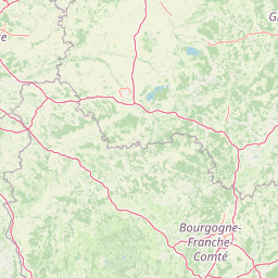
Use this park location map to pinpoint Réserve naturelle régionale des tourbières du Morvan in France, understand its exact geographic position, and read its mapped placement within the surrounding landscape more clearly.

Pigeon | © OpenStreetMap contributors

Location context for Réserve naturelle régionale des tourbières du Morvan

Bourgogne-Franche-Comté

Explore the wetland habitats, raised bogs, and scenic terrain defining this regional protected area network.

Visualizing Réserve naturelle régionale des tourbières du Morvan Photos, Scenery, and Protected Landscape Character

Visual documentation of Réserve naturelle régionale des tourbières du Morvan reveals the complex mosaic of peatlands, wet meadows, and fringe ponds spanning the Morvan massif. Photographic records provide clear insight into wetland recovery processes, rare bog vegetation, and the characteristic topography of protected sectors across central France.

A wooden boardwalk stretches through a green grassy area flanked by trees, ending at a small wooden viewing platform overlooking water.

Park atlas

Compare regional wetlands, protected landscapes, and neighboring nature reserves across central France

Parks Near Réserve naturelle régionale des tourbières du Morvan and Surrounding Protected Areas

Browsing other protected areas near Réserve naturelle régionale des tourbières du Morvan reveals connected wetland habitats and regional conservation patterns. Extending the geographic comparison helps trace broader ecological networks and regional terrain features across the surrounding granite massif.
Watercolor painting of the Loire river showing trees along the banks and soft pink clouds in the background.
Nature reserveBourgogne-Franche-Comté
About 57 km away#1 closest

Southwest

Réserve naturelle régionale de la Loire bourguignonne: Regional Nature Reserve Map

Protected fluvial geography in Bourgogne-Franche-Comté

Located in the Nièvre department, this reserve protects an essential section of the Loire river. The landscape offers a rich mosaic of 31 natural habitats, featuring exposed gravel banks and riparian woodlands that support rare endemic flora and diverse ground-nesting bird populations.

Area
7.397 km²
Established
2015
IUCN
IV
Relief
Lowland
A horizontal watercolor painting showing a green landscape with a winding stream, patches of marshy water, and distant hills, with soft light and green trees on the sides.
Nature reserveBourgogne-Franche-Comté
About 58 km away#2 closest

West

Réserve naturelle régionale des Mardelles de Prémery: Protected Wetland and Forest Geography

Mapping the peatland depressions of the Prémery forest

This nature reserve protects a rare assemblage of mardelles, shallow forest pools set within the Prémery state forest. The landscape serves as a vital ecological archive, with peat deposits documenting environmental changes over 15 millennia. Explore the unique hydrological and botanical features of this protected lowland habitat nestled in the heart of the Nièvre department.

Area
2.525 km²
Established
2015
IUCN
IV
Nature reserveAuvergne-Rhône-Alpes
About 62 km away#3 closest

Southwest

Réserve naturelle régionale du val de Loire Bourbonnais Protected Area and Atlas View

Riverine geography and floodplain landscapes in Allier, France

Examine the geographic profile of the Réserve naturelle régionale du val de Loire Bourbonnais. This site protects a significant stretch of the Loire River characterized by active meanders and alluvial deposits, representing a key example of riverine conservation in the Bourbonnais region of central France.

Area
3.08 km²
Established
2015
IUCN
IV
Watercolor painting of a green, rolling landscape showing forested hills in varying shades of light green and soft earth tones against a white background.
Nature reserveBourgogne-Franche-Comté
About 66 km away#4 closest

East

Réserve naturelle nationale de la combe Lavaux-Jean Roland Protected Area Geography

Limestone cliff landscapes in Bourgogne-Franche-Comté

Spanning over 400 hectares, this nature reserve showcases a dramatic interplay of steep limestone walls and scree slopes. The geographic profile highlights the contrast between north-facing forest and sunlit grasslands, creating a vital corridor for endemic species within the Burgundy landscape.

Area
4.87 km²
Established
2004
IUCN
IV
Relief
Upland
Nature reserveBourgogne-Franche-Comté
About 69 km away#5 closest

East

Réserve naturelle régionale de la grotte du Contard: Protected Karst and Cave Geography

Regional natural reserve in the Bourgogne-Franche-Comté landscape

Located near Dijon, the Réserve naturelle régionale de la grotte du Contard is a protected area focused on preserving the karst features and geological heritage of the Côte-d'Or. This site serves as a vital example of subterranean habitat conservation, showcasing the unique interaction between water-sculpted limestone cavities and the surrounding plateau terrain. Explore the geographic extent of this reserve and understand its role within the regional natural reserve network.

Area
0.259 km²
Established
2025
IUCN
IV
Climate
Temperate
A watercolor painting of a pastoral landscape featuring a calm river winding through green fields and forests with rolling mountains in the background, set against a soft sunset sky.
Nature reserveBourgogne-Franche-Comté
About 73 km away#6 closest

Northeast

Réserve naturelle régionale du Val-Suzon: Protected Landscape and Geographic Atlas

Wooded limestone valleys in the Bourgogne-Franche-Comté region

Spanning the meandering Suzon river, this large regional nature reserve provides a essential look at the limestone plateaus and deciduous woodlands of Côte-d'Or. The area serves as a primary reference for regional biodiversity, containing dry grasslands, rocky slopes, and sensitive tufa springs protected within its defined borders. This resource outlines the physical terrain and conservation significance of the territory for those mapping the natural landscape of eastern France.

Area
29.806 km²
Established
2011
Relief
Upland
Climate
Temperate
Watercolor illustration of a forested landscape with rolling hills, distant mountains, and a sky with soft pastel colors
National parkFrance
About 76 km away#7 closest

Northeast

Forêts National Park: A Protected Landscape of Lowland Deciduous Forests

Explore its unique geography and protected forest ecosystems.

Delve into Forêts National Park, a significant protected area in northeastern France dedicated to preserving lowland deciduous forests and their associated biodiversity. This park represents a unique atlas entry for understanding mapped protected lands, featuring extensive broad-leaved forest tracts, diverse wetlands, and limestone grasslands across the Grand Est and Bourgogne-Franche-Comté regions. Discover the geographic identity of this conservation landscape and its role within the Paris Basin's terrain.

Area
560 km²
Established
2019
IUCN
II
Relief
Lowland
Nature reserveBourgogne-Franche-Comté
About 79 km away#8 closest

Northeast

Réserve naturelle régionale du Peuptu de la Combe Chaignay: Regional Nature Reserve Profile

Protected calcareous habitats in the Burgundy limestone uplands.

Spanning 36.6 hectares in the Côte-d'Or, this reserve protects a characteristic combe landform carved into Jurassic limestone plateaus. It serves as a vital example of site-specific conservation within the Bourgogne-Franche-Comté region, focusing on the management of habitats essential to the northern French countryside.

Area
0.366 km²
Established
2025
IUCN
IV
Relief
Mixed relief

Common questions about visiting, size, designation, and location context for Réserve naturelle régionale des tourbières du Morvan

Réserve naturelle régionale des tourbières du Morvan FAQs for park facts, access, geography, and protected area context

Find quick answers about Réserve naturelle régionale des tourbières du Morvan, including protected-area facts, park geography, trail and visitor context, and how the park fits into its surrounding country and regional landscape.
MoriAtlas Explorer

Continue Your Protected Areas Search Across the Global Atlas

Deepen your exploration by continuing the structured search for national parks and protected areas worldwide. Utilize the comprehensive filtering capabilities to compare different conservation landscapes and refine your understanding of global park geography. Discover more about the distribution and characteristics of protected natural areas.

Global natural geography