Mori Atlas logo
Nature reserveRéserve naturelle régionale du bocage des Antonins

A detailed geographic look at the hedgerows, ancient ponds, and mosaic habitats of this protected French reserve.

Réserve naturelle régionale du bocage des Antonins: Mapping the Bocage Landscape in Deux-Sèvres

(Réserve naturelle régionale du bocage des Antonins (RNR286))

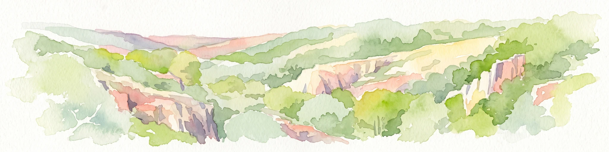
The Réserve naturelle régionale du bocage des Antonins represents a finely structured habitat network within the rural Gâtine armoricaine. This protected area preserves an ancient mosaic of meadows, ponds, and hedgerows that defines the regional geography of Deux-Sèvres. Through detailed mapping of its internal terrain, observers can trace the intersection of historical land use and ecological conservation within this small, dense landscape.

regional nature reservebocage landscapehedgerowspollarded treeswetlandpond

Réserve naturelle régionale du bocage des Antonins

Nature reserve

Park overview

Structured park overview, official facts, and landscape profile for Réserve naturelle régionale du bocage des Antonins

Réserve naturelle régionale du bocage des Antonins park facts, protected area profile, and essential visitor context

Review the core facts for Réserve naturelle régionale du bocage des Antonins, including designation, size, terrain, visitor scale, habitats, and operating context in one park-focused overview.

About Réserve naturelle régionale du bocage des Antonins

The Réserve naturelle régionale du bocage des Antonins is a small but unusually diverse regional nature reserve in western France, located in the southern part of the commune of Saint-Marc-la-Lande in the Deux-Sèvres department. Falling within the broader Nouvelle-Aquitaine region, it lies in the heart of the Gâtine armoricaine, a rural area traditionally defined by dense hedgerow networks, small fields, ponds, and mixed farming systems that constitute a classic bocage landscape.

Classified on 24 April 2015 under the French regional nature reserve framework, the reserve covers approximately 22.59 hectares. Although small in absolute terms, the reserve brings together a striking concentration of complementary habitats within a compact area. Centred on the étang des Forges, an old pond linked to the site's medieval monastic history, the protected area includes wet zones around the waterbody, species-rich meadows used for hay-cutting and grazing, ancient hedgerows featuring numerous pollarded trees, and small woodland parcels. This habitat mosaic is highly representative of the traditional bocage countryside that once dominated much of western France but has been substantially lost through agricultural intensification.

The reserve is managed by the association Deux-Sèvres Nature Environnement, which has been active on the site for more than a decade. The association combines on-the-ground stewardship with educational outreach and species monitoring. Although the reserve itself is not open to the general public for free access, a marked path runs along its perimeter and the manager organises regular nature events and pedagogical activities. The first formal management plan for the reserve was being developed following its classification.

The site's significance lies in both its ecological value and its cultural backstory. The land was once held by the Antonine order, a medieval hospitaller order established at Saint-Marc-la-Lande in the 13th century, and their commandery still stands nearby. Centuries of traditional land use shaped the mosaic that the reserve now protects, and the pond continues to testify to that historical relationship between human settlement and the rural landscape. Later, the property passed to the Litardière family, whose most famous naturalist member, the botanist René Verriet de Litardière, contributed substantially to regional botanical knowledge. That deep historical layering makes the bocage des Antonins not only an ecological island within the modern agricultural landscape, but also a place where centuries of human presence and careful land management are still visible in the patterns of fields, hedges, and water features.

Quick facts and research context for Réserve naturelle régionale du bocage des Antonins

The Réserve naturelle régionale du bocage des Antonins is a regional nature reserve in the Nouvelle-Aquitaine region of western France, situated in the Deux-Sèvres department near the commune of Saint-Marc-la-Lande. It is a habitat-protection reserve focused on a traditional bocage landscape, including a medieval monastic pond (étang des Forges), old hedgerows, and small woodlands. The reserve is managed by Deux-Sèvres Nature Environnement and was officially classified by the Regional Council on 24 April 2015. With a surface area of around 22.59 hectares, it is a small but ecologically dense site, notable for its concentration of meadows, ponds, hedgerows, and species-rich flora and fauna within a limited footprint.

Protection and recognition

Documented terrestrial protection history, designation year, and management scope.

Protection Status and International Recognition of Réserve naturelle régionale du bocage des Antonins

Terrestrial protection status for Réserve naturelle régionale du bocage des Antonins is documented alongside historical designation records established in 2015. Structured conservation facts provide verified protection parameters without international recognition sources.

Protection details

Protection scope
Terrestrial
Designated year
2015
Transboundary protection
No
WDPA ID
555597275
Park context

Deeper park guide and search-rich context for Réserve naturelle régionale du bocage des Antonins

Réserve naturelle régionale du bocage des Antonins history, landscape, wildlife, and travel context

Explore Réserve naturelle régionale du bocage des Antonins through its history, landscape character, ecosystems, wildlife, conservation priorities, cultural context, and seasonal travel timing in a structured park guide built for atlas discovery and search intent.

Why Réserve naturelle régionale du bocage des Antonins stands out

The reserve is best known for protecting a representative and ecologically rich example of the bocage landscape of the Gâtine armoricaine, a mosaic of ponds, meadows, ancient hedgerows, and small woodlands that has largely disappeared from many parts of western France. It is particularly valued for its botanical diversity, with close to 320 recorded plant species including rare and regionally threatened taxa such as Littorella uniflora, Pilularia globulifera, and the English cinquefoil. The presence of the étang des Forges, a pond originally dug by medieval Antonine monks, anchors the site's combination of natural and cultural heritage and gives the reserve a distinct historical-ecological character.

Réserve naturelle régionale du bocage des Antonins history and protected-area timeline

The lands now protected by the Réserve naturelle régionale du bocage des Antonins carry a long history of human use closely tied to the surrounding landscape. In the 13th century, the Antonine hospitaller order settled at Saint-Marc-la-Lande, where their commandery remained an influential presence in the local economy and land management for centuries. The monks were responsible for shaping key elements of the site that still define it today: they created the étang des Forges as a fish-supply pond, and the farming and land use practices they instituted left a lasting imprint on the bocage mosaic, including the rich flora and the traditional hedgerow structure that the reserve now protects.

After the monastic era, the property eventually passed to the Litardière family. This lineage produced the notable botanist René Verriet de Litardière, whose work was instrumental in developing scientific knowledge of the flora of the western French countryside, including the Gâtine landscape in which the reserve sits. The combination of medieval monastic land stewardship and later scientific interest established the site as a place with both cultural depth and a documented history of botanical observation.

The modern conservation story of the site began in 2007, when a group of naturalists and scientists established a civil-property company to acquire ten hectares of land near the étang des Forges. In 2009, the property was enlarged with the addition of the parcel containing the pond itself, bringing the protected footprint to around sixteen hectares. The idea of formal protection as a regional nature reserve emerged in 2010, and through the early 2010s additional neighbouring owners joined their land to the project. On 24 April 2015, the Regional Council formally classified the site as the Réserve naturelle régionale du bocage des Antonins, codifying the protections that the naturalist community had been working toward for nearly a decade.

Réserve naturelle régionale du bocage des Antonins landscape and geographic character

The reserve's landscape is a tightly woven mosaic of small, complementary elements typical of the Gâtine armoricaine bocage. The central feature is the étang des Forges, an old still-water pond set in a rural basin and surrounded by wet margins and meadows. Around it, the land rises gently into pastures and hay meadows, separated and enclosed by an exceptionally dense network of old hedgerows, many of them populated by ancient pollarded trees that contribute strongly to the visual texture of the site.

Beyond the pond and meadows, the reserve includes small woodland islands and groups of trees that punctuate the otherwise open agricultural matrix. Pools, ditches, and damp depressions add wetland character to the lower-lying areas, while slightly drier field edges and hedge banks carry distinctive plant communities. The overall impression is one of a small, intensely patterned countryside in which field, hedge, water, and tree are woven together into a tightly structured habitat network rather than separated into large monocultural blocks.

Although small in total area, the reserve captures a landscape type that has become increasingly rare in western France, where modern farming has simplified many similar areas into larger fields with reduced hedgerow density. The bocage des Antonins thus stands as a surviving example of the older, more structurally complex countryside that once characterised the region.

Réserve naturelle régionale du bocage des Antonins ecosystems, habitats, and plant life

Ecologically, the reserve's strength lies in the diversity of habitats packed into a small surface. The combination of still freshwater in the étang des Forges, wet margins, damp meadows, dry hedge banks, ancient hedgerows, and small woodland patches produces gradients of moisture, light, and soil conditions that support a wide range of plant and animal communities within a single protected footprint.

The floral inventory of approximately 320 species reflects this habitat richness. Twenty-one species are considered to have a heritage or patrimonial status in the region, including Littorella uniflora, Pilularia globulifera, and the English cinquefoil (Potentilla anglica), the latter appearing on the regional red list. Other notable plants recorded in the reserve include Cicendia filiformis, Limosella aquatica, and the wild service tree (Sorbus torminalis). The presence of multiple aquatic and wetland specialists in such a small area is a defining feature of the site's botanical identity.

The fauna mirrors this diversity in its own way. Mammals include around fifteen species, notably including the European polecat, while the bird list contains 123 species, ranging from woodland species such as the black woodpecker to waterbirds like the little grebe and migratory or seasonal visitors such as the black stork and the hobby. Amphibians and reptiles together account for thirteen species, including the common frog, the pool frog, and the marbled newt. Invertebrate groups are particularly well represented for a site of this size, with strong showings in butterflies, dragonflies, orthopterans, and beetles, several of which are themselves of conservation interest.

Réserve naturelle régionale du bocage des Antonins wildlife and species highlights

The reserve supports a rich and varied fauna compressed into a small area, with the diversity of habitats producing a similarly wide range of animal groups. Among the fifteen mammal species recorded, the European polecat is a highlight, reflecting the value of the hedgerow and small-woodland mosaic for carnivores that depend on edge habitats.

Birdlife is one of the reserve's most visible wildlife assets. The list of 123 species includes woodland indicators such as the black woodpecker, wetland species such as the little grebe, and seasonal or scarce species such as the black stork and the hobby. This range reflects the site's combination of pond, meadow, hedge, and wood, which together provide nesting, feeding, and shelter opportunities for species with different ecological requirements.

Amphibians and reptiles are well represented, with species such as the common frog, the pool frog, and the marbled newt indicating healthy wetland and pond conditions. Invertebrate diversity is unusually strong for a site of this size, including forty-six species of butterflies such as the large blue-likeApatura iris (grand mars changeant and the birch hairstreak), over two hundred species of moths, and thirty-one species of dragonflies including the golden-ringed dragonfly and several corduliid species. Notable beetles include the Alpine longhorn, the great capricorn beetle, and the hermit beetle, all charismatic and conservation-relevant species, while orthopterans are represented by thirty-one species. Together they underline the reserve's role as a compact refuge for invertebrate groups that have declined across much of the surrounding agricultural landscape.

Réserve naturelle régionale du bocage des Antonins conservation status and protection priorities

The reserve's conservation value rests on its role as a refuge for a structurally complex bocage landscape that has become increasingly fragmented in western France. By protecting ponds, meadows, ancient hedgerows, and small woodlands together, rather than as isolated elements, the site maintains the ecological interactions between habitats that many species require.

Several species of regional and national conservation concern are present, including plants with aquatic and wetland affinities such as Littorella uniflora and Pilularia globulifera, and invertebrates with high habitat requirements such as the hermit beetle, the great capricorn beetle, and the Alpine longhorn. The presence of amphibians like the marbled newt and birds like the black stork and the black woodpecker further underlines the site's importance for groups that depend on the continuity of natural habitat features.

The reserve is classified as a regional nature reserve under IUCN Category IV, recognising its role in active conservation and habitat management. Its management by a long-standing local naturalist association, combined with ongoing acquisition and stewardship of parcels, makes it a working example of community-driven habitat protection at a regional scale in France.

Réserve naturelle régionale du bocage des Antonins cultural meaning and human context

The reserve carries a layered cultural history that is unusually visible in its landscape features. The étang des Forges remains a tangible reminder of the Antonine hospitaller order, which settled at Saint-Marc-la-Lande in the 13th century and ran a commandery there for centuries. The pond, dug by the monks to supply fish, anchors a centuries-long tradition of land management that shaped the surrounding bocage and continues to influence the reserve's present-day character.

The site is also linked to the broader scientific and naturalist culture of the Gâtine region. René Verriet de Litardière, a botanist from the family that later owned the land, made significant contributions to knowledge of the flora of western France, lending the site a documented place in the region's botanical heritage. Today, the reserve continues this tradition through the work of Deux-Sèvres Nature Environnement, which integrates conservation, species monitoring, and public education, and is gradually compiling a management plan to formalise long-term stewardship.

Top sights and standout views in Réserve naturelle régionale du bocage des Antonins

The reserve's main highlights are its concentration of complementary habitats within a very small area, the ancient pond of the étang des Forges with its medieval monastic origins, the exceptionally rich flora of around 320 species including several regional rarities, and a remarkably complete fauna for a site of its size, including charismatic invertebrates and a varied birdlist of more than 120 species. Its value is not one of dramatic scenery but of fine-grained ecological richness, where meadows, hedgerows, pond margins, and small woodlands together form a working refuge for the traditional bocage countryside of the Gâtine armoricaine.

Best time to visit Réserve naturelle régionale du bocage des Antonins

Bocage landscapes such as this reserve are best appreciated in the warmer months, when meadow vegetation is in full growth and ponds and wet margins draw out amphibians, dragonflies, and a wide range of insects. Late spring and early summer typically bring the richest display of flowering plants and the peak activity of butterflies and other pollinators, while the reed and pond margins are most alive with dragonflies and amphibians into mid-summer.

Because the reserve itself is not open to free public access, timing of any visit is best considered in relation to whether the managing association is hosting a guided event or open day, and more broadly to the agricultural calendar of the surrounding meadows. Walking the perimeter path in spring or summer offers the most vivid impression of the bocage mosaic, while autumn can highlight the structure of the ancient hedgerows and pollarded trees that are such an important part of the site's character.
Monthly climate preview

Long-term monthly temperature ranges and precipitation averages across representative park terrain

Climate Normals and Annual Temperature Patterns for Réserve naturelle régionale du bocage des Antonins

Representative coordinates record measured monthly temperature swings and daily precipitation patterns spanning multiple decades. Examining complete twelve-month climate normals provides deeper context for long-term environmental conditions across the protected area.
Annual mean12 °C
5 °C20 °C
Jan
Feb
Mar
Apr11°
May14°
Jun18°
Jul20°
Aug20°
Sep17°
Oct13°
Nov
Dec
Warmest month
August

19.7 °C

Coolest month
January

4.8 °C

Wettest month
November

3 mm/day

Driest month
July

1.5 mm/day

Park location guide

Geography guide, regional context, and park location map for Réserve naturelle régionale du bocage des Antonins

Réserve naturelle régionale du bocage des Antonins park geography, regions, and map view in France

Understand where Réserve naturelle régionale du bocage des Antonins sits in France through a broader geographic reading of the surrounding landscape, nearby location context, and its mapped position within the national park landscape.

How Réserve naturelle régionale du bocage des Antonins fits into France

France is a unitary semi-presidential republic and one of the world's largest economies. It borders Belgium, Luxembourg, Germany, Switzerland, Italy, Monaco, Andorra, and Spain, with a maritime border to the United Kingdom. The country is known for its cultural influence, art, cuisine, and political history spanning centuries.

Wider geography shaping Réserve naturelle régionale du bocage des Antonins in France

France is located in Western Europe. Metropolitan France extends from the Rhine to the Atlantic Ocean and from the Mediterranean Sea to the English Channel and North Sea. The country borders Belgium, Luxembourg, Germany, Switzerland, Italy, Monaco, Andorra, Spain, and has a maritime border with the United Kingdom.

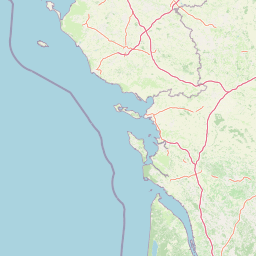
Map view of Réserve naturelle régionale du bocage des Antonins

Use this park location map to pinpoint Réserve naturelle régionale du bocage des Antonins in France, understand its exact geographic position, and read its mapped placement within the surrounding landscape more clearly.

Pigeon | © OpenStreetMap contributors

Location context for Réserve naturelle régionale du bocage des Antonins

Deux-SèvresNouvelle-Aquitaine
Park atlas

Compare regional habitats, ancient hedgerows, and connected rural landscapes across Nouvelle Aquitaine

Parks Near Réserve Naturelle Régionale Du Bocage Des Antonins And Surrounding Protected Areas

Browse nearby protected areas and regional reserves sharing similar traditional countryside characteristics with Réserve naturelle régionale du bocage des Antonins. Expanding the geographic scope helps place local mosaic habitats and wetland networks into a broader regional conservation context.
Nature reserveNouvelle-Aquitaine
About 23 km away#1 closest

Southwest

Réserve naturelle régionale du marais de Galuchet et des boucles de la Sèvre Niortaise Geography and Map

Urban protected wetland in the Nouvelle-Aquitaine region of France

This urban nature reserve protects 151 hectares of diverse wetland habitats along the Sèvre Niortaise. The landscape is defined by river meanders, wet meadows, and riparian corridors, making it a critical site for regional biodiversity and urban ecological connectivity in the Deux-Sèvres department.

Area
1.51 km²
Established
2025
IUCN
IV
Relief
Lowland
Nature reservePays de la Loire
About 44 km away#2 closest

West

Réserve naturelle régionale du marais communal du Poiré-sur-Velluire Regional Nature Reserve

Mapping wetland biodiversity in the Pays de la Loire region

Spanning over 240 hectares of reclaimed marshland, this protected area stands as a unique ecological stronghold in France. The reserve demonstrates how traditional collective land management sustains a rich mosaic of freshwater and brackish habitats, supporting more than 177 bird species and heritage livestock breeds in an expansive, open terrain.

Area
2.41 km²
Established
2012
IUCN
IV
Scope
Terrestrial
Nature reserveNouvelle-Aquitaine
About 52 km away#3 closest

North

Réserve naturelle régionale de la vallée du Pressoir: Protected Limestone Valley and Geoheritage

A rare natural and cultural mosaic in Nouvelle-Aquitaine

Trace the boundaries and natural features of the Réserve naturelle régionale de la vallée du Pressoir. This protected site in the Deux-Sèvres department is defined by thin calcareous soils, the historic Pommiers cascade, and fossil-rich limestone outcrops that form an unusual geoheritage landscape.

Area
0.56 km²
Established
2025
IUCN
IV
Visitors
10K annual
Nature reserveNouvelle-Aquitaine
About 55 km away#4 closest

North

Réserve naturelle nationale du Toarcien: Protected Jurassic Stratotype and Geological Map

A vital paleontological heritage site in the Nouvelle-Aquitaine region

As the smallest national nature reserve in France, Réserve naturelle nationale du Toarcien provides a concentrated, scientifically essential view of Jurassic marine sediments. The protected quarries preserve ammonite-rich strata and complex geological unconformities, serving as the international definition for the Toarcian geological stage within the Thouet valley landscape.

Area
0.006 km²
Established
1987
IUCN
III
Relief
Lowland
Watercolor painting of a wetland landscape featuring grassy banks, calm water, and soft rolling hills in the background.
Nature reservePays de la Loire
About 58 km away#5 closest

West

Réserve naturelle régionale du marais de la Vacherie: Protected Wetland Geography and Maps

Ecological mosaic of the Marais poitevin in Pays de la Loire

The Réserve naturelle régionale du marais de la Vacherie protects a high-quality fragment of historical marshland. Defined by flat terrain, winter-flooded depressions, and a complex system of drainage channels, the site serves as a crucial habitat for rare wetland flora and migratory waterbirds. This protected landscape offers insight into the sediment-rich, gently undulating terrain that characterizes the back-marsh zones of the Atlantic seaboard.

Area
1.81 km²
Established
2008
IUCN
IV
Relief
Lowland
Nature reserveNouvelle-Aquitaine
About 65 km away#6 closest

South

Vallée de l'Antenne: A Protected River Valley and Alluvial Landscape in Nouvelle-Aquitaine

Mapping riparian ecosystems and rare wetland habitats

Trace the course of the Antenne river as it meanders through a finely textured mosaic of ash and alder forests, poplar plantations, and floodplains. As a designated Natura 2000 site, this nature reserve acts as a critical refuge for biodiversity in western France, offering a textbook example of a low-energy river system that descends gently through the landscape of the Charente departments.

Area
12.08 km²
Established
1999
Relief
Lowland
Climate
Mediterranean
A soft watercolor painting of a serene natural landscape with rolling hills, a calm body of water, and forested ridges under a pastel sky.
Nature reserveFrance
About 68 km away#7 closest

East

Réserve naturelle régionale du site de Saint-Cyr: Wetland Geography and Protected Landscapes

Mapping a 39-hectare wetland refuge along the Clain river in France.

Located in the Vienne department, this regional nature reserve provides a critical link for waterbirds moving between the Loire valley and the Atlantic coast. The landscape features a mosaic of ponds, small islands, and alluvial forests that highlight the successful transition from former industrial quarry land into a biodiverse wetland ecosystem.

Nature reservePays de la Loire
About 69 km away#8 closest

West

Réserve naturelle régionale de la ferme de Choisy: Marshland Protected Area and Regional Geography

Sub-brackish wet meadows of the Marais poitevin, Pays de la Loire.

Discover the unique ecological character of Réserve naturelle régionale de la ferme de Choisy, a vital wetland site in western France. This reserve showcases the intersection of traditional pastoral management and marshland conservation, hosting extensive bird populations and rare flora across its low-lying, reclaimed landscape.

Area
0.8 km²
Established
1991
IUCN
IV
Relief
Lowland

Common questions about visiting, size, designation, and location context for Réserve naturelle régionale du bocage des Antonins

Réserve naturelle régionale du bocage des Antonins FAQs for park facts, access, geography, and protected area context

Find quick answers about Réserve naturelle régionale du bocage des Antonins, including protected-area facts, park geography, trail and visitor context, and how the park fits into its surrounding country and regional landscape.
MoriAtlas Explorer

Continue Your Protected Areas Search Across the Global Atlas

Deepen your exploration by continuing the structured search for national parks and protected areas worldwide. Utilize the comprehensive filtering capabilities to compare different conservation landscapes and refine your understanding of global park geography. Discover more about the distribution and characteristics of protected natural areas.

Global natural geography