
Mori Atlas logo
Wildlife reserveRichland Creek Wilderness

Uncovering the sandstone bluffs and remote creek corridors of Northern Arkansas

Richland Creek Wilderness: A Protected Ozark Landscape and Geographic Discovery Hub

Richland Creek Wilderness represents a significant protected area within the Ozark-St. Francis National Forest of northern Arkansas. This wildlife reserve features rugged terrain shaped by the clear waters of Richland Creek and Long Devil's Fork Creek, framed by distinct sandstone bluffs. The area provides an undisturbed oak-hickory woodland habitat that serves as a vital refuge for native species and offers a preserved glimpse into the natural geology of the Ozark highlands.

Ozark wildernessoak-hickory forestsandstone bluffscreek corridorsU.S. Wilderness Areanational forest wilderness
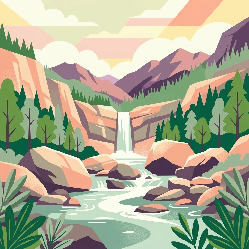
A vibrant flat-style illustration depicting a waterfall flowing into a river surrounded by rocky cliffs, pine trees, and smooth boulders under a soft sky.

Richland Creek Wilderness

Wildlife reserve

Park overview

Structured park overview, official facts, and landscape profile for Richland Creek Wilderness

Richland Creek Wilderness park facts, protected area profile, and essential visitor context

Review the core facts for Richland Creek Wilderness, including designation, size, terrain, visitor scale, habitats, and operating context in one park-focused overview.

About Richland Creek Wilderness

Richland Creek Wilderness lies in the heart of the Arkansas Ozarks, occupying a portion of the rugged hill country that defines much of the region's natural identity. Although the wilderness is relatively modest in size, it captures many of the qualities that make the Ozarks ecologically distinctive: deeply incised stream valleys, exposed sandstone outcrops, and a forest cover dominated by hardwoods that have regrown after an earlier era of logging.

The wilderness is centered on Richland Creek and its tributary Long Devil's Fork Creek, both of which cut narrow, scenic corridors through the surrounding hills. The steep sandstone bluffs that frame these watercourses are among the area's most distinctive landscape features, creating shaded cliff lines, small overhangs, and the kind of quiet, sheltered settings that define backcountry travel in the Ozarks.

Vegetation across the wilderness is overwhelmingly composed of second- and third-growth oak-hickory forest, giving the slopes a continuous canopy of familiar Ozark hardwoods. Within this matrix are scattered stands of shortleaf pine, a fire-adapted Southern conifer that adds structural variety to the forest and contributes to the region's ecological character. Because the area once supported timber operations, many of the trails that crisscross the wilderness today follow the alignment of old logging roads, lending the landscape a layered human history even within its current protected status.

As a congressionally designated wilderness, Richland Creek is governed by the strict protections of the 1964 Wilderness Act. No motorized or mechanized vehicles are permitted, and new roads or structures are not allowed. The result is a backcountry area where visitors move on foot along creek bottoms and ridge-top traces, encountering wildlife and scenery on its own terms. Its proximity to the broader Ozark-St. Francis National Forest also makes it part of a larger landscape of public land conservation in the Ozark highlands.

Quick facts and research context for Richland Creek Wilderness

Richland Creek Wilderness spans roughly 11,800 acres across Newton and Searcy counties in northern Arkansas, within the larger Ozark-St. Francis National Forest. It was established in 1984 by act of Congress and is administered by the U.S. Forest Service under the protections of the 1964 Wilderness Act.

The wilderness is characterized by oak-hickory forest, shortleaf pine stands, and dramatic sandstone bluffs along Richland Creek and Long Devil's Fork Creek. Its protected status prohibits motorized vehicles, logging, mining, and new road or building construction, preserving a quiet Ozark backcountry managed primarily for foot travel and traditional low-impact recreation.

Protection and recognition

Examine the terrestrial protection scope and designation records.

Richland Creek Wilderness Protection Status and Recognition Data

Richland Creek Wilderness maintains a documented terrestrial protection scope within the national park database. Scholars and researchers evaluate these recorded parameters to understand the administrative framework governing the protected landscape.

Protection details

Protection scope
Terrestrial
Transboundary protection
No
Park context

Deeper park guide and search-rich context for Richland Creek Wilderness

Richland Creek Wilderness history, landscape, wildlife, and travel context

Explore Richland Creek Wilderness through its history, landscape character, ecosystems, wildlife, conservation priorities, cultural context, and seasonal travel timing in a structured park guide built for atlas discovery and search intent.

Why Richland Creek Wilderness stands out

Richland Creek Wilderness is best known for its dramatic sandstone bluffs and clear Ozark creeks set within an oak-hickory wilderness that has been shielded from active timber harvest and development for decades. The wilderness has also earned a quiet reputation among hikers and outdoor enthusiasts as an off-the-beaten-path Ozark destination. Former logging roads now serve as informal foot trails, and the absence of motorized access leaves the area noticeably quieter and less crowded than many other public lands in the region.
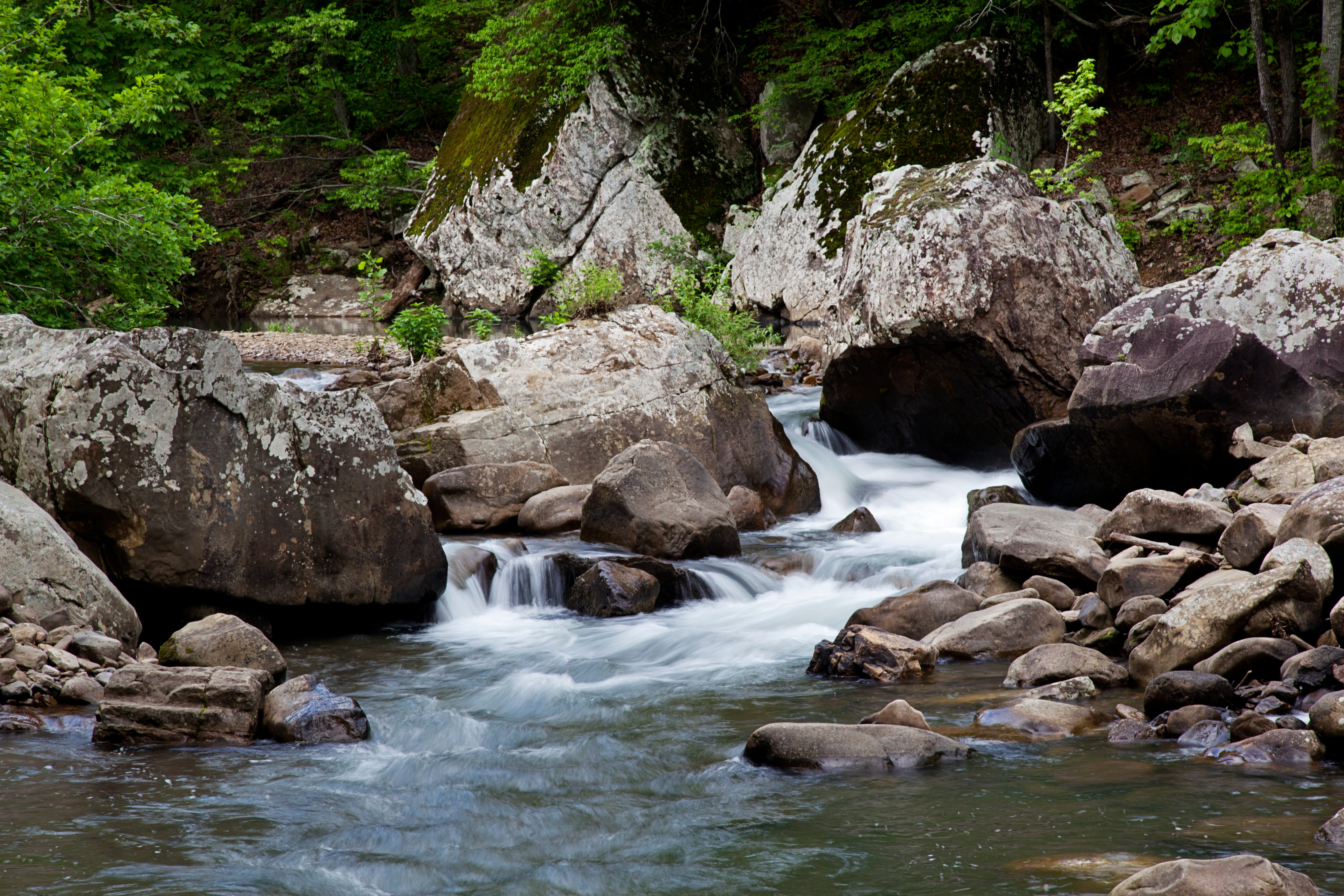
A rocky mountain stream flowing through a dense forest with large sandstone boulders on the banks.
Richland Creek flows through a rocky, forested landscape within the Richland Creek Wilderness.

Richland Creek Wilderness history and protected-area timeline

Richland Creek Wilderness was formally established in 1984 through an act of Congress, becoming part of the National Wilderness Preservation System and receiving the protective framework established by the 1964 Wilderness Act. Its designation reflected a broader national movement to formally protect representative samples of America's remaining wild landscapes, including portions of the eastern deciduous forest region that had been extensively logged and altered in earlier decades.

Prior to its wilderness designation, much of the area had been subject to logging operations, and the legacy of that era remains visible in the trail network. Many of the footpaths used today by visitors were originally constructed as logging roads, giving the wilderness a quiet industrial past beneath its current backcountry character. The transition from working forest to protected wilderness in the mid-1980s effectively ended that pattern of timber extraction within the area.

Since 1984, the wilderness has been administered by the U.S. Forest Service as part of the surrounding Ozark-St. Francis National Forest, with management guided by the wilderness-management principles that prioritize ecological preservation, minimal infrastructure, and non-motorized recreation over active resource extraction.

Richland Creek Wilderness landscape and geographic character

The landscape of Richland Creek Wilderness is defined by the deeply cut valleys of Richland Creek and Long Devil's Fork Creek, which together form the central geographic spine of the area. These watercourses have carved narrow corridors through the surrounding uplands, producing the steep sandstone bluffs and shaded cliff faces that give the wilderness much of its visual character. The exposed rock along the creeks is a hallmark of the eastern Ozark terrain.

Away from the creek bottoms, the wilderness rises into forested hills and ridges typical of the Ozark highlands. Elevations change modestly across the area, but the combination of bluffs, hollows, and mature hardwood canopy produces a striking sense of relief. Streams, seep zones, and short tributary drainages add further texture, especially in the upper reaches of the Long Devil's Fork drainage.

The overall impression is a compact but visually varied Ozark landscape, where sandstone outcrops, creek corridors, and continuous forest cover alternate over relatively short distances. This combination of geology and hydrology has made the wilderness a recognizable scenic feature of the broader Ozark-St. Francis National Forest setting.

Richland Creek Wilderness ecosystems, habitats, and plant life

Ecologically, Richland Creek Wilderness represents a recovering Ozark hardwood ecosystem shaped by past disturbance and current protection. The canopy is dominated by oaks and hickories that have returned as second- and third-growth forest since the area's earlier logging era, forming a relatively mature but continually regenerating woodland matrix across the slopes and ridges.

Mixed into this hardwood cover are patches of shortleaf pine, which contribute both ecological diversity and structural complexity to the forest. The interplay between oak-hickory hardwoods and these scattered conifer stands reflects the transitional character of Ozark forests between eastern deciduous and southern pine systems, and supports a mixture of habitat conditions across the area.

The creek valleys add a distinct riparian dimension to the wilderness. Where Richland Creek and Long Devil's Fork Creek flow through narrow, bluff-lined corridors, the forest transitions toward moister, more sheltered conditions. These zones create habitat edges and microhabitats that are ecologically richer than the surrounding uplands, and they are central to the wilderness's biodiversity despite their relatively limited footprint.

Richland Creek Wilderness wildlife and species highlights

Wildlife in Richland Creek Wilderness reflects the broader fauna of the Ozark highlands, with mammals and game species making up much of the area's visible animal life. Black bears are known to inhabit the wilderness, a presence that connects the area to the larger recovery of black bear populations across the Ozark region and underscores the value of contiguous, protected forest cover.

Other mammals present in the area include white-tailed deer, which are common throughout Ozark forests, along with smaller and more opportunistic species such as skunks, opossums, and minks. The presence of these mammals illustrates the mix of habitat generalists and more habitat-sensitive species that the wilderness is able to support. Wild turkey is also documented in the area, contributing to its identity as a game-rich Ozark landscape.

Gamebirds such as pheasants round out the notable wildlife presence. Although birdlife and other less conspicuous species are part of the area's broader ecological richness, the documented fauna emphasizes the kinds of species that thrive in mature, contiguous Ozark hardwood forest with intact creek corridors and limited human disturbance.

Richland Creek Wilderness conservation status and protection priorities

The central conservation significance of Richland Creek Wilderness lies in its formal protection under the 1964 Wilderness Act, which prohibits motorized access, logging, mining, and the construction of new roads or buildings. This legal framework has allowed the area to recover from its earlier history of logging and to stabilize as a maturing oak-hickory forest with intact riparian corridors.

By preserving a sizeable block of Ozark forest, sandstone bluff habitat, and free-flowing creek systems, the wilderness contributes to the broader conservation network of the Ozark-St. Francis National Forest and the Ozark region as a whole. Habitat connectivity with surrounding national forest lands is particularly important for wide-ranging species such as black bears, for which protected, contiguous forest blocks are essential.

The wilderness's strict management standards, including restrictions on mechanized vehicles like bicycles and limitations on development, set it apart from much of the surrounding forest. This higher level of protection preserves a baseline of ecological conditions against which the condition of more heavily used or managed forest lands can be measured, and it anchors the regional identity of the Ozarks as a landscape where wild character is still an actively protected legacy.

Richland Creek Wilderness cultural meaning and human context

Cultural context for Richland Creek Wilderness is closely tied to the broader Ozark heritage of timber use, small-scale settlement, and foot-powered travel through rugged hill country. Although the wilderness itself is sparsely populated and largely undeveloped today, the trail network that crosses it reflects the area's earlier logging economy, which shaped the routes that modern visitors now follow.

The Ozark region more broadly is known for its distinctive rural heritage, including traditional forest livelihoods, local hunting and fishing traditions, and a long history of self-reliant outdoor recreation. The wilderness fits naturally into this regional identity, providing a quiet protected landscape where traditional low-impact recreational uses such as hunting, fishing, and camping continue to be part of the cultural relationship with the land.

Top sights and standout views in Richland Creek Wilderness

Richland Creek Wilderness's most distinctive highlights include its dramatic sandstone bluffs along Richland Creek and Long Devil's Fork Creek, the broad sweep of its recovering oak-hickory forest, and its scattered shortleaf pine stands that add variety to the canopy. Together, these features define the wilderness's scenic Ozark character.

Equally notable is the wilderness character itself: a roadless, motor-free Ozark landscape where former logging routes have become foot trails, black bears still range through the hills, and the protections of the 1964 Wilderness Act keep the area ecologically and visually intact within a much larger national forest.

Best time to visit Richland Creek Wilderness

The most rewarding times to experience Richland Creek Wilderness generally align with the moderate seasons of the Arkansas Ozarks, when temperatures are comfortable for hiking along the creek corridors and through the oak-hickory forest. Spring brings rising streamflow, green-up across the hardwood canopy, and active wildlife movement, while autumn produces oak and hickory color changes that contrast sharply with the pale sandstone bluffs and the persistent green of the shortleaf pine.

Summer visits are possible but tend to be hot and humid, with shaded creek-bottom travel offering the most comfortable conditions. Winter visits are typically the quietest, with bare hardwood canopy revealing the underlying bluff lines and ridges, though weather conditions and short daylight hours call for more careful planning. Across all seasons, the wilderness's lack of roads and motorized access means visitors should expect conditions that reflect the natural seasonal rhythm of the Ozark landscape rather than curated park amenities.

Monthly climate preview

Long-term representative temperature and precipitation averages recorded at elevation

Richland Creek Wilderness Climate Normals and Annual Weather Patterns

Representative coordinate measurements track average temperatures and daily precipitation across twelve distinct monthly cycles for Richland Creek Wilderness. Opening the complete monthly climate record reveals comprehensive long-term averages, historical temperature extremes, and detailed precipitation data.
Annual mean14 °C
1 °C26 °C
Jan
Feb
Mar
Apr13°
May18°
Jun23°
Jul26°
Aug26°
Sep21°
Oct14°
Nov
Dec
Warmest month
July

25.9 °C

Coolest month
January

1 °C

Wettest month
May

4.5 mm/day

Driest month
January

2.4 mm/day

Park location guide

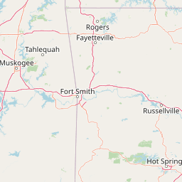
Geography guide, regional context, and park location map for Richland Creek Wilderness

Richland Creek Wilderness park geography, regions, and map view in United States of America

Understand where Richland Creek Wilderness sits in United States of America through a broader geographic reading of the surrounding landscape, nearby location context, and its mapped position within the national park landscape.

How Richland Creek Wilderness fits into United States of America

The United States of America is a federal presidential republic and one of the world's largest countries by area and population. It consists of 50 states across a vast territory spanning multiple time zones, with its capital in Washington, D.C. and largest city in New York City. The nation has a diverse economy, influential political system, and significant cultural and military presence globally.

Wider geography shaping Richland Creek Wilderness in United States of America

The United States occupies a vast territory in North America, bordered by Canada to the north and Mexico to the south. The 48 contiguous states stretch from the Atlantic to the Pacific Ocean, while Alaska occupies the northwestern region and Hawaii is an archipelago in the Pacific. The country encompasses diverse terrain including the Rocky Mountains, Appalachian Mountains, Great Plains, and extensive river systems.

Map view of Richland Creek Wilderness

Use this park location map to pinpoint Richland Creek Wilderness in United States of America, understand its exact geographic position, and read its mapped placement within the surrounding landscape more clearly.

Pigeon | © OpenStreetMap contributors

Location context for Richland Creek Wilderness

Arkansas

Explore photographic records of sandstone bluffs, creek corridors, and oak-hickory woodland habitats.

Richland Creek Wilderness Photos and Landscapes: Visualizing Ozark Scenery and Terrain

Visual documentation captures the rugged sandstone bluffs, clear creek corridors, and continuous oak-hickory canopy defining the protected Ozark landscape. Examining terrain photography helps observers understand the remote backcountry character and protected habitats preserved within the national forest.

A rocky mountain stream flowing through a dense forest with large sandstone boulders on the banks.

Park atlas

Compare adjacent highland terrain and regional wilderness areas across northern Arkansas

Parks Near Richland Creek Wilderness and Related Ozark Protected Landscapes

Browsing other protected areas near Richland Creek Wilderness reveals connected oak-hickory forests and sandstone canyon terrain across the broader Ozark highlands. Extending geographic comparison beyond a single wilderness helps map the full spread of regional public lands and protected river corridors.
National parkMissouri
About 67 km away#1 closest

Northeast

Mark Twain National Forest: Geography and Protected Area Atlas of Southern Missouri

Mapping the karst terrain and ancient ridges of the Ozark Highlands

Mark Twain National Forest represents a sprawling conservation area within the Missouri Ozark Highlands. Its geography is defined by volcanic mountain remnants, rocky glades, and significant river corridors like the Eleven Point National Scenic River. This record provides insight into the forest's complex mapped boundaries, seven designated wilderness areas, and the distinctive karst geology that characterizes this unique American landscape.

Area
6,037.3 km²
Established
1939
Relief
Upland
Climate
Temperate
Watercolor painting of a forested landscape with soft rolling mountains in the background and vegetation in the foreground.
Protected landscapeArkansas
About 92 km away#2 closest

Southwest

Ouachita National Forest: Protected Landscape and Mountain Geography in Arkansas

Exploring the ancient ridges and river corridors of the Ouachita Mountains

Ouachita National Forest protects a unique geological system of east-west folded ridges and sandstone bluffs in the interior United States. This expansive region provides vital habitats for diverse hardwood communities and hosts extensive wilderness areas, offering a deep look into the natural history and terrain of the Ouachita Mountain range within Arkansas.

Area
7,221.44 km²
Established
1907
IUCN
VI
Relief
Mountain
Wildlife reserveArkansas
About 93 km away#3 closest

East

Leatherwood Wilderness: A Deep Dive into Arkansas Rugged Ozark Highland Geography

Protected wilderness area featuring cliff-lined hollows and streamside habitats

As the largest wilderness area in Arkansas, Leatherwood Wilderness offers a sprawling look at the rugged, broken terrain characteristic of the Ozark region. Its landscape of vertical cliffs, deep hollows, and hardwood forests serves as an essential case study for protected backcountry environments. Explore the map of this trail-less wilderness to understand the complex drainage patterns and karstic features that define its unique ecological character.

Area
68.14 km²
Established
1984
IUCN
Ib
Relief
Mountain
Protected landscapeArkansas
About 115 km away#4 closest

Southwest

Ozark, St. Francis National Forest: Geographic Overview of Arkansas Protected Wilderness Areas

Mapping rugged mountain slopes and Mississippi River floodplains.

This geographic profile of Ozark, St. Francis National Forest details the distinct ecological divide between the northern Ozark Mountain units and the eastern St. Francis ridge landscape. Use this data to trace the boundaries of old-growth pine stands, karst topography, and river-bottom habitats within one of Arkansas's most significant federal forest management systems.

Area
4,693.55 km²
Established
1908
Relief
Mountain
Climate
Temperate
A horizontal watercolor painting showing rolling green hills and a small stream in the foreground with faint mountain ridges in the distance.
Wildlife reserveArkansas
About 120 km away#5 closest

South

Flatside Wilderness: Rugged Sandstone Ridges in the Ouachita Mountains

Arkansas wildlife reserve featuring mountain summits and mapped backcountry

Flatside Wilderness offers a deep look at the high-relief geography of the Ouachita Mountains. Featuring prominent sandstone summits and an 8.9-mile segment of the Ouachita National Recreation Trail, this protected landscape provides essential insight into the state's wilderness systems and regional forest ecosystems.

Area
38.47 km²
Established
1984
IUCN
Ib
National parkGarland County
About 153 km away#6 closest

South

Hot Springs National Park: National Park Protected Area and Geographic Context

Mapped boundaries and regional landscape of this US National Park.

Gain a structured understanding of Hot Springs National Park, focusing on its identity as a protected national park. Examine its mapped geography and regional landscape context within Garland County, providing essential details for atlas-based exploration. This entry details the park's protected area and its position in the broader geographic framework.

Area
22.5 km²
Established
1832
IUCN
II
Visitors
2.6M annual
Protected areaOklahoma
About 176 km away#7 closest

Southwest

Winding Stair Mountain National Recreation Area: Oklahoma Protected Mountain Landscape

Mapped ridge systems and forested highland geography.

Spanning the prominent Winding Stair Mountains, this protected area serves as a key geographic pillar in southeastern Oklahoma. The landscape is characterized by its high-elevation ridgeline profile, pine-covered slopes, and stream-fed valleys, offering a distinct look at the wider Ouachita National Forest ecosystem and its mountainous terrain.

Area
107.02 km²
Established
1988
Relief
Mountain
Climate
Temperate
A soft watercolor illustration featuring rolling green hills, a winding stream, and a forested treeline against a pale sky.
Wildlife reserveMissouri
About 221 km away#8 closest

Northeast

Irish Wilderness: Missouri Ozark Protected Area and Karst Landscape Atlas

Federally protected wilderness in the Eleven Point River landscape

Spanning the rugged terrain of the Missouri Ozarks, Irish Wilderness is a federally protected area known for its distinct karst geography. Visitors can study the network of caves, sinkholes, and springs that define the local environment, alongside historical remnants of frontier settlement. The area serves as a primary example of wilderness preservation within the Mark Twain National Forest, balancing sensitive cave ecosystems with forested ridge landscapes.

Area
65.87 km²
Established
1984
IUCN
Ib
Relief
Upland

Common questions about visiting, size, designation, and location context for Richland Creek Wilderness

Richland Creek Wilderness FAQs for park facts, access, geography, and protected area context

Find quick answers about Richland Creek Wilderness, including protected-area facts, park geography, trail and visitor context, and how the park fits into its surrounding country and regional landscape.
MoriAtlas Explorer

Continue Your Protected Areas Search Across the Global Atlas

Deepen your exploration by continuing the structured search for national parks and protected areas worldwide. Utilize the comprehensive filtering capabilities to compare different conservation landscapes and refine your understanding of global park geography. Discover more about the distribution and characteristics of protected natural areas.

Global natural geography