Mori Atlas logo
National parkNationalpark Río Negro

Explore the convergence of Pantanal wetlands, dry Chaco, and cerrado savanna ecosystems

Nationalpark Río Negro: Mapping the Ecological Transition of Paraguay Protected Landscapes

(Parque Nacional Río Negro)

Nationalpark Río Negro represents a vital protected landscape in the Alto Paraguay department, situated along the border with Bolivia. This conservation area serves as a key junction where the inland wetlands of the Pantanal meet the arid thorn scrub of the Chaco and the open cerrado savannas. Through detailed mapping and geographic analysis, the area reveals a complex mosaic of flood channels, palm forests, and hardwood stands that support a significant concentration of South American wildlife.

Pantanalwetlandscerradochacoecotonetransitional ecosystems

Nationalpark Río Negro

National park

Park overview

Structured park overview, official facts, and landscape profile for Río Negro National Park

Río Negro National Park park facts, protected area profile, and essential visitor context

Review the core facts for Río Negro National Park, including designation, size, terrain, visitor scale, habitats, and operating context in one park-focused overview.

About Río Negro National Park

Río Negro National Park is one of the most ecologically distinctive protected areas in Paraguay, occupying a strategic position where the country's northern wetlands meet the drier landscapes of the Chaco and the savannas of the cerrado. Located in the northeast of the Alto Paraguay department near the Bolivian border, the park covers roughly 1,238 square kilometers and represents Paraguay's share of the vast Pantanal wetland system.

Unlike the better-known Brazilian and Bolivian portions of the Pantanal, Río Negro is defined by its transitional character. Dry forest, thorn scrub, palm savanna, cactus formations, and seasonally flooded grassland all exist side by side, which produces exceptional habitat diversity in a relatively small territory. The result is a kind of ecological crossroads, where species typical of wetlands, savanna, and dry Chaco can be found within a single day's travel.

The park was formally established in 2004, reflecting growing recognition of the importance of the Paraguayan Pantanal. It continues onto the protected landscape of Bolivia in the form of Otuquis National Park, and together the two reserves form a transboundary corridor of wetland and dry forest conservation in the heart of South America.

Río Negro is not only a wildlife refuge. The Ybytoso and Tomaraho indigenous communities continue to inhabit the park, giving it a strong cultural dimension that sets it apart from purely ecological reserves elsewhere in the Pantanal basin. The closest town, Bahía Negra, on the Río Paraguay, serves as the main gateway to this remote region.

Quick facts and research context for Río Negro National Park

Río Negro National Park is located in the Alto Paraguay department of northern Paraguay, bordering Bolivia, where the Otuquis National Park continues the Pantanal landscape across the frontier. It was established in 2004 and covers approximately 1,238 square kilometers.

The park protects the Paraguayan share of the Pantanal, the world's largest tropical wetland system, but is defined more by its transitional character than by pure wetland. It sits between the cerrado savanna and the dry Chaco, producing a mosaic of palm forests, quebracho woodlands, cactus stands, and seasonally flooded grasslands.

The climate is tropical, with hot, rainy summers and mild, drier winters, and annual rainfall around 1,100 millimeters. Bahía Negra is the closest town, and indigenous communities including the Ybytoso and Tomaraho continue to live within the park.

Protection and recognition

Documented terrestrial boundaries, transboundary status, and Ramsar wetland listings

Nationalpark Río Negro Protection Status and International Recognition

Nationalpark Río Negro encompasses documented terrestrial protection scope and verified transboundary conservation measures. International recognition records include formal Ramsar wetland designations supporting regional ecological oversight.

International recognition

Protection details

Protection scope
Terrestrial
Transboundary protection
Yes
Park context

Deeper park guide and search-rich context for Río Negro National Park

Río Negro National Park history, landscape, wildlife, and travel context

Explore Río Negro National Park through its history, landscape character, ecosystems, wildlife, conservation priorities, cultural context, and seasonal travel timing in a structured park guide built for atlas discovery and search intent.

Why Río Negro National Park stands out

Río Negro is best known as the Paraguayan portion of the Pantanal and as a transitional zone where three major South American ecosystems overlap. This overlap, between the Pantanal wetlands, the cerrado, and the dry Chaco, is the park's defining ecological signature. The park is also recognized for its remarkable concentration of wildlife in a relatively small area. Jaguar, puma, giant otter, giant armadillo, marsh deer, tapir, and the endangered hyacinth macaw all occur here, supported by the diversity of habitats created by that biotic transition.

Río Negro National Park history and protected-area timeline

Río Negro National Park is a relatively recent addition to Paraguay's system of protected areas. It was formally established in 2004, in recognition of the ecological importance of the country's northern wetlands and the unique position they occupy between major South American biomes.

Its creation was also tied to broader efforts to protect the Pantanal as a continuous ecosystem across national borders. The adjacent Otuquis National Park on the Bolivian side plays a complementary role, and the two parks together are seen as a transboundary conservation corridor for wetland-associated species.

The park's modern administrative framework overlays a longer human history. The Ybytoso and Tomaraho indigenous communities have inhabited this landscape for generations, long before the establishment of any formal reserve, and their continued presence is part of the park's identity today.

Río Negro National Park landscape and geographic character

The landscape of Río Negro National Park is shaped by its position at the interface of three major South American ecosystems. To the south and west, the dry formations of the Chaco dominate, with thorn scrub, hardwood quebracho forests, and cactus stands adapted to long dry seasons. To the north and east, the seasonally flooded grasslands, palm savannas, and curiche wetlands of the Pantanal take over.

This transition produces a remarkable mosaic. Palm forests of Copernicia alba rise from seasonally inundated soils, while stands of white and red quebracho, palo blanco, palo cruz, palo borracho, and the striking floss silk tree occupy drier ground. Cactus formations add another distinctive visual layer, particularly in the more chaco-influenced portions of the park.

The terrain is generally flat to gently undulating, typical of the Pantanal basin, and is dissected by slow-moving rivers, swamps, and seasonal flood channels that can dramatically reshape the landscape between wet and dry seasons. Near the Bolivian border, the park connects to the wetter portions of the Pantanal that extend across South America's interior lowlands.

Río Negro National Park ecosystems, habitats, and plant life

The ecological identity of Río Negro National Park lies in its role as an ecotone. Where most of the Pantanal in Brazil and Bolivia is dominated by wetland, the Paraguayan sector is defined by the meeting of wetland with cerrado savanna on one side and dry Chaco on the other. This unusual combination of influences has produced one of the most diverse habitat combinations in the southern Pantanal.

The vegetation reflects this transition. Copernicia alba palm forests dominate the wettest zones, while quebracho woodlands, palo borracho, palo blanco, palo cruz, and Yvyra Ita occur across the drier portions. Cactus stands add a typically chacoan element, while the open, seasonally flooded grasslands support a wide range of aquatic and semi-aquatic vegetation during the wet months.

Faunal diversity follows the same pattern. Recorded biodiversity includes 116 mammal species, 42 reptile species, 23 amphibian species, 356 bird species, and 92 fish species. The variety of habitats in a relatively small area explains why such a high diversity can be sustained within the park's boundaries.

Río Negro National Park wildlife and species highlights

Río Negro National Park is one of the most species-rich protected areas in Paraguay, with more than 350 recorded bird species and over 100 mammal species. This diversity is linked directly to the park's location at the convergence of cerrado, chaco, and Pantanal ecosystems.

Among the most emblematic mammals are jaguar, puma, maned wolf, giant armadillo, giant otter, marsh deer, capybara, tapir, and several monkey species including night monkeys and marmosets. The mix of predators, large herbivores, and primates reflects the breadth of habitats maintained within the park.

The birdlife is equally varied. The park is an important stronghold for the hyacinth macaw, one of the most threatened parrot species in the Americas, along with jabiru storks, wood storks, hummingbirds, caimans, and a wide range of smaller wetland and forest birds. Reptile and amphibian diversity is similarly high, with 42 reptile and 23 amphibian species recorded.

Fish populations in the park's rivers and wetlands include 92 recorded species, supporting both resident aquatic life and seasonal migrations tied to the flood cycle of the Pantanal.

Río Negro National Park conservation status and protection priorities

Río Negro National Park plays an outsized conservation role in Paraguay because it protects the country's portion of the Pantanal, the largest tropical wetland system on Earth. The park has been included in discussions of the Paraguayan Pantanal as a tentative candidate for broader environmental recognition, underlining its regional importance.

Its conservation value is amplified by its transitional ecology. The meeting of cerrado, chaco, and Pantanal in one area creates a buffer against environmental change and supports species that may retreat into the park's varied habitats as surrounding landscapes face pressure. The presence of flagship species such as jaguar, giant otter, and hyacinth macaw gives the park a particular significance for large-vertebrate and wetland conservation in South America.

The park also functions as a transboundary conservation unit alongside Bolivia's Otuquis National Park, forming part of an international effort to maintain ecological connectivity across the Pantanal basin.

Río Negro National Park cultural meaning and human context

Long before the park's formal establishment, the landscape was inhabited by indigenous peoples who continue to live on the land. The Ybytoso and Tomaraho communities are recognized residents of what is now Río Negro National Park, and their presence adds a distinct cultural layer to the reserve's identity.

This human dimension is unusual for a protected area dominated by Pantanal wetlands and carries implications for how conservation and traditional land use are balanced. The park therefore functions both as a refuge for wildlife and as the homeland of communities with deep, long-standing ties to the surrounding ecosystems.

The small river town of Bahía Negra, near the park, is the nearest settlement and a useful reference point for understanding the regional context of this remote northern Paraguayan landscape.

Top sights and standout views in Río Negro National Park

The defining feature of Río Negro National Park is its biotic transition. The overlap of cerrado, chaco, and Pantanal in a single protected area produces an unusually rich concentration of habitats and wildlife for a relatively small reserve.

A second highlight is the park's role in protecting the Paraguayan share of the Pantanal, including key populations of jaguar, giant otter, and hyacinth macaw. Its connection to Bolivia's Otuquis National Park further strengthens its regional conservation importance.

Finally, the continued presence of the Ybytoso and Tomaraho indigenous communities gives the park a meaningful cultural dimension, making it both an ecological refuge and a living cultural landscape in northern Paraguay.

Best time to visit Río Negro National Park

The park's climate follows the rhythm of the Pantanal, with a clear seasonal contrast between wet and dry periods. The hot, rainy season runs roughly from November to March, when most of the annual rainfall of about 1,100 millimeters occurs, flooding wetlands, expanding habitat for aquatic species, and turning much of the park into an extensive marsh rich in birdlife.

The cooler, drier season runs roughly from May to September, with the lowest rainfall and mildest temperatures. Minimum temperatures at night can drop to around 17 to 18 degrees Celsius in the coldest months, while daytime highs climb into the high twenties to low thirties. This season is often considered more comfortable for travel and offers easier access across the landscape as floodwaters recede and animals concentrate around remaining water sources.

Both seasons have distinctive appeal. The wet months offer the most dramatic wetland scenery and the richest bird activity, while the dry months provide clearer land access and stronger chances of observing terrestrial wildlife against a more open backdrop.

Monthly climate preview

Long-term representative temperature and precipitation averages for Alto Paraguay

Nationalpark Río Negro Climate Normals and Annual Weather Patterns

Nationalpark Río Negro displays measured long-term temperature and precipitation cycles across its representative coordinate point from nineteen ninety-one to twenty twenty. Reviewing the complete monthly climate normals reveals full baseline variations in seasonal weather rhythms and thermal ranges.
Annual mean27 °C
23 °C30 °C
Jan30°
Feb29°
Mar29°
Apr27°
May24°
Jun23°
Jul23°
Aug25°
Sep28°
Oct30°
Nov29°
Dec30°
Warmest month
October

29.8 °C

Coolest month
July

22.9 °C

Wettest month
January

4.6 mm/day

Driest month
August

0.6 mm/day

Park location guide

Geography guide, regional context, and park location map for Río Negro National Park

Río Negro National Park park geography, regions, and map view in Paraguay

Understand where Río Negro National Park sits in Paraguay through a broader geographic reading of the surrounding landscape, nearby location context, and its mapped position within the national park landscape.

How Río Negro National Park fits into Paraguay

Paraguay is a landlocked presidential republic in central South America with a population of approximately 6.4 million. Originally inhabited by the Guaraní people, it was colonized by Spain in the 16th century and gained independence in 1811. The country is notable for its strong Guarani cultural influence, economic growth driven by soybean and beef exports, and significant hydroelectric power generation. Asunción is both the capital and largest city.

Wider geography shaping Río Negro National Park in Paraguay

Paraguay is located in the central region of South America, completely landlocked but with Atlantic Ocean access via the Paraná-Paraguay Waterway. It borders Bolivia to the northwest and north, Brazil to the northeast and east, and Argentina to the southeast, south, and west. The terrain consists mostly of rolling plains and lowlands, with the Paraguay River dividing the country into eastern and western regions.

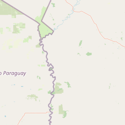
Map view of Río Negro National Park

Use this park location map to pinpoint Río Negro National Park in Paraguay, understand its exact geographic position, and read its mapped placement within the surrounding landscape more clearly.

Pigeon | © OpenStreetMap contributors

Location context for Río Negro National Park

Alto Paraguay
Park atlas

Compare adjacent wetland systems, savanna corridors, and transboundary protected landscapes

Explore Other Parks Near Nationalpark Río Negro and Surrounding Wetland Reserves

Browsing other parks near Nationalpark Río Negro reveals connected wetland basins, dry forest remnants, and transboundary conservation zones across the northern interior. Comparing these regional reserves provides deeper geographic context on South American biomes and wetland ecotones.
National parkSanta Cruz Department
About 64 km away#1 closest

North

Otuquis National Park and Integrated Management Natural Area: Mapped Protected Landscape in Santa Cruz Department

Bolivia's designated national park for atlas exploration.

Gain detailed geographic context for Otuquis National Park and Integrated Management Natural Area, a significant protected landscape within Bolivia's Santa Cruz Department. This page serves as a dedicated entry point for understanding the park's mapped boundaries, its role as a national park, and its natural terrain within the regional atlas. Explore its unique geographic features and its place within Bolivia's network of protected areas.

Area
10,059.5 km²
Established
1997
IUCN
II
Relief
Lowland
A soft, horizontal watercolor painting depicting a calm wetland landscape with distant rolling hills, green vegetation, and small islands in the water.
Protected landscapeSanta Cruz
About 155 km away#2 closest

North

Área Natural de Manejo Integrado San Matías: Mapping Bolivia’s Largest Protected Wetland

Ecological transitions across the Santa Cruz eastern lowlands

Área Natural de Manejo Integrado San Matías serves as a critical bridge between the Chiquitano forest, the Cerrado, and the Bolivian Pantanal. The landscape showcases a dramatic seasonal flood cycle that defines the regional hydrology and supports high biodiversity within its crystalline rock hills and sprawling lowland basins.

Area
29,185 km²
Established
1997
Relief
Mixed relief
Climate
Tropical
A watercolor illustration of a soft, hazy landscape featuring grassy wetlands in the foreground, water channels, and rolling hills in the background.
Protected areaDepartamento de Santa Cruz
About 157 km away#3 closest

Northwest

Área de Conservación e Importancia Ecológica Ñembi Guasu: Atlas of Protected Dry Forest

Chaco plain geography and indigenous-led conservation zones

Spanning roughly 12,000 square kilometers, this landmark conservation area in Departamento de Santa Cruz protects a continuous mosaic of dry tropical forests. The terrain features a distinct gradient from Andean-influenced foothills to the open plains, playing a critical role in regional biodiversity as a connector for neighboring reserves.

Area
12,046.3 km²
Established
2019
Relief
Lowland
Scope
Terrestrial
National parkBolivia
About 300 km away#4 closest

West

Kaa-Iya del Gran Chaco National Park and Integrated Management Natural Area: Bolivia's National Park and Protected Landscape

Explore the mapped geography and regional natural landscape.

Kaa-Iya del Gran Chaco National Park and Integrated Management Natural Area stands as a crucial component of Bolivia's protected lands, offering a distinct entry point for exploring its natural geography. This page details the park's status as a national park and integrated management natural area, providing context for its mapped boundaries and its role within the country's diverse landscapes. Engage with structured information designed to illuminate the park's geographic setting and its significance for atlas-style exploration and understanding of Bolivia's protected areas.

Area
34,411.1 km²
Established
1995
Relief
Upland
Climate
Subtropical
National parkConcepción Department
About 312 km away#5 closest

Southeast

Paso Bravo National Park: Protected Landscape Map and Regional Geographic Context

Exploring the diverse cerrado savanna and forest boundaries in northern Paraguay.

Paso Bravo National Park stands as the largest protected area in eastern Paraguay, offering significant insight into the cerrado and riparian landscape of the Concepción department. This reserve preserves essential habitat connectivity for large predators and diverse avian populations, marking a unique convergence of botanical heritage and subtropical wetland systems within the South American interior.

Area
1,030 km²
Established
1998
Climate
Subtropical
Scope
Terrestrial
National parkParaguay
About 392 km away#6 closest

Southeast

Cerro Corá National Park: Paraguay's Protected Landscape and Regional Geography

Discover the mapped boundaries and natural context of this national park.

Cerro Corá National Park serves as a critical element in Paraguay's protected natural areas. This page offers a deep dive into its identity as a national park, focusing on its geographic location, mapped boundaries, and its place within the broader landscape context of South America. Understand the specific atlas value of this protected land for detailed geographic exploration.

IUCN
II
Nature reserveDepartamento de Tarija
About 455 km away#7 closest

Southwest

Reserva natural El Corbalán: Gran Chaco Protected Landscape and Regional Geography

A private nature reserve in Tarija Department, Bolivia.

Spanning the dry plains of the Chaco Boreal, Reserva natural El Corbalán provides essential protection for a representative sample of South American dry forest. The terrain, characterized by sparse thorny woodlands and flat lowland scrub, serves as a crucial habitat refuge. This resource offers insights into the unique ecological structure and mapped boundaries of one of Bolivia's most significant private conservation initiatives.

Area
47.78 km²
Established
1996
Relief
Lowland
Water
Minor water
Protected areaSanta Cruz
About 497 km away#8 closest

West

Área Protegida Municipal Palmera de Saó: Mapping the Chaco Lowlands and Protected Forest Zones

A vital protected landscape in the Santa Cruz department.

The Área Protegida Municipal Palmera de Saó represents a critical effort to safeguard the saó palm and associated dry forest ecosystems in eastern Bolivia. Stretching along the Río Grande, this protected area features a mosaic of riverine vegetation and alluvial terrain. Understanding its geographic setting reveals how this compact, municipal-level reserve supports both native Chaco wildlife and the cultural crafts of surrounding Guaraní and local communities.

Area
7.58 km²
Established
2006
Relief
Lowland
Scope
Terrestrial

Common questions about visiting, size, designation, and location context for Río Negro National Park

Río Negro National Park FAQs for park facts, access, geography, and protected area context

Find quick answers about Río Negro National Park, including protected-area facts, park geography, trail and visitor context, and how the park fits into its surrounding country and regional landscape.
MoriAtlas Explorer

Continue Your Protected Areas Search Across the Global Atlas

Deepen your exploration by continuing the structured search for national parks and protected areas worldwide. Utilize the comprehensive filtering capabilities to compare different conservation landscapes and refine your understanding of global park geography. Discover more about the distribution and characteristics of protected natural areas.

Global natural geography