

Why Rogue-Umpqua Divide Wilderness stands out
The wilderness is best known for its dense, mixed conifer forests draped across a high volcanic and sedimentary ridge that separates two major Oregon river drainages. Public attention centers on its old-growth stands along the Acker Divide and Cripple Camp trails, the long-distance Rogue-Umpqua Divide National Recreation Trail that traces the crest, and the way it captures the transitional flora between the Klamath Mountains and the Cascades. Its geography creates dramatic east- and west-facing views across two distinct watersheds from a single ridgewalk.
Rogue-Umpqua Divide Wilderness history and protected-area timeline
The Rogue-Umpqua Divide Wilderness was part of a wave of federal wilderness designations in the United States in the early 1980s. Prior to its designation, the area was already national forest land managed by the U.S. Forest Service across the Rogue River-Siskiyou and Umpqua National Forests, but without the heightened protections that come with wilderness status. In 1984, the United States Congress formally established the Rogue-Umpqua Divide Wilderness, setting aside roughly 33,200 acres along the Rogue-Umpqua divide as a congressionally designated wilderness area.
The 1984 designation brought the area under the legal framework of the 1964 Wilderness Act, which limits road construction, mechanized use, and commercial development in designated wilderness. Since then, the area has continued to be managed for non-motorized recreation, ecological preservation, and watershed protection. The development of the Rogue-Umpqua Divide National Recreation Trail added a signature long-distance route along the crest, reinforcing the area's identity as a ridge-oriented hiking and forest experience rather than a lake- or canyon-focused destination.
Rogue-Umpqua Divide Wilderness landscape and geographic character
The Rogue-Umpqua Divide occupies a long forested ridge that forms the topographic boundary between the Rogue River basin to the south and the Umpqua River basin to the north in southwestern Oregon's Klamath Mountains. Elevations span roughly 3,000 to 6,783 feet, with the highest point at the summit of Fish Mountain. Because the area lies so close to the Cascade volcanic axis, the underlying geology includes both volcanic rocks and sedimentary outcrops, and these rocks appear in surface exposures that interrupt the otherwise continuous forest cover.
The result is a layered, ridge-centered landscape rather than a single dramatic peak. Drainages on either side of the divide cut into the flanks through canyons lined with older forest, while the upper slopes and crest carry a mix of montane and subalpine conifer stands. Views open up along the crest itself, where the Rogue-Umpqua Divide National Recreation Trail traces the high ground and looks east toward the high Cascades and the Crater Lake area and west over the forested basins that drain into the Umpqua. The terrain is rugged but consistently forested, giving the wilderness a strong closed-canopy character even in its higher elevations.
Rogue-Umpqua Divide Wilderness ecosystems, habitats, and plant life
Ecologically, the Rogue-Umpqua Divide sits in a transition zone. It is part of the Klamath Mountains but lies close enough to the Cascades that its flora blends species more typical of both regions. The result is an unusually diverse conifer mix for a single ridge-and-canyon landscape of its size.
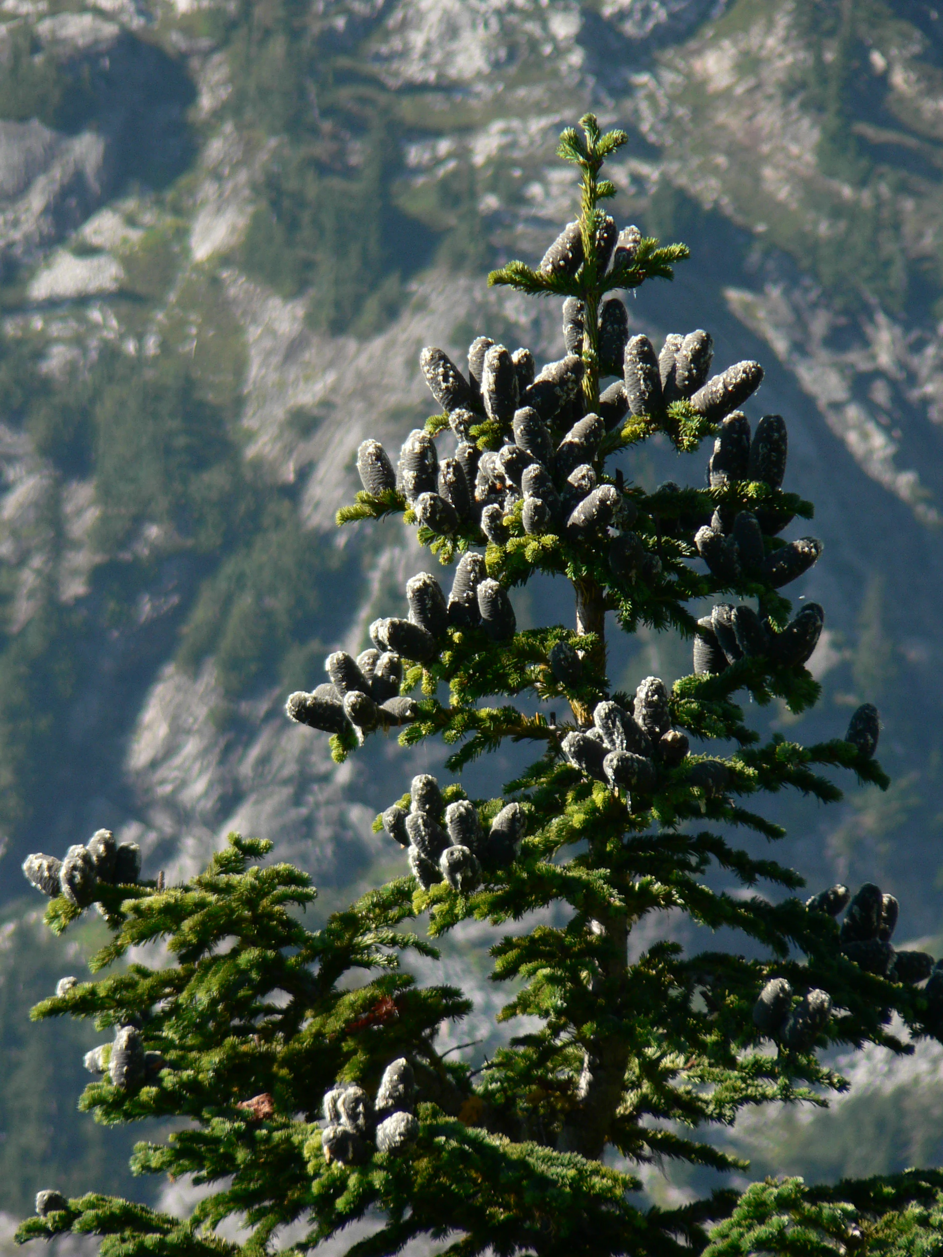
Drier, lower slopes carry ponderosa pine and Douglas-fir alongside white fir and grand fir, while upper slopes and the higher ridge add mountain hemlock, western white pine, subalpine fir, lodgepole pine, and at the very highest elevations whitebark pine. Where moisture is greater, the forest shifts toward western hemlock, western redcedar, and pacific silver fir, with Alaska cedar and Shasta red fir adding regional character. Along the Acker Divide and Cripple Camp trails, the forest includes stands of old-growth that retain large, slow-grown trees otherwise rare in more heavily logged parts of the region. Subalpine fir occurs at the upper end of the elevation gradient, where sites are cold enough for a more open, slower-growing forest type.
Rogue-Umpqua Divide Wilderness wildlife and species highlights
The wildlife profile of the Rogue-Umpqua Divide Wilderness is shaped by the dense forest cover, the elevation range from low canyons to high ridges, and the wilderness's connection to surrounding national forest lands. Large contiguous tracts of conifer forest, including old-growth stands, provide habitat for forest-dependent species typical of the southern Cascade and Klamath regions. These include deer, elk, and a variety of smaller mammals that use both the closed-canopy slopes and the more open ridgetops.
The area's elevations and transitional location also make it productive for birdlife, ranging from low-elevation songbirds and cavity-nesting species in the mature forest to high-country species in the subalpine zone near Fish Mountain. Raptors hunt the open ridge, and the mix of habitats along trails like the Rogue-Umpqua Divide National Recreation Trail gives visitors regular chances to see and hear forest birds across a range of elevations. The wilderness is best understood as supporting a representative cross-section of wildlife rather than concentrating on a single charismatic species.
Rogue-Umpqua Divide Wilderness conservation status and protection priorities
Conservation significance at the Rogue-Umpqua Divide comes primarily from the protection of an intact forested ridge system in the Klamath Mountains and from the safeguarding of headwater lands for both the Rogue and Umpqua river systems. By keeping this corridor in wilderness status, Congress has ensured that one of Oregon's key interbasin divides remains free from road development, logging, and other intensive land uses that affect much of the surrounding national forest landscape.
The wilderness is also an important refuge for old-growth forest and for the unusual mix of Cascadian and Klamath conifers that meet on this divide. Its proximity to Crater Lake National Park adds to its broader conservation network role, creating a larger protected footprint across the southern Oregon Cascade range and adjoining Klamath terrain. Together, these qualities make the area a small but meaningful contributor to watershed health, native biodiversity, and the long-term viability of mature forest habitat in the region.
Rogue-Umpqua Divide Wilderness cultural meaning and human context
The landscape that now forms the Rogue-Umpqua Divide has long been part of the working national forest landscape of southwestern Oregon, with the surrounding Umpqua and Rogue River-Siskiyou National Forests shaping generations of regional land use, timber management, and forest recreation. The communities of the broader Rogue and Umpqua valleys have historic ties to these watersheds, and the divide itself historically functioned as a practical boundary between the two drainage basins. The area's modern identity reflects both that watershed heritage and its more recent role as a designated wilderness for non-motorized recreation and forest preservation.
Top sights and standout views in Rogue-Umpqua Divide Wilderness
The Rogue-Umpqua Divide's strongest highlights are its long forested ridge along the Rogue-Umpqua watershed divide, its roughly 31-mile crest-view trail, and its unusually diverse conifer forest that bridges the Cascade and Klamath floras. Old-growth stands along the Acker Divide and Cripple Camp trails give the area a particular forest character that is increasingly uncommon in the region, and the view potential across two great river drainages from a single ridgewalk sets it apart from many of Oregon's more inward-focused forest wildernesses.
Best time to visit Rogue-Umpqua Divide Wilderness
Summer is the most reliable season for visiting the Rogue-Umpqua Divide Wilderness. Lower trails are typically snow-free earliest, but the crest trails and higher routes around Fish Mountain generally hold snow into late spring or early summer, making mid to late summer the most practical window for experiencing the full ridge and its views. Late summer and early fall also bring more stable conditions, cooler nights, and generally good trail access across the elevation range, while autumn can add seasonal color to the mixed conifer forest at lower and middle elevations. Winter and early spring visits are possible for experienced backcountry travelers but require skill in snow travel and a tolerance for limited trail access.