
Mori Atlas logo
Protected landscapeSabinares del Arlanza-La Yecla

A mapped journey through the ancient juniper forests and dramatic river gorges of Burgos.

Sabinares del Arlanza-La Yecla: Exploring the Protected Landscape and Limestone Geography

(Parque Natural de Sabinares del Arlanza-La Yecla)

Sabinares del Arlanza-La Yecla stands as a vital protected landscape in the Castilla y León region of Spain, defined by its complex limestone geology and expansive juniper woodlands. This area encompasses deep canyons like the Desfiladero de La Yecla and dramatic cliff faces that support a notable community of raptors. Through detailed mapping and landscape analysis, the unique ecological character of this territory emerges, showcasing a synthesis of calcareous plateaus, riparian forests, and deep ravines that shape the identity of this protected natural terrain.

juniper forestlimestone gorgeraptorsCastile and Leónnatural parkancient trees
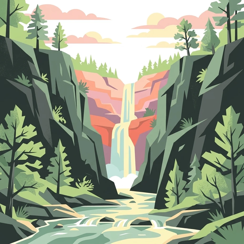
A flat-style digital illustration of a waterfall flowing between steep, rocky canyon walls flanked by evergreen trees.

Sabinares del Arlanza-La Yecla

Protected landscape

Park overview

Structured park overview, official facts, and landscape profile for Sabinares del Arlanza-La Yecla

Sabinares del Arlanza-La Yecla park facts, protected area profile, and essential visitor context

Review the core facts for Sabinares del Arlanza-La Yecla, including designation, size, terrain, visitor scale, habitats, and operating context in one park-focused overview.

About Sabinares del Arlanza-La Yecla

Sabinares del Arlanza-La Yecla is a regionally protected natural area in the southwestern part of the province of Burgos, in the Castile and León region of Spain. It covers the transition zone between two contrasting landscapes: the agricultural and forested Arlanza comarca, which takes its name from the Arlanza River, and the more rugged foothills of the Sierra de la Demanda. The park's administrative surface covers just under forty thousand hectares and spans twenty-one municipalities, including historically and culturally significant villages such as Santo Domingo de Silos, Covarrubias, and Contreras.

From a geological perspective, the park sits on calcareous substrates that have been folded over millions of years, producing a relief of synclines, plateaus, and deeply incised valleys. The most spectacular expression of this geology is the Desfiladero de La Yecla, a narrow limestone gorge carved into the Peñas de Cervera. Visitors can follow a series of bridges and hanging walkways through the ravine, which is so narrow and steep that sunlight rarely reaches the bottom. This combination of dramatic rock architecture and varied vegetation makes the area valuable both geologically and ecologically.

Vegetation is the defining ecological feature of the park. The open and sometimes sparsely wooded landscapes of the calcareal soils support one of the most extensive and well-developed populations of Juniperus thurifera, the Spanish juniper locally called sabina. Because individual trees can live for several millennia, some standing specimens in the park are believed to be more than two thousand years old, contributing to the site being regarded as one of Europe's most important juniper landscapes. Mixed holm oak woodlands, stands of Scots pine, laricio pine, and maritime pine, as well as Pyrenean oak (rebollo) and quejigo forests, give the park a varied forest mosaic. Along the Arlanza River there is also a well-developed riverside forest, while rocky slopes carry typical shrub species such as aulaga, juniper, bearberry, lavender, and thyme.

Wildlife conservation is another cornerstone of the park's identity. The cliffs and gorges provide nest sites for an exceptional raptor community, including large numbers of griffon vultures and Egyptian vultures, together with golden eagle, peregrine falcon, and eagle-owl. Mammal fauna includes wolves, roe deer, wild boar, otter, and wildcat. The area also hosts a critical population of Bonelli's eagle, a species classified as vulnerable in Spain, and the broader territory has been recognized since 2000 as a Special Protection Area for Birds, an international designation that highlights the area's importance for migratory and breeding birds alike.

Quick facts and research context for Sabinares del Arlanza-La Yecla

Sabinares del Arlanza-La Yecla is a Castile and León natural park located in the province of Burgos, in north-central Spain. It spans municipalities in both the Arlanza comarca and the Sierra de la Demanda comarca, and is administered by the Junta de Castilla y León. Originally classified in 2000 as a Special Protection Area for Birds, the broader area was elevated to natural park status in December 2020.

The park protects one of Europe's largest continuous stands of Juniperus thurifera, a long-lived Mediterranean conifer locally called sabina or enebro, alongside holm oak, several pine species, and rebollo oak forests. Its limestone relief produces dramatic gorges such as the Desfiladero de La Yecla and supports a major breeding population of cliff-nesting raptors, qualifying it as a nationally and internationally important bird area.

Protection and recognition

Examining documented terrestrial protection parameters and conservation governance metrics

Sabinares del Arlanza-La Yecla Protection Status and Official Designation Record

Sabinares del Arlanza-La Yecla maintains a documented terrestrial protection scope within the regional conservation network. Structured management facts compile official designation records for analytical terrain review.

Protection details

Protection scope
Terrestrial
Transboundary protection
No
Park context

Deeper park guide and search-rich context for Sabinares del Arlanza-La Yecla

Sabinares del Arlanza-La Yecla history, landscape, wildlife, and travel context

Explore Sabinares del Arlanza-La Yecla through its history, landscape character, ecosystems, wildlife, conservation priorities, cultural context, and seasonal travel timing in a structured park guide built for atlas discovery and search intent.

Why Sabinares del Arlanza-La Yecla stands out

Sabinares del Arlanza-La Yecla is best known for its ancient juniper woodlands, particularly the Spanish juniper (Juniperus thurifera), whose slow-growing individuals here can exceed two thousand years of age, making it one of the most significant juniper landscapes in Europe. Equally famous is the Desfiladero de La Yecla, a deeply cut limestone gorge with hanging walkways where sunlight barely reaches the floor. The park is also recognized for its concentration of cliff-nesting raptors. The limestone walls and crags around the Peñas de Cervera shelter large breeding colonies of griffon vulture and Egyptian vulture, along with golden eagle, peregrine falcon, Bonelli's eagle, and eagle-owl, giving the area notable national and international importance for bird conservation.
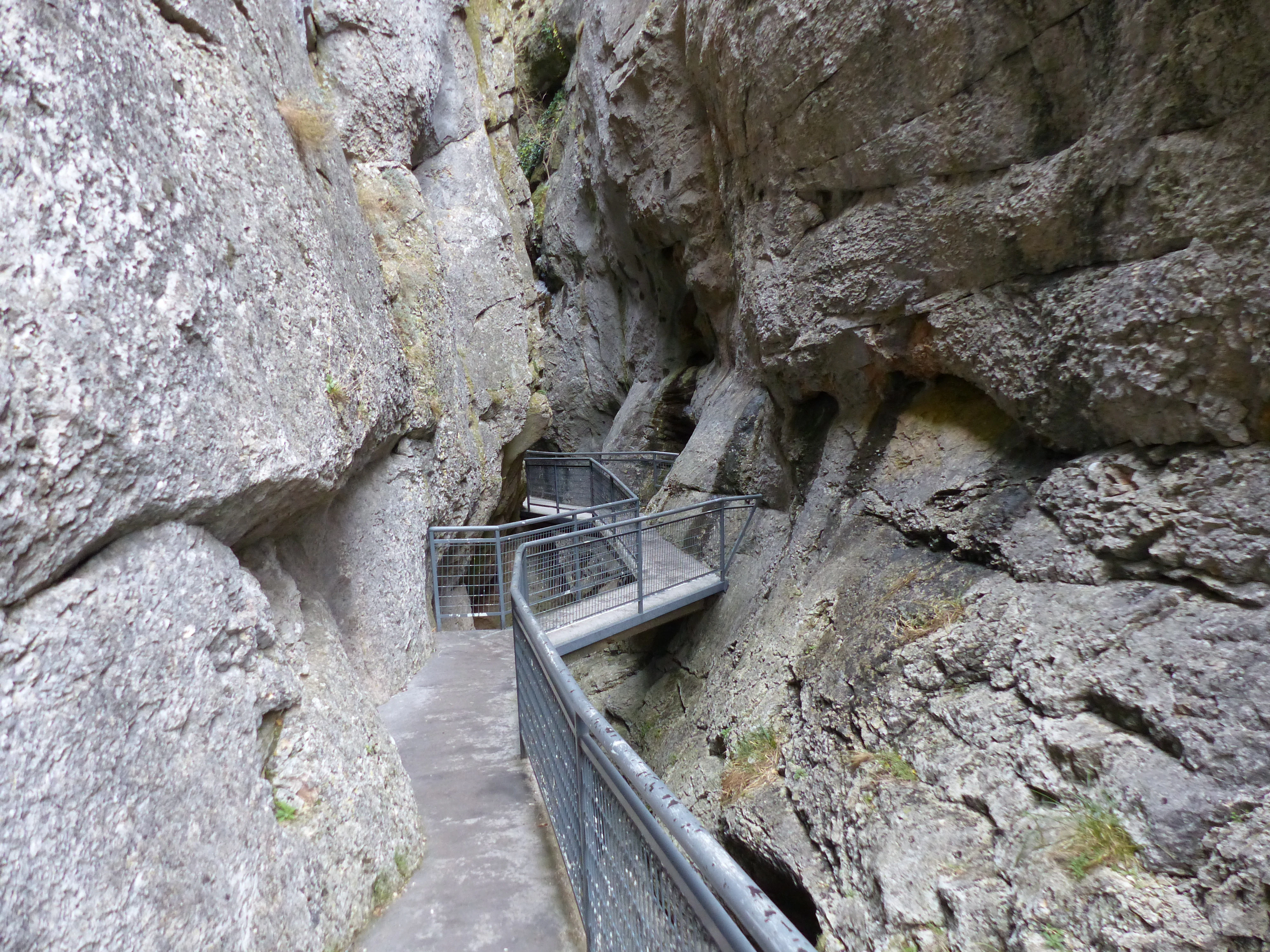
A metal boardwalk trail snakes through a very narrow, high-walled limestone gorge in Sabinares del Arlanza-La Yecla Natural Park.
A narrow metal walkway winding through the limestone walls of La Yecla gorge.

Sabinares del Arlanza-La Yecla history and protected-area timeline

The territory of Sabinares del Arlanza-La Yecla has long supported traditional land uses based on resin extraction, grazing, and Mediterranean woodland management. These activities shaped both the juniper woodlands and the mixed pine and oak forests that characterize the region today, and they are still seen as representative examples of long-standing Iberian silvicultural systems.

Formal protection came in stages. In October 2000 the area was classified as a Special Protection Area for Birds (ZEPA) under the European Birds Directive, acknowledging the importance of its cliffs and forests for breeding raptors and other species. Several successive plans followed, including a regional conservation plan for Bonelli's eagle issued in 2006, which identified critical areas within what was then the Espacio Natural de Sabinares del Arlanza.

The natural park itself was created relatively recently. On 14 December 2020, the regional legislature of Castile and León approved Law 4/2020, formally establishing the Parque Natural de Sabinares del Arlanza-La Yecla. Since then the park has been administered by the Junta de Castilla y León through the regional natural heritage framework, with management focused on preserving the juniper forests, protecting cliff-nesting birds, and integrating the protected area with the surrounding rural municipalities.

Sabinares del Arlanza-La Yecla landscape and geographic character

The relief of Sabinares del Arlanza-La Yecla is shaped by folded calcareous bedrock, which has been eroded into a varied pattern of dramatic canyons, synclinal valleys, and elevated plateaus. This geological structure gives the park some of its most visually striking features, including the deeply cut limestone gorges that occasionally plunge hundreds of meters below the surrounding tablelands.

The most iconic landform is the Desfiladero de La Yecla, a narrow gorge carved into the limestone of the Peñas de Cervera. The walls of the gorge rise vertically on either side, and at ground level sunlight is so restricted that the floor remains shaded for most of the day. A network of footbridges and catwalks allows visitors to walk along the flanks of the canyon and experience the sheer scale of the cliff faces. Beyond La Yecla, the park contains a mosaic of forested valleys, exposed rock outcrops, and agricultural mosaics, creating a landscape that visually and ecologically links the Sierra de la Demanda foothills with the Arlanza River basin.

A small, tiered waterfall cascades over a reddish limestone cliff into a stream, framed by juniper trees in the foreground.
A small waterfall flowing over a limestone cliff face, surrounded by juniper trees in the Arlanza region.

Sabinares del Arlanza-La Yecla ecosystems, habitats, and plant life

Ecologically, Sabinares del Arlanza-La Yecla lies at the intersection of Mediterranean and supramediterranean biogeographic zones. Its juniper woodlands are the park's most distinctive vegetation type: open formations of Juniperus thurifera, a slow-growing, drought-tolerant conifer adapted to calcareous soils and harsh continental climates. Because these trees can live for more than two millennia, the park preserves some of Europe's oldest living gymnosperm specimens, and the continuous stands here are among the best preserved in Spain.

Beyond the junipers, the park carries a varied forest mosaic. Holm oak (encina) woodlands are widespread, with Scots pine, Black pine (laricio), and maritime pine providing higher-elevation coniferous cover. Rebollo (Pyrenean oak) and quejigo form broadleaf forests on more mesic soils, while the Arlanza River corridor supports a well-developed riparian forest. Shrub communities typical of Mediterranean calcareal environments, including aulaga, juniper, bearberry, lavender, and thyme, fill the spaces between woodlands, contributing to habitat diversity and supporting a rich insect fauna that underpins much of the park's birdlife.

Sabinares del Arlanza-La Yecla wildlife and species highlights

The vertical cliffs and rugged relief of the park make it a stronghold for cliff-nesting raptors. Griffon vulture and Egyptian vulture are the most prominent species, with the park supporting a regionally and nationally significant share of Spain's breeding populations. Golden eagle, peregrine falcon, Bonelli's eagle, short-toed and booted eagles also nest in the cliffs, alongside eagle-owl. Lower slopes and open woodland carry populations of goshawk, partridge, and a range of smaller passerines, while the rivers and streams host aquatic birds.

Mammals are also well represented. The forested and rocky terrain supports roe deer, wild boar, and wildcat, while larger carnivores such as the Iberian wolf are present in the broader area. The Arlanza River and its tributaries provide habitat for otter, the presence of which reflects the relatively good water quality of the park's streams. Overall, the park functions as a connected complex of habitats where Mediterranean forest, rocky outcrops, and river corridors together sustain a rich and ecologically balanced community.

Sabinares del Arlanza-La Yecla conservation status and protection priorities

Conservation importance is central to the park's identity. The recognition of the area as a Special Protection Area for Birds in 2000 underscored its value for breeding vultures, eagles, and other raptors, and the subsequent reclassification as a natural park in 2020 extended protection to the full juniper-dominated landscape and its supporting habitats. The Spanish juniper woodlands are themselves considered a priority conservation target, both because of their age and because of their rarity within Europe.

Conservation planning has specifically addressed vulnerable species. A 2006 regional decree designated parts of the Sabinares del Arlanza territory as a critical area for Bonelli's eagle, classified as Vulnerable in the Spanish national threatened species catalogue. This implies special protective measures for territories vital to the survival and recovery of the species. The broader natural park framework now aims to integrate habitat protection with traditional land uses, including the sustainable management of pine forests and juniper woodlands that have shaped the area's character over centuries.

Sabinares del Arlanza-La Yecla cultural meaning and human context

The municipalities within Sabinares del Arlanza-La Yecla form part of a deeply rooted Castilian cultural landscape. Towns such as Santo Domingo de Silos, famous for its Benedictine monastery and Gregorian chant tradition, and Covarrubias, known for its medieval architecture and historical associations, anchor the area in Castile's religious and political history. Smaller villages like Contreras, Hortigüela, and Mambrillas de Lara preserve traditional Iberian rural architecture and have long been linked to the surrounding woodlands through resin tapping, grazing, and small-scale agriculture.

These human activities have coexisted with the natural environment for centuries, producing cultural landscapes where juniper and oak woodlands alternate with fields, dryland pastures, and river corridors. The park's designation reflects both a recognition of this cultural-natural fabric and an intent to maintain the traditional relationship between local communities and the land.

Top sights and standout views in Sabinares del Arlanza-La Yecla

The Desfiladero de La Yecla gorge, with its hanging walkways and permanently shaded floor, is one of the park's most photogenic landmarks. The extensive juniper woodlands, including individuals older than two millennia, represent one of Europe's most significant juniper landscapes and a centerpiece of the park's ecological identity.

The raptor-rich cliffs hold internationally important breeding numbers of griffon vulture and Egyptian vulture, alongside golden eagle, Bonelli's eagle, peregrine falcon, and eagle-owl. The mix of ancient junipers, mixed oak and pine forests, riparian habitat, and historic villages such as Santo Domingo de Silos and Covarrubias gives the park a layered identity that combines dramatic geology, distinctive Mediterranean vegetation, and deep Castilian cultural roots.

Best time to visit Sabinares del Arlanza-La Yecla

Spring and early autumn are generally the most rewarding seasons for visiting Sabinares del Arlanza-La Yecla. In spring, mild temperatures and variable weather bring out flowers and aromatic shrubs such as lavender and thyme, while raptor activity near nesting cliffs is high. Autumn offers cooler conditions, stable weather for hiking, and a richer display of color in the juniper and oak forests. Summer can be hot and dry, although mornings and evenings remain pleasant for outdoor activity; winter is often cold but reveals the structure of the rocky gorges and bare juniper silhouettes with striking clarity. Birdwatching interest tends to be highest between March and July, when most breeding raptors are active near the cliffs.
Monthly climate preview

Long-term annual temperature and precipitation patterns from representative coordinates

Sabinares del Arlanza-La Yecla Climate Normals and Temperature Rhythms

Historical climate data for Sabinares del Arlanza-La Yecla reveals measured monthly shifts in average temperature and precipitation across the designated coordinate point. Examining the complete twelve-month normals provides detailed context on long-term atmospheric patterns within the protected landscape.
Annual mean11 °C
2 °C20 °C
Jan
Feb
Mar
Apr
May13°
Jun17°
Jul20°
Aug20°
Sep16°
Oct11°
Nov
Dec
Warmest month
August

20.2 °C

Coolest month
January

2.5 °C

Wettest month
November

2.1 mm/day

Driest month
August

0.7 mm/day

Park location guide

Geography guide, regional context, and park location map for Sabinares del Arlanza-La Yecla

Sabinares del Arlanza-La Yecla park geography, regions, and map view in Spain

Understand where Sabinares del Arlanza-La Yecla sits in Spain through a broader geographic reading of the surrounding landscape, nearby location context, and its mapped position within the national park landscape.

How Sabinares del Arlanza-La Yecla fits into Spain

Spain, officially the Kingdom of Spain, is a unitary parliamentary constitutional monarchy located in Southern and Western Europe. The country occupies most of the Iberian Peninsula and includes territories in the Mediterranean and Atlantic. With a population of approximately 49.6 million and an area of 506,030 km², Spain is a major European economy and cultural force. Its capital is Madrid, and the country is known for its diverse landscapes ranging from mountainous regions to coastal areas.

Wider geography shaping Sabinares del Arlanza-La Yecla in Spain

Spain occupies the Iberian Peninsula in Southern and Western Europe. Peninsular Spain is bordered to the north by France, Andorra, and the Bay of Biscay; to the east and south by the Mediterranean Sea and Gibraltar; and to the west by Portugal and the Atlantic Ocean. The territory includes the Canary Islands in the Atlantic Ocean, the Balearic Islands in the Mediterranean Sea, and the autonomous cities of Ceuta and Melilla in mainland Africa. Spain features diverse terrain including the Pyrenees in the northeast, the Sierra Nevada in the south, and the Meseta Central plateau.

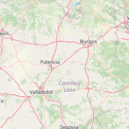
Map view of Sabinares del Arlanza-La Yecla

Use this park location map to pinpoint Sabinares del Arlanza-La Yecla in Spain, understand its exact geographic position, and read its mapped placement within the surrounding landscape more clearly.

Pigeon | © OpenStreetMap contributors

Location context for Sabinares del Arlanza-La Yecla

Castilla y León
Recorded earthquake history

Review the Seismic History of Sabinares del Arlanza-La Yecla

Explore the documented historical earthquake record for this protected area, featuring detailed event parameters and geographic data. MoriAtlas provides a clear, data-driven perspective on past seismic events recorded in the vicinity of the Sabinares del Arlanza-La Yecla limestone landscapes.

Sabinares del Arlanza-La Yecla Earthquake Records

Catalogued events

2 events

Strongest magnitude

Magnitude 4.4

Most recent event

May 31, 2002

This history includes earthquakes recorded inside the park or within 50 km of its borders

Visualizing ancient juniper woodlands, sheer limestone gorges, and protected terrain

Sabinares del Arlanza-La Yecla Photos and Landscape Scenery

Photographic records capture the dramatic limestone topography, narrow canyons, and ancient juniper forests defining the protected landscape of Sabinares del Arlanza-La Yecla. Visual documentation helps researchers and observers examine geological formations, cliff habitats, and regional vegetation patterns in greater detail.

A metal boardwalk trail snakes through a very narrow, high-walled limestone gorge in Sabinares del Arlanza-La Yecla Natural Park.

A narrow, vertical view between two towering, mossy limestone rock faces of a canyon, with a glimpse of a stony slope and bare branches in the background.

A small, tiered waterfall cascades over a reddish limestone cliff into a stream, framed by juniper trees in the foreground.

Park atlas

Compare adjacent limestone gorges, ancient woodlands, and regional reserves across northern Spain.

Parks Near Sabinares del Arlanza-La Yecla and Surrounding Protected Landscapes

Visitors exploring Sabinares del Arlanza-La Yecla can browse nearby protected areas and adjacent regional reserves that share similar limestone terrain and river basins. Comparing these connected conservation landscapes provides a broader view of the wildlife habitats and geological formations found throughout the surrounding territory.
Biosphere reserveLa Rioja
63 km away#1 closest

East

Valles del Jubera, Leza, Cidacos y Alhama: Protected Landscapes in La Rioja, Spain

A biosphere reserve featuring limestone gorges and dinosaur fossil sites

Valles del Jubera, Leza, Cidacos y Alhama forms a distinct mid-mountain region in northern Spain where four river valleys have carved deep passages into the earth. The area serves as a vital protected landscape containing rich paleontological history, thermal springs, and traditional Mediterranean forests. This atlas entry details the natural boundaries and geographic character of one of Spain's significant biosphere reserves.

Area
1,196.69 km²
Established
2003
Watercolor painting of a rolling green mountainous landscape featuring soft hills and a foreground meadow.
Biosphere reserveMadrid
82 km away#2 closest

South

Sierra del Rincón Biosphere Reserve: Mountain Geography and Protected Landscape Analysis

Transitional mountain terrain in the Sierra Norte region of Madrid

Sierra del Rincón provides a unique study of ecological compression, where Atlantic-flavored beech groves meet Mediterranean oak and highland shrublands. This protected mountain territory in Madrid integrates rich forest habitats with traditional agro-silvopastoral village life, making it a critical reference for understanding the transitional geography of the Iberian Central System.

Area
152.31 km²
Established
2005
Relief
Mountain
Climate
Alpine
Watercolor illustration depicting a mountain range, river, and green vegetation under a light sky
National parkSpain
97 km away#3 closest

South

Sierra de Guadarrama National Park: Protected Area Landscape and Geographic Context

Explore diverse high Mediterranean mountain terrain and ecosystems.

Sierra de Guadarrama National Park is a significant protected national park in central Spain, characterized by its extensive granite landscapes and eleven distinct ecosystems. This park protects crucial high Mediterranean mountain environments, ancient pine forests, and dramatic glacial formations. Its geographic position within the Sistema Central makes it essential for understanding the regional geography and mapped terrain of the Iberian Peninsula, offering a unique look at a vital protected landscape.

Area
339.6 km²
Established
2013
IUCN
II
Visitors
3M annual
Biosphere reserveBasque Country
141 km away#4 closest

North

Reserva de la biosfera de Urdaibai: Protected Coastal and Estuarine Geographic Atlas

Mapping wetlands, forests, and cliffs in the Basque Country

Explore the complex terrain of Reserva de la biosfera de Urdaibai, spanning the tidal Oka estuary to the peaks of Mount Oiz. This protected landscape is defined by its vast saltmarshes, Cantabrian oak forests, and dramatic coastal cliffs that anchor the natural geography of the Basque Country.

Area
224.52 km²
Established
1984
Relief
Mixed relief
Climate
Temperate
Watercolor illustration of a mountain landscape with green forests and a body of water.
National parkSpain
143 km away#5 closest

Northwest

Picos de Europa National Park: Dramatic Limestone Peaks and Protected Landscape Atlas

Explore Spain's historic national park and UNESCO Biosphere Reserve.

Picos de Europa National Park offers an unparalleled exploration of dramatic limestone peaks, deep glacial valleys, and extensive Atlantic forests. As Spain's oldest national park and a UNESCO Biosphere Reserve, it presents a remarkable study in karst landscape evolution and biodiversity conservation. This protected area, spanning significant territory across northern Spain, provides a rich geographic context for understanding regional natural heritage and mapped natural features.

Area
671.27 km²
Established
1918
IUCN
II
Relief
Mountain
Marine protected areaAsturias
207 km away#6 closest

Northwest

El Cachucho Marine Protected Area: Submarine Seamount and Cantabrian Sea Geography

Offshore protected landscapes and deep sea terrain mapping

El Cachucho represents a critical offshore protected area, defined by its massive seamount structure and proximity to the Asturian coastline. This marine habitat encompasses a complex array of geomorphological features, including rocky escarpments and submarine canyons that channel sediment across the narrow northern Iberian shelf, offering a detailed perspective on deep sea environmental architecture.

Area
57 km²
Relief
Upland
Climate
Temperate
Access
Remote access
Nature reserveNouvelle-Aquitaine
About 215 km away#7 closest

Northeast

Réserve naturelle régionale d'Errota Handia: Protected Wetland and Basque Geographic Atlas

Examining the ecological terrain of a historic French millpond reserve

Explore the structured geography of Réserve naturelle régionale d'Errota Handia, a compact but ecologically significant nature reserve in the Pyrénées-Atlantiques. This resource provides a detailed look at the park boundaries, wetland-woodland mosaic, and the historic hydraulic infrastructure that defines this unique Basque landscape, offering an essential perspective for understanding regional conservation in southwestern France.

Area
0.095 km²
Established
2001
IUCN
IV
National parkHautes-Pyrénées
237 km away#8 closest

East

Pyrénées National Park: Protected Landscape & Transboundary Protected Area Atlas

Discover Hautes-Pyrénées' dramatic glacial terrain and alpine environments.

Pyrénées National Park is a significant protected area in France's Hautes-Pyrénées department, renowned for its dramatic glacial cirques, high-altitude lakes, and extensive mountain landscapes. Established as a national park, it offers rich geographic context for atlas exploration, showcasing millions of years of geological formation shaped by tectonic uplift and glacial carving. This park is also notable for its transboundary conservation efforts with Spain, contributing to a broader protected region. Explore its unique terrain, from towering limestone formations to alpine meadows, and understand its place within the Pyrenean mountain range.

Area
458 km²
Established
1967
IUCN
II
Relief
Mountain

Common questions about visiting, size, designation, and location context for Sabinares del Arlanza-La Yecla

Sabinares del Arlanza-La Yecla FAQs for park facts, access, geography, and protected area context

Find quick answers about Sabinares del Arlanza-La Yecla, including protected-area facts, park geography, trail and visitor context, and how the park fits into its surrounding country and regional landscape.
MoriAtlas Explorer

Continue Your Protected Areas Search Across the Global Atlas

Deepen your exploration by continuing the structured search for national parks and protected areas worldwide. Utilize the comprehensive filtering capabilities to compare different conservation landscapes and refine your understanding of global park geography. Discover more about the distribution and characteristics of protected natural areas.

Global natural geography