
Mori Atlas logo
Nature reserveSalins d'Hyères

A distinctive Mediterranean mosaic of saline basins, freshwater marshes, and dunes in southeastern France.

Salins d'Hyères Nature Reserve: Mapping the Coastal Wetlands and Salt Pans of the Var Coast

The Salins d'Hyères represent a significant protected landscape set along the Mediterranean coast in the Var department. This complex comprises the historic Vieux Salins and the Salin des Pesquiers, which occupies the unique double tombolo of the Giens peninsula. The site features a mosaic of hypersaline ponds, freshwater marshes, and coastal pine woods that provide critical habitat for waterbirds along the western Mediterranean flyway.

wetlandscoastal salt pansRamsar sitebirdwatchingMediterranean coastmigratory birds
A graphic illustration featuring a waterfall cascading down a cliff into a winding river, flanked by coniferous trees and mountains under a sunlit sky.

Salins d'Hyères

Nature reserve

Park overview

Structured park overview, official facts, and landscape profile for Salins d'Hyères

Salins d'Hyères park facts, protected area profile, and essential visitor context

Review the core facts for Salins d'Hyères, including designation, size, terrain, visitor scale, habitats, and operating context in one park-focused overview.

About Salins d'Hyères

The Salins d'Hyères are a mosaic coastal wetland on the Mediterranean coast of southeastern France, taking in former salt pans, shallow basins, reedbeds, freshwater marshes, dunes, and coastal pine woods. Located within the commune of Hyères in the Var department, the site stretches across two distinct but ecologically complementary units: the Vieux Salins to the east, towards La Londe-les-Maures, and the Salin des Pesquiers on the double tombolo of the Giens peninsula, a rare geological formation in France.

Together these units form one of the most remarkable coastal natural areas of the Mediterranean French shoreline. Salt was once harvested here over many centuries, shaping the landscape of evaporation ponds and dykes that today defines the visual character of the site. When commercial salt production finally ceased in 1995, the area's biological importance, already recognized by naturalists since the 1970s, became the central focus of its management.

The Salins now serve principally as a refuge for wildlife and a reference point for Mediterranean wetland conservation. Their combination of salt, brackish, and freshwater environments, together with terrestrial habitats like dune scrub and Aleppo pine stands, creates conditions that sustain an exceptionally varied birdlife as well as reptiles, amphibians, fish, and a distinctive halophytic flora. As one of the last lowland coastal wetlands between the Camargue and the Italian border, the Salins d'Hyères hold an essential place in the network of Mediterranean protected sites.

Quick facts and research context for Salins d'Hyères

Les Salins d'Hyères form a protected Mediterranean wetland located in the commune of Hyères, in the Var department of Provence-Alpes-Côte d'Azur. The site covers roughly 900 hectares and combines the Vieux Salins east of the town with the more recent Salin des Pesquiers on the tombolo of the Giens peninsula.

Once an active salt-producing landscape reaching back to antiquity, the pans were definitively closed for production in 1995 and are now managed primarily for biodiversity. The site holds Ramsar status, recognizing its value for migratory and nesting waterbirds, and is the only major wetland of its kind in the eastern part of the Var coast.

Protection and recognition

Documented conservation history and official Ramsar wetland designation metrics.

Salins d'Hyères Protection Status and International Recognition Data

Salins d'Hyères maintains a mixed protection scope established in 2008 alongside recorded international recognition. Structured records detail official designation history and verified conservation status parameters.

International recognition

Protection details

Protection scope
Mixed
Designated year
2008
Transboundary protection
No
WDPA ID
193368
Park context

Deeper park guide and search-rich context for Salins d'Hyères

Salins d'Hyères history, landscape, wildlife, and travel context

Explore Salins d'Hyères through its history, landscape character, ecosystems, wildlife, conservation priorities, cultural context, and seasonal travel timing in a structured park guide built for atlas discovery and search intent.

Why Salins d'Hyères stands out

The Salins d'Hyères are best known as one of the richest birdwatching sites on the French Mediterranean coast. Nearly 300 bird species have been recorded, including significant breeding populations of pied avocets, black-winged stilts, Kentish plovers, slender-billed gulls, little terns, common terns, and Sandwich terns. The site also stands out for its mix of hypersaline flats, freshwater marshes, coastal pine stands, and sand dunes, creating a remarkable mosaic of habitats in a small coastal area. Its position between the Camargue and the Italian Riviera makes it a key stopover for migratory waterbirds across the western Mediterranean flyway.
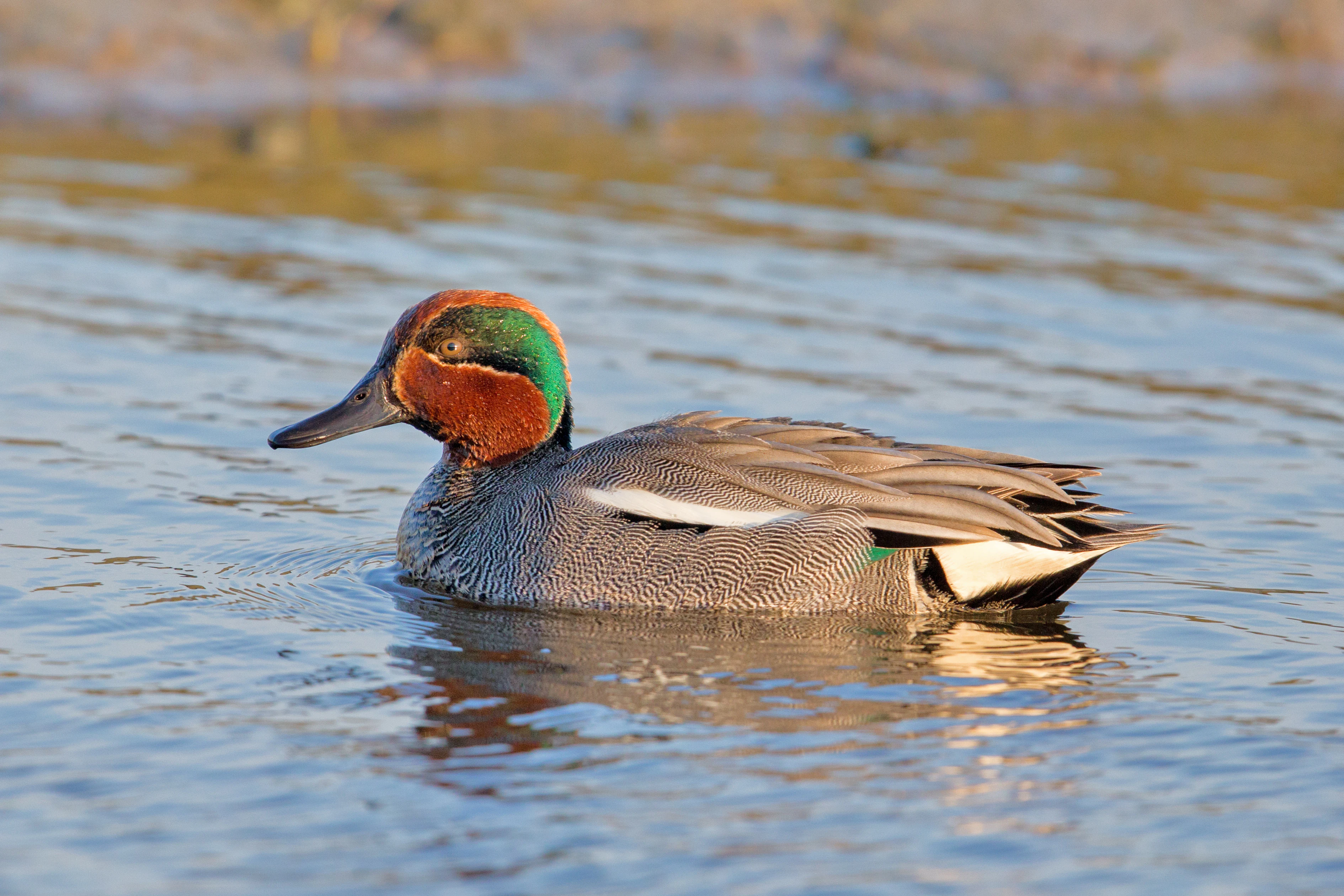
A male Eurasian teal with its distinctive green and chestnut head plumage, swimming in calm water.
A male Eurasian teal swimming in a wetland habitat at Salins d'Hyères.

Salins d'Hyères history and protected-area timeline

Human use of the Salins d'Hyères stretches back to antiquity, when salt was already being harvested in the 4th century BC by the inhabitants of the ancient Greek city of Olbia, and the presence of these saltworks is thought to have contributed to the early sedentarization of the Hyères region. The salt pans are first mentioned in a charter of 963 AD under Emperor Conrad, and in 1229 a charter granted the city of Genoa a near-monopoly on salt production at Hyères, attracting seasonal workers from northern Italy each late summer to harvest salt.

In the modern era, local salt production declined under competition from foreign salt, the Camargue saltworks, and the pressures of the salt tax, leading the surviving operations to concentrate at the present-day Vieux Salins. In 1848 the Gérard family founded the Société des Salins et Pêcherie de Hyères and created the Salin des Pesquiers; by 1856 the Compagnie des Salins du Midi had acquired the Vieux Salins, eventually absorbing the rival Pesquiers operation. A dedicated railway station, the Gare des Salins-d'Hyères, opened in 1876 to support the salt trade and closed for freight in 1987.

In 1984 the Vieux Salins briefly resumed activity, producing around 40,000 tonnes of salt a year, but this scale was too small to compete with much larger operations such as Aigues-Mortes and Salin-de-Giraud. Salt production finally ended at the Salins d'Hyères in 1995, opening the way for a new chapter centered on nature conservation. The site's ecological significance was formally recognized in 2008, when it was designated a Ramsar wetland of international importance.

Salins d'Hyères landscape and geographic character

The Salins d'Hyères are defined by a striking coastal mosaic shaped by centuries of salt-making and by their location on the northern shore of the Mediterranean. The terrain combines flat, brilliantly white evaporation basins with shallow saline ponds, dyked compartments, and channels, interspersed with freshwater marshes and reedbeds fringed by palustrine vegetation. These open, sunlit flats contrast with the wooded edges of the site, where coastal pine formations, oak clusters, and dune scrub add visual variety.

The site spans two main geographical units. The Vieux Salins, to the east of Hyères on the way to La Londe-les-Maures, form the older historical core of the saltworks, while the Salin des Pesquiers sits on the double tombolo that links the Giens peninsula to the mainland, an unusual and distinctive coastal landform unique in France. The Pesquiers unit includes a deeper water reservoir, traditional salt basins, freshwater marshes, littoral pine woods, and dune systems.

Coastal scenery surrounds and shapes the Salins, with the Golfe de Giens lying immediately to the south and the open Mediterranean beyond. Inland, the landscape gradually gives way to the more typical vegetation of Provence, while the maritime influence keeps the air, light, and plant communities distinctly coastal. The result is a distinctive hybrid landscape where cultural heritage and natural systems overlap across roughly 900 hectares of low-lying coastal terrain.
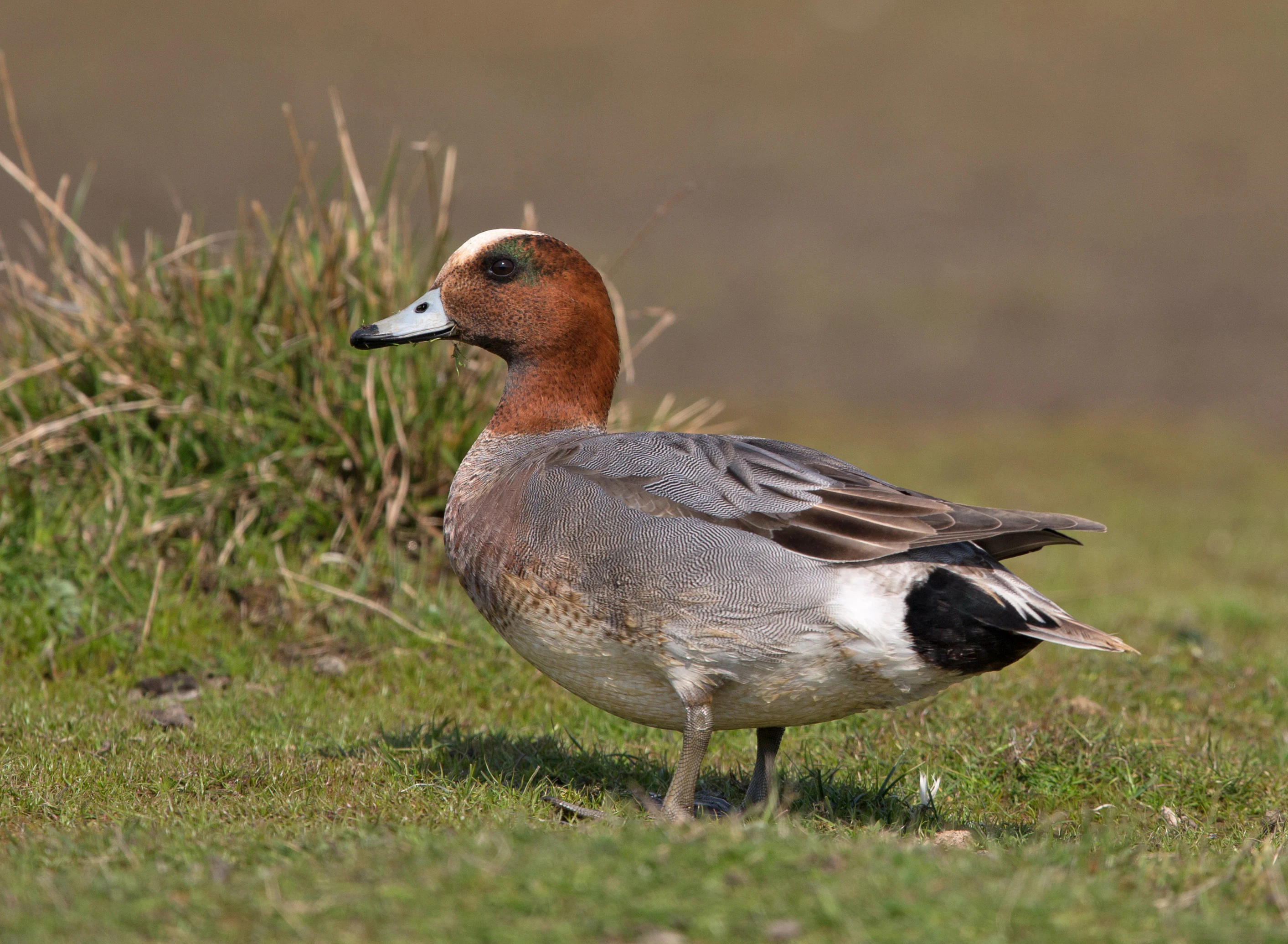
A male Eurasian Wigeon duck with a distinctive chestnut head, cream forehead, and grey body, standing on short grass near a water's edge.
A male Eurasian Wigeon standing in the wetland environment of Salins d'Hyères.

Salins d'Hyères ecosystems, habitats, and plant life

Ecologically, the Salins d'Hyères sit at the meeting point of marine, saline, freshwater, and terrestrial habitats, producing one of the most diverse coastal wetland complexes on the French Riviera. The open basins support halophytic vegetation typical of hypersaline environments, with glasswort dominating the most saline flats, while freshwater marshes host reeds and other palustrine species that frame the site in green even in the height of summer.

Terrestrial habitats add further variety. In the Pesquiers area, small groves of holm oak and Aleppo pine grow alongside the dunes, while invasive species such as Hottentot fig and eucalyptus have also established themselves in places. The overall pattern is a tight weave of salt pans, reedbeds, dune pines, and Mediterranean shrub, all set within sight of the Mediterranean Sea.

This habitat diversity is the foundation of the site's exceptional biodiversity. The Salins provide habitat for reptiles such as the European pond terrapin and the Montpellier snake, geckos like the Moorish wall gecko, amphibians including toads and frogs, and fish such as European sea bass and mullet. Predators including red fox, wild boar, and stray cats also live on or around the site, interacting with the bird colonies and other fauna that drive the area's ecological identity.
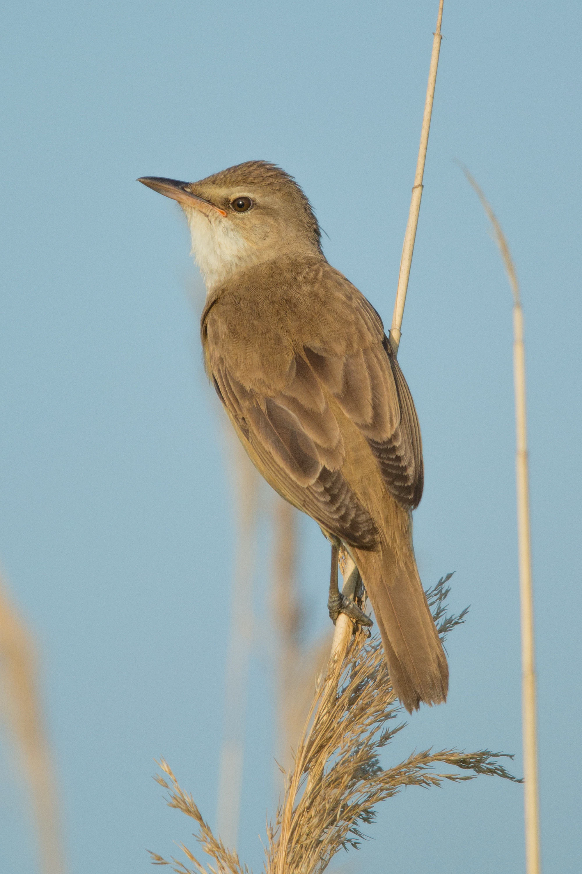
A Great reed warbler with brown feathers perched on a tall, thin reed against a clear blue sky.
A Great reed warbler perched on a reed in the Salins d'Hyères wetlands.

Salins d'Hyères wildlife and species highlights

The Salins d'Hyères derive their international reputation from their extraordinary birdlife. Systematic monitoring, in place since 2001 but with ornithological interest recognised since the 1970s, has documented nearly 300 bird species, of which around 51 breed on the site in varying numbers, 138 overwinter, and 259 pass through as migrants.

The breeding bird community is dominated by waders, terns, and gulls. Pied avocets, black-winged stilts, Kentish plovers, black-headed gulls, slender-billed gulls, little terns, common terns, Sandwich terns, and common shelducks all nest on the site, with several species representing the entire Var-department breeding population. The colony of slender-billed gulls, established at the Pesquiers since 2009, has held special importance, at times representing the only breeding colony of this vulnerable species in mainland France. Other breeders range from waterfowl such as mute swans and mallards to marshland rails, gulls, and a wide spectrum of passerines, raptors, and Mediterranean specialties such as the European bee-eater and the rare great reed warbler.

In winter the site hosts diving seabirds, ducks, herons, and shorebirds, including occasional great northern and black-throated divers, northern gannets, Mediterranean shags, black-necked grebes, great cormorants, Eurasian wigeons, common teals, northern shovelers, red-crested pochards, common pochards, and a selection of lapwings, plovers, and sandpipers. Migration seasons add an even greater variety, with white and black storks, ospreys, black and red kites, Eleonora's falcon, Bonelli's eagle, great reed warblers, bluethroats, golden orioles, and many passerines on passage. The site also regularly records exceptional rarities at national level, including Dalmatian pelicans, marbled ducks, white-headed ducks, and various rare shorebirds, reinforcing its status as one of the most remarkable birding sites on the French Mediterranean coast.
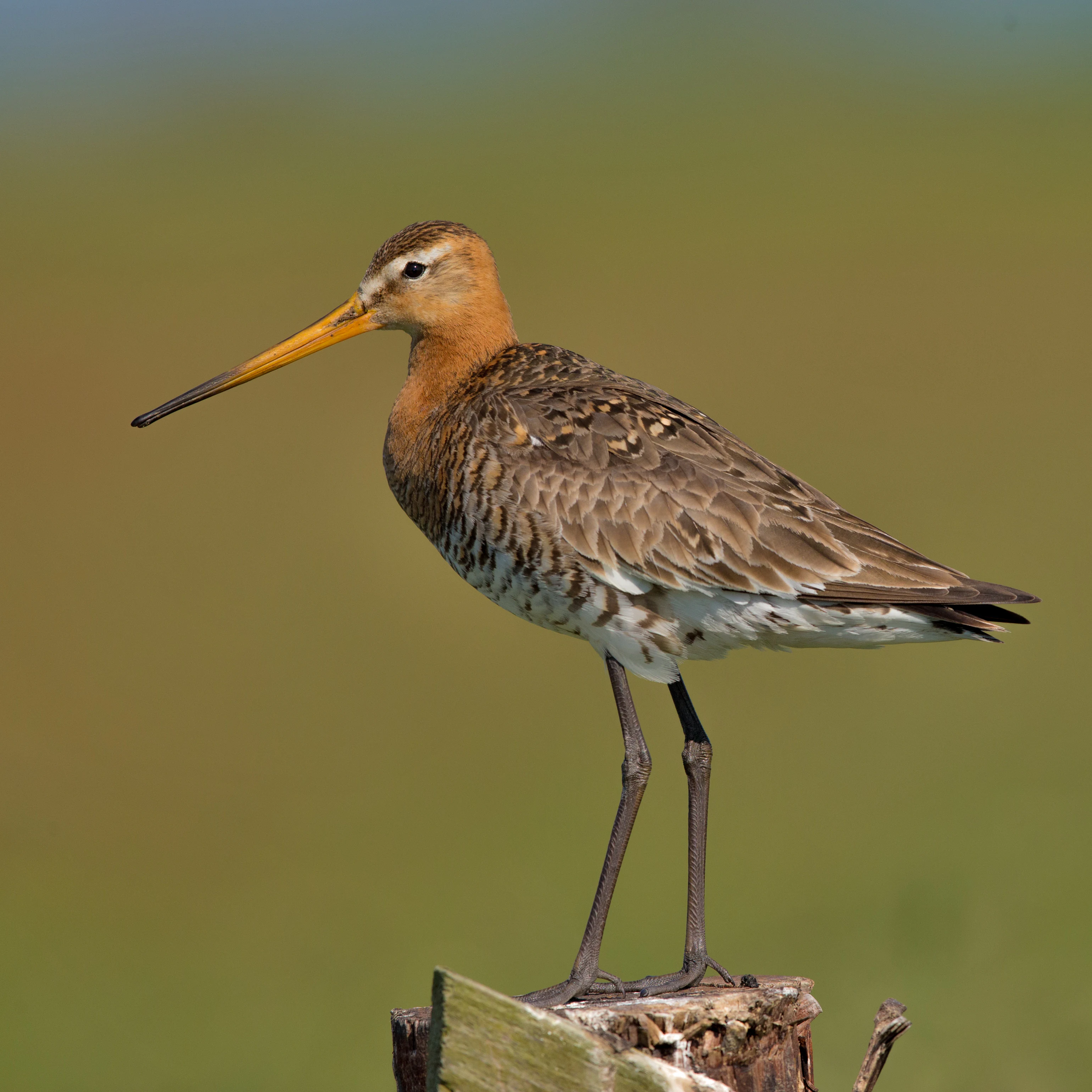
A side profile of a Black-tailed Godwit with a long, orange-tipped bill and brownish mottled feathers, standing on a wooden post against a blurred green background.
A Black-tailed Godwit perched in the salt marsh habitat of the Salins d'Hyères.

Salins d'Hyères conservation status and protection priorities

The Salins d'Hyères hold formal recognition as one of the most important Mediterranean coastal wetlands in France. Their designation as a Ramsar site on 15 September 2008 acknowledges the international value of the habitats they protect, particularly for migratory and breeding waterbirds. The site is also classified under the French IUCN system as a Category IV protected area, reflecting its management for habitat and species conservation.

Conservation significance arises from the site's role as one of the last lowland coastal wetland complexes between the Camargue and the Italian border on the French Mediterranean coast. The combination of hypersaline basins, freshwater marshes, dune systems, and coastal pine woods sustains a concentration of biodiversity that is unusual this far east along the Côte d'Azur.

Threats and concerns include invasive plant species such as Hottentot fig and eucalyptus, predator pressure on bird colonies from red foxes, wild boar, and feral cats, and the sensitivity of nesting birds to disturbance such as that caused by training flights of firefighting aircraft over the Golfe de Giens. The site's protected status, combined with ongoing ornithological monitoring, places it at the center of regional conservation efforts on the Var coast.

Salins d'Hyères cultural meaning and human context

The Salins d'Hyères carry a deep human and cultural heritage that remains visible in the landscape itself. Salt has been harvested here since antiquity, and the medieval and early modern history of the site is closely bound up with Mediterranean trade. A 1229 charter granted Genoa a near-monopoly on Hyères salt, drawing seasonal workers from northern Italy each summer, and the 19th-century industrial history of the site involved the Gérard family, who founded the Pesquiers operation in 1848, and the Compagnie des Salins du Midi, which consolidated salt production on the Var coast.

The arrival of the railway in 1876 with the opening of the Gare des Salins-d'Hyères tied the saltworks more tightly into broader French commerce, and the closure of freight services in 1987 foreshadowed the end of commercial production. Today the salt pans are largely silent, but their geometry of dykes and basins continues to define a cultural landscape that links Hyères to the broader history of Mediterranean salt-making and coastal settlement.
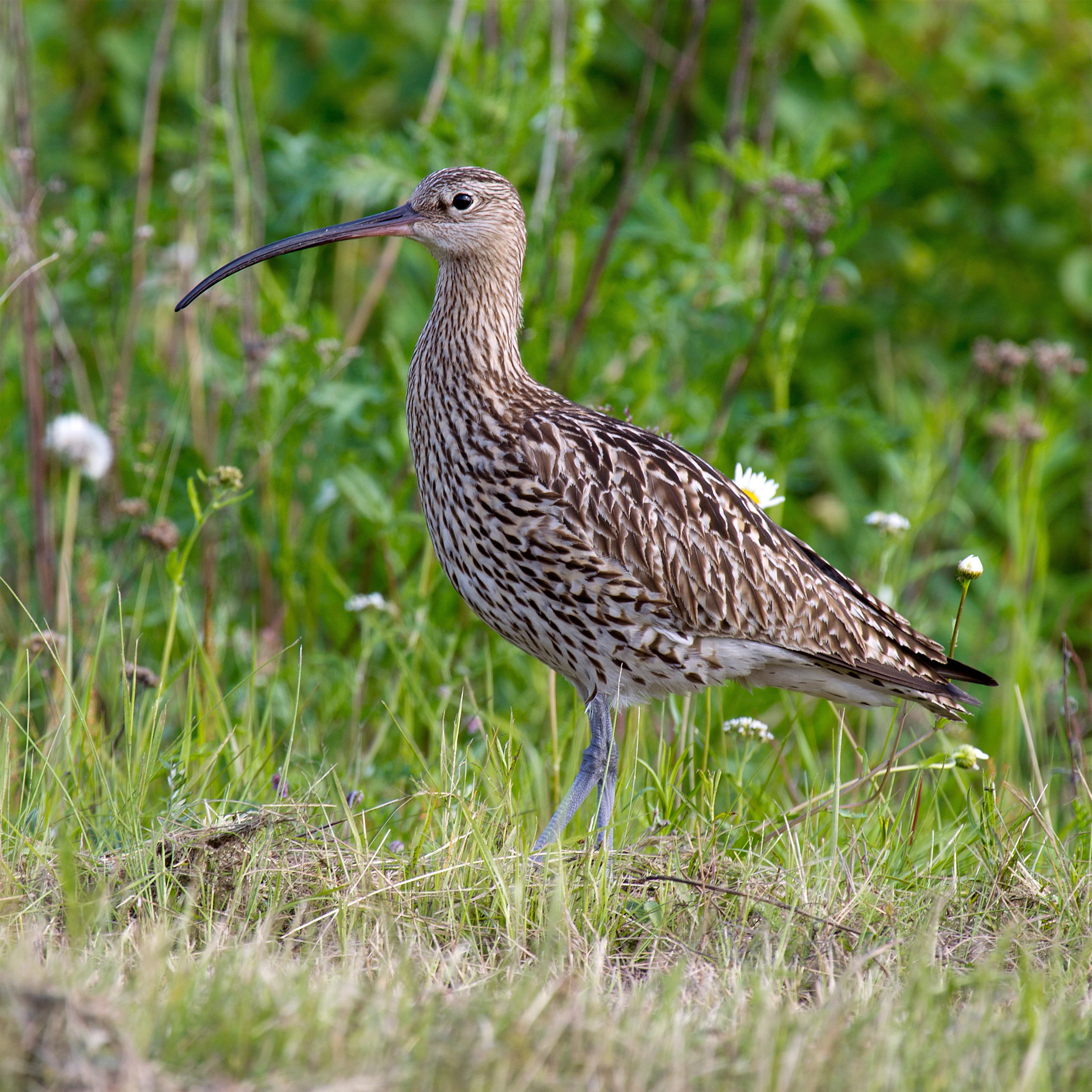
A medium-sized wading bird with a long, curved bill and mottled brown and white plumage standing in tall green grass.
An Eurasian Curlew standing in the grassy wetlands of Salins d'Hyères.

Top sights and standout views in Salins d'Hyères

The Salins d'Hyères offer an extraordinary blend of cultural and natural heritage on the Mediterranean coast, with the geometric patterns of centuries-old salt pans now serving as one of the richest bird habitats on the French Riviera. The site's two complementary units, the Vieux Salins and the Salin des Pesquiers, together support a mosaic of saline, freshwater, dune, and woodland environments.

Its Ramsar status, dense bird checklist, and unique position on the double tombolo of the Giens peninsula make the Salins d'Hyères a defining feature of the Var coastline, where salt-making heritage and Mediterranean wetland conservation meet in a single contiguous landscape.
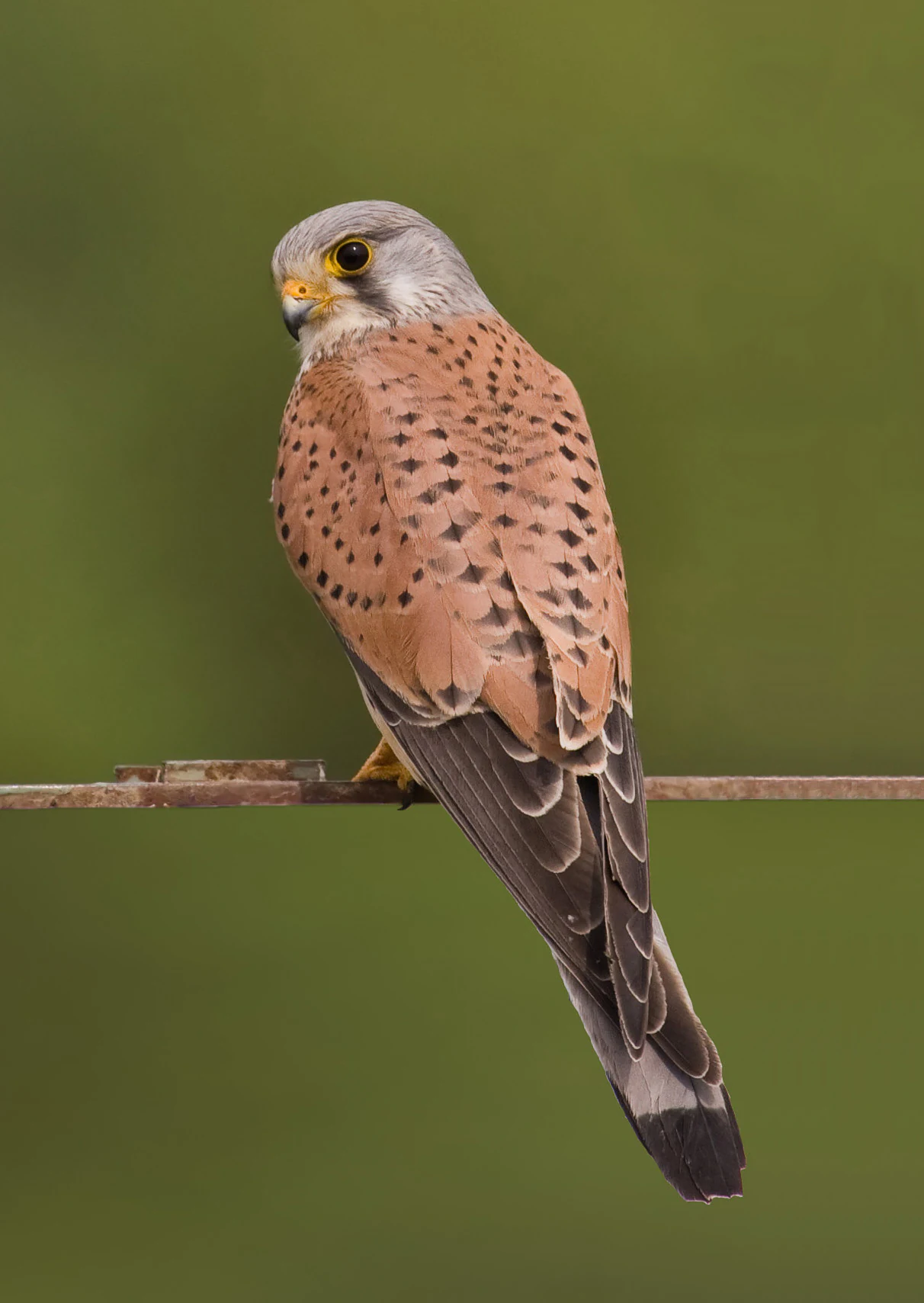
A side profile of a common kestrel with brown and spotted feathers perched on a thin horizontal metal wire against a blurred green background.
A common kestrel perched on a metal wire, a species often sighted in the wetlands of Salins d'Hyères.

Best time to visit Salins d'Hyères

The Salins d'Hyères are rewarding in every season, but each part of the year offers a different experience. Spring and autumn are particularly rich for birdwatching, as migration brings a flux of waders, terns, herons, and passerines passing through the Mediterranean flyway, while resident breeders are establishing territories around the salt pans.

Summer offers the warmest weather and the most active breeding bird colonies, including elegant terns, slender-billed gulls, and pied avocets nesting around the Pesquiers, though high temperatures and stronger human presence can make for quieter wildlife viewing at midday. Winter brings its own appeal, with wildfowl, grebes, herons, and occasional rarities on the open water, often framed by softer light and quieter conditions. The site's mild Mediterranean climate means visits are feasible throughout the year, with visiting birders typically aligning their trips with peak migration in spring and autumn for the widest variety of species.

Monthly climate preview

Long term temperature and precipitation patterns across representative coordinates

Salins d'Hyères Climate Normals and Annual Weather by Month

Historical climate normals for Salins d'Hyères reveal measured monthly shifts in temperature and precipitation based on representative coordinate sampling from 1991 to 2020. Examining the complete twelve month data profile provides detailed monthly averages for analyzing long term environmental conditions at this protected location.
Annual mean16 °C
10 °C24 °C
Jan10°
Feb10°
Mar12°
Apr14°
May17°
Jun21°
Jul24°
Aug24°
Sep21°
Oct17°
Nov14°
Dec11°
Warmest month
August

24.1 °C

Coolest month
February

9.8 °C

Wettest month
November

3.3 mm/day

Driest month
July

0.3 mm/day

Park location guide

Geography guide, regional context, and park location map for Salins d'Hyères

Salins d'Hyères park geography, regions, and map view in France

Understand where Salins d'Hyères sits in France through a broader geographic reading of the surrounding landscape, nearby location context, and its mapped position within the national park landscape.

How Salins d'Hyères fits into France

France is a unitary semi-presidential republic and one of the world's largest economies. It borders Belgium, Luxembourg, Germany, Switzerland, Italy, Monaco, Andorra, and Spain, with a maritime border to the United Kingdom. The country is known for its cultural influence, art, cuisine, and political history spanning centuries.

Wider geography shaping Salins d'Hyères in France

France is located in Western Europe. Metropolitan France extends from the Rhine to the Atlantic Ocean and from the Mediterranean Sea to the English Channel and North Sea. The country borders Belgium, Luxembourg, Germany, Switzerland, Italy, Monaco, Andorra, Spain, and has a maritime border with the United Kingdom.

Map view of Salins d'Hyères

Use this park location map to pinpoint Salins d'Hyères in France, understand its exact geographic position, and read its mapped placement within the surrounding landscape more clearly.

Pigeon | © OpenStreetMap contributors

Location context for Salins d'Hyères

Provence-Alpes-Côte d'AzurVar

Explore photographic records of evaporation basins, rare bird habitats, and Mediterranean coastal terrain.

Salins d'Hyères Photos and Landscape Scenery: Visualizing the Coastal Wetland

Visual documentation captures the stark geometry of historic salt pans alongside adjacent freshwater marshes and coastal pine woods. Examining photographic records reveals how complex wetland ecosystems and maritime landforms shape the protected terrain along the Mediterranean shore.

A male Eurasian teal with its distinctive green and chestnut head plumage, swimming in calm water.

A spotted crake, a small waterbird with brown speckled plumage and a yellowish-orange bill, stands on muddy vegetation at the edge of a pond.

A male Eurasian Wigeon duck with a distinctive chestnut head, cream forehead, and grey body, standing on short grass near a water's edge.

A Great reed warbler with brown feathers perched on a tall, thin reed against a clear blue sky.

A side profile of a Black-tailed Godwit with a long, orange-tipped bill and brownish mottled feathers, standing on a wooden post against a blurred green background.

A European goldfinch with a red face and yellow wing patches perched on a spiky thistle flower against a soft green background.

A medium-sized wading bird with a long, curved bill and mottled brown and white plumage standing in tall green grass.

A side profile of a common kestrel with brown and spotted feathers perched on a thin horizontal metal wire against a blurred green background.

A side profile shot of a common crane standing in shallow wetland water, with its grey plumage and distinctive red crown visible.

A common moorhen standing on a patch of dry ground with its distinctive red frontal shield and yellow bill visible.

A Common Greenshank standing in shallow water surrounded by green shoreline vegetation.

A small bird with white underparts, a light brown back, and a black facial marking standing on dark, wet sand with small shells scattered around.

A black kite soaring with wings spread against a clear blue sky.

A side profile view of a little ringed plover with its characteristic yellow eye ring, standing on a bed of small pebbles.

A side view of a common shelduck with white, black, and chestnut plumage flying against a clear blue sky.

A male Northern Shoveler with a distinctive iridescent green head, white chest, and chestnut-colored flanks swimming on calm water.

Park atlas

Compare adjacent coastal wetlands and regional Mediterranean habitats

Parks Near Salins d'Hyères and Surrounding Protected Landscapes

Browse other protected areas near Salins d'Hyères to examine shared Mediterranean coastal ecosystems and wetland geography. Continuing beyond these historic salt pans reveals connected regional habitats along the French Riviera.
Marine protected areaFrance
About 0.5 km away#1 closest

East

Sanctuaire Pelagos Marine Protected Area: Mediterranean Geography and Seascape

A transboundary conservation zone spanning 87,500 square kilometers.

Sanctuaire Pelagos represents a unique collaborative effort in marine conservation across the Mediterranean. Spanning the waters between France, Italy, and Monaco, this protected maritime area is defined by its deep-sea canyons and nutrient-rich currents that sustain diverse cetacean populations. Its immense scale and international governance make it a focal point for understanding Mediterranean marine biodiversity and environmental policy.

Area
87,500 km²
Established
1999
IUCN
IV
Relief
Lowland
Watercolor painting of a landscape with trees, hills, and a body of water
National parkFrance
About 20 km away#2 closest

Southeast

Port-Cros National Park: French Mediterranean Island National Park & Marine Sanctuary

Discover mapped protected land and unique Mediterranean ecosystems.

Port-Cros National Park offers a glimpse into a pioneering model of integrated terrestrial and marine conservation within the Mediterranean. This park protects a distinctive island geography marked by rugged terrain, endemic species, and vital underwater habitats, including crucial posidonia meadows and rich marine life. Through MoriAtlas, explore the mapped boundaries and ecological significance of Port-Cros, understanding its role as a vital protected landscape in the European atlas.

Area
46 km²
Established
1963
IUCN
II
Visitors
1M annual
A wide watercolor painting showing a landscape with green trees and bushes in the midground, purple hills in the background, and a pinkish foreground.
Nature reserveProvence-Alpes-Côte d'Azur
About 25 km away#3 closest

Northeast

Réserve naturelle nationale de la plaine des Maures: Protected Areas and Regional Landscape

Mediterranean habitats, cork oak forests, and temporary pool networks.

This nature reserve in the Var department protects a rare confluence of Mediterranean maquis, stone pines, and sandstone-based vernal pools. As a primary mainland habitat for the Hermann's tortoise, the area offers a significant study of lowland ecology and traditional Provençal land use within the broader Massif des Maures context.

Area
52.76 km²
Established
2009
IUCN
IV
Relief
Mixed relief
Watercolor illustration of coastal mountains and shoreline with scattered trees
National parkBouches-du-Rhône
About 47 km away#4 closest

West

Calanques National Park: Mediterranean Limestone Cliffs and Marine Protected Area

France's First Peri-Urban National Park

Calanques National Park, situated in the Bouches-du-Rhône department, represents a significant protected landscape where dramatic limestone geology meets the Mediterranean Sea. This atlas-focused entry details the park's iconic calanques, its combined terrestrial and marine protected zones, and its rich prehistoric cultural significance. Understand its unique geographic setting and its importance as a conservation area accessible for map-based discovery and regional landscape context.

Area
520 km²
Established
2012
IUCN
II
Relief
Mountain
A soft watercolor painting of a coastal landscape with rolling hills, distant mountains, and green vegetation against a light sky.
Marine protected areaProvence-Alpes-Côte d'Azur
About 74 km away#5 closest

Northeast

Parc maritime départemental Estérel-Théoule: Marine Protected Area and Coastal Geography

A vital Mediterranean corridor along the French Riviera coast

This marine protected area preserves a unique underwater mosaic where rocky shallows, sandy patches, and Posidonia seagrass meadows converge. Located offshore from the Estérel massif, the site provides a continuous conservation corridor between inland natural spaces and the Mediterranean Sea, offering insight into the littoral environment of the French Riviera.

Area
3.5 km²
Water
Water-dominated
Season
Seasonal
A soft watercolor illustration depicting layered rolling hills, distant mountain silhouettes, and clusters of trees in a pale color palette.
Regional parkProvence-Alpes-Côte d'Azur
About 75 km away#6 closest

Northwest

Parc naturel régional du Luberon: Regional Park Boundaries and Protected Landscape Atlas

Geology, mountain ridges, and Mediterranean ecosystems of Provence

Parc naturel régional du Luberon serves as a vital protected corridor in southeastern France. The park features three parallel limestone massifs, dramatic ochre formations, and fossil-rich plateaus. Its geography offers a case study in integrating sustainable land use with rich biodiversity across the Vaucluse and Alpes-de-Haute-Provence departments.

Area
1,747.26 km²
Established
1977
IUCN
V
Visitors
350K annual
Nature reserveProvence-Alpes-Côte d'Azur
About 75 km away#7 closest

North

Réserve naturelle régionale de Saint-Maurin: Geological Heritage in the Verdon Gorge

Travertine formations and cave habitats in Provence

Covering 25 hectares at the mouth of the Gorges du Verdon, this regional nature reserve protects a rare set of travertine terraces and tufa caves. Its geography creates a micro-refuge for specific cave-dwelling species and cliff-nesting raptors, standing as a significant example of geological and biological preservation in the Alpes-de-Haute-Provence department.

Area
0.248 km²
Established
2009
IUCN
IV
Relief
Upland
Watercolor painting of a park landscape with a foreground pond, grassy areas, and rolling hills in the background.
State or regional parkProvence-Alpes-Côte d'Azur
About 92 km away#8 closest

Northeast

Parc de Vaugrenier: Regional Protected Area and Archaeological Landscape in France

Wetland habitats and historic trails in Alpes-Maritimes

Parc de Vaugrenier protects a diverse hundred-hectare expanse between Antibes and Villeneuve-Loubet. Its terrain bridges Mediterranean woodland and lush freshwater meadows, distinguished by a rare collection of exotic trees and remnants of the ancient Via Julia Augusta. This park provides a quiet geographic contrast to the surrounding coastal urbanization of the French Riviera.

Area
1 km²
Established
1995
Visitors
500K annual
Relief
Lowland

Common questions about visiting, size, designation, and location context for Salins d'Hyères

Salins d'Hyères FAQs for park facts, access, geography, and protected area context

Find quick answers about Salins d'Hyères, including protected-area facts, park geography, trail and visitor context, and how the park fits into its surrounding country and regional landscape.
MoriAtlas Explorer

Continue Your Protected Areas Search Across the Global Atlas

Deepen your exploration by continuing the structured search for national parks and protected areas worldwide. Utilize the comprehensive filtering capabilities to compare different conservation landscapes and refine your understanding of global park geography. Discover more about the distribution and characteristics of protected natural areas.

Global natural geography