
Mori Atlas logo
Nature reserveSandsteinbrüche am Burzelberg bei Frau-Nauses

A rugged Buntsandstein quarry sanctuary in Hessen featuring critical inland cliff habitats

Sandsteinbrüche am Burzelberg bei Frau-Nauses Nature Reserve and Odenwald Protected Landscapes

(Naturschutzgebiet „Sandsteinbrüche am Burzelberg bei Frau-Nauses“)

Sandsteinbrüche am Burzelberg bei Frau-Nauses represents a significant protected nature reserve within the Odenwald hills of Hessen. This site documents the ecological transition from former sandstone extraction to a preserved cliff habitat, defined by steep red rock faces and secondary forest regeneration. The mapped area serves as a vital nesting ground for raptors, offering a unique look at post-industrial landscape recovery integrated with regional conservation efforts.

sandstone quarryOdenwaldcliff habitatraptor breeding siteperegrine falconEurasian eagle-owl
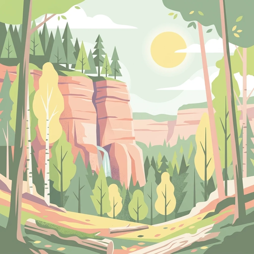
A stylized vector illustration of a forest landscape with towering red sandstone cliffs, a small waterfall, and a variety of trees under a bright sun.

Sandsteinbrüche am Burzelberg bei Frau-Nauses

Nature reserve

Park overview

Structured park overview, official facts, and landscape profile for Sandsteinbrüche am Burzelberg bei Frau-Nauses

Sandsteinbrüche am Burzelberg bei Frau-Nauses park facts, protected area profile, and essential visitor context

Review the core facts for Sandsteinbrüche am Burzelberg bei Frau-Nauses, including designation, size, terrain, visitor scale, habitats, and operating context in one park-focused overview.

About Sandsteinbrüche am Burzelberg bei Frau-Nauses

Sandsteinbrüche am Burzelberg bei Frau-Nauses is a small but ecologically focused protected area in the Sandstein-Odenwald, the portion of the Odenwald low mountain range where Lower Triassic Buntsandstein dominates the geology. The roughly 19 hectare reserve wraps around an abandoned quarry complex on the Burzelberg, just northeast of the village of Frau-Nauses, which itself is part of the town of Groß-Umstadt. The quarry, locally known as Steinbruch Am Burzelberg and historically also as a climbing area under the name Silberwald, ceased operations in the 1980s. By the time of its 1994 designation, the site had already begun to transform into a quiet enclave of rock walls, regenerating woodland, and warm-climate vegetation edges set against the broader forested hills of the northern Odenwald.

The protected area is anchored by a main quarry face that rises about 25 to 30 metres above the quarry floor, with several smaller pits distributed around it. After closure, the surrounding forest was partially taken out of active forestry, creating a near-natural forest mantle and adjacent fringe communities that meet the quarry walls directly. This combination of vertical sandstone cliffs, scrubby margins, and untouched mixed forest supports a specialized habitat that is rare in this part of Hesse.

Conservation management at the site explicitly aims at preserving the natural forest mantle, its heat-loving edge communities, and the geological and landscape value of the cliff faces themselves. Habitat structures have been created or maintained to support the reintroduction of peregrine falcons, and the successful breeding of the species was confirmed repeatedly between the mid-1990s and the late 2000s. Since 2009 the quarry has also been used as a regular breeding site by Eurasian eagle-owls. Because the reserve lies close to the busy Bundesstraße 45, and because of its ongoing role as a regulated climbing area, management also weighs the disturbance pressures associated with traffic, sport climbing, and sensitive raptor nesting, including periodic full closures to protect active raptor broods.

Quick facts and research context for Sandsteinbrüche am Burzelberg bei Frau-Nauses

The reserve lies in the Wiebelsbach / Frau-Nauses district of Groß-Umstadt, in the Landkreis Darmstadt-Dieburg of southern Hesse, within the Sandstein-Odenwald natural region of the Odenwald hills. Designated by statutory order on 14 December 1994, it is recorded under German nature-protection code 1432022, WDPA-ID 165318, and corresponds to the Natura 2000 site DE6119402, an EU Bird Directive area covering the cliff walls of the northern Odenwald.

Quarrying here targeted the Odenwald Buntsandstein, a regionally characteristic Lower Triassic red sandstone, and operations were halted in the 1980s, after which the site was allowed to revert to a near-natural mosaic of tall rock walls, rock rubble, scrub, and adjacent mixed forest. The reserve occupies about 19.46 hectares and protects both the geological heritage of the former workings and the warm-climate forest-edge vegetation, dry scrub margins, and cliff habitats that have since developed.

Protection and recognition

Documented terrestrial protection scope, management records, and official conservation designations

Protection Status and International Recognition for Sandsteinbrüche am Burzelberg bei Frau-Nauses

Comprehensive protected area records compile the terrestrial status, administrative scope, and official designation history for Sandsteinbrüche am Burzelberg bei Frau-Nauses. Detailed conservation metrics and verified recognition data provide clear contextual insights for structured geographic analysis.

Protection details

Protection scope
Terrestrial
Transboundary protection
No
WDPA ID
165318
Park context

Deeper park guide and search-rich context for Sandsteinbrüche am Burzelberg bei Frau-Nauses

Sandsteinbrüche am Burzelberg bei Frau-Nauses history, landscape, wildlife, and travel context

Explore Sandsteinbrüche am Burzelberg bei Frau-Nauses through its history, landscape character, ecosystems, wildlife, conservation priorities, cultural context, and seasonal travel timing in a structured park guide built for atlas discovery and search intent.

Why Sandsteinbrüche am Burzelberg bei Frau-Nauses stands out

The reserve is best known for combining a striking Odenwald Buntsandstein quarry landscape with one of southern Hesse's most important inland cliff habitats for breeding raptors. The roughly 25 to 30 metre main quarry wall, together with three smaller pits, provides the vertical rock structure targeted for the reintroduction and continued breeding of peregrine falcons and the more recently established breeding of Eurasian eagle-owls. Beyond the birdlife, the area is valued as a compact example of post-industrial landscape recovery, where abandoned red sandstone quarrying has given way to near-natural forest mantle, heat-loving scrub-edge communities, and protected cliff habitat. The site is also the locality that connects the regional sandstone quarrying heritage of the Odenwald with modern EU-level conservation under the Natura 2000 network.
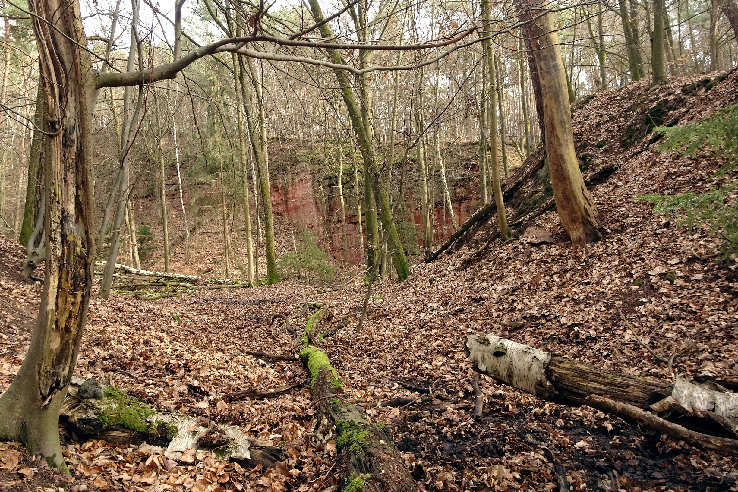
An eye-level outdoor shot showing a forest clearing with scattered fallen logs on a bed of dry leaves, leading towards a reddish exposed sandstone cliff face in the background.
A view of the former sandstone quarry at Burzelberg, showing the surrounding deciduous woodland and exposed rock faces.

Sandsteinbrüche am Burzelberg bei Frau-Nauses history and protected-area timeline

The sandstone at the Burzelberg was extracted as part of the long tradition of quarrying the regionally characteristic Odenwald Buntsandstein, a red Lower Triassic sandstone that has been worked across this part of Hesse for many generations. The quarry itself was active into the 1980s, after which operations were halted. The closure of the pit allowed the surrounding forest to encroach and the rock faces, scree, and fringes to develop towards a more natural state over the following decade.

Even before formal protection, the abandoned quarry was already known locally as a climbing area under the name Silberwald. Conservation recognition came in the form of a Hessian nature-protection ordinance dated 14 December 1994, which established the Naturschutzgebiet "Sandsteinbrüche am Burzelberg bei Frau-Nauses" under the code 1432 and registered it as WDPA-ID 165318. The protection order explicitly listed the natural forest mantle, the neighbouring warm-loving fringe communities, the cliff faces for their geological, natural-history and landscape value, and cliff-nesting raptors, especially peregrine falcons, as targets of management.

In 2008 the area gained an additional layer of conservation status when a near-identical sub-area became part of the Natura 2000 site "Felswände des nördlichen Odenwaldes", an EU Bird Directive area (6119-402) covering cliff walls across the northern Odenwald. Through the 1990s and 2000s the site became a regionally notable raptor breeding location, and from 2009 the quarry has hosted regular Eurasian eagle-owl broods as well.

Sandsteinbrüche am Burzelberg bei Frau-Nauses landscape and geographic character

The landscape of the reserve is shaped almost entirely by the interplay between former quarrying and forest regeneration along the northern edge of the Sandstein-Odenwald. The Burzelberg site carries the visual signature of Odenwald Buntsandstein: warm reddish-orange rock tones, sharp jointed faces, and a quarry floor littered with rubble that has slowly been recolonized by vegetation. The main working face rises about 25 to 30 metres above the pit floor, and three smaller pits are distributed around it, some already substantially overgrown.

Around the quarry walls sits a near-natural forest mantle, partially withdrawn from active forestry, in which scattered pines and birch trees have established themselves even on the rock itself. The transition from woodland to cliff is marked by heat-loving scrub and fringe communities, which are an integral part of the protected mosaic rather than a fringe feature. Outside the reserve, the terrain continues as part of the broader forested Odenwald hills, while the busy B45 corridor passes at the foot of the slope, making the quarry a quiet green break in an otherwise road-influenced landscape.
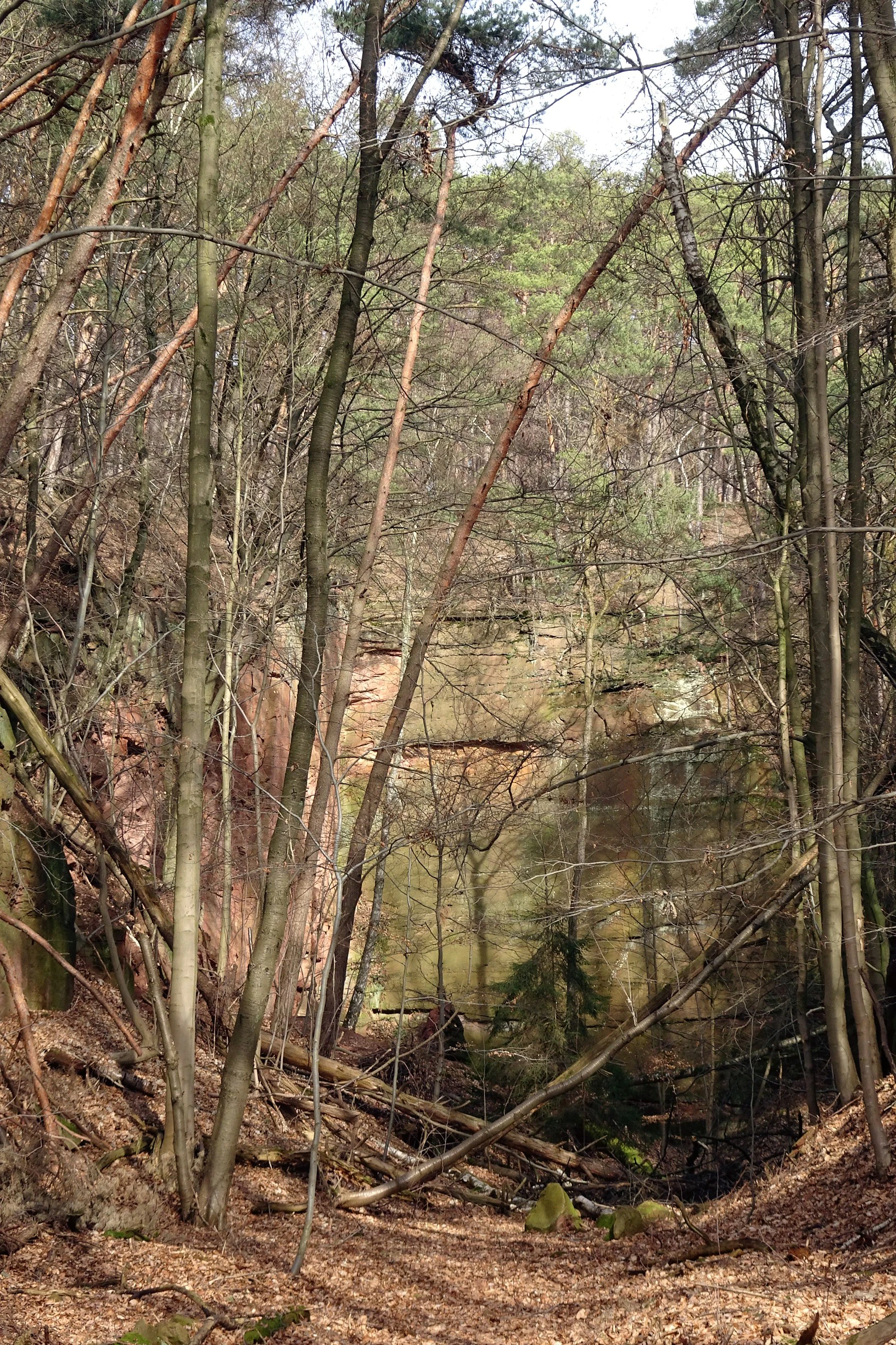
A vertical view of a sandstone rock quarry face surrounded by a deciduous forest in spring, with leaf litter on the ground.
A view of a sandstone rock face within the forested Sandsteinbrüche am Burzelberg nature reserve.

Sandsteinbrüche am Burzelberg bei Frau-Nauses ecosystems, habitats, and plant life

Ecologically, the reserve is best understood as a small-scale but unusually rich mosaic of three interconnected habitats: vertical sandstone cliff, warm-climate scrub and forest edge, and near-natural mixed forest. The cliff itself provides nesting ledges, sheltered cracks, and bare rock surfaces that are scarce in much of the surrounding low mountain range. The forest mantle above the quarries has been partly taken out of active forestry, allowing a more natural stand structure with mature trees, deadwood, and an understorey that supports species associated with old woodlands.

The transition zone between forest and cliff is especially important. Here, heat-loving fringe communities and scrub margins have established on the well-drained, sun-exposed sandstone substrate, providing a habitat type that is generally uncommon in the more wooded Odenwald. The combination of cliff, rubbly quarry floor, scrubby margins, and intact forest in a compact area gives the site an ecological profile that punches well above its modest 19.46 hectare footprint, as recognized by its overlap with the Natura 2000 site "Felswände des nördlichen Odenwaldes".
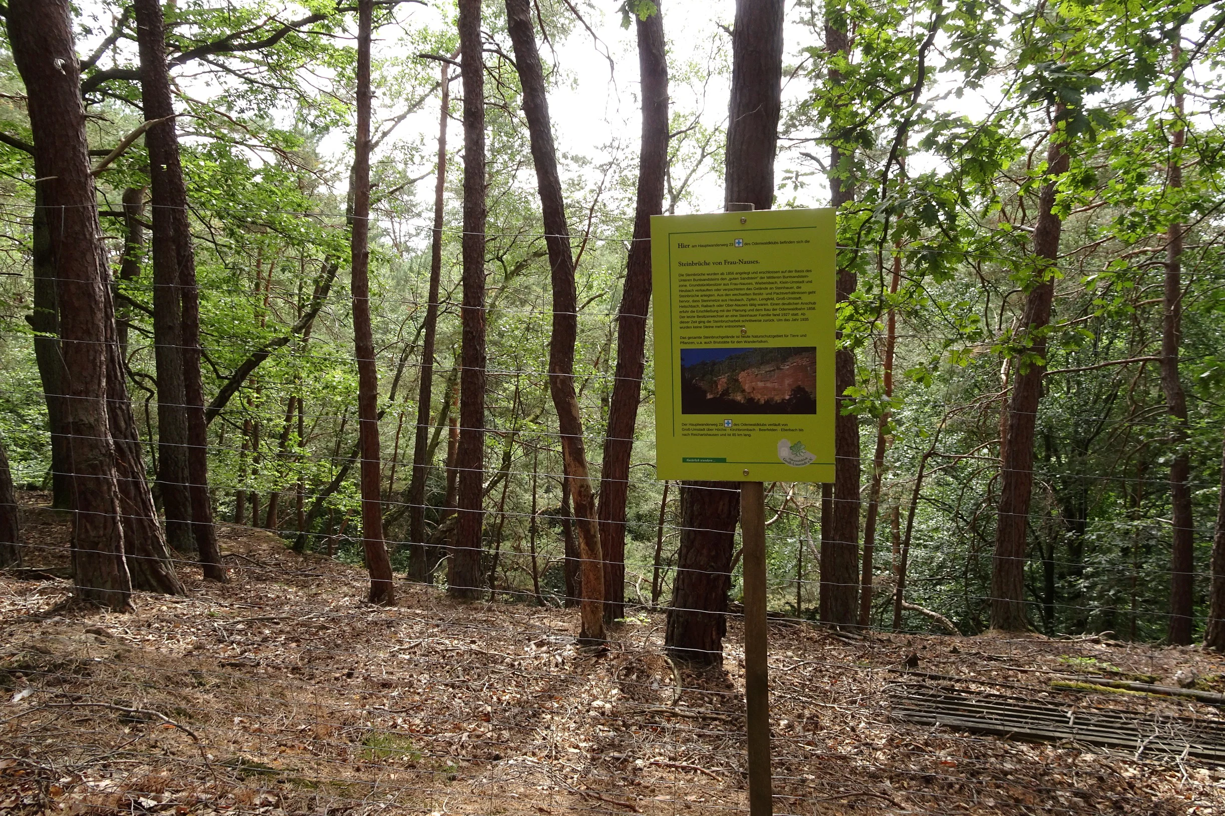
A yellow informational sign mounted on a wooden post stands in a forest, positioned in front of a wire fence with pine trees in the background.
An informational sign located within the woodland above the Sandsteinbrüche am Burzelberg quarry.

Sandsteinbrüche am Burzelberg bei Frau-Nauses wildlife and species highlights

Wildlife interest in the reserve is concentrated on cliff-nesting birds of prey, which are the headline feature of the site's biological value. The quarry has a documented record of successful peregrine falcon (Wanderfalke) breeding in the period from 1995 through 2010, and although individual peregrines continued to use the site afterwards, no successful broods were recorded in the year covered by the source. Since 2009 the quarry has also supported breeding pairs of the Eurasian eagle-owl (Uhu), making the site one of the more inland cliff-breeding raptor locations in southern Hesse.

The surrounding forest mantle and warm-clime fringe communities provide the supporting habitat for these cliff specialists, offering cover in mature trees, sheltered roosting spots, and a prey base drawn from the broader Odenwald forest. The management goal of preserving and actively enhancing cliff habitat structures is explicitly aimed at securing these raptor populations for the long term.

Sandsteinbrüche am Burzelberg bei Frau-Nauses conservation status and protection priorities

The conservation significance of Sandsteinbrüche am Burzelberg bei Frau-Nauses rests on the unusual combination of geological heritage and high-quality cliff habitat, both of which are rare in the regional landscape. Designated in December 1994 as a Hessian Naturschutzgebiet, the site protects a mosaic of near-natural forest mantle, heat-loving scrub-edge communities, and former quarry cliff faces, recognizing all three as integrated parts of the conservation target rather than as incidental features.

Since 2008 the reserve has also been part of the EU Natura 2000 network through the Bird Directive site "Felswände des nördlichen Odenwaldes" (6119-402), giving it trans-regional importance as one of the cliff locations protecting bird species of European conservation interest. The reserve's management actively aims at habitat structures suited to peregrine falcons and U data shows that this management has worked: the quarry supported documented peregrine breeding across multiple years and has become a regular eagle-owl breeding site.

Because the reserve lies directly beside the busy Bundesstraße 45 and is also used as a seasonal climbing area, conservation management is as much about limiting disturbance as about protection on paper. Climbing has been restricted to a narrow parcel of land and a defined season, and in years with sensitive raptor broods full closure for climbers has been recommended to reduce the risk of disturbance to nesting peregrines and eagle-owls.

Sandsteinbrüche am Burzelberg bei Frau-Nauses cultural meaning and human context

The most visible piece of cultural context at the Burzelberg is not traditional land use but a more recent recreational tradition. Before the site received its 1994 nature-protection status, the abandoned quarry was already established in the 1980s as an inland climbing area under the name Silberwald, and sport climbing has remained a regulated, partial use of the reserve since. That climbing heritage continues today under strict seasonal and spatial limits.

More broadly, the site carries the regional cultural imprint of Odenwald Buntsandstein quarrying, an extractive tradition that shaped the area's villages, roads, and built heritage for generations. The Burzelberg quarries are a small but characteristic trace of that history, now reinterpreted both as a piece of geological and industrial heritage and as a protected nature area within the modern conservation framework of Hesse and the EU.

Top sights and standout views in Sandsteinbrüche am Burzelberg bei Frau-Nauses

A redevelopment of an abandoned Odenwald Buntsandstein quarry into a formal nature reserve, with the 25 to 30 metre main quarry wall as the dramatic centrepiece and three smaller pits completing the geological story.

The site's main wildlife highlights are its peregrine falcon breeding record spanning many years and the more recent establishment of Eurasian eagle-owls, both supported by active habitat management aimed at cliff-nesting raptors.

The reserve's dual conservation status, at once a Hessian Naturschutzgebiet and part of the EU Natura 2000 "Felswände des nördlichen Odenwaldes", gives it a layered level of protection that is unusual for a site of its modest size. The locally protected climbing tradition at the former Silberwald quarry adds a small but distinctive cultural-recreational dimension to the place.

Monthly climate preview

Long-term representative monthly temperature and precipitation patterns across the protected coordinate

Climate Normals and Annual Temperature Range for Sandsteinbrüche am Burzelberg bei Frau-Nauses

Historical NASA records for Sandsteinbrüche am Burzelberg bei Frau-Nauses reveal a measured annual temperature range spanning winter freezing points to midsummer maximums alongside consistent daily precipitation averages. Detailed monthly breakdowns provide complete baseline climatology data for tracking long-term environmental patterns at this Hessen location.
Annual mean10 °C
0 °C21 °C
Jan
Feb
Mar
Apr10°
May14°
Jun18°
Jul21°
Aug20°
Sep15°
Oct10°
Nov
Dec
Warmest month
July

20.6 °C

Coolest month
January

0.2 °C

Wettest month
July

2.2 mm/day

Driest month
April

1.4 mm/day

Park location guide

Geography guide, regional context, and park location map for Sandsteinbrüche am Burzelberg bei Frau-Nauses

Sandsteinbrüche am Burzelberg bei Frau-Nauses park geography, regions, and map view in Germany

Understand where Sandsteinbrüche am Burzelberg bei Frau-Nauses sits in Germany through a broader geographic reading of the surrounding landscape, nearby location context, and its mapped position within the national park landscape.

How Sandsteinbrüche am Burzelberg bei Frau-Nauses fits into Germany

Germany is a federal republic in Western and Central Europe with a population of over 83 million across sixteen constituent states. It is Europe's largest economy by nominal GDP and a major global exporter and importer. The capital is Berlin, and the country borders Denmark, Poland, Czech Republic, Austria, Switzerland, France, Luxembourg, Belgium, and the Netherlands.

Wider geography shaping Sandsteinbrüche am Burzelberg bei Frau-Nauses in Germany

Germany is located in Western and Central Europe, spanning 357,022 km². It borders Denmark to the north, Poland and the Czech Republic to the east, Austria and Switzerland to the south, and France, Luxembourg, Belgium, and the Netherlands to the west. The country has coastlines on the Baltic Sea and North Sea to the north, with the Alps located in the southern region.

Map view of Sandsteinbrüche am Burzelberg bei Frau-Nauses

Use this park location map to pinpoint Sandsteinbrüche am Burzelberg bei Frau-Nauses in Germany, understand its exact geographic position, and read its mapped placement within the surrounding landscape more clearly.

Pigeon | © OpenStreetMap contributors

Location context for Sandsteinbrüche am Burzelberg bei Frau-Nauses

Hessen

Visual reference collection showcasing red sandstone cliffs, forest habitats, and Odenwald terrain

Sandsteinbrüche am Burzelberg bei Frau-Nauses Photos, Scenery, and Protected Landscape Views

Visual documentation captures the dramatic red sandstone quarry walls, regenerating forest mantle, and specialized cliff habitats defining the Odenwald reserve. Photographic records provide clear geographical insight into post-industrial landscape recovery and protected raptor breeding environments.

An eye-level outdoor shot showing a forest clearing with scattered fallen logs on a bed of dry leaves, leading towards a reddish exposed sandstone cliff face in the background.

A wide shot of a reddish sandstone cliff face in a quarry, topped with a dense forest of evergreen trees, viewed through bare tree branches in the foreground.

A vertical view of a sandstone rock quarry face surrounded by a deciduous forest in spring, with leaf litter on the ground.

A yellow informational sign mounted on a wooden post stands in a forest, positioned in front of a wire fence with pine trees in the background.

Park atlas

Compare adjacent Odenwald protected landscapes and regional cliff habitats

Other Parks Like Sandsteinbrüche am Burzelberg bei Frau-Nauses and Nearby Protected Areas

Browse protected areas and forested nature reserves located near Sandsteinbrüche am Burzelberg bei Frau-Nauses to compare regional geology and wildlife habitats. Discovering adjacent conservation zones helps trace the broader ecological and topographical spread of the surrounding mountain range.
A horizontal watercolor illustration of a soft, hazy landscape with rolling hills, meadows, and indistinct patches of vegetation against a light background.
Nature reserveHessen
About 5.8 km away#1 closest

Northeast

Bruchwiesen von Dorndiel Nature Reserve in Hessen: Protected Landscape and Geography

Wetland habitat and stream valley terrain in the Buntsandstein Odenwald

Bruchwiesen von Dorndiel represents a rare, compact concentration of wetland habitats, including open water, reedbeds, and moisture-gradient meadows. Located in the Amorbach stream corridor, this nature reserve is a key node for local biodiversity and regional landscape preservation within the broader Odenwald mountain range.

Area
0.087 km²
Established
1977
IUCN
IV
Relief
Upland
Watercolor painting of a green, rolling landscape with clusters of trees on the left and right against a soft, light-filled sky.
Nature reserveHessen
About 8.4 km away#2 closest

North

Buchertsgräben bei Schlierbach: Geographic Overview of the Hessian Nature Reserve

Protected forest landscape and geological loess ravine terrain

The Buchertsgräben bei Schlierbach nature reserve protects a vital woodland fragment in Hessen, where steep loess gullies cut through the landscape to create diverse microhabitats. This protected area supports a rare combination of semi-dry grassland relicts and forest-edge species, serving as a critical refugium for orchids and butterflies within the Odenwald foothills.

Area
0.516 km²
Established
1986
IUCN
IV
A soft watercolor painting of a wetland landscape with rolling hills in the background, a body of water in the middle, and green grass in the foreground.
Nature reserveHessen
About 8.7 km away#3 closest

South

Bruch von Bad König und Etzen-Gesäß: Nature Reserve and Floodplain Geography

Protected wetland landscapes in the Odenwald region of Hessen

Located along the Mümling river, this nature reserve protects a vital network of moist meadows, reed beds, and softwood forests. The site offers a clear view into the alluvial geography of the Odenwald, showcasing how protected floodplain corridors function within a developed regional landscape.

Area
0.427 km²
Established
1980
IUCN
IV
Relief
Lowland
Watercolor painting of a tranquil pond landscape with soft green reeds, grasses, and low trees under a pale, muted sky.
Nature reserveHesse
About 8.9 km away#4 closest

West

Reinheimer Teich Nature Reserve: Mapped Wetlands and Biodiversity in Hesse, Germany

A lowland wetland refuge in the Reinheimer Becken

Reinheimer Teich represents a significant nature reserve in the Darmstadt-Dieburg district of Hesse. This protected area features a mosaic of reed beds, wet meadows, and open water channels. It is recognized as one of the final strongholds for the European pond turtle and remains a key node within the Untere Gersprenz river system, demonstrating the vital role of floodplain restoration in local landscape conservation.

Area
0.75 km²
Established
1975
IUCN
IV
Relief
Lowland
A watercolor illustration of a soft, pastel-colored wetland landscape with trees, grassy banks, and distant hills.
Nature reserveHesse
About 9.1 km away#5 closest

Southwest

Bruch von Brensbach: Mapping the Nature Reserve and Wetland Mosaic in Hesse, Germany

Protected carr woodland and Gersprenz valley stream corridors

Located in the Odenwaldkreis district of Hesse, Bruch von Brensbach acts as a crucial protected wetland corridor. The reserve preserves a rare concentration of alder carr forest and reed beds along the Kilsbach stream, offering a stark geographic contrast to the agricultural fields that characterize the broader Gersprenz valley landscape.

Area
0.055 km²
Established
1983
IUCN
IV
A soft watercolor illustration depicting a green, hilly landscape with meadows and distant low slopes on a white background.
Nature reserveHesse
About 9.6 km away#6 closest

West

Forstberg von Ueberau: A Volcanic Nature Reserve and Protected Landscape in Hesse, Germany

Geographic atlas of an extinct volcano and dry grassland refuge.

Forstberg von Ueberau serves as a vital ecological anchor within the Reinheimer Hügelland. This 30-hectare nature reserve preserves an unusual volcanic substrate, featuring a crater-shaped basalt quarry surrounded by seminatural meadows and hedgerows. The site stands as a prime example of habitat management where traditional agricultural practices and biodiversity protection converge to sustain Red List species in a structured, open-country setting.

Area
0.305 km²
Established
1990
IUCN
IV
A wide watercolor painting showing a river flowing through a green meadow with trees and distant hills.
Protected areaHesse
About 10 km away#7 closest

Northwest

Scheelhecke von Groß-Zimmern Protected Area, Hesse: A Wetland and Riverine Landscape Study

Key protected wetland features in the Reinheimer Hügelland

Scheelhecke von Groß-Zimmern protects an essential network of wet meadows and brook corridors in the Darmstadt-Dieburg district. Its geography encompasses a transition from open sedge-dominated floodplain to softwood forest, providing critical support for avian species and amphibians within the Natura 2000 Gersprenz network.

Area
0.046 km²
Established
1983
Relief
Upland
Climate
Temperate
A horizontal watercolor painting depicting a soft-focus landscape with green fields, patches of wildflowers, and distant low hills.
Nature reserveHessen
About 13 km away#8 closest

Northwest

Auf dem Sand zwischen Hergershausen und Altheim Protected Nature Reserve in Hessen

Inland dune and floodplain landscape mapping

Explore the geography of Auf dem Sand zwischen Hergershausen und Altheim, a nature reserve in Hessen. The area serves as a critical habitat mosaic, featuring sandy inland dunes, expansive wet grasslands, and renaturalized floodplain terrain within the Gersprenz valley.

Area
0.233 km²
Established
1998
IUCN
IV

Common questions about visiting, size, designation, and location context for Sandsteinbrüche am Burzelberg bei Frau-Nauses

Sandsteinbrüche am Burzelberg bei Frau-Nauses FAQs for park facts, access, geography, and protected area context

Find quick answers about Sandsteinbrüche am Burzelberg bei Frau-Nauses, including protected-area facts, park geography, trail and visitor context, and how the park fits into its surrounding country and regional landscape.
MoriAtlas Explorer

Continue Your Protected Areas Search Across the Global Atlas

Deepen your exploration by continuing the structured search for national parks and protected areas worldwide. Utilize the comprehensive filtering capabilities to compare different conservation landscapes and refine your understanding of global park geography. Discover more about the distribution and characteristics of protected natural areas.

Global natural geography