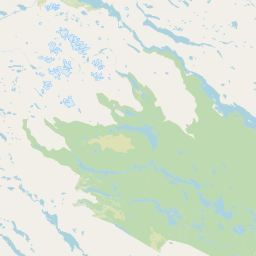
Peaks
Bielatjåhkkå
1,573 m

A structured examination of mountainous terrain, elevation ranges, and protected land features.
Analyze the spatial characteristics of Sarek National Park located in Norrbotten County, Sweden. This geographic profile details the park area of 1970 square kilometers, elevation data ranging from 477 to 2089 meters, and the surrounding boreal alpine environment, including glaciers, deep valleys, and significant mountain peaks.
Sweden's premier alpine wilderness with glaciers, deep valleys, and six of Sweden's highest peaks
Sarek National Park is a vast protected area in northern Swedish Lapland, established in 1909 as one of Europe's oldest national parks. Located in Jokkmokk Municipality within Norrbotten County, the park covers approximately 1,970 square kilometres and forms part of a larger wilderness complex together with the neighbouring Stora Sjöfallet and Padjelanta national parks. The park is centred on the Sarek mountain district, a rugged alpine landscape that represents the most mountainous region in Sweden. It contains six of Sweden's thirteen peaks exceeding 2,000 metres, including Sarektjåkkå at 2,089 metres—the second-highest mountain in the country. The landscape is characterized by massive mountain massifs, deep glacial valleys, high plateaus, and approximately 100 glaciers, making it one of the most glacier-rich areas in Sweden. The Rapa River flows through the park, creating the celebrated Laitaure delta at its confluence with Lake Laitaure. The park holds exceptional significance as part of the Laponian Area World Heritage Site and serves as a sanctuary for rare wildlife including brown bears, Eurasian lynx, wolverines, Arctic foxes, and gray wolves.
Regional placement and administrative status in Norrbotten County
Sarek National Park’s stored boundary encompasses 1,970 km²
Mountain relief spans from 477 to 2089 meters across recorded geography.
Peaks
1,573 m
Peaks
1,827 m
Lakes
Peaks
2,010 m
Peaks
1,928 m
Lakes
Analysis of boreal climate zones, mountain relief, and forest cover
Mountains · Valleys · Plateau · Glacier · Rivers · Lakes
Temperate coniferous forest · Boreal forest · Montane forest · Alpine meadow · Wetland · Riverine habitat · Lacustrine habitat
Uncover the surrounding regional geography of Sweden's high-alpine protected landscapes, tracing glacial valleys and mountain massifs.
West

Explore subarctic terrain, large lakes, and Laponia World Heritage Site geography.
Padjelanta National Park, situated in Norrbotten County, is Sweden's largest national park. It features a distinctive subarctic plateau ecosystem centered around two vast lakes, offering a starkly open landscape compared to adjacent alpine areas. This protected area is renowned for its exceptional botanical and lichen diversity, a vital part of the Laponia World Heritage Site. Users can explore its mapped geography, unique terrain, and the cultural significance of this expansive arctic wilderness.
Northeast
Explore mapped terrain and regional geography.
Stora Sjöfallet National Park stands as a significant protected landscape within Norrbotten County, Sweden, renowned for its striking Arctic mountain scenery centered on the Áhkká massif. As a key component of the Laponian Area UNESCO World Heritage Site, its vast expanse of over 1,278 square kilometers offers critical insights into subarctic ecosystems, glacial terrain, and the mapped boundaries of a protected natural territory. Discover the unique geographic features and ecological value of this expansive national park.
Southwest

Explore mapped boundaries and unique geographic context.
Delve into Junkerdal National Park, a significant protected area within Nordland county, Norway. This national park is celebrated for its rich arctic-alpine flora, including rare plant species that thrive at their southernmost European range. The varied landscape, shaped by glacial activity, features dramatic mountain valleys and alpine plateaus, offering a distinct geographic profile. Understand its protected status and mapped terrain, providing a critical point of discovery for regional landscape context.
West
Explore the mapped terrain and unique landscape context of this significant protected area.
Rago National Park is a protected national park in Nordland, Norway, recognized for its challenging mountainous terrain and its crucial role as part of a vast transboundary protected area complex spanning into Sweden. The park's landscape features alpine lakes and glaciers, offering a stark representation of northern Scandinavian mountain wilderness. Understanding Rago National Park provides insight into regional conservation efforts and the geographic significance of large-scale protected lands in Europe.
West
Mapped landscape context and regional geography details.
Explore the structured geographic data and protected landscape context for Sjunkhatten National Park, a significant national park in Nordland, Norway. This page provides detailed insights into its mapped boundaries and regional setting, offering an atlas-driven view of its natural terrain. Understand how this protected area contributes to the broader geography of Norway through factual, map-oriented discovery.
East
Mapped boreal terrain with ancient pines and dramatic ravines.
Muddus National Park is a landmark protected area in Norrbotten County, celebrated for its immense scale and preserved old-growth forest character. This national park features a unique geography defined by ancient coniferous forests, including Sweden's oldest pine tree, alongside striking ravines and extensive mire systems. As part of the Laponian Area UNESCO World Heritage Site, Muddus offers an unparalleled opportunity for atlas-based discovery of an undisturbed boreal ecosystem accessible solely by foot, highlighting its profound natural and mapped landscape significance.
South
Explore Sweden's protected landscape and mapped geography.
Pieljekaise National Park, a historic protected area in Norrbotten County, showcases one of Scandinavia's most intact boreal birch woodlands. Its landscape is shaped by ancient glacial activity, featuring a U-shaped valley, rolling hills covered in primeval-like birch forests, and distinctive twin peaks. Positioned along the renowned Kungsleden trail, this national park serves as a vital point for understanding the mapped geography and protected natural heritage of Sweden's Lapland region.
Southwest
Norway's vast national park with Svartisen glacier and unique flora.
Saltfjellet, Svartisen National Park spans over 2,100 square kilometers of diverse protected wilderness in Northern Norway. Renowned for Svartisen, Scandinavia's second-largest glacier, its landscape transitions from coastal influences to alpine plateaux. The park's calcareous bedrock supports a rich flora, rare in the region, contributing to its distinct geographic identity. Explore the mapped boundaries and natural terrain of this significant protected landscape.
Delve deeper into the structured geographic data of Sarek National Park, understanding its relation to the surrounding Norrbotten County and its unique alpine landscape features. MoriAtlas provides detailed map context for this significant protected area, allowing for a richer appreciation of its rugged terrain and remote wilderness. Continue your atlas exploration of Sweden's natural heritage by examining the park's mapped boundaries and its distinctive geographic setting.