
Mori Atlas logo
Protected areaSasthamkotta Lake

A detailed geographic analysis of the Ramsar wetland landscape, laterite basin, and regional water supply corridors.

Sasthamkotta Lake Protected Area: Mapping the Largest Freshwater Basin in Kerala India

Sasthamkotta Lake serves as the largest freshwater body in Kerala, situated within a complex landscape of undulating hills and alluvial plains along the southern coastal interior. This protected area supports a vital drinking water source for the Kollam district, framed by unique geomorphological zones ranging from laterite valley fills to the extensive flood plain of the Kallada River. Discover the structural geography and protected boundaries that define this essential wetland ecosystem within the Indian coastal belt.

freshwater lakeRamsar wetlandKeralaIndian wetlandsprotected lakedrinking water source
A minimalist, stylized vector art illustration of a mountain lake with a waterfall cascading down a cliff, surrounded by a coniferous forest under a soft sun.

Sasthamkotta Lake

Protected area

Park overview

Structured park overview, official facts, and landscape profile for Sasthamkotta Lake

Sasthamkotta Lake park facts, protected area profile, and essential visitor context

Review the core facts for Sasthamkotta Lake, including designation, size, terrain, visitor scale, habitats, and operating context in one park-focused overview.

About Sasthamkotta Lake

Sasthamkotta Lake occupies a prominent place in Kerala's wetland landscape, both as an ecological asset and as a long-standing cultural reference. Tucked into the highlands and valleys behind the west coast of India, the lake is surrounded on most sides by steep hills forming narrow valleys, while its southern edge borders the cultivated alluvial plains of the Kallada River. A 1.5 kilometre earthen embankment separates the lake from the paddy fields along this southern margin, marking the boundary between the open water and the working agricultural landscape around Karunagapally and Sasthamkotta.

Ecologically, the lake sits within a basin where Archaean-age rock formations, including charnockite, biotite gneiss, and dolerite dykes, meet the laterite-rich soils and younger Varkala sedimentary formations of the coastal belt. Geomorphologically, the catchment can be read as a layered system of undulating uplands under mixed crops and plantations, intensely cultivated valley fills of laterite and alluvium, and the broad flood plains of the Kallada River. The lake's hydrology depends largely on springs at its bottom and on seasonal rainfall, with the water level rising at the end of the monsoon.

Culturally, the lake is inseparable from the ancient Sastha temple on its bank, which gives the lake its name and which has historically supported resident troops of monkeys as part of the temple environment. The temple's significance, the lake's influence on regional identity, and its role as communal drinking water source give Sasthamkotta Lake a strong human dimension that complements its ecological value. Its designation as a Ramsar site since November 2002 underscores its standing as a wetland of international importance, while the wider Kerala landscape context, the proximity to Ashtamudi Lake further north, and the backdrop of the Western Ghats foothills position Sasthamkotta Lake within one of India's most ecologically distinctive regions.

Quick facts and research context for Sasthamkotta Lake

Sasthamkotta Lake is located in Kollam district, Kerala, near the towns of Sasthamkotta and Karunagapally. The catchment covers roughly 12.69 square kilometres and the lake itself spans about 373 hectares. It is officially designated as a Ramsar wetland of international importance, with reference number 1212, and serves as a major source of drinking water for the district as well as a working freshwater fishery.

Protection and recognition

Documented terrestrial protection scope, designation history, and international recognition records

Sasthamkotta Lake Protection Status and Ramsar Site Recognition

Sasthamkotta Lake features a recorded terrestrial protection scope alongside a documented Ramsar site designation established in 2002. Official international recognition records outline the conservation framework and historical designation milestones associated with the protected area.

International recognition

Protection details

Protection scope
Terrestrial
Designated year
2002
Transboundary protection
No
Park context

Deeper park guide and search-rich context for Sasthamkotta Lake

Sasthamkotta Lake history, landscape, wildlife, and travel context

Explore Sasthamkotta Lake through its history, landscape character, ecosystems, wildlife, conservation priorities, cultural context, and seasonal travel timing in a structured park guide built for atlas discovery and search intent.

Why Sasthamkotta Lake stands out

Sasthamkotta Lake is best known for being Kerala's largest freshwater lake, for supplying drinking water to a substantial portion of Kollam district, and for its Ramsar-recognized wetland status. Its cultural footprint is anchored by the pilgrimage-linked Sastha temple on its bank, and it stands out for the unusual claim that bacterial control by native _cavaborus_ larvae helps preserve the purity of its water.
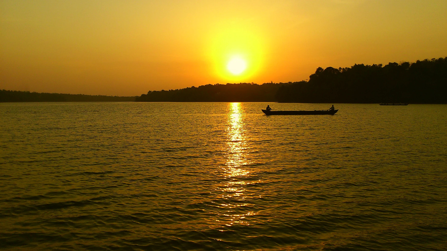
A wide view of a calm, large lake at sunset with the sun low on the horizon, casting a golden glow on the water and a silhouette of a small boat.
Sunset view over the tranquil waters of Sasthamkotta Lake, a major freshwater source in India.

Sasthamkotta Lake history and protected-area timeline

Sasthamkotta Lake has long been integrated into the cultural and economic life of the Kollam region, partly through the ancient Sastha pilgrimage temple on its bank, which gave the lake its name and anchored human presence along its shores. Over time, the lake became a vital municipal drinking water source for the Quilon (Kollam) district and an active freshwater fishery supporting local livelihoods.

In response to growing pressures on the lake, the Kerala State Government prepared a dedicated Conservation and Management Action Plan in 1999, aiming to safeguard the wetland while sustaining the services it provides. The plan was pursued with central government funding under the National Lake Conservation Plan and was coordinated through agencies including the Kerala Water Authority, the Departments of Forests and Wildlife and Fisheries, FIRMA, DRDA, and the Kerala State Council for Science Technology and Environment.

The lake's international profile was raised in 2002 when it was designated as a wetland of international importance under the Ramsar Convention, with formal designation recorded in November of that year. The site now carries Ramsar reference number 1212, reflecting formal recognition of its ecological significance alongside its long-standing role in the regional water economy and cultural landscape.

Sasthamkotta Lake landscape and geographic character

Sasthamkotta Lake sits in a varied post-and-valley landscape along Kerala's southern coastal interior. Most of its shoreline is enclosed by hills that rise steeply and frame narrow valleys, lending the lake a compact, sheltered character. Its southern boundary passes into the flat alluvial plains of the Kallada River, where paddy cultivation dominates and where a 1.5 kilometre earthen embankment separates the open water from the surrounding fields.

Within the catchment, the terrain can be understood as a sequence of geomorphological zones: undulating uplands carrying mixed plantations, low-lying valley fills of laterite, colluvium, and alluvium that are intensively cultivated, and the broad flood plain of the Kallada on the south. South and southwest of the lake, a network of smaller water bodies, waterlogged pockets, and tidal-influenced coastal stretches softens the transition toward the Varkala sedimentary formations underlying parts of the coastal belt.
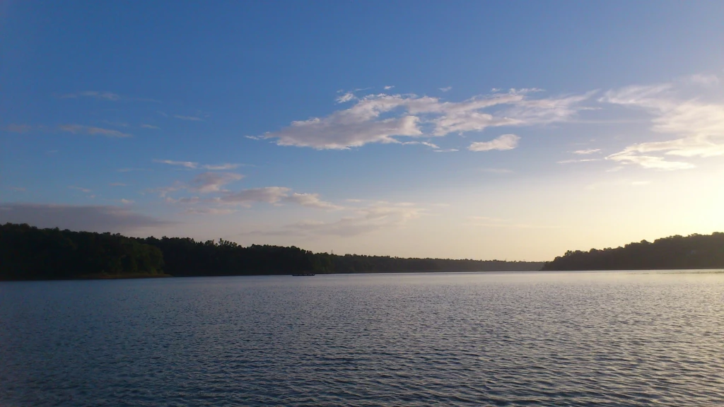
A wide view of a calm, large lake under a clear blue sky with soft sunset light hitting the horizon, surrounded by dark treelines on both shores.
A peaceful sunset view over the waters of Sasthamkotta Lake.

Sasthamkotta Lake ecosystems, habitats, and plant life

The ecological character of Sasthamkotta Lake centers on its open freshwater body and the productive basin around it. Rooted and floating aquatic plants play only a limited role in the lake, and open-water vegetation is sparse, leaving the lake clear and largely free of common salt or mineral contamination. The eastern shore supports insectivorous _Drosera_ plants, adding a distinctive biological note to the otherwise agriculture-dominated shoreline.

Surrounding land use patterns influence the wetland's ecological profile. The basin carries plantation crops such as cashew, tapioca, and plantain alongside paddy fields, while the upper catchment is clad in mixed forests, plantations, and cultivated valley soils. This mosaic of forest patches, agricultural lowlands, and open water shapes the movement of nutrients and sediment into the lake, and has historically supported both the water quality and the biological diversity for which the site is recognized.
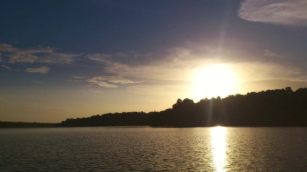
A wide angle sunset view over a calm lake, with the silhouette of a forested shoreline and the sun low in the sky.
Sunset over the waters of Sasthamkotta Lake.

Sasthamkotta Lake wildlife and species highlights

The lake and its fringes sustain a diverse freshwater fauna. Aquatic life includes 27 species of freshwater fish, together with two genera of prawns and 21 species of herrings and sardines from the family Clupeidae; pearl spot (Etroplus suratensis) and catfish, including _Wallago attu_ and _Calichrous bimaculatus_, are among the recognized species. The WWF has also recorded species of conservation concern in the lake, including the critically endangered _Puntius ticto punctatus_, the endangered _Horabagrus brachysoma_, and the vulnerable _Parambassis thomassi_.

Birdlife is anchored by the common teal, a small migratory dabbling duck that visits the wetland. On the banks, resident troops of monkeys associated with the Sasthamkotta temple environment form a familiar part of the shoreline scene. Insect diversity has been documented through 13 identified species, including nine butterflies, two odonates, and two hymenopterans, indicating a partially surveyed but ecologically meaningful invertebrate assemblage around the lake.

Sasthamkotta Lake conservation status and protection priorities

Sasthamkotta Lake's conservation significance rests on its role as a Ramsar-listed freshwater wetland, its importance as a regional drinking water source, and its ecological sensitivity in the face of rapid landscape change around the basin. The Kerala State Government's 1999 Conservation and Management Action Plan, supported through the National Lake Conservation Plan, frames the lake's protection around agro-forestry in the catchment, sanitation and drainage improvements, pollution abatement, limited desilting, weed control, and direct flora and fauna conservation, alongside fishery development and local awareness efforts.

These measures reflect broader recognition that long-term lake health depends on managing pressures from outside the open water, including soil erosion from tapioca cultivation, infiltration of domestic and agrochemical waste, sewage effluents, agricultural encroachment, and declining groundwater recharge. Coordinated implementation through the Kerala Water Authority, the Departments of Forests and Wildlife and of Fisheries, FIRMA, DRDA, and the Kerala State Council for Science Technology and Environment underscores the multi-agency approach needed to keep both the lake's water quality and its Ramsar-recognized status intact.

Sasthamkotta Lake cultural meaning and human context

Sasthamkotta Lake carries a strong cultural identity rooted in the ancient Sastha temple on its bank, a pilgrimage centre that gives the lake its name and continues to shape religious and social life in Sasthamkotta town. The temple's presence has produced distinctive shoreline features, including the resident monkey troops that inhabit the temple's environs and which are now part of the lake's everyday landscape.

The lake also underpins the local economy and water culture of the area, providing both drinking water and a working freshwater fishery to surrounding communities. The intertwining of pilgrimage, settlement, agriculture, and fishing around Sasthamkotta Lake gives the site a cultural depth that complements its standing as a major freshwater ecosystem in southern Kerala.

Top sights and standout views in Sasthamkotta Lake

Sasthamkotta Lake stands out as Kerala's largest freshwater lake and as a Ramsar wetland of international importance, combining ecological recognition with long-standing human use. Its shoreline complex of Sastha temple, resident monkey troops, and surrounding plantation and paddy landscapes offers a layered setting where culture, agriculture, and conservation meet. The lake's noted water purity, its role as a district-scale drinking water source, and its capacity to support a diverse freshwater fish and prawn community give it a distinctive identity within Kerala's wetland network.

Best time to visit Sasthamkotta Lake

The lake's water level rises toward the end of the monsoon season, and the surrounding landscape is at its greenest during and just after the wetter months, when plantations and paddy fields are fully refreshed. Cooler, drier conditions of the post-monsoon season offer calmer surfaces, clearer views, and more comfortable time on the water. Wildlife viewing such as common teal sightings on the lake is part of the broader draw, while the period leading up to and during the pilgrimage activity at the Sastha temple gives the visit a strong local cultural rhythm.
Monthly climate preview

Long-term monthly temperature ranges and precipitation rhythm for Sasthamkotta Lake

Sasthamkotta Lake Climate Normals: Annual Temperature and Precipitation Patterns

Historical climate data for Sasthamkotta Lake reveals measured monthly temperature variations and shifting precipitation levels from representative point observations. Reviewing the complete twelve-month profile provides deeper context on long-term weather by month and annual climate patterns.
Annual mean26 °C
24 °C29 °C
Jan25°
Feb27°
Mar29°
Apr28°
May27°
Jun26°
Jul25°
Aug25°
Sep25°
Oct25°
Nov25°
Dec24°
Warmest month
March

28.5 °C

Coolest month
December

24.1 °C

Wettest month
June

11.6 mm/day

Driest month
January

0.5 mm/day

Park location guide

Geography guide, regional context, and park location map for Sasthamkotta Lake

Sasthamkotta Lake park geography, regions, and map view in India

Understand where Sasthamkotta Lake sits in India through a broader geographic reading of the surrounding landscape, nearby location context, and its mapped position within the national park landscape.

How Sasthamkotta Lake fits into India

India is a South Asian country bordered by the Indian Ocean, Arabian Sea, and Bay of Bengal. It shares land borders with Pakistan, China, Nepal, Bhutan, Bangladesh, and Myanmar. The country has a population of over 1.4 billion people and operates as a federal parliamentary republic with its capital in New Delhi.

Wider geography shaping Sasthamkotta Lake in India

India occupies the Indian subcontinent in South Asia, bordered by the Arabian Sea to the southwest, the Bay of Bengal to the southeast, and the Indian Ocean to the south. It shares land borders with Pakistan to the west, China, Nepal, and Bhutan to the north, and Bangladesh and Myanmar to the east. The territory also includes the Andaman and Nicobar Islands in the Indian Ocean.

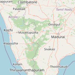
Map view of Sasthamkotta Lake

Use this park location map to pinpoint Sasthamkotta Lake in India, understand its exact geographic position, and read its mapped placement within the surrounding landscape more clearly.

Pigeon | © OpenStreetMap contributors

Location context for Sasthamkotta Lake

Kerala

Examine protected wetland terrain, shoreline hills, and freshwater habitats

Sasthamkotta Lake Photos and Landscape Scenery Visual Exploration

Visual records capture the topography, shoreline vegetation, and protected wetland character defining Sasthamkotta Lake across its basin. Detailed imagery illuminates the transition from upland hills to alluvial plains, clarifying the physical environment of this freshwater ecosystem.

A wide view of a calm, large lake at sunset with the sun low on the horizon, casting a golden glow on the water and a silhouette of a small boat.

A calm, expansive freshwater lake under a clear blue sky, bordered by dense green trees on the distant horizon.

A wide view of a calm, large lake under a clear blue sky with soft sunset light hitting the horizon, surrounded by dark treelines on both shores.

A wide angle sunset view over a calm lake, with the silhouette of a forested shoreline and the sun low in the sky.

Park atlas

Compare regional wetlands, lowland hills, and coastal conservation areas.

Other Parks and Protected Areas Near Sasthamkotta Lake

Browsing other parks near Sasthamkotta Lake reveals the broader ecological and geomorphological diversity of Kerala. Extended regional comparison connects isolated freshwater wetlands to surrounding protected landscapes.
A watercolor landscape painting of a calm lake with lush green vegetation on the banks and rolling hills in the background.
Wildlife reserveKerala
About 9.6 km away#1 closest

Southwest

Ashtamudi Lake Wildlife Reserve: Geographic Atlas of Kerala Wetland Systems

Mapping the eight-armed estuary and coastal wetland landscape

Ashtamudi Lake is a major estuarine system in Kerala, defined by its branching topography and significant tidal influence. This atlas entry provides a clear perspective on the park's protected boundaries, including its mangrove patches, inland navigation channels, and island clusters that form the core of the regional wetland geography.

Area
61.4 km²
Established
2002
Visitors
25K annual
Relief
Lowland
National parkKerala
About 85 km away#2 closest

Northeast

Periyar National Park: National Park Protected Area Atlas and Geographic Context

Mapped protected lands and regional landscape exploration in Kerala.

Discover Periyar National Park as a distinct protected landscape offering rich geographic context for atlas exploration. This entry details its mapped boundaries and its significance within the broader regional geography of Kerala. Understand the natural terrain and protected-area distribution that makes Periyar National Park a key element in India's conservation mapping.

Area
350.54 km²
Established
1982
IUCN
II
Visitors
754.3K annual
Protected areaIndia
About 95 km away#3 closest

North

Vembanad Protected Area: Mapping India's Iconic Kerala Backwaters and Wetland Landscape

An extensive inland lake system featuring tidal lagoons, islets, and below-sea-level agricultural plains.

Spanning over 96 kilometers, Vembanad forms a sprawling wetland environment that acts as the primary drainage basin for much of Kerala. Analyze the geography of its intricate shorelines, mangrove patches, and historic islets like Pathiramanal. This protected zone provides a critical habitat for thousands of waterbirds while illustrating the complex relationship between coastal estuaries and human-managed landscapes.

Area
2,033.02 km²
Relief
Lowland
Climate
Tropical
Access
Easy access
National parkIdukki
About 123 km away#4 closest

Northeast

Mathikettan Shola National Park: National Park Exploration and Geographic Mapping

Discover its protected landscape and regional context.

Mathikettan Shola National Park, a designated national park in the Idukki region, offers a focal point for understanding protected landscapes and their geographic distribution. This entry details the park's mapped boundaries and its specific setting within the regional geography, providing an atlas-level view of its conservation value. Users can explore the structured geographic identity of this protected natural area, enriching their understanding of India's park network.

Area
12.82 km²
Established
2003
IUCN
II
Relief
Mountain
National parkKerala
About 130 km away#5 closest

North

Eravikulam National Park: National Park with Mapped Protected Boundaries in Kerala

Understanding its geographic setting and landscape identity.

Delve into the protected landscape of Eravikulam National Park, a significant national park located in Kerala. This detailed entry focuses on its geographic coordinates, mapped boundaries, and its role as a distinct protected area within the regional geography. It serves as a valuable resource for exploring the park's natural terrain and its importance in conservation landscapes.

Area
97 km²
Established
1978
IUCN
II
Visitors
148.4K annual
National parkKerala
About 138 km away#6 closest

Northeast

Anamudi Shola National Park: Protected Montane Forest and Wildlife Corridor in Kerala

Explore unique high-altitude ecosystems and regional landscape context.

Anamudi Shola National Park is a compact yet ecologically significant protected area situated in the Western Ghats of Kerala, India. Covering around 7.5 square kilometers, the park preserves rare montane shola forests at elevations exceeding 2,100 meters. Its identity as a critical wildlife corridor, connecting contiguous protected zones, is fundamental to its conservation value. The park's landscape, defined by its unique ecosystems and regional geographic position, offers valuable insights for atlas-driven exploration of protected natural areas.

Area
7.5 km²
Established
2003
IUCN
II
Relief
Mountain
National parkIndia
About 141 km away#7 closest

Northeast

Pampadum Shola National Park: India's Protected Area Landscape Details

Explore mapped terrain and geographic context for this national park.

Gain insight into Pampadum Shola National Park, a key protected area within India's geography. This park detail provides essential information on its designation as a national park, its mapped boundaries, and its contribution to the regional landscape. It serves as a vital point for understanding the distribution and character of protected lands across India, offering a foundation for structured geographic research and atlas-based discovery of natural environments.

Wildlife reserveIndia
About 160 km away#8 closest

North

Anaimalai Tiger Reserve: Wildlife Reserve Park Atlas and Geographic Context in India

Mapping protected landscapes and natural terrain of this Indian wildlife reserve.

Anaimalai Tiger Reserve is a significant wildlife reserve located in India, offering rich opportunities for geographic and atlas-based discovery. This page provides detailed information on its protected area status, mapped boundaries, and the surrounding natural landscape context. Delve into the park's specific geography to understand its role as a conservation area within the broader Indian subcontinent.

Common questions about visiting, size, designation, and location context for Sasthamkotta Lake

Sasthamkotta Lake FAQs for park facts, access, geography, and protected area context

Find quick answers about Sasthamkotta Lake, including protected-area facts, park geography, trail and visitor context, and how the park fits into its surrounding country and regional landscape.
MoriAtlas Explorer

Continue Your Protected Areas Search Across the Global Atlas

Deepen your exploration by continuing the structured search for national parks and protected areas worldwide. Utilize the comprehensive filtering capabilities to compare different conservation landscapes and refine your understanding of global park geography. Discover more about the distribution and characteristics of protected natural areas.

Global natural geography