

Mori Atlas logo
Nature reserveScotia Sanctuary

Mapping the ecological boundaries of this significant private nature reserve in far south-western New South Wales.

Scotia Sanctuary: A Comprehensive Geographic Atlas of Mallee Shrubland and Protected Arid Landscapes

Scotia Sanctuary represents a significant protected area within the arid Murray Mallee subregion of New South Wales. This atlas entry provides a detailed view of the reserve's unique topography, where parallel sand dunes and calcareous swales form a complex mosaic of arid habitats. By focusing on the landscape structure and regional geography, the entry offers insight into one of Australia's most ambitious private conservation initiatives.

arid zonemallee shrublandsand dunescalcareous swalesnature reserveprivate conservation

Scotia Sanctuary

Nature reserve

Park overview

Structured park overview, official facts, and landscape profile for Scotia Sanctuary

Scotia Sanctuary park facts, protected area profile, and essential visitor context

Review the core facts for Scotia Sanctuary, including designation, size, terrain, visitor scale, habitats, and operating context in one park-focused overview.

About Scotia Sanctuary

Scotia Sanctuary is a major private conservation property in the Australian arid zone, established to protect and restore the semi-arid landscapes and wildlife of the Murray Mallee region. Stretching across some 650 square kilometres of sand-dune and swale country in far south-western New South Wales, it sits within a broader network of properties managed by the Australian Wildlife Conservancy, one of Australia's largest non-government conservation organisations.

The reserve's defining characteristic is the combination of large, contiguous habitat and a long-running program of rewilding. Rather than simply fencing off former pastoral country, Scotia has been used as a living laboratory and safe haven for mammals that disappeared from the region during the twentieth century, largely as a result of predation by feral cats and foxes and competition from herbivores such as rabbits. By removing livestock and rigorously controlling predators, managers have created conditions under which several native mammal species have been able to establish breeding populations again.

Its location at the interface of New South Wales and South Australia places Scotia within a broader landscape mosaic of mallee shrublands and woodlands that supports many of Australia's most range-restricted arid-zone species. The reserve contributes to the persistence of threatened birds, reptiles, and plants adapted to the unpredictable rainfall, calcareous soils, and dense, multi-stemmed mallee vegetation that characterise the region.

Quick facts and research context for Scotia Sanctuary

Scotia Sanctuary is a 650 square kilometre nature reserve in the south-western corner of New South Wales, adjacent to the South Australian border. It is part of the Murray Mallee subregion of the Murray-Darling Depression bioregion and is characterised by arid and semi-arid mallee landscapes with sandy soils, dune systems, and calcareous swales.

The property is owned and managed by the Australian Wildlife Conservancy and was originally assembled from two former grazing properties purchased in 1994 by Earth Sanctuaries Limited before passing into AWC ownership in 2002. It is recognised within the Riverland Mallee Important Bird Area, a designation reflecting its importance for threatened mallee bird species.

Protection and recognition

Review official terrestrial protection measures and international recognition data for Scotia Sanctuary.

Scotia Sanctuary Protection Status and Documented Conservation Scope

Scotia Sanctuary maintains a documented terrestrial protection scope within its designated conservation boundary. Official records outline the established protection status and administrative framework governing the protected landscape.

Protection details

Protection scope
Terrestrial
Transboundary protection
No
Park context

Deeper park guide and search-rich context for Scotia Sanctuary

Scotia Sanctuary history, landscape, wildlife, and travel context

Explore Scotia Sanctuary through its history, landscape character, ecosystems, wildlife, conservation priorities, cultural context, and seasonal travel timing in a structured park guide built for atlas discovery and search intent.

Why Scotia Sanctuary stands out

Scotia Sanctuary is especially known for the return of regionally extinct mammals to the wild through a sustained reintroduction program known as the Scotia Endangered Mammal Recovery Project. Species such as the numbat, greater bilby, burrowing bettong, brush-tailed bettong, and bridled nailtail wallaby have been re-established here in self-sustaining populations after disappearing from mainland ranges. The reserve is also known for protecting a large expanse of mallee habitat in the arid south-west of New South Wales, including parallel sand dunes, calcareous swales, eucalypt mallee shrubland, and sheoak woodlands. Its bird values are recognised through inclusion in the Riverland Mallee Important Bird Area, which highlights the site for threatened species including malleefowl, regent and scarlet-chested parrots, the striated grasswren, and the black-eared miner.

Scotia Sanctuary history and protected-area timeline

Scotia Sanctuary was assembled in 1994 from two former grazing properties, Tararra and Ennisvale, that were purchased by Earth Sanctuaries Limited as part of an early experiment in private conservation banking in Australia. Earth Sanctuaries Limited assembled a portfolio of properties with the goal of protecting declining wildlife outside the formal national park system, and Scotia became one of the flagship sites in that portfolio.

Following financial difficulties at Earth Sanctuaries Limited, the property was acquired in 2002 by the Australian Wildlife Conservancy, which has continued to manage it as a science-based conservation reserve. Under AWC management, the focus shifted toward large-scale predator control, habitat management, and the planned reintroduction of mammal species that had been lost from the region. This program became the basis of the Scotia Endangered Mammal Recovery Project, which since then has become one of the most cited examples of rewilding at scale in the Australian arid zone.

Scotia Sanctuary landscape and geographic character

The landscape of Scotia Sanctuary is defined by long, low sand dunes oriented roughly parallel to one another, separated by broader calcareous swales. The topography is gentle and rolling rather than dramatic, but the dune and swale patterning creates a repeating mosaic of sandier crests and finer-soil flats that strongly influences where vegetation grows and where water collects after rain.

Surface water is scarce, and the sandy soils shed rainfall quickly, leaving the reserve without permanent streams or watercourses. Rainfall is low and erratic, averaging around 250 millimetres per year, and falls within an arid climate of cool winters and hot summers. These conditions favour drought-tolerant plant communities and animals adapted to irregular pulses of resource availability rather than predictable seasonal cycles.

Scotia Sanctuary ecosystems, habitats, and plant life

Scotia protects a representative suite of Murray Mallee habitats, dominated by multi-stemmed mallee eucalypts growing as an open shrubland rather than as tall forest. Patches of sheoak woodland add structural diversity, while the calcareous swales between dunes support different suites of grasses, herbs, and small shrubs that respond quickly to rainfall.

Because rainfall is unpredictable and soils are often sandy, the vegetation has a strongly drought-adapted character, and the reserve's ecological value lies as much in the integrity of these communities as in any single species. The combination of intact mallee shrubland, sheoak woodland, and dune-and-swale patterning provides habitat for a wide range of reptiles, small mammals, and birds that depend on semi-arid mallee landscapes for survival.

Scotia Sanctuary wildlife and species highlights

The wildlife profile of Scotia is closely tied to its mammal reintroduction program. The numbat, an ant- and termite-eating marsupial once widespread across southern Australia, has been re-established here after disappearing from New South Wales. The greater bilby, a rabbit-sized ground-dwelling marsupial, has also been returned, alongside the burrowing bettong and brush-tailed bettong, both small macropods that dig or shelter in burrows and which had vanished from the mainland. The bridled nailtail wallaby, one of Australia's rarest macropods, lives in secure populations on the reserve. An attempted reintroduction of the greater stick-nest rat did not succeed, illustrating both the ambition and the difficulty of the program.

The reserve also supports a rich bird community adapted to mallee landscapes. Threatened species recorded here include the malleefowl, regent parrot, scarlet-chested parrot, striated grasswren, and black-eared miner. Together with surrounding lands, Scotia forms part of the Riverland Mallee Important Bird Area, a 12,200 square kilometre zone recognised by BirdLife International for its importance to mallee birds and their habitats.

Scotia Sanctuary conservation status and protection priorities

Scotia Sanctuary is significant from a conservation perspective because it demonstrates that large-scale reintroductions of regionally extinct mammals are feasible in the Australian arid zone when predator control and habitat management are sustained over many years. The reserve also safeguards a very large block of intact mallee habitat, an ecosystem type that has been heavily cleared and fragmented elsewhere through grazing and cropping.

By contributing to the Riverland Mallee Important Bird Area, Scotia plays a role in international efforts to conserve mallee-dependent bird species whose ranges have contracted sharply. Its management model, combining private ownership, rigorous ecological monitoring, and landscape-scale conservation action, makes it a reference point for arid-zone conservation in Australia.

Top sights and standout views in Scotia Sanctuary

Scotia's strongest point of distinction is its role as one of the few places in mainland Australia where endangered mammals such as the numbat, greater bilby, burrowing bettong, brush-tailed bettong, and bridled nailtail wallaby can be seen living wild again in self-sustaining populations. Few other reserves combine a comparable area with such a focused rewilding effort in an arid setting.

Equally distinctive is the reserve's landscape, where parallel sand dunes and calcareous swales support intact mallee shrubland and sheoak woodland under an arid, unpredictable climate. The reserve's inclusion in the Riverland Mallee Important Bird Area adds a further layer of recognition, linking Scotia to a continental strategy for the conservation of mallee birds.

Best time to visit Scotia Sanctuary

Scotia lies in an arid zone with cool winters and hot summers, and its character shifts strongly with rainfall rather than with a fixed calendar. After periods of rain, the mallee shrubland can green up briefly, bringing out wildflowers, increased bird activity, and greater chances of seeing larger mammals active during cooler parts of the day. In drier periods, the landscape becomes more subdued, and wildlife observations tend to concentrate near dawn and dusk.

For visitors, the cooler months of late autumn, winter, and early spring generally offer milder conditions for extended time outdoors, while summer heat can be harsh in exposed dune country. Wildlife encounters are highly variable and depend on recent rainfall patterns, so flexibility and patience tend to matter more than any single fixed season.
Monthly climate preview

Long-term representative point averages for monthly temperature and precipitation rhythm

Scotia Sanctuary Climate Normals and Measured Annual Temperature Patterns

Scotia Sanctuary exhibits a wide annual temperature swing alongside consistently modest monthly precipitation values across the monitored coordinate. Analyzing the full twelve-month climate profile reveals comprehensive long-term averages for average minimums and maximums across every season.
Annual mean19 °C
10 °C27 °C
Jan27°
Feb26°
Mar23°
Apr18°
May14°
Jun11°
Jul10°
Aug12°
Sep15°
Oct19°
Nov22°
Dec25°
Warmest month
January

27.3 °C

Coolest month
July

10.2 °C

Wettest month
February

1 mm/day

Driest month
March

0.5 mm/day

Park location guide

Geography guide, regional context, and park location map for Scotia Sanctuary

Scotia Sanctuary park geography, regions, and map view in Australia

Understand where Scotia Sanctuary sits in Australia through a broader geographic reading of the surrounding landscape, nearby location context, and its mapped position within the national park landscape.

How Scotia Sanctuary fits into Australia

Australia is a constitutional monarchy and federal parliamentary democracy comprising six states and ten territories. With a population of nearly 28 million, it is one of the world's most urbanised countries, with most people concentrated on the eastern seaboard. The country has a high Human Development Index and is known for its cultural diversity, ancient Aboriginal heritage, and unique wildlife.

Wider geography shaping Scotia Sanctuary in Australia

Australia occupies the entire Australian continent, the island of Tasmania, and numerous smaller islands. It is the world's flattest and driest inhabited continent, featuring vast deserts in the interior (the Outback), tropical rainforests along the eastern coast, and a coastline bordering the Indian and Pacific Oceans.

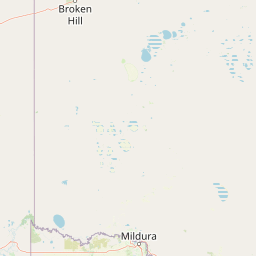
Map view of Scotia Sanctuary

Use this park location map to pinpoint Scotia Sanctuary in Australia, understand its exact geographic position, and read its mapped placement within the surrounding landscape more clearly.

Pigeon | © OpenStreetMap contributors

Location context for Scotia Sanctuary

New South Wales
Park atlas

Compare regional protected landscapes, mallee habitats, and nearby conservation reserves

Explore Other Parks Near Scotia Sanctuary and Protected Areas in the Surrounding Region

Browse nearby national parks and protected areas sharing the distinctive semi-arid terrain of the surrounding region. Comparing adjacent reserves reveals broader patterns in arid zone conservation and regional wildlife habitats.
Nature reserveSouth Australia
About 25 km away#1 closest

Southwest

Danggali Conservation Park: Semi-Arid Protected Land and Murray-Mallee Geography

Nature reserve geography and inland landscape context in South Australia.

Danggali Conservation Park preserves a substantial inland landscape north of the Riverland, characterised by open mallee scrubland, sandy dune systems, and dry eucalypt woodlands. This protected area acts as a crucial ecological bridge, showcasing the distinct shift from river-influenced environments to the arid interior of South Australia.

Area
484.16 km²
Established
1976
IUCN
Ia
Relief
Upland
Watercolor painting of a pastoral landscape with soft green hills, distant pink-hued ridges, and pine trees.
Biosphere reserveSouth Australia
About 47 km away#2 closest

West

Riverland Biosphere Reserve: Geography and Protected Landscapes in South Australia

Mapping the convergence of mallee woodland and riverine wetland ecosystems

Riverland Biosphere Reserve represents a significant landscape-scale conservation effort covering 9,000 square kilometres of South Australian terrain. The reserve encompasses an ecological mosaic, where arid, sandy mallee woodlands transition into a complex network of Murray River floodplains and riparian wetlands. This overview maps the protected area structure, highlighting the unique environmental interplay that supports essential bird populations and ecologically sustainable development.

Area
9,000 km²
Established
1977
Relief
Lowland
Climate
Arid
Nature reserveSouth Australia
About 68 km away#3 closest

Southwest

Calperum Station Nature Reserve: Mallee Landscapes and Riverland Wetlands in South Australia

Detailed geographic overview of a major Australian nature reserve.

Spanning over 2,300 square kilometers, Calperum Station preserves a vital stretch of mallee woodland and Murray River floodplain. This nature reserve serves as an international site for wetland conservation and provides a crucial stronghold for threatened bird species. The mapped area highlights the intersection of dryland dune-field ecology and riparian corridors, offering insight into large-scale habitat restoration.

Area
2,386 km²
Established
1993
Relief
Lowland
Climate
Arid
National parkAustralia
70 km away#4 closest

Southeast

Murray-Sunset National Park: Iconic Pink Lakes and Mallee Wilderness in Victoria's Semi-Arid Interior

Explore its unique landscape, mapped boundaries, and regional geography.

Murray-Sunset National Park offers a compelling glimpse into Australia's semi-arid heart, featuring a dramatic landscape of salt lakes, gypsum plains, extensive sand dunes, and dense mallee woodlands. This vast protected area is renowned for the vibrant pink hue of its salt lakes, a phenomenon created by microscopic algae that flourishes in the hypersaline conditions during warmer months. The park's rich biodiversity and unique ecosystem make it a significant conservation asset, providing crucial habitat for numerous species adapted to this challenging yet beautiful environment.

Area
6,330 km²
Established
1991
IUCN
II
Relief
Lowland
National parkSouth Australia
87 km away#5 closest

South

Murray River National Park: Protected Wetland Ecosystems in South Australia

Explore South Australia's unique river red gum floodplains.

Murray River National Park is a significant protected area in South Australia, renowned for its expansive wetland and floodplain environments situated along the Murray River. This national park preserves crucial habitats within the Murray-Darling Basin, characterized by river red gum woodlands, permanent water bodies, and dynamic seasonal floodplains. Its detailed maps and geographic context offer deep insights into one of Australia's most important riverine conservation landscapes.

Area
148.79 km²
Established
1991
IUCN
VI
Relief
Lowland
State or regional parkSouth Australia
94 km away#6 closest

Southwest

Cooltong Conservation Park: Geography and Protected Mallee Woodland in South Australia

A regional conservation area defined by dune and shale flat topography

Cooltong Conservation Park is a protected state area in South Australia's Riverland. It features 37 square kilometres of mallee shrubland shaped by undulating dunes and shale flats. This conservation landscape is a recognized stronghold for birdlife, particularly the iconic Malleefowl, offering an authentic look at Australia's inland semi-arid terrain and its ecological connectivity.

Area
37.1 km²
Established
1993
IUCN
VI
Relief
Lowland
Wildlife reserveSouth Australia
About 101 km away#7 closest

Southwest

Taylorville Station Wildlife Reserve: Mallee Woodland Map and Regional Geography

Protected mallee landscapes in the Murray-Mallee, South Australia.

Taylorville Station provides a critical refuge for mallee-dependent species within its 92 square kilometres of semi-arid woodland. As a cornerstone of the Riverland Biosphere Reserve, this protected area in South Australia offers a unique look at the ecological significance of the Murray-Mallee region's persistent eucalypt vegetation and habitat management frameworks.

Area
92.6 km²
Established
2005
IUCN
IV
Visitors
2.7K annual
National parkNew South Wales
104 km away#8 closest

Northeast

Kinchega National Park: National Park Protected Area in New South Wales

Explore the mapped Darling River terrain and outback landscapes.

Kinchega National Park stands as a protected national park entity within New South Wales, Australia. Its geographic significance is deeply tied to the Darling River, which shapes its unique riparian ecosystems and contrasts with the surrounding semi-arid outback terrain. This park offers a valuable point for atlas-based discovery, allowing exploration of its mapped boundaries, landscape context, and the conservation of its distinct natural and cultural heritage within the regional geography.

Area
442.59 km²
Established
1967
IUCN
II
Climate
Arid

Common questions about visiting, size, designation, and location context for Scotia Sanctuary

Scotia Sanctuary FAQs for park facts, access, geography, and protected area context

Find quick answers about Scotia Sanctuary, including protected-area facts, park geography, trail and visitor context, and how the park fits into its surrounding country and regional landscape.
MoriAtlas Explorer

Continue Your Protected Areas Search Across the Global Atlas

Deepen your exploration by continuing the structured search for national parks and protected areas worldwide. Utilize the comprehensive filtering capabilities to compare different conservation landscapes and refine your understanding of global park geography. Discover more about the distribution and characteristics of protected natural areas.

Global natural geography