Mori Atlas logo
Nature reserveSemey Ormany

Explore the unique sandy corridors and ecological boundaries of this major forest reserve.

Semey Ormany Nature Reserve: Mapped Protected Landscapes and Ribbon Pine Forest Geography

(State Forest Nature Reserve "Semey Ormany")

Semey Ormany Nature Reserve represents a critical conservation effort in the Abai Region of eastern Kazakhstan. This protected area safeguards the rare ribbon pine forests, where pine, birch, and aspen woodlands thrive in narrow sandy strips across the expansive steppe. By maintaining these vital forest belts along the Irtysh River basin, the reserve preserves a complex mosaic of wetland, shrubland, and grassland habitats essential to the regional ecosystem.

ribbon pine forestsforest reservesteppepine forestbirch forestaspen woodland

Semey Ormany

Nature reserve

Park overview

Structured park overview, official facts, and landscape profile for Semey Ormany

Semey Ormany park facts, protected area profile, and essential visitor context

Review the core facts for Semey Ormany, including designation, size, terrain, visitor scale, habitats, and operating context in one park-focused overview.

About Semey Ormany

Semey Ormany is a major state forest nature reserve in northeastern Kazakhstan, focused on the conservation and restoration of the Irtysh region's ribbon forests. These narrow belts of pine, birch, and aspen grow on sandy soils where groundwater lies close to the surface, creating a striking ecological contrast with the surrounding steppe, semi-desert, and shrubland communities. Embedded in a sharply continental climate with cold, relatively low-snow winters and hot, dry summers, the reserve captures a transitional zone where forest, steppe, and semi-desert ecosystems coexist.

The reserve was created in 2003 by merging ten separate state forest and wildlife protection institutions across the Irtysh region, consolidating fragmented forest stewardship into a single large management unit. Over the following years, additional lands from the Urdjar district and the Znamensky rural district near Semey were incorporated, while smaller areas were later reclassified for infrastructure development such as the Bulak hydropower plant. The reserve is administratively managed by Kazakhstan's Committee of Forestry and Animal World, and is classified under IUCN Category VI, recognizing its role in combining habitat protection with sustainable resource use.

Ecologically, Semey Ormany is one of the most important forest strongholds in eastern Kazakhstan. Its ribbon pines act as windbreaks, soil stabilizers, and refuges for species that would otherwise be absent from the steppe landscape. The reserve also protects important habitat for ungulates, large carnivores, raptors, and waterbirds, including species listed in the Red Book of Kazakhstan. Because of its size, its location near Semey, and its unique mix of forest and steppe, Semey Ormany carries both regional and national significance as a center for forest conservation, ecological research, and landscape protection in the broader Kazakh steppe.

Quick facts and research context for Semey Ormany

Semey Ormany is a state forest nature reserve (государственный лесной природный резерват) in northeastern Kazakhstan, administered by the Committee of Forestry and Animal World under the Ministry of Agriculture. It spans more than 654,000 hectares across several districts of Abai Region, with the city of Semey as the nearest major settlement.

The reserve's defining feature is the ribbon pine forests (ленточные боры) of the Irtysh region, narrow strips of pine, birch, and aspen woodland that thread through otherwise open steppe and semi-desert terrain. It is classified by IUCN as Category VI, a protected area with sustainable use of natural resources.

Protection and recognition

Examine the terrestrial protection scope and recorded designation data for Semey Ormany

Semey Ormany Protection Status and Documented Protected Area Record

Terrestrial protection records for Semey Ormany outline the documented administrative framework and management scope governing the reserve. Fact-based conservation parameters provide reliable reference metrics for tracking official protected area status over time.

Protection details

Protection scope
Terrestrial
Transboundary protection
No
Park context

Deeper park guide and search-rich context for Semey Ormany

Semey Ormany history, landscape, wildlife, and travel context

Explore Semey Ormany through its history, landscape character, ecosystems, wildlife, conservation priorities, cultural context, and seasonal travel timing in a structured park guide built for atlas discovery and search intent.

Why Semey Ormany stands out

Semey Ormany is best known for its ribbon pine forests, a rare landscape phenomenon where coniferous woodlands grow in narrow sandy corridors surrounded by steppe. These forests are ecologically unusual because pines, birches, and aspens thrive in a region dominated by dry grasslands and semi-desert. The reserve is also recognized for the sheer scale of its protected territory in eastern Kazakhstan and for the survival strategy these forests represent: pine, birch, and aspen communities rooted in sandy soils near groundwater, forming protective belts that stabilize the landscape of the Irtysh basin.
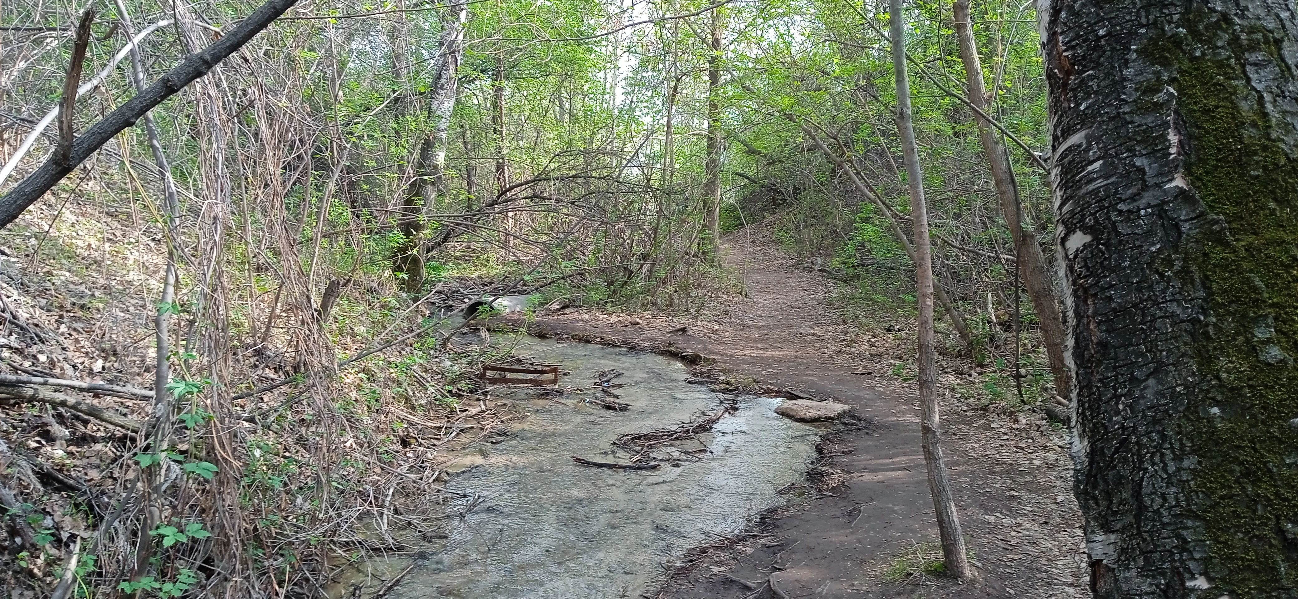
Holy Spring, Semey
Semey Ormany state forest natural reserve: East Kazakhstan Region

Semey Ormany history and protected-area timeline

Semey Ormany was formally established on 22 January 2003 by Government of Kazakhstan Resolution No. 75, which reorganized several state forest and wildlife protection institutions under the Ministry of Agriculture. The decision merged ten previously separate state bodies covering the Begen, Borodulikha, Bukebai, Dolon, Zhanasemey, Zharmа, Kanoner, Morozov, Novoshulbinsk, and Semipalatinsk forest territories into a single state forest nature reserve. The stated purpose was to preserve and rehabilitate the unique ribbon forests of the Irtysh region, which carry important protective functions and have special ecological, scientific, cultural, and recreational value. The merging of institutions was also explicitly motivated by forest fires that were destroying significant areas of woodland in the region.

In 2005, additional land totaling about 1,610 hectares from the Urdjar district was transferred to the reserve for permanent forest use. In 2008, around 1,725 hectares of pasture land from the reserve lands of the Znamensky rural district near Semey were also incorporated. In 2014, however, approximately 804 hectares of reserve territory were reclassified out of strictly protected status to make way for the construction of the Bulak hydropower plant, reducing the contiguous protected footprint.

Over the following two decades Semey Ormany was repeatedly affected by large forest fires, including major incidents in 2017, 2018, and especially the devastating 2023 fire in the Abai Region in which 14 firefighters lost their lives. Illegal logging has also been a persistent challenge, with thousands of cases documented and tens of millions of tenge in estimated damage. These pressures have made the active protection and restoration of the ribbon forests an ongoing institutional concern.

Semey Ormany landscape and geographic character

The landscape of Semey Ormany is defined by the ribbon pine forests, narrow strips of woodland that cut through otherwise open terrain. These forests grow on sandy soils where groundwater lies relatively close to the surface, allowing pines, birches, and aspens to survive in a region that would otherwise be dominated by steppe grasses. The result is a distinctive mosaic where pine stands, birch-aspen patches, sandy clearings, and herb-rich forest floors alternate across relatively short distances.

Geographically, the reserve sits on the Irtysh plain, with parts extending into the Kokpekty-Shar low hill region and toward the foothills of the Shynggystau (Shingistau) range. The Zharma branch of the reserve lies in a drier, more desert-like setting, while most other branches fall within the steppe belt. Wetlands and meadows occur locally, often alongside floodplain forests, introducing reed- and sedge-dominated pockets into an otherwise largely dry environment.

The terrain is generally flat to gently rolling in the steppe portions, with sand dunes and low hummocks creating locally varied relief. Near settlements such as Semey, the reserve's forests form an important ecological buffer between urban areas and the surrounding countryside, and they shelter the city from wind and sand movement across the plain.

Semey Ormany ecosystems, habitats, and plant life

Semey Ormany encompasses a unique blend of steppe, forest, semi-desert, shrubland, meadow, and wetland vegetation types. The ribbon forests host a vascular plant flora spanning 61 families and over 340 species, dominated by flowering plants, with dicots making up roughly four-fifths of the recorded species. The three principal forest-forming tree species are Scots pine, birch, and aspen, while the herb layer of the surrounding steppe openings is rich in feather grass, fescue, and various Artemisia (wormwood) species including Marshall's wormwood and steppe sagebrush.

In wetland and floodplain patches, reeds, sedges, bulrushes, and other hygrophytic plants dominate. The combination of groundwater-supported forests on sandy soils surrounded by dry steppe vegetation creates one of the most distinctive ecological mosaics in Kazakhstan, and gives the reserve its particular botanical character. Because the forests also carry soil and water-protection functions, their ecological role extends beyond biodiversity into landscape-scale environmental stability.

The reserve is recognized as a meeting point for species typical of forest, steppe, and semi-desert environments, and the diversity of habitats is widely considered one of the main reasons the area warrants strict conservation protection.

Semey Ormany wildlife and species highlights

Wildlife in Semey Ormany reflects the wide ecological span of the reserve. Vertebrate fauna includes around 354 recorded species: 2 cyclostomes, 25 fish, 4 amphibians, 16 reptiles, 234 birds, and 83 mammals. This diversity spans forest, steppe, wetland, and semi-desert specialists, all sharing access to a single protected territory.

Within the steppe portions of the reserve, ungulates such as moose, roe deer, and wild boar are widespread, along with carnivores including wolves and red foxes. Steppe and desert-adapted mammals such as corsac foxes, badgers, and pikas also occur. In the drier Zharma branch, larger and rarer mammals are present, including argali sheep, lynx, weasels, least weasels, marmots, and even brown bears, reflecting the more mountainous and semi-desert character of that area.

Birdlife is rich, with larks, grey partridges, steppe eagles, and steppe harriers being common in open habitats and waterbirds gathering on lakes and reservoirs. Several bird species recorded in the reserve are listed in the Red Book of Kazakhstan, including the black stork, whooper swan, osprey, golden eagle, white-tailed eagle, saker falcon, demoiselle crane, peregrine falcon, short-toed snake eagle, red-breasted goose, and spoonbill. Argali also appears on the Red Book list for the reserve's fauna. Fish fauna includes 25 species across 7 orders, four of which are listed in Kazakhstan's Red Book: taimen, Siberian sturgeon, nelma, and Balkhash perch.

Semey Ormany conservation status and protection priorities

Semey Ormany is a nationally important conservation area because it protects the largest surviving complex of ribbon pine forests (ленточные боры) in the Irtysh region, a landscape type that is uncommon globally. The reserve's IUCN Category VI designation reflects that it is intended to combine ecosystem protection with sustainable use of natural resources, while still maintaining the core ecological values of the forests.

The reserve serves multiple conservation roles at once: safeguarding rare and endemic elements of steppe and forest flora, preserving habitat for ungulates and large carnivores, protecting wetland-bird populations, and maintaining populations of Red Book species including black stork, saker falcon, osprey, argali, and several rare fish. The ribbon forests themselves provide critical soil and water protection across the dry Kazakh steppe, reducing erosion and stabilizing sandy landscapes.

However, the reserve faces significant conservation pressures. Repeated large forest fires, including a devastating 2023 fire in which 14 firefighters died, and persistent illegal logging have placed the forest resource under serious strain. Reports of thousands of illegal cutting incidents and tens of millions of tenge in damages indicate that active enforcement, restoration, and public accountability remain central to the reserve's long-term ecological future.

Top sights and standout views in Semey Ormany

Semey Ormany's defining highlight is the ribbon pine forests of the Irtysh region, narrow strips of pine, birch, and aspen woodland that survive where groundwater meets sandy soils amid the Kazakh steppe. This landscape is unusual globally and forms the centerpiece of the reserve's identity.

Equally notable is the reserve's massive territorial scale across Abai Region, its protection of a high diversity of steppe, forest, wetland, and semi-desert habitats in one continuous area, and its harbor for Red Book species such as black stork, saker falcon, osprey, golden eagle, and argali. The combination of ecological rarity, geographic scale, and conservation relevance makes Semey Ormany one of the most important forest reserves in Kazakhstan.

Best time to visit Semey Ormany

The sharply continental climate of Semey Ormany gives the landscape very different characters across the year. Late spring and early summer are when the steppe and forest understory vegetation are most vibrant, and when migrant waterbirds and raptors are most observable around wetlands and the forest edge. Summer can be hot and dry, with the risk of forest fires increasing as temperatures rise. Winters are cold and relatively low in snow, which can make some forest roads challenging but offers a quieter, stark seasonal atmosphere across the ribbon pines and surrounding steppe.

For visitors interested in seeing the forests at their most lush and the birdlife at its richest, the warmer months between late spring and early autumn tend to be the most rewarding window, while those interested in the quieter character of the reserve and potential winter landscapes may find late autumn and winter visits appealing for atmosphere rather than activity.
Monthly climate preview

Long-term representative monthly temperature and precipitation data for Abai Region

Semey Ormany Climate Normals and Annual Temperature Patterns

Representative point measurements reveal the annual temperature and precipitation rhythm across Semey Ormany, spanning subzero winter minimums and warm summer peaks. Examining the complete twelve-month record provides detailed monthly climate normals for comparative geographic analysis.
Annual mean4 °C
-17 °C23 °C
Jan-17°
Feb-14°
Mar-5°
Apr
May15°
Jun21°
Jul23°
Aug21°
Sep13°
Oct
Nov-5°
Dec-13°
Warmest month
July

23 °C

Coolest month
January

-16.6 °C

Wettest month
July

1.4 mm/day

Driest month
January

0.6 mm/day

Park location guide

Geography guide, regional context, and park location map for Semey Ormany

Semey Ormany park geography, regions, and map view in Kazakhstan

Understand where Semey Ormany sits in Kazakhstan through a broader geographic reading of the surrounding landscape, nearby location context, and its mapped position within the national park landscape.

How Semey Ormany fits into Kazakhstan

Kazakhstan is a Central Asian country spanning vast steppes and plains, bordered by Russia, China, Kyrgyzstan, Uzbekistan, and Turkmenistan, with a coastline along the Caspian Sea. It gained independence from the Soviet Union in 1991 and has a population of approximately 20.5 million people. The country is officially secular but predominantly Muslim, with Kazakh and Russian as official languages.

Wider geography shaping Semey Ormany in Kazakhstan

Kazakhstan occupies a vast territory in Central Asia, extending into Eastern Europe. Its terrain consists largely of hilly plateaus and plains, with lowlands covering about a third of the area. The southern and eastern regions are mountainous. The country borders Russia to the north and west, China to the east, Kyrgyzstan to the southeast, Uzbekistan to the south, and Turkmenistan to the southwest. It has a coastline along the Caspian Sea.

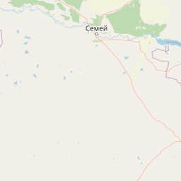
Map view of Semey Ormany

Use this park location map to pinpoint Semey Ormany in Kazakhstan, understand its exact geographic position, and read its mapped placement within the surrounding landscape more clearly.

Pigeon | © OpenStreetMap contributors

Location context for Semey Ormany

Abai Region

Explore protected area views, terrain characteristics, and unique forest habitats across the Irtysh basin.

Semey Ormany Photos and Landscape Scenery: Visualizing the Ribbon Pine Forests

Visual documentation reveals the distinctive ribbon pine forests and sandy terrain defining Semey Ormany across the dry steppe of eastern Kazakhstan. Examining field photography helps researchers and visitors understand local habitat mosaics, woodland structures, and ecological boundaries.

Holy Spring, Semey

Park atlas

Compare regional ecosystems and connected protected areas across eastern Kazakhstan

Explore Parks Near Semey Ormany and Related Protected Landscapes

Browse other conservation areas and protected reserves located near Semey Ormany across the wider Irtysh basin region. Evaluating these neighboring territories provides deeper geographic context for understanding regional steppe and forest habitats.
Nature reservePavlodar Region
About 150 km away#1 closest

Northwest

Ertis Ormany Nature Reserve: A Geographical Overview of Kazakhstan's Pine Belts

Protected forested corridors within the Kulunda Plain steppe.

Covering over 278,000 hectares, Ertis Ormany is a premier protected area in Kazakhstan's Pavlodar Region. The reserve manages unique ribbons of pine forest growing on sandy soils, forming an essential forest-steppe ecosystem that supports biodiversity and provides a natural barrier against desertification in the southwestern Kulunda Plain.

Area
2,779.61 km²
Established
2003
IUCN
VI
Relief
Lowland
Natural monumentPavlodar Region
About 277 km away#2 closest

Northwest

Gusiny Perelet Natural Monument: Geological Geography and Fossil Site Mapping in Pavlodar Region

An iconic Irtysh River protected area and Neogene research locality

Situated along the Irtysh River bank, Gusiny Perelet functions as a vital reference point for Neogene mammal evolution in Central Asia. The protected site showcases an exposed geological face, providing scientific insight into ancient ecosystems once dominated by Hipparion fauna. Its preserved fossil assemblage and riverside location offer a tangible connection to the region's deep natural history.

Established
1971
Relief
Lowland
Climate
Temperate
Access
Easy access
National parkKazakhstan
About 293 km away#3 closest

West

Bayanaul National Park: Kazakhstan's First National Park Mapped Landscape

Explore granite mountains, unique lakes, and striking rock formations.

Bayanaul National Park, situated in Kazakhstan's Pavlodar Province, represents a significant protected area renowned for its extraordinary granite mountain landscape. Established as the country's first national park, it showcases unique erosion-shaped rock formations, diverse vegetation including rare pines, and four significant freshwater lakes. This park offers a distinct visual tapestry of mountainous terrain and geological wonders within the broader Central Asian geography, making it a key destination for atlas-based discovery.

Area
684.53 km²
Established
1985
IUCN
II
Relief
Mountain
Nature reserveKazakhstan
About 297 km away#4 closest

East

West Altai State Nature Reserve: Protected Mountain Taiga and Alpine Geography in Kazakhstan

An ecological atlas of the Western Altai mountain system

Spanning the Ivanovsky and Uba ranges, this nature reserve protects a diverse terrain of mountain taiga, glacial cirques, and high-mountain bogs. It remains a key conservation landscape for Central Asian biodiversity, anchoring the headwaters of the Uba River within a striking environment of granite pillars and alpine meadows.

Area
861.22 km²
Established
1992
Relief
Mountain
Climate
Boreal
Watercolor illustration of a mountainous landscape with green hills, trees, and a river in the foreground
National parkKazakhstan
About 305 km away#5 closest

West

Karkaraly State National Nature Park: Kazakhstan's Mountain-Forest Protected Area

Discover unique geology, archaeology, and regional landscape context.

Delve into the distinctive protected landscape of Karkaraly State National Nature Park, situated in Kazakhstan's Karaganda Region. This park preserves a rare mountain-forest ecosystem with dramatic granite formations, ancient archaeological sites, and lakes, presenting a rich geographic contrast to the surrounding Kazakh Steppe. MoriAtlas provides structured insights into Karkaraly State National Nature Park's unique terrain, its conservation value, and its position within the broader regional geography of Central Asia.

Area
1,121.2 km²
Established
1998
IUCN
II
Relief
Mountain
National parkEast Kazakhstan Region
About 368 km away#6 closest

South

Tarbagatai National Park: Protected Landscape and Wild Fruit Tree Forests in East Kazakhstan Region

Explore the mapped boundaries and ecosystem of this national park.

Tarbagatai National Park is a protected area in East Kazakhstan recognized for its unique role in conserving wild fruit tree forests that have maintained genetic isolation. This national park provides a detailed view of a mountain-steppe ecosystem across the Tarbagatai mountain range, Karabas Mountains, and Arkaly Mountains, along with the Urzhar and Emel river valleys. Its establishment in 2018 highlights its importance for biodiversity and the study of natural forest genetics, offering significant geographic context for regional protected land exploration.

Area
1,364 km²
Established
2018
IUCN
II
Relief
Mountain
Watercolor painting of a river flowing through forested hills with mountains in the background under a sunset sky
National parkEast Kazakhstan Region
About 373 km away#7 closest

East

Katon-Karagay National Park: Discover Kazakhstan's Largest Protected Mountain Landscape

Explore the geography and park boundaries of East Kazakhstan's premier national park.

Katon-Karagay National Park, the largest national park in Kazakhstan, offers a deep dive into the protected landscapes of the Southern Altai Mountains. This page provides essential geographic context, detailing the park's terrain, its significance as a protected area within East Kazakhstan Region, and its role in mapping the natural contours of this ecologically diverse mountain system. Understand the park's boundaries and its contribution to regional conservation.

Area
6,435 km²
Established
2001
IUCN
II
Relief
Mountain
Nature reserveEast Kazakhstan Region
About 469 km away#8 closest

Southeast

Markakol Nature Reserve: Mapping the Protected Mountain Landscapes of East Kazakhstan

High-altitude glacial lake and alpine tundra ecosystems

Markakol Nature Reserve protects a remote tectonic depression within the Southern Altai. The area features a complex vertical zonation of fir and spruce forests, subalpine meadows, and alpine tundra, centered around the pristine and ecologically significant Lake Markakol. This protected site serves as a vital study of the intersection between Siberian boreal influences and high-mountain steppe biodiversity.

Area
1,029.71 km²
Established
1976
IUCN
Ia
Relief
Mountain

Common questions about visiting, size, designation, and location context for Semey Ormany

Semey Ormany FAQs for park facts, access, geography, and protected area context

Find quick answers about Semey Ormany, including protected-area facts, park geography, trail and visitor context, and how the park fits into its surrounding country and regional landscape.
MoriAtlas Explorer

Continue Your Protected Areas Search Across the Global Atlas

Deepen your exploration by continuing the structured search for national parks and protected areas worldwide. Utilize the comprehensive filtering capabilities to compare different conservation landscapes and refine your understanding of global park geography. Discover more about the distribution and characteristics of protected natural areas.

Global natural geography