
Mori Atlas logo
Protected areaSerranía de Zapalinamé

Mapping the ecological transition from Chihuahuan desert scrub to montane pine and oak forest

Serranía de Zapalinamé: A Protected Mountain Range and Watershed in Coahuila, Mexico

(Reserva Natural Estatal Sierra de Zapalinamé)

Serranía de Zapalinamé stands as a critical ecological frontier within the Sierra Madre Oriental of northeastern Mexico. This protected mountain landscape rises above the city of Saltillo in Coahuila, serving as essential natural infrastructure that captures rainfall to recharge vital aquifers for the region. The range preserves a complex mosaic of ecosystems, ranging from arid desert shrublands to sheltered high-altitude pine and oak forests.

mountain rangeSierra Madre Orientalpine-oak forestChihuahuan desertwatershedprotected area
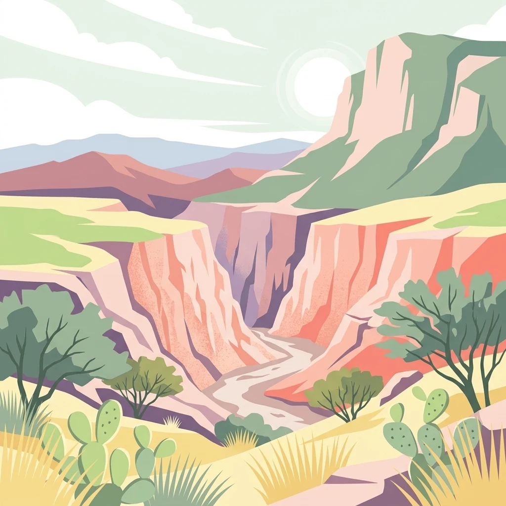
A digital illustration of a desert canyon landscape with rocky cliffs, sparse trees, and cacti in the foreground under a pale sky.

Serranía de Zapalinamé

Protected area

Park overview

Structured park overview, official facts, and landscape profile for Serranía de Zapalinamé

Serranía de Zapalinamé park facts, protected area profile, and essential visitor context

Review the core facts for Serranía de Zapalinamé, including designation, size, terrain, visitor scale, habitats, and operating context in one park-focused overview.

About Serranía de Zapalinamé

The Serranía de Zapalinamé is one of the most ecologically significant protected mountain landscapes in Coahuila. Although it sits close to a major Mexican city, it preserves an unusually varied mosaic of vegetation types across a relatively short elevation gradient. Lower slopes support Chihuahuan desert scrub and submontane shrubland characteristic of northern Mexico, while higher elevations give way to montane pine and oak forests that are otherwise rare in this part of the country. Between these extremes lie native grasslands, riparian corridors, and spring-fed aquatic habitats that together create a complex ecological tapestry.

The range represents the western edge of influence of the Sierra Madre Oriental, where the folded sedimentary ridges of the great eastern cordillera reach into the highlands of northern Mexico. This geographic position is also reflected in the range's biogeographic identity: it sits on the boundary between the Sierra Madre pine–oak forests ecoregion and the Chihuahuan Desert ecoregion, an overlap that contributes to its species richness. Across the protected area, biologists have documented well over a thousand plant and animal species, with high levels of endemism concentrated in the aquatic and montane habitats.

Human presence in and around the Serranía long predates modern conservation. The area was inhabited by gatherer-hunter societies for around twelve thousand years, and settlement patterns shifted dramatically after the Spanish founding of Saltillo in 1575. Today, more than a dozen rural localities depend partially or fully on the surrounding landscape for agriculture, livestock, and other traditional uses, while the mountains themselves serve as a recreation area for nearby urban populations and a growing destination for rock climbers drawn to the deep canyon country. The modern reserve balances these activities with watershed protection, ecosystem recovery, and biodiversity conservation.

Quick facts and research context for Serranía de Zapalinamé

Serranía de Zapalinamé is a mountain range and protected natural area in the state of Coahuila, Mexico, lying immediately south of the city of Saltillo. It belongs to the Sierra Madre Oriental system and functions as a transition zone between the Chihuahuan Desert and high-elevation pine–oak forests of northeastern Mexico.

The range reaches above 3,100 meters in elevation at its highest peak, El Penitente, with piedmont slopes sitting between roughly 1,500 and 2,000 meters. It was first designated as an ecological conservation area in 1996 by the state of Coahuila and reclassified as a State Natural Reserve in 2017. The protected landscape straddles two major hydrological regions and serves as a key recharge zone for aquifers supplying Saltillo and downstream settlements.

Protection and recognition

Examine the terrestrial conservation scope and official designation records

Serranía de Zapalinamé Protection Status and Designated Area History

Serranía de Zapalinamé holds a terrestrial protection designation established in 2017 within conservation records. Review the documented management scope and official recognition details associated with this protected natural area.

Protection details

Protection scope
Terrestrial
Designated year
2017
Transboundary protection
No
Park context

Deeper park guide and search-rich context for Serranía de Zapalinamé

Serranía de Zapalinamé history, landscape, wildlife, and travel context

Explore Serranía de Zapalinamé through its history, landscape character, ecosystems, wildlife, conservation priorities, cultural context, and seasonal travel timing in a structured park guide built for atlas discovery and search intent.

Why Serranía de Zapalinamé stands out

The Serranía de Zapalinamé is best known as a watershed protection range: its forests and soils capture rainfall and feed the aquifers that supply Saltillo and surrounding communities, which is the central legal and ecological justification for its protected status. It is also recognized for being a striking ecological meeting point, where Chihuahuan Desert scrub on the lower slopes transitions into pine, oak montane forest near the higher summits. The range is also distinguished by its biodiversity, including endemic species such as the Saltillo chub (Gila modesta), a fish found only in the region's streams, and populations of American black bear that use the San Lorenzo Canyon and other forested areas as habitat. Birdlife adds another layer of importance, with species such as the Golden Eagle and the endangered Maroon-fronted Parrot recorded in the range's forests and cliffs.
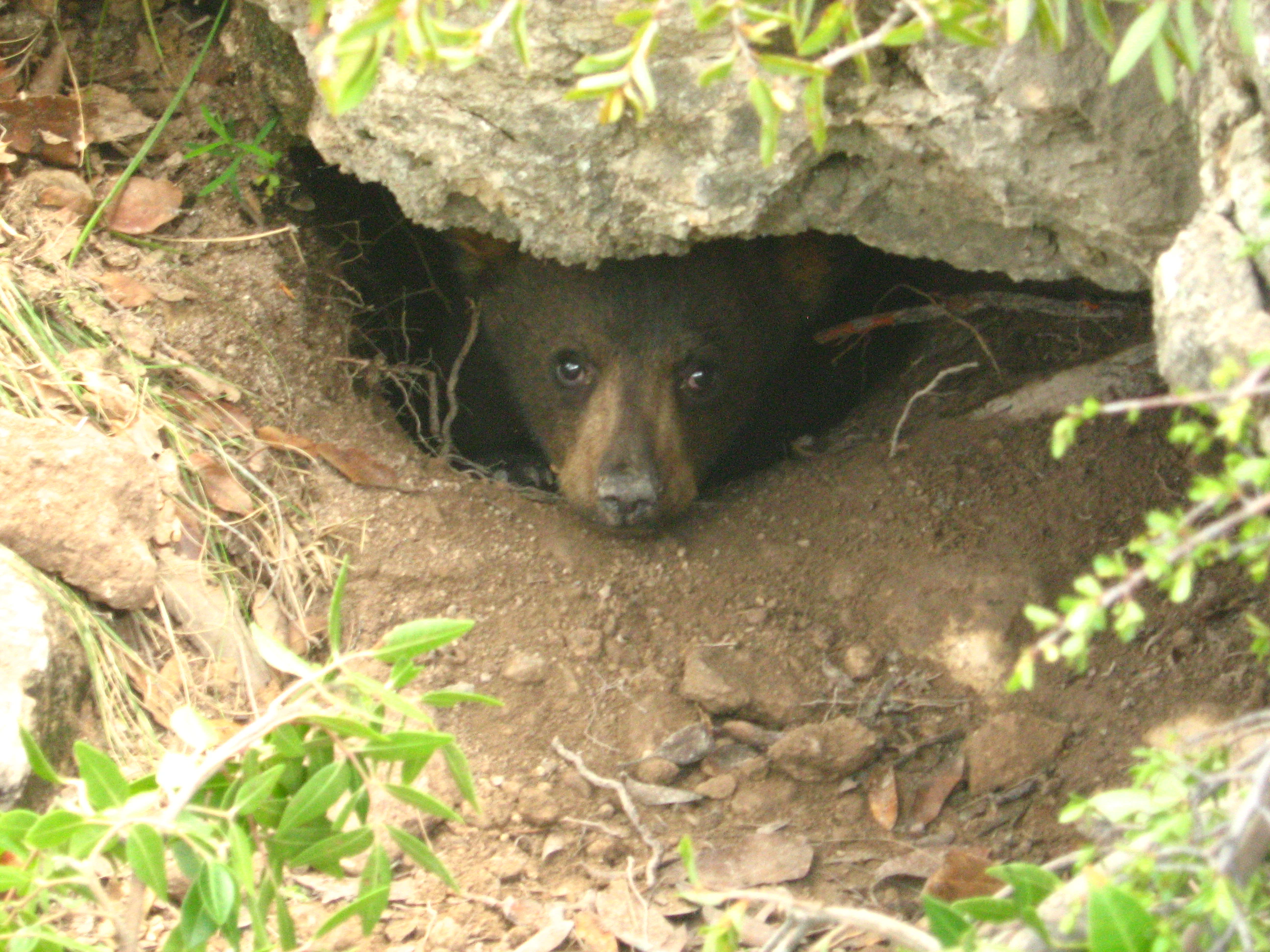
A young black bear cub looking out from a shallow cave or den under a rock ledge in a canyon.
A young American black bear cub peeking out from a rocky den in San Lorenzo Canyon.

Serranía de Zapalinamé history and protected-area timeline

Human history in the Serranía de Zapalinamé stretches back roughly twelve thousand years, when the area was inhabited by mobile gatherer-hunter societies adapted to the mountains and surrounding valleys. This long prehistoric presence began to change with the establishment of Saltillo in the sixteenth century, as Spanish and Tlaxcaltec settlements reshaped land use in the surrounding region and introduced agriculture and livestock practices that gradually extended toward the mountains.

In the modern era, the defining institutional event was the state government's establishment of the ecological conservation area in 1996. The decree was driven primarily by the recognition that the Serranía functions as a critical water catchment for Saltillo and downstream areas, protecting springs, recharging aquifers, and reducing flood risk. In 2017, under updated state environmental legislation in Coahuila, the area's legal category was modified from ecological conservation zone to State Natural Reserve (Reserva Natural Estatal), strengthening its long-term protection framework and reinforcing the central role of water and ecological integrity in the management goals.

Serranía de Zapalinamé landscape and geographic character

The Serranía de Zapalinamé is a folded mountain range whose relief reflects tens of millions of years of geological history. The landscape is composed of alternating ridges, bajadas, valleys, and plains created between the Late Jurassic and the Quaternary period, with shallow lithosols and rendzinas forming much of the surface soil. Structurally, the range trends roughly from southwest to northeast and reaches its highest point at El Penitente, rising above 3,100 meters. Other notable summits include La Alameda, the peak of La Encantada, and Los Elotes, while the piedmont slopes sit at elevations generally between 1,500 and 2,000 meters.

The canyon of San Lorenzo is one of the most striking physical features of the range, carving deeply into the mountains and creating long cliff lines, narrow gorges, and vertical walls that have made it a focal point for climbing and recreation. The canyon and other drainages collect surface runoff and channel it toward the base of the range, where intense subsurface infiltration feeds a series of springs that emerge at the piedmont. These landforms together create the topographic framework for the range's ecological variation, separating exposed, sun-baked slopes from shaded, forested draws.
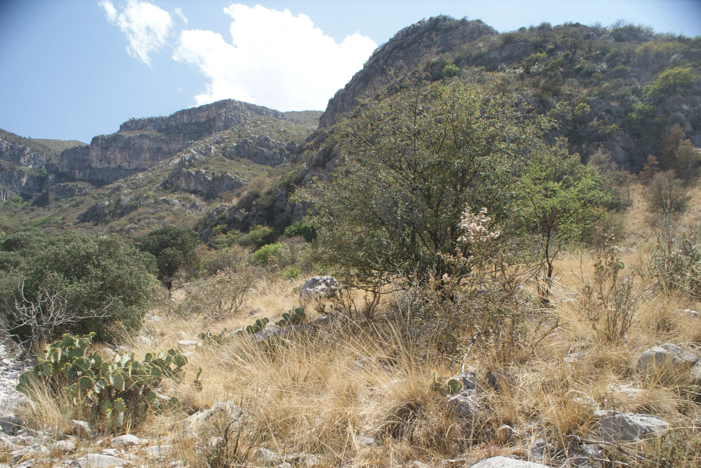
A sunny mountain landscape with rugged, rocky slopes covered in sparse dry grass, cacti, and shrubs under a bright sky.
A dry mountain landscape with scrub vegetation along the Camino del Cuatro trail in Serranía de Zapalinamé.

Serranía de Zapalinamé ecosystems, habitats, and plant life

The Seranía de Zapalinamé lies within the Nearctic biogeographic region and sits at the intersection of two major ecoregions: the pine–oak forests characteristic of the Sierra Madre Oriental and Occidental, and the Chihuahuan Desert to the west and north. This overlap produces a rich mosaic of vegetation types across relatively short distances. Lower elevations support Chihuahuan desert scrub and submontane shrubland; mid-elevations transition into native grasslands; higher slopes carry montane forest dominated by pines and oaks; and along streams and around springs grow patches of riparian, subaquatic, and aquatic vegetation.

This vegetation diversity supports a correspondingly diverse fauna, with montane forests, desert scrub, and aquatic habitats each contributing different animal communities. Botanists have documented hundreds of plant species in the range, including species endemic to southeastern Coahuila and others considered at risk under Mexican conservation listings. The aquatic habitats, though limited in extent, are particularly important for conservation because they harbor narrowly endemic species and disproportionately sensitive ecological processes.
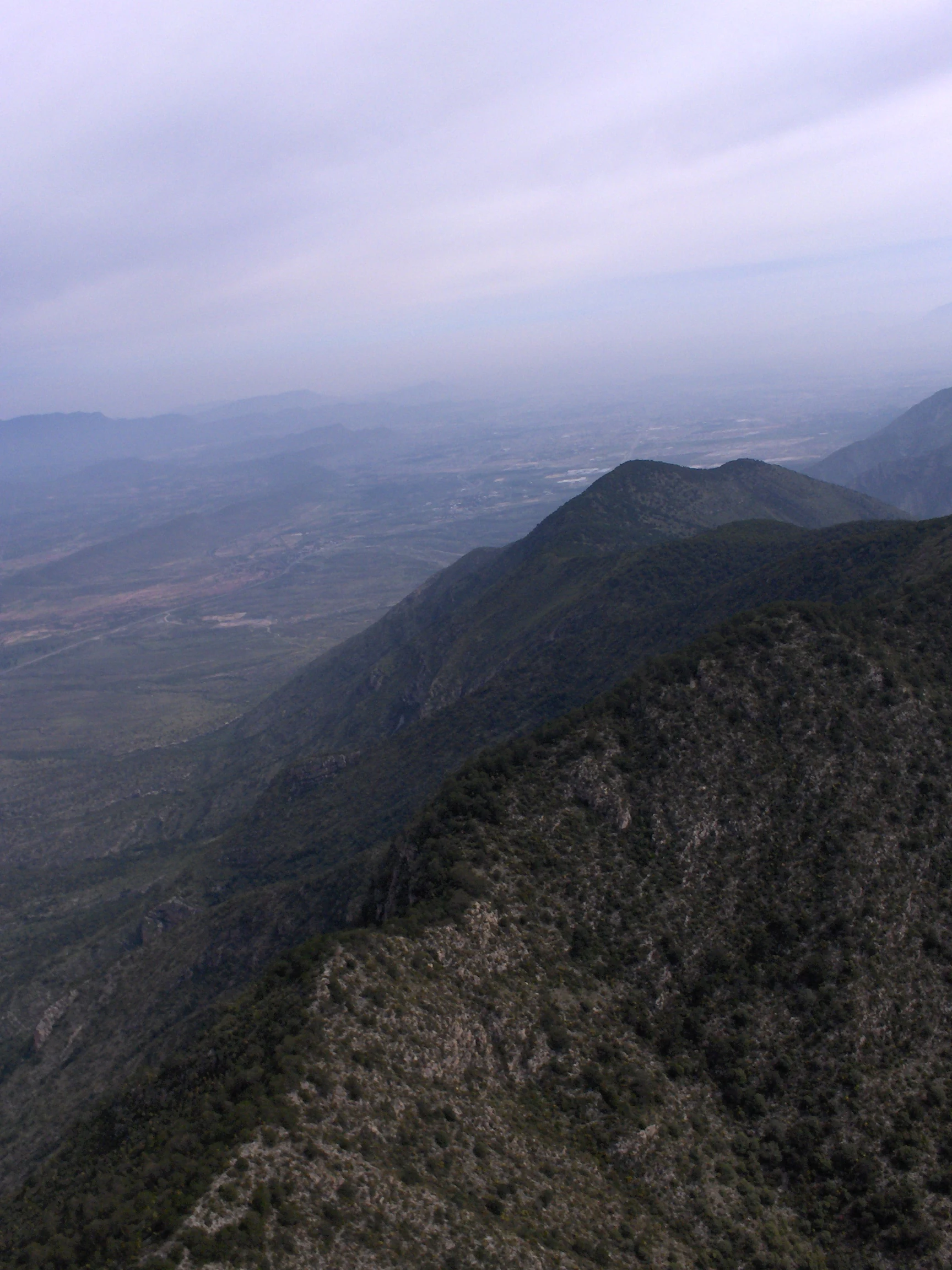
A high-angle view looking down a mountain ridge toward a hazy valley landscape with cloudy skies.
A view from the summit of La Encantada in the Serranía de Zapalinamé.

Serranía de Zapalinamé wildlife and species highlights

Wildlife in the Serranía de Zapalinamé reflects the ecological transition at the heart of the range. Ornithologists have documented a rich bird community of more than two hundred species, including species of conservation concern such as the Golden Eagle and the Peregrine Falcon, as well as the Maroon-fronted Parrot, an endemic Mexican species that nests and feeds in the range's pine forests and is considered endangered.

Mammals are likewise diverse and include several species of conservation significance. The American black bear, classified as endangered in Mexico, has been documented in the canyons and forested slopes, with individuals and family groups recorded in areas such as the San Lorenzo Canyon. The range also supports herpetofauna of conservation interest, with multiple reptile and amphibian species recorded in protected categories under Mexican regulations. In the aquatic realm, despite the relatively limited extent of surface water, researchers have documented fish species including the Saltillo chub, a small fish endemic to local streams and listed as endangered, illustrating how even small aquatic habitats in the range contribute disproportionately to regional biodiversity.

Serranía de Zapalinamé conservation status and protection priorities

Conservation of the Serranía de Zapalinamé is anchored in water. The mountains capture rainfall, promote infiltration into aquifers, and feed springs that sustain both ecosystems and human communities downstream, which is why water protection has been central to the reserve's legal framework. This focus reflects a recognition that water is not only a resource in its own right but also an indicator of broader ecological health, since the hydrological system interacts with vegetation, soils, wildlife, and downstream land use.

In 1996, the state of Coahuila designated the area an ecological conservation zone, and in 2017 it was reclassified as a State Natural Reserve (Reserva Natural Estatal), allowing a more formal management framework while retaining the original emphasis on ecological recovery and protection. Beyond water, the reserve's conservation significance lies in its role as a refuge for the Chihuahuan Desert–pine–oak forest transition, its populations of endangered mammals such as the black bear, its endemic aquatic species such as the Saltillo chub, and its importance for nesting and feeding habitat for species such as the Maroon-fronted Parrot.

Serranía de Zapalinamé cultural meaning and human context

The cultural context of the Serranía de Zapalinamé is shaped by a long human history of interaction with the mountains. The area was inhabited for at least twelve thousand years by gatherer-hunter societies whose presence faded with the colonial-era founding of Saltillo and the introduction of agriculture and livestock. Today, the mountain landscape is shared between rural communities that depend partly or wholly on the range for rain-fed farming and extensive ranching, and urban populations from Saltillo and neighboring towns that use the mountains for recreation, hiking, and outdoor activities.

The canyon of San Lorenzo has emerged as a particularly important cultural feature in the modern era, hosting a network of climbing routes of varying difficulty as well as opportunities for related mountain pursuits. This blend of traditional rural land use and growing outdoor recreation gives the Serranía a layered cultural identity, in which ecological protection, rural livelihoods, and an active outdoor culture coexist around a single mountain landscape.

Top sights and standout views in Serranía de Zapalinamé

The Serranía de Zapalinamé stands out for the clarity of its ecological transition, where Chihuahuan desert scrub gives way to montane pine and oak forest within a small geographic area, producing one of the richest biodiversity hotspots in Coahuila. Its role as a major watershed for Saltillo makes it a textbook example of mountain-based water security in northern Mexico, and the protected area's legal history reflects a regional recognition that protecting upland forests is inseparable from protecting downstream urban water supplies.

Equally distinctive is the range's concentration of rare species, including endemic fish such as the Saltillo chub in its spring-fed streams, endangered mammal populations such as the American black bear in its canyons, and endangered birds such as the Maroon-fronted Parrot in its high forests. The combination of rugged climbing terrain, dense biodiversity, and proximity to a major Mexican city makes the Serranía a compact but unusually rich example of how protected mountain landscapes can serve ecological, hydrological, and cultural functions at the same time.

Best time to visit Serranía de Zapalinamé

The Serranía de Zapalinamé is most rewarding to experience when its ecological contrasts are most visible, which generally corresponds to the cooler and greener portions of the year. Cooler months tend to make exploring the lower desert slopes and the pine–oak forests at higher elevations more comfortable, while also offering clearer views across the canyons and toward the high summits such as El Penitente. Wildlife viewing, including birdwatching, is often most productive when temperatures are moderate, as species concentrate around available water sources at lower elevations and remain active in the forests higher up.

Warmer months bring harsher conditions on exposed lower slopes and a drier, more brittle aspect to the vegetation, while the forested canyons and higher elevations can still offer cooler refuges. For visitors interested in water-related features such as springs and riparian vegetation, periods of moderate rainfall help showcase the recharge and runoff dynamics that underpin the reserve's conservation mission. Climbers and hikers visiting the San Lorenzo Canyon generally find the most pleasant conditions outside the hottest weeks of summer, when the deep walls retain more moderate temperatures and the ground is less arid.
Monthly climate preview

Long-term representative point measurements tracking monthly temperature ranges and precipitation

Serranía de Zapalinamé Climate Normals: Measured Annual Temperature and Precipitation Rhythm

Recorded monthly records for Serranía de Zapalinamé show mean temperatures ranging from 10.75 °C to 22.52 °C alongside varying precipitation rates across the twelve-month cycle. Analyzing the complete monthly climate normals provides a detailed breakdown of historical temperature bounds and rainfall patterns.
Annual mean17 °C
11 °C23 °C
Jan11°
Feb13°
Mar16°
Apr19°
May22°
Jun23°
Jul22°
Aug22°
Sep20°
Oct17°
Nov14°
Dec11°
Warmest month
June

22.5 °C

Coolest month
January

10.8 °C

Wettest month
September

3.7 mm/day

Driest month
December

0.4 mm/day

Park location guide

Geography guide, regional context, and park location map for Serranía de Zapalinamé

Serranía de Zapalinamé park geography, regions, and map view in Mexico

Understand where Serranía de Zapalinamé sits in Mexico through a broader geographic reading of the surrounding landscape, nearby location context, and its mapped position within the national park landscape.

How Serranía de Zapalinamé fits into Mexico

Mexico, officially the United Mexican States, is a country in North America spanning the Sierra Madre mountain ranges, coastal plains, and tropical regions. It borders the United States to the north, Guatemala and Belize to the southeast, and has coastlines along the Pacific Ocean, Gulf of Mexico, and Caribbean Sea. With a population exceeding 130 million, Mexico is home to one of the world's most significant concentrations of Indigenous languages alongside Spanish.

Wider geography shaping Serranía de Zapalinamé in Mexico

Mexico occupies a land area of 1,972,550 km2, making it the thirteenth-largest country in the world. The terrain is highly diverse, featuring the Sierra Madre Occidental and Sierra Madre Oriental mountain ranges, the Mexican Plateau, coastal lowlands along the Pacific and Gulf/Caribbean margins, and the Yucatan Peninsula. The country spans multiple climate zones from desert in the north to tropical rainforest in the south.

Map view of Serranía de Zapalinamé

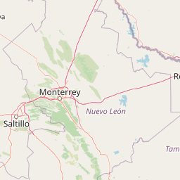
Use this park location map to pinpoint Serranía de Zapalinamé in Mexico, understand its exact geographic position, and read its mapped placement within the surrounding landscape more clearly.

Pigeon | © OpenStreetMap contributors

Location context for Serranía de Zapalinamé

Coahuila

Visual reference for mountain terrain, canyons, and protected habitats

Serranía de Zapalinamé Photos and Landscape Scenery

Visual documentation captures the rugged mountain relief, deep canyons, and ecological transition zones defining Serranía de Zapalinamé. Photographic exploration reveals how Chihuahuan desert scrub gives way to montane pine and oak forests across the protected reserve.

A young black bear cub looking out from a shallow cave or den under a rock ledge in a canyon.

Snow covered pine forests on a mountain ridgeline in the Serranía de Zapalinamé under a bright blue sky.

A sunny mountain landscape with rugged, rocky slopes covered in sparse dry grass, cacti, and shrubs under a bright sky.

A high-angle view looking down a mountain ridge toward a hazy valley landscape with cloudy skies.

Park atlas

Compare regional mountain ranges and protected habitats across northern Mexico

Other Parks Near Serranía de Zapalinamé and Surrounding Protected Landscapes

Visitors exploring Serranía de Zapalinamé can browse nearby protected areas and mountain reserves across the regional terrain. Comparing adjacent wilderness habitats reveals broader ecological patterns connecting desert scrub to upland pine and oak forests.
Protected areaCoahuila
About 46 km away#1 closest

East

Cuenca Alimentadora del Distrito Nacional de Riego 026 Bajo Rio San Juan Protected Landscape

Mountain watershed and forest habitat in Coahuila

An expansive protected area encompassing the upper catchments of the San Juan River. The terrain features a significant altitudinal gradient, ranging from semi-arid matorral shrublands to rare high-altitude conifer groves including Mexican Douglas-fir, defining the regional water supply landscape.

Area
1,971.57 km²
Established
1949
IUCN
VI
Relief
Mountain
National parkMexico
About 64 km away#2 closest

East

Cumbres de Monterrey National Park: National Park Protected Landscape Discovery

Explore Mexico's Mapped Terrain and Regional Geography

Understand Cumbres de Monterrey National Park as a distinct protected landscape within Mexico. This page provides detailed atlas-oriented information focused on its geographic boundaries, mapped terrain, and its role in regional conservation. It serves as a valuable entry point for exploring the park's natural context and understanding its place in the national geography.

Area
1,773.96 km²
Established
1939
IUCN
II
Relief
Mountain
Watercolor illustration of layered mountain ranges with purple peaks fading into a green and yellow foreground.
Natural monumentNuevo León
About 76 km away#3 closest

Northeast

Cerro de la Silla: Protected Natural Monument Geography and Regional Map Context

A rugged mountain landscape in Nuevo León, Mexico

Cerro de la Silla is defined by its unmistakable saddle-shaped silhouette and its status as a vital protected area within the urban matrix of Monterrey. The mountain features complex folded limestone geology and a diverse habitat mosaic that transition from arid scrubland to forested peaks. Use this atlas resource to understand its topographical boundaries, summit formations, and regional environmental significance within the Sierra Madre Oriental fold belt.

Area
60 km²
Established
1991
Relief
Mountain
Climate
Subtropical
Protected areaNuevo León
About 158 km away#4 closest

Northeast

Sierra de Picachos Protected Area: Geographic Boundaries and Regional Landscapes

Mountain geography in northern Nuevo León

Sierra de Picachos represents a vital conservation zone spanning north of Monterrey. The landscape is defined by its dramatic elevation changes, moving from desert-like plains to cool coniferous slopes. This atlas entry focuses on the physical boundaries, ecological zones, and the rugged, peak-studded terrain that distinguish the range from the surrounding Sierra Madre Oriental.

Area
1,405 km²
Established
2000
Relief
Mountain
Climate
Subtropical
Watercolor painting of a desert landscape with white gypsum dunes, a central turquoise blue pool, and yucca plants.
Wildlife reserveCoahuila
About 209 km away#5 closest

Northwest

Área de Protección de Flora y Fauna Cuatrociénegas: Protected Landscape and Atlas Map

Desert wetlands and gypsum dune geography in Coahuila, Mexico

This wildlife reserve in Coahuila represents a globally significant desert wetland complex. Featuring hundreds of spring-fed pozas and the second-largest gypsum dune field in the Americas, the reserve offers a unique look at isolated ecosystems and specialized biodiversity within the Chihuahuan Desert.

Area
843.47 km²
Established
1994
Relief
Lowland
Climate
Arid
State or regional parkDurango
About 275 km away#6 closest

West

Cañon de Fernández State Park: A Protected Wetland and Canyon Landscape in Durango

Geography and riparian forest mapping in northern Mexico

Cañon de Fernández State Park is an ecologically vital protected area in Durango, defined by the Nazas River corridor. Spanning desert canyons and ancient riparian forests, this site serves as a crucial Ramsar wetland in the Chihuahuan Desert. Learn about its unique geographic boundaries and the centuries-old cypress trees that define this rare northern Mexican landscape.

Area
170.19 km²
Established
2004
Relief
Mixed relief
Climate
Arid
Protected areaCoahuila
About 281 km away#7 closest

North

Cuenca Alimentadora del Distrito Nacional de Riego 004 Don Martín Protected Area Geography

A vast watershed and mountain corridor in central Coahuila

This expansive protected area in northern Mexico functions as the primary catchment for the Don Martín irrigation district. The terrain ranges from dry shrubland and grasslands in the Coahuila interior to the rugged, forested heights of the Sierra Madre Oriental. It remains a key case study in river conservation and the complex interplay between arid ecosystems and mountainous watershed systems.

Area
15,193.8 km²
Established
1949
IUCN
VI
Relief
Mountain
Wildlife reserveTamaulipas
About 335 km away#8 closest

East

Laguna Madre Wildlife Reserve: Geography and Protected Coastal Landscapes of Tamaulipas

Mapping the hypersaline lagoons and barrier island chains of Mexico

Laguna Madre represents a singular coastal ecosystem characterized by its extreme salinity, expansive seagrass meadows, and sheltered barrier island configuration. As a vital protected wetland, the area serves as a primary migratory flyway and habitat for diverse shorebirds and sea turtles, revealing a distinct arid coastal landscape along the Tamaulipas shore.

Area
5,728.08 km²
Established
2005
IUCN
VI
Relief
Lowland

Common questions about visiting, size, designation, and location context for Serranía de Zapalinamé

Serranía de Zapalinamé FAQs for park facts, access, geography, and protected area context

Find quick answers about Serranía de Zapalinamé, including protected-area facts, park geography, trail and visitor context, and how the park fits into its surrounding country and regional landscape.
MoriAtlas Explorer

Continue Your Protected Areas Search Across the Global Atlas

Deepen your exploration by continuing the structured search for national parks and protected areas worldwide. Utilize the comprehensive filtering capabilities to compare different conservation landscapes and refine your understanding of global park geography. Discover more about the distribution and characteristics of protected natural areas.

Global natural geography