

Mori Atlas logo
Protected landscapeSheyenne National Grassland

Discover the unique ecological intersection of tallgrass prairie, oak savannas, and riverine sand dunes.

Sheyenne National Grassland: An Authorized Protected Landscape in Southeastern North Dakota

Sheyenne National Grassland stands as a uniquely protected landscape within the tallgrass prairie ecosystem of the United States. Located across Ransom and Richland Counties in southeastern North Dakota, this area features a distinct geological composition of sandy soils and riparian zones along the Sheyenne River. The terrain encompasses rolling sand dunes, oak savannas, and lush river-bottom woodlands, supporting rare prairie species and providing an expansive setting for mapped trail exploration.

tallgrass prairienational grasslandprairie conservationgreater prairie chickensandy soilsoak savanna

Sheyenne National Grassland

Protected landscape

Park overview

Structured park overview, official facts, and landscape profile for Sheyenne National Grassland

Sheyenne National Grassland park facts, protected area profile, and essential visitor context

Review the core facts for Sheyenne National Grassland, including designation, size, terrain, visitor scale, habitats, and operating context in one park-focused overview.

About Sheyenne National Grassland

Sheyenne National Grassland is a National Grassland located in southeastern North Dakota, in the United States. It occupies a notable position within America's protected-area system as the only National Grassland situated in the tallgrass prairie region of the country, a biome that once blanketed large areas of the eastern Great Plains but has been largely converted to agriculture elsewhere.

The grassland lies amid the sandy soils along the Sheyenne River, spanning eastern Ransom County and western Richland County. The setting is defined by gently rolling sand dunes, prairie swales, and patches of oak woodland, creating a varied habitat mosaic that supports both prairie species and woodland-edge flora. Surrounding the public lands are significant stretches of private ranch and farmland, giving the grassland a patchwork character that integrally connects it to the working rural landscape of the region.

Administration of the grassland falls under the U.S. Forest Service, which manages it as part of the broader Dakota Prairie Grasslands unit. Planning and administrative offices sit in Bismarck, while a local ranger district office in Lisbon provides on-the-ground management and visitor assistance. This arrangement links Sheyenne to a network of prairie grasslands across the northern Plains, sharing ecological restoration and grazing management approaches across the region.

The grassland's significance extends beyond its plant communities. It is one of the most important strongholds in North Dakota for the greater prairie chicken, a bird closely tied to large, unbroken grasslands, and supports other sensitive prairie-dependent species such as the Dakota skipper butterfly, a butterfly of conservation concern, and the western prairie fringed orchid, a rare native wildflower. These species occurrences underscore the area's role not only as a scenic landscape but as a living reservoir of native prairie biodiversity.

Alongside its conservation mission, Sheyenne National Grassland continues to function as a working landscape. Approximately 83 cattle ranchers hold grazing allotments within the grassland, the largest number among National Grasslands, integrating livestock production with habitat preservation. Meanwhile, the passage of the North Country National Scenic Trail through the unit adds a recreational dimension, inviting visitors to experience one of the country's longest hiking routes as it winds through this distinctive Midwestern prairie.

Quick facts and research context for Sheyenne National Grassland

Sheyenne National Grassland is located in southeastern North Dakota within Ransom and Richland Counties, with the nearest city being Milnor and the county seat of Lisbon roughly 12 miles to the west. It is administered by the U.S. Forest Service as part of the larger Dakota Prairie Grasslands administrative unit, with planning offices in Bismarck and a local ranger district office in Lisbon.

The unit covers approximately 70,446 acres of public land intermixed with around 64,769 acres of private land, all situated in a region of sandy soils along the Sheyenne River. It holds the distinction of being the only National Grassland located within the tallgrass prairie region of the United States, and is recognized as an important stronghold for greater prairie chickens and other prairie-associated species.

Park context

Deeper park guide and search-rich context for Sheyenne National Grassland

Sheyenne National Grassland history, landscape, wildlife, and travel context

Explore Sheyenne National Grassland through its history, landscape character, ecosystems, wildlife, conservation priorities, cultural context, and seasonal travel timing in a structured park guide built for atlas discovery and search intent.

Why Sheyenne National Grassland stands out

Sheyenne National Grassland is best known as the sole National Grassland within the tallgrass prairie region of the United States, preserving a stretch of this increasingly rare ecosystem in the sandy soils zone of southeastern North Dakota. The landscape stands out for its unusual mix of sand prairie, oak savanna, and river-influenced plant communities, which together harbor some of the largest remaining populations of prairie chickens in the state. Its ecological signature also includes rare sand-prairie species such as the Dakota skipper butterfly, the western prairie fringed orchid, and unusually northern fern populations. The grassland's long-standing coexistence of conservation values with active livestock grazing on roughly 83 ranching allotments reinforces its identity as a working prairie landscape rather than a strictly preserved reserve.
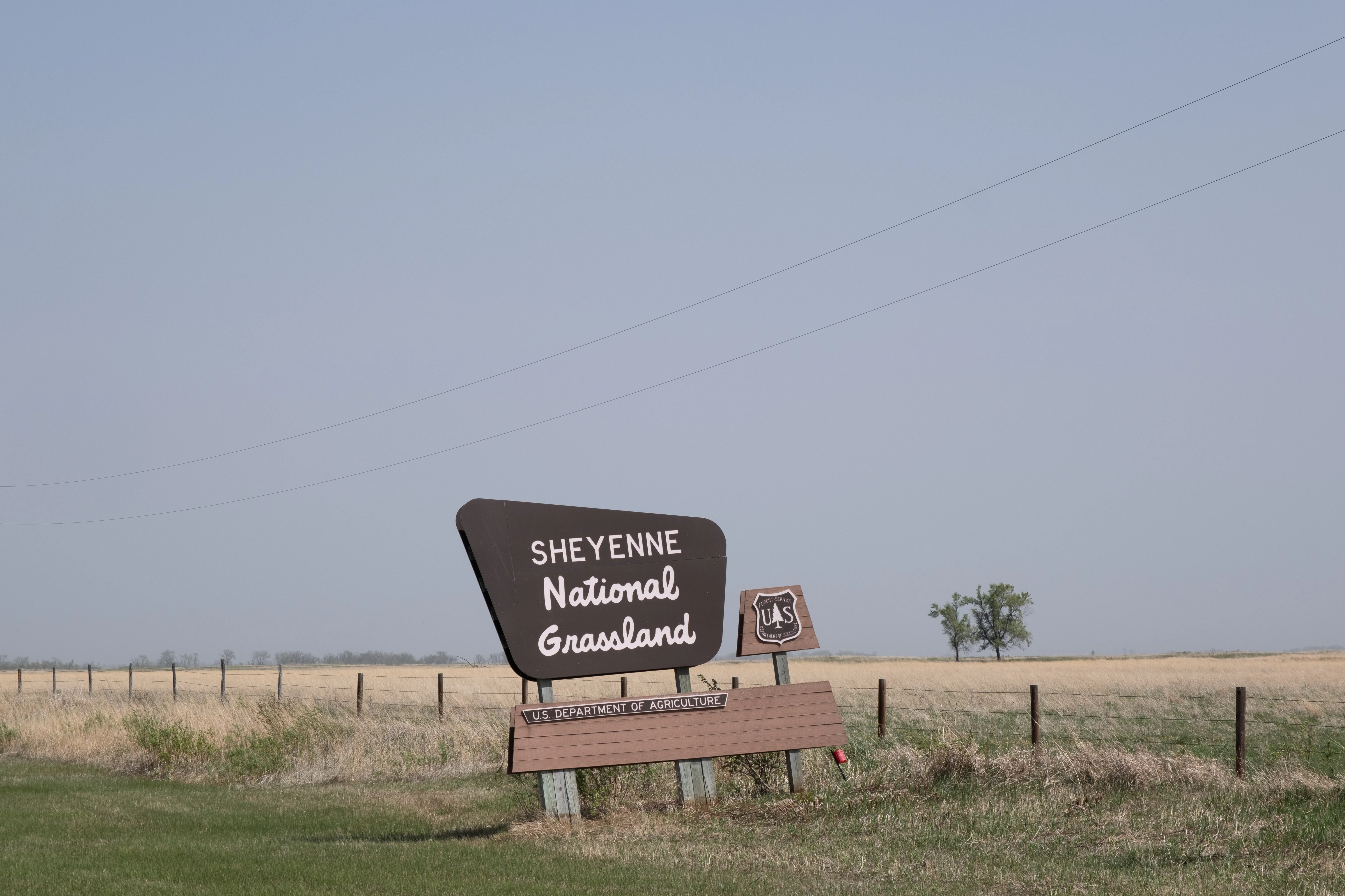
A brown road sign for Sheyenne National Grassland stands in a flat, open prairie landscape with a wire fence and a few distant trees.
The entrance sign to Sheyenne National Grassland.

Sheyenne National Grassland history and protected-area timeline

Sheyenne National Grassland was established as part of the federal National Grassland system, an effort initiated during the New Deal era and expanded in subsequent decades to address severely degraded farmland and to restore grassland cover in regions where native prairie had been heavily disrupted by cultivation.

Though the source content does not provide a detailed chronology of administrative milestones, the grassland has long been managed by the U.S. Forest Service, which oversees its conservation programs, grazing permits, and recreation infrastructure. Its administrative integration into the Dakota Prairie Grasslands reflects a broader shift toward coordinating management across the scattered National Grasslands of the northern Great Plains.

The presence of approximately 83 grazing permittees within Sheyenne indicates that ranching has been a longstanding part of the grassland's management philosophy, reflecting a policy approach that combines soil conservation, native habitat protection, and continued agricultural use. Over time, the grassland has gained recognition for its role in supporting prairie-dependent wildlife, including populations of greater prairie chickens and rare plant and insect species that rely on intact sandy-prairie habitat.

Sheyenne National Grassland landscape and geographic character

The landscape of Sheyenne National Grassland is defined by sandy soils and the influence of the Sheyenne River, which winds through the southeastern North Dakota countryside. This substrate and hydrology together support a varied terrain of low, rolling sand dunes, open swales between ridges, and lowland areas near the river where moisture-loving plants can establish.

Vegetation stretches across native and restored grass cover, with patches of oak savanna and even marginal woodlands adding leafy character to an otherwise sweeping prairie setting. The result is a broad, open horizon punctuated by occasional wooded edges and dune contours, giving the grassland a softer, more undulating visual quality than the flatter plains found elsewhere in the region.

The Sheyenne River corridor adds depth to the scenery, creating green ribbons of riparian vegetation among the grasslands. Together, these features produce a landscape that feels simultaneously expansive and intricate, combining the openness of prairie with the textural variety of dunes, bluffs, riverbanks, and oak-studded swales.

Sheyenne National Grassland ecosystems, habitats, and plant life

Sheyenne National Grassland sits at an unusual intersection of ecological zones, combining tallgrass prairie elements with sand-prairie and oak-woodland communities. Its sandy soils create conditions favorable to drought-adapted prairie plants and, paradoxically, to a notable presence of ferns, which find moisture-conserving microsites among the dunes.

Native grass species, forbs, and wildflowers make up the core of the vegetation, with western prairie fringed orchid among the most notable plant species present. This orchid is a regionally rare wildflower that thrives in undisturbed prairie habitat and signals the high botanical value of the area. Oak trees and other woody species add structural diversity, particularly in savanna-like zones where grasses and trees intermix.

The combination of soil type, climate, and hydrology within the Sheyenne River watershed gives the grassland an ecological identity that differs from most other National Grasslands, which are generally situated in mixed-grass or shortgrass regions of the Western United States. This position in the tallgrass transition zone is what gives Sheyenne its distinctive botanical signature.

Sheyenne National Grassland wildlife and species highlights

Wildlife at Sheyenne National Grassland is shaped by the area's tallgrass and sand-prairie habitats, which support both iconic grassland birds and rare, range-restricted invertebrates. The grassland hosts the largest known population of greater prairie chickens in North Dakota, a species that depends on large, contiguous grasslands for its dramatic mating displays and seasonal habitat needs.

Insect diversity is also notable, particularly for the presence of the Dakota skipper, a butterfly of conservation concern that depends on intact native prairie for its survival. This species signals the continued ecological function of the grassland beyond its role as simply open pasture, highlighting the importance of maintaining plant community diversity to support declining insect populations.

Other wildlife benefits from the mosaic of habitats, including birds and mammals that use the oak savanna edges, the riverine strips along the Sheyenne River, and the dense grassland interior. The mix of cover types provides a richer wildlife experience than typical open prairie, with more vertical structure and shelter than uniform grasslands would offer.

Sheyenne National Grassland conservation status and protection priorities

Conserva­tion significance at Sheyenne National Grassland stems from its unique status as the only National Grassland in the tallgrass prairie region of the United States, a biome type that has been heavily converted elsewhere to row-crop agriculture. By preserving sandy-soil prairie remnants, oak savanna, and Sheyenne River riparian habitats in a public-land framework, the grassland maintains ecological functions that have largely disappeared from the broader region.

Its plant and animal communities reflect this priority. Native prairie flora, including rare species such as the western prairie fringed orchid, and fauna such as greater prairie chickens and Dakota skippers, indicate that the grassland sustains populations of tallgrass-prairie specialists at a landscape scale. This habitat-level conservation value is amplified by the surrounding matrix of private ranch land, which, while used for grazing and agriculture, maintains a working landscape around the protected core.

Management by the U.S. Forest Service under the Dakota Prairie Grasslands umbrella also links the site to broader northern Plains conservation efforts. Grazing programs are an important conservation tool here, used not solely for livestock production but also for maintaining grass structure suitable for wildlife such as prairie chickens. Public conservation visibility is further increased by the passage of the North Country National Scenic Trail, which connects the grassland to a national network of long-distance trails and brings conservation awareness to passing hikers, riders, and cyclists.

Sheyenne National Grassland cultural meaning and human context

Culturally, Sheyenne National Grassland reflects the rural, ranching heritage of southeastern North Dakota, where local land use has long been shaped by cattle grazing, small grain farming, and a close relationship with the land. The presence of approximately 83 cattle ranchers holding grazing allotments shows that ranching families remain integral to the grassland's identity and ongoing management.

The river and land corridors around the Sheyenne River also carry a long agricultural and settlement history in the region, with towns such as Lisbon and Milnor serving as community hubs for the area. While the source material does not center on the broader Native American cultural context of the Sheyenne River valley, the river itself carries a name with deep associations in regional and tribal geography, linking the protected grassland to a wider cultural landscape shaped by generations of human interaction with the prairie.

Top sights and standout views in Sheyenne National Grassland

Sheyenne National Grassland's strongest distinguishing qualities include its status as the sole National Grassland in the U.S. tallgrass prairie ecosystem, its concentration of rare sand-prairie flora such as the western prairie fringed orchid, and its importance for the largest greater prairie chicken population in North Dakota. The intermingling of oak savanna, dunes, and Sheyenne River riparian areas creates a habitat patchwork that supports more ecological diversity than typical open-prairie preserves.

Recreationally, the grassland stands out for carrying a 31-mile segment of the North Country National Scenic Trail, allowing visitors to traverse this prairie landscape on foot, horseback, or mountain bike. The combination of working ranchlands, conservation-focused habitat management, and accessible long-distance trail infrastructure makes Sheyenne a uniquely vibrant example of the National Grassland system's blend of ecological preservation and rural land use.

Best time to visit Sheyenne National Grassland

The character of a visit to Sheyenne National Grassland shifts with the seasons in ways typical of northern Plains prairies. Late spring brings fresh green growth across the grasses and the ascent of wildflowers such as the western prairie fringed orchid, while early summer offers warmer conditions for hiking and horseback riding along the North Country National Scenic Trail. Dawn and dusk throughout the warmer months are particularly rewarding for those hoping to observe greater prairie chickens and other grassland wildlife in active periods.

Late summer and early fall maintain open access for hiking, biking, and ranching activity, with cooler weather and golden grass hues adding visual warmth to the rolling dunes. Winter visits are possible but require preparation for cold northern Plains conditions and any seasonal trail surface changes; visitors should be ready for limited services during this time.
Monthly climate preview

Long-term monthly temperature and precipitation data for Sheyenne National Grassland

Sheyenne National Grassland Climate Normals and Annual Temperature Patterns

Measured coordinates record significant seasonal shifts in average temperature and precipitation across the protected landscape. Examining the full twelve-month profile provides complete historical averages for climate comparison.
Annual mean6 °C
-12 °C23 °C
Jan-12°
Feb-9°
Mar-1°
Apr
May14°
Jun20°
Jul23°
Aug22°
Sep16°
Oct
Nov-1°
Dec-8°
Warmest month
July

22.6 °C

Coolest month
January

-11.9 °C

Wettest month
June

3.6 mm/day

Driest month
January

0.5 mm/day

Park location guide

Geography guide, regional context, and park location map for Sheyenne National Grassland

Sheyenne National Grassland park geography, regions, and map view in United States of America

Understand where Sheyenne National Grassland sits in United States of America through a broader geographic reading of the surrounding landscape, nearby location context, and its mapped position within the national park landscape.

How Sheyenne National Grassland fits into United States of America

The United States of America is a federal presidential republic and one of the world's largest countries by area and population. It consists of 50 states across a vast territory spanning multiple time zones, with its capital in Washington, D.C. and largest city in New York City. The nation has a diverse economy, influential political system, and significant cultural and military presence globally.

Wider geography shaping Sheyenne National Grassland in United States of America

The United States occupies a vast territory in North America, bordered by Canada to the north and Mexico to the south. The 48 contiguous states stretch from the Atlantic to the Pacific Ocean, while Alaska occupies the northwestern region and Hawaii is an archipelago in the Pacific. The country encompasses diverse terrain including the Rocky Mountains, Appalachian Mountains, Great Plains, and extensive river systems.

Map view of Sheyenne National Grassland

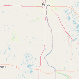
Use this park location map to pinpoint Sheyenne National Grassland in United States of America, understand its exact geographic position, and read its mapped placement within the surrounding landscape more clearly.

Pigeon | © OpenStreetMap contributors

Location context for Sheyenne National Grassland

North Dakota
Recorded earthquake history

Explore Recorded Seismic Events Near Sheyenne National Grassland

Investigate the historical record of earthquakes located in the proximity of Sheyenne National Grassland. This catalogue provides access to verified seismic data, allowing users to observe past activity patterns relative to the grassland without making claims about local hazard or future risk.

Sheyenne National Grassland Earthquake History

Catalogued events

1 event

Strongest magnitude

Magnitude 3.7

Most recent event

Oct 20, 1995

This history includes earthquakes recorded inside the park or within 50 km of its borders

Visual reference guide to sandy dunes, oak savanna, and river corridor habitats across the protected area.

Sheyenne National Grassland Photos and Scenery: Exploring Tallgrass Prairie Landscapes

Visual documentation captures the rolling sand dunes, oak savanna patches, and expansive tallgrass prairie habitats defining the protected terrain. Examining field imagery reveals the distinct ecological character and wide open horizons of the region.

A brown road sign for Sheyenne National Grassland stands in a flat, open prairie landscape with a wire fence and a few distant trees.

Park atlas

Compare surrounding Midwestern grasslands and connected conservation landscapes

Other Parks Near Sheyenne National Grassland and Regional Protected Areas

Browse protected areas and natural reserves located near Sheyenne National Grassland to expand regional geographic comparison. Analyzing adjacent tallgrass ecosystems provides deeper context into the broader conservation network across the surrounding territory.
Wildlife reserveNorth Dakota
293 km away#1 closest

West

Cedar River National Grassland: A Protected Prairie Landscape in Southern North Dakota

Mixed-grass prairie geography and regional watershed context

Cedar River National Grassland preserves a representative mosaic of upland plains and rolling hills in southern North Dakota. As part of the wider Dakota Prairie Grasslands, this wildlife reserve provides insight into northern prairie topography and intermittent stream ecosystems that define the regional character of the Great Plains.

Area
27.18 km²
Relief
Lowland
Climate
Temperate
Scope
Terrestrial
Protected areaSouth Dakota
313 km away#2 closest

Southwest

Fort Pierre National Grassland: An Atlas of South Dakota Mixed-Grass Prairie Ecosystems

Exploration of central Great Plains protected terrain and boundaries

Focusing on the authentic mixed-grass prairie of South Dakota, Fort Pierre National Grassland serves as a critical example of northern Plains conservation. Its landscape, marked by sweeping vistas and seasonal wetlands, provides a deep look into the spatial character and ecological heritage of the interior United States. Gain a precise understanding of its boundaries and the surrounding geographic features that define this expansive public land.

Area
469 km²
Relief
Upland
Access
Access unknown
Scope
Terrestrial
Protected landscapeSouth Dakota
350 km away#3 closest

West

Grand River National Grassland: Protected Landscape and Regional Geography in South Dakota

Mapped prairie, riparian corridors, and badland terrain.

Grand River National Grassland represents a complex protected landscape in South Dakota. Managed by the U.S. Forest Service, this area features diverse landforms including sand dunes, claypan playas, and green ash draws. This record provides a structured geographic overview of the grassland mosaic, spanning Perkins, Corson, and Ziebach counties with significant cultural ties to local tribal lands.

Area
626.38 km²
Established
1960
Relief
Lowland
Climate
Temperate
National parkMinnesota
368 km away#4 closest

Northeast

Voyageurs National Park: Minnesota's Mapped Protected Landscape and Geography

Explore the atlas context and mapped park boundaries of Voyageurs National Park.

Voyageurs National Park in Minnesota is a key protected area offering rich geographic discovery. As a designated National Park, it provides a unique lens through which to study regional landscapes and mapped natural terrain. Users can delve into its protected boundaries and understand its specific identity within the broader Minnesota geography, making it a vital point for atlas-focused exploration.

Area
883 km²
Established
1975
IUCN
II
Visitors
239.7K annual
Nature reserveWisconsin
About 371 km away#5 closest

East

Lake Superior National Estuarine Research Reserve: Protected Landscape and Map Context

Freshwater estuarine geography in northwestern Wisconsin

Spanning the confluence of the St. Louis River and Lake Superior, this nature reserve preserves expansive coastal marshland, forested bluffs, and rare sand dune ecosystems. The area serves as a critical freshwater research site within the Great Lakes region, showcasing unique transitions between forest types and complex hydrologic structures shaped by wind driven seiche events.

Area
67.57 km²
Established
2010
Relief
Lowland
Scope
Mixed
Protected landscapeNorth Dakota
428 km away#6 closest

West

Little Missouri National Grassland: Geography and Protected Landscape Context

Exploring North Dakota's expansive badlands and prairie terrain

Spanning over a million acres, Little Missouri National Grassland stands as a massive protected landscape in western North Dakota. This area showcases the complex transition where open mixed-grass prairie meets the eroded, rugged badlands of the Little Missouri River corridor. Home to White Butte, the state's highest point, the grassland offers a unique topographic profile of buttes, canyons, and canyons that defines the region's broader geographic and conservation character.

Area
4,163.34 km²
Established
1960
Relief
Upland
Climate
Temperate
Wildlife reserveBayfield County
433 km away#7 closest

East

Rainbow Lake Wilderness: Protected Forest and Lake Mosaic in Bayfield County

Exploration of a designated wildlife reserve in northern Wisconsin

Rainbow Lake Wilderness presents a deeply forested landscape in northern Wisconsin, marked by a high density of sixteen named lakes and numerous ponds. Managed to maintain its natural character, this protected area in Bayfield County provides an essential look at the intersection of glacial geography, old-growth hardwood stands, and quiet aquatic habitats within a larger federal forest context.

Area
28.9 km²
Established
1975
IUCN
Ib
Relief
Upland
Wildlife reserveBayfield County
444 km away#8 closest

East

Porcupine Lake Wilderness: Mapping the Protected Forest and Glacial Basins of Bayfield County

A federally designated wildlife reserve and forest landscape

Examine the geographic composition of Porcupine Lake Wilderness. This protected area features a dense network of glacial lakes, including the namesake Porcupine Lake and Eighteen Mile Spring Pond, surrounded by a rolling landscape of northern hardwoods and white pine. The mapped boundaries highlight a roadless wilderness that serves as a core forest habitat in northern Wisconsin.

Area
17.99 km²
Established
1984
IUCN
Ib
Relief
Upland

Common questions about visiting, size, designation, and location context for Sheyenne National Grassland

Sheyenne National Grassland FAQs for park facts, access, geography, and protected area context

Find quick answers about Sheyenne National Grassland, including protected-area facts, park geography, trail and visitor context, and how the park fits into its surrounding country and regional landscape.
MoriAtlas Explorer

Continue Your Protected Areas Search Across the Global Atlas

Deepen your exploration by continuing the structured search for national parks and protected areas worldwide. Utilize the comprehensive filtering capabilities to compare different conservation landscapes and refine your understanding of global park geography. Discover more about the distribution and characteristics of protected natural areas.

Global natural geography