
Mori Atlas logo
Biosphere reserveSierra del Rincón

Explore the geographic mosaic of transitional forests, ancient beech woods, and historic mountain villages.

Sierra del Rincón: A Mountainous Biosphere Reserve and Protected Landscape in Northern Madrid

(Reserva de la Biosfera de la Sierra del Rincón)

Sierra del Rincón forms a protected mountain territory in the northeast of the Community of Madrid, acting as a vital ecological bridge between the Sierra de Ayllón and the Sierra de Guadarrama. This expansive biosphere reserve contains a dense mosaic of Pyrenean oak forests, holm oak stands, and the renowned Hayedo de Montejo, representing one of the southernmost natural beech woods in Europe. The reserve integrates six traditional mountain municipalities within a varied relief of stream-carved valleys and highland plateaus, offering a significant look at the transitional terrain of the Central System.

biosphere reservemountain landscapebeech forestPyrenean oak woodlandHolm oak forestpine forest
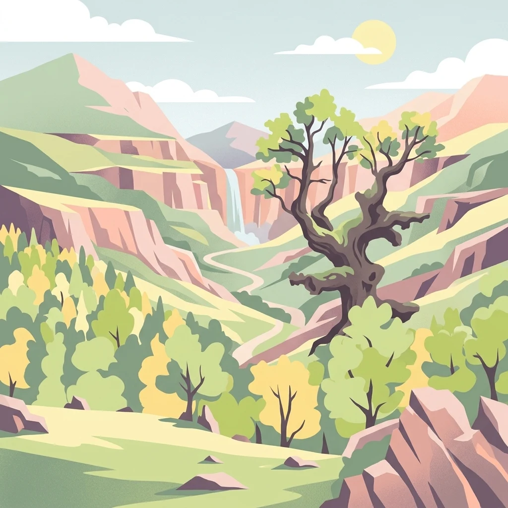
A flat-style vector illustration of a mountain landscape featuring a central waterfall flowing into a stream, surrounded by trees and rugged peaks.

Sierra del Rincón

Biosphere reserve

Park overview

Structured park overview, official facts, and landscape profile for Sierra del Rincón

Sierra del Rincón park facts, protected area profile, and essential visitor context

Review the core facts for Sierra del Rincón, including designation, size, terrain, visitor scale, habitats, and operating context in one park-focused overview.

About Sierra del Rincón

Sierra del Rincón represents a distinct kind of protected territory in Spain. Rather than a single national park, it functions as a UNESCO-recognized Biosphere Reserve that organizes conservation around a working rural landscape in the mountains northeast of Madrid. The territory sits at the hinge between two major ranges of the Iberian Central System, the Sierra de Ayllón to the north and the Sierra de Guadarrama to the south, giving it a transitional character that is unusually rich in habitats for its modest size.

Six small municipalities are at the heart of the reserve: La Hiruela, Horcajuelo de la Sierra, Montejo de la Sierra, Prádena del Rincón, Puebla de la Sierra, and (since 2022) Madarcos. Together they cover roughly 15,000 hectares of mountain terrain under varying overlays of protection. Approximately 90 percent of the surface area benefits from some form of conservation designation, ranging from national-level natural site status for the Hayedo de Montejo to broader biosphere-level recognition that encompasses the surrounding valleys and rural settlements.

Ecologically, Sierra del Rincón is striking for the way it concentrates an unusually diverse set of forest and scrub habitats within one compact mountain system. Beech forests of clearly Atlantic affinity grow here alongside extensive Pyrenean oak woodlands, holm oak formations, Scots and black pine stands, broom-dominated highland shrublands of piorno, Mediterranean scrub, and areas of pasture that have been shaped by centuries of grazing and charcoal-making. The combination of altitude, slope, aspect, and underlying geology creates a patchwork in which different plant communities sit remarkably close together, making the reserve a valuable reference site for biogeographers studying the transition between northern European and Mediterranean forest worlds.

Beyond its natural values, Sierra del Rincón is a place where rural life, traditional land use, and contemporary culture remain visible in the landscape. The municipality of Puebla de la Sierra hosts an open-air sculpture park featuring works by leading Spanish and international artists such as Pablo Picasso, Eduardo Chillida, Antoni Tàpies, and Miquel Barceló, alongside a Museum of Drawing and Graphic Art. The centuries-old dehesa oaks of La Hiruela stand as living evidence of long-standing communal land use, illustrating the kind of cultural-natural heritage that biosphere reserves are designed to safeguard.

Quick facts and research context for Sierra del Rincón

Sierra del Rincón is a UNESCO Biosphere Reserve located in the Sierra Norte comarca, in the extreme northeast of the Community of Madrid, Spain. It lies geographically between the Sierra de Ayllón and the Sierra de Guadarrama, occupying roughly 15,231 hectares across six municipalities.

Approximately 90 percent of the territory enjoys some form of legal protection. The reserve was designated in June 2005 by UNESCO and later enlarged in June 2022 with the incorporation of Madarcos. It hosts over 2,000 recorded species of plants and animals and contains the Hayedo de Montejo, one of Europe's southernmost beech forests and a National Natural Site of Interest since 1974.

Protection and recognition

Documented terrestrial protection scope and official UNESCO Biosphere Reserve status

Sierra del Rincón Protection Status and International Recognition

Sierra del Rincón holds documented terrestrial protection status and formal international recognition as a UNESCO Biosphere Reserve. Structured records provide official designation data and management scope for this protected area.

International recognition

Protection details

Protection scope
Terrestrial
Designated year
2005
Transboundary protection
No
Core area
5.88 km²
Buffer area
70.23 km²
Park context

Deeper park guide and search-rich context for Sierra del Rincón

Sierra del Rincón history, landscape, wildlife, and travel context

Explore Sierra del Rincón through its history, landscape character, ecosystems, wildlife, conservation priorities, cultural context, and seasonal travel timing in a structured park guide built for atlas discovery and search intent.

Why Sierra del Rincón stands out

Sierra del Rincón is best known for hosting the Hayedo de Montejo, widely regarded as one of the southernmost natural beech forests in Europe and protected as a National Natural Site of Interest since 1974. Beyond this flagship woodland, the reserve is also recognized for its unusually compressed ecological diversity, where Atlantic-influenced beech stands meet Mediterranean holm oak woodlands, Pyrenean oak forests, pine stands, broom-dominated highland scrub, and open pasture, all within the same mountain block. The reserve has also become known as a model of integrated rural conservation. Its small historic municipalities, traditional agro-silvopastoral landscape, centuries-old dehesa oaks, and contemporary outdoor sculpture collection combine ecological protection with active maintenance of mountain village life, distinguishing it from purely wilderness-focused reserves.
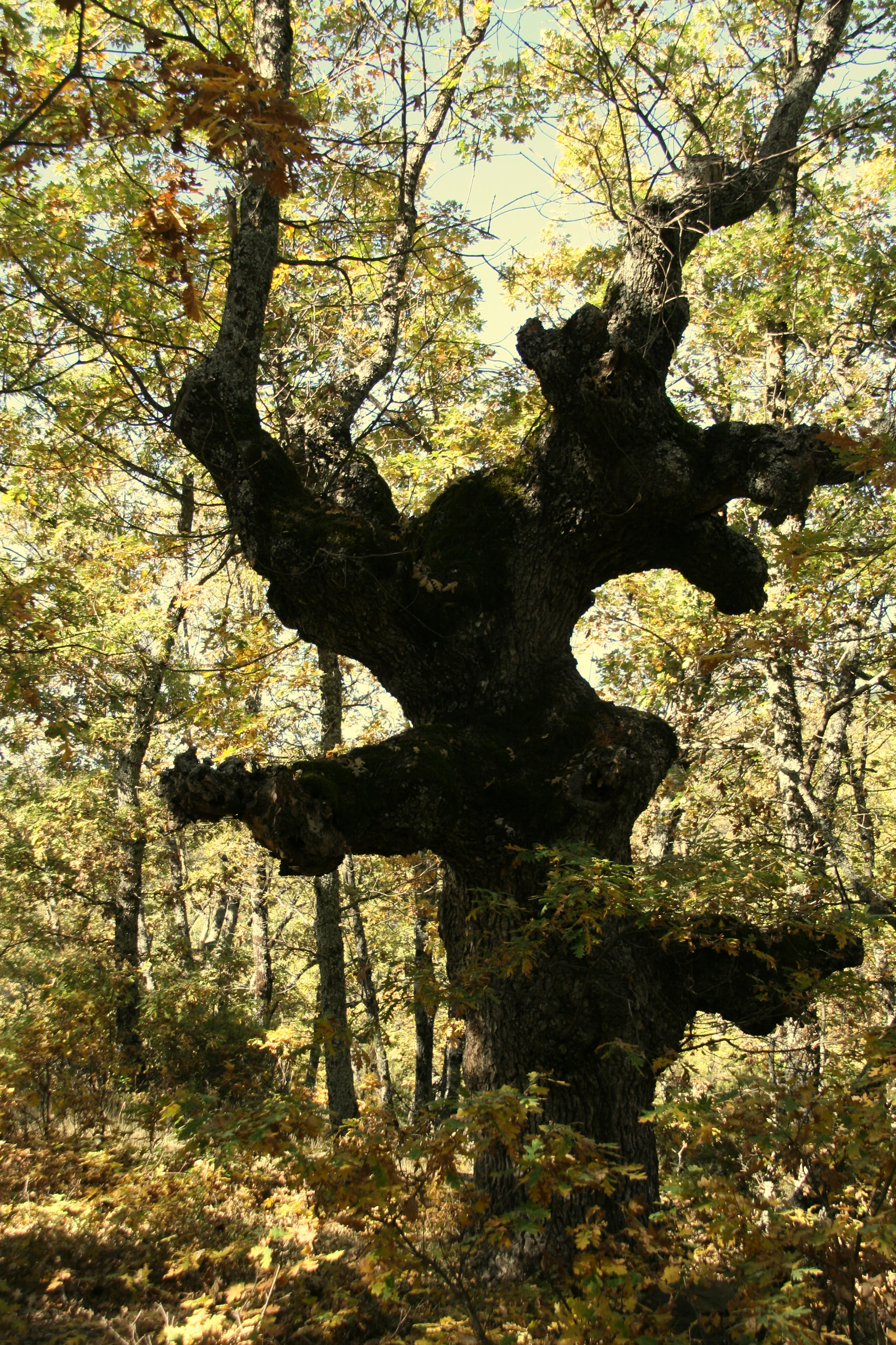
A large, ancient oak tree with thick, twisted, and gnarled dark bark stands in the foreground, surrounded by autumn foliage in a forest setting.
A gnarled, centennial oak tree standing within the forests of Sierra del Rincón.

Sierra del Rincón history and protected-area timeline

The modern protected status of Sierra del Rincón was established through international recognition rather than a single national park designation. In June 2005, UNESCO declared the territory a Biosphere Reserve in recognition of its combination of high ecological value and an actively inhabited rural landscape.

The decision built on a longer history of local and national protection efforts. The Hayedo de Montejo, the reserve's signature beech forest and the area that first drew scientific and conservation attention, had already been declared a National Natural Site of Interest in 1974, securing its beech stands before broader landscape-level recognition arrived. The early 2000s also saw preliminary floristic inventories of the wider territory, which began to document the area's unusually rich plant and animal biodiversity.

In June 2022, the biosphere designation was expanded to include the municipality of Madarcos, broadening the protected territory and further consolidating the reserve's role in the northeast of the Community of Madrid. Over the same period, cultural projects including the Puebla de la Sierra sculpture park, begun in 1998, have added a contemporary layer of artistic heritage to a landscape shaped by centuries of mountain agriculture, transhumance, charcoal production, and forestry.

Today, Sierra del Rincón reflects the biosphere reserve model in action: a territory where ecological conservation, traditional rural economies, scientific research, and cultural investment are pursued together rather than as competing priorities.

Sierra del Rincón landscape and geographic character

Sierra del Rincón occupies a mountainous stretch of terrain in the northeast of the Community of Madrid, set between the higher massifs of the Sierra de Ayllón to the north and the Sierra de Guadarrama to the south. Its relief is broken and varied, with deep valleys carved by mountain streams alternating with ridgelines, slopes, and small upland plateaus.

The landscape is best understood as a transitional Central System terrain, where neither the dominant Atlantic-flavored beech and oak forests of the northern Iberian mountains nor the Mediterranean holm oak woodlands of the center reach complete dominance. Instead, slopes carry mixed woodlands of Pyrenean oak, Scots and black pine, holm oak, and beech at the higher, moister sites, while the higher elevations give way to open shrublands dominated by piorno (Cytisus oromediterraneus) and Mediterranean-type matorral.

Valley bottoms historically carried meadows, agricultural land, and small villages, many still inhabited today. The sixth municipalities of the reserve: La Hiruela, Horcajuelo de la Sierra, Montejo de la Sierra, Prádena del Rincón, Puebla de la Sierra, and Madarcos, sit within this landscape as small traditional mountain settlements whose built environment remains closely integrated with the surrounding forest and pastoral land. At a more local scale, exposures and altitudes shift the landscape rapidly from sunny oak slopes to cool, humid beech hollows, producing the dense habitat mosaic that defines the reserve.
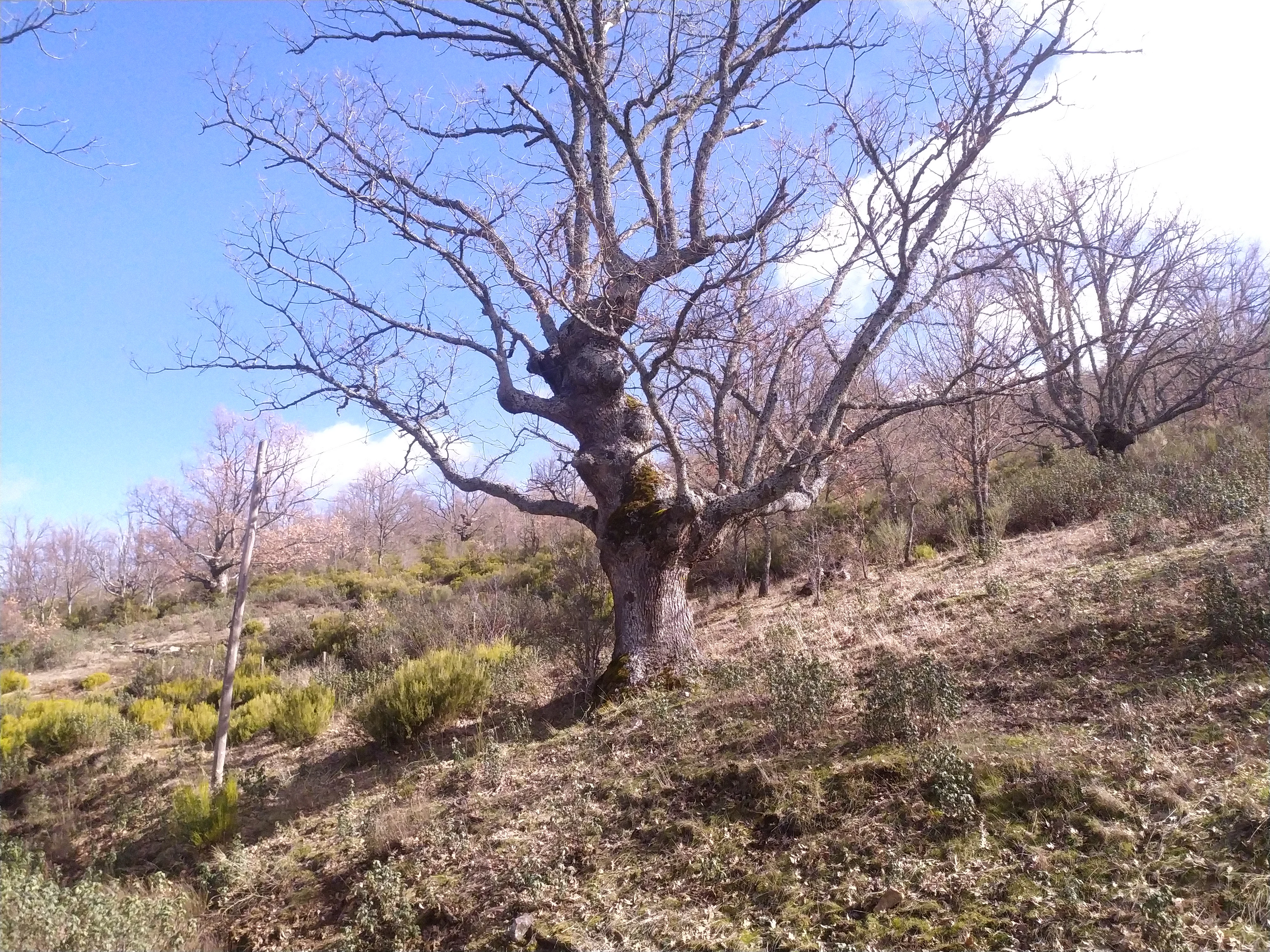
A mature, bare-branched oak tree stands on a grassy, sloping hillside with other sparse trees in the background under a blue sky.
Old Pyrenean oak trees in the Dehesa of La Hiruela, Sierra del Rincón.

Sierra del Rincón ecosystems, habitats, and plant life

The defining ecological feature of Sierra del Rincón is the unusual concentration of different forest and shrubland types within a relatively small mountain block. The reserve is regularly described as having exceptional habitat diversity, encompassing pine forests (pinares), Pyrenean oak woodlands (robledales), holm oak forests (encinares), beech forests (hayedos), pasturelands (pastizales), highland broom shrublands (piornales), and Mediterranean scrub (matorral).

Among these, the beech forests of Montejo and surroundings stand out as a textbook example of a relict Atlantic-type woodland pushed unusually far south. These stands are reinforced by extensive Pyrenean oak and Scots pine forests that occupy much of the reserve's mid-slopes, while holm oak and Mediterranean scrub communities anchor the warmer, sunnier exposures. The presence of centuries-old dehesa oaks around La Hiruela adds another layer, showing how traditional agro-silvopastoral management has shaped part of this natural heritage over very long timescales.

Flora records for the territory include more than 690 species of vascular plants, around 140 species of non-vascular plants, and a broader floral catalogue estimated at close to 1,000 taxa, although no complete floristic study has yet been published. Together, these figures position Sierra del Rincón as one of the botanically richest areas of the Community of Madrid and as a key site for understanding the transition between northern temperate and Mediterranean vegetation in central Spain.
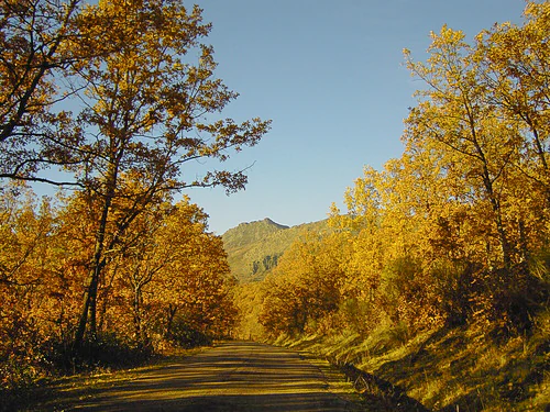
A dirt road winds through a dense deciduous forest with bright golden yellow autumn foliage, with a mountain ridge visible in the distance under a clear blue sky.
A dirt road leading through the autumn forest of Hayedo de Montejo in Sierra del Rincón, Spain.

Sierra del Rincón wildlife and species highlights

The wildlife profile of Sierra del Rincón reflects the same diversity seen in its habitats. Inventories have recorded close to 200 vertebrate species in the territory, of which roughly 140 are regarded as rare, endemic, or listed in the Regional Catalogue of Threatened Species. When invertebrates, plants, and other groups are added, more than 2,000 species of animals and plants have been documented across the reserve.

The mix of beech forest, oak woodland, pine stands, highland broom scrub, pasture, and stream-side vegetation supports a wide range of fauna typical of central Iberian mountain landscapes. Forest-dependent species occupy the beech and oak stands, while open areas and shrublands host different communities adapted to more exposed, drier conditions. The combination of habitats within a relatively compact area contributes to the reserve's significance for both resident fauna and species that move between forest and open ground across seasons.

The continued presence of traditional land uses, including extensive grazing and the persistence of old dehesa trees, also contributes to wildlife habitat structure, particularly for species associated with mature oak landscapes and ecotones between woodland and pasture.
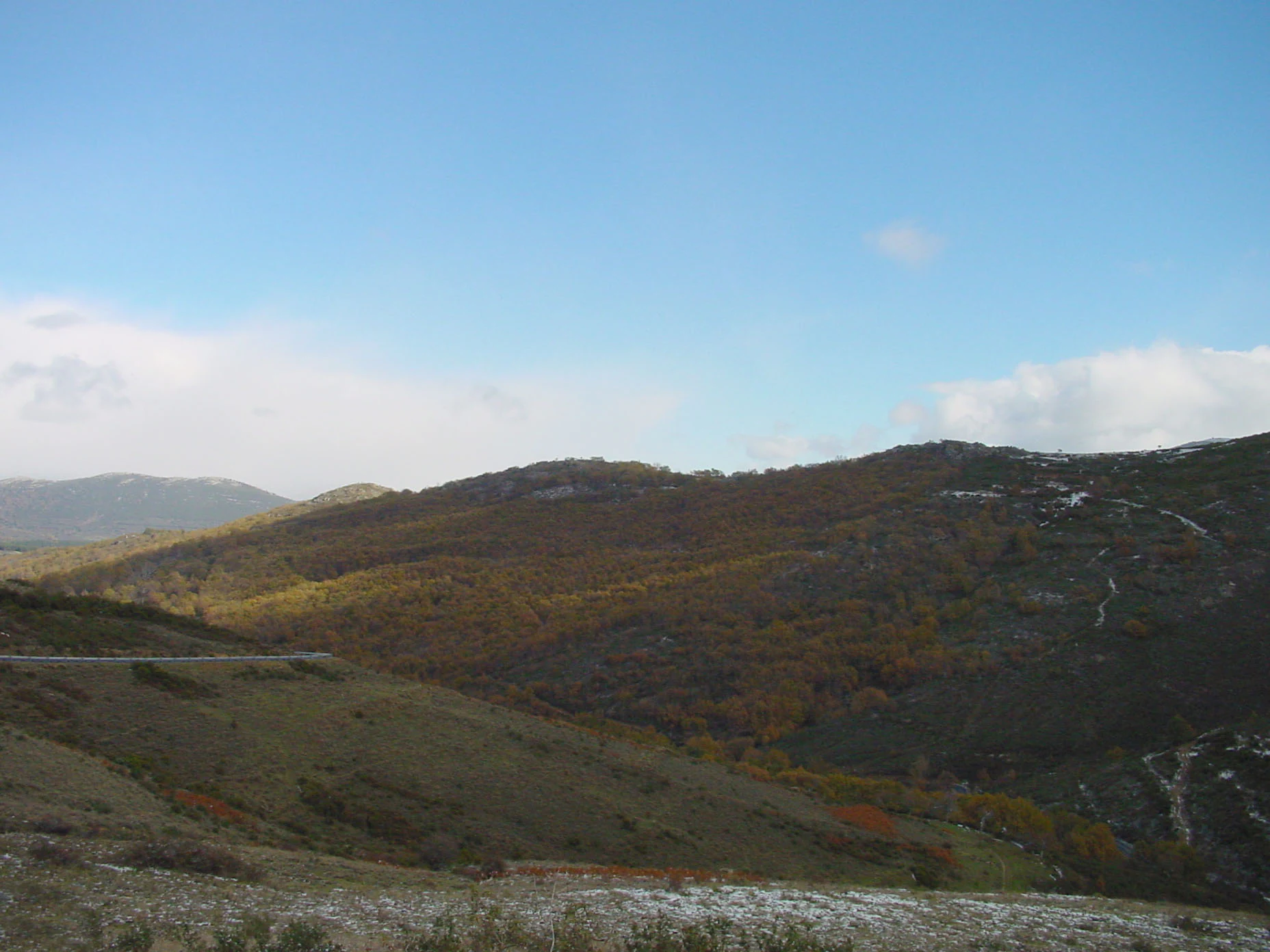
A wide landscape view of rolling hills and forested slopes under a clear blue sky, with a dusting of snow in the foreground.
A view of the rolling mountainous terrain in the Sierra del Rincon biosphere reserve.

Sierra del Rincón conservation status and protection priorities

Sierra del Rincón's conservation significance is rooted in the layering of protection rather than in any single national park designation. Approximately 90 percent of the territory is covered by some form of legal protection, combining the UNESCO Biosphere Reserve designation, the national-level Natural Site of Interest status of the Hayedo de Montejo, and other regional and local protection categories.

The 2005 UNESCO Biosphere Reserve designation recognized both the area's ecological importance and the value of its inhabited rural landscape, while the 2022 expansion to include Madarcos strengthened the coherence of the protected territory. The Hayedo de Montejo, declared a National Natural Site of Interest in 1974, remains the single most iconic protected element, preserving one of Europe's southernmost natural beech forests.

The reserve also serves as a reference site for understanding how transitional mountain ecosystems between the Ayllón and Guadarrama ranges function, and for testing integrated conservation approaches that combine biodiversity protection with continued traditional land use and local economic activity.

Sierra del Rincón cultural meaning and human context

Sierra del Rincón is as much a cultural landscape as a natural one. Its six small mountain municipalities have preserved much of their traditional rural character, with stone villages, terraced fields, pathways through old oak woodlands, and long-standing agro-silvopastoral practices continuing to shape the land.

The centuries-old dehesa oaks of La Hiruela, used historically as communal grazing woodlands, are a visible expression of this human-nature relationship. Many of the reserve's paths, such as trails through the centennial oaks of Puebla de la Sierra, follow centuries-old connections between villages, pastures, and forest.

A distinctive contemporary layer is the open-air sculpture park associated with Puebla de la Sierra, which since 1998 has hosted roughly one hundred sculptures donated or loaned by prominent artists including Pablo Picasso, Eduardo Chillida, Antoni Tàpies, Miquel Barceló, and Teddy Cobeña. Housed alongside the Museum of Drawing and Graphic Art, this collection has made the reserve an unusual meeting point of traditional mountain rural culture and modern artistic heritage.

Top sights and standout views in Sierra del Rincón

Sierra del Rincón offers a distinctive blend of ecological concentration, traditional rural character, and contemporary cultural heritage. Its most celebrated single feature is the Hayedo de Montejo, one of Europe's southernmost beech forests and a National Natural Site of Interest since 1974, but the reserve's identity is broader than any single site.

The combination of UNESCO Biosphere Reserve status, near-total territorial protection, layered habitats spanning Atlantic beech and Mediterranean oak woodlands, ancient dehesa oaks, inhabited mountain villages, and a major open-air sculpture park makes this compact mountain territory unusually rich for its size in the Community of Madrid.

Best time to visit Sierra del Rincón

Sierra del Rincón has a mountain climate with average annual temperatures between roughly 9 and 12 °C and annual precipitation close to 700 mm, distributed fairly evenly through the year except for a drier summer period. Snowfall is a regular feature of autumn and winter at higher elevations, which transforms the beech and oak forests of the reserve into some of their most atmospheric scenes.

Autumn brings strong color shifts across the Pyrenean oak, beech, and birch woodlands, while winter offers snow cover that emphasizes the relief of the valleys and the dense forest cover. Spring is a productive time to experience the reserve's botanical diversity, while summer is the driest and warmest season and a good time for exploring villages, dehesas, and the sculpture park. Conditions can vary considerably between valley and ridge, so visitors should generally expect mountain weather variability in any season.
Monthly climate preview

Long-term monthly temperature averages and precipitation patterns for Sierra del Rincón

Sierra del Rincón Climate Normals, Annual Temperature and Precipitation Rhythm

Representative coordinates record sustained temperature swings alongside measurable precipitation variations across twelve distinct monthly intervals. Detailed month-by-month climate data clarifies the long-term averages shaping the protected landscape.
Annual mean11 °C
2 °C22 °C
Jan
Feb
Mar
Apr
May13°
Jun18°
Jul22°
Aug22°
Sep17°
Oct11°
Nov
Dec
Warmest month
July

21.6 °C

Coolest month
January

2.1 °C

Wettest month
October

2.2 mm/day

Driest month
July

0.5 mm/day

Park location guide

Geography guide, regional context, and park location map for Sierra del Rincón

Sierra del Rincón park geography, regions, and map view in Spain

Understand where Sierra del Rincón sits in Spain through a broader geographic reading of the surrounding landscape, nearby location context, and its mapped position within the national park landscape.

How Sierra del Rincón fits into Spain

Spain, officially the Kingdom of Spain, is a unitary parliamentary constitutional monarchy located in Southern and Western Europe. The country occupies most of the Iberian Peninsula and includes territories in the Mediterranean and Atlantic. With a population of approximately 49.6 million and an area of 506,030 km², Spain is a major European economy and cultural force. Its capital is Madrid, and the country is known for its diverse landscapes ranging from mountainous regions to coastal areas.

Wider geography shaping Sierra del Rincón in Spain

Spain occupies the Iberian Peninsula in Southern and Western Europe. Peninsular Spain is bordered to the north by France, Andorra, and the Bay of Biscay; to the east and south by the Mediterranean Sea and Gibraltar; and to the west by Portugal and the Atlantic Ocean. The territory includes the Canary Islands in the Atlantic Ocean, the Balearic Islands in the Mediterranean Sea, and the autonomous cities of Ceuta and Melilla in mainland Africa. Spain features diverse terrain including the Pyrenees in the northeast, the Sierra Nevada in the south, and the Meseta Central plateau.

Map view of Sierra del Rincón

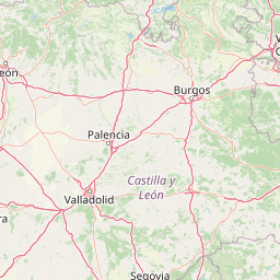
Use this park location map to pinpoint Sierra del Rincón in Spain, understand its exact geographic position, and read its mapped placement within the surrounding landscape more clearly.

Pigeon | © OpenStreetMap contributors

Location context for Sierra del Rincón

Madrid
Recorded earthquake history

Explore the Historical Seismic Catalogue for Sierra del Rincón

Review documented seismic events associated with the geography of Sierra del Rincón. This catalogue serves as a reliable reference for historical earthquake records occurring in the surrounding mountain landscape, allowing for clear and factual exploration of regional seismic data.

Sierra del Rincón Earthquake History

Catalogued events

1 event

Strongest magnitude

Magnitude 3.3

Most recent event

Jul 7, 1990

This history includes earthquakes recorded inside the park or within 50 km of its borders

Explore high-resolution park imagery capturing rare beech forests, transitional habitats, and traditional mountain villages.

Sierra del Rincón Landscapes and Scenery: Visualizing Protected Mountain Terrain

Visual documentation of Sierra del Rincón reveals the intricate topography of its protected mountain territory, including deep stream valleys and high upland ridges. Examining these park photographs helps researchers understand the compressed mosaic of Atlantic beech groves, Mediterranean oak woodlands, and highland shrublands.

A large, ancient oak tree with thick, twisted, and gnarled dark bark stands in the foreground, surrounded by autumn foliage in a forest setting.

A wide mountain landscape in autumn with forested slopes displaying yellow and orange fall colors and a rocky foreground.

A mature, bare-branched oak tree stands on a grassy, sloping hillside with other sparse trees in the background under a blue sky.

A dirt road winds through a dense deciduous forest with bright golden yellow autumn foliage, with a mountain ridge visible in the distance under a clear blue sky.

A wide landscape view of rolling hills and forested slopes under a clear blue sky, with a dusting of snow in the foreground.

Park atlas

Compare adjacent Central System mountain reserves and regional terrain

Parks Near Sierra del Rincón and Surrounding Protected Landscapes

Browsing other parks near Sierra del Rincón reveals wider ecological transitions across the Central System mountain ranges. Comparing these surrounding protected areas highlights regional forest mosaics and connected highland terrain.
Watercolor illustration depicting a mountain range, river, and green vegetation under a light sky
National parkSpain
12 km away#1 closest

Southwest

Sierra de Guadarrama National Park: Protected Area Landscape and Geographic Context

Explore diverse high Mediterranean mountain terrain and ecosystems.

Sierra de Guadarrama National Park is a significant protected national park in central Spain, characterized by its extensive granite landscapes and eleven distinct ecosystems. This park protects crucial high Mediterranean mountain environments, ancient pine forests, and dramatic glacial formations. Its geographic position within the Sistema Central makes it essential for understanding the regional geography and mapped terrain of the Iberian Peninsula, offering a unique look at a vital protected landscape.

Area
339.6 km²
Established
2013
IUCN
II
Visitors
3M annual
A horizontal watercolor illustration showing soft, stylized hills, valleys, and forest patches in muted greens, pinks, and yellows.
Protected landscapeCastilla y León
82 km away#2 closest

North

Sabinares del Arlanza-La Yecla: A Detailed Protected Landscape and Map of Burgos

Ancient juniper woodlands and deep limestone ravines in Castilla y León.

This protected area centers on the remarkable juniper forests and the narrow, vertical walls of the La Yecla gorge. The landscape serves as an essential habitat for cliff-nesting raptors while bridging the terrain between the Sierra de la Demanda foothills and the Arlanza River basin. The map captures the geological diversity of these limestone structures and the expansive botanical value found within this significant Spanish natural entity.

Area
391.74 km²
Established
2020
IUCN
V
Relief
Upland
Biosphere reserveLa Rioja
136 km away#3 closest

Northeast

Valles del Jubera, Leza, Cidacos y Alhama: Protected Landscapes in La Rioja, Spain

A biosphere reserve featuring limestone gorges and dinosaur fossil sites

Valles del Jubera, Leza, Cidacos y Alhama forms a distinct mid-mountain region in northern Spain where four river valleys have carved deep passages into the earth. The area serves as a vital protected landscape containing rich paleontological history, thermal springs, and traditional Mediterranean forests. This atlas entry details the natural boundaries and geographic character of one of Spain's significant biosphere reserves.

Area
1,196.69 km²
Established
2003
Watercolor painting showing green fields, scattered trees, and distant mountains under a light sky
National parkToledo Province
181 km away#4 closest

Southwest

Cabañeros National Park: Spain's Premier Iberian Oak Woodland Protected Landscape

Mapped Geography of Montes de Toledo Protected Area

Cabañeros National Park is celebrated as the most extensive and well-conserved example of Iberian Mediterranean forest in Spain. Situated within the Montes de Toledo, the park features a remarkable dichotomy between its unique raña flatlands and mountainous sierras, harboring ancient oak woodlands and significant biodiversity. This national park serves as a crucial component of the region's geographic context and a prime destination for atlas-based discovery of protected landscapes.

Area
409 km²
Established
1995
IUCN
II
Visitors
104.6K annual
Watercolor illustration showing a wetland landscape with grasses, a body of water, and distant hills
National parkSpain
199 km away#5 closest

South

Tablas de Daimiel National Park: Spain's Inland Wetland National Park and Protected Area

Explore mapped boundaries and regional geographic context.

Tablas de Daimiel National Park represents one of the last remaining examples of floodplain wetland systems in Spain's interior. Located in Castilla-La Mancha, this protected area showcases a unique confluence of fresh and brackish waters, supporting a rich mosaic of emergent vegetation and serving as a critical habitat for migratory birds. Use MoriAtlas to explore its precise geographic setting, mapped terrain, and its role as a vital conservation landscape within the Iberian Peninsula.

Area
30.3 km²
Established
1973
IUCN
II
Relief
Lowland
Watercolor illustration of rolling green hills, a winding river, and a distant horizon with a soft sun
National parkExtremadura
231 km away#6 closest

Southwest

Monfragüe National Park: Dramatic Cliffs, Raptor Haven, and Extremadura's Protected Landscape

Discover its mapped terrain and unique geography in Spain.

Monfragüe National Park, situated in Extremadura, Spain, offers a compelling study in protected landscape geography. The park's identity is shaped by its formidable cliffs and river valleys carved by the Tagus, providing critical nesting grounds for European raptors. This MoriAtlas entry details the park's mapped boundaries and its significance as a vital protected area within the region. Users can explore the specific natural terrain and regional context that establish Monfragüe as a unique protected territory.

Area
179 km²
Established
2007
IUCN
II
Visitors
331.8K annual
Watercolor illustration of a mountain landscape with green forests and a body of water.
National parkSpain
239 km away#7 closest

Northwest

Picos de Europa National Park: Dramatic Limestone Peaks and Protected Landscape Atlas

Explore Spain's historic national park and UNESCO Biosphere Reserve.

Picos de Europa National Park offers an unparalleled exploration of dramatic limestone peaks, deep glacial valleys, and extensive Atlantic forests. As Spain's oldest national park and a UNESCO Biosphere Reserve, it presents a remarkable study in karst landscape evolution and biodiversity conservation. This protected area, spanning significant territory across northern Spain, provides a rich geographic context for understanding regional natural heritage and mapped natural features.

Area
671.27 km²
Established
1918
IUCN
II
Relief
Mountain
Biosphere reserveExtremadura
About 242 km away#8 closest

Southwest

La Siberia Biosphere Reserve: Mapped Geography and Protected Lands of Extremadura

A study of reservoir coastlines and Mediterranean serranías

La Siberia Biosphere Reserve offers a deep look into the rural landscape of Extremadura, Spain. Characterized by five major reservoirs and vast Mediterranean oak dehesas, the area provides essential habitat for raptors and preserves significant prehistoric rock art within its complex serranía topography. Explore the geographic boundaries and water-dominated landscape of this distinct inland region.

Area
2,836.7 km²
Established
2019
Relief
Mountain
Climate
Mediterranean

Common questions about visiting, size, designation, and location context for Sierra del Rincón

Sierra del Rincón FAQs for park facts, access, geography, and protected area context

Find quick answers about Sierra del Rincón, including protected-area facts, park geography, trail and visitor context, and how the park fits into its surrounding country and regional landscape.
MoriAtlas Explorer

Continue Your Protected Areas Search Across the Global Atlas

Deepen your exploration by continuing the structured search for national parks and protected areas worldwide. Utilize the comprehensive filtering capabilities to compare different conservation landscapes and refine your understanding of global park geography. Discover more about the distribution and characteristics of protected natural areas.

Global natural geography