
Why Sleeping Bear Dunes National Lakeshore stands out
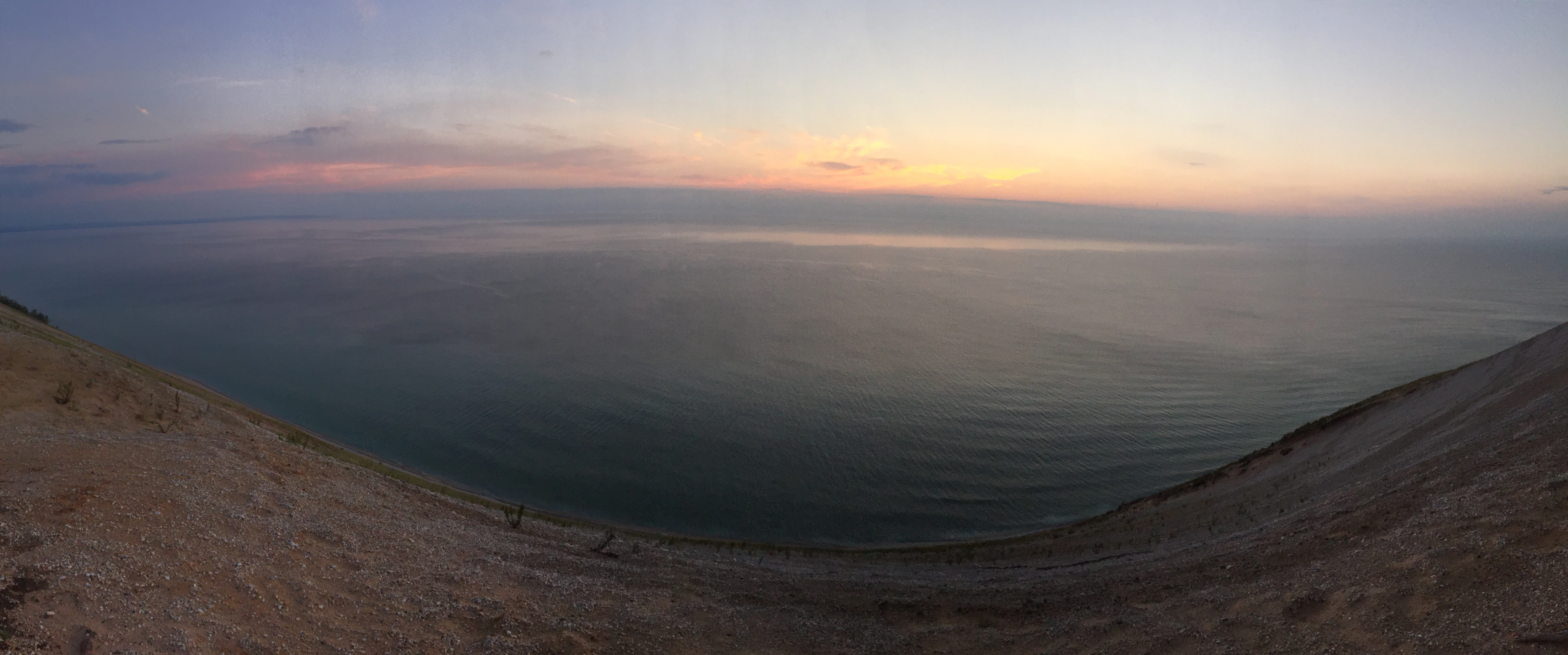
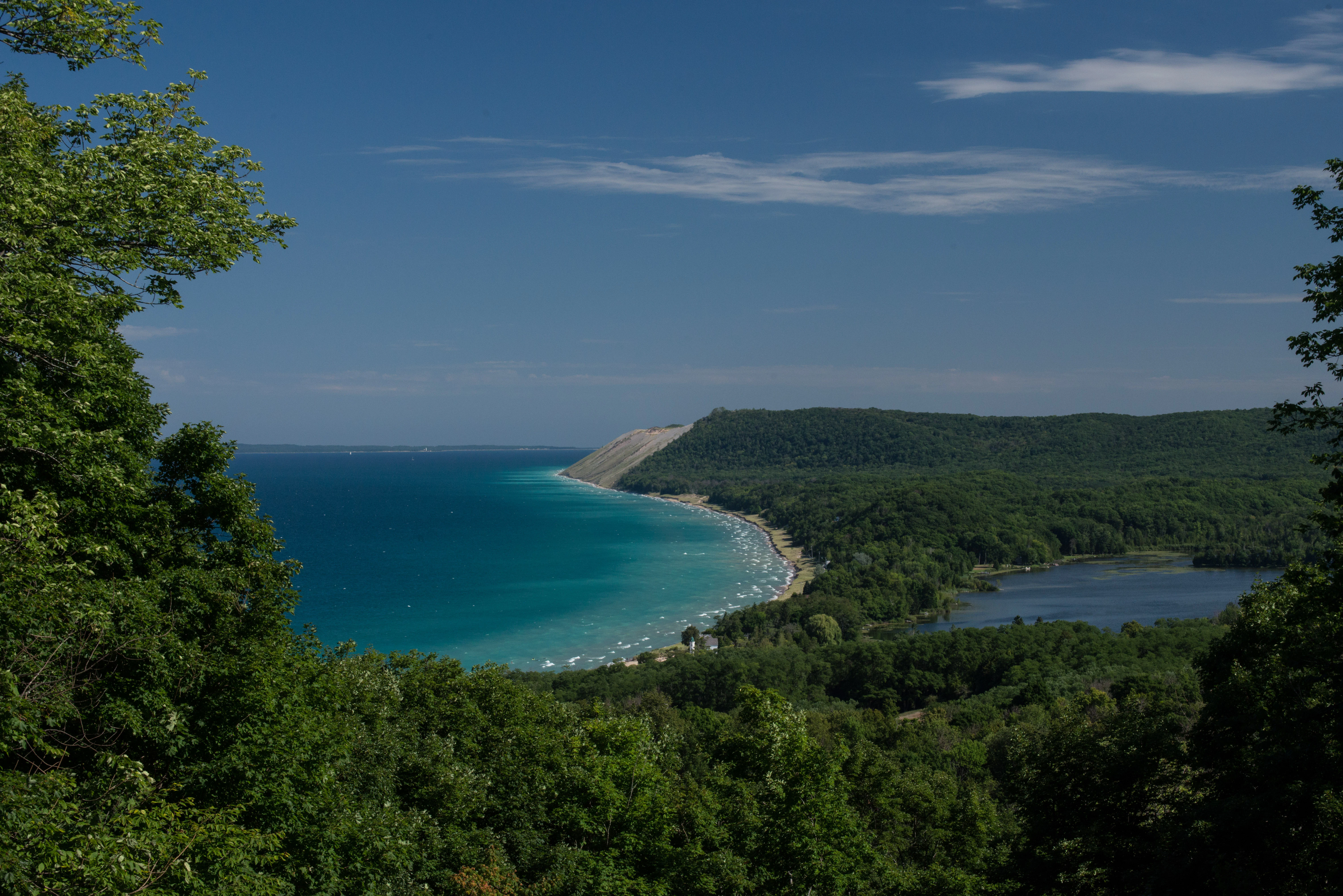
Sleeping Bear Dunes is most renowned for its towering perched dunes, which rise dramatically hundreds of feet directly from the shore of Lake Michigan. Unlike classic Sahara-style dunes, these are thin blankets of wind-deposited sand resting on massive deposits of glacial debris left behind at the end of the last ice age, producing steep, ever-shifting slopes and breathtaking overlooks. Equally iconic is the sweep of Lake Michigan shoreline itself, framed by forested bluffs and backed by the deep-blue waters of Glen Lake and the Platte River. The pairing of dunes, bluffs, hardwood forest, freshwater lakes, and the offshore Manitou Islands creates a landscape that feels both expansive and intimate, a quality that helped earn the park its 2011 designation as the "Most Beautiful Place in America."
Sleeping Bear Dunes National Lakeshore history and protected-area timeline
The physical foundation of Sleeping Bear Dunes was laid during the Wisconsin glaciation at the end of the last ice age, roughly 10,000 to 14,000 years ago. Massive ice sheets retreated northward, leaving behind deep deposits of sand, gravel, and till along what is now the Lake Michigan shoreline. Wind then began lifting sand from the broad beaches and depositing it on higher ground, forming the perched dune system that still defines the park. Over thousands of years, these dunes have migrated slowly eastward, with wind and erosion continually reshaping bluffs and burying forest edges.
Long before the park existed, the landscape carried deep cultural meaning for the Ojibwe people. The name "Sleeping Bear" comes from a traditional legend in which a mother bear and her two cubs fled a western forest fire by swimming across Lake Michigan. When the cubs drowned before reaching the far shore, the Great Spirit transformed them into what are now North and South Manitou Islands, and the mother bear allegedly waited atop a bluff until the sands of the dunes buried her. The small, tree-covered knoll that once resembled a sleeping bear from the water has since been reduced by wind and erosion.
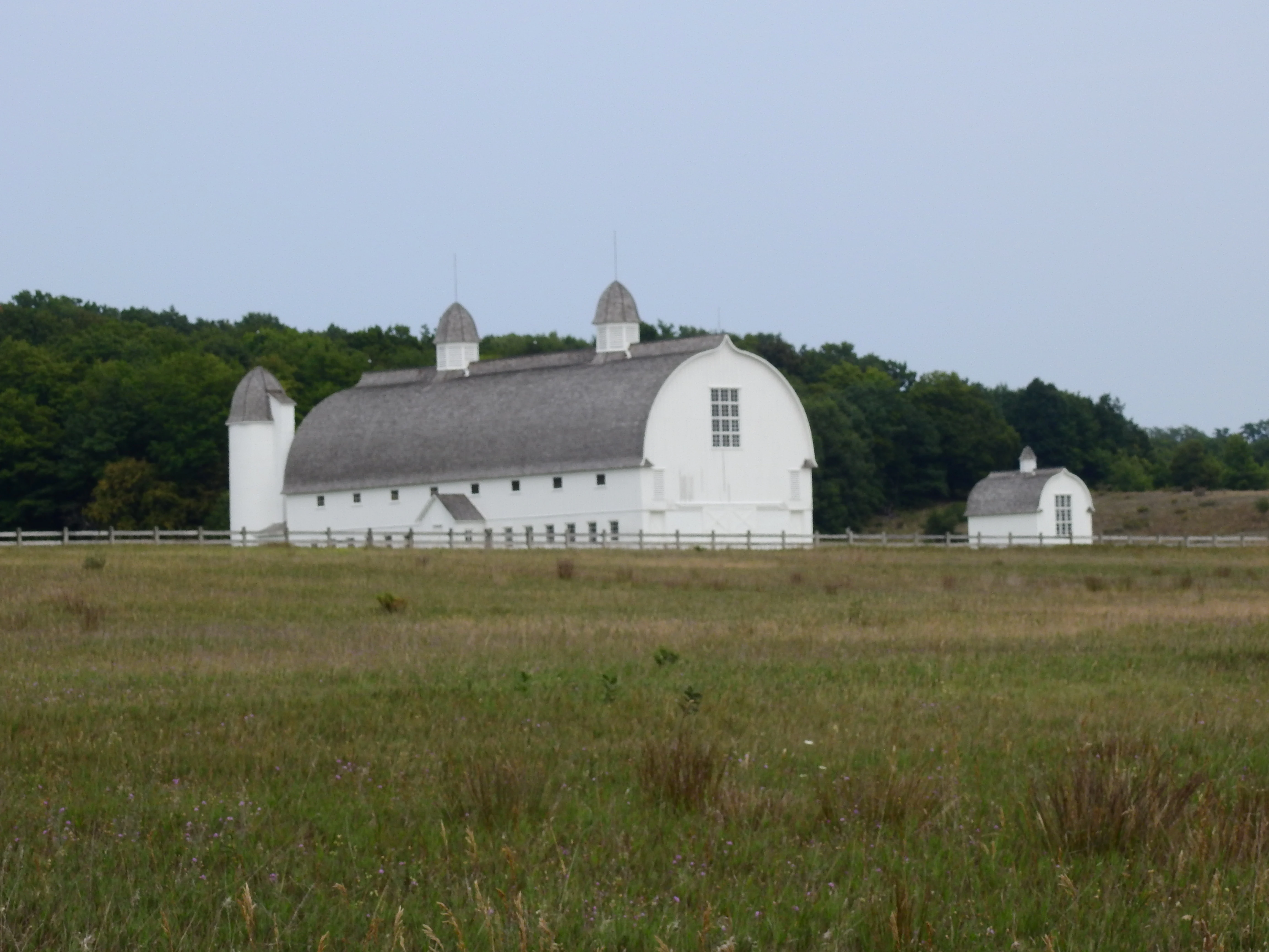
In the 19th and early 20th centuries, the lakeshore was a working landscape. Glen Haven grew as a company town tied to the wood-fired steamship trade, while Port Oneida supported a community of small farms. The South Manitou Island Lighthouse, built in 1871, guided ships past the treacherous Manitou Passage, and U.S. Life-Saving Service stations guarded the shoreline.
Modern protection began in 1962, when Senator Philip Hart of Michigan first introduced legislation to create a national park here. The effort became contentious: many local residents saw themselves as careful stewards of the land and resisted surrendering private property to public ownership. The federal government prevailed, in part by compensating local schools for lost tax revenue and by including the Manitou Islands in the protected area. The lakeshore was officially established on October 21, 1970. In 2014, the Sleeping Bear Dunes National Lakeshore Conservation and Recreation Act designated roughly a third of the park as the Sleeping Bear Dunes Wilderness, the first congressionally designated wilderness in the lakeshore system in five years.
Sleeping Bear Dunes National Lakeshore landscape and geographic character
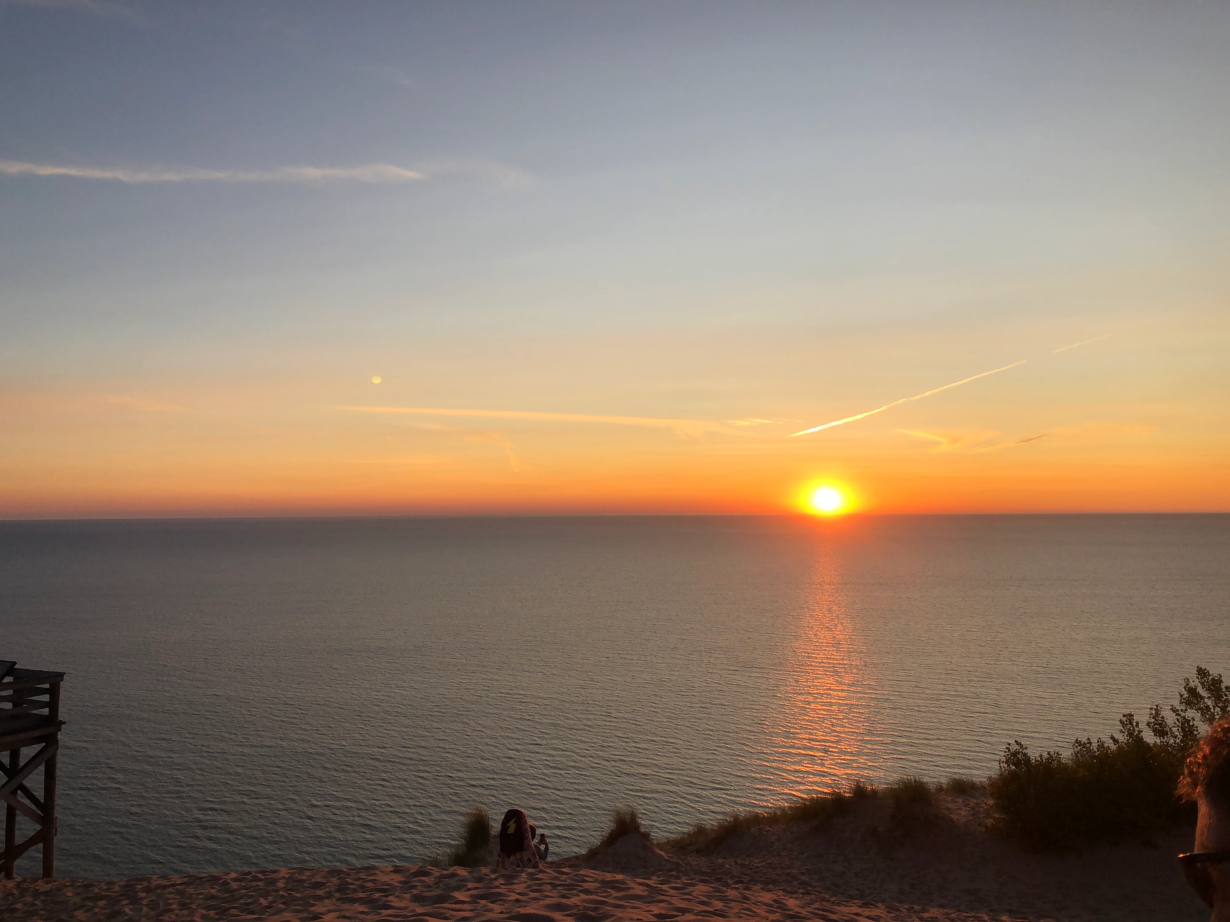
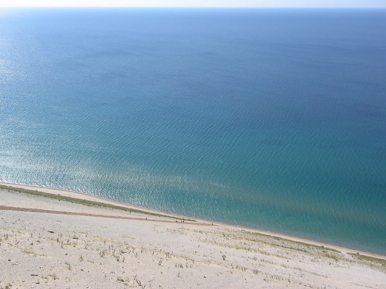
Sleeping Bear Dunes is defined by the interplay of three landscape elements: high perched dunes, forested glacial bluffs, and the freshwater expanse of Lake Michigan. The dunes are not classic free-standing desert forms; instead, they are thin sheets of wind-blown sand draped over much older glacial deposits, producing dramatic, steep-sided ridges that can tower more than 400 feet above the lake. Because the sands rest on loose material, the dunes are slowly but persistently migrating eastward, visibly swallowing forests in some areas and exposing bare bluffs in others.
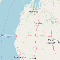
Beyond the dunes, the Leelanau Peninsula contributes its own character. Gently rolling ridges of glacial drift drop down to Lake Michigan in tall headlands such as Empire Bluff and Pyramid Point. Inland from the shoreline, the park encompasses Glen Lake, one of Michigan's largest inland lakes, along with the Platte River and its estuary at Platte Bay, smaller lakes, and pockets of wetland. The southern end of the park, in Benzie County, is comparatively flat, while the Leelanau sections rise into the more dramatic overlooks captured along the Pierce Stocking Scenic Drive.
Offshore, North and South Manitou Islands add a second scale of landscape to the park. The islands share the same glacial and dune geology as the mainland but feel more remote, with long sand beaches, interior forests, historic farm clearings, and the iconic South Manitou Island Lighthouse standing watch over the shipping lane.
Sleeping Bear Dunes National Lakeshore ecosystems, habitats, and plant life
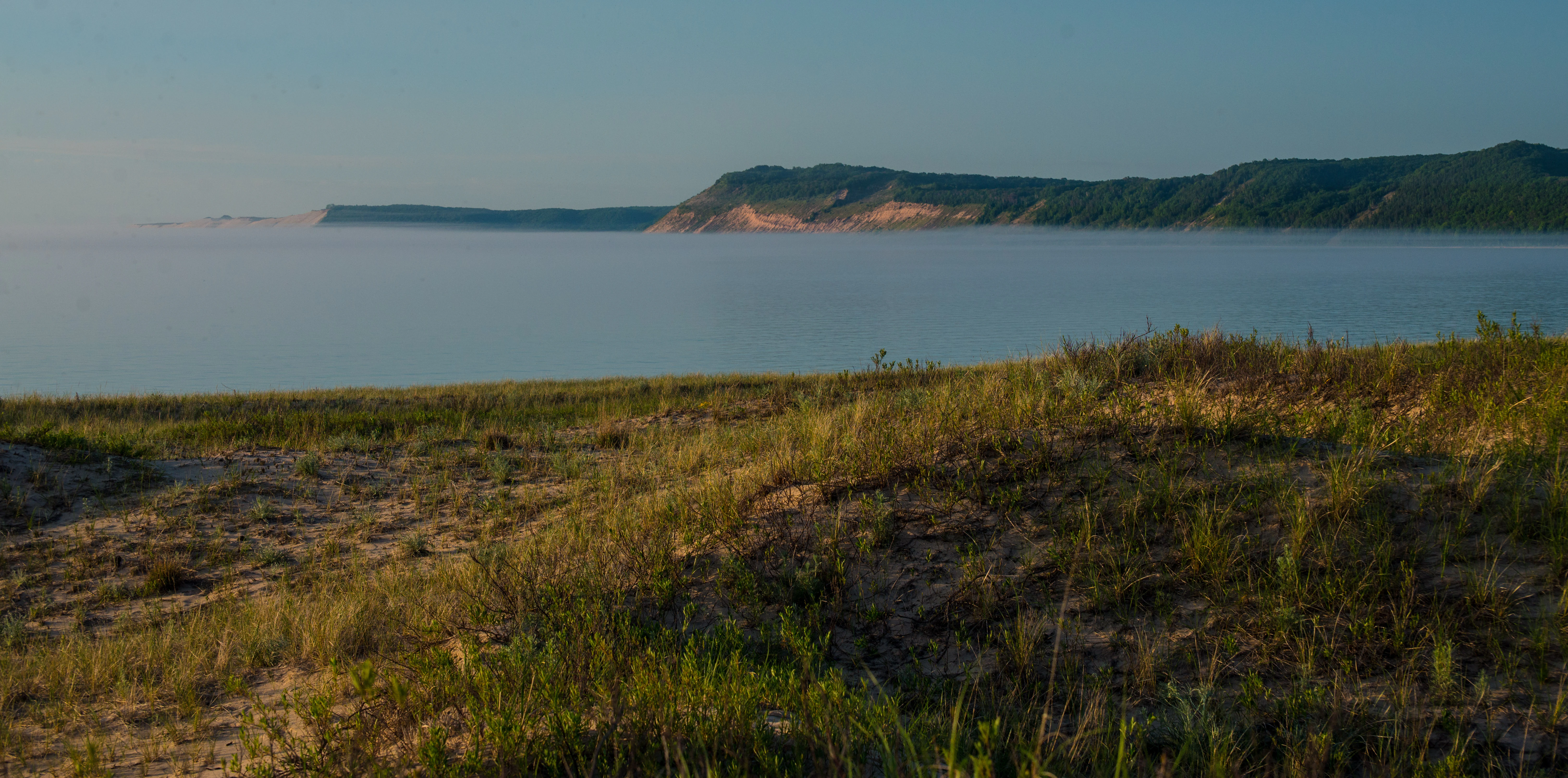
The freshwater coastal ecosystems of Sleeping Bear Dunes are unusually diverse for a single protected area. Just inland from the beach, the lakeshore supports a shifting mosaic of open dune, dune grassland, and dune shrub communities, where pioneer plants stabilize otherwise mobile sand. Behind the dunes, classic northern hardwood forests dominated by beech and sugar maple rise on the glacial ridges; pine and oak sometimes occupy drier, sandier sites, while lowlands shelter cedar, hemlock, and wetland vegetation. River corridors along the Platte and Crystal Rivers add riparian forest and freshwater marsh to the mix.
The shoreline itself is a vital ecological zone. Wide, sandy beaches and shallow bays function as critical habitat for shorebirds, while the cold, deep waters of Lake Michigan sustain a freshwater ecosystem distinct from any terrestrial forest. North and South Manitou Islands carry similar habitats but feel wilder and more exposed, providing important nesting and resting habitat for migratory species that move along the Great Lakes flyway.
Because the lakeshore sits where northern forests meet the open lake, its ecological character is shaped by constant change. Wind and waves continually rework the dunes and bluffs, forests creep across old fields at places like Port Oneida, and wildlife communities shift with the seasons. The result is a dynamic, working freshwater coast that preserves not just a single habitat but a layered system of dunes, forest, lake, and island.
Sleeping Bear Dunes National Lakeshore wildlife and species highlights
Wildlife at Sleeping Bear Dunes reflects the meeting of lake, dune, and forest. The park's beaches provide important nesting habitat for the piping plover, a federally protected shorebird whose recovery has become one of the defining conservation stories of the lakeshore. Throughout the year, the shoreline and dunes support a wide variety of gulls, terns, sandpipers, and other waterbirds, while the open waters of Lake Michigan host seasonal migrations of waterfowl and fish.
Inland, the beech-maple forests, pine stands, and shrublands host white-tailed deer, red fox, coyote, and both snowshoe hare and eastern cottontail. Black bears are present in the park, and smaller mammals such as chipmunks, squirrels, and beavers are widespread. Reptiles and amphibians use wetlands, rivers, and forest pools across the protected area, and the islands support many of the same species as the mainland in lower densities.
Because the lakeshore lies along a major migratory corridor, birdwatching is a major attraction, particularly during spring and fall when songbirds, raptors, and waterfowl move along the lake. The combination of nesting shorebirds on the beaches, forest breeding birds in the interior, and seasonal migrants passing offshore gives the park a rich and changing birdlife throughout the year.
Sleeping Bear Dunes National Lakeshore conservation status and protection priorities
Sleeping Bear Dunes plays an important role in conserving a representative stretch of Great Lakes shoreline. Although Lake Michigan is enormous, only a small fraction of its eastern coast retains the natural dune, bluff, and forest sequence that has existed since the last ice age. By protecting about 35 miles of that shoreline along with the related offshore islands, the lakeshore safeguards an unusually complete cross-section of Lake Michigan coastal ecology.
A central conservation focus is the recovery and protection of the piping plover, which nests on the park's beaches. Stewardship of nesting areas, predator management, and visitor education all contribute to plover recovery efforts coordinated across the region. At the landscape scale, the 2014 designation of the Sleeping Bear Dunes Wilderness added a strong formal protection layer, shielding a large interior tract from roads and development and preserving habitat connectivity for species that need quiet, unbroken forest and dune terrain.
Beyond single species, the lakeshore contributes to broader Great Lakes conservation priorities: controlling invasive species, maintaining forest health alongside climate stress, preventing fragmentation, and protecting water quality along the Platte and Crystal Rivers. The combination of National Lakeshore and Wilderness status gives managers a layered set of tools to balance recreation, visitation, and long-term ecological integrity.
Sleeping Bear Dunes National Lakeshore cultural meaning and human context
The Sleeping Bear Dunes region carries a layered cultural history that stretches back well beyond the establishment of the national lakeshore. The Ojibwe legend of the sleeping bear gives the landscape one of its deepest identities, linking the dunes, the Lake Michigan crossing, and the Manitou Islands into a single narrative still told today. The word "Manitou" itself reflects that spiritual and cultural framing.
In the 19th and 20th centuries, the shoreline supported a working maritime economy. Ships loaded cordwood at Glen Haven and elsewhere, fueling the steam-powered freighters that traveled the lakes; lumber camps and small farms dotted the interior; and life-saving stations guarded against shipwreck along the treacherous Michigan coast. The 1871 South Manitou Island Lighthouse, three former Coast Guard stations, the company town of Glen Haven, and the 16 historic farms of the Port Oneida Rural Historic District together preserve that heritage within the park.
The surrounding communities of Empire and Glen Arbor, along with nearby Traverse City, remain closely tied to the lakeshore. The M-22 highway shield, which threads through the park, has become a cultural symbol of the region itself, appearing on local merchandise, artwork, and tourism branding, and reflecting how deeply Sleeping Bear Dunes is woven into the identity of Northern Michigan.
Top sights and standout views in Sleeping Bear Dunes National Lakeshore
Among the park's defining features are the towering perched dunes that drop straight down to Lake Michigan, the dramatic overlooks of Empire Bluff and Pyramid Point, and the sweeping vistas along the 7.4-mile Pierce Stocking Scenic Drive. Glen Lake's vivid blue waters and the dune climb near Glen Arbor give visitors immediate, iconic views, while the quieter Platte River corridor offers gentler river and estuarine scenery. Offshore, North and South Manitou Islands extend the park's sense of wildness and isolation, with the South Manitou Island Lighthouse standing as one of its most photographed historic landmarks.
What sets Sleeping Bear Dunes apart is the density of distinct experiences packed into a single shoreline. A visitor can move in a single day from deep hardwood forest to open dune to freshwater beach, while also passing through preserved company towns, lighthouse stations, and 19th-century farmsteads. That blend of glacial geology, freshwater coast, boreal-influenced forest, and living maritime heritage makes Sleeping Bear Dunes feel less like a single scenic park than a complete, self-contained slice of Great Lakes country.
Best time to visit Sleeping Bear Dunes National Lakeshore
Sleeping Bear Dunes is fundamentally a warm-season park. Summer brings the park's most active atmosphere, with warm Lake Michigan waters, full ferry service to the Manitou Islands, and long days ideal for tackling the famous dune climb, scenic drives, and beach outings. Late spring and early fall are quieter, cooler, and often favored by visitors interested in hiking, fewer crowds, and more vivid color in the hardwood forests of the Leelanau Peninsula.
Autumn is particularly striking as the beech and maple forests turn, while winter transforms the lakeshore into a quieter, starker landscape of snow-covered dunes, frozen inland lakes, and the occasional view of ice along Lake Michigan. Each season reveals a different face of the same glacial, dune-scoured coastline; the choice depends largely on whether a traveler prefers beach and island activity, forest hiking, or a more contemplative, off-season atmosphere.