Mori Atlas logo
National parkSnæfellsjökull National Park

A detailed look at the glacial stratovolcano and protected ecosystems of the Snæfellsnes Peninsula.

Snæfellsjökull National Park: Mapping the Volcanic Landscapes and Coastal Terrain of Iceland

Snæfellsjökull National Park preserves a striking convergence of geologic and marine environments at the tip of western Iceland. Centered on the iconic glacier-capped stratovolcano, the park encompasses rugged lava fields, basaltic coastal cliffs, and expansive black sand beaches. This protected area serves as a vital anchor for regional ecology, linking mountain alpine tundra with the island-rich seascapes of the North Atlantic.

stratovolcanoglaciervolcanic landscapecoastal cliffsblack sand beacheslava fields

Snæfellsjökull National Park

National park

Park overview

Structured park overview, official facts, and landscape profile for Snæfellsjökull National Park

Snæfellsjökull National Park park facts, protected area profile, and essential visitor context

Review the core facts for Snæfellsjökull National Park, including designation, size, terrain, visitor scale, habitats, and operating context in one park-focused overview.

About Snæfellsjökull National Park

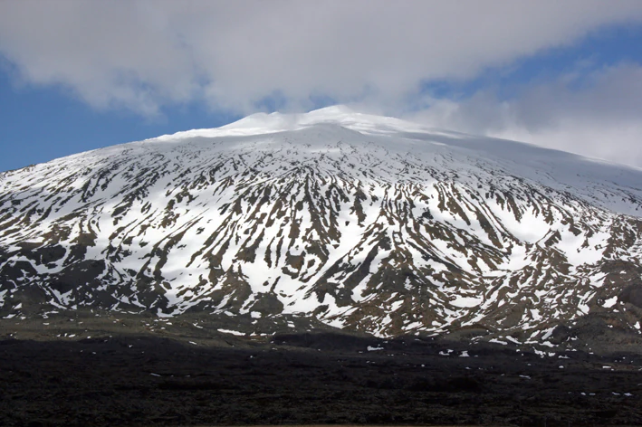
Snæfellsjökull National Park covers the westernmost reaches of the Snæfellsnes Peninsula in western Iceland, reaching from the volcanic interior of the peninsula outward to dramatic coastal cliffs and black sand shores. The defining centerpiece of the park is Snæfellsjökull, a stratovolcano rising to 1,446 meters and crowned by a glacier that gives the mountain its name. This conical, ice-covered peak is a defining feature of Iceland's western skyline and one of the most photographed natural landmarks in the country.

The park is part of a broader geological story: the Snæfellsnes volcanic belt runs through the center of the peninsula, and the volcano that anchors the park is its most famous expression. Surrounding the mountain, the landscape shifts between moss-covered lava fields, rough basalt ridges, gentle grassy lowlands, and the abrupt coastal terrain where the peninsula meets the sea. To the south of the peninsula lies the broad, island-dotted expanse of Breiðafjörður, a marine ecosystem of significant ecological value that complements the terrestrial protected area.

Culturally, Snæfellsjökull occupies a position that few Icelandic natural sites can match. Jules Verne chose it as the setting for the descent into the Earth in Journey to the Center of the Earth, and the surrounding peninsula is one of the principal settings of the Laxdœla saga, one of the classic works of medieval Icelandic literature. Recognized as one of only four national parks established by the Icelandic government, and designated a UNESCO Biosphere Reserve in 2025, the park embodies both the geological drama and the layered cultural memory that define western Iceland.

Quick facts and research context for Snæfellsjökull National Park

Snæfellsjökull National Park is located on the Snæfellsnes Peninsula in the Vesturland region of western Iceland, extending across the western tip of the peninsula to the coast. The park encompasses the 1,446-meter Snæfellsjökull stratovolcano with its summit glacier, surrounding lava fields, coastal cliffs, and parts of the surrounding lowlands. It is one of only four national parks in Iceland and was designated a UNESCO Biosphere Reserve in 2025. Snæfellsnes is widely regarded as one of the geographical symbols of Iceland, both for its scenic diversity and its place in international literature.

Protection and recognition

Examine documented protection scope and international recognition history.

Snæfellsjökull National Park Protection Status and Designated Area Record

Snæfellsjökull National Park holds a mixed protection scope established through official designation records from 2025. Verification of legal status and management history supports reliable spatial analysis for this protected area.

Protection details

Protection scope
Mixed
Designated year
2025
Transboundary protection
No
Park context

Deeper park guide and search-rich context for Snæfellsjökull National Park

Snæfellsjökull National Park history, landscape, wildlife, and travel context

Explore Snæfellsjökull National Park through its history, landscape character, ecosystems, wildlife, conservation priorities, cultural context, and seasonal travel timing in a structured park guide built for atlas discovery and search intent.

Why Snæfellsjökull National Park stands out

The park is best known for the glacier-capped Snæfellsjökull volcano, a 1,446-meter peak that stands as an enduring symbol of Iceland. Its fame is amplified by the role it plays as the entry point to the subterranean world in Jules Verne's Journey to the Center of the Earth, making it a touchstone of literary as well as natural significance. Beyond the volcano itself, the park is recognized for the ecological richness of the surrounding peninsula. Snæfellsnes hosts boreal birch forests and alpine tundra, undisturbed southern coastline wetlands, more than 300 species of flowering plants and ferns, and important marine habitats in nearby Breiðafjörður. White-tailed eagles, puffins, and Arctic foxes all find refuge here, contributing to the park's identity as a compact but ecologically diverse protected area.
Snæfellsjökull National Park history and protected-area timeline

The area surrounding Snæfellsjökull has long held cultural and natural significance, long predating its formal protection. The Snæfellsnes Peninsula is one of the main settings of the Laxdœla saga, a foundational text of medieval Icelandic literature that recounts the lives of figures including Guðrún Ósvífursdóttir, Bolli Þorleiksson, Bolli Bollasson, and Snorri Goði. According to the saga, Bolli Bollasson, born in the area, became the first West Norse member of the Varangian Guard.

The volcano itself entered global imagination through French author Jules Verne's 1864 novel Journey to the Center of the Earth, in which Snæfellsjökull serves as the gateway to a subterranean world. This literary association has endured for more than 150 years and remains a major element of the mountain's cultural identity.

In modern times, the area's ecological value prompted government action. The landscape surrounding Snæfellsjökull was formally designated as one of Iceland's four national parks, placing the volcano and its surrounding lava fields, lowlands, and coastline under national protection. Within the park, fox hunting has been banned since 2001, reflecting an early conservation measure aimed at protecting the resident Arctic fox population. In 2008, the broader Snæfellsnes community earned EarthCheck certification, the first such certification in Iceland and in Europe, recognizing sustained commitment to environmental benchmarking that had begun in 2003. In 2025, the national park was designated a UNESCO Biosphere Reserve, formalizing its international recognition as a site of both natural and cultural value.

Snæfellsjökull National Park landscape and geographic character

At the heart of the park, the Snæfellsjökull volcano rises to 1,446 meters, a classic conical stratovolcano capped by white glacier ice that contrasts sharply with the darker terrain below. The mountain itself anchors a range of dramatic landscapes that radiate outward from its slopes.

The high country around the volcano is shaped by past volcanic activity. Lava fields, rough basalt outcrops, and mossy volcanic cones spread across the peninsula, reflecting the underlying Snæfellsnes volcanic belt. Lower on the peninsula, the terrain softens into rolling grassy lowlands and boreal birch woodland, eventually dropping to coastal cliffs, sea stacks, and the broad black sand beaches characteristic of Iceland's shoreline.

Along the southern coast, the landscape is defined by a sequence of small fishing villages, including Arnarstapi and Hellnar, which sit against towering cliffs and sheltered coves. To the north and west lies the broad, island-strewn bay of Breiðafjörður, which frames the peninsula and contributes its own seascape of low islands, tidal flats, and submerged ridges. The interplay between active volcanic geology, glacial ice, and the rugged sea coast makes Snæfellsjökull National Park a compact landscape of unusual variety.
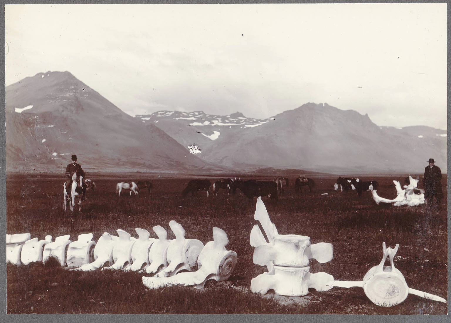
Snæfellsjökull National Park ecosystems, habitats, and plant life

The park and surrounding peninsula fall within the Iceland boreal birch forests and alpine tundra ecosystem, a biome typical of western Iceland. Vegetation reflects both the cool maritime climate and the volcanic substrate: low birch woods and willow shrubs occupy sheltered areas, while higher and more exposed terrain gives way to tundra-like heaths and moss-dominated surfaces.

More than 300 species of flowering plants and ferns have been identified across the peninsula. Among the ecological specialties is Ligusticum scoticum, known as Scots lovage or Scottish licorice-root, an edible plant found in Iceland only on the western aspects of the Snæfellsnes Peninsula. The southern coast hosts relatively undisturbed wetland habitats, which harbor a notable diversity of plant communities. Thirteen species of wading birds make use of these wetlands, alongside many other aquatic birds that depend on the coastal shallows and freshwater sites.

At sea, the Breiðafjörður bay forms a major marine ecosystem adjacent to the park. Its seaweed and kelp forests support rich invertebrate communities and provide feeding grounds for seals and seabirds. Together, the terrestrial plant communities and the nearby marine ecosystem give Snæfellsjökull National Park a layered biological character shaped by both land and sea.
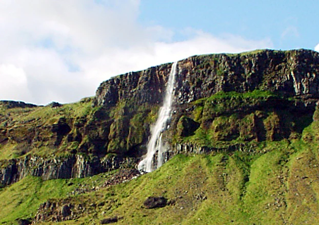
Snæfellsjökull National Park wildlife and species highlights

Snæfellsnes supports more than 60 nesting bird species. Puffins are particularly associated with the western part of the peninsula, although they are absent in winter. White-tailed eagles, protected in Iceland since 1913, began recovering their populations in the 1970s and are among the significant raptors of the area. Other birds of prey are present as well, and the short-eared owl, a protected species in Iceland, is common across parts of the peninsula.

The Arctic fox is the only land mammal native to Iceland and is the historic top carnivore of the ecosystem. Within Snæfellsjökull National Park, fox hunting has been banned since 2001, allowing the local population to develop in relative peace. Foxes on the peninsula are generally separated into highland and lowland populations, with lowland foxes displaying a reddish-brown coat year-round. The American mink, introduced after escaping into the wild in the early 1930s, has also become established, and among the four rodent species in Iceland, only the wood mouse is found in significant numbers on the peninsula.

The marine waters around the peninsula are an important part of its wildlife profile. Breiðafjörður hosts the largest seal and seabird populations in Iceland, though seal hunting has been banned nationally since 2019 following a steep decline after 1980. Killer whale pods are frequently observed off the western part of the peninsula, and other whale species are also recorded. Together, these marine mammals, seabirds, and terrestrial predators give the park a distinctive wildlife identity that reflects both Icelandic and Arctic influences.

Snæfellsjökull National Park conservation status and protection priorities

Snæfellsjökull National Park represents one of Iceland's four formally designated national parks, placing the volcano and the surrounding peninsula under the highest level of national environmental protection. The park's designation reflects the convergence of unusual ecological values: a glaciated volcano, coastal cliffs, intact lowland wetlands, and proximity to the highly productive marine environment of Breiðafjörður.

Within the park, targeted conservation measures have shaped wildlife management for decades. Fox hunting has been banned within park boundaries since 2001, offering protection to the resident Arctic fox population at a time when hunting of this species remains a topic elsewhere in Iceland. Wetland habitats along the southern coast remain relatively undisturbed, supporting wading birds and aquatic species that depend on these fragile systems.

The broader Snæfellsnes region has pursued an institutionalized path to environmental stewardship. The community committed to the EarthCheck programme in 2003 and in 2008 became the first EarthCheck-certified area in Iceland and Europe, joining a small global group of certified destinations at the time. In 2025, Snæfellsjökull National Park was designated a UNESCO Biosphere Reserve, acknowledging the park and its surrounding region as a model for balancing ecological protection, cultural heritage, and sustainable regional development.

Snæfellsjökull National Park cultural meaning and human context

Snæfellsnes is one of the principal stages of the Laxdœla saga, where it features as the homeland of major figures, including Guðrún Ósvífursdóttir, Bolli Þorleiksson, Bolli Bollasson, and Snorri Goði. According to the saga, Bolli Bollasson, said to have been born in the area, became the first West Norse member of the Varangian Guard, lending the region a notable place in the cultural memory of medieval Scandinavia.

In the 19th century, the volcano gained an additional layer of meaning through Jules Verne's 1864 novel Journey to the Center of the Earth, set in French as Voyage au centre de la Terre, and later retold and reinterpreted in Icelandic imagination under the title Leyndardómar Snæfellsjökuls. The Icelandic tradition has long associated the mountain with mystical or hidden forces, fusing indigenous folklore with the international literary fame that Verne's novel brought.

The modern cultural landscape of the peninsula is defined by its small coastal communities. Fishing villages such as Arnarstapi, Hellnar, Rif, Ólafsvík, Grundarfjörður, and Stykkishólmur have built their economies on the sea for generations, and in more recent decades have aligned their identity with sustainability and ecotourism, including the EarthCheck recognition achieved in 2008.

Top sights and standout views in Snæfellsjökull National Park

The standing landmark of the park is of course the glacier-topped Snæfellsjökull volcano, a 1,446-meter peak that ranks as one of Iceland's most recognizable natural features. Equally notable is the park's literary and folkloric heritage: the site of Verne's underground journey, and a landscape repeatedly traversed in the Laxdœla saga.

Beyond the mountain itself, the park's highlights include the dramatic southern coastline around Arnarstapi and Hellnar, the ecological richness of Breiðafjörður, and the presence of seabird cliffs where puffins nest in summer. The combined recognition of being one of Iceland's four national parks, an EarthCheck-certified community, and a 2025 UNESCO Biosphere Reserve gives the park a layered significance few Icelandic protected areas can match.

Best time to visit Snæfellsjökull National Park

Summer is the most accessible and ecologically revealing season at Snæfellsjökull National Park, when daylight extends late into the evening, coastal trails are most easily walked, and the cliffs and lowlands host their richest variety of breeding birds. Puffins are present along the western headlands during summer months and absent in winter, making this the season for the most celebrated seabird viewing in the area.

Autumn brings shifting light, the gradual retreat of migratory species, and often quieter conditions on the trails, while winter transforms the volcano into a stark white silhouette against dark skies, an ideal period for viewing the northern lights from the peninsula. Snow can limit access to some interior paths, and the summit glacier remains cold year-round, so visitors in colder months typically focus on the coastal villages and accessible scenic viewpoints rather than higher routes. Spring returns migratory birds and reawakens the lowland vegetation, offering a quieter experience before peak summer visitation.
Monthly climate preview

Long-term temperature ranges and precipitation rhythm for Snæfellsjökull National Park

Snæfellsjökull National Park Climate Normals and Monthly Weather Records

Representative coordinate records show measured monthly temperature averages alongside twelve-month precipitation rates for Snæfellsjökull National Park. Examining the complete monthly climate dataset provides deeper analytical context for long-term environmental patterns across the protected landscape.
Annual mean5 °C
0 °C10 °C
Jan
Feb
Mar
Apr
May
Jun
Jul10°
Aug10°
Sep
Oct
Nov
Dec
Warmest month
July

10.3 °C

Coolest month
February

0.5 °C

Wettest month
February

4.8 mm/day

Driest month
June

2 mm/day

Park location guide

Geography guide, regional context, and park location map for Snæfellsjökull National Park

Snæfellsjökull National Park park geography, regions, and map view in Iceland

Understand where Snæfellsjökull National Park sits in Iceland through a broader geographic reading of the surrounding landscape, nearby location context, and its mapped position within the national park landscape.

How Snæfellsjökull National Park fits into Iceland

Iceland is a Nordic island nation located between Europe and North America on the Mid-Atlantic Ridge. With a population of approximately 394,000 and an area of 103,125 km², it is one of the world's most sparsely populated countries. The country features dramatic volcanic terrain, extensive glaciers, geysers, and geothermal activity, all while maintaining a temperate climate warmed by the Gulf Stream.

Wider geography shaping Snæfellsjökull National Park in Iceland

Iceland is an island nation located in the North Atlantic Ocean between the Arctic Ocean and the Atlantic Ocean, situated on the Mid-Atlantic Ridge between Europe and North America. The interior consists of volcanic plateaus with sand and lava fields, while mountains and glaciers dominate the terrain. Numerous glacial rivers flow from the highlands through lowlands to the sea. The country sits at a latitude just south of the Arctic Circle.

Map view of Snæfellsjökull National Park

Use this park location map to pinpoint Snæfellsjökull National Park in Iceland, understand its exact geographic position, and read its mapped placement within the surrounding landscape more clearly.

Pigeon | © OpenStreetMap contributors
Park atlas

Compare surrounding volcanic terrain and regional protected landscapes across the peninsula

Explore Protected Areas and Parks Near Snæfellsjökull National Park in Western Iceland

Browse nearby national parks and protected areas sharing the volcanic and coastal geography of Snæfellsjökull National Park. Comparing adjacent protected landscapes helps trace regional environmental patterns and broader terrain diversity.
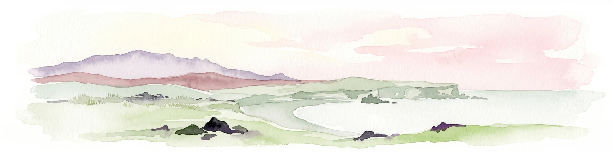
Watercolor illustration of a mountain landscape with a glacier-capped peak and surrounding green fields
National parkIceland
About 4.4 km away#1 closest

Southeast

Snæfellsjökull National Park: Geography and Protected Landscapes of Western Iceland

Glacial volcanoes, lava fields, and coastal topography.

Snæfellsjökull National Park sits at the western tip of the Snæfellsnes peninsula, creating a unique intersection of glacial, volcanic, and maritime environments. This database provides structured insights into the park's rugged terrain, including its moss-covered lava fields, sea-carved cliffs, and the namesake glacier that dominates the local landscape.

Established
2001
IUCN
II
National parkIceland
About 4.5 km away#2 closest

East

Snæfellsjökull National Park: Volcanic Stratovolcano and Coastal Protected Area in Iceland

Mapped geologic features, glacier terrain, and coastal volcanic landmarks.

Snæfellsjökull National Park features a unique assembly of volcanic landforms, including the iconic glacier-capped stratovolcano, the towering Lóndrangar basalt pinnacles, and symmetrical craters like Saxhóll. This protected area offers deep insights into the glacial and submarine origins of western Iceland through its diverse palagonite ridges and extensive lava plains.

Area
170 km²
Established
2001
Relief
Mountain
Scope
Terrestrial
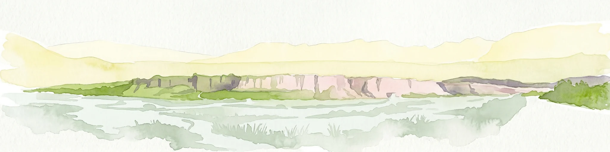
Watercolor painting depicting a landscape with cliffs, a body of water, and distant hills under a light sky
National parkSouthern Region
About 136 km away#3 closest

Southeast

Þingvellir National Park: Witness Tectonic Plates and Ancient Icelandic Governance

Explore the rift valley and historic parliament site in Iceland's Southern Region.

Þingvellir National Park offers a singular opportunity for geographic discovery, situated in Iceland's Southern Region. This protected national park is globally recognized for its visible expression of the Mid-Atlantic Ridge, where the North American and Eurasian tectonic plates actively diverge, creating a dramatic rift valley. Moreover, Þingvellir served as the site of the Althing, Iceland's ancient parliament, making it a crucial historical landmark. Explore this landscape to understand both powerful geological processes and the foundations of Icelandic democratic history through its mapped terrain.

Area
92.7 km²
Established
1930
IUCN
II
Relief
Lowland
Natural monumentIceland
About 204 km away#4 closest

East

Hveravellir Natural Monument: Geothermal Plateau Geography and Highland Protected Areas

Central Iceland geothermal field and volcanic plateau

Located on the Kjölur route, Hveravellir serves as a protected natural monument characterized by high-temperature geothermal activity. The area features a concentration of fumaroles, geysers, and mineral-rich springs set upon a stark volcanic plateau. This site offers significant insights into the geological processes shaping the central highlands of Iceland, blending ancient lava fields with active thermal surface transformations.

Area
2.5 km²
Relief
Highland
Climate
Subpolar
Access
Moderate access
Nature reserveIceland
About 232 km away#5 closest

Southeast

Surtsey Nature Reserve: Mapping Volcanic Landscapes and Ecological Succession in Iceland

A pristine laboratory of North Atlantic volcanic terrain.

Surtsey represents a rare geological event, a volcanic island created by sustained eruptions and now protected as a strict nature reserve. The island acts as a primary research site for observing how life colonizes barren volcanic substrates, from mosses and insects to seabird colonies. Its mapped boundaries encompass dramatic basaltic lava flows and tephra deposits, providing a vital window into the formative processes of oceanic islands.

Area
1.4 km²
Established
1963
Relief
Upland
Climate
Subpolar
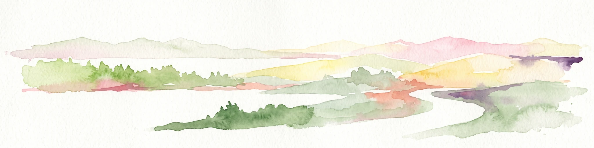
Watercolor illustration showing a landscape with green fields, a winding path, pink flowers, and mountains in the background
National parkIceland
About 250 km away#6 closest

East

Vatnajökull National Park: Iceland's Expansive Protected Glacier and Volcanic Terrain

Mapped boundaries of a UNESCO World Heritage site dynamic with fire and ice.

Vatnajökull National Park offers a profound exploration of one of Earth's most dynamic natural environments. This Icelandic national park protects the vast Vatnajökull ice cap, a landscape shaped by active volcanoes and powerful glacial forces, creating a region of extraordinary geographic diversity. Discover the mapped terrain, from subglacial mountain ranges to dramatic caldera systems, and understand the unique protected area context of this significant European natural heritage.

Area
14,967 km²
Established
2008
IUCN
II
Relief
Mountain
Nature reserveIceland
About 332 km away#7 closest

East

Mývatn Nature Reserve: Mapping the Volcanic Lakes and Tephra Formations of Northern Iceland

Protected wetland landscapes and volcanic rift zone geography.

Mývatn represents a complex of protected wetlands and volcanic landforms, including the Hverfjall explosion crater and the Skútustaðir pseudocraters. This geography-rich basin in northern Iceland offers insight into post-glacial volcanic activity and serves as an internationally significant breeding site for diverse bird populations within a compact, walkable terrain.

Area
37 km²
Relief
Upland
Climate
Polar
Access
Easy access
Watercolor illustration showing a mountain landscape with green valleys, pink mountains, and a winding river
National parkIceland
About 344 km away#8 closest

East

Skaftafell National Park: Iceland's Accessible Protected Landscape with Glacial Terrain and Basalt Columns

Discover glacial landscapes and volcanic geology.

Skaftafell National Park is a vital protected area in Southeast Iceland, offering a unique atlas-level view of dramatic glacial landscapes. Located at the base of Vatnajökull, Europe's largest glacier, the park features accessible hiking trails that traverse outwash plains, birch woodlands, and glacial tongues like Skaftafellsjökull. Explore the iconic Svartifoss waterfall, framed by striking basalt columns, and understand the park's dynamic terrain shaped by volcanic activity and glacial processes, providing rich geographic context for protected landscape discovery.

Established
1967
IUCN
II
Scope
Terrestrial

Common questions about visiting, size, designation, and location context for Snæfellsjökull National Park

Snæfellsjökull National Park FAQs for park facts, access, geography, and protected area context

Find quick answers about Snæfellsjökull National Park, including protected-area facts, park geography, trail and visitor context, and how the park fits into its surrounding country and regional landscape.
MoriAtlas Explorer

Continue Your Protected Areas Search Across the Global Atlas

Deepen your exploration by continuing the structured search for national parks and protected areas worldwide. Utilize the comprehensive filtering capabilities to compare different conservation landscapes and refine your understanding of global park geography. Discover more about the distribution and characteristics of protected natural areas.

Global natural geography