Why South Bruny National Park stands out
South Bruny National Park is best known for its dramatic coastal landscape featuring dolerite cliff formations, pristine beaches, and the historic Cape Bruny Lighthouse standing sentinel over the southern Tasman Sea. The park is equally significant as a sanctuary for two of Australia's rarest birds: the forty-spotted pardalote, one of the rarest birds in the country which relies on old-growth white gum habitat, and the swift parrot which breeds in the park's blue gum forests. The park also supports unusual white variants of Bennett's wallaby and hosts a colony of Australian fur seals at The Friars islands. The combination of coastal wilderness, ecological significance, and historic lighthouse makes South Bruny a distinctive Tasmanian protected area.
South Bruny National Park history and protected-area timeline
South Bruny National Park was established in 1997 as a recognition of the area's outstanding coastal scenery, Aboriginal and historic heritage, and the need to protect several threatened species endemic to Bruny Island. The declaration came after growing recognition that the island's unique biodiversity, particularly its endangered bird populations, required formal protection beyond what existing reserves provided. The park embraces the Labillardiere Peninsula, named in honor of French botanist Jacques Labillardiere who participated in the Bruni d'Entrecasteaux expedition to Tasmania in the late 18th century. The Nuenonne Aboriginal people historically occupied South Bruny, and the landscape contains culturally significant sites that are now protected within the park. The Cape Bruny Lighthouse, constructed in 1838, represents the historic European presence in the area and remains an important cultural feature. Several smaller islands, including Partridge Island, Green Island, and The Friars, were reserved as part of the national park for their ecological significance, particularly as seabird breeding sites and habitat for rare species.
South Bruny National Park landscape and geographic character
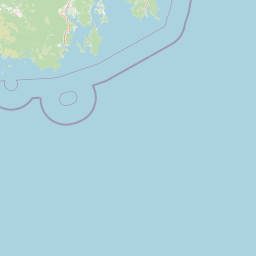
The landscape of South Bruny National Park is defined by its coastal setting and dramatic topography. Dolerite cliffs characterize much of the dramatic coastline, particularly along the southern and western shores where these dark igneous rock formations create steep, weathered faces that contrast with the white sand beaches below. Continuous expanses of beach stretch from Fluted Cape around the southern tip to encompass Cloudy Bay and the whole southern part of Great Taylors Bay. The park's highest point, Mount Bruny, rises to 504 meters above sea level and provides panoramic views over the surrounding coastal terrain and the southern Tasman Sea. Small islands punctuate the coastal waters, with The Friars being the most southerly point of the park and serving as an important haul-out site for Australian fur seals. The coastal terrain supports a mosaic of vegetation types, with heathland dominating exposed headlands and coastal slopes while eucalypt woodland covers the more sheltered valleys and ridges. The landscape creates a sense of isolation and wilderness despite the park's proximity to Hobart.
South Bruny National Park ecosystems, habitats, and plant life
The ecological character of South Bruny National Park is defined by a mosaic of plant communities that support exceptional biodiversity. Much of the park's vegetation comprises dry sclerophyll eucalypt woodland, with brown-top stringy bark as the dominant tree species, along with pockets of white gum, blue gum, and white peppermint. Coastal heathland covers large areas and supports a remarkable diversity of plant species, including several rare and endemic orchids such as the endangered chestnut leek orchid and the pretty leek orchid, which occurs in some of the only known populations globally. Small patches of wet eucalypt forest and temperate rainforest exist in more sheltered locations, adding to the habitat diversity. The park contains several species of high conservation significance, including the eyebright which occurs in only four populations statewide, with South Bruny being the only place where it is protected within a national park. The coastal communities feature she-oaks and casuarinas that tolerate the salt spray and strong winds typical of the exposed coastline.
South Bruny National Park wildlife and species highlights
South Bruny National Park supports a remarkable diversity of wildlife, with particular significance attached to its bird populations. The park provides critical habitat for two of Australia's most endangered bird species. The forty-spotted pardalote, one of the rarest birds in Australia, survives in only two populations, both on Bruny Island, with the park protecting essential old-growth white gum habitat essential for the species' survival. The swift parrot, a migratory species breeding in Tasmania, uses the park's blue gum forests as key nesting sites. All twelve of Tasmania's endemic bird species are present in the park. Mammals include Bennett's wallaby, common brushtail possum, and Tasmanian pademelon, with the park protecting a small population of unusual white wallabies not found elsewhere. Australian fur seals colony occupies The Friars rocks, while little penguins and hooded plovers breed along the coast. Several birds of prey including the white-bellied sea eagle, Tasmanian wedge-tailed eagle, and the endangered grey goshawk hunt throughout the park.
South Bruny National Park conservation status and protection priorities
South Bruny National Park plays a vital role in conserving some of Australia's most threatened species and unique ecosystems. The park provides essential protected habitat for the forty-spotted pardalote, which has declined dramatically across its former range and now survives only on Bruny Island where the national park protects crucial old-growth white gum habitat. The swift parrot, estimated at only about 1,000 breeding pairs total, finds one of its core breeding areas within the park despite approximately 80 percent of the species' habitat occurring outside protected areas. The park protects several rare plant species including endangered orchids and the eyebright, which occurs in only four populations statewide. Conservation challenges include habitat fragmentation from land clearing, competition with invasive species for nest hollows, predation by feral cats which carry toxoplasmosis, and the impacts of vehicle traffic on beaches used by breeding shorebirds. Management focuses on habitat rehabilitation, invasive species control, visitor impact minimization, and maintaining the connectivity essential for threatened species survival.
South Bruny National Park cultural meaning and human context
South Bruny National Park encompasses landscape of significant Aboriginal heritage, representing the traditional Country of the Nuenonne people who occupied South Bruny Island prior to European settlement. Several cultural sites exist within the park boundaries and are protected, with some publicized to raise awareness of the area's indigenous significance. The park also bears the name of French botanist Jacques Labillardiere, after whom the Labillardiere Peninsula is named, commemorating his role as author of the first general flora of Australia and participant in the d'Entrecasteaux expedition that explored Tasmanian waters in the late 18th century. The Cape Bruny Lighthouse, constructed in 1838, represents the historic European presence and remains an important cultural landmark within the park. The interplay of Aboriginal heritage, European exploration history, and ongoing conservation values creates a layered cultural context for this protected landscape.
Top sights and standout views in South Bruny National Park
South Bruny National Park offers a distinctive combination of coastal wilderness, historic landmarks, and exceptional wildlife significance. The Cape Bruny Lighthouse stands as an iconic feature, one of Tasmania's oldest lighthouses providing dramatic views over the southern coast. The park protects critical habitat for the endangered forty-spotted pardalote and swift parrot, making it internationally significant for bird conservation. The Friars islands host a colony of Australian fur seals, while the coastal cliffs and beaches create a scenic landscape typical of Tasmanian exposed shores. Offshore islands including Partridge Island and Green Island provide important seabird breeding habitat. The dolerite cliff formations at Fluted Cape and continuous beach expanses through Cloudy Bay represent the park's dramatic coastal character.
Best time to visit South Bruny National Park
South Bruny National Park can be visited year-round, though autumn and spring typically offer the most comfortable conditions for outdoor exploration. The park's coastal location means weather can change rapidly, and visitors should be prepared for Tasmania's variable conditions. Summer months bring warmer temperatures but also higher visitor numbers, particularly around Cloudy Bay beach areas. Autumn often provides calm seas and milder temperatures, making it ideal for coastal walking and wildlife observation. Winter brings cooler conditions but fewer visitors, though some tracks may be muddy. The breeding season for little penguins and hooded plovers occurs during spring and summer, making this period particularly significant for wildlife viewing, though visitors should be mindful of nesting areas. Birdwatchers interested in the forty-spotted pardalote and swift parrot may find the breeding season more rewarding for sightings.