


Mori Atlas logo
Nature reserveSpioenkop Dam Nature Reserve

Mapping the convergence of reservoir ecosystems, temperate woodlands, and historic battlefield topography.

Spioenkop Dam Nature Reserve: A Detailed Geographic Study of Protected Inland Landscapes in KwaZulu-Natal

Spioenkop Dam Nature Reserve represents a critical protected area in KwaZulu-Natal, South Africa, encompassing approximately 4,400 hectares of diverse inland terrain. Centered on the extensive reservoir, the reserve provides a vital intersection between aquatic habitats and the rolling midland countryside. Its northern edge is dominated by the prominent Spioenkop hill, a significant landmark that marks both the topographic skyline and the site of a major historic conflict. This protected landscape offers a unique look at how river systems and historical heritage integrate within the broader geography of the region.

damreservoirfreshwater habitatKwaZulu-Natalinland reservebattlefield heritage
A graphic illustration showing a flat, dry grassy landscape in the foreground, with acacia trees and a river leading toward a central waterfall cascading from a large, craggy mountain range under a light sky.

Spioenkop Dam Nature Reserve

Nature reserve

Park overview

Structured park overview, official facts, and landscape profile for Spioenkop Dam Nature Reserve

Spioenkop Dam Nature Reserve park facts, protected area profile, and essential visitor context

Review the core facts for Spioenkop Dam Nature Reserve, including designation, size, terrain, visitor scale, habitats, and operating context in one park-focused overview.

About Spioenkop Dam Nature Reserve

Spioenkop Dam Nature Reserve sits within the interior of KwaZulu-Natal, a province in eastern South Africa known for its varied terrain, from coastal lowlands to the rolling interior midlands. The reserve occupies a relatively compact footprint of about 4,400 hectares, but it packs several distinct elements into that space. At its core lies the Spioenkop Dam and its reservoir, a sizable body of fresh water that shapes both the scenery and the ecology of the protected area. Along the northern boundary rises the hill known as Spioenkop, or Spion Kop, which lends the reserve its name and gives the landscape a prominent topographical feature visible from much of the surrounding terrain.

The reserve is framed by its proximity to human settlement. Winterton is the closest town, while Ladysmith, a larger regional center of historical significance, lies not far away. Despite this accessibility, the reserve preserves a working natural environment where aquatic habitat along the dam meets the broader KwaZulu-Natal countryside of grasslands, valley bushveld, and wooded slopes. The temperate climate, with its seasonal rainfall pattern concentrated between March and October, supports a vegetation profile that remains relatively green and lush through much of the year, contrasting with the drier western parts of the country.

Established in 1975 and administered by Ezemvelo KZN Wildlife, the provincial conservation authority for KwaZulu-Natal, the reserve functions as part of a wider network of protected areas across the province. Its identity is unusual in combining a strong natural and water-based focus with an equally important historical association, since the road-accessible Spion Kop battlefield remains one of the most visited sites of military heritage in the region. The result is a reserve that speaks to two themes at once: the conservation of inland aquatic and terrestrial habitat in the South African midlands, and the preservation of a landscape tied to a defining moment in the country's history.

Quick facts and research context for Spioenkop Dam Nature Reserve

Spioenkop Dam Nature Reserve is a protected area of about 4,400 hectares located in KwaZulu-Natal, South Africa. It surrounds the Spioenkop Dam and its reservoir, with the eponymous Spioenkop hill forming part of the northern boundary. The closest town is Winterton, and the larger town of Ladysmith lies nearby. The reserve was established in 1975 and is governed by Ezemvelo KZN Wildlife. The climate is temperate, with annual rainfall of roughly 814 mm, concentrated between March and October.

Protection and recognition

Terrestrial protected area classification, management scope, and recognition metrics

Spioenkop Dam Nature Reserve Protection Status and Regional Designation Record

Spioenkop Dam Nature Reserve features a documented terrestrial protection scope and established administrative boundaries within the regional landscape. Official conservation data outlines the structural designation framework and governance context recorded for the protected area.

Protection details

Protection scope
Terrestrial
Transboundary protection
No
Park context

Deeper park guide and search-rich context for Spioenkop Dam Nature Reserve

Spioenkop Dam Nature Reserve history, landscape, wildlife, and travel context

Explore Spioenkop Dam Nature Reserve through its history, landscape character, ecosystems, wildlife, conservation priorities, cultural context, and seasonal travel timing in a structured park guide built for atlas discovery and search intent.

Why Spioenkop Dam Nature Reserve stands out

Spioenkop Dam Nature Reserve is best known for encircling the Spioenkop Dam, whose waters and shoreline form the centerpiece of the protected landscape. It is equally recognized for its connection to the Spion Kop battlefield, a site of major historical importance during the Boer War that sits along the reserve's northern edge and is accessible by road from within its boundaries. Beyond these two anchor features, the reserve is valued for its combination of water, woodland, and typical KwaZulu-Natal midland scenery in a temperate, seasonally moist climate.
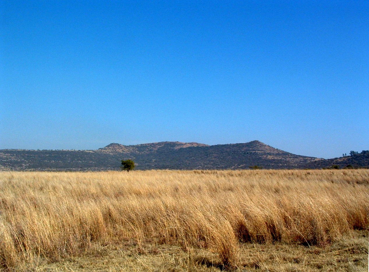
A wide shot of a dry, golden grassy plain in the foreground under a clear, bright blue sky, with a low-lying mountain range in the background.
The landscape of Spioenkop Dam Nature Reserve, featuring the prominent Spion Kop mountain in the distance.

Spioenkop Dam Nature Reserve history and protected-area timeline

Spioenkop Dam Nature Reserve was formally established in 1975 as a protected area in the province of KwaZulu-Natal. Its creation reflects the broader pattern of conservation planning in late twentieth-century South Africa, when provincial authorities worked to set aside parcels of land around dams, river systems, and ecologically valuable terrain to safeguard them from uncontrolled development.

The reserve is inseparably linked to an older and far more dramatic history. The hill along its northern boundary, known as Spioenkop or Spion Kop, was the site of the Battle of Spion Kop during the Second Boer War, a fierce and ultimately costly engagement that has remained a touchstone of South African and British military memory. Although the reserve was only formally designated in the latter half of the twentieth century, the landscape it protects includes the approaches to and surroundings of this internationally known battlefield. The battlefield itself remains reachable by road from the reserve, extending the site's significance well beyond purely natural heritage.

Since 1975, the area has been managed within KwaZulu-Natal's provincial conservation system, today under the stewardship of Ezemvelo KZN Wildlife. Over the decades, this institutional framework has provided continuity for the reserve's protection, integrating it into wider regional efforts to manage freshwater habitat, terrestrial ecosystems, and heritage landscapes in the South African interior.

Spioenkop Dam Nature Reserve landscape and geographic character

The landscape of Spioenkop Dam Nature Reserve is defined by the interplay between its impoundment and the surrounding inland KwaZulu-Natal terrain. The Spioenkop Dam and its reservoir form the visual and ecological centerpiece, with the dam's waters backed up against a valley setting typical of the region's river systems. The shoreline and fringing terrain provide a transition zone between open water and terrestrial habitat, a pattern that shapes much of the reserve's scenery.

Dominating the northern boundary is the Spioenkop hill, the same hill that gave the dam and the reserve their name. This prominent landform rises above the reservoir and gives the protected area a clear topographical anchor. From many vantage points within the reserve, the hill forms a recognizable skyline element, framing views and reinforcing a sense of enclosure.

Away from the water and the hill, the reserve extends into the broader midland landscape characteristic of interior KwaZulu-Natal. This terrain combines gently rolling ground with patches of woodland, open grassland, and valley vegetation. The temperate climate and the seasonal rainfall, concentrated between roughly March and October, keep the countryside relatively well vegetated for much of the year, lending the reserve a verdant, water-rich feel that contrasts with the drier regions further west in South Africa.

Spioenkop Dam Nature Reserve ecosystems, habitats, and plant life

The natural character of Spioenkop Dam Nature Reserve emerges from the meeting of three broad habitat types: the open water and shoreline of the dam, the slopes and summit area of Spioenkop hill, and the surrounding inland countryside of KwaZulu-Natal. Each of these creates its own ecological conditions, and together they produce a mosaic typical of mid-altitude South African protected areas.

The dam itself is the most distinctive ecological asset. As a sizable standing body of fresh water, it supports aquatic plant communities along its margins and provides a resource for waterbirds and other fauna that depend on reservoir habitat. The fringing zones, where water meets land, tend to support denser vegetation and offer particularly rich habitat for a range of bird and animal species.

On the slopes of Spioenkop hill and across the wider reserve, the vegetation reflects the region's temperate climate and seasonal rainfall, with annual precipitation of roughly 814 mm falling mainly between March and October. This moisture regime supports a mix of woodland, grassland, and thicker bush patches characteristic of KwaZulu-Natal's midland environments. The combination of varied topography, dependable rainfall, and a mix of aquatic and terrestrial habitats gives the reserve an ecological profile that is more diverse than its relatively compact size might suggest.

Spioenkop Dam Nature Reserve wildlife and species highlights

Spioenkop Dam Nature Reserve draws much of its wildlife interest from the presence of the dam and its surrounding habitats. Freshwater impoundments of this kind in KwaZulu-Natal typically support a range of waterbirds and waders along the shoreline, as well as fish and aquatic invertebrates within the reservoir itself. The margins of the dam, where water and land intermingle, tend to be the most active areas for visible wildlife.

Beyond the water, the reserve's mix of hill country, woodland patches, and open ground provides habitat for a variety of terrestrial species typical of the region. The temperate climate and reliable seasonal rainfall support consistent forage and cover, which in turn sustains populations of smaller mammals, reptiles, and a broad community of land birds. The diverse vegetation structure, ranging from denser thickets to more open grassy areas, contributes to this habitat variety.

Although the reserve is relatively compact at around 4,400 hectares, the combination of aquatic, slope, and open-country habitats allows it to host a richer wildlife assemblage than its size alone might imply. The presence of the dam elevates its importance for water-associated species and adds a distinct ecological dimension compared with purely terrestrial reserves in the same region.

Spioenkop Dam Nature Reserve conservation status and protection priorities

As a formally protected area under the management of Ezemvelo KZN Wildlife, Spioenkop Dam Nature Reserve plays a defined role within KwaZulu-Natal's broader conservation network. Its designation in 1975 brought the dam and its surroundings under a structured framework of protection, helping to safeguard them from incompatible development and to ensure ongoing ecological management.

The reserve's conservation value lies in the combination of freshwater habitat, hill terrain, and inland KwaZulu-Natal countryside within a single, relatively accessible protected area. Preserving the dam environment is significant in its own right, as inland freshwater systems in South Africa face ongoing pressure from water demand, land use change, and invasive species. The reserve helps maintain a functioning example of such a system, with its associated shoreline and aquatic vegetation.

Equally, the reserve extends conservation principles into a landscape of strong cultural and historical resonance. By integrating the natural setting around Spioenkop hill with management that protects both ecological and heritage values, the reserve illustrates an approach in which conservation serves multiple purposes, from safeguarding biodiversity to preserving the wider character of the surrounding landscape.

Spioenkop Dam Nature Reserve cultural meaning and human context

The cultural weight of Spioenkop Dam Nature Reserve rests heavily on the hill at its northern edge. Spioenkop, or Spion Kop, was the site of the Battle of Spion Kop during the Second Boer War, a confrontation of international historical significance. The battlefield remains reachable by road from within the reserve, linking the protected natural area to one of the most recognizable sites of military heritage in southern Africa.

This connection gives the reserve a layered identity. Visitors encounter not only a landscape of dam, hill, and surrounding countryside, but also a setting deeply associated with events that shaped late nineteenth and early twentieth century history in the region. The reserve's management, through Ezemvelo KZN Wildlife, sits alongside this heritage dimension, framing the area as a place where natural and historical preservation come together.

The surrounding human geography reinforces this layered character. Winterton lies close by as the nearest town, while Ladysmith, a city with strong historical associations of its own from the same era, is within easy reach. The reserve thus sits within a regional landscape where human settlement, military memory, and conservation intersect.

Top sights and standout views in Spioenkop Dam Nature Reserve

Spioenkop Dam Nature Reserve stands out for anchoring a sizable freshwater impoundment within a protected landscape in KwaZulu-Natal. The Spioenkop Dam and its reservoir define both the scenery and the ecology of the reserve, supporting water-associated habitat and giving the area a clear natural focus.

Equally distinctive is the reserve's relationship with the Spion Kop battlefield, which lies along its northern boundary and remains accessible by road. This makes the reserve unusual in offering a combined experience of inland aquatic habitat and one of South Africa's most significant historical landscapes, all within a compact, accessible protected area of about 4,400 hectares.

Best time to visit Spioenkop Dam Nature Reserve

The climate of Spioenkop Dam Nature Reserve is temperate and rainfall-driven, with most precipitation falling between roughly March and October. Visiting during and after this wetter period tends to coincide with the greenest conditions across the reserve, when the dam's margins, slopes, and surrounding countryside look their most lush.

Outside the main rainfall window, the reserve still offers a temperate inland setting, though the countryside may appear drier and the reservoir and its shoreline habitats can feel more exposed. For visitors particularly interested in water-associated birdlife and freshwater scenery, the wetter months and the period immediately following them are likely to provide the richest conditions, while those drawn primarily by the historical landscape of Spion Kop will find the site accessible throughout much of the year.
Monthly climate preview

Long term representative measurements tracking monthly temperature and precipitation variation across protected terrain

Spioenkop Dam Nature Reserve Climate Normals and Annual Temperature Patterns

Spioenkop Dam Nature Reserve exhibits a measured annual cycle defined by warm summer months with regular precipitation and cooler winter periods featuring subzero overnight minimums. Examining the complete monthly climate dataset provides structured meteorological normals for a representative coordinate at 1394 meters elevation.
Annual mean17 °C
10 °C22 °C
Jan22°
Feb21°
Mar19°
Apr16°
May13°
Jun10°
Jul10°
Aug13°
Sep17°
Oct19°
Nov20°
Dec21°
Warmest month
January

21.5 °C

Coolest month
July

10.3 °C

Wettest month
January

5 mm/day

Driest month
June

0.4 mm/day

Park location guide

Geography guide, regional context, and park location map for Spioenkop Dam Nature Reserve

Spioenkop Dam Nature Reserve park geography, regions, and map view in South Africa

Understand where Spioenkop Dam Nature Reserve sits in South Africa through a broader geographic reading of the surrounding landscape, nearby location context, and its mapped position within the national park landscape.

How Spioenkop Dam Nature Reserve fits into South Africa

South Africa is the southernmost country in Africa, spanning 1.22 million km² with a population of over 63 million. The country operates with three capital cities, Pretoria (executive), Cape Town (legislative), and Bloemfontein (judicial), and is renowned for its biodiversity, national parks, and multicultural society.

Wider geography shaping Spioenkop Dam Nature Reserve in South Africa

South Africa occupies the southernmost region of Africa, with coastline along both the Atlantic Ocean to the west and the Indian Ocean to the east. The interior features elevated plateaus including the Highveld, with the Drakensberg escarpment marking the eastern highlands. The country shares borders with Namibia, Botswana, Zimbabwe, Mozambique, Eswatini, and Lesotho.

Map view of Spioenkop Dam Nature Reserve

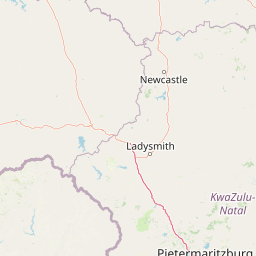
Use this park location map to pinpoint Spioenkop Dam Nature Reserve in South Africa, understand its exact geographic position, and read its mapped placement within the surrounding landscape more clearly.

Pigeon | © OpenStreetMap contributors

Location context for Spioenkop Dam Nature Reserve

KwaZulu-Natal

Visual reference guide to reservoir habitats, midland terrain, and protected reserve views

Spioenkop Dam Nature Reserve Photos and Landscape Scenery

Visual documentation captures the freshwater expanse, rolling midland terrain, and prominent hill topography that define the protected area. Examining these environmental details reveals the natural character and scenic composition of the inland KwaZulu-Natal reserve.

A wide shot of a dry, golden grassy plain in the foreground under a clear, bright blue sky, with a low-lying mountain range in the background.

Park atlas

Compare regional KwaZulu-Natal reserves and connected conservation terrain.

Parks Near Spioenkop Dam Nature Reserve and Surrounding Protected Areas

Browsing other parks near Spioenkop Dam Nature Reserve reveals wider regional conservation patterns across interior South Africa. Exploring adjacent protected landscapes provides valuable geographical context for regional terrain comparison.
A watercolor illustration featuring soft, green rolling hills in the foreground with pale, layered mountain peaks in the background, set against a plain white field.
Protected areaKwaZulu-Natal
About 33 km away#1 closest

South

Maloti-Drakensberg Park Geography: Mountain Escarpments and Alpine Plateau Exploration

A transboundary protected landscape spanning South Africa and Lesotho

Spanning the core of the Drakensberg mountain system, Maloti-Drakensberg Park provides a unique window into high-altitude biodiversity and geological drama. The protected area features basalt cliffs, rolling valleys, and an extensive plateau, forming a critical ecological and cultural corridor. This atlas entry covers the topographic features and spatial distribution of one of southern Africa's most significant protected landscapes.

Area
2,493.13 km²
Established
2001
Relief
Mountain
Climate
Alpine
Protected areaKwaZulu-Natal
About 33 km away#2 closest

South

uKhahlamba-Drakensberg Park: Protected Mountain Landscapes and Escarpment Geography in South Africa

Exploring the basalt cliffs and alpine plateau of KwaZulu-Natal.

uKhahlamba-Drakensberg Park encompasses an expansive protected region where the Drakensberg escarpment rises sharply from the foothills of KwaZulu-Natal. This atlas record details the park landscape, including its transition from sandstone terraces to high-altitude basalt, its extensive river gorges, and the concentration of archaeological cave sites. Use this resource to understand the geographic scale of this transboundary conservation area.

Area
2,429.13 km²
Relief
Mountain
Climate
Temperate
Access
Access unknown
Wildlife reserveKwaZulu-Natal
About 50 km away#3 closest

East

Weenen Game Reserve: Wildlife and Restored Acacia Savanna in Inland KwaZulu-Natal

A mapped wildlife reserve and ecological restoration project

Located in the inland reaches of KwaZulu-Natal, Weenen Game Reserve represents a significant success in landscape recovery. The reserve protects a distinct mix of dry tall grassveld, dense thornveld, and valley bushveld, providing critical habitat for black and white rhinoceros, giraffe, and numerous bird species. This atlas entry details the physical terrain, drainage lines, and the engineering history that transformed the land into a functioning sanctuary.

Area
50.09 km²
Established
1975
Relief
Upland
Climate
Subtropical
State or regional parkKwaZulu-Natal
About 56 km away#4 closest

West

Royal Natal National Park: State or Regional Park in KwaZulu-Natal's Geography

Mapped boundaries and landscape context for South African protected areas.

Royal Natal National Park serves as a vital protected landscape within the diverse geography of KwaZulu-Natal, South Africa. This state or regional park offers a focused point for atlas exploration, allowing for a detailed understanding of its mapped boundaries and regional significance. By examining Royal Natal National Park, users can gain specific insights into South Africa's network of protected natural areas and their distribution, enriching overall geographic comprehension.

Area
80.94 km²
Established
1916
Relief
Mountain
Access
Moderate access
National parkFree State
About 72 km away#5 closest

West

Golden Gate Highlands National Park: Protected Area Atlas & Geographic Exploration

Mapping the natural terrain and boundaries of this national park.

Understand the geographic scope and protected landscape of Golden Gate Highlands National Park. This detail page provides an atlas-informed perspective on its natural terrain, mapped boundaries, and regional context within South Africa's Free State. It serves as a foundational entry point for exploring the park's specific geography and protected-area status.

Area
340 km²
Established
1963
Relief
Mountain
Climate
Temperate
Nature reserveKwaZulu-Natal
About 113 km away#6 closest

South

Impendle Nature Reserve: Protecting Endangered Grasslands and Mistbelt Ecosystems

A highland conservation sanctuary in the KwaZulu-Natal region

Located in the mist-prone foothills of the Drakensberg, Impendle Nature Reserve stands as a critical block of surviving Midlands Mistbelt Grassland. The reserve terrain combines rugged dolerite ridges with moisture-rich seepage zones and wetlands, providing a specialized habitat for threatened bird species. This protected area remains a significant site for regional biodiversity, emphasizing scientific conservation over expansive development within the KwaZulu-Natal landscape.

Area
30.46 km²
Established
1983
IUCN
IV
Relief
Upland
National parkLeribe District
About 114 km away#7 closest

West

Ts'ehlanyane National Park: Indigenous Forest & Maloti Mountain Protected Landscape

Explore unique terrain and endemic plant habitats.

Ts'ehlanyane National Park is a vital protected area in Lesotho's Leribe District, distinguished by its rare indigenous forest and the prevalence of berg bamboo. This national park offers insight into unique altitudinal landscapes and botanically significant ecosystems, situated within the expansive Maloti Mountains. Its protected status makes it a key destination for understanding the regional geography and the conservation of specialized natural habitats.

IUCN
II
Relief
Mountain
Climate
Temperate
Access
Moderate access
National parkQacha's Nek District
About 137 km away#8 closest

South

Sehlabathebe National Park: Mapped Protected Landscape in Lesotho's Maloti Mountains

Explore high-altitude terrain, waterfalls, and ancient rock art sites.

Sehlabathebe National Park stands as a protected national park within the rugged Maloti Mountains of Lesotho's Qacha's Nek District. This destination is vital for understanding the geographic context of protected areas, featuring dramatic cliffs, iconic waterfalls like Tsoelikana, and numerous rock art sites that speak to its cultural and historical significance. Its high-altitude Afro-Alpine and sub-alpine ecosystems offer unique landscape characteristics and support notable biodiversity, making it a key point of interest for atlas-driven exploration of natural and protected terrains.

Area
69.5 km²
Established
1969
IUCN
IV
Relief
Mountain

Common questions about visiting, size, designation, and location context for Spioenkop Dam Nature Reserve

Spioenkop Dam Nature Reserve FAQs for park facts, access, geography, and protected area context

Find quick answers about Spioenkop Dam Nature Reserve, including protected-area facts, park geography, trail and visitor context, and how the park fits into its surrounding country and regional landscape.
MoriAtlas Explorer

Continue Your Protected Areas Search Across the Global Atlas

Deepen your exploration by continuing the structured search for national parks and protected areas worldwide. Utilize the comprehensive filtering capabilities to compare different conservation landscapes and refine your understanding of global park geography. Discover more about the distribution and characteristics of protected natural areas.

Global natural geography

