
Mori Atlas logo
Nature reserveStation d'écologie de Lamto

Mapping the ecological forest and savanna contact zone along the Bandama River system

Station d'écologie de Lamto: A Protected Nature Reserve within the Ivory Coast Savanna Mosaic

The Station d'écologie de Lamto is a protected nature reserve located in the Taabo department of central Ivory Coast, encompassing 2,500 hectares of forest and savanna mosaic. Positioned where southern humid forests meet the Borassus palm savanna of the Baoulé V region, the site serves as a vital laboratory for studying tropical savanna ecosystems and riverine landscape dynamics. Its geographic setting provides a long-term record of vegetation transitions along the Bandama River.

ecological research stationtropical ecologysavanna ecosystemBorassus palm savannaforest-savanna transitionstrict nature reserve
A stylized digital illustration of a lush tropical environment featuring a large cliff face with a waterfall cascading into a valley, surrounded by savanna vegetation and palm trees under a light sky.

Station d'écologie de Lamto

Nature reserve

Park overview

Structured park overview, official facts, and landscape profile for Station d'écologie de Lamto

Station d'écologie de Lamto park facts, protected area profile, and essential visitor context

Review the core facts for Station d'écologie de Lamto, including designation, size, terrain, visitor scale, habitats, and operating context in one park-focused overview.

About Station d'écologie de Lamto

The Station d'écologie de Lamto occupies a distinctive position in the institutional and scientific landscape of West African ecology. Although it is formally classified as a strict nature reserve under IUCN Category Ia, its primary identity is that of a research station rather than a conventional public national park. The site lies in central Côte d'Ivoire, in the department of Taabo, on the banks of the Bandama River, and falls within the 2,500 hectare Lamto Natural Reserve. Its particular ecological value comes from its placement right at the contact between the humid forests of southern Côte d'Ivoire and the characteristic Borassus aethiopum, or rônier, palm savanna of the Baoulé 'V,' a transition zone that has fascinated ecologists for decades.

From its founding in 1962, the station was conceived as a base for sustained scientific inquiry into how herbaceous biocenoses are structured and how they function. The founders, Maxime Lamotte and Jean-Luc Tournier, brought their earlier experience from work at Mount Nimba and chose Côte d'Ivoire for the cooperative climate offered by the national government. Over the following four decades, the station became a focal point for multidisciplinary tropical ecology in the region, operating under the aegis of the École normale supérieure in Paris, initially through its zoology laboratory and later through its ecology laboratory. Through these institutional ties, Lamto participated in major international research frameworks, including the International Biological Programme.

In addition to producing influential research on savanna dynamics, the station became a center for training African ecologists, hosting thematic schools on sustainable development that helped shape a generation of regional expertise. The site is closely associated with a substantial body of ecological literature, exemplified by the 2006 volume 'Lamto: Structure, Function, and Dynamics of a Savanna Ecosystem,' which synthesizes decades of work carried out there. While the political instability in Côte d'Ivoire from the late 1990s onward severely reduced French cooperation and curtailed many activities, the station remains an enduring reference point for the study of tropical savannas and forest-savanna boundaries in West Africa.

Quick facts and research context for Station d'écologie de Lamto

The Station d'écologie de Lamto is a research reservation of IUCN Category Ia (strict nature reserve) status, situated within a 2,500 hectare natural reserve on the Bandama River in the Taabo department of central Côte d'Ivoire. Founded on 12 July 1962, it was originally attached to the CNRS and later to the Université Félix-Houphouët-Boigny, with research direction linked to the zoology and ecology laboratories of the École normale supérieure in Paris.

The site is scientifically significant because of its position at the forest-savanna transition, particularly the Borassus palm savanna of the Baoulé 'V,' and because of its long-standing role in studying the structure and dynamics of West African tropical savanna ecosystems.

Protection and recognition

Examine documented terrestrial conservation frameworks and administrative scope.

Station d'écologie de Lamto Protection Status and Official Designation Record

Station d'écologie de Lamto maintains a documented terrestrial protection profile within official conservation databases. Review verified designation records and administrative parameters compiled for geographical reference.

Protection details

Protection scope
Terrestrial
Transboundary protection
No
WDPA ID
555547526
Park context

Deeper park guide and search-rich context for Station d'écologie de Lamto

Station d'écologie de Lamto history, landscape, wildlife, and travel context

Explore Station d'écologie de Lamto through its history, landscape character, ecosystems, wildlife, conservation priorities, cultural context, and seasonal travel timing in a structured park guide built for atlas discovery and search intent.

Why Station d'écologie de Lamto stands out

Lamto is best known as one of West Africa's most influential tropical ecology research sites, with a special focus on the structure, functioning, and dynamics of savanna biocenoses at the edge of the southern Ivorian forest zone. Its location within the Bandama riverine landscape and the Borassus palm savanna of the Baoulé region has made it a natural laboratory for studying forest-savanna transitions. The station is also renowned historically as a founding center of modern ecological research in Côte d'Ivoire, having hosted decades of international collaborative programs, including work linked to the International Biological Programme.
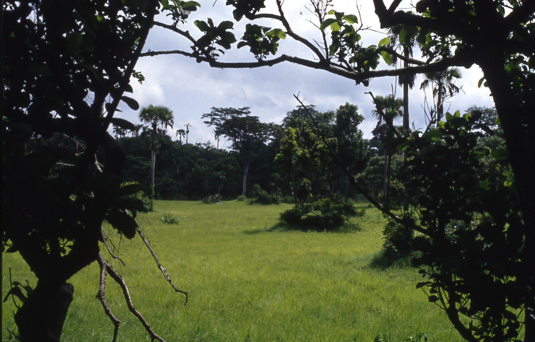
A wide view of a grassy savanna plain in Lamto, with scattered trees and palms, seen through the dark leafy branches of foreground trees.
A view of the savanna at Lamto, framed by the foliage of a gallery forest.

Station d'écologie de Lamto history and protected-area timeline

The station was founded on 12 July 1962 by Maxime Lamotte and Jean-Luc Tournier, two French scientists whose combined initials gave the place its name, Lam-to. The project emerged from earlier ecological research conducted at Mount Nimba, and Côte d'Ivoire was chosen as the host country in part because of the cooperative attitude of its government at the time.

Initially operating under the CNRS and later attached to the Université Félix-Houphouët-Boigny, the station developed under the scientific direction of the zoology and then ecology laboratory of the École normale supérieure in Paris. For roughly forty years it served as an active hub of multidisciplinary research and training in tropical ecology, contributing in particular to international programs such as the International Biological Programme.

The station also hosted thematic African schools on sustainable development, an initiative that cemented its role as a center of ecological training on the continent. However, the military and political unrest that affected Côte d'Ivoire from the late 1990s onward, combined with the suspension of much French cooperation, sharply reduced the range of activities conducted at the station.

Station d'écologie de Lamto landscape and geographic character

Lamto lies within the central interior of Côte d'Ivoire, in the Taabo department, on the edge of the Bandama River. Its terrain represents a classic West African transition between two major biomes: the more humid forests of the country's south and the open, grass-dominated savannas further north. The site is therefore characterized by mosaics of woodland, open grass cover, and gallery formations associated with the river.

A particularly distinctive feature of the local landscape is the presence of the Borassus palm savanna, locally associated with the rônier tree, which dominates large stretches of the open country in the so-called Baoulé 'V,' a wedge-shaped region where the savannas push furthest south into otherwise forested territory. The reserve's scale, around 2,500 hectares, encompasses enough of this mosaic to support the long-term study of vegetation transitions alongside the Bandama's riparian environments.

Station d'écologie de Lamto ecosystems, habitats, and plant life

From an ecological standpoint, Lamto's significance lies in its location at a sharp forest-savanna boundary, dominated in many places by stands of Borassus aethiopum, the rônier palm, whose tall fan-shaped crowns and distinctive trunks structure much of the open landscape. The vegetation patterns combine forest patches, gallery vegetation along the Bandama, and grass-dominated savannas rich in herbaceous species typical of West Africa.

The station's ecological value extends well beyond its plant communities. By the early 2000s, Lamto had become the center of a substantial body of work on ecosystem functioning, incorporating energy flow, nutrient cycling, and the dynamics of herbaceous biocenoses. Much of this work is synthesized in the 2006 Springer volume 'Lamto: Structure, Function, and Dynamics of a Savanna Ecosystem,' which provides one of the most comprehensive portraits of a West African savanna system available in the scientific literature.

Station d'écologie de Lamto conservation status and protection priorities

Lamto is officially protected under the strict nature reserve classification of the IUCN (Category Ia), within a 2,500 hectare reserve that safeguards one of West Africa's most studied forest-savanna transition zones. Its protected status has historically been oriented less toward tourism and more toward enabling sustained scientific research into savanna ecosystems.

The site's conservation value rests on the long-term ecological record it preserves. Because the station has supported continuous research since 1962, it offers one of the most deeply documented baselines for vegetation change, ecosystem dynamics, and biocenose structure in the West African savanna belt. That legacy of research itself represents an important contribution to the conservation science of the region, even as field operations were disrupted by the political instability of the late twentieth and early twenty-first centuries.

Station d'écologie de Lamto cultural meaning and human context

The Lamto reserve lies within the territory historically associated with the Baoulé people, and the surrounding landscape is recognized in regional geography through the cultural concept of the Baoulé 'V,' a wedge-shaped intrusion of savanna into the forested south of Côte d'Ivoire. The station itself has played a cultural role in the development of African ecological science, having hosted thematic schools on sustainable development aimed at training a new generation of regional researchers.

Its history also reflects a particular moment in the post-colonial scientific relationship between France and Côte d'Ivoire, embodying the cooperative spirit that initially brought French and Ivorian institutions together to create one of West Africa's first sustained tropical ecology research programs.

Top sights and standout views in Station d'écologie de Lamto

Lamto's strongest distinguishing qualities are its position at a forest-savanna boundary dominated by Borassus palm savanna, its status as a strict nature reserve of more than two thousand hectares on the Bandama River, and its role as one of the founding centers of modern tropical ecology in West Africa. Its scientific archives, dating back to 1962, give it an unusually rich long-term ecological record.

Equally notable is the station's legacy as a training ground for African ecologists, where thematic schools on sustainable development helped build regional expertise that continues to influence ecological research and policy in the region.
Monthly climate preview

Long-term representative temperature ranges and precipitation rhythm across twelve months

Station d'écologie de Lamto Climate Normals and Monthly Weather Patterns

Station d'écologie de Lamto records measured baseline temperature and precipitation rhythms across a representative coordinate with monthly averages spanning from 24.51 to 28.14 degrees Celsius. Examining the complete twelve-month climatology profile reveals detailed shifts in long-term atmospheric conditions for this protected location.
Annual mean26 °C
25 °C28 °C
Jan27°
Feb28°
Mar28°
Apr27°
May26°
Jun25°
Jul25°
Aug25°
Sep25°
Oct26°
Nov26°
Dec27°
Warmest month
February

28.1 °C

Coolest month
July

24.5 °C

Wettest month
June

6.9 mm/day

Driest month
January

0.7 mm/day

Park location guide

Geography guide, regional context, and park location map for Station d'écologie de Lamto

Station d'écologie de Lamto park geography, regions, and map view in Ivory Coast

Understand where Station d'écologie de Lamto sits in Ivory Coast through a broader geographic reading of the surrounding landscape, nearby location context, and its mapped position within the national park landscape.

How Station d'écologie de Lamto fits into Ivory Coast

Ivory Coast, officially the Republic of Côte d'Ivoire, is a West African country with a coastline on the Gulf of Guinea. It gained independence from France in 1960 and is now a presidential republic. The country is a major producer of cocoa and coffee, with Abidjan serving as its largest city and economic hub, while Yamoussoukro is the official capital.

Wider geography shaping Station d'écologie de Lamto in Ivory Coast

Ivory Coast is situated on the southern coast of West Africa along the Gulf of Guinea. It borders Guinea to the northwest, Liberia to the west, Mali to the northwest, Burkina Faso to the northeast, Ghana to the east, and the Atlantic Ocean to the south. The terrain includes coastal plains, interior highlands, and forested regions.

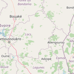
Map view of Station d'écologie de Lamto

Use this park location map to pinpoint Station d'écologie de Lamto in Ivory Coast, understand its exact geographic position, and read its mapped placement within the surrounding landscape more clearly.

Pigeon | © OpenStreetMap contributors

Visualizing the forest and savanna transition zones of central Côte d'Ivoire

Station d'écologie de Lamto Photos and Landscape Scenery

Photographic records reveal the distinct mosaic of riparian woodland and palm savanna defining Station d'écologie de Lamto along the Bandama River. Visual archives provide essential reference material for studying tropical ecology and the rare vegetation boundaries of the Baoulé region.

A wide view of a grassy savanna plain in Lamto, with scattered trees and palms, seen through the dark leafy branches of foreground trees.

Park atlas

Explore surrounding landscapes, riverine corridors, and connected savanna reserves.

Parks and Protected Areas Near Station d'écologie de Lamto for Regional Comparison

Browse protected areas and regional reserves situated near Station d'écologie de Lamto across the central Côte d'Ivoire transition zone. Comparing adjacent natural habitats provides broader context on West African forest and savanna ecosystems.
Nature reserveLôh-Djiboua
About 42 km away#1 closest

Southwest

Réserve botanique de Divo: Protected Forest Landscapes and Regional Geography in Lôh-Djiboua

Nature reserve featuring extensive forest restoration projects.

Discover the complex landscape of Réserve botanique de Divo, one of the oldest nature reserves in Côte d'Ivoire. Located in the Lôh-Djiboua region, this protected area represents a transition between remaining secondary forest fragments and agricultural land, serving as a primary site for international tropical forestry restoration efforts.

Area
68.02 km²
Established
1935
Relief
Lowland
Climate
Tropical
Protected areaIvory Coast
About 45 km away#2 closest

Southwest

Forêt classée de Divo: Protected Area and Forest Geography of Southwestern Ivory Coast

A study of humid Guinean forest remnants and regional land use

Discover the mapped landscape and protected status of the Forêt classée de Divo. Situated in the Divo department, this reserve highlights the interaction between Guinean-type humid forests and agricultural expansion, providing a critical look at state-managed forest conservation in southwestern Ivory Coast.

Area
20 km²
Established
1928
Relief
Lowland
Climate
Tropical
National parkIvory Coast
About 105 km away#3 closest

South

Assagny National Park: Ivory Coast's Protected Natural Landscape and Park Boundaries

Explore the mapped terrain and regional geography.

Assagny National Park is a significant protected area in Ivory Coast, functioning as a national park. This entry provides detailed information on its geographic setting, mapping its protected boundaries and surrounding natural landscapes. It serves as a resource for understanding the park's specific landscape character and its contribution to the regional geography of West Africa, offering an atlas-style exploration of its conservation significance.

Area
170 km²
Established
1981
IUCN
II
National parkLagunes
About 113 km away#4 closest

South

Parc national d'Azagny: Protected Coastal Wetlands and Estuarine Terrain in Lagunes

Coastal wetland geography and savanna ecosystems in Côte d'Ivoire

Explore the unique estuarine geography of Parc national d'Azagny, a Ramsar site encompassing a dense mosaic of mangrove swamps, coastal savanna clearings, and tidal waterways. This protected area plays a crucial role in maintaining the ecological stability of the Lagunes region and supports a variety of species within its specialized low-lying habitats.

Area
194 km²
Established
1981
IUCN
II
Relief
Lowland
National parkAbidjan
About 136 km away#5 closest

Southeast

Banco National Park National Park: Primary Forest Landscape and Abidjan Geography

Explore mapped boundaries and urban conservation.

Banco National Park is a globally significant protected area, uniquely preserving dense primary tropical forest within the urban sprawl of Abidjan, Ivory Coast. This national park offers critical insights into urban conservation, featuring rare tree species and providing essential ecosystem services like water supply and carbon sequestration for the surrounding region. Its landscape, characterized by the Gbangbo River and rare mahogany and avodire trees, forms a vital geographic element within the metropolitan atlas.

Area
30 km²
Established
1953
IUCN
II
Relief
Lowland
A horizontal watercolor painting showing a green landscape with trees, a winding stream, and rolling hills in the background against a soft, light-filled sky.
National parkAbidjan
About 136 km away#6 closest

Southeast

Parc national du Banco: Protected Tropical Rainforest and Urban Water Reserve in Abidjan

A dense primary forest island within a major urban landscape

Parc national du Banco preserves a significant block of primary tropical vegetation in the center of Abidjan. Functioning as both a vital municipal water reservoir and a complex wildlife refuge, this protected area offers a unique intersection of tropical forest ecology and dense urban development. Its central core of rare hardwood species and distinct river corridors illustrate a rare conservation landscape surrounded by the growth of a major West African metropolis.

Area
34.4 km²
Established
1953
IUCN
II
Relief
Lowland
A minimalist watercolor painting depicting a soft green savanna landscape with scattered trees, rolling hills, and a central waterway, isolated on a white background.
National parkSassandra-Marahoué
About 149 km away#7 closest

Northwest

Parc national de la Marahoué: Sassandra-Marahoué Protected Landscape and River Atlas

Analyzing the savanna and forest mosaic of Côte d'Ivoire

Parc national de la Marahoué represents a critical ecological junction in Côte d'Ivoire, spanning over 100,000 hectares along the Marahoué River. This protected area offers an analytical look at the intersection of Sudano-Guinean savanna and humid forest biomes, providing a unique case study in West African conservation landscapes and biodiversity patterns within the Sassandra-Marahoué region.

Area
1,010 km²
Established
1968
IUCN
II
Scope
Terrestrial
National parkSassandra-Marahoué District
About 149 km away#8 closest

Northwest

Marahoué National Park: Geographic and Protected Landscape Analysis in Central Ivory Coast

Examining the ecological terrain within the Sassandra-Marahoué District

Marahoué National Park occupies a transitional zone where forest remnants meet savanna grasslands in the heart of Ivory Coast. This analysis explores the park's geographic boundaries along the Marahoué River and the shifting habitats that continue to sustain a notable variety of bird species within this protected district.

Area
1,000 km²
Established
1968
IUCN
II
Relief
Upland

Common questions about visiting, size, designation, and location context for Station d'écologie de Lamto

Station d'écologie de Lamto FAQs for park facts, access, geography, and protected area context

Find quick answers about Station d'écologie de Lamto, including protected-area facts, park geography, trail and visitor context, and how the park fits into its surrounding country and regional landscape.
MoriAtlas Explorer

Continue Your Protected Areas Search Across the Global Atlas

Deepen your exploration by continuing the structured search for national parks and protected areas worldwide. Utilize the comprehensive filtering capabilities to compare different conservation landscapes and refine your understanding of global park geography. Discover more about the distribution and characteristics of protected natural areas.

Global natural geography