
Mori Atlas logo
Nature reserveSteinberg bei Wesseln

Mapping the warm calcareous slopes and semi-dry grassland habitats of this German hill range

Steinberg bei Wesseln Nature Reserve: A Protected Muschelkalk Landscape in Lower Saxony

(Naturschutzgebiet Steinberg bei Wesseln)

Steinberg bei Wesseln sits as a distinct protected landscape on the south-facing slope of a ridge within the Tosmarberg hill range of Lower Saxony. This nature reserve, characterized by its Muschelkalk shell limestone substrate and warm microclimate, preserves a vital mosaic of semi-dry grassland, scrub, and woodland patches. By protecting this sun-exposed terrain, the reserve serves as an essential refuge for specialized species that thrive in dry, calcareous conditions.

nature reservecalcareous grasslandsemi-dry grasslandMuschelkalkdry habitatslimestone slope
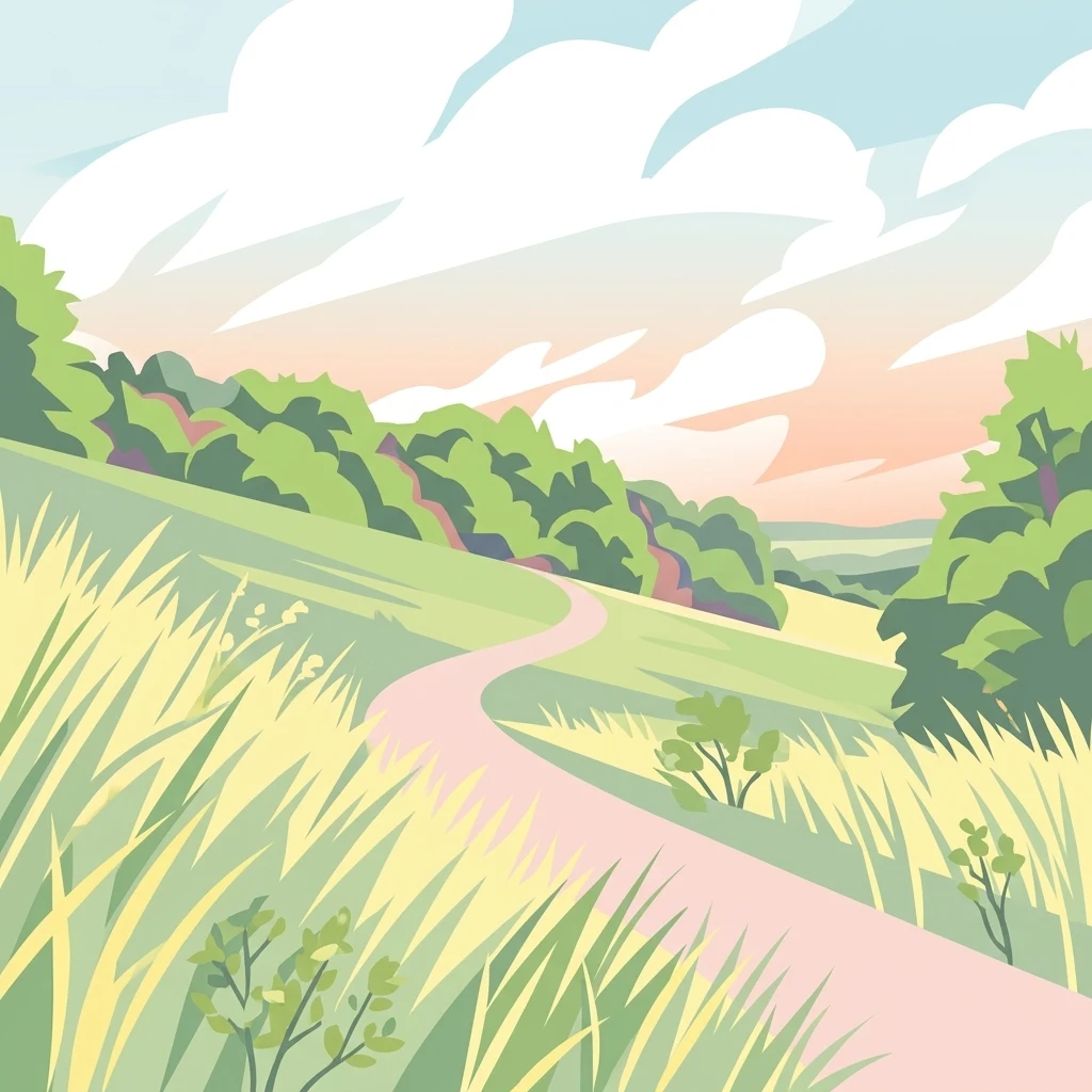
A stylized digital illustration of a winding dirt path through a grassy hill at sunset, with rolling green hills and a cloudy sky in the background.

Steinberg bei Wesseln

Nature reserve

Park overview

Structured park overview, official facts, and landscape profile for Steinberg bei Wesseln

Steinberg bei Wesseln park facts, protected area profile, and essential visitor context

Review the core facts for Steinberg bei Wesseln, including designation, size, terrain, visitor scale, habitats, and operating context in one park-focused overview.

About Steinberg bei Wesseln

Steinberg bei Wesseln is a compact but ecologically focused protected area in the Hildesheim region of Lower Saxony, Germany. It safeguards the south-facing slope of a limestone ridge just north of Bad Salzdetfurth and west of the village of Wesseln, preserving a habitat that is biologically uncommon in the surrounding landscape. The reserve is also an FFH site under the European Union Habitats Directive, underscoring its contribution to the broader European ecological network.

The reserve's defining character comes from its geology. The Steinberg is built from Muschelkalk, a Triassic shell limestone that produces thin, calcareous, easily warmed soils. On the steep south-facing slopes, these soils combine with strong solar exposure to create dry, warm conditions that are unusual in this part of Lower Saxony. Over centuries of grazing and limited woodland cover, this setting has favored the development of semi-dry grassland, interspersed with scrub patches and small woodland inclusions, with additional grassland parcels toward the eastern side of the protected area.

What distinguishes Steinberg bei Wesseln most is its concentration of rare, warmth-loving species. The reserve supports a notable variety of plants, snails, and insects that depend on dry, calcareous habitats, many of which are scarce or declining elsewhere in the region. The combination of a small spatial footprint, a clearly defined microclimate, and a well-matched conservation management approach makes it a textbook example of a habitat-and-species management area, falling within IUCN Category IV. Its identity is therefore less about dramatic scenery and more about a finely tuned ecological niche that the surrounding agricultural and forested landscape cannot easily replicate.

Quick facts and research context for Steinberg bei Wesseln

Steinberg bei Wesseln is a nature reserve (Naturschutzgebiet) in Lower Saxony with the official identifier NSG HA 074, situated in the town of Bad Salzdetfurth within the Landkreis Hildesheim. It covers roughly 16 hectares, an area that coincides with a 14.83 hectare FFH (Habitat Directive) site, and is managed under the authority of the Landkreis Hildesheim with oversight from the Niedersächsischer Landesbetrieb für Wasserwirtschaft, Küsten- und Naturschutz (NLWKN). The reserve lies at elevations between roughly 114 m and 192 m above sea level and is classified as an IUCN Category IV: Habitat/Species Management Area, reflecting its targeted conservation of dry-warm habitats and their characteristic species.

Protection and recognition

Examining documented protected area records, management scope, and Natura 2000 listings.

Steinberg bei Wesseln Protection Status and International Recognition Data

Protected area records for Steinberg bei Wesseln outline documented conservation frameworks and official Natura 2000 designations. Official recognition sources establish baseline administrative tracking for this protected landscape.
Park context

Deeper park guide and search-rich context for Steinberg bei Wesseln

Steinberg bei Wesseln history, landscape, wildlife, and travel context

Explore Steinberg bei Wesseln through its history, landscape character, ecosystems, wildlife, conservation priorities, cultural context, and seasonal travel timing in a structured park guide built for atlas discovery and search intent.

Why Steinberg bei Wesseln stands out

The reserve is best known for its semi-dry grassland on a warm Muschelkalk (shell limestone) slope. The easily warmed limestone-derived soil, combined with the steep southern exposure of the Steinberg ridge, creates a notably warm microclimate that supports Halbtrockenrasen, scrub, and small woodland patches. This habitat mosaic is the reason the reserve is recognized as an FFH site and is valued as a refuge for plant, snail, and insect species adapted to dry, warm conditions that are otherwise scarce in the wider Lower Saxony landscape.
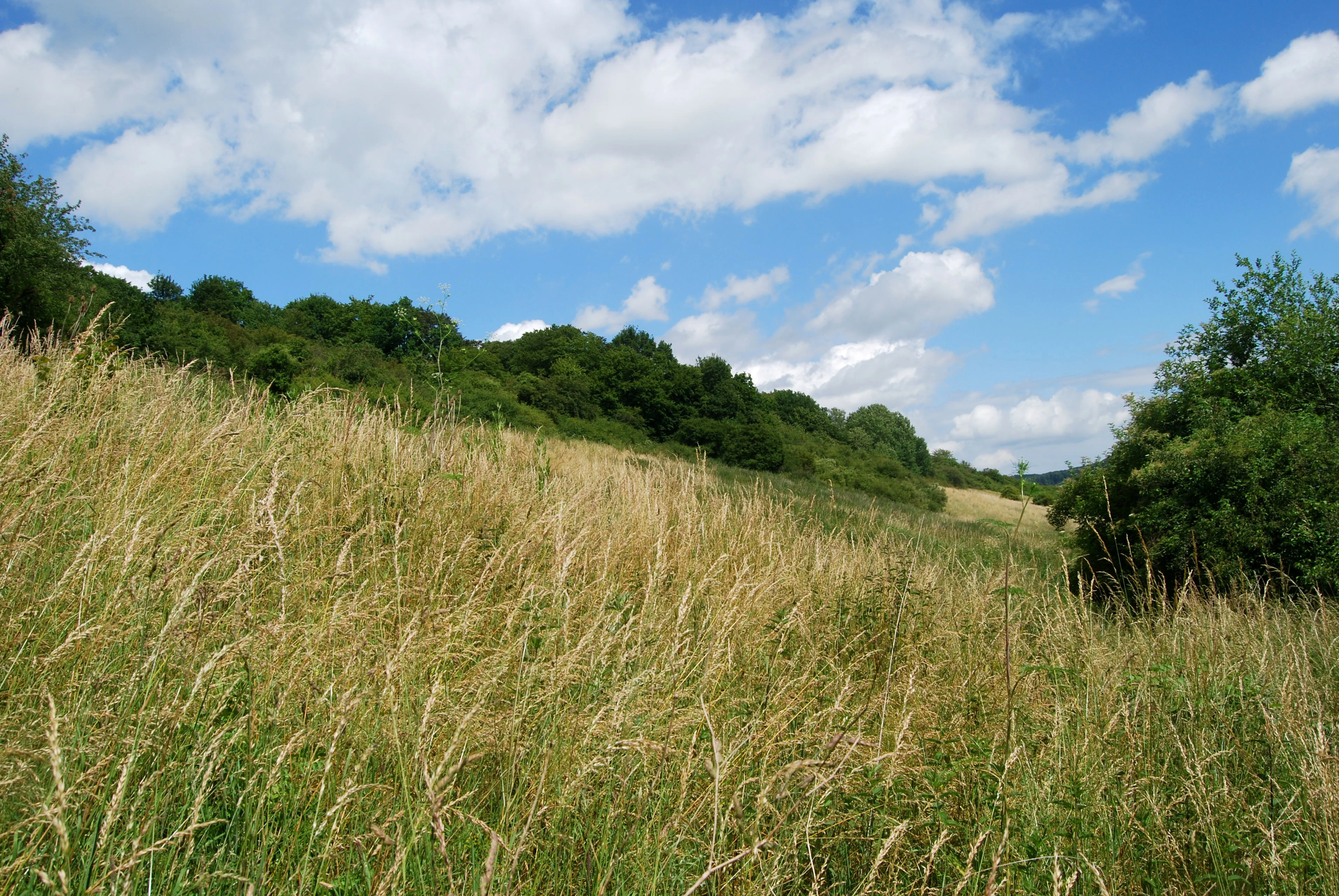
A sloped meadow with tall dry grass in the foreground and a line of trees and shrubs along a ridge against a blue sky with white clouds.
A summer view of the grassy slopes and scrub vegetation at Steinberg bei Wesseln.

Steinberg bei Wesseln history and protected-area timeline

The current Steinberg bei Wesseln nature reserve was formally established on 23 August 2007, bearing the official designation NSG HA 074. It replaces an earlier protected area of the same name that had been designated on 12 July 1984, with the 2007 redefinition expanding the protected boundary to the southeast. The expansion brought additional slope habitat into protection and aligned the reserve exactly with the boundaries of an FFH (Fauna-Flora-Habitat) site under the European Union's Habitats Directive, giving the area a unified national and European conservation framework.

The reserve falls under the responsibility of the Landkreis Hildesheim as the lower nature conservation authority, with technical oversight provided by the Niedersächsischer Landesbetrieb für Wasserwirtschaft, Küsten- und Naturschutz (NLWKN). Management continues the long-standing grazing tradition on the semi-dry grasslands, an approach that has shaped the open habitat structure of the hillside for generations.

Steinberg bei Wesseln landscape and geographic character

Steinberg bei Wesseln lies on the south-facing flank of a modest limestone ridge forming the eastern part of the Tosmarberg hill range. The topography is moderately steep to steep, with elevations ranging from about 114 m to 192 m above sea level. The underlying rock is Muschelkalk, a Triassic shell limestone whose weathering produces thin, calcareous, easily warmed soils that are central to the character of the site.

The visual landscape is a mosaic of open semi-dry grassland covering the main slope, patches of scrub, small inclusions of woodland, and grassland areas concentrated toward the eastern part of the reserve. Because the slope faces south and the substrate warms rapidly, the hillside has a notably warm microclimate compared with surrounding terrain, reinforcing its openness and the dry character of its vegetation. The ridge sits among the rolling agricultural and wooded country typical of the Hildesheim region, but the protected hillside stands out as a distinct, more open, more sun-exposed patch within that broader landscape.

Steinberg bei Wesseln ecosystems, habitats, and plant life

The nature of the reserve is shaped primarily by its calcareous, sun-warmed soils and the traditional land use that has maintained open conditions. Semi-dry grassland, known in German as Halbtrockenrasen, dominates the slope. These grasslands are managed through grazing, which preserves the open structure and prevents succession into closed woodland. Interlocking with the grassland are areas of scrub, small woodland patches, and additional grassland parcels toward the eastern side of the protected area, producing a varied habitat mosaic within a compact footprint.

This habitat mosaic is the ecological identity of the reserve. The combination of warm microclimate, thin calcareous soils, and open dry grassland creates conditions that are increasingly rare in the intensified agricultural landscapes of Lower Saxony, and it is what qualifies the area as a European FFH site. The ecological value lies less in the total area than in the persistence and quality of these particular dry-warm habitats.

Steinberg bei Wesseln wildlife and species highlights

Steinberg bei Wesseln is recognized in particular for the richness of warmth-loving, dry-habitat species it harbors. The reserve hosts a large number of rare plants adapted to dry, warm calcareous conditions, alongside notable assemblages of snails (Schnecken) and insects (Insekten) that depend on similar habitats. These groups are highlighted because they are especially sensitive to changes in land use and microclimate, and because they are typically underrepresented in the surrounding regional landscape. The reserve therefore functions as a stable refuge where specialized invertebrate communities and associated flora can persist amid broader regional change.

Steinberg bei Wesseln conservation status and protection priorities

The reserve's conservation significance is rooted in the protection of dry-warm calcareous habitats that are scarce in Lower Saxony and disproportionately affected by changes in land use. By formally designating and managing a steep Muschelkalk slope as a nature reserve, authorities safeguard both the habitat itself and the dependent communities of rare plants, snails, and insects. The coincidence of the protected area with a European FFH site links its management to the broader obligations of the EU Habitats Directive, reinforcing its role as a node in a transnational ecological network.

Management, led by the Landkreis Hildesheim with technical support from the NLWKN, focuses on maintaining the open character of the grasslands through grazing, a practice appropriate to the reserve's IUCN Category IV (Habitat/Species Management Area) classification. This category reflects the intent to actively manage specific habitats and species rather than simply exclude human influence. The 2007 redesignation, which expanded the earlier 1984 area to the southeast, illustrates an ongoing effort to strengthen protection for these particular dry-habitat communities.

Top sights and standout views in Steinberg bei Wesseln

The reserve's most distinctive quality is the marriage of a south-facing Muschelkalk slope with traditional grazed semi-dry grassland, producing a habitat mosaic capable of supporting unusually rich warmth-loving flora and fauna in the heart of Lower Saxony. Its coincidence with an FFH site, its IUCN Category IV management designation, and its compact but ecologically focused footprint make it a clear example of targeted habitat and species conservation in a regional context.

Monthly climate preview

Long-term representative coordinate measurements mapping monthly averages across Lower Saxony

Steinberg bei Wesseln Climate Normals: Annual Temperature and Precipitation Rhythm

Representative coordinate data reveals measured monthly temperature and precipitation normals across the terrain of Steinberg bei Wesseln. Analyzing the complete twelve-month sequence provides deeper insight into long-term environmental patterns for this protected location.
Annual mean9 °C
0 °C18 °C
Jan
Feb
Mar
Apr
May13°
Jun16°
Jul18°
Aug18°
Sep14°
Oct
Nov
Dec
Warmest month
July

18.4 °C

Coolest month
January

-0.1 °C

Wettest month
July

2.6 mm/day

Driest month
April

1.4 mm/day

Park location guide

Geography guide, regional context, and park location map for Steinberg bei Wesseln

Steinberg bei Wesseln park geography, regions, and map view in Germany

Understand where Steinberg bei Wesseln sits in Germany through a broader geographic reading of the surrounding landscape, nearby location context, and its mapped position within the national park landscape.

How Steinberg bei Wesseln fits into Germany

Germany is a federal republic in Western and Central Europe with a population of over 83 million across sixteen constituent states. It is Europe's largest economy by nominal GDP and a major global exporter and importer. The capital is Berlin, and the country borders Denmark, Poland, Czech Republic, Austria, Switzerland, France, Luxembourg, Belgium, and the Netherlands.

Wider geography shaping Steinberg bei Wesseln in Germany

Germany is located in Western and Central Europe, spanning 357,022 km². It borders Denmark to the north, Poland and the Czech Republic to the east, Austria and Switzerland to the south, and France, Luxembourg, Belgium, and the Netherlands to the west. The country has coastlines on the Baltic Sea and North Sea to the north, with the Alps located in the southern region.

Map view of Steinberg bei Wesseln

Use this park location map to pinpoint Steinberg bei Wesseln in Germany, understand its exact geographic position, and read its mapped placement within the surrounding landscape more clearly.

Pigeon | © OpenStreetMap contributors

Location context for Steinberg bei Wesseln

Lower Saxony
Recorded earthquake history

Review the Historical Earthquake Catalogue for Steinberg bei Wesseln

Examine a catalogue of registered seismic events occurring within proximity to the Steinberg bei Wesseln nature reserve. This data collection allows for the focused review of regional seismic history, providing chronological event details and epicentre locations for research and geographic context.

Steinberg bei Wesseln Earthquake Records

Catalogued events

1 event

Strongest magnitude

Magnitude 3

Most recent event

Mar 30, 1995

This history includes earthquakes recorded inside the park or within 50 km of its borders

Explore photographic records of limestone slopes, semi-dry grasslands, and rare natural terrain.

Visualizing Steinberg bei Wesseln: Landscapes, Scenery, and Protected Habitats

Visual records reveal the steep south-facing limestone slopes and open semi-dry grassland mosaic that define the protected terrain of Steinberg bei Wesseln. Examining field photography helps researchers and visitors understand the warmth-loving habitats and unique microclimate preserved across this reserve.

A sloped meadow with tall dry grass in the foreground and a line of trees and shrubs along a ridge against a blue sky with white clouds.

Park atlas

Compare regional hill country landscapes and connected limestone reserves

Parks Near Steinberg bei Wesseln and Surrounding Protected Areas

Browse protected areas and natural reserves located near Steinberg bei Wesseln in the Hildesheim hill country. Comparing adjacent terrain helps trace regional limestone habitats and connected ecological networks across Lower Saxony.
A minimalist watercolor painting featuring soft green, yellow, and purple tones depicting a rolling hill landscape with trees and distant hills.
Nature reserveNiedersachsen
9 km away#1 closest

Northwest

Haseder Busch, Giesener Berge, Gallberg, Finkenberg Protected Landscape and Map Data

A diverse hill and floodplain ecosystem in Niedersachsen, Germany.

Trace the ecological boundaries and terrain of this expansive nature reserve. The site features a rare convergence of Triassic sedimentary landscapes, including the northernmost calcareous semi-dry grasslands and beech forests in the region, alongside historic floodplain meadows shaped by the Innerste river.

Area
7.42 km²
Established
2019
Nature reserveWolfenbuettel
About 14 km away#2 closest

East

Steinbruch Baddeckenstedt Nature Reserve: Protected Limestone Landscape in the Wolfenbuettel District

A restored former quarry environment with rich fossil deposits

Steinbruch Baddeckenstedt protects a six-hectare area of limestone cliffs and calcareous rubble slopes within the Wolfenbuettel district. This former quarry offers a specialized habitat for rare plants and wildlife, providing a vital example of post-industrial land conservation and geological exposure in central Germany.

Area
0.063 km²
Established
2009
IUCN
IV
Relief
Upland
Nature reserveHildesheim District
About 20 km away#3 closest

North

Wätzumer Tonkuhle Nature Reserve: Geography and Protected Boundaries in Hildesheim District

A restored wetland refuge in the Lower Saxony agricultural landscape

Wätzumer Tonkuhle offers a rare glimpse into secondary wetland succession within the Hildesheim District. This nature reserve features two primary ponds and an extensive fallow corridor along the Alpebach, serving as a critical sanctuary amidst the surrounding intensive farmland of Northern Germany.

Area
0.105 km²
Established
1986
IUCN
IV
Nature reserveSalzgitter
About 20 km away#4 closest

East

Tagebau Haverlahwiese Nature Reserve: Geography and Protected Area Mapping in Salzgitter

Mapping restored post-industrial landscapes and habitat mosaics.

This protected area in Salzgitter showcases the natural recovery of former ironstone mining lands. Users can examine the spatial arrangement of the 15-hectare mining lake, extensive reedbeds, and dry calcareous grassland slopes. The site remains a vital example of landscape conservation, illustrating how engineered topography provides new niches for amphibians and salt-tolerant plant communities across the Lichtenberge ridge.

Area
2.06 km²
Established
2016
Relief
Upland
Climate
Temperate
A soft watercolor illustration of a river winding through a green floodplain with rolling hills in the background.
Nature reserveRegion Hannover
22 km away#5 closest

Northwest

Leineaue zwischen Hannover und Ruthe: Protected Floodplain and River Geography

Nature reserve geography and alluvial habitat mapping.

Examine the topographic and hydrological features of the Leineaue zwischen Hannover und Ruthe nature reserve. This atlas entry provides insights into the site's dual-channel river structure, calcareous tufa springs, and fragmented alluvial woodlands that define this significant conservation area near Hannover.

Area
9.678 km²
Established
2007
Relief
Lowland
Scope
Terrestrial
Watercolor painting of a rolling, forested ridge landscape in shades of green, yellow, and soft pink.
Protected areaLower Saxony
23 km away#6 closest

West

Ith Protected Area: Mapped Limestone Ridge Geography and Geological Features

Continuous limestone cliff formations in the Lower Saxony uplands

The Ith stands as a major geological landmark in Lower Saxony, featuring a 22 kilometer spine of Upper Jurassic limestone. This protected area preserves a unique collection of cliff crags, dense beech forests, and limestone-dependent plant communities that span the districts of Hameln-Pyrmont and Holzminden.

Relief
Mountain
Climate
Temperate
Access
Access unknown
Scope
Terrestrial
Nature reserveLower Saxony
About 26 km away#7 closest

Northwest

Zigeunerwäldchen Nature Reserve: A Detailed Geographic Atlas of the Haller River Floodplain

Protected riparian forest boundaries in Lower Saxony

Zigeunerwäldchen is a protected nature reserve in Lower Saxony that preserves a vital fragment of the Haller river floodplain. The landscape is defined by willow-dominated alluvial forest, marshy clearings, and thick stands of sedge. By maintaining these natural water-influenced terrains, the reserve provides a rare glimpse into the historical floodplain architecture of the Calenberger Land region.

Area
0.15 km²
Established
1986
Nature reserveLower Saxony
About 27 km away#8 closest

West

Südhang des Thüster Berges: Protected Limestone Landscape and Regional Terrain in Lower Saxony

Nature reserve located in the Weserbergland range

Südhang des Thüster Berges offers a focused look at a sixty-hectare nature reserve defined by steep, sun-exposed limestone slopes. This protected area in Lower Saxony preserves a specialized mosaic of calcareous semi-dry grassland, traditional meadow, and near-natural forest that stands out within the broader, densely forested ridges of the German Weserbergland landscape.

Area
0.6 km²
Established
1989
IUCN
IV
Relief
Mountain

Common questions about visiting, size, designation, and location context for Steinberg bei Wesseln

Steinberg bei Wesseln FAQs for park facts, access, geography, and protected area context

Find quick answers about Steinberg bei Wesseln, including protected-area facts, park geography, trail and visitor context, and how the park fits into its surrounding country and regional landscape.
MoriAtlas Explorer

Continue Your Protected Areas Search Across the Global Atlas

Deepen your exploration by continuing the structured search for national parks and protected areas worldwide. Utilize the comprehensive filtering capabilities to compare different conservation landscapes and refine your understanding of global park geography. Discover more about the distribution and characteristics of protected natural areas.

Global natural geography