

Mori Atlas logo
National parkSundown National Park

Explore the mapped boundaries and geographic context of this national park.

Sundown National Park: Australia's Protected Landscape in Southern Downs Region

Sundown National Park stands as a significant protected area within Australia's Southern Downs Region, offering a clear representation of its natural geography and conservation landscape. This page provides detailed atlas-style information, focusing on the park's mapped boundaries and its integral role within the regional geography, serving as a key point for structured discovery of Australia's protected lands.

National parkGorge countryQueenslandRiparian ecosystemsSubtropical woodlandBirdwatching

Sundown National Park

National park

Park overview

Structured park overview, official facts, and landscape profile for Sundown National Park

Sundown National Park park facts, protected area profile, and essential visitor context
Review the core facts for Sundown National Park, including designation, size, terrain, visitor scale, habitats, and operating context in one park-focused overview.

About Sundown National Park

Sundown National Park occupies a distinctive position in Queensland's protected area network as a wilderness landscape of significant geological and ecological value. The park's location on the border between Queensland and New South Wales places it within a transition zone between temperate and subtropical ecosystems. The dramatic terrain features deep gorges, rugged peaks, and boulder-strewn creek beds that characterize the Severn River catchment. The park's establishment in 1977 reflected growing recognition of the area's natural values, particularly its watershed function as the source of a river system that ultimately becomes part of the Murray-Darling Basin, one of Australia's most important river systems. The landscape tells a complex geological story through its trap rock formations, granite intrusions, and fossil evidence of ancient marine environments found on summit plateaus. Historical mining activity has left a legacy of contaminated sites that now serve as reminders of the tension between resource extraction and environmental preservation.

Quick facts and research context for Sundown National Park

Sundown National Park covers 160 square kilometres in southern Queensland, Australia, established in 1977 under IUCN Category II protection. The park serves as the source of the Severn River, which forms the headwaters of the Darling River system. The terrain features dramatic gorge landscapes carved through ancient trap rock, with Mount Donaldson reaching 1,038 metres above sea level. The area has a complex mining history, with former operations for molybdenum, arsenic, tungsten, copper, gold, and tin leaving some contaminated zones with restricted access. The park supports at least 150 bird species and represents the northern range limit for several marsupial and avian species.

Park context

Deeper park guide and search-rich context for Sundown National Park

Sundown National Park history, landscape, wildlife, and travel context
Explore Sundown National Park through its history, landscape character, ecosystems, wildlife, conservation priorities, cultural context, and seasonal travel timing in a structured park guide built for atlas discovery and search intent.

Why Sundown National Park stands out

Sundown National Park is best known for its dramatic gorge country and its significance as a biogeographic frontier protecting rare northern populations of species more common in southern Australia. The 10-kilometre-long Severn River gorge, carved through hard trap rock, represents the park's most spectacular geological feature. The park preserves the northernmost population of superb lyrebirds in Australia, a species renowned for its extraordinary mimicry abilities. Additionally, Sundown hosts the most northerly population of common wombats, a marsupial typically associated with cooler highland habitats. The combination of subtropical woodland, riparian corridors, and rocky escarpments creates a unique ecological transition zone.

Sundown National Park history and protected-area timeline

The land now protected as Sundown National Park has a history of mineral exploitation that predates its protected area status. Prior to the park's establishment in 1977, the area was subject to mining operations for various minerals including molybdenite, arsenic, tungsten, copper, gold, and tin. These activities left a visible legacy across the landscape, with disused mine sites now representing contamination hazards that require restricted access zones. The geological survey of the area revealed a complex history of intrusion and fracturing, with granite magma forcing its way through ancient rock formations to create the distinctive trap rock terrain visible today. Shellfish fossil beds on Mount Donaldson indicate that the area was once covered by shallow seas, with subsequent uplift and erosion revealing these ancient marine sediments at elevations exceeding 1,000 metres. The formal protection of the area in 1977 marked a shift from extractive use to conservation management, though the Queensland Parks and Wildlife Service continues to manage the legacy of historical disturbance.

Sundown National Park landscape and geographic character

The physical landscape of Sundown National Park is dominated by dramatic gorge systems and rugged elevated terrain. The Severn River has carved a spectacular 10-kilometre gorge through hard trap rock, creating a deep incision into the surrounding plateau. Tributary streams have similarly excavated their own gorges, some featuring waterfall cascades where they descend from the upland areas. The park contains multiple peaks exceeding 1,000 metres, with Mount Donaldson reaching 1,038 metres above sea level and preserving marine fossils on its summit surfaces. The underlying geology consists primarily of trap rock with embedded granite intrusions, a combination that has produced distinctive fracture patterns throughout the terrain. River red gum, river oak, and tea-tree dominate the riparian corridors along watercourses, while the higher slopes support stringybark, yellow box, and brown box woodlands. The contrast between the rocky gorge floors and the surrounding sclerophyll forest creates a visually diverse landscape.

Sundown National Park ecosystems, habitats, and plant life

The ecological character of Sundown National Park reflects its position as a transition zone between Queensland's subtropical lowlands and the cooler highland environments of the Great Dividing Range. The park supports a mosaic of vegetation communities including sclerophyll woodland on slopes, riparian forest along watercourses, and rocky outcrop vegetation on exposed ridges. The northern portions of the park feature stringybark, yellow box, brown box, and Tenterfield woollybutt as the dominant tree species, while the river corridors support red river gum, river oak, tea-tree, and bottlebrush. Some areas of the park were historically cleared for grazing and wool production, leaving modified landscapes that now exist within the protected area boundary. The park's elevation range and geographic position create conditions that support species more typical of southern regions, making it an important refuge for temperate-adapted organisms at their northern range limits.

Sundown National Park wildlife and species highlights

Sundown National Park supports remarkable biodiversity, with at least 150 bird species recorded within its boundaries. The park holds particular significance as the northernmost population of superb lyrebirds, a ground-dwelling bird famous for its elaborate tail feathers and extraordinary vocal mimicry. This represents a notable range extension for a species typically associated with wet sclerophyll forests of southeastern Australia. The park also protects the most northerly population of common wombats, a burrowing marsupial more commonly found in highland areas of Victoria, Tasmania, and New South Wales. This population, shared with the adjacent Girraween National Park, represents an isolated northerly outpost of a species adapted to cooler climates. Additional notable species include tiger quolls, a spotted carnivorous marsupial, and platypus, the iconic monotreme that inhabits the park's freshwater streams. The diverse birdlife includes both woodland species and those associated with riparian habitats.

Sundown National Park conservation status and protection priorities

Sundown National Park contributes to regional conservation by protecting a landscape that serves as both a watershed and a biogeographic refuge. The park's position as the source of the Severn River connects it to the broader Murray-Darling Basin ecosystem, emphasizing its role in maintaining water quality and catchment integrity for downstream environments. The protection of northernmost populations of superb lyrebirds and common wombats demonstrates the park's significance in preserving species at the edge of their ecological ranges, which may become increasingly important as climate change shifts habitat zones. The management of contaminated legacy mine sites represents an ongoing challenge, with restricted access zones protecting visitors from historical environmental hazards. The park works in conjunction with adjacent protected areas including Girraween National Park to preserve contiguous habitat for wide-ranging species.

Sundown National Park cultural meaning and human context

The Sundown National Park region has historical associations with grazing and mining activities that predate its protected area status. European settlement of the area involved clearing for pastoral use and mineral extraction from the trap rock and granite formations. The park's location near the Queensland-New South Wales border places it within a landscape that has been shaped by both state jurisdictions and the management practices of early settlers. Indigenous heritage context for the area would likely involve Aboriginal connection to the Severn River catchment and the elevated terrain, though the available source material does not provide detailed information on traditional ownership or cultural significance.

Top sights and standout views in Sundown National Park

The Severn River gorge stands as the park's most dramatic geological feature, a 10-kilometre incision through ancient trap rock that showcases the power of fluvial erosion. Mount Donaldson offers visitors the opportunity to observe marine shellfish fossils at elevation, a tangible record of the region's ancient geological history. The superb lyrebird population represents an exceptional wildlife viewing opportunity, with these accomplished mimics occupying their northernmost known range within the park. The Broadwater campground provides accessible infrastructure for visitors seeking to explore the gorge country, with the western section offering the most developed facilities including hot showers and walking tracks. The combination of dramatic peaks, deep gorges, and rare wildlife makes Sundown a distinctive protected area within Queensland's national park system.

Best time to visit Sundown National Park

The cooler months from late autumn through winter into early spring typically offer the most comfortable conditions for exploring Sundown National Park. Winter temperatures in the elevated terrain can be cold overnight, but daytime temperatures are mild and ideal for walking. The landscape takes on a different character in each season, with spring bringing flowering eucalypts and increased bird activity while autumn displays falling foliage and excellent visibility for photography. Summer months can be hot and may bring reduced water flow in some streams, though the gorge country offers shade in the deeper valleys. Visitors should note that some areas of the park remain restricted due to historical mine contamination, and camping permits are required at designated sites.
Park location guide

Geography guide, regional context, and park location map for Sundown National Park

Sundown National Park park geography, regions, and map view in Australia
Understand where Sundown National Park sits in Australia through a broader geographic reading of the surrounding landscape, nearby location context, and its mapped position within the national park landscape.

How Sundown National Park fits into Australia

Australia is a constitutional monarchy and federal parliamentary democracy comprising six states and ten territories. With a population of nearly 28 million, it is one of the world's most urbanised countries, with most people concentrated on the eastern seaboard. The country has a high Human Development Index and is known for its cultural diversity, ancient Aboriginal heritage, and unique wildlife.

Wider geography shaping Sundown National Park in Australia

Australia occupies the entire Australian continent, the island of Tasmania, and numerous smaller islands. It is the world's flattest and driest inhabited continent, featuring vast deserts in the interior (the Outback), tropical rainforests along the eastern coast, and a coastline bordering the Indian and Pacific Oceans.

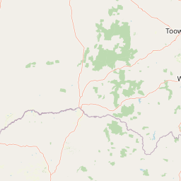
Map view of Sundown National Park

Use this park location map to pinpoint Sundown National Park in Australia, understand its exact geographic position, and read its mapped placement within the surrounding landscape more clearly.

Pigeon | © OpenStreetMap contributors

Location context for Sundown National Park

QueenslandSouthern Downs Region
Park atlas

Uncover the regional spread of protected areas and compare diverse park geographies in Queensland after exploring Sundown National Park.

Discover More Protected Landscapes Near Sundown National Park: Explore Queensland's Adjacent Parks
After exploring Sundown National Park's distinct gorge country and unique ecological frontier, browse a curated list of national parks and protected areas across Queensland's broader Southern Downs region. This atlas view facilitates geographic comparison, revealing other significant conservation landscapes that feature similar rugged terrain, diverse riparian ecosystems, and valuable wildlife habitats.
National parkQueensland

Girraween National Park: Queensland's Protected National Park Landscape for Atlas Exploration

Mapped geography and protected natural terrain.

Delve into Girraween National Park, a significant protected national park located in Queensland, Australia. This detailed entry provides essential information for understanding its geographic features, mapped boundaries, and the unique natural landscape it preserves. Discover how Girraween National Park fits into the wider Australian atlas and explore its specific regional geography and protected land context.

Area
117 km²
Established
1966
IUCN
II
Relief
Mountain
National parkNew South Wales

Bald Rock National Park: Detailed National Park Atlas and Protected Landscape Context

Explore its mapped boundaries and natural terrain within New South Wales.

Bald Rock National Park serves as a key protected area for understanding regional geography and mapped landscapes in New South Wales. This page offers an atlas-centric view of the park, detailing its protected boundaries and providing context for its natural terrain. It is designed for users seeking structured information about national parks and their geographic significance, contributing to a comprehensive understanding of Australia's conservation lands.

Area
88.83 km²
Established
1971
IUCN
II
Relief
Mountain
National parkNew South Wales

Basket Swamp National Park: New South Wales National Park and Protected Landscape Mapping

Geographic context and mapped boundaries within Australia.

Basket Swamp National Park represents a significant protected area within New South Wales, Australia. This page offers a geographic exploration of its specific location, mapped boundaries, and its role as a national park. Delve into the landscape context and atlas-level understanding of this natural reserve, distinct within the broader regional geography.

Area
28.2 km²
Established
1999
IUCN
II
Relief
Lowland
National parkNew South Wales

Boonoo Boonoo National Park: New South Wales National Park Atlas Entry

Explore mapped park boundaries and regional terrain.

This entry provides detailed information on Boonoo Boonoo National Park, a key protected area within New South Wales. Discover its specific geographic context, landscape features, and its role as a national park within the MoriAtlas geographic discovery platform. Understand the park's unique regional setting and mapped characteristics for informed atlas exploration.

Area
43.77 km²
Established
1982
IUCN
II
Relief
Upland
National parkNew South Wales

Maryland National Park: A Detailed Map and Protected Landscape Overview

Explore the geography and mapped boundaries of this national park.

Maryland National Park represents a distinct protected area within New South Wales, Australia, offering rich geographic context for exploration. This page details its role as a national park, focusing on its mapped terrain, landscape character, and position within the regional geography. Users seeking to understand the park's protected boundaries and natural setting will find valuable atlas-style information here, providing a concrete foundation for further geographic study.

Area
9 km²
Established
1999
IUCN
Ia
Relief
Upland
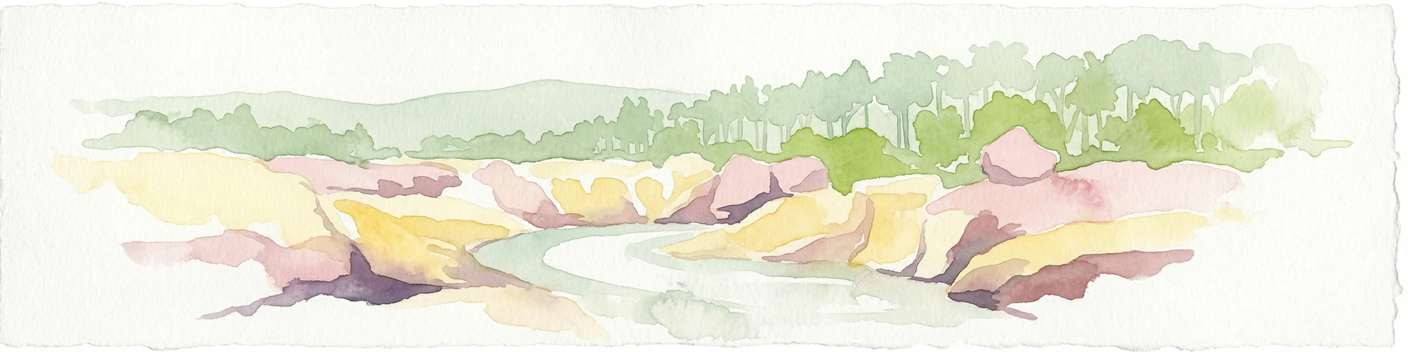
Watercolor painting of a river flowing between rocky cliffs with forest in the background
National parkNew South Wales

Kwiambal National Park: New South Wales National Park with Granite Landscapes and River Confluence

Explore the dramatic scenery of MacIntyre Falls and surrounding protected terrain.

Kwiambal National Park is a significant protected area in New South Wales, Australia, celebrated for its unique granite outcrops and the spectacular confluence of the Severn and Macintyre Rivers at MacIntyre Falls. This national park provides a clear example of regional protected landscape identity, offering valuable context for atlas-driven discovery of Australia's natural geography and mapped terrain. The park's distinctive features contribute to its importance as a conservation reserve within the New England region.

Area
65.17 km²
Established
2000
IUCN
II
Scope
Terrestrial
National parkNew South Wales

Capoompeta National Park National Park: Protected Landscape and Regional Geography

Explore mapped boundaries and natural terrain in New South Wales.

Capoompeta National Park represents a key protected landscape entity within New South Wales, Australia. This detail page provides focused geographic information, emphasizing its status as a national park and its contribution to the regional atlas. Users can investigate the park's mapped terrain, understand its protected land characteristics, and grasp its geographical setting within the Australian context.

Area
39 km²
Established
1999
IUCN
II
Relief
Mountain
National parkNew South Wales

Butterleaf National Park: National Park Protected Landscape with Regional Geographic Context

Mapped boundaries and terrain within New South Wales.

Butterleaf National Park represents a distinct national park entity within the geographic landscape of New South Wales. This resource provides a focused atlas view, detailing the park's protected boundaries and its specific contribution to the regional terrain. Users can explore the mapped geography and understand the park's identity as a significant protected natural area, offering foundational data for landscape context and conservation analysis.

Area
30 km²
Established
1999
IUCN
II
Scope
Terrestrial

Common questions about visiting, size, designation, and location context for Sundown National Park

Sundown National Park FAQs for park facts, access, geography, and protected area context
Find quick answers about Sundown National Park, including protected-area facts, park geography, trail and visitor context, and how the park fits into its surrounding country and regional landscape.
MoriAtlas Explorer

Continue Your Protected Areas Search Across the Global Atlas

Deepen your exploration by continuing the structured search for national parks and protected areas worldwide. Utilize the comprehensive filtering capabilities to compare different conservation landscapes and refine your understanding of global park geography. Discover more about the distribution and characteristics of protected natural areas.

Global natural geography