
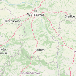
Streams
Park geography
Regional context, terrain elevations, and internal natural feature distribution
Structured Geographic Profile and Mapped Boundaries of Świętokrzyski National Park
Examine the physical geography of Świętokrzyski National Park located within the Świętokrzyskie Voivodeship of Poland. This profile details the 76.26 square kilometer protected area, featuring mountain terrain with elevations reaching 614 meters, alongside established forest habitats and diverse hydrologic features.

Poland's ancient mountain sanctuary protecting the Holy Cross ridgeline
Świętokrzyski National Park
Świętokrzyski National Park occupies the highest ridge of the Świętokrzyskie (Holy Cross) Mountains in central Poland, within the Świętokrzyskie Voivodeship. Established in 1950, the park covers approximately 76 square kilometers of mountainous terrain centered on the Łysogóry range, which contains the region's two highest peaks: Łysica at 612 meters and Łysa Góra (Bald Mountain) at 595 meters. The park also encompasses portions of the Klonowski Ridge and the Pokrzywianski Ridge, together forming a compact protected area in the heart of Poland's oldest mountain range. The landscape is characterized by gentle, rounded ridgelines and distinctive rocky gołoborze—bare rock rubble fields that formed during periglacial climatic conditions and give the mountain summits their unique character. The park maintains its headquarters in Bodzentyn, a historic town at the edge of the protected area.
- Location
- Poland
- Park type
- National park
- Established
- 1950
- Area
- 76.3 km²
- Highest point
- 614 m
Location overview
National park geography across Poland and Świętokrzyskie Voivodeship
Geographic Setting and Regional Location of Świętokrzyski National Park
Świętokrzyski National Park is situated within Poland and the Świętokrzyskie Voivodeship regional administrative boundaries. Recorded country memberships and territorial statuses define this protected area without transboundary or marine classifications.
- Countries
- Poland
- Regions
- Świętokrzyskie Voivodeship
- Primary location
- Świętokrzyskie Voivodeship
- Geographic setting
- Inland
Boundary and coordinates
Interactive boundary geometry and derived spatial measurements
Świętokrzyski National Park Boundary Map and Spatial Extent
Mapped park boundaries provide precise spatial context for examining protected territory and regional configuration. Recorded area measurements and coordinate limits accompany the digital outline for detailed geographic analysis.
- Boundary area
- 77 km²
- Boundary perimeter
- 133.9 km
- Northernmost point
- 50.9666° N
- Southernmost point
- 50.8393° N
- Easternmost point
- 21.1748° E
- Westernmost point
- 20.8078° E
- Geographic centre
- 50.8994° N, 20.9433° E
- North–south span
- 14.2 km
- East–west span
- 25.8 km
Elevation and terrain
Vertical relief data and recorded natural features across the park
Swietokrzyski National Park Elevation Summary and Mountain Terrain
Recorded elevation details highlight a peak altitude reaching six hundred fourteen meters within the mountain terrain. Linked feature cards supply names, types, and spatial relationships for streams, peaks, and valleys.
- Maximum elevation
- 614 m
- Highest point
- 614 m
Selected named natural features
Peaks
Agata
614 m
Peaks
Hucka Góra
546.9 m
Rivers
Pokrzywianka
Streams
Złota Struga
Streams
Ciek od Świętej Katarzyny
Environmental setting
Temperate broadleaf forest habitats, mountainous relief, and dominant forest cover.
Environmental Setting and Landscape Classifications of Świętokrzyski National Park
Recorded landscape features and habitat types combine to define the physical setting of Świętokrzyski National Park across mountain terrain. Mapped categories link directly to related environmental classifications within the protected area atlas.
- Relief
- Mountain
- Water
- Minor water
- Forest cover
- Dense forest cover
Landscape features
Mountains · Forest · Cliffs
Habitat types
Temperate broadleaf forest · Temperate coniferous forest
Park atlas
Compare regional mountain terrain, ancient forests, and connected protected landscapes.
Parks Near Świętokrzyski National Park and Protected Areas in Central Poland
Browsing other protected areas near Świętokrzyski National Park reveals the broader ecological spread of Poland's oldest mountain region. Regional park comparison provides valuable geographic context for understanding Central European forest reserves and rocky ridgeline habitats.
National parkŚwiętokrzyskie Voivodeship
Park boundaries overlap#1 closest
Northwest

Świętokrzyski Park Narodowy: Protected Forests and Mountain Geography in Central Poland
A preserved landscape of ancient fir forests and rubble fields
Situated within the Świętokrzyskie Voivodeship, this protected area guards the Łysogóry range and its rare forest associations. The landscape is characterized by its dramatic gołoborza rubble fields and dense mixed-woodland terrain, providing a unique look into the natural geography of the region.
- Area
- 76.26 km²
- Established
- 1950
- Visitors
- 168K annual
- Relief
- Mountain
Protected areaŚwiętokrzyskie Voivodeship
3.5 km away#2 closest
Northeast
Wzgórza Kunowskie: Geographic Atlas of an Essential Polish Protected Area and Habitat Mosaic
Mapping riparian forests and inland dunes in Świętokrzyskie
Wzgórza Kunowskie serves as a crucial Natura 2000 site in Poland, blending sand grasslands, oak-hornbeam forests, and riverine floodplains within a compact landscape. This overview analyzes the topographical gradients and habitat distribution that define the area, from elevated dunes to the moisture-rich valley floors of the Świętokrzyskie region, reflecting the interplay between sandy substrate and river regulation.
- Area
- 18.687 km²
- Water
- Major water bodies
Protected landscapeŚwiętokrzyskie Voivodeship
4.6 km away#3 closest
Northwest
Suchedniowsko-Oblęgorski Park Krajobrazowy: A Protected Landscape in Świętokrzyskie
Geographic terrain, forest ecosystems, and industrial heritage
Located in the Świętokrzyskie Voivodeship, this protected area preserves significant forest stands and historic industrial remnants. The terrain captures the intersection of plateau geology and hill country, hosting the headwaters of the Bobrza and Krasna rivers within a culturally layered, heavily forested environment.
- Area
- 198.95 km²
- Established
- 1988
- Relief
- Mountain
- Climate
- Temperate
Nature reserveŚwiętokrzyskie Voivodeship
About 5.2 km away#4 closest
East
Małe Gołoborze Nature Reserve: Mapping Cambrian Geology and Forested Ridge Ecosystems
A study of protected terrain in the Świętokrzyskie Voivodeship
Małe Gołoborze Nature Reserve stands as a preserved fragment of the Jeleniowskie Range, showcasing rare surface exposures of Cambrian quartzite sandstones alongside mature deciduous woodland. This entry offers a focused perspective on the reserve's topography, including its signature boulder slope and the valley floor that reveals the underlying geological foundations of central Poland's mountain landscape.
- Area
- 0.216 km²
- Established
- 1994
- Relief
- Mountain
- Climate
- Temperate
Protected landscapeŚwiętokrzyskie Voivodeship
5.6 km away#5 closest
South
Cisowsko-Orłowiński Park Krajobrazowy: Protected Landscape and Geological Atlas
Mapping biodiversity and Paleozoic formations in Świętokrzyskie, Poland
Cisowsko-Orłowiński Park Krajobrazowy stands as a center for biodiversity in southeastern Poland, protecting rare peat-bog forests and 200-year-old tree stands. This atlas profile highlights the park's distinct geological character, from the volcanic rock exposures at Sieraków to the fossil-rich sandstone cliffs at Zalesie, offering insight into the complex mosaic of the Góry Świętokrzyskie foothills.
- Area
- 206.93 km²
- Established
- 1988
- Relief
- Mountain
- Climate
- Temperate
Nature reserveświętokrzyskie
9.4 km away#6 closest
West
Ostoja Wierzejska Nature Reserve: Protected Forest and Ridge Geography in Świętokrzyskie
Ecological corridors and rare fir forest habitat mapping
Uncover the landscape characteristics of Ostoja Wierzejska, a protected area in Poland featuring quartzite ridges and diverse forest ecosystems. The reserve acts as a crucial ecological link within the Masłowskie Range, sheltering mature tree stands, rare fungi, and specialized invertebrates that define the unique phytosociology of the Świętokrzyskie Mountains.
- Area
- 2.25 km²
- Established
- 2011
- Relief
- Mountain
- Climate
- Temperate
Protected landscapeŚwiętokrzyskie Voivodeship
15 km away#7 closest
West
Chęcińsko-Kielecki Park Krajobrazowy: Protected Landscapes and Geological Atlas
Geographical overview of the Świętokrzyskie foothills in Poland
Located in the Świętokrzyskie Voivodeship, this protected area features a unique concentration of rocky hill summits, limestone caves, and forested corridors. The landscape serves as a vital transition zone, linking the regional capital of Kielce with traditional agricultural valleys and historic cultural landmarks. Map the terrain and understand the protected features that define this significant Polish landscape park.
- Area
- 197.816 km²
- Established
- 1996
- Relief
- Upland
- Climate
- Temperate
Nature reserveświętokrzyskie
18 km away#8 closest
Southeast
Ostoja Żyznów Protected Landscape: Loess Ravines and River Valleys of Świętokrzyskie
A dense mosaic of xerothermic grasslands and mixed forest ecosystems
Ostoja Żyznów protects a compact yet ecologically rich region characterized by deep loess gullies and the meandering paths of the Koprzywianka and Kacanka rivers. The area creates a striking transitional landscape, shifting from flat agricultural plateaus to steep, forest-covered ravines and cliff-like river walls. This site offers significant value for understanding regional biodiversity, featuring a rare combination of warm-dry grasslands and moisture-dependent peatland habitats in the heart of Poland.
- Area
- 44.8 km²
- Established
- 2011
- Relief
- Mixed relief
- Climate
- Temperate
MoriAtlas Explorer
Continue Exploring the Protected Landscapes of Świętokrzyski National Park
Examine the unique geological formations and forest boundaries of Świętokrzyski National Park. MoriAtlas provides structured geographic data and landscape context for this vital mountain protected area in the heart of Poland.
Browse next
Global natural geography
Explore related park routes
Explore MoriAtlas Global ParksBrowse All MoriAtlas ParksGlobal Park Map DiscoveryMoriAtlas: Browse All CountriesBrowse All MoriAtlas ContinentsNational Park Environment AtlasGrand Canyon National Park AtlasYellowstone National Park AtlasYosemite National Park Atlas and GeographySerengeti National Park AtlasGalápagos National Park Protected LandscapeBanff National Park Geography and AtlasKruger National Park Atlas EntryUluṟu-Kata Tjuṯa National Park AtlasExplore Uluru-Kata Tjuta National Park GeographyPlitvice Lakes National Park AtlasFiordland National Park Protected LandscapeGreat Smoky Mountains National Park AtlasAfghanistan National Parks and Protected AreasAlbania National Parks and Protected AreasAlgeria National Parks and Protected AreasAmerican Samoa National Parks and Protected AreasAndorra National Parks and Protected AreasAngola National Parks and Protected AreasAntarctica National Parks and Protected AreasAntigua and Barbuda Park List