
Mori Atlas logo
National parkSwiss National Park

Tracing the mapped boundaries and high-elevation natural heritage of the central Alps

Swiss National Park: An Authoritative Atlas of Alpine Wilderness and Protected Landscapes

(Schweizerischer Nationalpark)

The Swiss National Park stands as a landmark of strict conservation in the heart of the Engadin valley, representing the oldest national park in the Alps. This protected area covers a expansive range of mountainous terrain across Graubünden, where natural processes dictate the evolution of diverse habitats ranging from dense subalpine stone pine forests to high-altitude karst lakes and scree slopes. Through a commitment to total protection, the park serves as a primary reference for ecological research and landscape recovery in Central Europe.

Alpine landscapesubalpine forestmountain pinedolomitic geologycirque lakeswildlife observation
A flat-style digital illustration of a winding river flowing through a forested valley toward a central, snow-capped mountain peak under a soft, pastel-colored sky.

Swiss National Park

National park

Park overview

Structured park overview, official facts, and landscape profile for Swiss National Park

Swiss National Park park facts, protected area profile, and essential visitor context

Review the core facts for Swiss National Park, including designation, size, terrain, visitor scale, habitats, and operating context in one park-focused overview.

About Swiss National Park

The Swiss National Park occupies the lower Engadin in the far east of Switzerland, framed by the communities of Zernez, S-chanf, Scuol, and Val Müstair. Its territory of around 170 square kilometers spans a wide elevation band along the Sesvenna range, from the floor of the Inn valley to the crest of the surrounding peaks. The landscape combines dense subalpine forest, open Alpine pasture and meadow, dolomitic scree slopes, rock faces, snowfields, and small glacial cirque lakes, creating a compact mosaic of distinct Alpine habitats within a single protected area.

Geologically, most of the park sits on Engadine Dolomite, a sedimentary substrate that gives the area a relatively dry climate compared to many other parts of the Alps. The dominant tree is mountain pine, also known as dwarf pine, which forms about 90 percent of the forest cover along with Swiss stone pine. Roughly a quarter of the standing timber is deadwood, allowed to remain as part of the park's strict nature-reserve approach, and decomposition is so slow that individual dead trees often persist on the landscape for more than a century.

Beyond its natural assets, the park is a cornerstone of Swiss conservation history and Alpine environmental research. It was founded in 1914 after a decade of effort by Swiss naturalists, including the forester Johann Wilhelm Coaz and the Basel zoologist Paul Sarasin, building on broader late 19th and early 20th century impulses to safeguard the country's last untouched regions. Today the park is administered by a public-law foundation headquartered in Bern, with its operational base at Schloss Planta-Wildenberg in Zernez, where the visitor center Nationalparkhaus introduces visitors to the park's geology, wildlife, and ecological projects.

Quick facts and research context for Swiss National Park

The Swiss National Park lies in the canton of Graubünden in eastern Switzerland, within the Engadin region, and is by far the largest protected area in the country. Established in 1914 after a 1913 lease agreement, it predates virtually every other national park in the Alps and was already in place when the broader European conservation movement was still in its infancy.

It is internationally recognized as a strict nature reserve of the highest protection class. The area encompasses a broad elevation range across the Sesvenna range, dominated climatically by Engadine Dolomite geology. Roughly half of this area lies above the treeline.

Protection and recognition

Documented terrestrial protection scope and historical designation records

Swiss National Park Protection Status and Designation History

Swiss National Park maintains a documented terrestrial protection scope established through official designation history. Recorded conservation frameworks outline the administrative status and management timeline for the protected area.

Protection details

Protection scope
Terrestrial
Designated year
1979
Transboundary protection
No
Park context

Deeper park guide and search-rich context for Swiss National Park

Swiss National Park history, landscape, wildlife, and travel context

Explore Swiss National Park through its history, landscape character, ecosystems, wildlife, conservation priorities, cultural context, and seasonal travel timing in a structured park guide built for atlas discovery and search intent.

Why Swiss National Park stands out

The Swiss National Park is internationally recognized as a strict wilderness reserve, a place where the landscape is intentionally allowed to evolve without active human management. Its core identity rests on the idea of total protection: no forestry, no hunting, no grazing, and no leaving of the trails, so that the Alpine ecosystem can develop along the same natural processes that shaped it before human arrival in the region. Alongside this strict conservation philosophy, the park is known for the breadth of its protected Alpine terrain, encompassing pine-dominated forests, dry alpine meadows, scree slopes, and high-elevation cirque lakes. It also stands as one of the best-documented long-term ecological research sites in the Alps, with a research publication series running since 1920, and it functions as a reference site for studying rewilding processes in a Central European mountain setting.
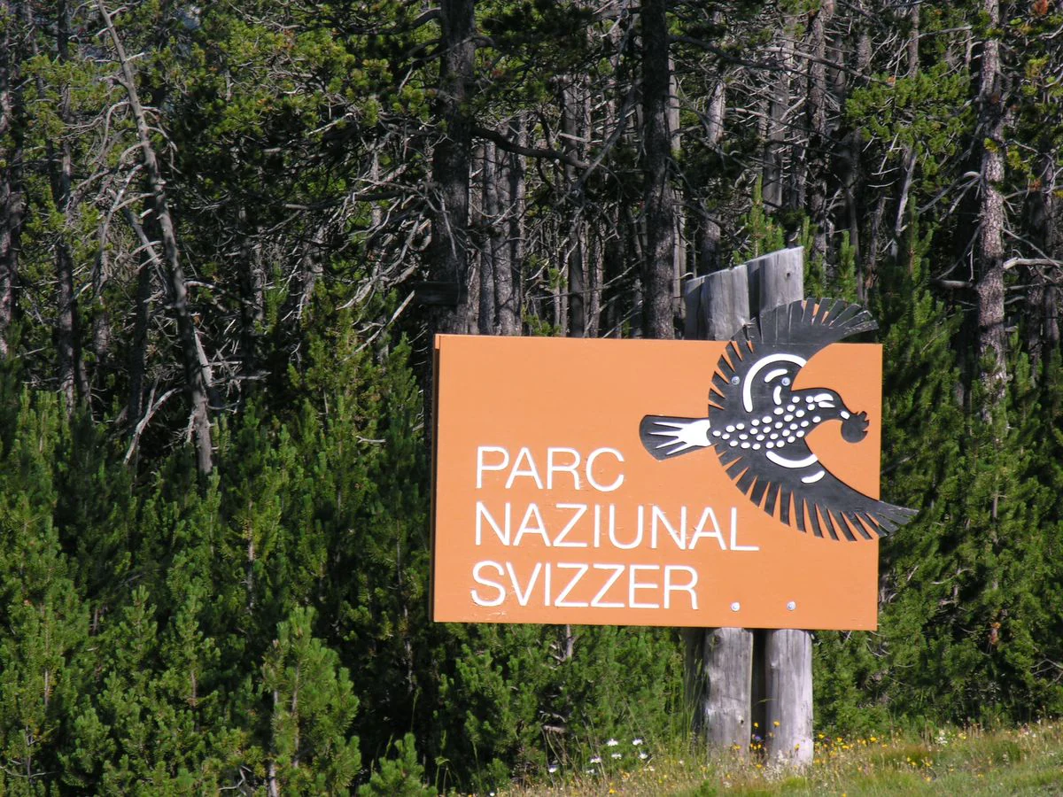
An orange rectangular sign for the Parc Naziunal Svizzer features an illustration of a bird and stands in front of a dense pine forest.
The official entrance sign for the Swiss National Park.

Swiss National Park history and protected-area timeline

The Swiss National Park emerged from a convergence of late 19th century Alpine conservation sentiment and early 20th century institutional backing. The initiative was driven by the Swiss Society of Natural Sciences, the present-day SCNAT, and culminated in the Ofen pass area being identified as a region of minimal agricultural value and high ecological integrity, with the Val Cluoza proposed in 1908 as the original nucleus. The forester and Alpine surveyor Johann Wilhelm Coaz and the Basel zoologist and conservationist Paul Sarasin were among the leading figures behind the project, and the Swiss League for the Protection of Nature, today Pro Natura, founded in 1909, helped finance the first phase.

In 1913 the Federal Council signed a 99-year easement contract with the relevant municipalities, and in 1914 the park officially opened with an area of around 79 square kilometers, already including the key core zones of Val Cluozza, the Ofenpass area, and Val Minger. By the early post-war years visitor numbers were still only in the low hundreds. From 1920 onwards the trail network was progressively developed, and by the second half of the 20th century approximately 80 kilometers of marked hiking routes were in place, including more demanding alpine sections.

The park's governance has evolved significantly over time. The 1913 agreement organized cooperation among the Confederation, the natural science society, and the Swiss League for the Protection of Nature, but as funding pressures grew, the Confederation gradually assumed a larger share of the burden and the park was reorganized as a public-law foundation. A revised National Park federal decree in 1959 made the contracts indefinite, introduced new lease terms, and forbade hydropower development with the exception of pre-existing installations. In 1961 the park area underwent its penultimate enlargement; in 2000 the high karst lake area of Macun, northeast of Zernez, was added. International recognition followed with the Council of Europe's European Diploma for Protected Areas in 1967 and UNESCO Biosphere Reserve status in 1979, the first designation of its kind in Switzerland.

Swiss National Park landscape and geographic character

The Swiss National Park stretches across the lower Engadin and the Sesvenna range, with elevations from roughly 1,400 meters near Zernez to about 3,174 meters at Piz Pisoc. The bulk of the protected area lies in the subalpine zone, where mountain pine and Swiss stone pine form extensive forests that give the lower slopes a distinctly Alpine, lightly forested character. Active forest dynamics are a central feature of the landscape: dead trees remain in place, bark beetle outbreaks run their course, and natural forest gaps open without human intervention, producing an unusually high proportion of structural deadwood that is now widely recognized as a defining trait of the park's forests.

Above the treeline the terrain transitions into alpine meadow, scree, bare rock, snowfields, and small cirque lakes. The high karst lake area of Macun, incorporated into the park in 2000, is a particularly striking example of these cold, open high-elevation landscapes and is closed to visitors to protect its fragile ecosystems. Other notable landscape features include the Val Cluoza and Val Minger valleys, the Ofenpass, and the Spöl gorge. Former traces of human use are still legible on the landscape, in the form of abandoned alpine pasture, charcoal kiln sites, and historic clearings. Old pasture flora persists in places where the soil memory of grazing runs deep, but in many areas natural succession is slowly reclaiming these sites, even though dolomitic conditions can slow recovery.

Active geomorphological features also contribute to the park's character. The Val Sassa contains an active rock glacier, and solifluction soils can be observed in the Val dal Botsch, both of which are highlighted as part of the visitor experience. Fossils, including dinosaur tracks near Piz dal Diavel, are an additional feature that links the park's geological history to a much deeper time scale. Although parts of the area are crossed by the Ofenpass road, allowing easier access, and by a hydroelectric compensation reservoir at Ova Spin, the majority of the interior valleys are kept free of through traffic to preserve the quiet character that is central to the park's management philosophy.
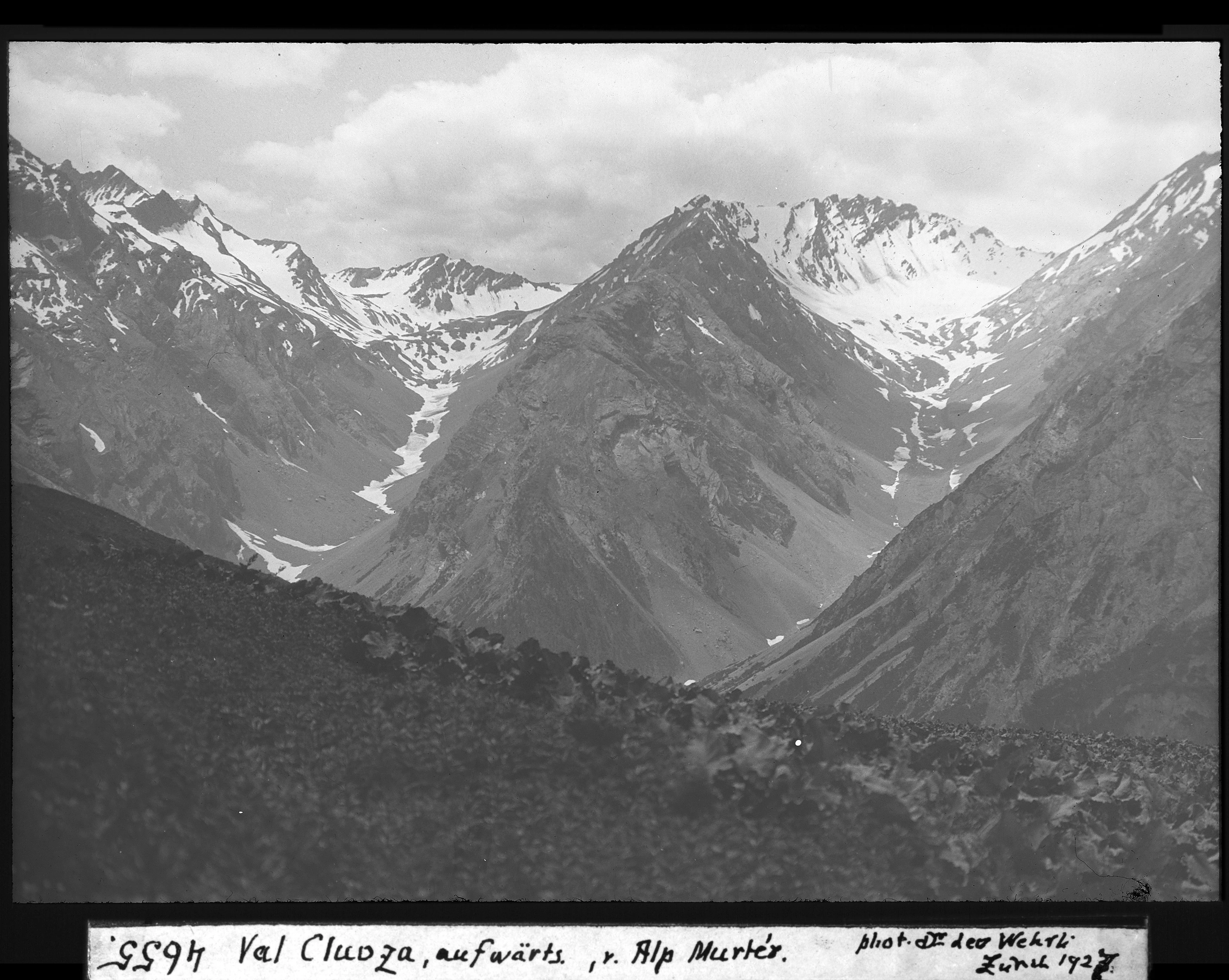
A black and white historical photograph of steep, snow-dusted alpine mountains rising over a deep valley, with a rocky, shadowed foreground.
A vintage black and white photograph showing a view of the Val Cluoza valley, viewed from Alp Murter.

Swiss National Park ecosystems, habitats, and plant life

Ecologically, the Swiss National Park is best understood as an Alpine subalpine-to-nival mosaic, stretching from dry, light-rich pine forests at lower elevations to bare rocky terrain and cirque lakes near the summits. Forests cover roughly a third of the park and are characterized by mountain pine and Swiss stone pine as the dominant tree species, while the remaining two-thirds consist of alpine meadows, rocky slopes, snow, ice, and open water. The dolomitic substrate contributes to relatively dry conditions throughout much of the park, which influences which plant communities are able to thrive.

Vegetation patterns in the park are strongly shaped by geology. Because most of the area sits on calcareous substrate, including sandstone, limestone, Verrucano and the Engadine Dolomite itself, calcicole, lime-loving flora dominates most sites. Only in the Macun karst lake area do small patches of crystalline rock such as gneiss and amphibolite occur, supporting slightly different plant communities. Climate extremes also shape the park's ecological character: average annual temperatures hover around freezing and annual precipitation is roughly 1,140 millimeters, conditions that favor hardy Alpine specialists, including a large share of the plant species found across the Swiss Alps.

In keeping with the strict protection regime, the park is managed as a total reserve where natural processes, rather than intervention, drive the dynamics of forest, meadow, and wildlife. Visitors are asked to remain on marked trails, a rule that is partly intended as a conservation tool because it limits disturbance to wildlife, especially ground-nesting birds and large mammals, and concentrates foot traffic on a relatively limited network. Together, the combination of carbonate geology, broad elevation range, large area, and total protection makes the Swiss National Park one of the most ecologically distinctive protected areas in the European Alps.
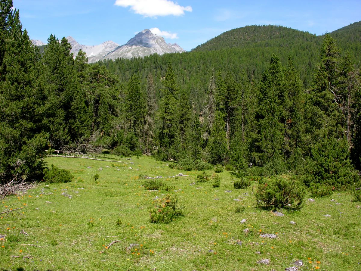
A green alpine meadow in the foreground with a dense forest of evergreen trees extending up the mountain slopes toward rocky peaks under a blue sky.
A summer view of a meadow and surrounding coniferous forest in the Swiss National Park.

Swiss National Park wildlife and species highlights

Wildlife observation is one of the central ways visitors experience the Swiss National Park, and the strict protection regime means animals are often visible from the trails, sometimes at strikingly close range. Common sightings include Alpine ibex, red deer, chamois, Alpine marmots, roe deer, mountain hares, lizards, snakes, and a wide variety of birds. The park is also an important stronghold for the bearded vulture, also known as the lammergeier, a raptor that was reintroduced in the park in 1991 and which, after initial natural breeding successes, was no longer supplemented with captive-bred birds from 2007 onwards.

Among the wildlife highlights of recent decades is the unexpected return of the brown bear. In July 2005, after an absence of roughly 90 years from Switzerland, an individual brown bear was documented in and around the park, apparently having arrived from South Tyrol. Rather than being hazed away, the bear was tolerated as a sign of a continuing expansion of European mammal populations and visitors were simply given updated advice on how to behave in the event of an encounter. Wolf and lynx sightings also occur occasionally, though they remain less frequent.

The park's wildlife populations have shifted measurably since its founding. Ibex numbers have remained broadly stable, whereas red deer and roe deer have significantly increased, leading in some areas to higher browsing pressure on young trees. Wild boar populations also vary; chamois and marmot populations fluctuate year to year. Poaching pressure remains a periodic concern, particularly because the park lies close to the borders of Austria and Italy, but illegal hunting is treated as a continuous management challenge rather than an existential threat.
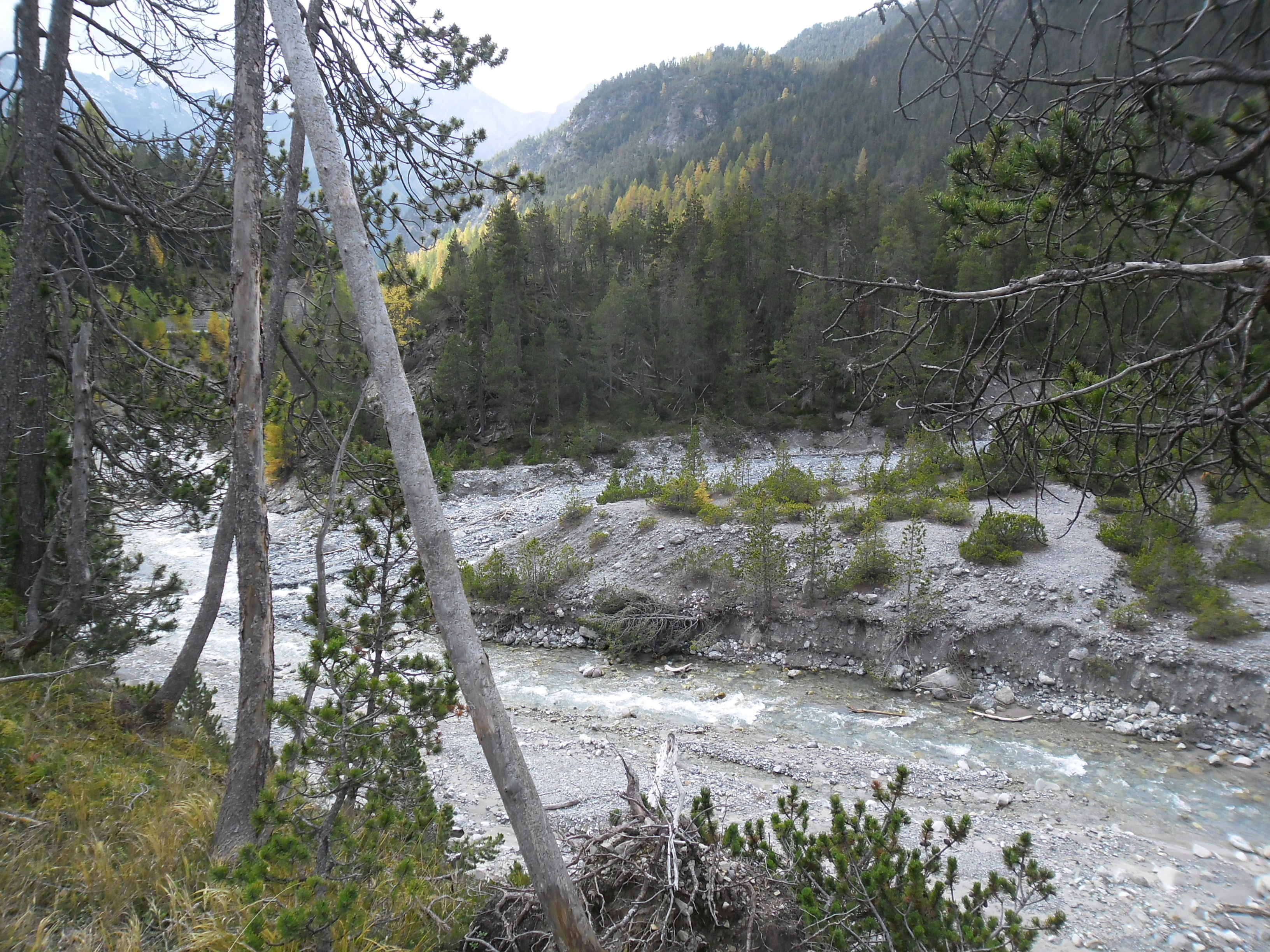
A view of the Spöl and Ova del Fuorn river confluence in the Swiss National Park, featuring a rocky riverbed, evergreen forest, and rugged mountain slopes.
The Spöl and Ova del Fuorn river confluence in the Swiss National Park.

Swiss National Park conservation status and protection priorities

The Swiss National Park is one of the most important protected areas in the Alps from a conservation perspective. Designated as a Category Ia strict nature reserve under the IUCN system, the highest level of protection recognized for a land-based site, it is governed by a strict non-intervention philosophy: no forestry, no hunting, no fishing, no grazing, no mowing, and no overnight camping are permitted. The goal is to allow natural succession and disturbance regimes to operate freely over the long term, so that in the coming centuries the area may approach the ecological character it had before human settlement in the region roughly 5,000 years ago.

The park has additional layers of international recognition. In 1967 it received the Council of Europe's European Diploma for Protected Areas, and in 1979 it became the first Swiss site to be designated a UNESCO Biosphere Reserve. Much of the surrounding area is listed in the Federal Inventory of Landscapes and Natural Monuments of National Significance, a measure that extends a high level of landscape protection to a buffer zone of tens of thousands of hectares around the core area.

Long-term ecological research is a defining feature of the park's conservation identity. Since 1920 the park has hosted a dedicated research publication series under the title Nationalpark-Forschung in der Schweiz, and since 1992 a dedicated Geographic Information System, developed in partnership with the University of Zurich, has been tracking ecological change across the reserve. This combination of passive protection philosophy, long-term monitoring, and active scientific synthesis is one reason the park is often cited as a model for evidence-based conservation in mountainous temperate regions. Conservation challenges nevertheless remain: the impacts of growing visitor numbers, slow recovery of soils at former charcoal kiln and pasture sites, the lingering risk of fire despite the generally damp environment, and the ongoing debate over whether any intervention-based restoration should ever be allowed inside a strict reserve.

Swiss National Park cultural meaning and human context

The Landschaft of the Swiss National Park reflects a long history of human use that only ended in the early 20th century. Before the park's establishment, parts of the area were exploited for seasonal alpine pasture, charcoal burning, and small-scale mining, and traces of these activities are still visible on the landscape today. Visitors who climb through Macun or walk into Val Cluoza often encounter old kiln sites, vegetation patterns reflecting centuries of grazing, and the relicts of former valley settlements. The local Romansh-speaking communities of Graubünden have thus shaped the very ecosystems that the park now protects, a fact that underlies the park's continuing commitment to interpreting that cultural layer for visitors.

The Romansh language is itself part of the cultural identity of the park. The Romansh name Parc Naziunal Svizzer is used on official signposting and presentations, alongside the German Schweizerischer Nationalpark and the French Parc National Suisse. Visitor information is offered in multiple national languages as well as English. Pathway interpretation covers not only ecological themes but also local land use history and Alpine rural culture, lending the park a strong sense of place rooted in Graubünden's regional identity.

In the wider Swiss imagination the national park holds a singular place: it is the country's only national park, and it carries the symbolic weight of the early 20th century conservation movement that led to its creation. Books by Paul Sarasin, Robert Schloeth, Willi Dolder, and more recent historians such as Patrick Kupper have made the park a recurring subject of Alpine cultural and natural-history writing, reinforcing its status as both a protected landscape and a touchstone of Swiss environmental heritage.

Top sights and standout views in Swiss National Park

Key highlights of the Swiss National Park include the Val Cluoza, a long, narrow side valley of the lower Engadin that has been the symbolic core of the park since its founding, and the Ofenpass, the high pass that serves both as a scenic gateway and as a focus of interpretation on the park's natural and cultural history.

Other standout experiences include hiking segments of the Nationalpark-Panoramaweg regional route that cross the heart of the reserve, exploring the forests of mountain pine and Swiss stone pine near Il Fuorn, and visiting the Nationalparkhaus visitor center in Zernez, with its permanent exhibition on the park's nature and research. Climbers and experienced hikers can reach the high Macun karst lake area, now part of the park, where the most fragile Alpine ecosystems are preserved. For wildlife enthusiasts, opportunities to observe ibex, chamois, marmots, and bearded vultures at relatively close range make the park one of the most rewarding wildlife-watching destinations in the Alps.

Best time to visit Swiss National Park

The Swiss National Park's high valley setting means that winter conditions are prolonged and snow lies deep at higher elevations for much of the year. Most visitors come in summer and early autumn, when the alpine meadows are in bloom, the trails above the treeline are largely free of snow, and wildlife is most active in the morning and evening hours along the forest edges and open slopes.

In late spring, snowmelt opens up the lower trails and reveals wildflower displays in the meadows, though higher routes may still require alpine equipment and experience. Autumn brings quieter conditions, the appearance of rutting behavior in red deer, and the chance to observe Alpine ibex moving to lower elevations in search of food. Winter visits are possible for experienced winter hikers, but the reserves strict protection rules mean that overnight stays in or beyond the park are prohibited and weather and avalanche risk can be serious considerations.

Monthly climate preview

Long-term representative monthly temperature and precipitation rhythm in Graubünden

Swiss National Park Climate Normals and Measured Annual Temperature Patterns

Recorded measurements at a high-elevation reference coordinate track long-term average temperature variations and monthly precipitation amounts across the year. Reviewing the complete twelve-month dataset provides a detailed baseline for analyzing regional climate conditions and annual weather distributions.
Annual mean0 °C
-10 °C11 °C
Jan-10°
Feb-10°
Mar-6°
Apr-1°
May
Jun
Jul11°
Aug10°
Sep
Oct
Nov-4°
Dec-9°
Warmest month
July

10.6 °C

Coolest month
January

-10.1 °C

Wettest month
June

4.4 mm/day

Driest month
February

1.5 mm/day

Park location guide

Geography guide, regional context, and park location map for Swiss National Park

Swiss National Park park geography, regions, and map view in Switzerland

Understand where Swiss National Park sits in Switzerland through a broader geographic reading of the surrounding landscape, nearby location context, and its mapped position within the national park landscape.

How Swiss National Park fits into Switzerland

Switzerland is a landlocked federal republic in Central Europe comprising 26 cantons, with Bern as the federal city and Zurich as the largest city. The country features the Swiss Alps, Swiss Plateau, and Jura Mountains, with German, French, Italian, and Romansh as official languages. It is noted for its political neutrality, direct democracy traditions, and strong economy.

Wider geography shaping Swiss National Park in Switzerland

Switzerland is located in Central Europe at the intersection of Western and Southern Europe. It is bordered by Germany to the north, France to the west, Austria and Liechtenstein to the east, and Italy to the south. The country is geographically divided among the Swiss Alps (covering most of the territory), the Swiss Plateau (where most of the population resides), and the Jura Mountains. Switzerland is landlocked.

Map view of Swiss National Park

Use this park location map to pinpoint Swiss National Park in Switzerland, understand its exact geographic position, and read its mapped placement within the surrounding landscape more clearly.

Pigeon | © OpenStreetMap contributors

Location context for Swiss National Park

Graubünden
Natural feature types

Explore the Natural Landscapes and Geographic Features of the Swiss National Park

Trace the varied natural landforms, valleys, and geological sites that constitute the Swiss National Park. Use this collection to map the diverse alpine terrain of the Engadin region through MoriAtlas. Examine how specific features contribute to the overall character of this protected wilderness.
Recorded earthquake history

Explore the Historical Earthquake and Seismic Catalogue for Swiss National Park

Delve into the documented record of seismic events associated with the geography of Swiss National Park. This historical data provides insight into the regional activity of the Engadin valley, offering researchers and visitors a clear look at recorded geological history through the MoriAtlas catalogue.

Swiss National Park Earthquake Records

Catalogued events

96 events

Strongest magnitude

Magnitude 4.8

Most recent event

Jan 17, 2018

This history includes earthquakes recorded inside the park or within 50 km of its borders

Explore photographic records of strict wilderness, subalpine pine forests, and high-elevation habitats.

Swiss National Park Landscape and Scenery: Visualizing Protected Alpine Terrain

Visual documentation captures the rugged topography, strict wilderness zones, and native habitats of Swiss National Park. Photographic archives illustrate the protected terrain, mountain pine forests, and high alpine scenery that define the region.

An orange rectangular sign for the Parc Naziunal Svizzer features an illustration of a bird and stands in front of a dense pine forest.

Wide panoramic view of a snow-covered mountain valley with evergreen forests and snow-capped peaks under a clear blue sky.

A black and white historical photograph of steep, snow-dusted alpine mountains rising over a deep valley, with a rocky, shadowed foreground.

A green alpine meadow in the foreground with a dense forest of evergreen trees extending up the mountain slopes toward rocky peaks under a blue sky.

A view of the Spöl and Ova del Fuorn river confluence in the Swiss National Park, featuring a rocky riverbed, evergreen forest, and rugged mountain slopes.

A clear, shallow mountain stream with gray rocks and stones along its bed, set against a steep, partially vegetated slope.

Park atlas

Compare adjacent Alpine terrain and regional conservation areas

Explore Other Parks Near Swiss National Park and Protected Landscapes

Discover protected areas and nearby national parks that share the rugged ecological characteristics of the Engadin valley. Compare surrounding mountain terrain and protected landscapes to understand regional conservation patterns across the Alps.
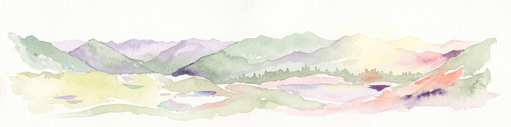
A soft watercolor painting showing a wide, high-altitude alpine plateau with rolling hills, scattered small lakes, and distant mountain ridgelines.
Nature reserveGraubünden
Mapped location lies within the park boundary#1 closest

Northwest

Macun-Seen Nature Reserve: Protected Alpine Plateau and Cirque Lake Landscape

High-altitude basin and crystalline geological features in Graubünden

Located in the Lower Engadine region of Graubünden, the Macun-Seen nature reserve is a significant high-altitude basin formed by glacial action. This protected exclave contains 23 small cirque lakes across a silicate plateau, offering a distinct ecological profile and expansive views of peaks approaching 3000 metres. It stands as a prime example of preserved alpine terrain within the broader Swiss National Park context.

Area
3.6 km²
Established
2000
Relief
Mountain
Climate
Alpine
Watercolor painting of a mountain range with a lake, green hills, and a sunset sky
National parkTrentino-Alto Adige/Südtirol
Park boundaries overlap#2 closest

Southeast

Stelvio National Park National Park: Protected Landscape and Regional Geographic Context

Explore its mapped boundaries and natural terrain.

Navigate Stelvio National Park, a designated national park in Italy's Trentino-Alto Adige/Südtirol region, through a map-centric lens. This page provides critical context for understanding the park's protected landscape, its geographic position within the Alps, and its mapped terrain. Utilize MoriAtlas to grasp the park's boundaries and its place in regional geography for structured natural landscape discovery.

Established
1935
IUCN
II
Relief
Mountain
Scope
Terrestrial
A soft, horizontal watercolor painting showing rolling green hills, a winding river or lake, and misty mountain silhouettes in the background against a white backdrop.
Regional parkGraubünden
About 7.9 km away#3 closest

Southeast

Biosfera Val Müstair Regional Park: Alpine Landscapes and UNESCO Biosphere Geography

Protected glacial terrain and cultural alpine valleys in eastern Switzerland.

Discover the distinctive natural geography of Biosfera Val Müstair, where a dry inner-Alpine climate meets high-altitude glacial features like the Lai da Rims. This regional park protects an extensive area of Graubünden, balancing rare ecosystems, broad alluvial fans, and the traditional alpine economy of the Romansh-speaking community.

Area
198.65 km²
Established
2011
Relief
Mountain
Climate
Alpine
A soft watercolor painting of a river winding through a valley with green trees, grassy plains, and distant purple hills against a white background.
Nature reserveGraubünden
About 11 km away#4 closest

Southwest

Naturschutzgebiet Isla Glischa-Arvins-Seglias Nature Reserve in Graubünden

Mapped alluvial terrain and alpine river geography

Situated in the broad valley floor of the Upper Engadin, this nature reserve protects one of the most significant alpine floodplain zones in the Swiss canton of Graubünden. The area features a complex network of river channels, gravel lakes, and marshes that are currently undergoing active revitalization to restore natural riverine processes and support rare riparian ecosystems.

Area
0.867 km²
Established
1992
IUCN
IV
Relief
Upland
Watercolor illustration of a panoramic mountain landscape with soft green hills, rolling ridgelines in shades of pink and purple, and small patches of blue water in the foreground.
Regional parkCanton of Graubünden
About 26 km away#5 closest

West

Parc Ela: Regional Nature Park and Alpine Geography in the Canton of Graubünden

A vertical protected landscape in the Swiss Alpine arc.

Parc Ela encompasses a remarkable span of Swiss Alpine geography, protecting everything from low-lying forested gorges at seven hundred meters to high-altitude peaks over three thousand meters. The park serves as a vital refuge for threatened insect species and large alpine mammals, while preserving the linguistic and architectural heritage of the Albula and Oberhalbstein valleys. Explore the mapped terrain where paleontological treasures meet historic trade routes.

Area
659 km²
Established
2012
Relief
Mountain
Climate
Alpine
A horizontal watercolor illustration showing stylized, overlapping mountain ridges in shades of soft green, pink, and yellow against a white background.
Natural monumentGraubünden
About 29 km away#6 closest

Southwest

Roseggletscher Natural Monument: Alpine Glacier Geography and Proglacial Lake Mapping

Protected landscape data for the Bernina range in Graubünden.

Examine the geographic boundaries and terrain of the Roseggletscher, a protected natural monument situated in the upper Val Roseg. This record captures its glacial extent, the emergence of the Lej da Vadret proglacial lake, and its role within the wider Bernina glacier ensemble of southeastern Switzerland.

Area
6.38 km²
Relief
Mountain
Climate
Alpine
Access
Moderate access
Regional parkGraubünden
40 km away#7 closest

West

Naturpark Beverin: Exploring Alpine Gorges and Cultural Landscapes in Graubünden

A regional nature park shaped by high alpine ridges and ancient settlement traditions.

Naturpark Beverin encompasses a vast, multi-layered environment in the Swiss Alps. The area is defined by the sharp vertical contrast between carved river gorges like the Viamala and high-elevation ridges. Beyond the rugged mountain terrain, this protected landscape preserves centuries of pastoral history through the distinct settlement traditions of its Romanesque and Walser valleys.

Area
515 km²
Established
2013
Relief
Mountain
Climate
Alpine
Nature reserveLombardia
About 48 km away#8 closest

Southwest

Val di Mello Nature Reserve: Mapping the Granitic Geography of the Italian Alps in Lombardia

A study of protected vertical relief, glacial cirques, and Alpine terrain.

Val di Mello offers a profound look at high-altitude Alpine geography, characterized by its immense, light-colored granitic walls and deeply carved tributary valleys. This protected nature reserve acts as a gateway to the broader mountainous terrain of the Lombardia region, showcasing the geological evolution of the Italian Alps through its steep gullies, high summits, and expansive valley floor.

Established
2009
Relief
Mountain
Access
Moderate access
Scope
Terrestrial

Common questions about visiting, size, designation, and location context for Swiss National Park

Swiss National Park FAQs for park facts, access, geography, and protected area context

Find quick answers about Swiss National Park, including protected-area facts, park geography, trail and visitor context, and how the park fits into its surrounding country and regional landscape.
MoriAtlas Explorer

Continue Your Protected Areas Search Across the Global Atlas

Deepen your exploration by continuing the structured search for national parks and protected areas worldwide. Utilize the comprehensive filtering capabilities to compare different conservation landscapes and refine your understanding of global park geography. Discover more about the distribution and characteristics of protected natural areas.

Global natural geography