
Mori Atlas logo
National parkTalassemtane National Park

Understanding the mapped boundaries and natural terrain of this key national park.

Talassemtane National Park: Morocco's Protected Landscape Atlas and Geographic Context

Talassemtane National Park represents a significant protected landscape within Morocco, offering a distinct geographic identity for atlas-driven exploration. This page details the park's mapped boundaries and its role as a protected national park, providing essential context for understanding its natural terrain and regional significance. Explore how this protected area contributes to the geographic tapestry of North Africa.

Mediterranean mountainsEndemic conifer forestsRif MountainsMoroccan firBirdwatchingMountain hiking
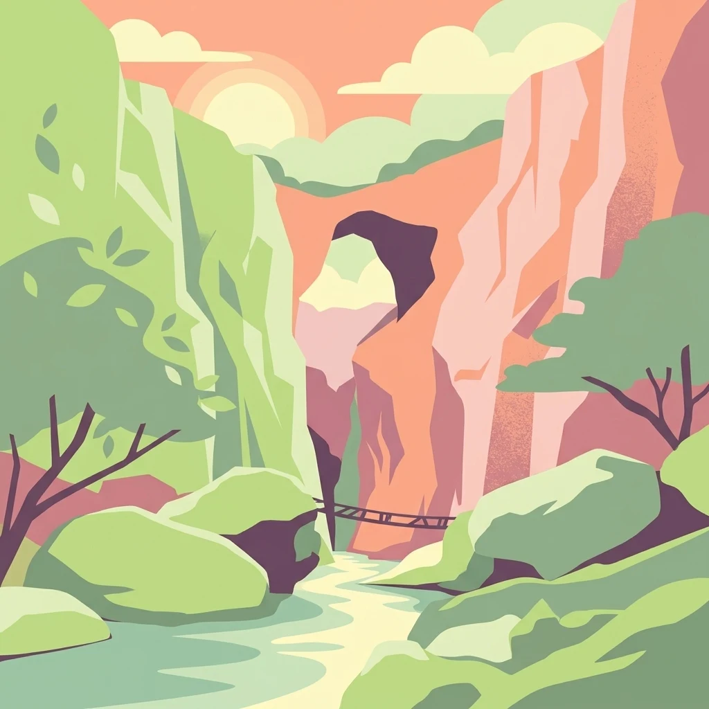
Illustration showing a river flowing through a canyon with green trees, orange cliffs, and a suspension bridge under a bright sun

Talassemtane National Park

National park

Park overview

Structured park overview, official facts, and landscape profile for Talassemtane National Park

Talassemtane National Park park facts, protected area profile, and essential visitor context

Review the core facts for Talassemtane National Park, including designation, size, terrain, visitor scale, habitats, and operating context in one park-focused overview.

About Talassemtane National Park

Talassemtane National Park occupies a significant position in Morocco's protected area network as the premier conservation site for Mediterranean mountain forests in the Rif region. The park's establishment in 2004 marked a critical milestone in protecting one of the Mediterranean's most threatened forest types, as Moroccan fir forests had been dramatically reduced by centuries of logging, grazing pressure, and agricultural expansion. The park's location within the Intercontinental Biosphere Reserve of the Mediterranean reflects its international ecological significance, connecting it to a broader network of protected areas spanning the European and African Mediterranean coasts.

The park's terrain consists of steep mountain ridges, deep valleys, and rocky outcrops characteristic of the Rif Mountains, a range that forms part of the broader Alpine-Mediterranean mountain system. The elevation gradient from 350 to 1,050 meters supports distinct ecological zones, with lower slopes characterized by mixed evergreen and deciduous woodland transitioning into conifer-dominated forests at higher elevations. The proximity to Chefchaouen, Morocco's iconic blue-painted city, has made the park an increasingly popular destination for visitors combining cultural tourism with outdoor exploration. The traditional villages of El Kalaá and Akchour provide access points into the park's interior, where visitors can experience the mountain landscapes and forest environments that define this protected area.

Quick facts and research context for Talassemtane National Park

Talassemtane National Park is located in the Rif Mountains of northern Morocco, approximately 589.5 square kilometers in size with elevations between 350 and 1,050 meters. The park was formally established in October 2004 and forms part of the Intercontinental Biosphere Reserve of the Mediterranean. It was added to UNESCO's World Heritage Tentative List in 1998 and serves as a critical refuge for endangered conifer species, particularly the Moroccan fir and Atlas cedar. The area supports over 1,380 plant species, including 47 that are endemic to Morocco, and has been designated an Important Bird Area by BirdLife International due to its significant avian populations.

Protection and recognition

Examining documented conservation frameworks and regional management boundaries

Documented Protection Status and Legal Designation of Talassemtane National Park

Exploring the documented protection status of Talassemtane National Park reveals the essential management parameters and conservation framework designated to safeguard the regional landscape. Verifying official records assists researchers and geographers in understanding the established environmental protections applied to the park boundaries.

Protection details

Protection scope
Mixed
Transboundary protection
No
Park context

Deeper park guide and search-rich context for Talassemtane National Park

Talassemtane National Park history, landscape, wildlife, and travel context

Explore Talassemtane National Park through its history, landscape character, ecosystems, wildlife, conservation priorities, cultural context, and seasonal travel timing in a structured park guide built for atlas discovery and search intent.

Why Talassemtane National Park stands out

Talassemtane National Park is best known for protecting the last remaining old-growth forests of Moroccan fir (Abies pinsapo), a relict conifer species that survived the last glacial period and now exists in only a handful of locations worldwide. The park contains the only Spanish firs native to Morocco, growing under the highest level of protection within its core areas. Its dramatic landscapes feature the famous Bridge of God, a natural stone arch formation, and the park supports exceptional bird diversity including the bearded vulture, a striking Mediterranean raptor. The combination of endemic conifer forests, significant biodiversity, and accessible mountain scenery makes this park a flagship conservation site for Morocco's Mediterranean mountain ecosystems.
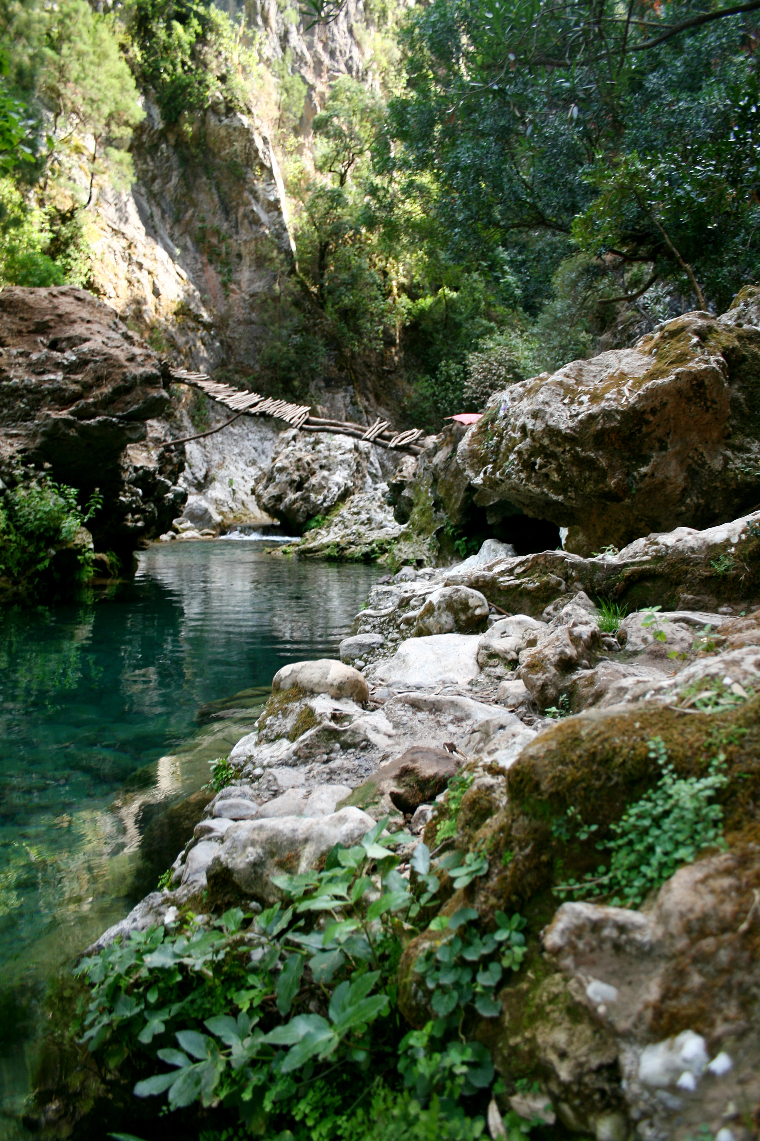
Clear blue stream surrounded by rocks and greenery with a wooden bridge crossing the water in Talassemtane National Park.
A serene stream flows through rocky terrain with a wooden bridge in Talassemtane National Park.

Talassemtane National Park history and protected-area timeline

The creation of Talassemtane National Park in October 2004 represented the culmination of growing recognition that Morocco's Mediterranean mountain forests required formal protection to prevent further ecological decline. The site had already gained international attention when it was added to UNESCO's World Heritage Tentative List in October 1998, acknowledging its outstanding universal value as a Mediterranean forest ecosystem. The primary driver for park establishment was the urgent need to conserve the last remaining stands of Moroccan fir, a species that had been severely depleted by centuries of logging and forest clearance.

Prior to national park status, the forest had experienced significant pressure from logging operations and grazing, leading to concerns among conservation scientists about the long-term survival of the fir populations. The designation as a national park provided legal framework for stricter protection of the old-growth forest areas and enabled more coordinated management of the broader landscape. The park's inclusion in the Intercontinental Biosphere Reserve of the Mediterranean also situates it within a broader transcontinental conservation framework that recognizes the ecological connections between Mediterranean ecosystems across national boundaries.

Talassemtane National Park landscape and geographic character

The landscape of Talassemtane National Park embodies the rugged character of the Rif Mountains, a range that runs parallel to Morocco's Mediterranean coast and creates a dramatic backdrop of steep peaks and forested slopes. The terrain is characterized by limestone and sandstone formations that have been sculpted by millions of years of erosion, creating a network of deep ravines, cliff faces, and mountain ridges. The elevation range of 350 to 1,050 meters creates a varied topography that supports distinct ecological communities across relatively short distances.

The park's most distinctive geological feature is the Bridge of God, a natural arch formation that has become one of the park's signature landmarks. This impressive stone bridge spans a small valley and can be reached via hiking trails from the surrounding villages. The landscape transitions through woodland zones as elevation increases, with the lower slopes supporting mixed forests of evergreen oaks and juniper before giving way to the pure stands of Moroccan fir that characterize the higher elevations. Rocky outcrops and cliff faces provide habitat for specialized plant species and create visual diversity throughout the park.

Talassemtane National Park ecosystems, habitats, and plant life

Talassemtane National Park supports extraordinary botanical diversity, with over 1,380 plant species recorded within its boundaries, including 47 species that are endemic to Morocco. The park lies within the Spanish-Maghrebi biodiversity hotspot, one of the world's most significant centers of plant diversity. The most ecologically important feature is the population of Moroccan fir (Abies pinsapo), a relict species that survived the Pleistocene ice ages in this limited refugium and represents a crucial component of the park's conservation value. These fir forests represent the only native Spanish fir populations in Morocco and occur in only a few isolated locations globally.

The park also protects significant populations of Atlas cedar (Cedrus atlantica), another iconic Mediterranean conifer that has been designated as endangered. The understory of the forest supports the Andalusian Belladonna (Atropa baetica), a relative of the deadly nightshade that adds to the botanical distinctiveness of the area. The combination of endemic conifers, Mediterranean evergreen species, and specialized mountain flora creates an ecosystem of considerable scientific and conservation importance. The vegetation zones reflect the elevation gradient, with holm oak and juniper woodland giving way to pure fir forest at higher elevations, creating a layered landscape of considerable ecological complexity.

Talassemtane National Park wildlife and species highlights

Talassemtane National Park supports remarkable avian diversity, with over 100 bird species recorded within its boundaries, leading to its designation as an Important Bird Area by BirdLife International. The bearded vulture (Gypaetus barbatus), one of the Mediterranean's most impressive raptors, inhabits the park's cliffs and mountain terrain, using its unique feeding ecology to scavenge carcasses across the landscape. The park supports significant populations of several bird species of conservation concern, including the Barbary partridge, a gamebird species with declining numbers across its range.

The diverse bird community includes species such as the red-necked nightjar, Levaillant's woodpecker, both subalpine and Sardinian warblers, spotless starlings, Moussier's redstarts, and both black-eared and black wheatears. These species represent the Mediterranean avifauna that has evolved in step with the region's distinctive forest and scrub habitats. Beyond birds, the park supports populations of Barbary macaques (Macaca sylvanus), the only wild primate species in North Africa, as well as Greek tortoises and the many-scaled cylindrical skink, a specialized lizard species. The combination of forest, cliff, and open habitat types supports this diversity of vertebrate life.

Talassemtane National Park conservation status and protection priorities

Talassemtane National Park represents one of Morocco's most significant conservation achievements, protecting a unique Mediterranean forest ecosystem that had been under considerable pressure. The park's primary conservation focus on Moroccan fir forests addresses a critical gap in global biodiversity protection, as this species exists in only a handful of locations worldwide. The inclusion of the park in UNESCO's World Heritage Tentative List reflects international recognition of its outstanding universal value as a representative Mediterranean forest ecosystem.

The park's designation as part of the Intercontinental Biosphere Reserve of the Mediterranean connects it to broader conservation frameworks that coordinate protection across national boundaries in the Mediterranean basin. The protection of both Moroccan fir and Atlas cedar addresses the conservation needs of two endangered conifer species, while the Important Bird Area designation acknowledges the site's significance for bird conservation. Management challenges include balancing conservation objectives with the growing tourism pressure from visitors to the Chefchaouen area, requiring careful visitor management and trail planning to protect sensitive forest areas.

Talassemtane National Park cultural meaning and human context

The landscape of Talassemtane National Park has been shaped by centuries of human activity, with traditional Berber communities maintaining a presence in the villages surrounding the protected area. The villages of El Kalaá and Akchour serve as traditional access points into the mountain environment, with settlement patterns that reflect the agricultural potential of the valley floors and the use of higher elevations for seasonal grazing. The local communities have historically relied on the forests for timber, charcoal production, and grazing, creating a complex relationship between human use and forest ecosystems.

The Rif region has a rich cultural history as part of the broader Amazigh (Berber) cultural region of North Africa, with distinctive traditions, architecture, and land management practices that have shaped the landscape over generations. The proximity to Chefchaouen, a city with its own distinctive cultural identity shaped by its founding as a refuge for Moorish exiles from Granada in the 15th century, provides cultural context for understanding the human geography of the region. Modern park management seeks to balance traditional land use patterns with conservation objectives, recognizing the importance of local community involvement in sustainable protected area management.

Top sights and standout views in Talassemtane National Park

Talassemtane National Park offers exceptional Mediterranean mountain experiences centered on its ancient fir forests and dramatic Rif mountain scenery. The opportunity to walk among the last old-growth Moroccan fir trees, some of which are hundreds of years old, provides a profound connection to a forest ecosystem that survived the Ice Age and now depends on protected area management for survival. The hike to the Bridge of God natural arch rewards visitors with both physical challenge and one of the park's most photogenic landmarks. Birdwatchers can seek the elusive bearded vulture soaring on thermal currents above the cliffs, while the more than 100 additional bird species provide diverse observation opportunities throughout the year. The accessibility from Chefchaouen makes this park an ideal destination for travelers seeking to experience Morocco's natural heritage alongside its famous cultural sites.

Best time to visit Talassemtane National Park

The best time to visit Talassemtane National Park is during the spring months of April and May, when wildflowers carpet the forest understory and bird activity peaks with migratory species present. Summer months from June to August can be warm but offer long days for hiking and the opportunity to experience the Mediterranean forest at its most verdant. Autumn brings changing colors to the deciduous elements of the forest and provides good conditions for walking, while winter, though cooler, offers a different character with reduced visitor numbers and the possibility of snow on the higher peaks. The park can be visited year-round, though conditions in the higher elevations may be more challenging during winter months.
Monthly climate preview

Long-term temperature ranges and precipitation patterns recorded across twelve monthly intervals.

Talassemtane National Park Climate Normals and Monthly Weather Data

Representative coordinate records outline how average temperatures shift between cooler winter months and warmer summer highs alongside varying daily precipitation rates. Examining the full twelve-month profile provides deeper analytical context for long-term meteorological trends across the protected terrain.
Annual mean16 °C
8 °C27 °C
Jan
Feb
Mar11°
Apr13°
May17°
Jun22°
Jul26°
Aug27°
Sep22°
Oct17°
Nov12°
Dec
Warmest month
August

26.7 °C

Coolest month
January

7.8 °C

Wettest month
November

4.1 mm/day

Driest month
July

0.1 mm/day

Park location guide

Geography guide, regional context, and park location map for Talassemtane National Park

Talassemtane National Park park geography, regions, and map view in Morocco

Understand where Talassemtane National Park sits in Morocco through a broader geographic reading of the surrounding landscape, nearby location context, and its mapped position within the national park landscape.

How Talassemtane National Park fits into Morocco

Morocco is a North African country bordering the Mediterranean Sea to the north and Atlantic Ocean to the west. It borders Algeria to the east and the disputed Western Sahara territory to the south. The country operates as a parliamentary constitutional monarchy under King Mohammed VI, with Arabic and Tamazight as official languages. Morocco has a population of approximately 37 million and covers an area of about 446,550 km².

Wider geography shaping Talassemtane National Park in Morocco

Morocco occupies the northwestern corner of Africa, bordering the Mediterranean Sea to the north and Atlantic Ocean to the west. The country shares borders with Algeria to the east and the disputed Western Sahara territory to the south. The terrain is diverse, featuring the Atlas Mountains in the central and southern regions, Rif Mountains in the north, and plains along the coastal areas. The country also claims Spanish exclaves of Ceuta and Melilla.

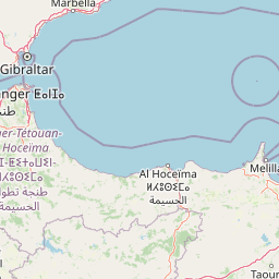
Map view of Talassemtane National Park

Use this park location map to pinpoint Talassemtane National Park in Morocco, understand its exact geographic position, and read its mapped placement within the surrounding landscape more clearly.

Pigeon | © OpenStreetMap contributors

Location context for Talassemtane National Park

Rif

Visualizing Talassemtane's Protected Habitats, Dramatic Scenery, and Unique Geological Features

Talassemtane National Park Photos: Explore Majestic Moroccan Fir Forests and Rugged Rif Mountain Landscapes

Visually explore Talassemtane National Park, understanding its diverse Mediterranean mountain landscapes and the critical Moroccan fir forests through detailed imagery. Examine the rugged terrain of the Rif Mountains, the famous Bridge of God natural arch, and varied habitats, providing a clear geographic understanding of this significant protected area.

Clear blue stream surrounded by rocks and greenery with a wooden bridge crossing the water in Talassemtane National Park.

Natural rock arch between steep rocky cliffs with vegetation and water at the base

Park atlas

Trace the connected protected landscapes and diverse ecosystems throughout Morocco's Rif Mountain region.

Discover Other National Parks and Protected Areas Near Talassemtane National Park

Expand your park exploration beyond Talassemtane National Park to discover other national parks and protected areas across Morocco's Rif Mountains. Compare varied conservation landscapes, tracing the geographic spread of mountain forests, dramatic gorges, and coastal protected zones within the broader region.
Watercolor illustration showing a landscape with green hills, vegetation, and distant mountains
National parkMorocco
About 84 km away#1 closest

East

Al Hoceima National Park: Morocco's Coastal and Marine Protected Wilderness

Explore dramatic cliffs, kelp forests, and marine biodiversity.

Al Hoceima National Park represents a significant protected coastal and marine area in northern Morocco, distinguished by its rugged 50-kilometer Mediterranean coastline featuring spectacular limestone cliffs. This national park offers an atlas-style view of a landscape transitioning from the Ibaqouyen Rif mountains to the sea, harboring rich marine biodiversity including significant osprey colonies and dolphin habitats. Discover the mapped extent of this wild protected territory and its unique ecological features.

Area
480 km²
Established
2004
IUCN
II
Relief
Mountain
Protected areaMorocco
About 109 km away#2 closest

West

Merja Zerga Protected Area: Moroccan Coastal Wetland Map and Geography

Explore the protected landscape and regional context of Merja Zerga.

Merja Zerga is a designated protected area situated on Morocco's Atlantic coast, characterized by its important wetland ecosystems. This entry facilitates detailed atlas exploration, providing users with mapped geographic data and insights into the park's protected boundaries. Understanding Merja Zerga offers valuable context for the distribution of protected lands and natural landscapes within the broader North African region.

IUCN
VI
National parkTaza Province
About 141 km away#3 closest

Southeast

Tazekka National Park: Protected Landscape and Geographic Context in Taza Province

Discover its national park status and mapped terrain.

Tazekka National Park serves as a vital protected area within the geographic framework of Taza Province, Morocco. This national park offers a distinct landscape for exploration, allowing users to investigate its mapped boundaries and regional natural features. Understand the park's role in the local geography and its contribution to Morocco's atlas of protected lands. Its specific terrain and setting make it a key point for structured geographic discovery.

Area
120 km²
Established
1950
IUCN
II
Relief
Mountain
National parkSpain
About 158 km away#4 closest

North

Sierra de las Nieves National Park: Ancient Fir Forests and Karst Geography in Andalusia

Mapped protected landscape and unique geologic features

Sierra de las Nieves National Park stands as a remarkable protected area in Andalusia, Spain, celebrated for its world-leading Spanish fir forests and intricate karst topography. This national park showcases significant geological diversity, from towering limestone formations and deep caves to the striking red peridotite mountains of Sierra Bermeja. Its elevation, reaching Pico Torrecilla at 1,919 meters, offers a unique alpine landscape context within southern Europe, mapped for detailed geographic discovery and protected area exploration.

Area
939.3 km²
Established
1989
IUCN
II
Visitors
100K annual
National parkMorocco
About 188 km away#5 closest

South

Ifrane National Park: Protected Landscape and Geographic Context in Morocco

National park boundaries and mapped terrain.

Investigate Ifrane National Park, a designated national park in Morocco, and its contribution to the country's protected lands. This profile details its geographic location, providing context for its mapped presence and the natural landscapes it encompasses. Delve into the atlas-relevant features that define this protected area, focusing on its geographic identity within Morocco's natural heritage.

Area
500 km²
Established
2004
IUCN
II
Relief
Mountain
Nature reserveAndalusia
About 211 km away#6 closest

Northeast

Acantilados de Maro-Cerro Gordo: Protected Coastal Cliffs and Marine Geography Atlas

Mapping the rugged Mediterranean boundary in Andalusia, Spain

Discover the complex geography of Acantilados de Maro-Cerro Gordo, a protected nature reserve defined by vertical cliffs exceeding 200 meters and isolated coastal coves. This atlas entry details the transition between Betic mountain terrain and marine ecosystems, documenting prominent headlands like Cerro Gordo and the biological richness of its protected reefs and seagrass meadows.

Area
19.129 km²
Established
1989
Relief
Upland
Climate
Mediterranean
Watercolor illustration of a river flowing through wetlands with trees and distant hills
National parkHuelva
About 218 km away#7 closest

Northwest

Doñana National Park National Park: Mapped Geography and Protected Landscape Context

Explore Huelva's key protected area and its regional geographic setting.

Delve into the structured geographic data and mapped boundaries of Doñana National Park. This entry highlights its identity as a national park within the Huelva region, providing essential context for understanding its protected landscape. MoriAtlas offers this detail to facilitate a clear, atlas-driven exploration of its natural terrain and its place in the broader geographic framework of Spain.

Area
543 km²
Established
1969
IUCN
II
Visitors
376.3K annual
National parkMorocco
About 246 km away#8 closest

South

Khenifra National Park: National Park Atlas and Mapped Protected Landscape

Geographic context and protected area mapping for Morocco.

Explore the atlas perspective of Khenifra National Park, a designated national park in Morocco. This page provides detailed geographic context, focusing on its mapped protected landscape and its role within the country's network of conservation areas. Understand the park's terrain and regional setting through structured geographic data.

Area
842 km²
Established
2008
Relief
Mountain
Climate
Mediterranean

Common questions about visiting, size, designation, and location context for Talassemtane National Park

Talassemtane National Park FAQs for park facts, access, geography, and protected area context

Find quick answers about Talassemtane National Park, including protected-area facts, park geography, trail and visitor context, and how the park fits into its surrounding country and regional landscape.
MoriAtlas Explorer

Continue Your Protected Areas Search Across the Global Atlas

Deepen your exploration by continuing the structured search for national parks and protected areas worldwide. Utilize the comprehensive filtering capabilities to compare different conservation landscapes and refine your understanding of global park geography. Discover more about the distribution and characteristics of protected natural areas.

Global natural geography