

Mori Atlas logo
Marine protected areaTasman Fracture Commonwealth Marine Reserve

Analyzing the deep ocean seafloor, underwater ridges, and transitional currents off the Tasmanian coast.

Tasman Fracture Commonwealth Marine Reserve: Geographic Mapping and Marine Protected Area Atlas

The Tasman Fracture Commonwealth Marine Reserve serves as a major marine protected area situated off the rugged south-west coastline of Tasmania. This massive offshore territory encompasses the significant Tasman Fracture geological zone and a series of undersea peaks that rise from deep ocean waters. Through structured mapping, observers can understand how this site provides critical habitat for deepwater corals and serves as a confluence for Australian temperate waters and subantarctic currents.

marine protected areadeep-sea habitatseamountsdeepwater coralssubantarctic watersZeehan Current

Tasman Fracture Commonwealth Marine Reserve

Marine protected area

Park overview

Structured park overview, official facts, and landscape profile for Tasman Fracture Commonwealth Marine Reserve

Tasman Fracture Commonwealth Marine Reserve park facts, protected area profile, and essential visitor context

Review the core facts for Tasman Fracture Commonwealth Marine Reserve, including designation, size, terrain, visitor scale, habitats, and operating context in one park-focused overview.

About Tasman Fracture Commonwealth Marine Reserve

The Tasman Fracture Commonwealth Marine Reserve is a large offshore protected area in Australian Commonwealth waters, located in the Indian Ocean beyond the wild south-west coast of Tasmania. Covering approximately 42,500 square kilometres of open ocean and deep seafloor, it extends to the outer boundary of Australia's exclusive economic zone in this region, making it one of the more geographically remote marine reserves in the national system.

At the heart of the reserve is the Tasman Fracture itself, a prominent seafloor feature that the reserve is named after. The surrounding sea floor is far from uniform: a series of undersea peaks rise toward the surface, with their summits lying at depths of less than about 1,500 metres. These elevated features interrupt what would otherwise be a continuous deep plain and create varied conditions for marine life, particularly for hard corals that can colonize the harder substrates of the peaks.

The reserve sits in waters shaped by the Zeehan Current, the most easterly branch of the broader subantarctic current system. This oceanographic setting is central to the reserve's ecological character, linking it to colder southern waters and influencing the composition of species found there. The combination of deep topography, varied substrates, and this distinctive current pattern gives the reserve an unusual mix of habitats for a marine protected area and helps explain its placement within Australia's South-east Commonwealth Marine Reserve Network.

Management of the reserve reflects the layered nature of Australian marine conservation. While much of the area is classified as IUCN Category VI, allowing regulated sustainable use, the reserve is also divided into internal zones with differing levels of protection, including a smaller Marine National Park zone where extractive activities are prohibited, and larger Special Purpose and Multiple Use zones where certain commercial and recreational activities may be allowed subject to approval. The nearest onshore reference point is the remote community of Melaleuca in south-west Tasmania, underscoring how isolated this marine environment is from major population centres.

Quick facts and research context for Tasman Fracture Commonwealth Marine Reserve

Tasman Fracture Commonwealth Marine Reserve is an Australian Commonwealth marine protected area of roughly 42,500 square kilometres, situated in the Indian Ocean off south-west Tasmania and reaching the outer limit of the national exclusive economic zone. It is managed by Parks Australia for the Commonwealth of Australia and forms part of the South-east Commonwealth Marine Reserve Network, with zoned areas including Marine National Park, Special Purpose, and Multiple Use classifications under the IUCN system.

Protection and recognition

Documented marine protection scope, management framework, and international recognition records

Tasman Fracture Commonwealth Marine Reserve Protection Status and Recognition

Tasman Fracture Commonwealth Marine Reserve maintains a documented marine protection scope and structured management framework. Official conservation records outline international recognition status and designation details for this protected area.

Protection details

Protection scope
Marine
Transboundary protection
No
Park context

Deeper park guide and search-rich context for Tasman Fracture Commonwealth Marine Reserve

Tasman Fracture Commonwealth Marine Reserve history, landscape, wildlife, and travel context

Explore Tasman Fracture Commonwealth Marine Reserve through its history, landscape character, ecosystems, wildlife, conservation priorities, cultural context, and seasonal travel timing in a structured park guide built for atlas discovery and search intent.

Why Tasman Fracture Commonwealth Marine Reserve stands out

The reserve is best known for encompassing the Tasman Fracture, a significant deep-sea geological structure, and for protecting the undersea peaks and deepwater hard coral habitats of the south Tasmanian margin. It is also recognized for its location at the eastern reach of the Zeehan Current, which shapes the mix of subantarctic marine life found in the reserve and supports seabirds, seals, cetaceans, and a characteristic deep-sea fauna.

Tasman Fracture Commonwealth Marine Reserve history and protected-area timeline

The Tasman Fracture Commonwealth Marine Reserve was proclaimed on 31 August 2007 as part of a broader effort by the Australian Government to establish a representative network of Commonwealth marine reserves around the continent. Its creation reflected growing recognition of the deep-sea environments off south-west Tasmania as ecologically significant, particularly due to the presence of the Tasman Fracture and the unique oceanographic influence of the Zeehan Current.

The reserve was established as one of the component areas of the South-east Commonwealth Marine Reserve Network, designed to provide coordinated protection across distinct deep-water habitats in this part of Australia's exclusive economic zone. Management responsibility was assigned to Parks Australia, operating on behalf of the Commonwealth of Australia, and the reserve was given a zoned structure from the outset to accommodate both strict conservation and regulated sustainable use.

Following its initial declaration, the reserve has continued to function as a key element of Australia's offshore marine conservation framework, although the broader history of Commonwealth marine reserves in the South-east network has been marked by periodic reviews and adjustments to zoning arrangements. Within that wider context, the Tasman Fracture reserve has remained a flagship example of protection for deep-sea coral habitats and subantarctic marine fauna in the Indian Ocean sector south of Tasmania.

Tasman Fracture Commonwealth Marine Reserve landscape and geographic character

Although the Tasman Fracture Commonwealth Marine Reserve is entirely submerged, its 'landscape' is best understood as a deep-sea topography. The reserve is dominated by deep ocean waters lying off the rugged south-west Tasmanian coastline, with sea floor depths generally far below the surface but punctuated by a series of undersea peaks.

These seamounts and ridges rise to within roughly 1,500 metres of the sea surface, creating the most prominent physical features within the reserve. Their elevated structure contrasts sharply with the surrounding deeper plains and provides the harder substrates needed by deepwater hard corals and other sessile invertebrates to establish themselves.

The defining geological feature of the reserve is the Tasman Fracture itself, a major structural feature of the regional sea floor that gives the reserve its name. The fracture zone shapes local bathymetry and influences how water masses move across the area, including the path of the Zeehan Current, which enters the reserve as the most easterly expression of a broader subantarctic flow.

Tasman Fracture Commonwealth Marine Reserve ecosystems, habitats, and plant life

The ecological character of the Tasman Fracture Commonwealth Marine Reserve is shaped by its deep-water setting, its seamount-like peaks, and its position at the southern extremity of Australia's oceanic waters. The reserve's benthic environments include hard substrates on the undersea peaks that sustain communities of deepwater hard corals, an unusual habitat type within Australian marine protected areas.

Surrounding areas of sea floor support diverse assemblages of seabed invertebrates, while the water column above is influenced by the Zeehan Current. This current carries cold, nutrient-rich subantarctic waters into the reserve, contributing to a marine environment that blends elements of cold-temperate and subantarctic ecosystems. The combination of varied topography and distinctive oceanography results in a layered set of habitats, from the deep sea floor up through the mid-water column to the surface where seabirds and marine mammals forage.

Biodiversity within the reserve reflects this transitional setting, with species typical of both southern Australian and more remote subantarctic waters recorded there. This mix of influences gives the reserve particular ecological interest as a boundary zone between regional oceanographic regimes.

Tasman Fracture Commonwealth Marine Reserve wildlife and species highlights

The waters of the Tasman Fracture Commonwealth Marine Reserve support a broad community of marine animals, drawn both from Australia's southern temperate zone and from more remote subantarctic environments. The reserve is recognized as habitat for numerous seabirds that use the area for foraging, as well as for seals, which use the region as part of their wider range in southern Australian waters.

Cetaceans are a particularly visible component of the reserve's fauna. Dolphins are recorded throughout the area, and killer whales are also documented in these waters, reflecting the importance of the region for higher predators that depend on the productivity generated by the Zeehan Current and the upwelling and mixing it promotes.

Below the surface, the reserve's wildlife profile shifts to a deep-sea assemblage. Subantarctic fishes are part of the fauna, alongside a rich variety of seabed invertebrates. On the shallower summits of the reserve's undersea peaks, deepwater hard corals form habitat for associated invertebrates and small fish, creating localised hotspots of biodiversity within an otherwise deep and uniform sea floor.

Tasman Fracture Commonwealth Marine Reserve conservation status and protection priorities

As a Commonwealth marine reserve, the Tasman Fracture reserve plays an important role in protecting deep-sea ecosystems that would otherwise be exposed to activities such as commercial fishing, recreational fishing, and seabed mining. Establishing protection over this area safeguards a substantial portion of the south-west Tasmanian margin, including the geological structure of the Tasman Fracture and the surrounding seamount features that support deepwater hard corals.

The reserve's conservation significance is heightened by its position at the eastern extent of the Zeehan Current. Because this current links the reserve to broader subantarctic oceanographic processes, protecting the area helps preserve a transitional marine environment where cold-temperate and subantarctic influences intersect. This gives the reserve value beyond its immediate boundaries, contributing to the connectivity of marine ecosystems across the southern Indian Ocean.

The reserve is also a key component of the South-east Commonwealth Marine Reserve Network, and its zoned structure, incorporating a no-take Marine National Park zone alongside multiple-use and special-purpose zones, reflects an approach that combines strict habitat protection with regulated sustainable use. This layered design aims to maintain the integrity of the most sensitive habitats, particularly the coral-bearing peaks and the fracture zone itself, while accommodating broader human activities in line with Australian marine conservation policy.

Tasman Fracture Commonwealth Marine Reserve cultural meaning and human context

The Tasman Fracture Commonwealth Marine Reserve lies well offshore from one of the most sparsely populated and historically remote regions of Tasmania. The nearest onshore community, Melaleuca in south-west Tasmania, is itself a small and isolated settlement, best known historically for its association with the tin mining era of the early twentieth century and, more recently, as a gateway to the wilderness of South West Tasmania.

Indigenous connection to this part of Tasmania centres on the south-west coast and its waters, where Aboriginal Tasmanian peoples historically had relationships with the marine environment as part of their broader use of the rugged south-west landscape. The offshore reserve itself has no permanent human population and is experienced primarily through scientific research, management activities, and occasional visits by vessels operating in these distant waters.

Top sights and standout views in Tasman Fracture Commonwealth Marine Reserve

Among the reserve's standout features are the undersea peaks that rise to within about 1,500 metres of the surface and support one of the more distinctive deepwater hard coral habitats in Australian waters. The reserve's inclusion of the Tasman Fracture itself gives it a clear geological identity that few other marine protected areas share.

Equally notable is the reserve's role as a meeting point between Australian southern temperate waters and the subantarctic influence of the Zeehan Current. This oceanographic setting supports a fauna that combines seabirds, seals, dolphins, and killer whales with subantarctic fishes and diverse seabed invertebrates, making the reserve a recognised example of a transitional, deep-water marine ecosystem at the edge of Australia's exclusive economic zone.

Best time to visit Tasman Fracture Commonwealth Marine Reserve

Experiencing the Tasman Fracture Commonwealth Marine Reserve is shaped less by conventional tourism seasons and more by the conditions of the southern Indian Ocean off Tasmania. The waters here are exposed and often rough, with weather patterns driven by the Roaring Forties and the seasonal shift of weather systems across the Southern Ocean. Sea conditions generally become calmer during the relatively milder months of late spring through early autumn in the Southern Hemisphere, which is also when longer daylight hours and more stable weather windows make offshore activity more feasible.

Wildlife viewing opportunities, including encounters with seabirds, seals, dolphins, and killer whales, can occur throughout the year but are most commonly reported during periods when the Zeehan Current's influence is strong and marine productivity is elevated. Anyone planning to engage with this distant reserve should expect a remote, weather-dependent environment in which conditions, rather than visitor amenities, dictate the practical experience.
Monthly climate preview

Long term temperature ranges and monthly precipitation averages for representative marine coordinates

Tasman Fracture Commonwealth Marine Reserve Climate Normals and Annual Weather Patterns

Representative coordinate records show measured monthly temperature variations alongside steady precipitation patterns across the marine reserve. Examining the complete twelve month baseline provides deeper insight into long term climatological rhythms.
Annual mean11 °C
10 °C13 °C
Jan13°
Feb13°
Mar13°
Apr12°
May11°
Jun11°
Jul10°
Aug10°
Sep10°
Oct10°
Nov11°
Dec12°
Warmest month
February

13.2 °C

Coolest month
August

9.8 °C

Wettest month
August

3.3 mm/day

Driest month
February

2.2 mm/day

Park location guide

Geography guide, regional context, and park location map for Tasman Fracture Commonwealth Marine Reserve

Tasman Fracture Commonwealth Marine Reserve park geography, regions, and map view in Australia

Understand where Tasman Fracture Commonwealth Marine Reserve sits in Australia through a broader geographic reading of the surrounding landscape, nearby location context, and its mapped position within the national park landscape.

How Tasman Fracture Commonwealth Marine Reserve fits into Australia

Australia is a constitutional monarchy and federal parliamentary democracy comprising six states and ten territories. With a population of nearly 28 million, it is one of the world's most urbanised countries, with most people concentrated on the eastern seaboard. The country has a high Human Development Index and is known for its cultural diversity, ancient Aboriginal heritage, and unique wildlife.

Wider geography shaping Tasman Fracture Commonwealth Marine Reserve in Australia

Australia occupies the entire Australian continent, the island of Tasmania, and numerous smaller islands. It is the world's flattest and driest inhabited continent, featuring vast deserts in the interior (the Outback), tropical rainforests along the eastern coast, and a coastline bordering the Indian and Pacific Oceans.

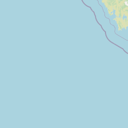
Map view of Tasman Fracture Commonwealth Marine Reserve

Use this park location map to pinpoint Tasman Fracture Commonwealth Marine Reserve in Australia, understand its exact geographic position, and read its mapped placement within the surrounding landscape more clearly.

Pigeon | © OpenStreetMap contributors

Location context for Tasman Fracture Commonwealth Marine Reserve

Tasmania
Recorded earthquake history

Explore Recorded Earthquake Data for Tasman Fracture Commonwealth Marine Reserve

Browse the historical seismic records associated with the geography of Tasman Fracture Commonwealth Marine Reserve. Use this catalogue to identify recorded earthquake locations, magnitudes, and depths across the regional seafloor as documented in public seismic datasets.

Tasman Fracture Marine Reserve Earthquake History

Catalogued events

2 events

Strongest magnitude

Magnitude 4.9

Most recent event

Oct 8, 2024

This history includes earthquakes recorded inside the park or within 50 km of its borders

Park atlas

Compare adjacent marine protected areas and surrounding oceanic environments.

Parks Near Tasman Fracture Commonwealth Marine Reserve and Regional Protected Areas

Browse protected areas near Tasman Fracture Commonwealth Marine Reserve to compare similar deep sea habitats and offshore marine ecosystems. Regional park navigation reveals connected oceanographic zones and related conservation landscapes across the southern margin.
National parkTasmania
5.5 km away#1 closest

Northeast

Southwest National Park: Tasmania's Core Wilderness National Park and World Heritage Landscape

Mapping the remote buttongrass moorlands and rugged terrain of this expansive park.

Southwest National Park represents a significant protected area in Tasmania, Australia, spanning over 6,183 square kilometers. As the heart of the Tasmanian Wilderness World Heritage Area, it showcases an extraordinary landscape characterized by vast buttongrass moorlands, ancient temperate rainforests, and dramatic mountainous terrain. This park is vital for its wilderness character and conservation significance, offering a unique opportunity to explore one of the Southern Hemisphere's last remaining untouched temperate wildernesses through its mapped geography and protected boundaries.

Area
6,182.67 km²
Established
1968
IUCN
II
Relief
Mountain
Marine protected areaTasmania
27 km away#2 closest

East

Huon Commonwealth Marine Reserve: Deep Ocean Topography and Tasmanian Marine Protected Areas

Exploring underwater mountain peaks and protected seafloor habitats.

Situated in the Pacific Ocean south of Tasmania, the Huon Commonwealth Marine Reserve is defined by a dense cluster of seventy submerged seamounts. These massive cone-shaped structures provide rare structural complexity on the deep seafloor, acting as critical nodes for biodiversity, foraging marine life, and protected benthic communities. This atlas entry provides a detailed look at the reserve's topography and its role in the broader South-east Commonwealth Marine Reserve Network.

Area
9,991 km²
Established
1999
IUCN
VI
Relief
Mixed relief
National parkTasmania
47 km away#3 closest

Northeast

Hartz Mountains National Park: Tasmania's National Park Protected Landscape

Mapped geography and regional landscape context.

Delve into the specific protected landscape identity of Hartz Mountains National Park, situated in Tasmania, Australia. This page provides a detailed geographic breakdown, focusing on mapped park boundaries and its unique regional setting. Understand the atlas value of this national park by exploring its terrain and its role within Tasmania's broader conservation landscape.

Area
71.4 km²
Established
1939
IUCN
II
Visitors
11.8K annual
National parkTasmania
48 km away#4 closest

Northeast

South Bruny National Park: Tasmania's Protected Area Geography and Mapped Landscape Context

Discover the geographic identity and mapped boundaries of this Tasmanian National Park.

South Bruny National Park is a key protected landscape located in Tasmania, Australia, offering critical insights into regional conservation efforts. As a designated National Park, its identity is tied to the preservation of its unique geographic features and natural terrain. This entry provides detailed information on its mapped boundaries and its place within Tasmania's broader atlas of protected areas, facilitating a deeper understanding of its protected landscape significance.

Area
50.59 km²
Established
1997
IUCN
II
Visitors
9.2K annual
National parkTasmania
106 km away#5 closest

Northeast

Tasman National Park: Discover Its National Park Geography and Protected Landscape

Explore mapped boundaries and regional context within Tasmania.

Tasman National Park represents a key protected area for exploration within Tasmania's distinctive geography. This page facilitates a detailed look at its national park identity, focusing on its mapped natural landscapes and its contribution to the protected area network of the Australian island state. Gain structured geographic insight into this significant conservation landscape.

Area
107.5 km²
Established
1999
IUCN
II
Relief
Mixed relief
National parkTasmania
108 km away#6 closest

Northeast

Mount Field National Park: Explore Tasmania's Protected Landscape and Geographic Identity

Mapped terrain and regional atlas context for this Australian national park.

Mount Field National Park serves as a cornerstone of protected natural landscapes in Tasmania, Australia. This entry provides detailed geographic context, focusing on its mapped boundaries and distinct environmental setting. Users can explore its identity as a national park, understand its regional placement within Tasmania, and gain insight into the mapped terrain that defines this significant protected area. It is designed for atlas-based discovery of the park's landscape characteristics.

Area
162.65 km²
Established
1916
IUCN
II
Relief
Mountain
National parkTasmania
About 129 km away#7 closest

North

Franklin, Gordon Wild Rivers National Park: Mapped Protected Landscape Identity in Tasmania's Geography

Explore the mapped boundaries of this Tasmanian National Park.

Franklin, Gordon Wild Rivers National Park stands as a testament to Tasmania's commitment to preserving its natural heritage. This national park provides a unique opportunity to examine protected land boundaries and understand its specific geographic setting within the Australian state. Its landscape context is integral to the regional atlas, offering a clear representation of conservation priorities and natural geographic features for detailed study.

Area
4,463.42 km²
Established
1908
Relief
Mountain
Climate
Temperate
Marine protected areaTasmania
148 km away#8 closest

Northwest

Zeehan Commonwealth Marine Reserve: Geographic Map and Protected Marine Landscape Overview

Deep-sea habitats and shelf bathymetry off the Tasmanian coast

Spanning from fifty meters to over three thousand meters deep, the Zeehan Commonwealth Marine Reserve represents a massive, bathymetrically diverse protected area in the southern Indian Ocean. This geographic overview highlights the reserve's role in conserving limestone seabed features and deep-sea corridors west of Tasmania, offering a clear perspective on its location and scale within the broader regional marine network.

Area
19,897 km²
Established
2007
IUCN
VI
Relief
Lowland

Common questions about visiting, size, designation, and location context for Tasman Fracture Commonwealth Marine Reserve

Tasman Fracture Commonwealth Marine Reserve FAQs for park facts, access, geography, and protected area context

Find quick answers about Tasman Fracture Commonwealth Marine Reserve, including protected-area facts, park geography, trail and visitor context, and how the park fits into its surrounding country and regional landscape.
MoriAtlas Explorer

Continue Your Protected Areas Search Across the Global Atlas

Deepen your exploration by continuing the structured search for national parks and protected areas worldwide. Utilize the comprehensive filtering capabilities to compare different conservation landscapes and refine your understanding of global park geography. Discover more about the distribution and characteristics of protected natural areas.

Global natural geography