Mori Atlas logo
National parkTomaree National Park

Mapping the protected boundaries and regional geography of Tomaree National Park.

Tomaree National Park: A National Park Atlas and Protected Landscape in New South Wales

Tomaree National Park stands as a distinct protected area within New South Wales, offering a dedicated space for understanding Australia's natural landscapes. As a national park, its geographic identity is grounded in its mapped boundaries and its place within the regional atlas. This entry provides essential context for exploring the park's role as a conserved natural entity, focusing on its landscape character and its contribution to the broader geography of New South Wales.

Coastal national parksNew South Wales parksHeadland landscapesWorimi heritage sitesKoala habitatsWhale watching locations

Tomaree National Park

National park

Park overview

Structured park overview, official facts, and landscape profile for Tomaree National Park

Tomaree National Park park facts, protected area profile, and essential visitor context
Review the core facts for Tomaree National Park, including designation, size, terrain, visitor scale, habitats, and operating context in one park-focused overview.

About Tomaree National Park

Tomaree National Park occupies a striking position along the Tomaree Peninsula, protecting a coastal landscape that blends rocky headlands, sandy beaches, and forested areas against the backdrop of the Tasman Sea. The park extends north from Fishermans Bay to Shoal Bay, threading through coastal communities that have grown alongside the protected area. The landscape is defined by the prominent Tomaree Head, a dramatic headland that rises from the ocean and provides one of the most recognizable vantage points in the Port Stephens region.

The establishment of Tomaree National Park in 1984 marked recognition of the area's dual significance as both a natural coastal environment and a place of cultural importance. The park's relatively compact size of approximately 23 square kilometers belies its ecological value, with the coastal position creating a transition between marine and terrestrial environments that supports diverse habitats. The park is accessible from several entry points, with signs from the NSW National Parks and Wildlife Service indicating permitted activities and any restrictions within different areas.

Visitors to Tomaree National Park encounter a landscape shaped by both natural forces and human history. The coastal position means that wind, waves, and tidal action continually reshape the shoreline, while the headland itself represents ancient geological processes. Against this natural backdrop, evidence of human presence spans from the traditional Worimi connection to the landscape through to colonial-era infrastructure and more recent military installations, creating a layered cultural landscape that adds depth to the natural visitor experience.

Quick facts and research context for Tomaree National Park

Tomaree National Park occupies roughly 23 square kilometers along the Tomaree Peninsula in the Port Stephens region of New South Wales, Australia. The park was established in 1984 and is managed by the NSW National Parks and Wildlife Service. It sits approximately 145 to 155 kilometers northeast of Sydney, directly on the coastline of the Tasman Sea. The park is notable for its dramatic headland formations, with Tomaree Head providing commanding views across the surrounding coastal area. Key heritage features within the park include Point Stephens Light, a lighthouse constructed in 1862, and the Tomaree Head Fortifications, World War II-era gun emplacements built in 1941. The park represents the traditional Country of the Worimi Aboriginal people, for whom the area holds ongoing cultural significance.

Park context

Deeper park guide and search-rich context for Tomaree National Park

Tomaree National Park history, landscape, wildlife, and travel context
Explore Tomaree National Park through its history, landscape character, ecosystems, wildlife, conservation priorities, cultural context, and seasonal travel timing in a structured park guide built for atlas discovery and search intent.

Why Tomaree National Park stands out

Tomaree National Park is best known for its spectacular coastal headland landscapes, particularly the summit of Tomaree Head which offers sweeping views across Port Stephens and the Tasman Sea. The park is recognized for the distinctive combination of military heritage sites and natural coastal scenery, with the Point Stephens Light lighthouse and WWII-era fortifications providing historical context to the landscape. The park is also notable as a place where visitors can observe koalas in their natural habitat, often spotted dozing in trees throughout the park. Whale watching is a popular activity, with the coastal position offering opportunities to observe migrating whales during the appropriate season. The Worimi cultural heritage adds another dimension, representing the continuing connection between the land and its traditional Aboriginal custodians.

Tomaree National Park history and protected-area timeline

Tomaree National Park was established in 1984 through the formal declaration of the area as a protected national park under New South Wales legislation. The creation of the park represented recognition of the environmental and cultural values of the Tomaree Peninsula coastline, which had previously existed in various forms of tenure and protection. The park falls under the management of the NSW National Parks and Wildlife Service, which maintains the protected area and facilitates public access while preserving its natural and cultural values.

The history of human activity in the area predates the national park designation by many thousands of years, with the traditional land belonging to the Worimi Aboriginal people. This indigenous connection to Country represents the deepest layer of human history in the area, with the landscape providing essential resources including food, medicine, and shelter. The Worimi continued their connection to this Country throughout the colonial period and into the present day.

More recent historical layers include Point Stephens Light, a lighthouse constructed in 1862 to aid navigation along the dangerous coastal stretch. During World War II, military significance was added to the area with the construction of the Tomaree Head Fortifications in 1941, featuring gun emplacements designed to defend the coastline. The No. 20 Radar Station RAAF was also established in the area during this period, reflecting the strategic importance of the Tomaree Head position for coastal surveillance. These heritage features remain visible within the park today, providing tangible connections to different periods of the area's history.

Tomaree National Park landscape and geographic character

The landscape of Tomaree National Park is characterized by its dramatic coastal setting on the Tomaree Peninsula, where the land rises sharply from the Tasman Sea to form prominent headlands and then slopes more gently toward the interior. The park encompasses a sequence of coastal environments, from the rocky base of headlands through sandy beaches to the forested slopes that ascend toward the summits. This vertical variation creates diverse visual experiences as visitors move through the park, with ocean vistas constantly providing the dominant backdrop.

Tomaree Head stands as the most prominent landscape feature within the park, a steep-sided headland that commands attention from both the water and land. The summit of Tomaree Head offers panoramic views across Port Stephens and out to the Tasman Sea, making it a destination for visitors seeking the quintessential coastal vista of the region. The surrounding coastline features smaller headlands, sheltered bays, and beach corridors that create a varied coastal character despite the relatively compact area of the park. The transition from the exposed ocean-facing coast to the more protected waters of Port Stephens occurs along the park's length, providing different coastal experiences within a single protected area.

Tomaree National Park ecosystems, habitats, and plant life

Tomaree National Park protects a coastal ecosystem where terrestrial and marine environments meet and interact. The park's position on the Tomaree Peninsula creates a transition zone between ocean and land, with associated habitats ranging from coastal cliffs and beach systems to dry sclerophyll forest on the slopes and ridges. The vegetation reflects the coastal climate, with species adapted to salt-laden winds, relatively low rainfall, and the well-drained soils of the headland environments.

The coastal location provides particular ecological significance through the connection to marine environments. Seabirds utilize the headlands and coastlines for nesting and foraging, while the waters offshore support marine life that forms part of the broader Port Stephens marine ecosystem. The forest areas within the park provide habitat for terrestrial species, with the koala population representing one of the more visible mammal species that visitors may encounter. The combination of coastal and forest habitats within a relatively compact area creates ecological diversity that supports various species assemblages across different habitat types.

Tomaree National Park wildlife and species highlights

The wildlife of Tomaree National Park reflects its coastal and forest habitats, with species adapted to both environments present throughout the park. Koalas are among the most visible wildlife encounters for visitors, as these iconic Australian marsupials inhabit the eucalypt trees throughout the park and can often be observed resting in the branches during daylight hours. The coastal position also attracts seabirds, with various species utilizing the headlands and shoreline for feeding and nesting.

Whale watching represents one of the notable wildlife experiences available in the park, particularly during migration seasons when whales move along the coast. The offshore waters of the Tasman Sea provide a migration corridor, and from elevated positions within the park such as Tomaree Head, visitors may observe whales passing offshore. Marine birds including various seabird species are associated with the coastline, while the forest and woodland areas support birdlife typical of coastal New South Wales. The combination of coastal and terrestrial habitats supports a diversity of species that reflects the ecological transition between ocean and land environments.

Tomaree National Park conservation status and protection priorities

Tomaree National Park contributes to the protection of coastal ecosystems in the Port Stephens region, representing a managed landscape where natural values are maintained alongside public access and enjoyment. The IUCN categorization of the park as Category II reflects its designation as a national park, focusing on ecosystem protection while allowing for sustainable visitor use. The protection of the coastal headlands and associated habitats preserves ecological processes and species populations that would otherwise face pressures from development or intensive use.

The conservation significance extends beyond purely natural values to encompass the cultural landscape, with the protection of both indigenous heritage sites and more recent historical features adding dimensions to the park's protected values. The Worimi connection to the land represents a cultural conservation dimension that continues to be recognized and respected within the park management framework. The relatively confined area of the park, while limiting the scale of ecological processes that can be protected, ensures that significant coastal and headland environments remain preserved within the broader Port Stephens landscape.

Tomaree National Park cultural meaning and human context

Tomaree National Park is situated within the traditional Country of the Worimi Aboriginal people, whose connection to this landscape spans thousands of years. The Worimi people utilized the resources of the coastal environment for food, medicine, and shelter, establishing a relationship with the land that continues through to the present day. This indigenous heritage represents the deepest historical layer of human presence in the area and forms an essential part of the park's cultural identity.

The cultural context extends beyond traditional indigenous heritage to include more recent historical layers. The construction of Point Stephens Light in 1862 reflects colonial-era activity and the subsequent development of navigation infrastructure along the coast. The World War II fortifications represent a later period when the coastline took on strategic significance, with the gun emplacements and radar station reflecting the military concerns of the mid-twentieth century. These diverse cultural elements create a layered landscape where natural, indigenous, and colonial histories intersect within the protected area.

Top sights and standout views in Tomaree National Park

The highlights of Tomaree National Park center on the combination of dramatic coastal scenery, accessible heritage sites, and opportunities for wildlife observation. The summit walk to Tomaree Head provides one of the premier coastal viewpoints in the Port Stephens region, with panoramic vistas across the water and surrounding coastline. The Point Stephens Light lighthouse offers a tangible connection to maritime history, while the WWII fortifications present military heritage in an accessible outdoor setting. Koala sightings in the treed areas of the park provide memorable wildlife encounters, and the coastal position creates opportunities for whale watching during migration seasons. The beach access throughout the park allows for coastal recreation while the Worimi cultural heritage adds a dimension of indigenous significance that distinguishes the area from purely natural landscape experiences.

Best time to visit Tomaree National Park

The best time to visit Tomaree National Park depends on the experience sought, with different seasons offering distinct advantages. The warmer months from late spring through summer bring optimal conditions for beach activities and coastal walking, though this period also corresponds with higher visitor numbers. The views from Tomaree Head are particularly clear during these months, and whale migration typically occurs during the cooler autumn months from April to June when whales can be observed moving northward along the coast.

The moderate climate of the Port Stephens region allows for year-round visits, though winter brings cooler temperatures that may be less comfortable for extended outdoor activities. The park's relatively compact size means that visits can be structured around weather conditions, with the headland walks offering spectacular views on clear days while forest areas provide sheltered experiences during windier periods. The shoulder seasons of spring and autumn often provide the most comfortable conditions for walking and exploring, with moderate temperatures and smaller visitor numbers than the peak summer period.
Park location guide

Geography guide, regional context, and park location map for Tomaree National Park

Tomaree National Park park geography, regions, and map view in Australia
Understand where Tomaree National Park sits in Australia through a broader geographic reading of the surrounding landscape, nearby location context, and its mapped position within the national park landscape.

How Tomaree National Park fits into Australia

Australia is a constitutional monarchy and federal parliamentary democracy comprising six states and ten territories. With a population of nearly 28 million, it is one of the world's most urbanised countries, with most people concentrated on the eastern seaboard. The country has a high Human Development Index and is known for its cultural diversity, ancient Aboriginal heritage, and unique wildlife.

Wider geography shaping Tomaree National Park in Australia

Australia occupies the entire Australian continent, the island of Tasmania, and numerous smaller islands. It is the world's flattest and driest inhabited continent, featuring vast deserts in the interior (the Outback), tropical rainforests along the eastern coast, and a coastline bordering the Indian and Pacific Oceans.

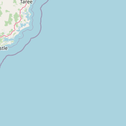
Map view of Tomaree National Park

Use this park location map to pinpoint Tomaree National Park in Australia, understand its exact geographic position, and read its mapped placement within the surrounding landscape more clearly.

Pigeon | © OpenStreetMap contributors

Location context for Tomaree National Park

New South Wales
Park atlas

Compare regional park geography and protected coastal landscapes surrounding Tomaree Peninsula, New South Wales.

Explore National Parks and Protected Areas Near Tomaree National Park, New South Wales, Australia
After exploring Tomaree National Park, continue your discovery by browsing nearby national parks and protected areas throughout the Port Stephens region and coastal New South Wales. This atlas view offers geographic context for comparing diverse protected landscapes, allowing users to trace the regional spread of significant conservation areas.
National parkNew South Wales

Myall Lakes National Park National Park: Mapped Boundaries and Protected Landscape Exploration

Discover its regional geography and natural terrain context.

Delve into the specific protected landscape and geographic features of Myall Lakes National Park. As a national park located in New South Wales, it provides critical atlas context for understanding protected areas and their distribution. Explore its mapped terrain and boundaries to gain a deeper appreciation for this significant natural area within Australia's geography.

Area
448 km²
Established
1972
IUCN
II
Relief
Lowland
National parkNew South Wales

Wallingat National Park: Explore Protected Landscape and Regional Geography in New South Wales

Discover mapped park boundaries and terrain context.

Wallingat National Park in New South Wales is a protected landscape crucial for understanding Australia's natural geography. This canonical page detail provides essential information for atlas exploration, focusing on the park's protected status, mapped contours, and its place within the regional context. Discover the unique geographic features that distinguish this national park from others in the atlas.

Area
65.57 km²
Established
1999
IUCN
II
Relief
Lowland
National parkNew South Wales

Booti Booti National Park: New South Wales National Park Protected Landscape Atlas

Mapped boundaries and regional geography for this Australian national park.

Delve into the specifics of Booti Booti National Park, a designated national park within New South Wales, Australia. This resource facilitates a detailed understanding of its protected area status, landscape characteristics, and precise geographic placement. Explore its mapped features and regional context to enrich your atlas-based discovery of Australia's protected lands.

Area
15.67 km²
Established
1992
IUCN
II
Relief
Highland
National parkNew South Wales

Werakata National Park: Protected Area Exploration and Eucalypt Forest Atlas

Mapping New South Wales' unique spotted gum-ironbark woodlands.

Werakata National Park is a significant protected area in New South Wales, Australia, dedicated to conserving the valuable spotted gum-ironbark vegetation communities of the Lower Hunter Region. This national park offers insight into the region's natural landscape, featuring undulating terrain with eucalypt forests and woodlands that are crucial for threatened species and avian biodiversity. Its distinct geographic character and mapped boundaries provide a clear focus for atlas-driven discovery of protected lands and their ecological significance.

Area
33.37 km²
Established
1999
IUCN
II
Relief
Lowland
National parkNew South Wales

Watagans National Park: National Park Protected Landscape in New South Wales

Explore its mapped boundaries and regional geography.

Watagans National Park stands as a key protected area within New South Wales, Australia. This detail page focuses on its specific role as a national park, offering insights into its mapped geographic boundaries and its place within the regional landscape. Understand the protected natural identity of Watagans National Park through a structured, atlas-informed lens.

Area
77.51 km²
Established
1999
IUCN
II
Climate
Temperate
National parkAustralia

Belford National Park: Strict Nature Reserve and Endangered Forest Landscape in Australia

Mapped boundaries and ecological context for a vital protected area.

Belford National Park, located in Australia's Hunter Valley, functions as a strict nature reserve focused on preserving the endangered Central Hunter Ironbark-Spotted Gum-Grey Box Forest. This protected area, though modest in size, is crucial for safeguarding vulnerable wildlife species and maintaining a significant example of a rare ecological community. Its clearly defined mapped boundaries highlight its role as a dedicated conservation landscape, offering essential habitat and serving as a reference point for the region's natural geography and biodiversity.

Area
2.88 km²
Established
2003
IUCN
Ia
Access
Highly restricted
National parkNew South Wales

Wyrrabalong National Park National Park: Protected Littoral Rainforest and Coastal Geography

Explore mapped terrain and vital bird habitats in New South Wales.

Wyrrabalong National Park on New South Wales' Central Coast is an essential protected landscape, noted for safeguarding the last significant coastal littoral rainforest of its kind. This park entry details the mapped geography across its peninsula, island, and beachfront sections, revealing a compact yet ecologically rich environment. It highlights the park's importance as part of an Important Bird Area, supporting significant waterbird and woodland bird populations within its protected boundaries, offering a unique glimpse into a vanishing coastal ecosystem.

Area
6.2 km²
Established
1991
IUCN
II
Relief
Lowland
National parkNew South Wales

Mount Royal National Park: A National Park in New South Wales for Geographic Discovery

Explore its protected boundaries and landscape context.

Mount Royal National Park is a key protected area in New South Wales, offering an opportunity to delve into its specific geographic identity and mapped landscape features. As a national park, it provides structured data for understanding protected lands within Australia. This detailed entry supports exploration of the park's unique regional context and its contribution to the broader atlas of natural landscapes.

Area
69 km²
Established
1997
IUCN
II
Relief
Mountain

Common questions about visiting, size, designation, and location context for Tomaree National Park

Tomaree National Park FAQs for park facts, access, geography, and protected area context
Find quick answers about Tomaree National Park, including protected-area facts, park geography, trail and visitor context, and how the park fits into its surrounding country and regional landscape.
MoriAtlas Explorer

Continue Your Protected Areas Search Across the Global Atlas

Deepen your exploration by continuing the structured search for national parks and protected areas worldwide. Utilize the comprehensive filtering capabilities to compare different conservation landscapes and refine your understanding of global park geography. Discover more about the distribution and characteristics of protected natural areas.

Global natural geography