

Mori Atlas logo
National parkTsimanampetsotsa National Park

Explore the distinct terrain of saline wetlands, limestone plateaus, and Madagascar spiny forests.

Tsimanampetsotsa National Park: Mapping the Biodiversity of the Atsimo-Andrefana Protected Landscapes

(Parc national Tsimanampesotse)

Tsimanampetsotsa National Park stands as a vital protected area within the Atsimo-Andrefana region of Madagascar. This site features a complex landscape transition from hypersaline coastal lake basins to the arid Mahafaly Plateau. The mapped geography reveals an exceptional concentration of endemic dry forest ecosystems and paleontological significance that defines this southwestern region.

spiny forestdry forestMadagascar endemismRamsar wetlandsaline lakelimestone plateau
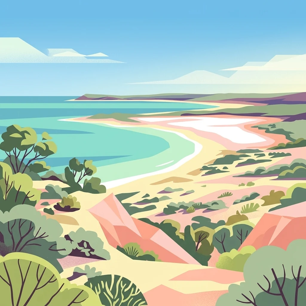
Digital illustration of a coastal landscape with turquoise water, sandy shores, and desert vegetation under a blue sky.

Tsimanampetsotsa National Park

National park

Park overview

Structured park overview, official facts, and landscape profile for Tsimanampetsotsa National Park

Tsimanampetsotsa National Park park facts, protected area profile, and essential visitor context

Review the core facts for Tsimanampetsotsa National Park, including designation, size, terrain, visitor scale, habitats, and operating context in one park-focused overview.

About Tsimanampetsotsa National Park

Tsimanampetsotsa National Park is one of the most ecologically distinctive protected areas in Madagascar, located in the country's south-west where the environment transitions from semi-arid coastal flats to limestone plateau and dry forest. The Atsimo-Andrefana region where it sits is the driest part of Madagascar, with annual rainfall often below 300 millimetres and long dry seasons that shape every facet of the park's character.

The park's defining identity comes from the convergence of three major natural systems within a relatively compact area: the saline Lake Tsimanampetsotsa and its seasonal salt flats, the Mahafaly limestone plateau with its xerophytic thickets, and the surrounding spiny forest that contains some of the rarest plant communities on Earth. Botanical work stretching back to the early twentieth century has revealed that the area hosts an exceptional density of narrowly endemic vascular plants, with the great majority of species restricted to this corner of southwestern Madagascar.

Beyond its botanical value, Tsimanampetsotsa is significant for its wildlife, its fossil record, and its conservation profile. The lake is internationally recognized as a Ramsar Wetland, the spiny forest region is considered ecologically critical at a global scale, and the park has been integrated into a broader biosphere reserve that links it to the nearby Nosy Ve-Androka marine area. The combination of arid-adapted wildlife, ancient plants, sacred caves, and paleontological heritage makes it a flagship site for understanding southern Madagascar's natural history.

The visitor experience of the park is built around a small number of circuits that connect the lake shore, the Mitoho sacred cave, ancient baobabs, and the Mahafaly Plateau. These trails bring visitors face to face with the same landscapes and species that have defined the area for researchers since the early twentieth century, while also reflecting the long-standing cultural presence of local communities such as the Antambahoka.

Quick facts and research context for Tsimanampetsotsa National Park

Tsimanampetsotsa National Park lies on Madagascar's arid south-west coast in Atsimo-Andrefana, about 90 kilometres south of Toliara. It was first protected in 1927 and formally established as a national park in 1966, and has long been valued for its endemic flora and fauna.

The park spans roughly 430 square kilometres across four distinct landscape zones, ranging from the saline flats of Lake Tsimanampetsotsa through dry sandy forest, the limestone Mahafaly Plateau, and a red-soil eastern dry forest. The Mahafaly Plateau and its spiny vegetation represent one of the highest concentrations of plant endemism in Madagascar, with the vast majority of vascular plant species found nowhere else.

Protection and recognition

Documented terrestrial protected area designation history and Ramsar wetland status

Tsimanampetsotsa National Park Protection Status and International Recognition

Tsimanampetsotsa National Park maintains established terrestrial protection status backed by a designated establishment year of 1998 and recorded international Ramsar wetland recognition. Structured preservation records outline the official administrative scope and documented conservation designations associated with the protected landscape.

International recognition

Protection details

Protection scope
Terrestrial
Designated year
1998
Transboundary protection
No
Park context

Deeper park guide and search-rich context for Tsimanampetsotsa National Park

Tsimanampetsotsa National Park history, landscape, wildlife, and travel context

Explore Tsimanampetsotsa National Park through its history, landscape character, ecosystems, wildlife, conservation priorities, cultural context, and seasonal travel timing in a structured park guide built for atlas discovery and search intent.

Why Tsimanampetsotsa National Park stands out

Tsimanampetsotsa is best known for the spectacular diversity of its spiny forest ecosystem and the extraordinary level of plant endemism it protects, including many species confined almost exclusively to the south-west of Madagascar. The park is a benchmark site for the Madagascar spiny forests, a globally recognized ecoregion dominated by drought-adapted succulents and ancient woody lineages. Equally distinctive is the presence of the saline Lake Tsimanampetsotsa, registered as a Ramsar Wetland, where flamingos, endemic waterbirds, and salt-tolerant vegetation create a sharply different ecological interface against the surrounding spiny thicket. The park is also a major paleontological site, famous for subfossils of elephant birds, giant tortoises, and giant lemurs preserved in its caves and sinkholes.
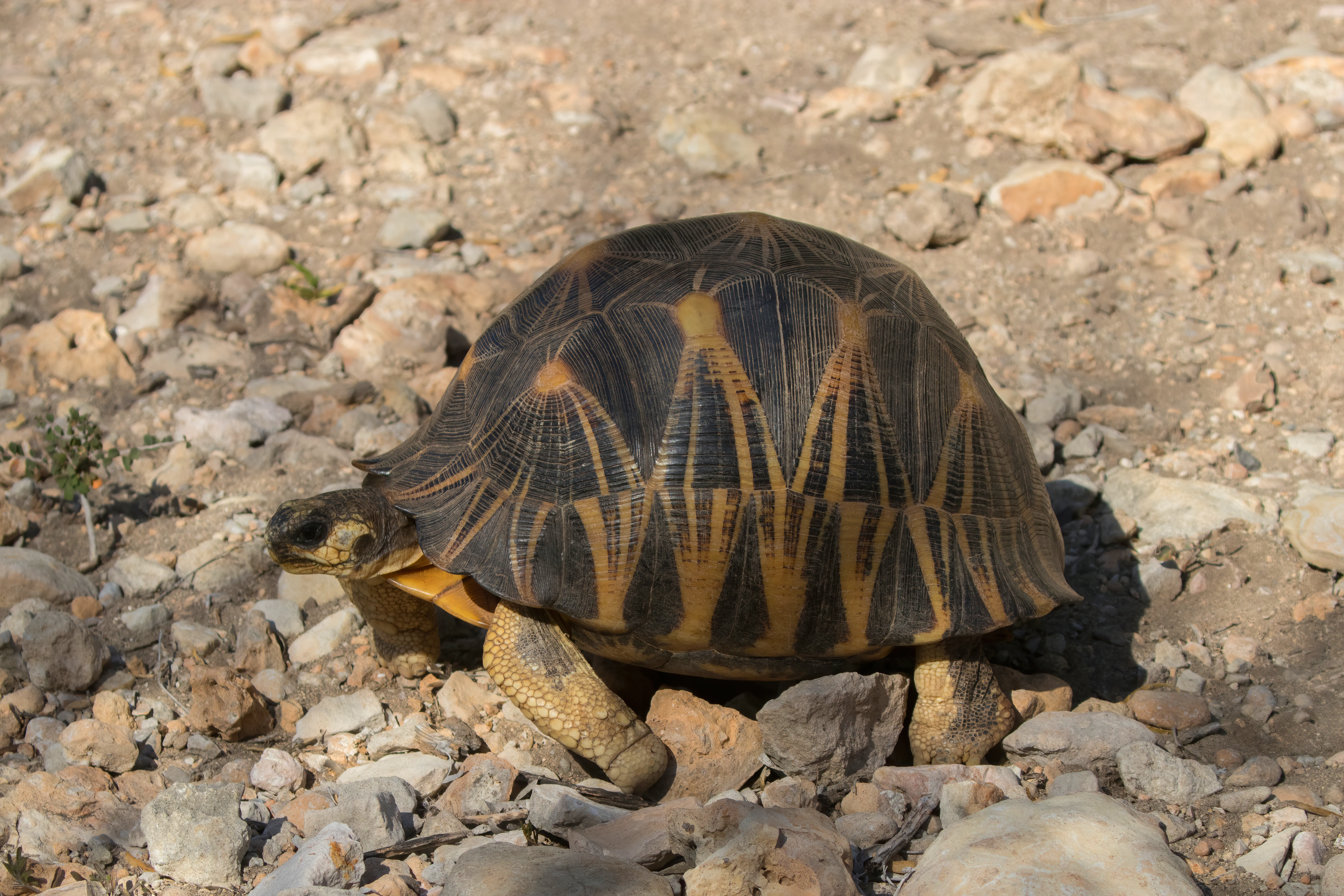
A radiated tortoise with a distinct star-patterned shell walks across a dry, rocky, light-colored ground in bright daylight.
A radiated tortoise, Astrochelys radiata, moving across the rocky terrain of Tsimanampetsotsa National Park.

Tsimanampetsotsa National Park history and protected-area timeline

Tsimanampetsotsa was first officially protected in 1927, making it one of the oldest reserves in Madagascar, and it was established as a national park in 1966. Early protection was driven primarily by the recognition of the exceptional endemic flora and fauna found in the region's spiny forests and on the limestone Mahafaly Plateau.

Scientific exploration of the area goes back to the early twentieth century, with the French botanist Henri Perrier de la Bâthie beginning plant collections in the region in 1910. Investigations during the 1930s at sites such as the Mitoho Grotto revealed significant subfossil remains, including giant tortoise, ancient crocodiles, and eggshell fragments of elephant birds and the giant lemur Megaladapis edwardsi, confirming Tsimanampetsotsa as an important paleontological locality.

In 1998, the lake system was formally recognized as a Ramsar Wetland of International Importance, reinforcing the wetland's conservation profile. More recently, in July 2018, the broader Tsimanampesotse, Nosy Ve, and Androka area was designated as Madagascar's fifth Biosphere Reserve, bringing together terrestrial lakes, dry forests, marine ecosystems, and community-managed protected areas under a single framework.

Tsimanampetsotsa National Park landscape and geographic character

The park's landscape is shaped by sharply contrasting zones compressed into a relatively small area. The western shoreline is dominated by Lake Tsimanampetsotsa, a shallow, highly mineralized and moderately alkaline waterbody whose salt concentrations approach those of seawater. As the dry season advances, the lake shrinks dramatically, exposing extensive hypersaline flats that are colonized by salt-tolerant glasswort and the golden leather fern.

Immediately inland, east of the lake basin, lies a strip of dry forest on sandy soils derived from Quaternary sand deposits. Here, short-statured trees and shrubs dominate, with patches of unvegetated ground interspersed. Springs and seeps where underground water emerges from beneath the plateau support larger fruit-bearing trees such as figs, tamarinds, and Salvadora angustifolia.

The most dramatic landscape feature is the Mahafaly Plateau, a Tertiary limestone formation running roughly north to south, capped by thin, calcareous soils. Open xerophytic thickets of silver thicket, bottle trees, and octopus trees cover much of the plateau, while collapsed sinkholes concentrate moisture and create microhabitats that support endemic reptiles and cave-dwelling species.

The easternmost zone marks a transition where the limestone gives way to red ferruginous clay soils, fostering richer dry forest growth. Here, spectacular specimens of fony baobab and large Pachypodium geayi stand among spiny thickets dominated by Didiereaceae, Euphorbiaceae, and myrrh relatives, producing some of Madagascar's most iconic dry-land scenery.
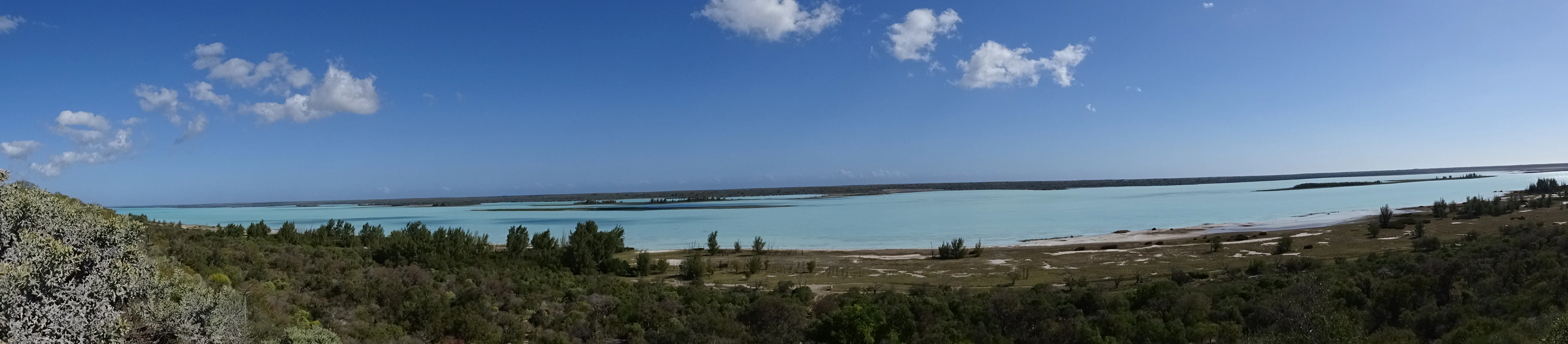
A panoramic view of a wide, turquoise-colored lake under a clear blue sky with sparse clouds, framed by shrubby vegetation in the foreground.
A wide panoramic view of the hypersaline Lake Tsimanampetsotsa from a surrounding viewpoint.

Tsimanampetsotsa National Park ecosystems, habitats, and plant life

Tsimanampetsotsa lies at the heart of the Madagascar spiny forests, an ecoregion of global ecological importance and one of the most arid-adapted vegetation systems on Earth. Botanical inventories have identified over 200 vascular plant species from around 70 families in the park and its immediate surroundings, with more than 95 percent of species endemic to Madagascar and nearly half of the genera endemic as well.

Vegetation patterns shift dramatically across the park's four landscape zones. The lake margin features specialized salt-tolerant plants such as glasswort, leather fern, Salvadora angustifolia, and small stands of introduced beach sheoak. The sandy dry forest is characterized by short, open woodland with sparse understory, while the limestone plateau supports an open, xerophytic thicket of succulents and woody endemics, including silver thicket, bottle trees, and octopus trees.

The eastern red-soil zone, with deeper and more fertile substrate, supports some of the most diverse and structurally impressive dry forests in the park. Here, Didiereaceae, Euphorbiaceae, and Burseraceae coexist with ancient baobabs and large Pachypodium individuals. Eleven rare plant species are known only from Tsimanampetsotsa and its immediate vicinity, with another seven rare species known from five or fewer locations in total.
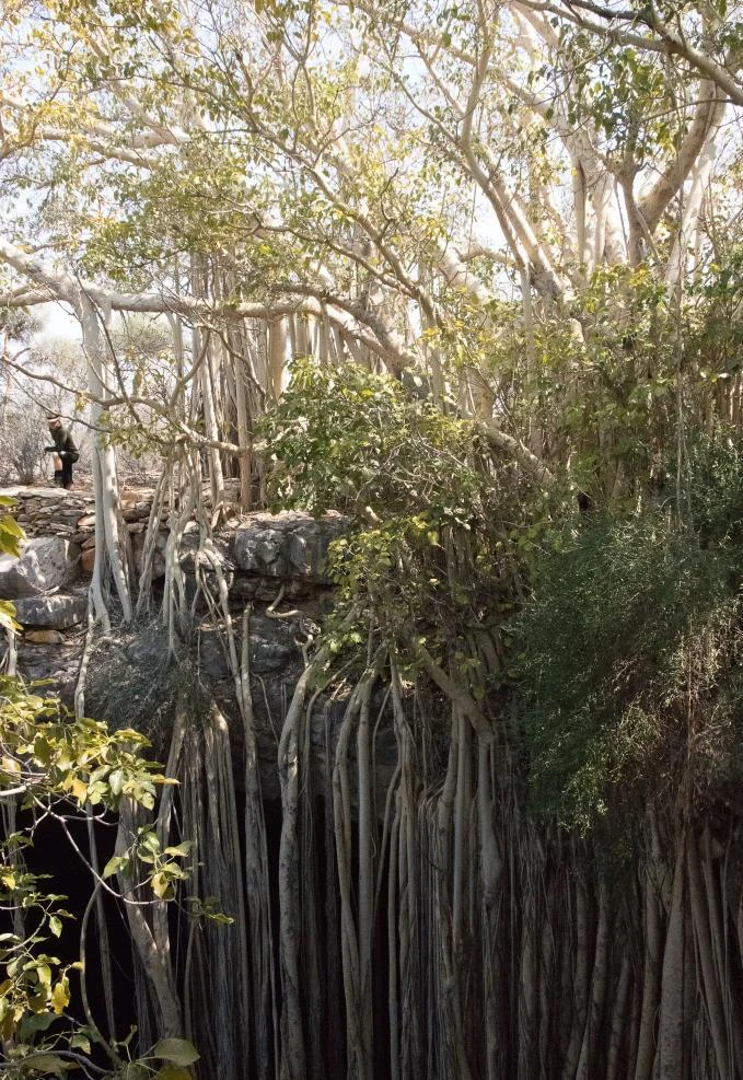
A large banyan fig tree with numerous long aerial roots hanging down into a dark, rocky sinkhole opening.
A banyan fig tree extending its aerial roots into a limestone sinkhole in Tsimanampetsotsa National Park.

Tsimanampetsotsa National Park wildlife and species highlights

The park supports a remarkable concentration of fauna for such an arid landscape, including six primate species representing four of the five lemur families endemic to Madagascar. Diurnal lemurs include the ring-tailed lemur and Verreaux's sifaka, while nocturnal species include the reddish-gray mouse lemur and fat-tailed dwarf lemur, both tightly associated with the spiny forest habitat.

Among mammals, the park holds particular importance as the only documented location for the endangered Grandidier's mongoose, a carnivore described as new to science in 1986. The white-footed sportive lemur and reddish-gray mouse lemur are restricted to the spiny forests of this part of Madagascar, while near-endemic small mammals such as the large-eared tenrec and the lesser hedgehog tenrec also occur.

The bird life of Tsimanampetsotsa is exceptionally rich for a dry region, with at least 112 recorded species, of which around 35 are endemic to Madagascar. The lake supports important populations of greater flamingos, occasional lesser flamingos, the vulnerable Madagascar plover, and the endangered Madagascar grebe, while the surrounding spiny forest hosts endemic couas, vangas, weavers, and the Madagascar Sparrowhawk.

Reptiles are equally prominent, with around 40 species recorded, including two chameleons endemic to the regional ecoregion, the spider tortoise, the critically endangered radiated tortoise, Dumeril's ground boa, several rock-dwelling iguanids, and various geckos. The Mitoho Cave also shelters the blind cave fish Typhleotris madagascariensis and the locally endemic Mitoho Cave Giant Pill-Millipede, both of which are tied tightly to the park's unique geology.
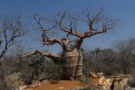
A thick, wide-trunked Fony baobab tree with leafless branches stands in a sparse, dry forest clearing with red-brown earth and limestone rocks.
A mature Fony baobab, also known as the Grandmother Tree, stands within the dry spiny forest of Tsimanampetsotsa National Park.

Tsimanampetsotsa National Park conservation status and protection priorities

Tsimanampetsotsa stands out as one of the most important conservation sites in Madagascar because it lies within the Madagascar spiny forests, a globally distinctive ecoregion that has been recognized among the world's most ecologically significant regions. The park protects what is widely considered the area of highest plant endemism on the island, both at the species and genus levels, ensuring the survival of dozens of narrowly endemic woody succulents, baobabs, and other dry-adapted plants.

Designation of Lake Tsimanampetsotsa as a Ramsar Wetland of International Importance in 1998 added a major international layer to the site's protection, recognizing its value for migratory and resident waterbirds, including flamingos and Madagascar's endangered grebe and plover. The lake's seasonal dynamics are themselves a conservation feature, as receding water creates hypersaline flats that support specialized vegetation and invertebrate communities.

More broadly, the July 2018 establishment of the Tsimanampesotse, Nosy Ve, and Androka Biosphere Reserve integrated the national park with the adjacent Nosy Ve-Androka marine protected area and the community-managed Amoron'i Onilahy reserve. That designation connects terrestrial endemism, coastal wetland conservation, and marine biodiversity in a single framework, emphasizing the park's role not just as an isolated reserve but as part of a larger regional conservation strategy.

Tsimanampetsotsa National Park cultural meaning and human context

The cultural layer of Tsimanampetsotsa is closely interwoven with its natural features. Local communities belonging to the Antambahoka people regard certain sites, including the Mitoho Grotto, as sacred places associated with an invisible ancestral presence. The cave is treated with cultural respect, and its ecological richness is understood through a blend of local belief and scientific observation.

Ancient baobabs in the park carry cultural weight as living landmarks and as objects of long-term ecological study. Individuals such as the so-called Grandmother baobab, composed of three fused trunks with the oldest portion estimated at around 1,600 years, and the polygamous baobab with six fused stems, anchor a local sense of deep natural history that predates formal protection by centuries.

The integration of the park into the 2018 Biosphere Reserve also reflects an evolving relationship between Malagasy protected-area authorities and local communities, with parts of the surrounding landscape managed through community-based conservation arrangements. This mix of sacred sites, ancient trees, and collaborative stewardship gives Tsimanampetsotsa a cultural depth that complements its ecological significance.
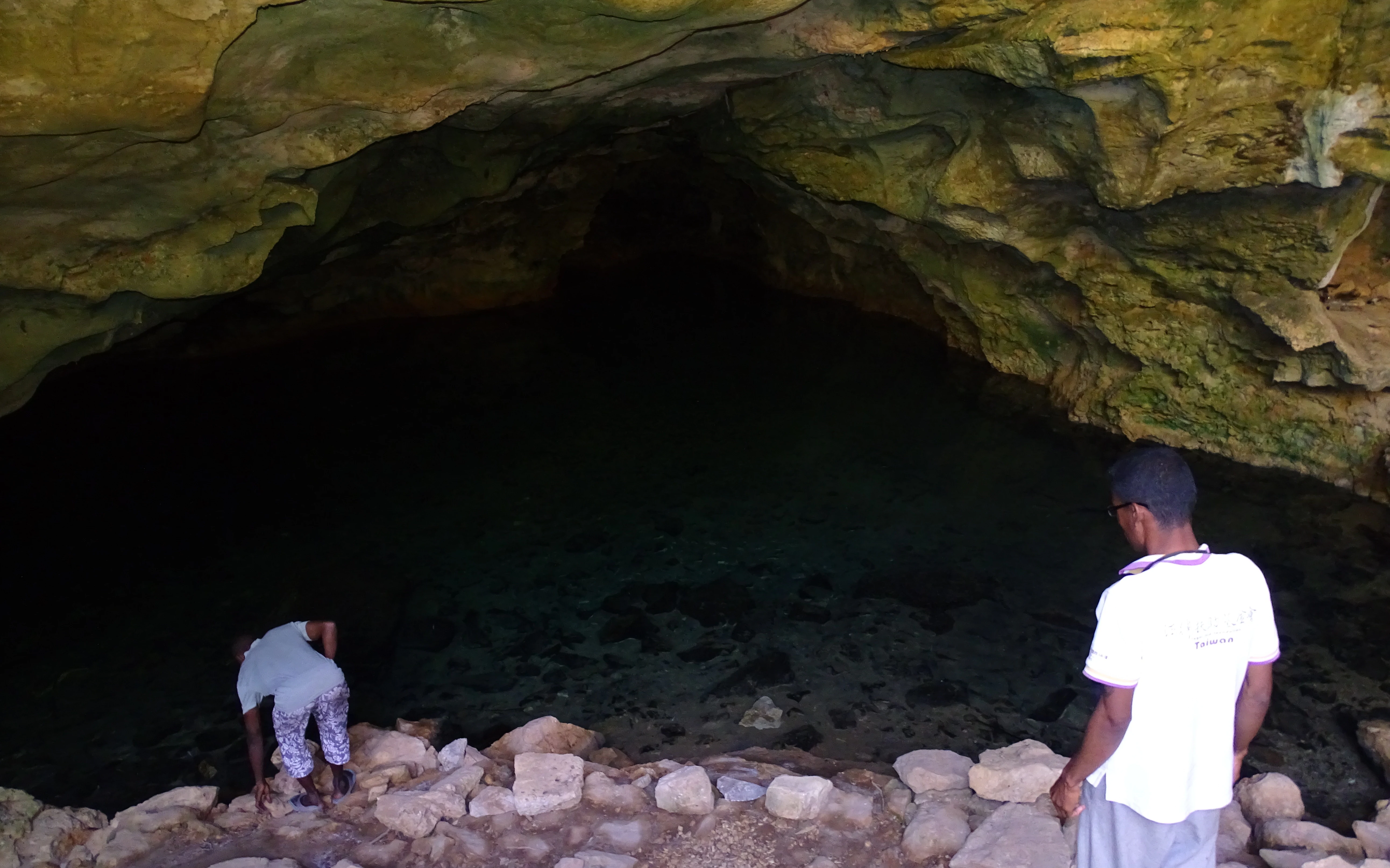
Two people standing at the edge of a water-filled limestone cave opening, looking into the dark cavern.
Visitors at the entrance of the Mitoho Grotto in Tsimanampetsotsa National Park.

Top sights and standout views in Tsimanampetsotsa National Park

Among Tsimanampetsotsa's strongest points of distinction is its concentration of endemic plant life in a single location, with a vascular flora overwhelmingly restricted to southern Madagascar and including species found nowhere else on Earth. These include rare Alluaudia montagnacii, Delonix edulis, and a range of narrowly endemic Acanthaceae and Euphorbiaceae.

Equally notable is the lake system and its wildlife, combining flamingos, endangered grebes and plovers, and unique salt-flat vegetation into a recognizable Ramsar wetlands signature. The Mitoho Grotto adds a rare combination of sacred cultural site, cave-dwelling blind fish, nesting martins, and elephant-bird fossils in a single location.

Finally, ancient fony baobabs, the dramatic limestone sinkholes such as the Banyan Tree Sinkhole, and the contrast between dry red-soil forest and semi-arid plateau scenery give Tsimanampetsotsa a strong visual identity. The integration of these features into a UNESCO-style biosphere reserve framework reinforces its standing as a flagship site for Madagascar's southern natural heritage.
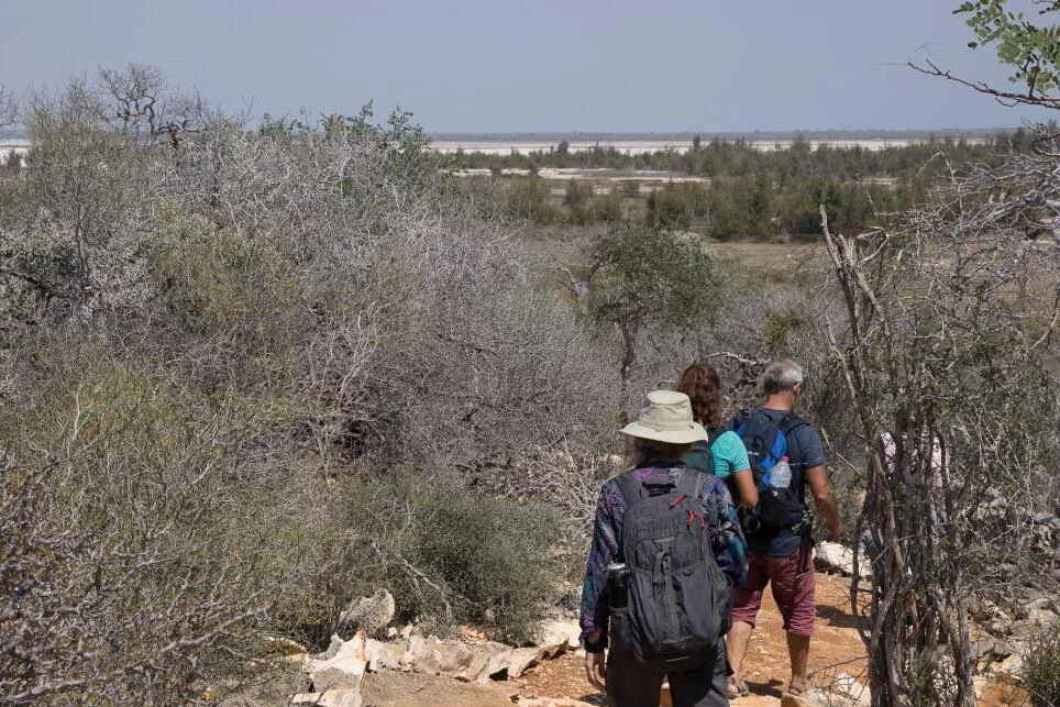
Two hikers walking along a dry, rocky trail through sparse, thorny vegetation with a distant view of a salt lake.
Hikers on a trail overlooking the landscape of Tsimanampetsotsa National Park.

Best time to visit Tsimanampetsotsa National Park

Given the park's hot, semi-arid climate and long dry season, visits are generally most comfortable during the cooler window of the austral winter. The dry season, lasting roughly nine to eleven months in much of the area, offers more reliable access along sandy tracks and clearer viewing conditions across the lake and plateau.

The rainy period, concentrated between late December and February, brings the majority of annual rainfall. While the landscape becomes greener and conditions for some flora are improved, tracks can become more challenging, biting insects may increase, and high temperatures exceeding 40 degrees Celsius can make day travel taxing. For visitors prioritizing milder temperatures and more comfortable hiking, the cooler dry months offer the most balanced experience, though wildlife and birding interest can be strong year-round due to the presence of resident endemics and visiting flamingo flocks.
Monthly climate preview

Long-term representative temperature and precipitation patterns across Atsimo-Andrefana

Tsimanampetsotsa National Park Climate Normals and Monthly Weather Records

Representative coordinate records show average monthly temperatures ranging from 21.29 degrees Celsius to 28.21 degrees Celsius alongside distinct precipitation variations throughout the year. Reviewing the complete twelve-month climatology profile provides deeper insight into measured baseline conditions across the protected landscape.
Annual mean25 °C
21 °C28 °C
Jan28°
Feb28°
Mar28°
Apr26°
May24°
Jun22°
Jul21°
Aug22°
Sep24°
Oct26°
Nov27°
Dec28°
Warmest month
January

28.2 °C

Coolest month
July

21.3 °C

Wettest month
January

4.4 mm/day

Driest month
August

0.2 mm/day

Park location guide

Geography guide, regional context, and park location map for Tsimanampetsotsa National Park

Tsimanampetsotsa National Park park geography, regions, and map view in Madagascar

Understand where Tsimanampetsotsa National Park sits in Madagascar through a broader geographic reading of the surrounding landscape, nearby location context, and its mapped position within the national park landscape.

How Tsimanampetsotsa National Park fits into Madagascar

Madagascar is an island nation in the Indian Ocean, positioned off the southeastern coast of Africa. As the world's fourth-largest island and second-largest island country, it stands out for its exceptional biodiversity, over 90% of its wildlife is endemic, making it one of 17 megadiverse countries. The population is approximately 32 million, with Antananarivo as both the capital and largest city.

Wider geography shaping Tsimanampetsotsa National Park in Madagascar

Madagascar lies in the Indian Ocean off the southeastern coast of Africa, separated from the mainland by the Mozambique Channel. The island is situated approximately 400 km from the African continent. As the world's fourth-largest island, it also includes numerous smaller peripheral islands.

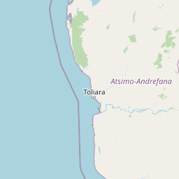
Map view of Tsimanampetsotsa National Park

Use this park location map to pinpoint Tsimanampetsotsa National Park in Madagascar, understand its exact geographic position, and read its mapped placement within the surrounding landscape more clearly.

Pigeon | © OpenStreetMap contributors

Location context for Tsimanampetsotsa National Park

Atsimo-Andrefana
Recorded earthquake history

Explore Recorded Earthquake History Near Tsimanampetsotsa National Park

Access the comprehensive catalogue of recorded seismic events associated with Tsimanampetsotsa National Park. Review historical data points to gain a clearer understanding of the geological context surrounding this protected area through the MoriAtlas dataset.

Tsimanampetsotsa National Park Earthquake History

Catalogued events

1 event

Strongest magnitude

Magnitude 5.3

Most recent event

Jan 25, 2013

This history includes earthquakes recorded inside the park or within 50 km of its borders

Explore visual records of the limestone plateau, saline lake, and spiny forest habitats.

Tsimanampetsotsa National Park Photos and Landscape Scenery Visual Guide

Examine detailed visual documentation of arid coastal terrain, ancient baobabs, and unique protected ecosystems. Photographic evidence reveals the stark ecological contrasts that define this remarkable southern Malagasy sanctuary.

A radiated tortoise with a distinct star-patterned shell walks across a dry, rocky, light-colored ground in bright daylight.

A group of tall, thick-trunked Pachypodium geayi trees with silvery bark and sparse, leafy crowns rising above low, thorny desert scrub under a clear blue sky.

A panoramic view of a wide, turquoise-colored lake under a clear blue sky with sparse clouds, framed by shrubby vegetation in the foreground.

A large banyan fig tree with numerous long aerial roots hanging down into a dark, rocky sinkhole opening.

A thick, wide-trunked Fony baobab tree with leafless branches stands in a sparse, dry forest clearing with red-brown earth and limestone rocks.

A pair of thick, smooth-barked Fony baobab trees stands prominently in a sparse, dry forest clearing under a bright sky.

Two people standing at the edge of a water-filled limestone cave opening, looking into the dark cavern.

Two hikers walking along a dry, rocky trail through sparse, thorny vegetation with a distant view of a salt lake.

A wide, flat, and arid landscape featuring sparse, low-lying scrub vegetation across a saline plain under a clear blue sky.

A wide, eye-level shot of a dry, arid forest landscape under a clear blue sky, featuring sparse, grey, spiny trees and shrubs growing in light-colored sandy soil.

A wide, eye-level shot of a calm, turquoise lake shore with sparse, tufted grasses growing from sandy, light-colored mudflats under a hazy sky.

A medium-distance photograph of an endemic Alluaudia comosa tree characterized by its dense, branching, thorny structure standing in a dry forest environment.

A side profile view of a Grandidier's mongoose walking across sandy ground at night, showing its striped back and bushy tail.

Park atlas

Compare adjacent spiny forest reserves and regional conservation landscapes

Parks Near Tsimanampetsotsa National Park and Regional Protected Areas

Browsing other protected areas near Tsimanampetsotsa National Park reveals broader ecological patterns across the dry limestone terrain of south-west Madagascar. Extending geographic comparison beyond a single wetland basin helps place unique regional plant endemism into wider perspective.
National parkMadagascar
Park boundaries overlap#1 closest

Tsimanampetsotsa National Park: National Park Protected Landscape and Geographic Features

Mapping the protected area boundaries and landscape context.

Delve into the protected landscape identity of Tsimanampetsotsa National Park, a designated national park. This profile focuses on its geographic significance, providing a clear view of its mapped boundaries and the surrounding natural terrain. Understand its role as a protected area within the larger atlas for comprehensive geographic exploration.

Area
432 km²
Established
1927
Relief
Mixed relief
Climate
Arid
Wildlife reserveAtsimo-Andrefana
About 85 km away#2 closest

Northeast

Beza Mahafaly Special Reserve: Atlas of the Gallery Forest and Dry Bush Landscape

Protected riparian ecosystems in the Atsimo-Andrefana region

Beza Mahafaly Special Reserve provides a concentrated look at Madagascar's rare gallery forest ecosystems. Situated within the dry, thorny spiny bush of the Atsimo-Andrefana region, the reserve protects a unique linear woodland environment. Its geography is characterized by the striking contrast between river-fed riparian corridors and the arid, undulating terrain that defines the southwestern landscape.

Area
6 km²
Established
1986
IUCN
IV
Natural monumentAtsimo-Andrefana
About 144 km away#3 closest

North

Analavelona Natural Monument: An Isolated Montane Forest Refuge in Southwestern Madagascar

Mapping a sacred and biodiverse massif in the Atsimo-Andrefana region

Analavelona Natural Monument represents a striking geographic contrast, standing as an elevated montane forest massif surrounded by arid plains. This protected landscape contains a complex ecological mosaic, ranging from humid evergreen forests to rocky sclerophyllous slopes. Recognized for its sacred status and high level of narrow-range endemism, the massif serves as an essential ecological island within the broader topography of southwestern Madagascar.

Area
44.87 km²
Established
2015
Relief
Mountain
Climate
Tropical
National parkAtsimo-Andrefana
About 158 km away#4 closest

Northeast

Zombitse-Vohibasia National Park: Protected Landscape and Regional Geographic Context

Mapped protected areas and natural terrain discovery.

Investigate Zombitse-Vohibasia National Park, a designated national park within the Atsimo-Andrefana region. This dedicated entry provides detailed geographic information, focusing on the park's mapped terrain and its contribution to the regional protected landscape. Gain insight into the park's atlas-relevant features and its specific place within Madagascar's conservation geography.

Area
363.08 km²
Established
2002
IUCN
II
Relief
Upland
Marine protected areaAtsimo-Andrefana
About 179 km away#5 closest

Southeast

Nosy Ve-Androka National Park Marine Protected Area: Geographic and Atlas Discovery

Understand its marine landscape and regional geographic context.

Delve into Nosy Ve-Androka National Park, a critical marine protected area located in Madagascar's Atsimo-Andrefana region. This park offers a focused look at protected marine geography, allowing for detailed atlas exploration of its mapped boundaries and its role within the surrounding natural landscapes. Understand the specific geographic identity and conservation significance of this vital protected area through structured data.

Area
914.45 km²
Climate
Tropical
Access
Moderate access
Water
Water-dominated
Wildlife reserveAndroy
About 184 km away#6 closest

Southeast

Réserve spéciale du Cap Sainte-Marie: Wildlife Reserve and Protected Coastal Landscape in Androy

An essential arid-zone habitat at the southernmost edge of Madagascar

Réserve spéciale du Cap Sainte-Marie protects a fragile ecosystem of spiny thicket and coastal terrain. As a focal point for tortoise conservation in the Androy region, this reserve offers a window into the specialized reptile habitats and harsh environmental conditions that define the southern extremity of the Madagascar landscape.

Area
17.5 km²
Established
1962
IUCN
IV
Scope
Terrestrial
National parkIhorombe Region
205 km away#7 closest

Northeast

Isalo National Park: Explore Madagascar's Sandstone Canyons and Protected Landscape Geography

Discover unique geology, tapia woodlands, and regional park context.

Isalo National Park is a prominent protected area in Madagascar's Ihorombe Region, celebrated for its spectacular sandstone landscape. This national park features deep canyons, eroded rock domes, and striking runiform mountains, formed from ancient sedimentary deposits. The park preserves significant tapia woodlands and remarkable plant endemism, offering a rich context for understanding protected land distribution and Madagascar's unique geography. Its mapped terrain provides a visual atlas of natural wonders.

Area
815.4 km²
Established
1962
IUCN
II
Visitors
32.7K annual
Marine protected areaMadagascar
About 220 km away#8 closest

North

Velondriake Marine Protected Area: Coastal Geography and Conservation Landscape in Madagascar

A large-scale community marine reserve in southwestern Madagascar.

Velondriake protects 64,000 hectares of marine and terrestrial environment, spanning coral reefs, extensive mangroves, and inland baobab-rich spiny forests. As a focal point for regional marine management, the area showcases the intersection of coastal ecology and community governance in the western Indian Ocean. Explore the geographic boundaries and habitat features that define this significant marine protected territory along the coast of Madagascar.

Area
640 km²
Established
2006
Relief
Lowland
Climate
Tropical

Common questions about visiting, size, designation, and location context for Tsimanampetsotsa National Park

Tsimanampetsotsa National Park FAQs for park facts, access, geography, and protected area context

Find quick answers about Tsimanampetsotsa National Park, including protected-area facts, park geography, trail and visitor context, and how the park fits into its surrounding country and regional landscape.
MoriAtlas Explorer

Continue Your Protected Areas Search Across the Global Atlas

Deepen your exploration by continuing the structured search for national parks and protected areas worldwide. Utilize the comprehensive filtering capabilities to compare different conservation landscapes and refine your understanding of global park geography. Discover more about the distribution and characteristics of protected natural areas.

Global natural geography