

Mori Atlas logo
Nature reserveTsingy de Bemaraha Strict Nature Reserve

Explore the dramatic limestone labyrinth and riverine biodiversity within this protected Madagascar region

Tsingy de Bemaraha Strict Nature Reserve: Mapping the Karst Pinnacles and Forest Landscapes of Melaky

Tsingy de Bemaraha Strict Nature Reserve serves as a flagship conservation landscape in western Madagascar, defined by an extraordinary karst plateau of sharp limestone pinnacles and deep canyons. The reserve encompasses a vast mosaic of dry deciduous forests and the dramatic gorges of the Manambolo river system, providing essential habitat for endemic lemurs and rare bird species. This protected area offers profound insight into the geological history of the region and the unique ecological complexity of the Melaky landscape.

karst landscapelimestone pinnaclestsingy formationsUNESCO World Heritage Sitewestern MadagascarMelaky region
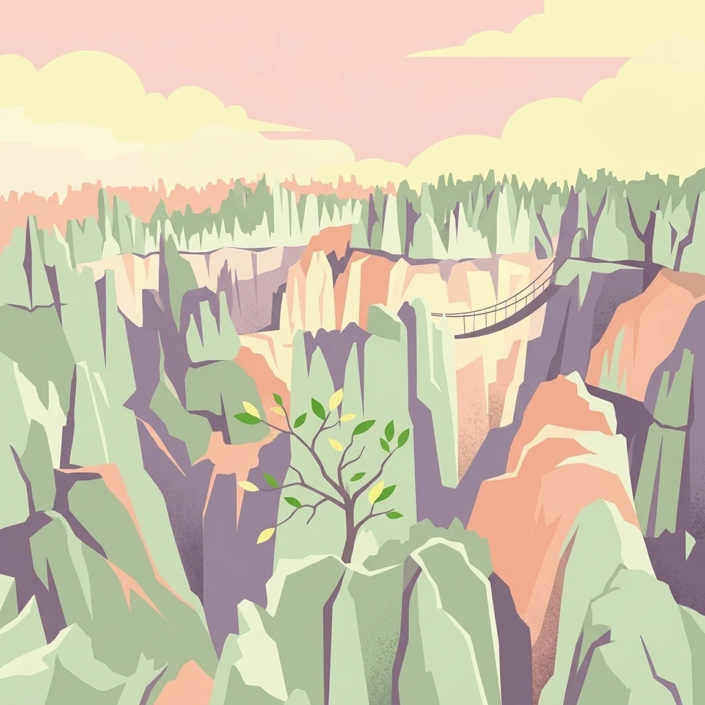
A stylized digital illustration of a jagged limestone canyon with a suspension bridge spanning the gap between rocky formations.

Tsingy de Bemaraha Strict Nature Reserve

Nature reserve

Park overview

Structured park overview, official facts, and landscape profile for Tsingy de Bemaraha Strict Nature Reserve

Tsingy de Bemaraha Strict Nature Reserve park facts, protected area profile, and essential visitor context

Review the core facts for Tsingy de Bemaraha Strict Nature Reserve, including designation, size, terrain, visitor scale, habitats, and operating context in one park-focused overview.

About Tsingy de Bemaraha Strict Nature Reserve

The Tsingy de Bemaraha Strict Nature Reserve is one of the most exceptional geological landscapes in the world and a cornerstone of Madagascar's conservation estate. Located in the west of the country within the Melaky region, the reserve protects an immense limestone massif shaped by millions of years of weathering, dissolution, and collapse along deep fracture lines.

What emerges today is a labyrinth of vertical needles, sharp ridges, deep crevices, and intervening plateaus that local inhabitants named the tsingy because the rock formations cut like razors. Mature examples of karst topography such as this are rare globally, and at Bemaraha the phenomenon unfolds on an unusually grand scale, with canyon walls sometimes reaching several hundred meters in depth where rivers like the Manambolo have cut through the massif.

The reserve's significance extends far beyond geology. The mosaics of dry forest, riverine habitat, lakes, and mangrove that surround the limestone pinnacles shelter an exceptional concentration of endemic species. Several lemur species, including the Decken's sifaka and Milne-Edwards' sportive lemur, depend on these isolated forests for survival. Endemic reptiles, such as the armored leaf chameleon, and rare birds like Henst's goshawk also inhabit the reserve. Roughly 650 plant species have been documented across the complex.

The site's protected status reflects its dual importance. It has been a formal reserve since 1927, was named cultural national heritage in 1991, and joined the UNESCO World Heritage List in 1990. In 1997 a portion of the surrounding reserve was reclassified as the Tsingy de Bemaraha National Park, allowing managed ecotourism to complement the stricter conservation regime of the original reserve. Together, both designations safeguard an area that is at once a remarkable geological wonder and one of the most important strongholds of Madagascar's endemic biodiversity.

Quick facts and research context for Tsingy de Bemaraha Strict Nature Reserve

The Tsingy de Bemaraha Strict Nature Reserve lies in the Melaky region of west-central Madagascar, near the town of Bekopaka and roughly 150 kilometers north of Morondava. It is managed under Madagascar National Parks and has been inscribed on the UNESCO World Heritage List since 1990 under criteria for natural significance.

The protected complex combines a strict nature reserve with a national park, covering a combined area measured in the hundreds of thousands of hectares. Its terrain rises between roughly 150 and 700 meters in altitude and includes the deep Manambolo river gorge, a network of dry tropical forests, and the dramatic limestone pinnacles that give the site its name.

Protection and recognition

Documented protection history, terrestrial scope, and international recognition details

Tsingy de Bemaraha Strict Nature Reserve Protection Status and Recognition

Tsingy de Bemaraha Strict Nature Reserve holds official terrestrial protection status established in 1990 alongside documented international recognition as part of the UNESCO World Heritage Andrefana Dry Forests. Structured records assemble verified designation details, management parameters, and international framework listings for this protected area.

International recognition

Protection details

Protection scope
Terrestrial
Designated year
1990
Transboundary protection
No
WDPA ID
2302
Park context

Deeper park guide and search-rich context for Tsingy de Bemaraha Strict Nature Reserve

Tsingy de Bemaraha Strict Nature Reserve history, landscape, wildlife, and travel context

Explore Tsingy de Bemaraha Strict Nature Reserve through its history, landscape character, ecosystems, wildlife, conservation priorities, cultural context, and seasonal travel timing in a structured park guide built for atlas discovery and search intent.

Why Tsingy de Bemaraha Strict Nature Reserve stands out

The Tsingy de Bemaraha is most famous for its dramatic karst landscape, a dense labyrinth of towering limestone needles and sharp ridges that the Malagasy name "tsingy" literally translates as "the place where one cannot walk barefoot." The site is also celebrated for the ecological richness that grows around and within these formations. Dry deciduous forests cling to the erosional plateaus above the pinnacles, while the sheltered canyons and gorges below harbor endemic lemurs, rare reptiles, and bird species found nowhere else.
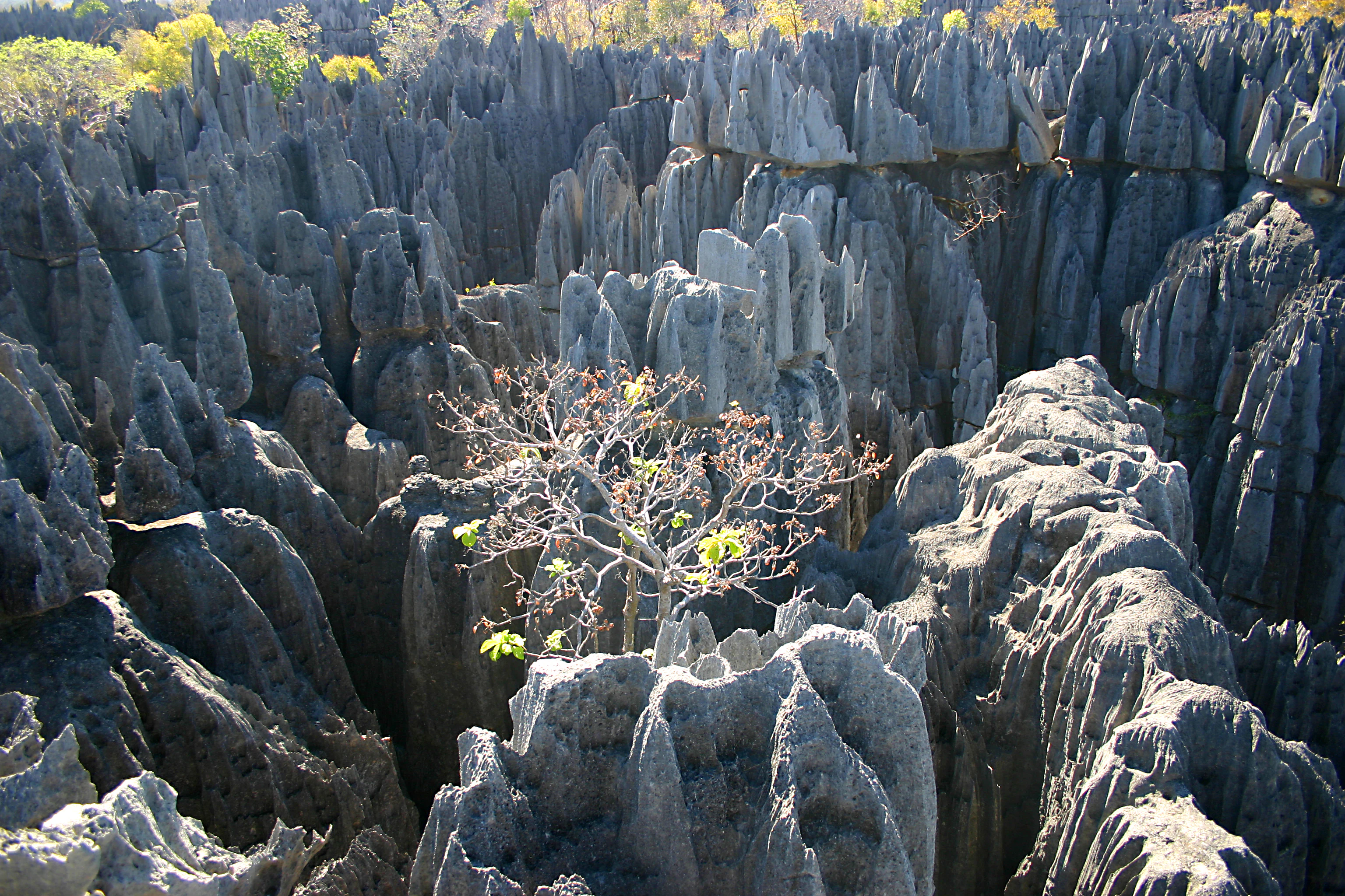
A vast field of sharp, grey limestone karst formations with a small tree growing in the center of the jagged rock crevices.
Sharp limestone karst formations, known as Tsingy, define the rugged landscape of Tsingy de Bemaraha Strict Nature Reserve.

Tsingy de Bemaraha Strict Nature Reserve history and protected-area timeline

The Tsingy de Bemaraha was first established as a strict nature reserve in 1927, when Madagascar's colonial administration formally recognized the exceptional geological and ecological value of the western limestone massif. This early designation placed the entire area under strict protection, prohibiting resource extraction or extensive human activity across roughly 1,520 square kilometers.

In 1990 the site was inscribed on the UNESCO World Heritage List in recognition of its outstanding natural value, and a year later it was additionally classified as a Cultural National Heritage site by Madagascar. These designations cemented the reserve's significance on both international and national stages.

In 1997 the boundaries and zoning of the area were restructured. Approximately 723 square kilometers were recategorized as the Tsingy de Bemaraha National Park, where managed ecotourism could be permitted under controlled conditions. The remaining core area retained its strict nature reserve status, continuing under the guardianship of what became Madagascar National Parks. This split-management approach has allowed the site to serve both as a benchmark for conservation and as one of Madagascar's flagship natural tourism destinations.

Tsingy de Bemaraha Strict Nature Reserve landscape and geographic character

The defining landscape of the Tsingy de Bemaraha is one of the most extraordinary karst formations on Earth. The plateau was uplifted from the seabed when Madagascar broke away from the African plate roughly 160 million years ago, leaving behind a vast block of limestone that has since been intricately carved by water and weathering.

Over time, surface monsoon rains etched the upper surfaces of the rock while groundwater dissolved stone along existing fracture lines, hollowing out deep cavities from beneath. As ceilings collapsed and the water table dropped, what remained was a sweeping labyrinth of canyons, sharp ridges, and vertical pinnacles that can rise several tens of meters into the air. The word tsingy captures the difficulty of crossing this terrain, since the formations resemble a forest of stone needles.

Beyond the bare pinnacle fields, the reserve also contains deeply contrasting environments. The Manambolo River has cut a dramatic gorge up to 300 to 400 meters deep through the limestone, supporting isolated patches of vegetation along its banks and cliffs. Hilly interior zones, dry forests, and mangrove fringes complete the landscape mosaic, giving the protected area a visual richness that ranges from stark white stone architecture to lush green forested valleys.
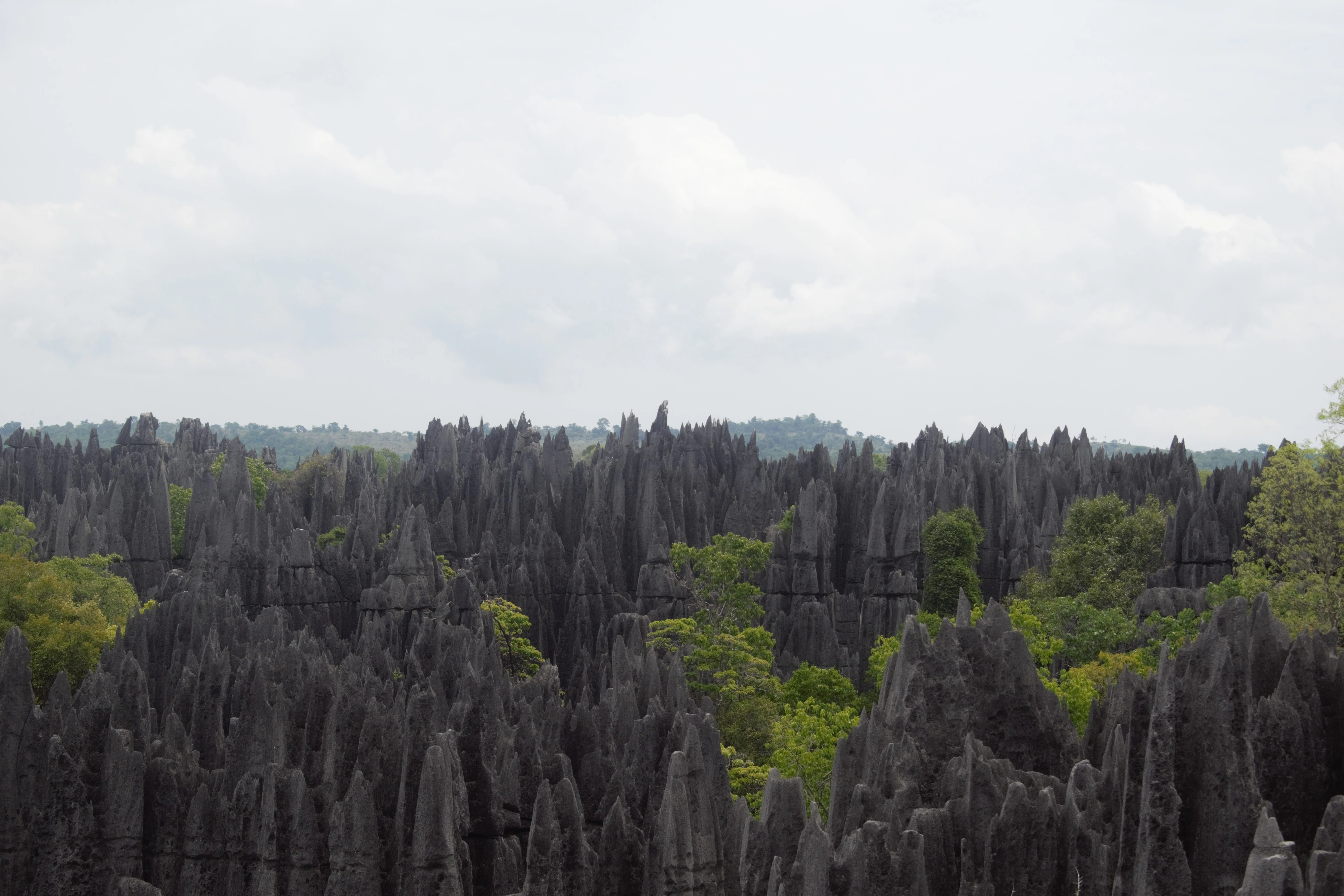
A vast expanse of sharp, grey limestone needles and peaks rising from a lush green forest under a cloudy sky.
Jagged limestone karst formations, known as Tsingy, in the Tsingy de Bemaraha Strict Nature Reserve.

Tsingy de Bemaraha Strict Nature Reserve ecosystems, habitats, and plant life

The ecological identity of the Tsingy de Bemaraha is inseparable from its unusual geology. The reserve sits in a tropical dry climate zone, where the alternating wet and dry seasons have shaped a vegetation mosaic that includes dry deciduous forests on the upper plateaus, gallery forests along rivers, and isolated floral communities clinging to the canyon walls and crevices of the limestone.

A defining feature of the ecosystem is its high level of endemism. The isolation created by the limestone labyrinth and the harsh conditions of the region have driven the evolution of unusually specialized flora and fauna, with roughly 650 plant species recorded in the reserve. Within these communities, xerophytic and lithophytic plants thrive in cracks where only the thinnest soils accumulate.

The dry tropical climate, dominated by strong southeast trade winds that produce a pronounced rain-shadow effect behind the plateau, enhances the seasonal contrast of the reserve. During the dry season, landscapes become stark and mineral; during the rainy season, vegetation on the plateaus and in the gorges greens dramatically, restoring moisture to habitats that support the area's exceptional wildlife.
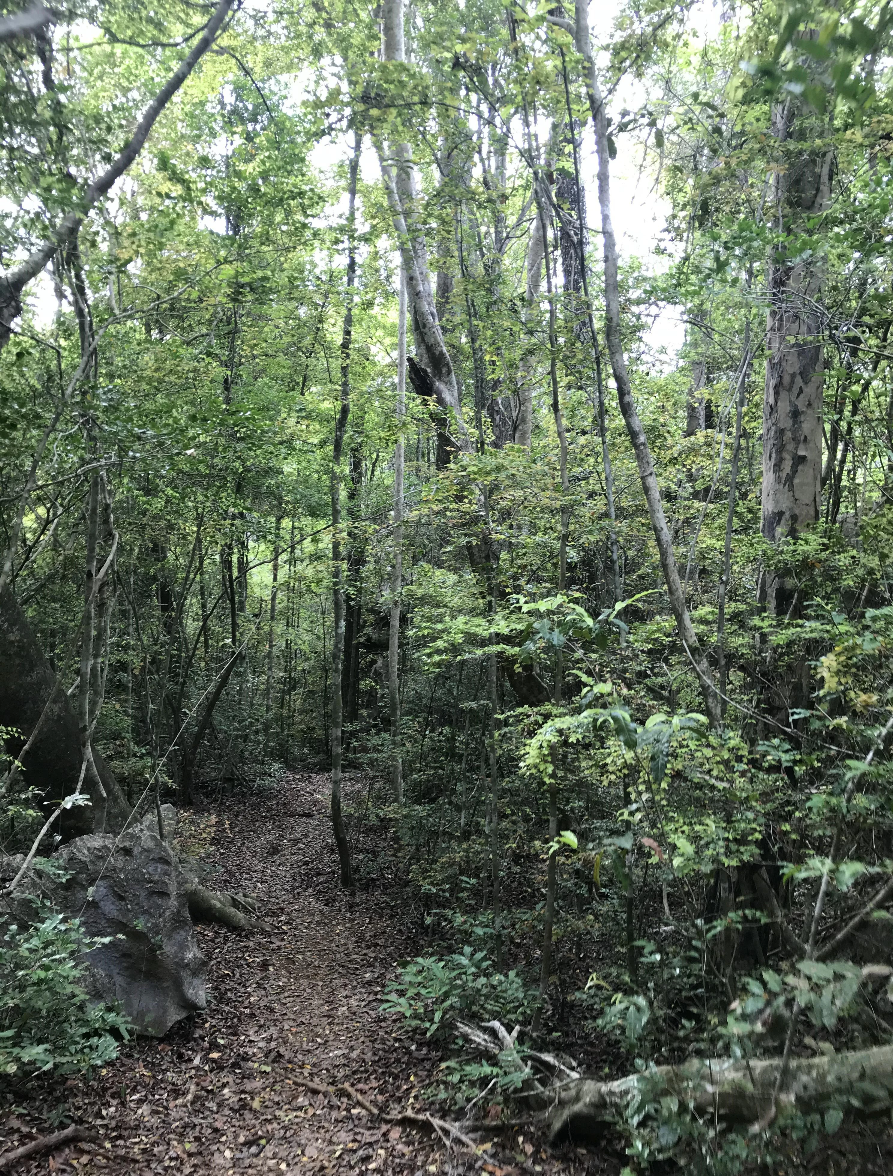
A narrow walking path covered in leaf litter leading through a dense, green forest with tall trees and rocky ground features.
A narrow dirt path winding through the dense forest vegetation of Tsingy de Bemaraha Strict Nature Reserve.

Tsingy de Bemaraha Strict Nature Reserve wildlife and species highlights

The wildlife of the Tsingy de Bemaraha is one of the most distinctive assemblages in Madagascar, marked by endemism and unusual habitat specialization. The reserve's combination of forested plateaus, shaded canyons, and rocky labyrinth supports several primate species of significant conservation importance, including the Decken's sifaka, the eastern fork-marked lemur, the greater bamboo lemur subspecies Hapalemur griseus occidentalis, and Milne-Edwards' sportive lemur.

The reserve is also an important habitat for rare reptiles and amphibians adapted to the limestone environment. Antsingy leaf chameleons inhabit crevices between the rock needles, while other endemic reptiles find refuge in the forest patches above and along the river gorges below. The aye-aye also occurs here, although its nocturnal habits make it far less commonly seen.

Birdlife is exceptional. The reserve shelters rare species such as the white-throated rail and Henst's goshawk, both of which depend on the intact forest reserves for nesting and foraging. Lamberton's rat adds to the list of mammals with restricted ranges present here. Together these species underscore the reserve's role as a refuge for wildlife that has disappeared from much of Madagascar's surrounding landscapes.

Tsingy de Bemaraha Strict Nature Reserve conservation status and protection priorities

The Tsingy de Bemaraha is a conservation landmark of international importance. Its inscription on the UNESCO World Heritage List in 1990 reflects both the geological uniqueness of the site and its extraordinary value as a sanctuary for species found nowhere else on Earth. The reserve and its associated national park together form one of the cornerstones of Madagascar's protected-area system.

Under management by Madagascar National Parks, the area benefits from a layered governance model that pairs the strict protection of the original reserve with the managed ecotourism of the reclassified national park. This dual structure helps to safeguard the most ecologically sensitive zones while allowing carefully designed visitor activity in areas suited to it.

The conservation significance of the site is amplified by its biological role. Its habitats shelter endemic primates, reptiles, and plant species that depend on the reserve's combination of intact forest and undisturbed karst environments. As surrounding landscapes in western Madagascar face growing pressure from slash-and-burn agriculture, charcoal production, and habitat fragmentation, Tsingy de Bemaraha stands out as one of the most essential reservoirs of regional biodiversity.

Tsingy de Bemaraha Strict Nature Reserve cultural meaning and human context

The name "tsingy" itself reflects a meaningful cultural connection between the local Malagasy communities and the landscape. The word carries the meaning "the place where one cannot walk barefoot," recognizing both the hazard and the beauty of the limestone needles. This naming tradition speaks to a long-standing familiarity with the terrain and a deep awareness among local peoples of its distinctiveness.

Recognition at the national level reinforces this cultural dimension. In 1991, just after the UNESCO inscription, the area was formally designated as a Cultural National Heritage site, positioning the reserve not only as a natural treasure but also as a defining symbol of Madagascar's identity and geological inheritance.

Top sights and standout views in Tsingy de Bemaraha Strict Nature Reserve

The Tsingy de Bemaraha offers one of the world's most striking karst landscapes, with a sharpening labyrinth of limestone canyons and pinnacles that reward exploration of both the dramatic geology and the wildlife adapted to it. The deep Manambolo gorge adds a rare riverine dimension to a landscape otherwise dominated by stone.

For naturalists, the reserve holds exceptional value. It harbors multiple lemur species, rare reptiles, and endemic birds that depend on the dry tropical forest patches scattered across the plateau and in the canyons. The combined natural and cultural recognition at both national and UNESCO levels reinforces its status as a flagship destination for anyone interested in Madagascar's singular natural heritage.

Best time to visit Tsingy de Bemaraha Strict Nature Reserve

The park is generally accessible during the dry season, broadly from around June through November, when roads in the surrounding region are most easily traveled and visitor conditions within the reserve are most stable. The rainy season dramatically limits access to this remote western region, with tracks becoming largely impassable in many directions.

Visiting in the dry months also tends to offer clearer views across the limestone labyrinth and cooler conditions for exploring the forested plateaus above the canyons. Wildlife viewing remains rewarding year-round, although lighter vegetation outside the rainy season can make some species easier to observe in the forest interior.
Monthly climate preview

Long-term temperature and precipitation patterns across representative coordinates

Tsingy de Bemaraha Strict Nature Reserve Climate Normals and Annual Weather Rhythm

Historical climate data reveals measured shifts in monthly temperature and daily precipitation averages for Tsingy de Bemaraha Strict Nature Reserve. Examining the complete twelve-month profile provides detailed context on long-term regional weather variations.
Annual mean24 °C
21 °C27 °C
Jan25°
Feb25°
Mar25°
Apr24°
May22°
Jun21°
Jul21°
Aug23°
Sep25°
Oct27°
Nov27°
Dec26°
Warmest month
November

27.1 °C

Coolest month
June

20.6 °C

Wettest month
January

12.5 mm/day

Driest month
August

0.3 mm/day

Park location guide

Geography guide, regional context, and park location map for Tsingy de Bemaraha Strict Nature Reserve

Tsingy de Bemaraha Strict Nature Reserve park geography, regions, and map view in Madagascar

Understand where Tsingy de Bemaraha Strict Nature Reserve sits in Madagascar through a broader geographic reading of the surrounding landscape, nearby location context, and its mapped position within the national park landscape.

How Tsingy de Bemaraha Strict Nature Reserve fits into Madagascar

Madagascar is an island nation in the Indian Ocean, positioned off the southeastern coast of Africa. As the world's fourth-largest island and second-largest island country, it stands out for its exceptional biodiversity, over 90% of its wildlife is endemic, making it one of 17 megadiverse countries. The population is approximately 32 million, with Antananarivo as both the capital and largest city.

Wider geography shaping Tsingy de Bemaraha Strict Nature Reserve in Madagascar

Madagascar lies in the Indian Ocean off the southeastern coast of Africa, separated from the mainland by the Mozambique Channel. The island is situated approximately 400 km from the African continent. As the world's fourth-largest island, it also includes numerous smaller peripheral islands.

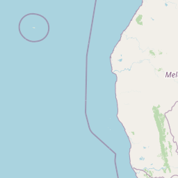
Map view of Tsingy de Bemaraha Strict Nature Reserve

Use this park location map to pinpoint Tsingy de Bemaraha Strict Nature Reserve in Madagascar, understand its exact geographic position, and read its mapped placement within the surrounding landscape more clearly.

Pigeon | © OpenStreetMap contributors

Location context for Tsingy de Bemaraha Strict Nature Reserve

Melaky

Visualizing the dramatic limestone pinnacles and protected habitats of western Madagascar

Tsingy de Bemaraha Strict Nature Reserve Landscape Photos and Scenery

Examine detailed photography capturing the razor sharp limestone pinnacles and deep river gorges of Tsingy de Bemaraha Strict Nature Reserve. Visual records illustrate the stark karst terrain, dry tropical forests, and unique protected habitats defining this UNESCO World Heritage landscape.

A vast field of sharp, grey limestone karst formations with a small tree growing in the center of the jagged rock crevices.

A wooden suspension bridge with metal cable railings leads towards jagged, grey limestone rock formations under a cloudy sky.

A vast expanse of sharp, grey limestone needles and peaks rising from a lush green forest under a cloudy sky.

A narrow walking path covered in leaf litter leading through a dense, green forest with tall trees and rocky ground features.

Park atlas

Compare surrounding conservation landscapes and neighboring reserves across western Madagascar

Parks Near Tsingy de Bemaraha Strict Nature Reserve and Regional Protected Areas

Browsing other protected areas near Tsingy de Bemaraha Strict Nature Reserve reveals the broader geographic spread of regional conservation terrain. Examining connected natural habitats and neighboring reserves deepens understanding of Madagascar's unique geological diversity.
National parkMelaky
About 25 km away#1 closest

South

Tsingy de Bemaraha National Park: A Protected Landscape within Melaky, Madagascar

Explore mapped boundaries and regional geography for atlas discovery.

Tsingy de Bemaraha National Park is a designated national park offering profound opportunities for geographic discovery. As a key protected area in the Melaky region, its mapped boundaries and natural landscape characteristics are vital for understanding Madagascar's conservation geography. This resource facilitates detailed atlas exploration, providing structured insights into the park's terrain and its position within the broader regional context, enabling a focused study of its protected land identity.

Area
723.4 km²
Established
1997
IUCN
II
Visitors
10.1K annual
Marine protected areaMelaky
About 59 km away#2 closest

West

Barren Isles Marine Protected Area: Geographic Overview and Island Chain Mapping

Exploration of the nine islands in the Mozambique Channel.

The Barren Isles comprise a distinct chain of nine islands and sand banks stretching across the Mozambique Channel in Madagascar. This marine protected area offers a look into a complex coastal system that balances sensitive wetland habitats with seasonal maritime migration. Gain geographic perspective on this isolated archipelago located within the Melaky region, where shifting marine environments create a unique natural landscape.

Water
Water-dominated
Nature reserveMadagascar
About 193 km away#3 closest

South

Réserve spéciale d'Andranomena: Protected Nature Reserve in Western Madagascar

Deciduous forest canopy, seasonal wetlands, and endemic baobab ecosystems.

Réserve spéciale d'Andranomena protects a significant block of dry dense forest within the Menabe region. The territory is known for its monumental baobab specimens, intricate seasonal hydrology, and high concentrations of Malagasy endemic species. This nature reserve provides a critical baseline for understanding the western island landscape, bridging the gap between coastal dune influence and interior deciduous terrain.

Area
64.2 km²
Established
1958
IUCN
IV
Relief
Lowland
National parkMahajanga Province
About 228 km away#4 closest

North

Tsingy de Namoroka National Park: Geography, Karst Formations, and Regional Context

Protected karst landscapes in Mahajanga Province.

Tsingy de Namoroka National Park stands as a prime example of Madagascar's unique geological heritage, featuring sprawling fields of razor-sharp limestone pinnacles and intricate cave networks. This protected area offers deep insight into the intersection of subterranean hydrology and dry forest ecology within the broader Mahajanga Province.

Area
220.71 km²
Established
1927
IUCN
II
Relief
Mixed relief
National parkBoeny
About 267 km away#5 closest

North

Baie de Baly National Park: Mapped Boundaries and Protected Landscape Context

Explore the geography and natural terrain of this national park.

Baie de Baly National Park presents a critical focal point for understanding protected areas within the Boeny region. As a national park, it showcases specific mapped boundaries that contribute to the broader geographic understanding of Madagascar's conservation landscapes. This detailed view allows for an atlas-driven exploration of the park's natural terrain and its significance as a distinct protected landmass within its regional context.

Area
571.42 km²
Established
1997
IUCN
II
Climate
Tropical
Nature reserveToliara Province
About 269 km away#6 closest

South

Kirindy Forest Nature Reserve: Protected Dry Deciduous Forest in Western Madagascar

Geography, protected boundaries, and unique dry forest ecosystems

Kirindy Forest offers a detailed look into the ecology of western Madagascar. As a protected nature reserve, it shelters three species of baobab trees and diverse primate populations. Its terrain ranges from flat to gently undulating, creating a distinct visual rhythm through alternating dry and rainy seasons within the Menabe region.

Area
125 km²
Relief
Lowland
Climate
Tropical
Access
Moderate access
National parkMadagascar
About 269 km away#7 closest

South

Kirindy Mitea National Park: Madagascar National Park with Distinct Protected Landscape Identity

Explore the mapped geographic context of Kirindy Mitea National Park.

Kirindy Mitea National Park serves as a notable protected area, holding national park status within Madagascar's distinctive island geography. This entry focuses on understanding the park's unique protected landscape and its charted boundaries, offering essential context for atlas-driven exploration. Discover the geographic elements that define Kirindy Mitea National Park and its place within the broader conservation map of the region.

Area
1,563.5 km²
Established
1997
IUCN
IV
Relief
Mixed relief
National parkBoeny Region
About 302 km away#8 closest

Northeast

Ankarafantsika National Park: Protected Area Atlas and Regional Geography Discovery

Explore mapped boundaries and natural landscape context.

Ankarafantsika National Park serves as a key protected area for understanding the geography of Madagascar's Boeny Region. This canonical page offers a detailed atlas-style view, highlighting the park's mapped boundaries and its role as a distinct natural landscape. Engage with structured geographic data to comprehend the park's protected status and its contribution to the regional terrain, facilitating a deeper appreciation of protected lands.

Area
1,365.13 km²
Established
2002
IUCN
II
Relief
Lowland

Common questions about visiting, size, designation, and location context for Tsingy de Bemaraha Strict Nature Reserve

Tsingy de Bemaraha Strict Nature Reserve FAQs for park facts, access, geography, and protected area context

Find quick answers about Tsingy de Bemaraha Strict Nature Reserve, including protected-area facts, park geography, trail and visitor context, and how the park fits into its surrounding country and regional landscape.
MoriAtlas Explorer

Continue Your Protected Areas Search Across the Global Atlas

Deepen your exploration by continuing the structured search for national parks and protected areas worldwide. Utilize the comprehensive filtering capabilities to compare different conservation landscapes and refine your understanding of global park geography. Discover more about the distribution and characteristics of protected natural areas.

Global natural geography